LE BLANC, Jean-BernardLivre Rare Book
40 617 résultats
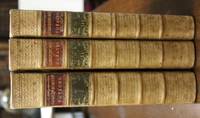
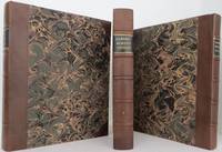
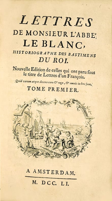
LCS-2714La première critique gastronomique adressée aux anglais par un français. « Des plaisirs de la table chez les anglais… ». L’exemplaire finement relié pour Madame de Pompadour, la protectrice de l’auteur. Amsterdam (Paris) 1751. 3 tomes en 3 volumes in-12 de : I/ (1) f.bl., (2) ff., lvi pp. de préface, 346 pp., (1) f. de fautes à corriger, (1) f.bl. ; II/ (1) f.bl., (2) ff., 380 pp. (1) f.bl. ; III/ (1) f.bl., (2) ff., 412 pp. (1) f.bl. Reliés en plein maroquin rouge de l’époque, large roulette richement dorée encadrant les plats, armes frappées or au centre, dos lisses ornés de fleurons dorés, pièces de titre et de tomaison de maroquin havane, filet doré sur les coupes, roulettes intérieures dorées, tranches dorées. Reliures de l’époque. 165 x 96 mm.
17187011Ausgburg, Lotter, 1719 [1718 ?]. 8 Teile in 2 Bdn. 1 Kupfer-Frontip. und 304 Kupfertafeln. Gr.-8°. Pgmt. der Zeit (Rücken fachmännisch erneuert, etw. gebräunt fleckig und bestoßen).
in-folio (mm 310x210), pp. 36 n.n., 470, 23 n.n. (su 24), legatura coeva in pergamena floscia, capitelli passanti. Con oltre 570 silografie n.t. magnificamente colorate all'epoca. Quinta edizione accresciuta da pp. 420-470 dell'opera Teutsche ''Speißkammer, in zahlr'', ove vengono dettagliatamente descritti prodotti agricoli, cibo, bevande e condimenti.Nel 1539 uscì la prima edizione dell'opera di Bock non illustrata ma già comprensiva della classificazione delle piante in famiglie; la presente comprende 568 silografie a mezza pagina, tratte per lo più dai disegni di Kandel, Fuchs, Brunfels; mentre le aggiunte testuali di Tessier e Gessner comprendono il primo tentativo di una bibliografia botanica. La particolarità dell sua opera è da individuarsi nel modo sistematico di descrivere le piante basato sull'osservazione a prima vista. Esemplare genuino, anticamente postillato (foglio di titolo con angolo esterno restaurato, primi 2 ff., p. 451 e 470 con antichi rattoppi che non interessano il testo, alcune usuali bruniture e macchie d'umico, soprattutto in fine). Esemplare con bellissima acquerellatura coeva.. BM STC, German Books S. 130. - Nissen 182. - Muller 532, 266. - Vgl. Weiss 427 und Horn/Arndt 21. - Nicht bei Adams.
1783310851Hartford: Nathaniel Pattern 1783. First edition lacking the map as in almost all copies. 208 pp. 1 vols. 8vo. Contemporary sheep over boards finely rebacked with period spine to style. Highest quality conservation repairs to edges of first four leaves of text and to corner margins on last two leaves. Very good copy in a handsome binding. First edition lacking the map as in almost all copies. 208 pp. 1 vols. 8vo. Rare. "This is not only the first American book on the Northwest Coast but also the first American book on Hawaii" Streeter. <br /> <br /> Ledyard is distinguished in many respects he was the only American to sail on Cook's third voyage which explored Alaska and discovered Hawaii. He was also in the boat that carried Cook ashore on the morning of his death. Indeed this work contains a detailed account of Cook's death "distinguished by its evident authority" Hill.<br /> The purpose of Cook's third voyage was twofold. Ostensibly it was to return Omai to his homeland in French Polynesia but the main purpose was to search for the Northwest Passage. The Resolution and Discovery departed Plymouth in 1776 and made their way via the Cape to New Zealand and Tahiti. It was from there that Cook discovered Hawaii which he regarded as his greatest achievement. The boats then proceeded to the Pacific Northwest and commenced their search for a route to the Atlantic. They returned to Hawaii for the winter of 1778-9. Their initial warm welcome soon wore off and tensions between the Hawaiians and the British resulted in Cook being killed on the shore of Kealakekua Bay on February 14 1779. Charles Clerke assumed command of the expedition and proceeded north once again to pursue the voyage's objective. The two ships returned to England in 1780.<br /> A Connecticut native after the voyage Ledyard remained in England until 1782 when he was posted to the North American station - the Revolutionary War was ongoing. He promptly deserted and returned to Hartford where this account was published. This work preceded Rickman's by a matter of months though in fact Ledyard made "liberal use of the first English edition of Rickman's account in his own narrative" Hill. This is not to deride Ledyard unnecessarily; in addition to his account of Cook's death his keen observations on the fur trade in the Pacific northwest are of great value.<br /> <br /> Ledyard's account is one of the rarest works on Cook's third's voyage and Hill confirms that "only a few copies still have the map." It was wanting in both the Streeter and Brooke-Hitching copies. Beddie 1603; Evans 17998; Sabin 39691; Forbes 52; Hill 991; Howes L-181 "d"; Lada-Mocarski 36; Smith 5797; Streeter Sale VI:3477 Nathaniel Pattern unknown
178448217London: W. and A. Strahan 1784. First Edition. Full leather. Very good. 421p 549p 556p illustrated with 87 maps and views 63 of which are in the Atlas volume all but a couple with tissue guards. 24 in the three quarto volumes. Bound in original leather boards rebacked in the twentieth century in blonde calf not matching the original leather boards. Atlas volume folio with original marbled boards and rebacked more recently and wearing along the base of the spine splitting 6 inches down the front board corners worn yet still very attractive. Contents fine and with original tissue guards. Light foxing. Small bookplate in each volume later personal gift inscription 1945 in each volume. This Atlas volume includes the rare plate "Death of Cook" not issued with the book but occurs in some copies <br/><br/> W. and A. Strahan hardcover
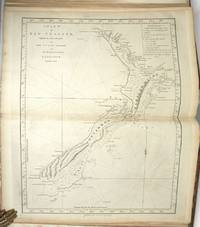
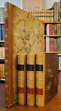
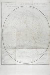
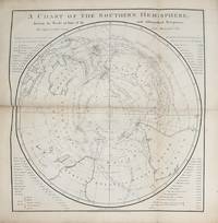
177329437London: W. Strahan and T. Cadell 1773. Second edition. Hardcover. An unusual folio atlas to accompany Cook's first voyage. The watermarks composition presentation and binding indicate that this was done contemporaneously with the release of the official account. The plates are full size with very large margins most unfolded. The large maps have many fewer folds than usual. With minor exceptions they are in very good condition. <br /> <br /> There are many highlights in this important voyage. The magnificent large single fold map of New Zealand is the first accurate map of the country. Other highlights include the print of the Endeavour beached on the Queensland coast the first image of the kangaroo that Europeans experienced the first accurate map of the East coast of Australia and the map of the Straits of Magellan which was unfinished when the first issue of the publication was released. It appeared in the second issue of the same year.<br /> <br /> The paper appears to be Dutch. There are two different watermarks one of which is an LVG mark conforming with Churchill #434 which establishes it as an 18th century paper that appears with Gerrevink and Villedary watermarks. The other watermark is a domed building with a long series of letters. The original endpapers are composed of green yellow and red matte swirls. <br /> <br /> The prints are printed on laid paper in both a medium and heavy weight paper some with tissue guards. Some prints are tipped onto album sheets some full page. Tiny light penciled numbers are on the lower right corners of impression mark mostly consecutive some looking altered although no evidence of plates being removed. There are a total of 47 maps and plates numbered 1-52. <br /> <br /> The atlas is in its full brown period calf binding boards bear gilt dentelles on all edges with gilt anchors in the corners the decorated spine rubbed. The partial label reads CAPTAIN COOK'S FIRST VOYAGE.<br /> <br /> The map of New Zealand is very striking. The extensive coastal detail and the topography of New Zealand are beautifully defined. The map is engraved by John Bayly the engraver of the earliest printed map showing Cook's discoveries. In 1772 by order of Joseph Banks he engraved "A Chart of the Great Pacific Ocean as described by Mr. Banks and Dr. Solander in the Year 1772". In one of the rarest of Cook associated books "Astronomical Observations Made in the Voyages which were Undertaken. for making Discoveries in the Southern Hemisphere" London 1788 there is a map of New Zealand with the identical style border of italic longitude and latitude figures. The map itself has considerably less detail than the chart issued with Cook's first voyage. <br /> <br /> There are a variety of engravers W. Whitchurch J. Russell Isaac Noüal J. Hall T. Bowen J. Gibson JB Cipriani Bartolozzi E. Rooker James Roberts W. Woollett J. Cheevers John Ryland I. Bayly. <br /> <br /> These maps and prints illustrated the official account of Cook's first voyage in which he discovered and explored New Zealand the east coast of Australia naming it New South Wales and the Society Islands. Cook's voyage was designed to observe the transit of Venus across the sun from Southern Hemisphere determine the distance between the sun and the earth and continue Byron's exploration. The narratives include Byron's voyage to the Gilbert & Tuamotu Islands Wallace's discovery of Tahiti & Moorea and Carteret's discovery of Pitcairn Island after his separation Capt. Wallis. Usually the maps and prints are folded and inserted in the quarto text volumes. <br /> <br /> There are three maps and two plates lacking four of which are added loose from other copies. These plates are Map Charles Saunders Island; Map Pitcairns Island; Map Otahiti; Plate 19 Endeavour River; Plate Bread fruit. The only plate lacking is plate 21 Otahiti. <br /> <br /> An intriguing atlas with an as-yet untold story. The watermarks and composition indicate that this was done contemporaneously with the release of the official account. W. Strahan and T. Cadell hardcover
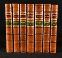
1816722L20Milano: Sonzogno e Comp 1816. First edition. Fine Binding. Very Good. 7" by 4". None. A beautifully illustrated Italian language edition of James Cook's global voyages. The first edition with these illustrations. Very rare and collated complete with all illustrations. In Italian. Captain James Cook was responsible for mapping New Zealand to Hawaii in a detail not previously charted by Western explorers. He sailed for twelve years around the Pacific Ocean which contributed to European's knowledge of the area. Illustrated with a frontispiece three coloured plates and a folding map to volume I. four coloured plates to volume II three coloured plates and one uncoloured plates to volume III. three coloured plates one uncoloured to volume IV four plates to volume V all hand-coloured. five plates to volumes VI and VII respectively all hand coloured. Therefore a frontispiece folding map 27 coloured plates and two uncoloured plates across all volumes. Folding map remains extremely bright. Collated all plates are present according to binder's instructions. Volume VII binder's instructions have not been bound in. With half titles to all volumes. A very scarce complete set of this work. In later uniform half calf bindings with paper covered boards. Externally very smart with just some light shelfwear to the extremities. Internally all volumes are firmly bound. Pages are bright. Minor damp-staining to all volumes with tidemarks to the head of all pages to volume I. This does not affect the readability of text. Volume II has the heaviest damp staining throughout affecting some of the text to page 205. Damp staining to the head of pages 212 to end of volume VI heavier to the final ten pages. Light tidemarks to the head of final few leaves to volume VII. Repair to the rear of folding map to volume I. Light ink spots to the bottom edges of volume III to margins only. Small worm hole from 385-end of volume V only affecting one letter per page. Otherwise just the odd spots to pages. Very Good Sonzogno e Comp unknown
44936London Printed from W. Stra (2 aot 1773) 3 volumes in-4, demi-veau coins, plats de papier mouchet, dos sans nerfs orns d'une pice de titre mosaque en maroquin rouge, d'une pice de tomaison mosaque en maroquin vert, l'ensemble orn de fers et filets dors; doublures et gardes de papier marbr, non rogns (reliures de l'poque). Seconde dition en anglais du premier voyage de James Cook vers les Terres australes effectu de 1768 1771 bord de l'Endeavour, illustre de 53 planches et cartes dpliantes graves dont 27 cartes (avec notamment la grande carte du dtroit de Magellan) et 26 planches (14 hors texte et 12 dpliantes). Cette seconde dition, publie le 2 aot 1773, soit moins de deux mois aprs la premire (juin 1773), se caractrise par une prface dans laquelle Hawkesworth rpond la raction vive qu'eut le gographe cossais Alexandre Dalrymple lors de la sortie de la premire dition, reprochant en particulier l'chec de Cook localiser le Grand Continent Sud.Le premier tome contient les voyages du commandant Byron et des capitaines Carteret et Wallis et leur dcouverte de Tahiti. Les second et troisime tomes relatent le premier voyage du lieutenant Cook qui ne fut promu capitaine qu' son retour. Les instructions de Cook pour ce premier voyage taient d'observer le transit de Vnus depuis Tahiti et de poursuivre l'examen de John Byron consacr aux mers entre le cap Horn et la Nouvelle-Hollande (l'Australie), en passant par la Nouvelle-Zlande. Son expdition prend fin avec une mission demi russie puisquil na pu ni confirmer ni infirmer lexistence dun continent au sud du Pacifique. De la bibliothque Arpad Plesch (ex-libris).
LCS-14600Première édition de la traduction française de J.-B. Le Febvre de Villebrune de l’œuvre principale d’Athénée « Le livre des Deipnosophistes » ou le Banquet des Savants. Paris, Lamy (de l’imprimerie de Didot jeune), 1789-1791. 5 volumes grand in-4 de: I/ (3) ff., 504 pp., (2) ff.; II/ (2) ff., 537 pp. (chiffrée par erreur 503), (3) pp; III/ (1) f.bl., (2) ff., 565 pp. (mal chiffrées), (4) pp., (1) f.bl.; IV/ (1) f.bl., (2) ff., 561 pp., (4) pp.; V/ (2) ff., 562 pp. Plein maroquin rouge de l’époque, grecque dorée autour des plats, dos à nerfs ornés, coupes décorées, roulette intérieure dorée, tranches dorées. Reliures de l’époque. 307 x 227 mm.
171861917Augsburg, Johann Jacob Lotter, 1718. 4°. Titel in Rot und Schwarz. Mit gest. Frontispiz, einigen Holzschn.-Vignetten u. -Initialen sowie 303 blattgroßen Kupfern. 20 Bll., 206 S., 11 Bll., 100 S., 4 Bll., 32 S., 2 Bll., 88 S., 6 Bll., 4 Bll., 2 Bll., 2 Bll., 1 Bl., 4 Bll., 216 S., 19 Bll., 116 S., 10 Bll., 199 S., 18 Bll., 203 S., 16 Bll., Reich blindgepr. Schweinsldr.-Bd. d. Zt. über Holzdeckeln a. 3 Bünden mit 2 intakten Schließen.
in-4, pp. 144, (8), leg. novecentesca con pergamena antica rimontata e colorata, doppio tass. in pelle al d. Risguardi in carta dec. Ritr. dello Stefani inc. in rame in vignetta al front. Dedicat. a Ottavio Gonzaga. Fregi e iniziali xilogr. Rarissima e celebre opera di gastronomia dello Stefani cuoco presso la corte dei Gonzaga, e inventore del famoso piatto mantovano del “cappone alla Stefani” che da lui prende il nome. Contiene centinaia di ricette con descrizioni di portate e menù per diverse occasioni e diversi palati. Divenne un testo di riferimento anche per le altre corti italiane. Inoltre colpiscono alcune sue annotazioni circa l’approvvigionamento delle materie prime “a chilometro zero” come diremmo noi oggi, anche a fini meramente economici come anche le diverse versioni di polpette e polpettoni con lo scopo di riciclare gli avanzi. Nella seconda parte del suo trattato viene ampiamente e minuziosamente descritto il banchetto, decisamente barocco, ordinato in occasione della visita a Mantova della Regina Cristina di Svezia nel 1655, allestito dai Gonzaga “nella solita Cameria Regia detta la Camera delle Virtù”, in cui si sofferma anche sui particolari delle portate, le materie prime, l’allestimento e vettovaglie (“Nel terzo della Tavola s’ergeva un Trionfo fatto di zuccaro, ed era il Monte Olimpo”). Al fine vi è un “Avvertimento” circa la difficoltà di procurarsi alcuni prodotti fuori stagione, e lo Stefani dimostra di ben conoscere i migliori mercati italiani (la riviera del Garda, la Sicilia, la riviera di Genova, Napoli, Venezia, Bologna la sua patria, il mantovano...) con la possibilità di approvvigionamenti “per chi hà valorosi destrieri, e buona borsa”. Antica nota di possesso ms al front. recita “Di Ercole Bulgarini”. Front. e prime cc con lieviss. gora presente anche sulle ultime 4 cc di indice. Qualche numero annotato a margine di calligrafia antica, forse per calcoli. Fresco e marginoso esempl. [209]
17858603<p><strong>Cook's Third Voyage</strong></p><p><strong>Discovery of the Hawaiian Islands</strong></p><p>3 volumes text plus atlas. Text volumes; quarto. 11½ x 9 inches. Atlas; elephant folio. 22½ x 16 inches. 10 i-xcvi 421pp 14 548pp 14 564pp. Text volumes with original dark brown leather boards rebacked with newer tan leather spines; 5 raised bands with gilt rule and gilt embossed embellishments red and black gilt lettered spine labels. Bookplates in each volume. Atlas in three-quarter brown leather and marbled paper boards. Gilt rule and gilt embossed embellishments on spine dark red leather spine label. Collated complete with 87 total plates; 24 plates bound into text volumes atlas with 63 plates one folding one double-page. Engraved medallions on titles. Covers of text volumes worn at corners boards worn and scuffed minor scuffing to spines. Each volume internally fine and bright with very minimal scattered foxing and offsetting from plates. Atlas with wear to edges covers worn and scuffed slight dent to fore edge. Minor wear to tissue guards but all plates bright and clean.</p><p>Third edition printed only one year after the first edition and the same year as the second. This edition includes the first appearance of "A Defence of the arguments advanced in the introduction to Captain Cook's last Voyage against the existence of Cape Circumcision" by William Wales. vol. III pp.557-564. The official narrative of Cook's third and final voyage. This is widely seen as the most important of his three voyages and certainly one of the most important books on the Hawaiian Islands as it documents all aspects of the Hawaiian culture at the time of discovery by Europeans. Includes the discovery of the Hawaiian Islands named the Sandwich Islands by Cook and is here where he ultimately met his death the exploration of the west coast of North America and the determination that there was no practical water route between the Pacific and Atlantic oceans. The first two volumes were taken from Cook's own journals which had been sent overland from Kamchatka by Clerke in May 1779. King one of Cook's closet companions was selected to write the account of Cook's death and the return voyage back to England which occupies the third volume. Beddie: 1553; Forbes: 62</p><p>Each text volume with the armorial bookplate of Robert Stirling Newall 1812-1889 well known Scottish engineer and astronomer.</p> Printed by H. Hughs, for G. Nicol and T. Cadell hardcover
1773BA0-570London, printed for Stanfield Parkinson, 1773. Lederband der Zeit, 4?, xxiii, 212 Seiten, 1 Blatt Errata, 27 Kupfertafeln inkl. Frontispiz und einer Landkarte, komplett, Einband altersgem?? berieben, Au?engelenke teils etwas m?rbe, dennoch gutes Exemplar, Mit dem Ex Libris des Henry Carew Glanville (1830-1900) Priester in Sheviock, (Cornwall ) // Leather binding of the time, 4?, xxiii, 212 pages, 1 leaf errata, 27 copper plates, incl. frontispiece and one map , complete, binding rubbed due to age, outer joints partly a little friable, nevertheless a good copy, with the bookplate of Henry Carew Glanville (1830-1900) Reverend in Sheviock, (Cornwall )
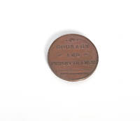
109674London 1780. . Bronze medal 37mm; obverse uniformed bust of Cook three-quarter right legend 'Capt. James Cook'; reverse inscription in three-lines 'Courage and Perseverance' 'Born 1728 Died 1779' in exergue; small dig to bust forehead otherwise about extremely fine.<br /> The Courage and Perseverance medal was struck soon after word of Capt. Cook's death reached England via Büsching's Wöchentlichte Nachrichten Berlin 1780. The news had arrived in Europe via despatches sent by Clerke and King from Kamchatka and word quickly spread to England of the events at Kealakekua Bay. The medal was produced in this period before the Resolution and Adventure returned to England in September 1780. This makes the medal one of the earliest artefacts associated with Cook's death. Rare.<br /> BHM 218. London [1780]. unknown
122696London W. Strahan and T. Cadell 1777. . First edition; 2 vols 4to 30 x 24.5 cm; engraved portrait of Captain Cook by James Basire as frontispiece 14 maps 6 of these folding 47 engraved plates after Hodges 23 of these folding 2 folding schematics 1 folding letterpress table small tear to one of the folding maps with old repair a couple of plates with marginal toning; publisher's original boards backed in later linen and title labels edges uncut a little wear to boards as expected housed in modern clamshell boxes a near fine set; xl 378; viii 396 pp.<br /> The first edition of the official account of Cook's second voyage with the maps in rare uncut state with full margins. Cook was sent by the Admiralty to ascertain whether Terra Australis really existed below the Antarctic Circle. <br /><br />Cook captained the first ship on record to cross the Antarctic Circle and the first to use the Larcum Kendall K1 chronometer. Although he discovered the South Sandwich Islands and South Georgia he did not gain sight of a Southern Continent and definitively disproved the Terra Australis theory. What he did see were the pacific islands between New Zealand and South America with much attention paid to the cultures and peoples he encountered. The plates show views plants and fauna indigenous handicrafts including weapons and most importantly eighteen portraits of Pacific Island peoples including New Zealand Tahiti Amsterdam Island Easter Island Marquesas Islands Raiatea Islands Bora Bora Tonga Vanuatu New Caledonia and Tierra del Fuego. <br /><br />Cook sailed aboard HMS Resolution whilst HMS Adventure was commanded by Tobias Furneaux. The two vessels were split up twice during their voyage: the first time they successfully met at the rendezvous at Queen Charlotte Sound in New Zealand the second time on their loop to Tonga they both made it back but missed each other by four days. Cook had returned first and set off again into the South Pacific leaving a message for his fellow captain. When Furneaux returned he lingered in New Zealand and lost ten crewmen in a clash with the M ori people after one of them broke a tapu i.e. taboo convincing him to make his return to Britain rather than chase Cook. His narrative is included at the end of the work.<br /><br />'Cook was a brilliant navigator and hydrographer an excellent administrator and planner and probably the first sea captain to realize the importance of preserving the health and well-being of his crew On his second voyage of 112 men on board the Resolution which he commanded Cook lost only one by disease - and that not scurvy - a unique achievement in his time' PMM.<br /> Beddie 1216; Hill 358; Holmes 24; PMM 223; Taurus 1. London, W. Strahan and T. Cadell, 1777. hardcover
1777376185London: for W. Strahan and T. Cadell 1777. Atlas only without text volumes. 63 plates and charts several double-page. Uncut. Folio. Contemporary blue paper covered boards later manuscript spine label a bit worn. Foxing. Atlas only without text volumes. 63 plates and charts several double-page. Uncut. Folio. The goal of Cook's second voyage undertaken in 1772-75 was to circumnavigate the world as far south as possible in search of unknown southern lands. "The success of Cook's first voyage led the Admiralty to send him on a second expedition . which was to circumnavigate the globe as far south as possible in search of any southern continents.The men of this expedition became the first to cross the Antarctic Circle. Further visits were made to New Zealand and on two great sweeps Cook made an astonishing series of discoveries and rediscoveries including Easter Island the Marquesas Tahiti and the Society Islands Niue the Tonga Islands the New Hebrides New Caledonia Norfolk Island and a number of smaller islands. Rounding Cape Horn on the last part of the voyage Cook discovered and charted South Georgia after which he called at Cape Town St. Helena and Ascension and the Azores.This voyage produced a vast amount of information concerning the Pacific peoples and islands proved the value of the chronometer as an aid to finding longitude and improved techniques for preventing scurvy" Hill. <br /> <br /> Present here is a highly desirable separate atlas of the maps and plates to the first edition of the second voyage. Almost all copies of the second voyage had the engraved plates trimmed and folded into the two text volumes but a very few examples were produced likely for members of the Admiralty or other notables with the plates unfolded untrimmed and bound in atlas form with the exception of the frontispiece portrait of Cook which remained in the text and therefore not present here. We have seen only a handful of examples of this format which represent a distinct and special issue of the book and note that the plates within such atlases tend to be far superior impressions than those found bound within the text volumes.<br /> <br /> "Cook earned his place in history by opening up the Pacific to western civilization and by the foundation of British Australia. The world was given for the first time an essentially complete knowledge of the Pacific Ocean and Australia and Cook proved once and for all that there was no great southern continent as had always been believed. He also suggested the existence of antarctic land in the southern ice ring a fact which was not proved until the explorations of the nineteenth century" Printing and the Mind of Man.<br /> <br /> The Cook voyages form the basis for any collection of Pacific exploration and the second in particular is the foundation for any Antarctic collection. Hill 358; Beddie 1216; Spence 314; Holmes 24; PMM 223; Sabin 16245; Rosove 77 for W. Strahan and T. Cadell unknown
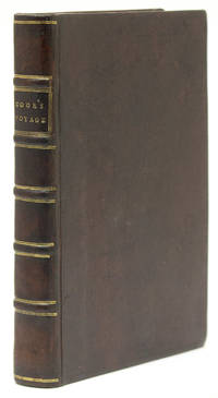
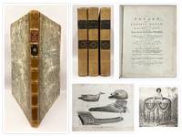
1773B3354London: Strahan & Cadell 1773. Minor tears in the charts of Magellan’s Strait and of New Zealand and in the plates “No. 6†“No. 21†and “No. 22†all professionally repaired. In Volume 1 pp. 139 is marked as “139-360†after which the pagination jumps to pp. 363 with no loss. The gathering “4 N†pp. 641-648 is misbound having been placed before “4 M†pp. 633-640 but there is no loss. In Volume 3 pp. 189 is marked as “191†with no loss. A fine set of this rare first edition of Cook’s first voyage. Text and plates are clean and crisp and bound in full contemporary gilt decorative calf. Edition: First edition Binding: Contemporary full speckled tan calf rebacked superbly matching the speckled tan boards and saving original title labels spine in seven compartments of raised gilt bands and densely-gilt compartments red and green morocco labels on two and three respectively gilt-tooled board edges endpapers marbled. Notes: “The first voyage under the not-yet famous Captain Cook’s command on the Endeavour was primarily of a scientific nature…Entering the Pacific around Cape Horn Cook reached Tahiti in 1769 and carried out the necessary astronomical observations…Leaving Tahiti in July Cook discovered named and charted the Society Islands and then heading southwest explored New Zealand…Cook then headed towards Australia and discovered and charted the eastern coast for 2000 miles naming the New South Wales. He nearly lost his ship on the Great Barrier Reef. Both Australia and New Zealand were annexed by Britain as a result of this voyage which began in 1768 and ended in 1771. Cook had charted upwards of 5000 miles of coastline under great difficulties. Cook’s discoveries won him prominence promotion and the opportunity to sail again…Hawksworth an eminent London author was chosen by Lord Sandwich and commissioned by the Admiralty to prepare these narratives for publication. Hawkesworth had succeeded Dr. Samuel Johnson as the editor of the Gentleman’s Magazine and with him had founded The Adventure. He had also edited the work of Jonathan Swift.†Hill Size: 4to Illustration: Complete with all 52 plates and charts including the “Chart of the Strait of Magellan†and the directions for placing the cuts. Volume: Three Volumes References: Hill 782; Beddie 648; Sabin 30934. Pages: P. Volume 1. 6 title blank dedication 3 contents 6 introduction i-xxi blank glossary xxiii-xxxiv directions for placing the cuts xxxvi-xxxvi half-title blank 3-139 blank half-title blank 363-632 641-648 633-640 649-676 6; Volume 2. 6 title blank contents 5 blank half-title blank introduction xi-xv errata 1-410 6; Volume 3. 6 title blank contents 4 411-799 blank 6. Category: Book Voyages General; Book Pacific Strahan & Cadell hardcover
in-4 (mm 206x150), ff. (4), 311, (13, ill.), leg. coeva in pergamena floscia. Nei ff. preliminari: privilegio di Pio V, dedica "a Don Franc. di Reinoso scalco e cameriero secreto" e dedica ai Lettori. Stupendamente illustrato con ritratto inciso in rame dell'autore e da 27 artistiche tavole a piena pag. f.t. in silografia (una su doppia pag. delinea con ricchezza di particolari il cerimoniale del servizio di mensa nel Conclave dell'inverno 1549-50): esse offrono una straordinaria documentazione degli arnesi e dei lavori di cucina e rivelano la progredita tecnologia e l'armamentario di una tra le officine gastronomiche principesche del tardo Rinascimento italiano. "Il trattato, ch'è il più ampio e completo fra quanti ne vennero elaborati nel ‘500, ha il carattere di una summa sistematica, frutto di innumerevoli esperienze codificate e filtrate da una rielaborazione unitaria ad opera di un redattore lucido, asciutto, efficiente, che usa un linguaggio tecnico altamente specializzato." (Firpo, Gastronomia del Rinascimento). Quinta edizione (prima 1570) di questo celebre classico della letteratura gastronomica italiana, di grande valore anche per la storia del costume e della tecnologia. Opera rara a trovarsi in buono stato e integra di tavole. Bell'esemplare, puro, grande di margini. Lievissimi aloni e arrossamenti della carta.. Westbury, p.202. Vicaire, 773. BING 1781. Bitting 419. Oberlè cita solo le edizioni del 1605 e 1610..
177325577London: printed for W. Strahan and T. Cadell 1773. 3 volumes quarto. 11 x 8 5/8 inches. 51 engraved plates maps and charts 41 folding. Some small repaired tears. Contemporary calf gilt border to covers expertly rebacked to style spine with raised bands in six compartments red and green morocco lettering pieces in the second and fourth compartments the others with a repeat decoration in gilt period marbled endpapers<br/> <br/>Provenance: Earl Fitzwilliam Milton House Cambridgeshire book label armorial bookplate<br/> <br/>The Fitzwilliam set of the first edition first issue of Hawkesworth's account of the most important mid-18th century English voyages of exploration to the southern hemisphere including the official account of Cook's first voyage. A fascinating narrative intended to "embellish England's prestige as a maritime power" Hill and describing events that were to be major factors in the shaping of Pacific exploration.<br/> <br/>The first volume contains accounts edited by Hawkesworth of the voyages of Byron Wallis and Carteret with the remaining volumes dedicated wholly to Cook's first voyage. "The first voyage under . Captain Cook's command on the Endeavour was primarily of a scientific nature. The expedition was to sail to Tahiti in order to observe the transit of Venus across the disk of the sun to determine the earth's distance from the sun and also to carry on the geographical discovery that John Byron had started. Entering the Pacific around Cape Horn Cook reached Tahiti in 1769 and carried out the necessary astronomical observations . Sir Joseph Banks and Daniel C. Solander carried out extensive ethnological and botanical research. Leaving Tahiti in July Cook discovered named and charted the Society Islands and then heading southwest explored New Zealand which resulted in . a detailed survey of the country. Cook then headed toward Australia and discovered and charted the eastern coast for 2000 miles naming the area New South Wales . Both Australia and New Zealand were annexed by the British as a result of this voyage which began in 1768 and ended in 1771. Cook had charted upwards of 5000 miles of coastline under great difficulties. Cook's discoveries won him prominence promotion and the opportunity to sail again. They also ensured John Hawkesworth's position in maritime literary history as the official chronicler of Cook's first voyage. Hawkesworth an eminent London author was chosen by Lord Sandwich and commissioned by the Admiralty to prepare these narratives for publication . He was expected to add polish to the rough narratives of sea men and to present the accounts in a style befitting the status of the voyages as official government expeditions intended to embellish England's prestige as a maritime power" Hill. This copy is bound without the "Directions for placing the cuts" or the "Chart of the Strait of Magellan" in vol. I both not required in the earliest issues.<br/> <br/>Beddie 648; Hill p.139; Holmes 5; Sabin 30934. printed for W. Strahan, and T. Cadell unknown books
17732409002W. Strahan and T. Cadell 1773. first. hardcover. nera fine/very good. First editions 3 volumes. All 3 volumes have been rebound. !st vol.: old front free end paper taped to binding with paper tape. 2nd vol.: front free end paper partially repaired where tears were. Vol 2 and 3 have former owner's name written to top of title pages. All 3 volumes in near fine to very good condition some minor foxing. W. Strahan and T. Cadell unknown
1664ABC_50496Amsterdam 1664. Oblong 8vo. Hieronymus Sweerts Contemporary vellum sewn on 2 supports laced through the joints. With an engraved frontispiece and 32 engraved plates 1 folding 31 full-page. 96 pp. Rare first edition of one the finest and most extensively illustrated early works on culinary carving describing and illustrating refined techniques the order of serving and the handling of various foods including poultry hare rabbit pork veal lamb mutton venison ham lobster fish artichokes and both sweet and savoury pastries. The plates illustrate a variety of carving methods and include a large folding plate depicting forks and carving knives. The work predates Joseph Moxons well-known deck of cards with illustrated carving instructions by thirteen years.The frontispiece depicts a gentleman at table attended by a servant carving a fowl in the Italian manner holding it aloft on a fork and carving it in mid-air for display. As noted by the anonymous author in the preface this method was not customary in the Netherlands. Accordingly the work addresses both this practice and the more conventional technique of carving on a platter. Hieronymous Sweerts 1629-1696 was a printer bookseller and poet from Amsterdam who was trained at the printing office of his uncle Paulus Aertsz. van Ravesteyn. He established his own press in 1664 and printed a wide variety of works including Bibles poetry fables and separate prints. The present work was published anonymously but one WorldCat description of the present edition says that Sweerts signed the preface "H. Sw." suggesting he might be the author of the work or at least the preface. However in all copies we have seen including the present the preface is unsigned.The vellum is soiled and somewhat stained with a small split at the spine and at the bottom of the front board. The leaves and plates are somewhat foxed and occasionally stained. Otherwise in good condition.l Bibliotheca Gastronomica 6508 4 copies; Bitting p. 530; Ferro 81a; Horn-Arndt 114; Landwehr Ned. Kookboek 17.2 this issue & 17 1664 issue; STCN 84289344X 4 copies; Van Tol et al. Kookboeken 1991 13 & ill. 10; USTC 1801667 4 copies; Vicaire col. 870; WorldCat 993593983 1170905165 902095689 504084118 8 copies; cf. for Sweerts: Van Eeghen IV pp. 138-140. hardcover
in-8 (mm 200x129), pp. VIII, 3 a 51, (1 di Errata), cartonato rustico coevo, titolo manoscritto in inchiostro antico al dorso. Con 3 tavole ripiegate raffiguranti il celeberrimo tubero, incise a colori da Louis Charles Gautier D'Agoty. Interessantissimo studio sui tartufi bianchi piemontesi, di notevole rarità ed importanza scientifica e gastronomica. E' scritto in forma di tre lettere inviate al marchese di Balbiano ed al conte Morozzo. I D'Agoty furono tra i primi inventori dell'arte d'incidere a mezzotinto a più colori, mediante la tricromia: ''consistait à imprimer avec trois planches préparées au berceau, encrées en bleu, jaune et rouge, de telle sorte que les autres couleurs fussent obtenues par superposition et les valeurs par le jeu du brunissoir sur le cuivre bercé de chaque planche... On connaît très peu de pièces de Louis d'Agoty et ces 3 planches ont échappé à l'Inventaire du Fonds français, X, p. 92'' (Oberlé, nei suoi Fastes de Bacchus). Il conte polacco Michel-Jean de Borch, naturalista e viaggiatore, dopo un soggiorno nel Monferrato descrisse dettagliatamente le caratteristiche morfologiche ed organolettiche di alcune specie di tartufi ("deux espèces de truffes blanches (tuber albidum et bianchetti), qui croissent dans le Piémont et dont la finesse est proverbiale." . Riferisce della presenza di ''filamenti'' (ife) e ''semi'' spore, in grado di determinare la crescita a distanza. Escludendo l'ipotesi della germinazione spontanea dei tuberi, sostenne il ruolo essenziale di taluni alberi d'alto fusto nella crescita dei tuberi. Indica i terreni idonei alla loro vegetazione, in particolare di un tartufo meno pregiato, ma presente sul territorio piemontese, allora noto con il nome di Bianchetto, che nel 1788 avrà la sua definitiva classificazione tra i miceti ipogei come Tuber Borchii. Pare che esista una prima tiratura con l'Errata impressa su un solo lato di un foglio aggiunto, invece che al verso dell'ultimo f. come il presente. Rarissimo libretto. Qualche alone limitato al frontespizio, per il resto ottimo esemplare.. Pritzel 996. Vicaire 104. Schliemann 154. Georg 172. Oberlé, ''Fastes'', 721. Manca a Bitting, Nissen, Simon, Westbury..
17881602202797<p>Heinrich Zimmermann's account of Captain James Cook's last voyage is one of the earliest and most vivid firsthand descriptions of that historic expedition. Written by a German sailor who served aboard the Discovery Zimmermann's narrative offers a unique perspective—less formal and scientific than the official reports but rich in human detail and emotional depth.</p><p>Zimmermann describes Cook's third voyage which set out in 1776 with the goal of discovering a northwest passage between the Pacific and Atlantic oceans. His observations take readers through the Pacific islands the icy northern coasts of America and ultimately to Hawaii where Cook met his tragic death at Kealakekua Bay in 1779. Unlike some later accounts Zimmermann's portrayal captures both the adventurous spirit of the expedition and the everyday challenges faced by its crew—storms disease and cultural misunderstandings.</p><p>His description of Cook's death is especially poignant. Zimmermann depicts the confusion and violence of the encounter with remarkable immediacy revealing both his respect for Cook and his sorrow at the loss of a leader he admired deeply. Throughout the text Zimmermann's tone conveys sincerity and wonder showing a sailor's eye for detail and a genuine appreciation for the peoples and lands encountered.</p><p>Though less polished than the official journals Zimmermann's narrative remains valuable for its honesty and humanity. It complements the more formal accounts by giving voice to the ordinary seaman's experience making it not only a historical record but also a deeply personal reflection on exploration leadership and the tragic end of one of history's greatest navigators.</p><p>This is a second Russian edition revised and augmented presents Heinrich Zimmermann's important narrative of Captain Cook's third and final voyage including a vivid description of Cook's death at Kealakekua Bay Hawaii. In addition to Zimmermann's account this edition contains articles on Tahiti a biographical sketch of James Cook and an essay on America which were not included in the first Russian edition of 1786.</p><p>Title-page stained. With owner's entry in Russianat flyleafs. Spine damaged at head foot and center. Bumped corners. Cover nearly dettached from book block. Pages soiled at corners. Contemporary calf Pages: 4 211 1 blank pp. Overall a good copy of an extremely rare Russian edition of Zimmerman's account.l Beddie 1570; Forbes 154; Howes 11435; Strathern Navigations 631 vii; cf. Holmes 40 first German ed.</p> P. B. [Piotr Bogdanovich] hardcover
178542677Paris, Hôtel de Thou, 1785. Ensemble de 18 vol. in-8 et 3 vol. d'atlas in-4 de 52-67-88 planches, demi-veau havane, dos lisse orné de filets dorés, pièces de titre et de tomaison en veau vert (reliure de l'époque).
In-8 (mm 197x145), ff. (3), 343 numerate solo al recto, ritratto dell'Aautore inciso a piena pagina e al fondo 15 fogli con illustrazioni xilografiche su ambo le facciate, di notevole importanza per la storia della gastronomia. Legatura in piena pergamena antica abilmente rimontata. Bella quarta edizione in carattere tondo e capilettera ornati. La prima edizione di questo celebre classico della letteratura gastronomica italiana, apparve nel 1570, è da considerare di grande valore anche per la storia del costume e della tecnologia. Nei ff. preliminari: privilegio di Pio V, dedica "a Don Franc. di Reinoso scalco e cameriero secreto" e dedica ai Lettori. Stupendamente illustrato con ritratto inciso in rame dell'autore e da 27 artistiche tavole a piena pag. f.t. in silografia (una su doppia pag. delinea con ricchezza di particolari il cerimoniale del servizio di mensa nel Conclave dell'inverno 1549-50): esse offrono una straordinaria documentazione degli arnesi e dei lavori di cucina e rivelano la progredita tecnologia e l'armamentario di una tra le officine gastronomiche principesche del tardo Rinascimento italiano. "Il trattato, ch'è il più ampio e completo fra quanti ne vennero elaborati nel "500, ha il carattere di una summa sistematica, frutto di innumerevoli esperienze codificate e filtrate da una rielaborazione unitaria ad opera di un redattore lucido, asciutto, efficiente, che usa un linguaggio tecnico altamente specializzato." (Firpo, Gastronomia del Rinascimento). Opera rara a trovarsi in buono stato e integra di tavole. Buon esemplare, rari aloni, restauri alla tavola doppia raffigurante il banchetto, piccoli scarabocchi in inchiostro su tre fogli dell'indice.. Westbury, p.202, Vicaire, 773. Bitting 419. Oberlè cita solo le edizioni del 1605 e 1610..