ORTELIUS Abraham (1528 - 1598)MareMagnum

6 228 résultats
Decorativa carta geografica delle Isole Britanniche, riferita al tempo degli antichi Romani.La carta, per la prima volta pubblicata da Ortelius nel suo Parergon del 1595, è basta su informazioni geografiche fornite dalla carta murale delle Isole Britanniche di Mercator (1564) e sugli aggiornamenti forniti da Saxton (1579). Le notizie storiche sono invece derivanti dalle fonti classiche quali Plinio, Tacito, Appiano e Strabone. Tratta dal Parergon, il primo atlante storico mai pubblicato. Fu inizialmente concepito da Ortelius come appendice del suo Theatrum Orbis Terrarum ma visto il notevole successo di queste carte storiche divenne in seguito un lavoro indipendente e rimase la fonte principale di tutti i lavori simili per tutto il XVII secolo. Come sottolinea Koeman “il Parergon deve essere considerato come lavoro personale di Ortelius. Per quest'opera, infatti, diversamente dal Theatrum, non copiò le mappe di altri cartografi, ma ne disegnò lui stesso di nuove ed originali…prese luoghi, regioni e territori delle civiltà classiche illustrandone e spiegandone la storia, una materia molto vicina al suo cuore. Le mappe e le lastre del Parergon devono essere valutate come le più importanti incisioni che rappresentano il diffuso interesse per la geografia classica nel XVI secolo”. Il Theatrum Orbis Terrarum e che è considerato il primo vero “atlante” moderno. L’opera fu pubblicata in 7 lingue e 36 edizioni, per il quale – nel 1570 - Ortelius ottenne il privilegio, ovvero una sorta di diritto d'autore che impediva ad altri cartografi di pubblicare i propri lavori. Il Theatrum rappresentava il lavoro più avanzato del lavoro della descrizione cartografica. L’Ortelius vi raccolse il sapere geografico e cartografico del suo tempo, proponendo in 147 spettacolari tavole incise l’immagine più fedele del mondo allora conosciuto e, in alcune straordinarie “carte storiche”, regioni e itinerari tratti dalla letteratura, dalla mitologia, dalla tradizione. Esemplare tratto dall'edizione latina del 1619. Incisione in rame, finemente colorata a mano, in ottimo stato di conservazione. Decorative and rare map of the British Isles in Roman times. The map was first published in the 1595 edition of Ortelius' atlas. The map was made based upon modern information from Mercator's 1564 map of the British Isles, improved by a new outline from Saxton's 1579 map (Meurer p. 197, Karrow 56/16, p. 387-388)nd ancient knowledge from Diodorus, Siculus, Plinius, Appianus, Tacitus, Cæsar and Strabo. The map is filled with ancient place names, Hadrian's Wall, and Wall of Pius (mislabeled Severi Imp. Murus).Richly embellished with three large strapwork cartouches and several sailing vessels. Map taken from the Parergon, the first historical atlas ever published. It was initially conceived by Ortelius as an appendix to his Theatrum Orbis Terrarum, but given the considerable success of these historical maps it later became an independent work and remained the main source of all similar works throughout the seventeenth century. Koeman wrote: "This atlas of ancient geography must be regarded as a personal work of Ortelius. For this work he did not, as in the Theatrum, copy other people's maps but drew the originals himself... He took many places and regions from the lands of classical civilization to illustrate and clarify their history, a subject very close to his heart... The maps and plates of the Parergon have to be evaluated as the most outstanding engravings depicting the wide-spread interest in classical geography in the 16th century." The Theatrum Orbis Terrarum, which is considered the first true modern "Atlas". The work was published in 7 languages and 36 editions, for which - in 1570 - Ortelius obtained the privilege, a kind of copyright that prevented other cartographers from publishing his works. The Theatrum represented the most advanced work of cartographic description. Ortelius collected in it the geographical and cartographic knowledge of his time, proposing in 147 spectacular engraved plates the most faithful image of the world then known and, in some extraordinary "historical maps", regions and routes taken from literature, mythology, tradition. Latin editon of 1619. Copperplate with fine hand colouring, very good condition. Van den Broecke #192; Shirley, R.W. (BI to 1650) 186, pl.42.
192005907THE STORY OF DOCTOR DOLITTLE Stokes 1920 first edition slight wear to the spine extremities some age toning to the page edges else a tight vg copy with unbroken inner hinges in the publishers original pictorial binding. Profusely illustrated by the author/artist. Once the copy of famous syndicated cartoonist William Ireland of the Columbus Dispatch who had made a Christmas gift of this book to his family doctor with not only an inscription to him dated 1921 but also with a full page drawing making this copy unique and of course very special. The first book in this marvelous series and the origin book for the film of the same name along with Ireland's original pen & ink art. A PETER PARLEY TO PENROD title. Ireland's doctors name was James Dolittle and thus the reason of this as a gift to him I'm sure. Stokes unknown
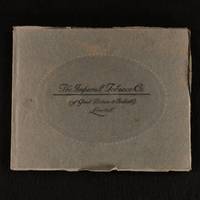
1922851W32Bristol: The Imperial Tobacco Company of Great Britain and Ireland Limited 1922 . First edition. Paperback. Very Good. 10" by 12". The Imperial Tobacco Company of Great Britain and Ireland Limited. A scarce photographic catalogue for the Imperial Tobacco Company for its shareholders. First edition of The Imperial Tobacco Company of Great Britain and Ireland Limited catalogue. In the original publishers paper covered boards. A scarce photographic catalogue of the factories and offices of The Imperial Tobacco Company. With only one copy held in libraries.With fifty six pages including many black and white photographs. An album presented to the shareholders of the company 'to give them ocular rather than verbal descriptions of the Factories and Offices'.The company was founded in 1901 through the amalgamation of thirteen British tobacco and cigarette companies. In the original publishers paper covered boards. Externally smart. There is some bumping to the head and tail of the spine and to the extremities. There is some wear to the extremities. Internally firmly bound. The pages are bright and clean. Very Good The Imperial Tobacco Company (of Great Britain and Ireland) Limited paperback
1916ZB679337Anthropological Institute of Great Britain and Ireland 1916. Volumes 16-54 1916-1954 bound library markings else text clean and bindings tight. - If you are reading this this item is actually physically in our stock and ready for shipment once ordered. We are not bookjackers. Buyer is responsible for any additional duties taxes or fees required by recipient's country. Photos available upon request. Anthropological Institute of Great Britain and Ireland unknown
1812WN55111London: Boydell and Co. 1812. Red burgundy straight grain morocco gilt spine lettering 5 raised bands gilt rules borders dentelles etc. and much blind stamping. AEG. Spines joints corners and edges worn with some leather loss. Some hinges starting. Owner signatures at top of title pages. A unique assemblage and commentary on the work of William Hogarth. Third Edition. Full Leather. Good/No Jacket. Illus. by Hogarth William. 8vo - over 7¾" - 9¾" tall. Trade. Boydell and Co. Paperback books
1885CCC-126Reliure percaline grenas tachée avec lettrage dorée, edition original numerote sur papier epais, dedicace par l auteur a son oncle sur la page d avant garde (5 lignes date de janvier 1900), signature sous la gravure du frontispice, in-4 24.5cm X 30.5cm, nombreuses gravures de charles Laurie, 514 pages, taches de rousseurs, photos possibles
Nuova e revisionata carta delle isole britanniche di Frederick De Wit. Estremamente decorativo il cartiglio del titolo e le armi reali di William e Mary (1689-94) sopra la scala miliare in basso a sinistra. Esemplare nel primo stato. Incisione in rame, finemente colorata a mano, sapiente lavoro di restauro alle estremità dei margini e sulla piega centrale, altrimenti in ottime condizioni. Fine decorative map of Britain that includes an inset of the Faro, Shetland and Orkney Islands. The cartography of Ireland follows Petty's surveys and the map is fully engraved with political information. The title cartouche is surrounded by clouds in which putti display the coats of arms of England, Scotland and Ireland. The scale of miles is further embellished with the royal coat of arms during the reign of William and Mary (1689-94) and several figures. This is the second state. This example appears to be state 1. Original color with some light spots and two cracks due to the oxidation of the green pigment, although paper is otherwise supple. Shirley, Mapping of the British Isles 1650-1750, De Wit 6
1915ZB679333Royal Anthropological Institute of Great Britain and Ireland 1915. Volumes 45-94 1915-1964 uniformly bound library markings else text clean and bindings tight. - If you are reading this this item is actually physically in our stock and ready for shipment once ordered. We are not bookjackers. Buyer is responsible for any additional duties taxes or fees required by recipient's country. Photos available upon request. Royal Anthropological Institute of Great Britain and Ireland unknown
2 vols., 8vo., First Edition, Large Paper, with engraved pictorial titles, printed titles, 53 fine sepia aquatint plates, 21 woodcut illustrations in the text and 2 full-page maps, mild dust-soiling at blank margins, some offsetting from plates to facing pages; attractively bound in early twentieth century crushed brown half morocco, brown cloth boards, back with five raised bands tooled in gilt, second and fourth compartments lettered and numbered in gilt, all other compartments ruled in gilt, a bright, firm copy. With half-titles, and errata leaf at end of each volume. The aquatint titles and plates are engraved by C. Apostool after Ireland. LARGE PAPER COPIES ARE SCARCE. Abbey: Scenery 430; Anderson, p. 38; Upcott CXLIII.
Folio, xxxviipp., followed by 198 collotype facsimile leaves, from the library of Percy J. Paley, Castle Hacket (bookplate), orig. cloth, some light staining and scratches but overall a very good copy. The manuscript was prepared for Finghin MacCarthy Reagh in the fifteenth-century and discovered in 1814 at Lismore Castle, Co. Waterford, Ireland.
1797579047Published by R. Faulder T. Egerton 1797. 1st edition. Hardback. Very Good. Very good condition with no wrapper. Picturesque Views on the River Wye From its Source at Plinlimmon Hill to its Junction With the Severn Below Chepstow With Observations on the Public Buildings and Other Works of Art in its Vicinity. Map showing the course of the River Wye 30 sepia aquatints plus b/w portrait plate of John Kyrle. xii 159 pages errata slip. Three-quarter brown calf binding raised bands gilt decorations and title to spine. Marbled endpapers. Top edge gilt. 9" x 6.5". All plates present. Prelims foxed. No half-title but no evidence of any removal. Some pencil annotation. Bookplate of J. Arthur Hutton the famous angling author on front pastedown. Hutton wrote numerous books on salmon fishing and of particular relevance here given the book title are Wye Salmon and Other Fish; Rod-Fishing for Salmon on the Wye. Slight rubbing to spine. Overall a handsome copy. Published by R. Faulder, T. Egerton hardcover
179488755London: Faulder 1794. hardcover. 2 vols. 102 copper engravings tall 8vo full green straight grained morocco a.e.g. London 1794.<br/><br/> Faulder unknown books
179488755London: Faulder 1794. hardcover. 2 vols. 102 copper engravings tall 8vo full green straight grained morocco a.e.g. London 1794.<br/> <br/> Faulder unknown
1814G105956Buckingham/ London, Seeley/ Payne 1814 Volume 1 only (out of 4): V + CCLXXVI + CLXXXIV + [X] + CCVII pp., complete with its 7 plates out of text (of which 4 folding) and one folding map, limited edition of only 200 copies printed at the expense of the first Duke of Buckingham and Chandos, modern hardcover with gilt title on spine, 30cm., stamp and small inscribed number on blanco endpaper, ex-libris tipped on at verso of title page, pages partly uncut, text is clean and bright except for some occasional foxing (text always well readable), good copy, weight: 2.3kg., G105956
Volume 1 only (out of 4): V + CCLXXVI + CLXXXIV + [X] + CCVII pp., complete with its 7 plates out of text (of which 4 folding) and one folding map, limited edition of only 200 copies printed at the expense of the first Duke of Buckingham and Chandos, modern hardcover with gilt title on spine, 30cm., stamp and small inscribed number on blanco endpaper, ex-libris tipped on at verso of title page, pages partly uncut, text is clean and bright except for some occasional foxing (text always well readable), good copy, weight: 2.3kg., G105956
1825G105957Buckingham/ London, Seeley/ Payne 1825 Volume 2 only (out of 4): XXXII + 317,[2] + [XIII] + 156 + IX + 84,[1] + 48,[1] pp., complete with its 6 plates out of text (in fine), limited edition of only 200 copies printed at the expense of the first Duke of Buckingham and Chandos, modern hardcover with gilt title on spine, 30cm., stamp and small inscribed number on blanco endpaper, most pages still uncut, some occasional foxing (text always well readable), good copy, weight: 2.2kg., G105957
Volume 2 only (out of 4): XXXII + 317,[2] + [XIII] + 156 + IX + 84,[1] + 48,[1] pp., complete with its 6 plates out of text (in fine), limited edition of only 200 copies printed at the expense of the first Duke of Buckingham and Chandos, modern hardcover with gilt title on spine, 30cm., stamp and small inscribed number on blanco endpaper, most pages still uncut, some occasional foxing (text always well readable), good copy, weight: 2.2kg., G105957
26137London: Published by His Majesty's Stationery Office 1913 and 1912 respectively. 1. A Bill To amend the Provision for the Government of Ireland 43pp fol. sewn no wraps or covers p.i and titlepage dusted ow good condition; 2. Outline of Financial Provisions 8pp. fol. no wraps or covers poor condition but complete. London: Published by His Majesty's Stationery Office, [1913] and 1912 respectively. paperback
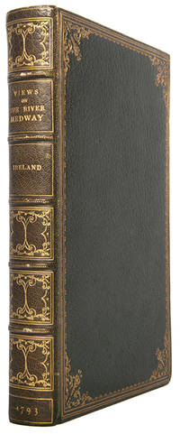
114023London T. and J. Egerton 1793. . First edition; 8vo 23 x 17 cm; 28 hand-coloured aquatint plates additional hand-coloured title plate and monochrome map further in-text engravings with half-title bookplate to front pastedown text block clean and tight; later full crushed morocco by Morrell boards gilt board edges ruled in gilt spine lettered in gilt in six compartments inner dentelles gilt top edge gilt a touch of rubbing to corners and spine bands otherwise fine; xii 206 2pp.<br /> A smartly bound work showing lovely scenes of the river Medway and landmarks including Minster Abbey Hever Castle and Bayham Abbey. This was Ireland's third work in his Picturesque Views series and not always issued with the plates hand-coloured. Also issued in a folio format.<br /> Abbey Scenery 428; ESTC T146600. London, T. and J. Egerton, 1793. hardcover
180035667London: Printed by C. Clarke and Published By R. Faulder and J. Egerton 1800. Small 4to. First edition. xvi. 254 errata leaf. 21 sepia aquatints of the Inns of Court. Bound in a very pleasant full tan calf executed by Baytun Riviere. Black and red title labels and compartments filled with a leaf and berry design. Gilt lines to the boards with a leaf and berry design towards the corners between lines. Blind stamped vine-leaf border panel in the middle of each board. Gilt inner-dentelles and all edges gilt 236 mm tall. A beautiful volume. Samuel Ireland was the father of the Shakespeare forger W. H. Ireland. . Near Fine. Gilt-decorated Calf. First Edition. 1800. Printed by C. Clarke and Published By R. Faulder and J. Egerton 1800 unknown
40033Maestricht.Dufour & Roux.1779.7 vols.in-12 en veau blond raciné d'époque.Traduit de l'anglais. Be.Trace de vers sur coiffe supérieure du Tome VI.Coins très légèrement émoussés.Tranches rouges.Pièces de titre et de tomaison en maroquin rouge et vert.Signatures à l'encre très discrète en débuts de volumes.
29383Amsterdam. Chez les Freres Chatelain. 1708. No Binding. Fine. 45x 52.5cm 17.5"x 20.5" image 34.5x 46cm with 2 small inset maps: 11cm x 8cm 4.5cm x 3cm uncoloured indexes in fine condition The copper-plate maps from Chatelain's "Atlas Historique" published 1705-1720 in 7 vols. are based on the work of French cartographer Guillaume De L'Isle. There were four issues/editions of this seven volume atlas; 1705-1720 1712-20 1718-120 & 1732-1739. In these subsequent edition the present map appears in Vol. 3. The inset maps are of ancient Ireland and contemporary ecclesiastical Ireland with descriptions in French on both. Tables include political ecclesiastical and geographical information. - "Title appears outside the neat line across the top. The main map is again flanked by columns of engraved text. In this instance each column is headed by a small map of the country that on the left shows the ancient religious divisions that on the right the present day 1708 divisions. There is a single scale line towards the border of the main map. The box at the title now has 'Tome 2 / Nop 58' and the imprint Avec Privilege de Nosseigneurs les Etats'd'Hollande et de Westfri; appear at the bottom of the left column". Bonar Law #47. Amsterdam. Chez les Freres Chatelain. 1708 unknown
1824008008London: Printed for Robert Triphook 1824. RARE. Printed by J. Moyes Greville Street. clxii 2 239; cccxix 144 pp. Vol. I with with frontispiece engraved portrait and fold-out chart of the Siege of Orleans in 1428; Vol. II with fold-out frontispiece engraving of the Presentation of Jeanne D'Arc to Charles VII at Chinon and two plates bound after cclxxii showing exterior and interior of house at Domremy where Jeanne D'Arc was born. Bookplates of Monsignor Joseph M. Gleason 1869-1942 who was a Californian Catholic priest educator historian and noted collector of books and photographs Two volumes bound in full polished calf the backs with intricate fleurs-de-lys decorations and two calf labels lettered in gilt the fronts and backs with blind tooled rules bordering three gilt rules and small gilt decorations at corners fronts with gilt initials and numbers bottom left corner with those on Vol. II appearing to be rubbed out. All edges gilt. Plain green end papers that appear early 20th c. A Very Good set dime-sized stain front cover Vol. II light rubbing to boards foxing and toning only at end pages and frontis engraving of Vol. I. rest of interior pages quite clean and lovely. Fold-outs are Fine. "Consists mainly of translation from French works with notes by the editor."WorldCat . First Edition. Full Calf. Very Good/No Jacket As Issued. 8vo - over 7¾" - 9¾" tall. Printed for Robert Triphook Hardcover books
033564University of Texas Press 1965. First edition. 1965. Hardcover with dust jacket. 4to with 476 pages. Signed by "LeRoy Ireland" on front free endpaper. The book is in very good condition with slight shelf wear some very slight foxing to the top of the page block. Some slight bumping to corners. The dust jacket is in good condition with some rubbing and wear to edges. There are two tears to dj 1/4" to bottom of front cover and a 2" to top of back cover. Sunning to spine. Interior is clean and tight. Pictures available upon request. "The work of 30 years of research by Ireland this book contains over 1500 authenticated Inness paintings and nearly 1000 illustrated. 476 pp. 5 pounds. Hardback: cloth over boards with a sewn binding. Color frontispiece and black & white illustrations. Chronology Exhibitions Bibliography Index." "Leroy Ireland 1889-1970 was an art dealer and painter in New York and Philadelphia. Ireland is best know for his research on the works of landscape painter George Inness 1825-1894 culminating in a catalogue raisonne of his work." Green spine/White-Black text. #033564. Signed. 1st Edition. Hardcover. Very Good/Good. 4to. Art / Collection. University of Texas Press Hardcover
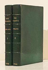
179219565London: T. and J. Egerton Whitehall 1792. First Edition. 8vo. xvi 209; viii 258 pp. 54 full color plates including extra engraved title page in each volume signed in plate: C. Apostool London June 1 1791; 2 maps; in-text illustrations. Errata at rear in each volume. Bound by The Hampstead Bindery in full green morocco with gilt lettering to spines; AEG; marbled endpapers. Minor wear; a near fine set with the uncommon color plates in exceptionally nice condition occasional foxing throughout. Samuel Ireland's guide to sites along the Thames including Blenheim Castle Windsor Castle London bridges Westminster Abbey and Greenwich Hospital. T. and J. Egerton, Whitehall unknown