Bradshaw's Railway Information OfficeBiblio.com
10 874 résultats
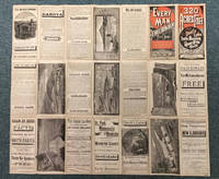
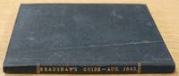
1845619717London: Bradshaw's Railway Information Office 1845. Slender hard cover no jacket intended from the collection of the Worshipful Company of Clothworkers; their coat of arms is stamped to the FEP. In fine condition for its age showing some wear to boards and notable tanning to content however this remains clear and informative. Contains a number of unusual contemporaneous advertisements including Macassar oil; 'For The Hair The Skin & The Teeth' a number of 'Life Assurance Societies' and 'Cabburn's Oil' for the cure of Rheumatism and Gout. Small water mark at spine point of title page. Text block is notably tanned but remains firmly bound. Railways timetables all present including the Second Edition fold out timetable for the journey London to Ely and Norwich and return. A lovely historical piece. Please contact us for further information or additional pictures. CN. Hardcover. Very Good/No Dust Jacket. Bradshaw's Railway Information Office Hardcover
19832110502150908383Atene shobo 1983. Soft Cover. Fine. Number of books: 26 Atene shobo paperback
19312111902160501307Not Available 1931. Soft Cover. Fine. Volume: Imperial Railway Association Not Available paperback
19042488Alois Beer k. u. k. Hof- und Marine-Photograph. Mit 33 Tafeln nach Zeichnungen und Photographien. Klagenfurt, [1904]. Quer-4to. (23,8 x 32,2 cm). Titel mit Inhaltsverzeichnis u. 1 Bl. Vorwort. Weinroter Orig.-Leinwandband mit Goldprägung (Franz Gogl's Nachfolger, Karl Scheibe, Wien VI, Marchettigasse 4).
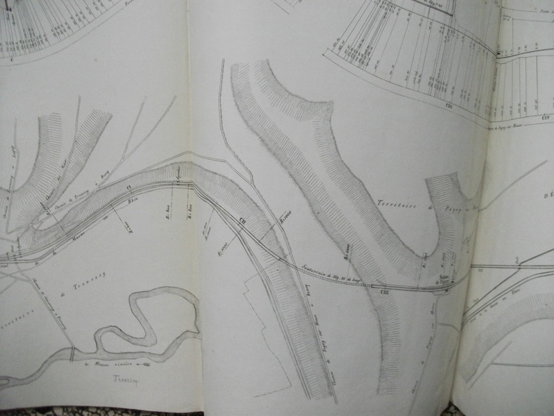
4894Exceptionnel par son format de 11,04 mètres x 0,35 ,en accordéon,complet de la page de titre avant la date et l’échelle.Très rare,très bon état.Il est joint 5 pages in folio,manuscrites Chemin de Fer Paris à la frontière d’Allemagne 3ème section rapport sur les résultats des études dans le département de la Meuse Toul le 7 août 1847. Rare,trés bon état
18346168Aufgesetzt, mit Beiträgen von neuern englischen Konstrukzionen vermehrt und herausgegeben von Franz Anton von Gerstner. 3 Bände u. Atlasband. Mit gest. Porträt, Tabelle (zu Bd. I, S. 478) u. 109 gest. Tafeln (plano, 2 mit Aquatinta). Prag, Gedruckt bei J. Spurny (1 u. 2), 1831-1832 u. Wien, Gedruckt bei J. P. Sollinger, 1834; Atlas: Prag, 1831-1832 u. Wien, 1834. 4to. (27,6 x 20,5 cm) u. Quer-Folio (32,5 x 46,0 cm). Marmorierte Halblederbände d. Zt. mit etwas Rückenvergoldung u. Halblederband d. Zt. (Rücken u. Ecken erneuert).
Features: Steel Bridge Across Chehalis River at Aberdeen Formally Opened - article with photo; The Panama Canal Route for Canadian Northwest Shipping; Photo of Charles M. Hays, president of the Grand Trunk Railway; Address to General Passenger Agents by Howard Elliott, president of the Northern Pacific Railway (four pages); Brief business biography of George W. Hibbard, General Passenger Agent of the C.M. & P.S., with photo; Bernard N. Baker's Steamship Line a Golden Opportunity; Puget Sound Tugboat Co. on the Columbia River; New Boilers for North Vancouver Ferries; Steamer Maunganui Launched; Review of the Charter Market; Casualties to Pacific Coast Shipping; Modern Aids to Navigation Demanded for Alaskan Waters - article including lengthy list of vessels lost; Excellent illustrated centerfold makes the case for lighthouses in Alaskan waters; Review of Marine Insurance and Shipping Law; Address by president of the San Francisco Merchants' Exchange, Robert Dollar, entitled "The American Merchant Marine As It Affects Our Foreign Commerce" - with photo of Dollar; and more. 44 pages including several pages of nostalgic ads, some illustrated in black and white, featuring local marine and rail interests. Printed upon glossy coated stock. Average wear. Binding intact. Few library markings to front cover. A well-preserved copy of this highly-informative memento of Pacific Northwest transportation over a century ago. 12" x 9". Magazine
185245102 Abt. in 1 Band. Mit 4 gest. Tafeln, 4 (2 kolor.) lithogr. Tafeln sowie 6 ganzseitigen Holzstichen (davon 5 in der Paginierung von Teil 2). Braunschweig, Druck von F. M. Meinecke, (1852). Kl.-8vo. (12,4 x 10,1 cm). 1: 1 Bl., XVI S., 1 Bl., (11)-128 S. 2: 159 S., (1 S. Anzeige). Halbleinwandband d. Zt. (vorderer Orig.-Umschlag mit Holzschnitt-Vignette eingebunden).
Features: Big Improvements by Northern Pacific During 1912; Through Service Seattle to Texas; O.-W. R. & N. Enter Vancouver; Will Carl Gray Succeed L.W. Hill? - article with photo of Gray; Dangers Attending Hauling Explosives; New H-H-1 Locomotive Design; Seattle's Greatest Opportunity; Bush Terminal Company to Build on Harbor Land - article with photo of Model Loft buildings at the New York Bush Terminal, similar to those to be built on Harbor Island; Portland's Proposed Harbor Front Development and the Commission of Public Docks - major article; South and Central American Trade; Great Prospects for Vancouver, B.C.; The Official Statement of the [Seattle] Port Commission re: improvements and facilities; Economy of the [Seattle] Municipal Plan (part 4) - major article which includes official map of Grand Trunk Pacific Railway showing proposed extension to Vancouver and Seattle, plus map of new thoroughfare donated to Seattle by Great Northern Railway with franchise for Interbay-Ballard Route; Bogue Plans for Tacoma Harbor Are Impressive - major article with map showing City section of harbor plans; Casualties to Pacific Coast Shipping for Year 1911 - Four full pages of fine print document the voluminous incidents of the year including the vessel and damage it sustained; Photo of Strathalbyn's bow after collision; Review of Marine Insurance and Shipping Law; Big Company to use Panama Canal - International Mercantile Marine; and more. 44 pages including several pages of nostalgic ads, some illustrated in black and white, featuring local marine and rail interests. Printed upon glossy coated stock. Average wear. Binding intact. Few library markings to front cover. A well-preserved copy of this highly-informative memento of Pacific Northwest transportation over a century ago. 12" x 9". Magazine
Contents: Seattle will build 15,000 fine new homes (ad); Schlitz beer ad - in color with lovely model; New York Central Railroad ad - "Black Magic" - 95,000,000 tons of coal per year; Block votes tipped teh balance in closest election since 1916 - photo of FDR with Harry Truman; Photos of voting shenanigans in Chicago; V-2 weapons may win next war but come too late for this one - detailed article with air photo; Ignorant men and modern weapons - the inside story of the Chinese Army - with photos of refugees fleeing the Japanese; White trucks - color ad; France given more say in Europe in prelude to Big Three Meeting; Reprieve for the Canadian Zombies; Doukhobor mass disrobing; Cuban housecleaning - Grau purges Batista henchmen; Long-suffering victims of sinus problems can be cured; Nikola Tesla - prophet of tomorrow; Very military ad by Bankers Trust Company shows a soldier pulling the pin from a grenade with his teeth; Color Sheaffer's pen ad inside back cover. Average wear. Address label atop front cover. Unmarked. A sound copy. Book
18831076Mit 203 Abb. auf 84 (5 doppelblattgr.) Tafeln u. einigen Abb. im Text. New York, The Railroad Gazette, 1883. Folio (ca. 39,5 x 28,0 cm). 4 Bll., 46 S., 1 Bl. Zwischentitel, 1 Bl. Index. Halblederband d. Zt. [6 Warenabbildungen]
189132829St. Louis: Woodward & Tiernan Printing Co. n.d. 1891. 1891. First edition. Third edition. 12mo. Original orange wrappers printed in black ink 82 2 pp. illustrated map. advertising. Issued by the general passenger department of the Missouri Pacific Railway. A general description of the state and its place in history is provided. Plus soil rainfall churches schools higher educational opportunities newspapers population and wealth corn wheat oats stock farming wild flowers orchards and vineyards salt lead and zinc stone brick and lime coal gas hunting and fishing cities irrigation etc. Views are offered of farms and ranches parade grounds city parks etc. of various cities. Herd 1204 says "Issued by the Missouri Pacific Railway Company this book appeared in many editions though all are now rare." Prior to this copy the earliest edition of a similar booklet was a 13th edition and that was 15 years ago. Fine clean copy with a fine folding map. An exceptional copy of a rare item. Woodward & Tiernan Printing Co., n.d. (1891)]. unknown
1936List3240United States 1936. Forty-two letters with several miscellaneous documents circulars stock offerings etc. Conditions vary with some items worn and quite fragile; most excellent. The Chicago Burlington and Quincy Railroad CB&Q was formed in 1855 by a consolidation of several other western railroad companies. The company and its subsidiaries known for their sleek diesel Zephyr trains operated extensively throughout the midwest west and Texas throughout the nineteenth and twentieth centuries. Today its former passenger operation has been assumed by Amtrak and its freight operation continues as the BNSF Railway. The Burlington Cedar Rapids and Northern Railway BCR&N operated between 1876 and 1903 and was succeeded by the Rock Island Line.<br /> <br /> Offered here is a small collection of letters and documents pertaining to the relatively early days of the CB&Q and BCR&N alongside later correspondence from an Iowan who was writing a history of Iowa railroads.<br /> <br /> Earlier letters include discussions of plans for the extension of the CB&Q lines; for instance railroad official O.W. Palmer writes:<br /> <br /> “The other day at the meeting I gave Mr. McClure some changes to Leavenworth – Since that time I have gone into the question a little more thoroughly and find that to be consistent we would have to reduce a great many points in Western Iowa where there is no competition whatever no need of a reduction – I have therefore concluded not to make any changes except where we have to meet some other fellows rate.†August 7 1894<br /> <br /> On the reverse of this letter and one other is an attractive map of the many CB&Q lines between Chicago and Denver/Cheyenne. <br /> <br /> Also from around this time are several letters from William W. Baldwin discussing railroad business in both an official and unofficial capacity with BCR&N President Charles J. Ives. In 1895 Baldwin tells Ives about a scalping scheme on the BCR&N for which several conductors are fired April 20 and in 1896 about a silver-backing newspaperman:<br /> <br /> “A fellow named Hyskel has persuaded certain silver idiots here to loan him $200 or $300 with which he has started a morning daily called the “Burlington Democratâ€. It is a violent vindictive anarchistic silver sheet and Hyskel himself a thorough crook of the bigoted sort although personally decent and mild enough. Has your company given them transportation They will be after it hot foot. Our folks here have refused him – saying he will have to get it under a regular advertising contract. These are to be made January 1st. If you can put him off until then I think the paper will die before January. They own no press nor any property – are simply trying to bull it through past the election. It is easy enough to put them off there are plenty of good reasons why it ought to be done. There is not a meaner silver organ in the state. It was started as a silver venture purely. I suppose Tracy will get them B.CR. N. transportation if he can. He is the same variety. It is such examples that make the situation so full of menace danger to all business.†October 19<br /> <br /> “Tracy†is Samuel K. Tracy then Solicitor general for the BCR&N the son of Judge Joshua Tracy who was president of the line until his death in 1884.<br /> <br /> Later correspondence is mainly between Baldwin and Albert N. Harbert of Iowa; Harbert was writing a history of Iowa railroads and Baldwin had apparently written a number of pieces on the topic the collection includes a mimeographed bibliography of his works. Harbert had a particular interest in the china dinnerware used on the lines.<br /> <br /> Of interest to historians of western railroads around the turn of the century. unknown
185833688Chicago: Illinois Central Rail Road Office 1858. 8vo 5 p.l. pp. 5-80; full-page map of Illinois double-page map of the guide to the Illinois Central Railroad Lands wood-engraved frontispiece 6 wood-engraved illustrations in the text; slight nibble out of the fore-margin of the first 3 leaves else a near fine copy in original yellow pictorial wrappers. Another edition with same text has imprint: Boston G.C. Rand & Avery printers 1857. Byrd 2683; Ante-Fire Imprints 263. <br/><br/> Illinois Central Rail Road Office unknown books
18972111902153000232Hakubunkan 1897. Soft Cover. Fine. Number of pages: 502 pages Size: approx. 20 x width approx. 13 cm Hakubunkan paperback
19382111902160201087Otake Kenji 1938. Soft Cover. Fine. Number of pages: 53 map size: 22cmx15.2cm 53p Number of books: 1 Otake Kenji paperback
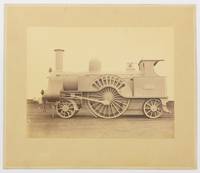
130267Very Good. Two albumen paper photographs each 280 × 372 mm on the original card mounts each approximately 405 × 485 mm. Mounts uniformly tanned and lightly marked; trifling surface loss to silverfish to one plate confined mainly to the blank upper portion where it is inconspicuous; tiny blemishes near the top corners of the second plate; overall in excellent condition. The first image shows 665 'Lord of the Isles' a Problem class or Lady of the Lake class passenger locomotive. Clearly visible on the wheel arch is its build date 'Jany 1863'. The second image shows 2146 a DX Goods class locomotive. Both locomotives are shown in 'photographic grey' livery without tender and it is likely that these are official photographs for London and North Western Railway or the Crewe Works. <p>Both models were designed by John Ramsbottom and entered service in the late 1850s. However these examples are fitted with cabs suggesting that the photographs were taken after the appointment of his successor Francis Webb in 1871. Provenance: 'Mile End Railway Museum South Australia Inc.' inkstamp on the verso of one mount with 'Ex A.E. Cottrell 1/84' in ballpoint pen below the stamp. The contents of the museum were recently dispersed. 2 items. unknown
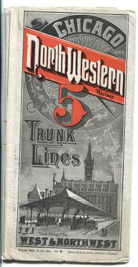
188841991Chicago: Rand McNally & Co. 1888. 1888. TIME TABLES & MAP. 16" x 46 1/2" sheet folded to 50 panels. Printed in red and black. Map. 23 panels of time tables; 1 panel showing tariff of charges for Pullman sleeping accommodations . Between Chicago and San Francisco cost $17.00; Between Chicago ad Madison cost $1.50; 1 cover panel; 1 panel showing an illustration of the North-Western dining car . "Only 75 cents for a splendid meal in these cars." Time tables offered for Council Bluffs and Omaha Line; Sioux city & Southern Dakota Line; Chicago Council Bluffs & California Line; Council Bluffs Omaha & Denver Line; Chicago St. Paul & Minneapolis Line; Minnesota and Central Dakota Line; Huron Pierre & Deadwood Lines; Janesville Watertown and Fond Du Lac Line; Rockford Freeport and Dubuque Line; St. Paul Minneapolis & Manitoba Northern Pacific and St. Paul & Duluth Railways; Milwaukee Green Bay & Marquette Line; Minnesota and Central Dakota Line; Clinton & Anamosa Line; Chicago & North-Western and Milwaukee Lake Shore & Western Railways; Kenosha and Rockford Line; Dayton & Lake city Line; Eagle Grove & Sioux Rapids Line; etc. Opposite panels offers a 24 panel color system map entitled "Geographically Correct Map of the Chicago & North-Western R'y and Its Principal Connections. Correct to September 1st 1881. It Will Be Noticed hat This Is The Leading Railway Of The West And Northwest." A statement at the bottom corner of the map touting that the Chicago & North-Western Railway is one of the largest railway corporations in the world. It controls and operates nearly 3000 miles of road forming the following lines: Chicago Council Bluffs Denver & California Line; Sioux City & Southern Dakota Line; Chicago & Des Moines Line; Chicago Freeport & Dubuque Line; Chicago St. Paul & Minneapolis Line; Chicago La Crosse & Winona Line; Chicago Minnesota & Central Dakota Line; Chicago Pierre & deadwood Line; Chicago Milwaukee & Marquette Line; and Chicago Green Bay & Lake Superior Line. Map shows all states from the west coast to the east coast and to the south showing upper 2/3ds of California and all of Nevada Utah Colorado Kansas Missouri Kentucky and Virginia. 1/2" split to edge at fold along with a couple tiny holes at folds. Very good plus. Rand, McNally & Co., 1888. unknown
188341860Chicago: The J.M.W. Jones Stationery and Printing Co. 1883. 1883. NORTH DAKOTA. 22 ½" x 25 3/4" sheet folded to 42 panels. Outermost panels printed in red and black. Issued to promote the travel to and settlement of the Red River Valley area and lands west of there. "Every Man a Free Holder. How to Secure a Free Home in North Dakota. Sectional Map and Full Particulars Published by the St. Paul Minneapolis & Manitoba Rail-way." The text panels provide much information regarding agricultural production in the region. Wheat production stock raising soil and climate and other agricultural products are described along with information on Devil's Lake the Mouse River Valley the Turtle Mountain region Stump Lake etc. On verso the small map shows "The St. Paul Minneapolis & Manitoba Railway System and its Important Connections." The large map illustrates in detail the northwestern part of Minnesota from Breakenridge northward and east to include Barnesville Ada Crookston etc. and Dakota north from Wahpeton north and west to Ft. Stevenson on the Missouri River northward and includes southern Manitoba to Winnipeg. Also on this side is an extensive section of text describing "Government Lands and How to Get Them" with emphasis on pre-emptions homesteads and tree claims. Another large section entitled "Facts From a Farmer in North Dakota on the Line of the St. Paul Minneapolis & Manitoba R'y." In this section Mr. James Twamley a Grand Fork area farmer and wholesale grocer describes local agricultural production and recommends specific varieties of wheat oats corn squash beets cabbages carrots beans onions tomatoes asparagus cucumbers berries currants plums grapes potatoes and fodder corn. 1" closed tear to bottom edge of one panel splits at one fold and to top edge have been professionally repaired. An interesting and attractive promotional. A very scarce work. The J.M.W. Jones Stationery and Printing Co., 1883. unknown
188542263Chicago: Chas. N. Trivess Printer 1885. 1885. DAKOTA TERRITORY. RAILROAD. First edition. 7 5/8" x 5 1/8" original stapled printed wrappers 16 pp. map of the Chicago & North-Western Railway system on the back cover. Primarily a series of signed testimonials solicited by the Railway to describe "the Dakota boom." Farmers relate their experiences settling and cultivating the land detail their crop yields and profits from cattle ranching and encourage further settlement as land is still inexpensive and readily available. Several describe the settlers as "a most excellent class of people" who are educated industrious and and morally upright. And if that’s not incentive enough there’s the unsurpassed healthfulness of the air which is "free from malaria and full of inspiring oxygen and invigorating ozone." 3 copies found in OCLC. Top corner of rear cover has been torn away but with minor influence on the railway system map else very good. Chas. N. Trivess, Printer, [1885]. unknown
93225aafGraphische Anstalt H. Vontobel & Co., Meilen / E. Goetz Kunstanstalt Luzern, ca. 1920-1930, 45x70 cm, Chromolithographie signiert „G.M.“, Ortschaften, Seen, Berge, etc. im Bild beschriftet, auch die Bahnlinien (insbesondere Rigi u. Scheidegg) sind rot eingetragen, 3 vertikale Knitterspuren, ansonsten guter Zustand. gerollt.
140807aafSt.Gallen, Verlag der Isenring’schen Kunsthandlung, 1856, kl. in-8vo, Frontispiz (Eidg. Sängerhalle in St.Gallen, Juli 1856) + 45 S. (+ 1w.) + 10 gest. Tafeln + 1 Übersichtskarte der St.Gallisch-Appenzell. Eisenbahn, vereinzelt stockfleckig, Original-Broschüre. Umschlag etwas stockig.
119233aafParis, A. Combette, 1856, in-folio, au total 102 planches dont 100 doubles planches gravées sur acier montées sur onglets dont: un très beau titre + un tableau statistique ... + 92 cartes numérotées ("Atlas National Illustré": La France et ses colonies), frontières coloriées + 6 cartes (Atlas Universel Illustré": 2 cartes pour l'Amérique, 4 cartes pour les autres continents), frontières coloriées + 2 grandes cartes repl. gravées sur acier et entièr. coloriées (- "Nouvelle Carte de la France indiquant les routes de poste, les routes impériales & départementales, ... les chemins de fer et les canaux. Dressé ... par Charle"; 1 pet. déchir. marg., un faux pli, pet. déchirure dans deux crois. de plis / - "Mappemonde par A. Vuillemin ..."), qqs lég. traces de doigts, brunissures cachet sur verso du titre gravé, reliure en demi-cuir à nerfs, dos orné en or, titre doré au dos et, dans encadrement ornam. au centre du plat devant, coiffes avec manques, frotté et éraflé surtout aux bords, charnières et coins.
200917716Paris, Bachelier, imprimeur libraire, 1835 ; in-12, 407 pp., demi-cuir marron restauration sur un coin etat correct coins un peu écrassé. Suivi d'un appendice contenant l'exposé des dépenses de ces machines pour le halage des fardeaus sur les chemins de fer, edition originale bien complète de ses quatres planches - tampons ancien exemplaire de bibliothèque bon état, exemplaire de travail usures.
18503164Handbuch der Dampfmaschinen-Baukunst. Aus dem Französischen von Andreas Valentin Demme.] 3 Atlasteile in 1 Band. Mit 48 (26 doppelblattgr.) lithogr. Tafeln. [Quedlinburg u. Leipzig, G. Basse, 1847-1850]. Kl.-Folio (35,5 x 23,7 cm). Pappband d. Zt. mit mont. Titelschild.