10 862 résultats
1857040173Chicago: Illinois Central Rail Road Office 1857. First Edition. Softcover. Very Good. 80pp. Bound in at front: Outline Map of Illinois; Railway Guide to the Illinois Central Rail Road Lands double-page map; woodcut frontispiece "Prairie Scene in Illinois." Six woodcuts in the text. Bound in at back: four pages of broadside-style ads printed in diaplay type on lavender stock. 1 "Passengers for St. Louis Jacksonville Naples Kansas and Nebraska should procure their tickets via Illinois Central R. Road." 2 "Great Western and Michigan Central Railway Line only direct route via Niagara Falls and Suspension Bridge." 3 Great Reduction of Fare! For St. Paul! Great Western Mail Route. Galena and Chicago Union Rail Road." 4 "Passengers for St. Paul should be particular and call for tickets via Dunleith . Having Twelve Splendid Steamers." Bound in printed wrappers with prairie scene on cover. 9" x 5.5" Byrd Illinois Imprints 2683. Buck Travel and Description 559. <br/><br/> Illinois Central Rail Road Office paperback books
1869288969New York: American Photolithographic Company 1869. paperback. very good. Map: lithograph. 16" x 28.5". In very good condition. <br><br>Pamphlet: Thin 8vo. 31 pages. Staple-bound stain to paper cover binding fragile. Washington: Government Printing Office. In very good condition.<br/><br/> Map is tipped in at back cover of pamphlet and shows Northern & Southern Pacific Trunk Lines railways completed and railways projected. The majority of the committee that wrote this report included W.M. Stewart Chas D. Drake John Conness Alexander Ramsey J.C. Abbott B.F. Rice<br/><br/> American Photolithographic Company unknown books
184939429Boston: Redding & Co.; New York:Clark Austin & Co 1849. States outlined in colors. 1 vols. 20 1/2 x 24 3/4 inches overall. Folding engraved map 16 ca. 5 x 6 inch panels Four rows of four panels backed on linen engraved ornamental bordersmall engraved paper label on back. Some browning or soiling generally light cloth darkened with some spotting on verso of map else a very good copy. States outlined in colors. 1 vols. 20 1/2 x 24 3/4 inches overall. Each of the railroad lines is identified. Redding & Co.; New York:Clark, Austin & Co unknown books
1873403707Jay Cooke & Co 1873. 8vo. 51 4 pp. Folding map of the railroad and its inter-oceanic connections. Original printed wrappers the rear wrapper with map of the railroad. Wrappers separated along spine last two text leaves loose. FIRST EDITION. The map shows the northern half of the U.S. from the Pacific to Lake Superior and Lake Michigan. The proposed railroad extends from the Missouri River near Fort McKean westward to the towns of Olympia Portland Seattle and terminating at Whatcom just north of Bellingham. The route splits into a northern and southern branch just above Coeur d'Alene Lake. The publisher Jay Cooke was the famous financier of the Civil War; his private bank financed the construction of the railroad. This promotional pamphlet was used to gain investors. <br/><br/> Jay Cooke & Co unknown books
1884100459<p>Folding train schedule 4 1/2x 9 20 panels large folding map in color. Some browning and aging some separation at the middle fold two of those separations are a few inches three other smaller tears at the middle fold these are repairable a few chips and tears at edge folds. Nice piece of railroad memorabilia with substantial information about rates and schedules. Most of the trains are geared toward the west which gives an idea on the process of opening up this still relatively new part of the country.The map has its flaws but it is sound enough to get a feel for the lines of the Union Pacific.</p> Rand McNally & Co.
1884100459Folding train schedule 4 1/2x 9 20 panels large folding map in color. Some browning and aging some separation at the middle fold two of those separations are a few inches three other smaller tears at the middle fold these are repairable a few chips and tears at edge folds. Nice piece of railroad memorabilia with substantial information about rates and schedules. Most of the trains are geared toward the west which gives an idea on the process of opening up this still relatively new part of the country.The map has its flaws but it is sound enough to get a feel for the lines of the Union Pacific. Rand McNally & Co. books
1876102314<p> Folding railroad time table unfolded 16" x 28" folded 4" x 8" illustrated with route map and engravings. Some minor chips and tears at folds and extremities some browning and aging and a little soiling; otherwise about very good. Attractive Erie Railroad time table and map. Includes large illustration of the inside of a Pullman car and two additional illustrations of a dinning car and part of Niagara Falls. The time table and schedule has considerable detail. # 102314</p> books
1904106398<p>Small 8vo soft red covers numerous illustrations from photographs; map on inside of rear wrapper 160 pp. Light wear top corner slightly bent normal aging; very good or better condition. Descriptions of the numerous locales accessible by the California Northwestern Railway running from Tiburon north to Willits with branches to Guerneville Sebastopol and a few other places. Includes interesting famility type pictures of places like Oleander's Farm Ridgewood Sonoma Creek and Greenwood Park. There is a map of California Northwestern Railway and Connections on the inside of the rear cover. The railroad was formed in 1898 and merged into the Northwestern Pacific Railway in 1907. Seems to be rather rare the OCLC/WorldCat lists only the copies at Stanford and UCLA. OCLC. </p> California Northwestern Railway, books
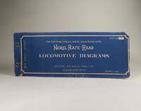
19463938Post-bound printed blue wraps. Some wear to front cover which see. Comprised of mostly verso-only indices and diagrams of locomotives including one folding. Neat corrections and notes in blue ink to first seven pages. An otherwise clean copy. ; Oblong: 14 x 5 inches ; All shipments through USPS insured Priority Mail. Advisory Mechanical Committee paperback
1884WRCAM23845New York 1884. 27pp. plus large folding map. Original printed wrappers. Some minor edge nicks and chips to front wrapper else just about very good. Annual stockholder's report for the famous western railway. With detailed financial statement and other statistics relative to western lands etc. Total surplus earnings for 1883 topped $12700000. The handsome and quite large folding map of the United States west of the Mississippi shows the Union Pacific Route and its connections. unknown books
1875977DBBde. 1-3 u. 5 in 5 Bdn. (von insges. 5 Bdn.). Stuttgart, Julius Maier, 1875-1877. 8°. (1) Bl., (1) VI, 330 S.; (1) Bl., X, 374 S.; VIII, 199 S.; VIII, 494 S.; (1) Bl., VI, S. 495-978. Mit 93 gest. Abb. im Text u. 1 gef. Tafel. Halblederbände der Zeit mit Rückenschildchen u. Rückenvergoldung (berieben und bestossen).
92581aafs.d. (vers 1910), in-4to, oblong, 75 photographies sepia 12x9 cm, rel. originale d’album photo du temps, plat sup. illustré, bon état.
123274aafLausanne, Adrien Bourgeaud, Imprimeur-Editeur, 1894, in-8°, 2 ff. + 224 p. + 12 ff. (papier rose, bleu et jaune de publicité illustr.), abondamment illustré de vignettes photographiques et de dessins dans les texte, d'une carte dépl. en frontispice, deux (2) panoramas dépliants en couleurs + 1 dépl. ‘Chemin de Fer Lausanne-Échallens-B’, exlibris Peter E. Obrgfell, reliure en toile rouge de l'éditeur, décor à la plaque en couleurs montrant un château sur le plat supérieur, bel exemplaire, en parfait état.
28661London, Reimar 1914, 320x235mm, 1165pages, editor's binding. Book in good condition.
189330730Chicago: Keogh & Schroeder Co. Printers 1893. 1893. 16 1/2" x 22 folded to 24 panels. 15 panels offer time tables; 1 panel offers information on the sleeping car routes to include rates. 6-panel black and white system map showing the Chicago Milwaukee and St. Paul Railway and its connections from Chicago to the West Coast. Brief mention of the Columbian Exposition on one panel. 1/2" split to two folds along with 1/2" closed tear to edge of one panel. Very good copy. Keogh & Schroeder Co., Printers, [1893]. unknown
188937702Chicago: Rand McNally & Co. 1889. 1889. 5 1/2" x 4" printed folder with map of the United States on the rear cover. Inside front cover offers a list of advantages of living in Wisconsin. Attached to inside rear cover is a folded 12" x 9" colored map of Wisconsin with rail lines in red ink. Apparently printed for distribution at a gathering of Grand Army of the Republic Veterans. Covers lightly soiled. Map fine. Rand, McNally & Co., 1889. unknown
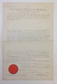
190416809Washington DC: United Sates Land Office 1904. Document. Very good. Folio Document measuring 10.5†x 16â€; Partly printed document with red embossed seal of the General Land Office at bottom left signed by President Theodore Roosevelt lower right Secretarial Signature Washington D. C. June 3 1904. A Land Grant Of Federal Lands To The Santa Fe Pacific Railroad Company. This land a forty acre parcel east of Gila & Salt River Meridian Arizona Territory as part of the Grand Canyon Forest Preserve owned by the SFRR is being exchanged with the United States for a forty acre parcel east of the Mount Diablo Meridian in California. This “swap†was for land east of San Francisco Bay for a parcel near Phoenix Az. Also signed by a F. McKean Secretary & C. H. Brush Recorder of the Land Office. An unusual land grant. There was a controversy in 1902 regarding these exchanges. The Railroad wanted to consolidate its lands and wished to trade uneven numbered parcels for even numbered ones. Their argument was that this would benefit all. Some members of TR’s cabinet were opposed but the argument that grazing lands Arizona could not be parceled out if they were not contiguous won the day and the exchanges were executed. This is a simplification of the event and there were other arguments. This document is a vestige of this series of exchanges. United Sates Land Office unknown
186835665New York: Published by the Company 1868. 1st edition. Original printed paper wrappers with elaborate lithographed graphic to front wrapper. Bit of light soiling & age-toning to wrappers. Faint vertical fold-line. A VG to Nr Fine copy and unusual thus. 32 pp. Frontis "Map of the Union Pacific Rail Road and its Connections." 8vo. p" x 5-3/4" <br/><br/>A progress report as well as promotional pamphlet issued by the company 2 April 1868 keeping their efforts in front of the public as well as Congress who was providing the financial underwriting. Published by the Company unknown books
19372091502135416819Not Available 1937. Soft Cover. Fine. Number of books: 1 Not Available paperback
19762090202120405342Hiroshima Railway Administration Bureau 1976. Soft Cover. Fine. Number of books: 1 Hiroshima Railway Administration Bureau paperback
19262111902153303301Tetsu-do-sho 1926. Soft Cover. Fine. Number of books: 1 Tetsu-do-sho paperback
19782091502135302531Koyu-sha 1978. Soft Cover. Fine. Volume: 1 Koyu-sha paperback
19272091502133701805South Manzhou Railway Co. Ltd. 1927. Soft Cover. Fine. The book is in fine condition. South Manzhou Railway Co., Ltd. paperback
20122091502135420912Pukukennori 2012. Soft Cover. Fine. Number of books: 1 Pukukennori paperback
132 figures dans le texte et 40 planches hors texte, 1 vol. in-4 reliure pleine percaline éditeur bordeaux, Librairie Polytechnique Ch. Béranger, Editeur, Successeur de de Baudry et Cie, Paris, 1906, III-334 pp. avec nomb. planches dépliantes. Rappel du titre complet : La Locomotive Actuelle. Etude générale sur les Types récents de Locomotives à grande puissance. Complément au Traité Pratique de la Machine Locomotive [ Edition originale ] Proportions - Conditions d'Etablissement - Construction - Régime Economique - Utilisation - Revue des Principaux Types usités en Europe et aux Etats-Unis Bel exemplaire de l'édition originale, en très bel état. Français