2 675 résultats
56-0331Oakland Calif.: Southern Pacific Company 1935. Map. Blueline print 21" x 71". From State Highway and McKinley Avenue to Harding Way. Includes Mormon Slough Stockton State Hospital 10 blocks by 27 blocks of downtown along railroad tracks. Scale 1" = 400'. Oakland, Calif.: Southern Pacific Company, 1935. unknown
19832080202102502077Kogyosho Oki Shou Education Publishing 1983. Soft Cover. Fine. The book is in fine condition. Kogyosho Oki Shou Education Publishing paperback
1998x-0415183022Routledge 1998. Hardcover. New. 1st edition. 348 pages. 9.75x6.50x1.25 inches. Routledge hardcover
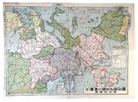
1939179796Nagoya: Shin'aichi 1939. Coloured folded map of Europe published at the beginning of World War II in Europe; 38.5 cm. x 54 cm.; a few tiny closed tears at margins; Shin'aichi Nagoya n.d.1939. The Japanese text on the map gives numbers of Europe's ethnic groups: Teutonic Latin Slav Asian while another block of text lists the population of the world's Jews in units of 10000 by country. The world population by region in units of 100000000 and those of the world's ethnic groups are shown to the left. In the upper right corner facts about World War I are given including number of troops by country in units of 10000. A legend shows national borders prior to World War I railways navigable rivers etc. Neutral powers are indicated together with naval bases place names in international dispute etc.; Originally purchased from Asia Bookroom the basis of whose catalogue description is used here. Shin'aichi unknown
192818880n.p.: Southern Pacific Lines 1928. First edition. Rubbed and retouched area at center of rear board else fine. Original reptile-skin patterned boards oblong quarto 8.75 x 15 inches 20 leaves printed on rectos only. 9 large group photographs several portrait photos of SP executives. Laid in loose are 1 5.5 x 9.5-inch cyanotype photo print of a locomotive works and 1 vintage 6 x 8.5-inch silver print photograph of a coal-fired locomotive and crew. Also laid in is a typed letter dated San Francisco July 3 1929 signed J. N. Clark to Mr. O. B. Schoenky presenting this album. Dated ink stamp recording receipt of Southern Pacific Co. Los Angeles Cal. July 5 1929 at top of sheet. Both sender and recipient are pictured in the management portraits portion of the album. Founded in 1865 1929 was Southern Pacific's heyday with 13848 miles of their own track. A fine piece of railroading history. Southern Pacific Lines hardcover
190953081Seattle & Berkeley CA: Ellis A. Davis 1909. Folio. 190 pp. Illust. & decorated title 100s of photo illusts. over 100 colour maps many double page 1 very large folding colour map tipped-in on rear pastedown a couple minor closed tears at creases. Red cloth silver lettering & decoration embossed on front cover minor bumping to corners bumping & minor fraying head & foot of spine very faint tidemark to fore-edges still a VG- copy very clean and bright textblock. First edition of this well-illustrated commercial atlas intended to promote the Pacific Northwest during the Alaska-Yukon Exposition carefully listing most of the major and minor cities their counties industries local products and 100s of photos of buildings logging railroads shipping and more. The atlas includes detailed economic statistical maps of Oregon Washington and Idaho; street maps of Spokane WA Portland OR Seattle WA Boise ID and more. The large folding colour map at rear is of Oregon State -- these atlases were also issued with Idaho Washington and Oregon & Washington colour maps separately. Ellis A. Davis, hardcover
190263438The Dalles OR: Benj. A. Gifford 1902. Oblong 8vo. 9.5 x 6.5 in. 37 leaves unnumbered. including 18 boudoir-sized collotype photographs printed on matte-finish paper stock w/ Benj. Gifford copyright notice lower fore-edge of image captions & negative number indicated all printed with excellent contrast w/in the negative also included 18 printed caption tissue guards. Dark gray ribbed softcovers yapp fore-edges w/ folding clasp flap at fore-edge of front cover decorative white lettering front cover punch-sewn w/ colour silk braid at gutter margin minor chipping to foot of spine into lower left front cover minor shelfwear creasing to yapp fore-edges still a VG- copy w/ ownership markings on title for Lillie D. Stewart a railroad company stenographer living in Denver CO at the beginning of the 20th Century and she paid $ 1.50 for the booklet. First edition of this very scarce and nicely printed collotype photographic views of the Columbia River Gorge sold from Gifford’s studio in The Dalles OR. Gifford 1859-1936 is considered perhaps Oregon’s most famous photographer and his beautiful images included here depict Rooster Rock sternwheeler at the Dalles Latourelle Falls Cape Horn the Pillars of Hercules Multnomah Falls shot 12 years prior to the historic Benson Footbridge at Multnomah Falls constructed by Robert Lee Ringer in 1914. Other images include the Sternwheeler Regulator Warren’s Salmon Cannery Sternwheeler Bailey Gatzert approaching the Cascade Locks Fish Wheel on the Columbia the Oregon Railway & Navigation Chicago-Portland Special leaving Tunnel 2 and the Native American burial ground of Memaloose Island. Gifford first worked in Portland until 1895 then opened a studio in The Dalles and later returned to Portland in 1910 where he continued to operate both studios until about 1920. Later his son Ralph I Gifford took over operation of the studio and continued to operate the business. Worldcat locates 1 copy OSU. Benj. A. Gifford, paperback
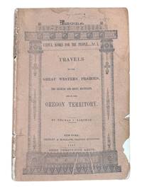
18439124New York: Greeley & McElrath 1843. Third edition. 23.5x15.5cm 112pp. Printed in two columns with tables ads on inner wrappers. Stitched in original printed brown wraps. Damp staining to upper corner of first 35 or so pages more pronounced at title and near the front. Spine cocked and with ends chipped chipping along edges of wraps. Pencil annotation to front cover. A very good copy. <br /> <br /> Third edition following the 1841 and 1843 Poughkeepsie printings of this popular text issued as an "Extra" of the New York Tribune. The book is essentially an account of the first overland to Oregon migration of emigrants bound for the territory led by Farnham and known as the "Peoria Party." They left Independence Missouri on May 20th 1839 and as a substantially smaller group arrived in Oregon on September 23 1839 with Marcus Whitman. Scarce in the original wrappers.<br /> <br /> Howes F50. Wagner-Camp 85:3. Washington 89 20. Greeley & McElrath unknown
2299San Francisco: H. S. Crocker & Co. 1883. . Large 8vo printed color-lithographed wrappers; lacking one inch at the head of the spine and one half inch at the foot. Institutionally common. Scarce in trade. San Francisco: H. S. Crocker & Co., 1883. unknown
198110623Chamberlain Press 1981. Limited Edition of 125 copies. Of 125 copies printed this is number 121. Fine. Illustrated by Sarah Chamberlain. 6" X 5.78" tall Green illustrated boards. Bound Japanese style. Charming wood engravings by Sarah Chamberlain . No dust jacket as issued. -- Signed by Sarah Chamberlain. -- Condition. COLOPHON: "This was the first book printed at the Chamberlain Press since its move to Portland Oregon from New England. It was designed printed and illustrated by Sarah Chamberlain. The illustrations are cut in boxwood the type is Garamond and the paper is Sekishu. The binding is by Barbara Blumenthal of Northampton Massachusetts. It was completed in the summer of 1981. ." FROM PROSPECTUS: "The seven full page illustrations as well as the decorative border ornamental device and cover design are wood engravings designed and cut by Sarah Chamberlain. The text is hand set Garamond printed in black on Sekishu paper. The ornaments are printed in pale green and yellow."Wood engravings printed on front and back of hard covers. Title printed on front. Pages are double leaves bound with Japanese-style stab binding. Text is taken from folk song. Chamberlain Press unknown
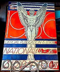
193610688Los Angeles 1936. Near fine. Folio pp. 56 illustrations advertisements full page Coca-Cola ad in color on the inside back cover. Nice art deco front cover. Separate sheet "Today's Racing Entries Friday September Fourth laid in loose. -- No notable defects. -- Overall Condition. "The National Air Races also known as Pulitzer Trophy Races are a series of pylon and cross-country races that have taken place in the United States since 1920. The science of aviation and the speed and reliability of aircraft and engines grew rapidly during this period; the National Air Races were both a proving ground and showcase for this. -- In 1920 publisher Ralph Pulitzer sponsored the Pulitzer Trophy Race and the Pulitzer Speed Trophy for military airplanes at Roosevelt Field Long Island New York in an effort to publicize aviation and his newspaper. The races eventually moved to Cleveland in 1929 where they were known as the Cleveland National Air Races.2 They drew the best flyers of the time including James Doolittle Wiley Post Tex Rankin Frank Hawks Jimmy Wedell Roscoe Turner and others from the pioneer age of aviation. These air races helped to inspire Donald Blakeslee as a young boy. Other races included in the U.S. National Air Races were the Mitchell Trophy Race the Town & Country Club Race for civilians the Kansas City Rotary Club Trophy "for all three military services" and the Glenn Curtiss Trophy Race for "biplanes with engines having less than 510 cubic inches. Starting in 1929 the races usually ran for up to 10 days usually from late August to early September to include Labor Day. Aviation promoter Cliff Henderson was managing director of the National Air Races from 1928 to 1939. During World War II the races were on hiatus. The races included a variety of events including cross-country races originating in Portland Oakland and Los Angeles with a final destination in Cleveland.4: 79-81 Also included were landing contests glider demonstrations airship flights and parachute-jumping contests. The more popular events were the Thompson Trophy Races which started in 1929; a closed-course race where aviators raced their planes around pylons; and the Bendix Trophy Race the "transcontinental air race" across most of the USA starting in 1931. In 1929 a Santa Monica California to Cleveland Ohio route was started for the Women's Air Derby nicknamed the "Powder Puff Derby" featuring well-known female pilots such as Amelia Earhart Pancho Barnes Bobbi Trout and Louise Thaden. Thaden was the winner in the heavy Class D engines with 510-810 cubic inches 8400-13300 cm3 while Phoebe Omlie won the light Class C engines with 275-510 cubic inches 4510-8360 cm3. This was also the year for the first female pylon race the winner of which was awarded the Aerol Trophy beginning in 1931".-wikipedia. unknown
56-0260Stockton Calif.: Southern Pacific Company 1922 revised 1935. Map. Blueprint 24" x 36." From Bear River to Creegan. With Key to Industry with 52 listings including Union Oil Co Merced Growers' Packing Assoc. Scale 1" = 400'. Stockton, Calif.: Southern Pacific Company, 1922, revised 1935. unknown
56-0287San Francisco Calif.: Southern Pacific Company 1938 revised 1944. Map. Blueline print 24" x 56" From WP crossing to Luther. Includes Monarch Match Co Levin Machinery and Salvage Co California Concrete Products Co. Scale 1" = 100'. San Francisco, Calif.: Southern Pacific Company, 1938, revised 1944. unknown
56-0437San Francisco Calif.: Southern Pacific Company 1920 rev. 1949. Blueline print 24" x 56". From Belmost Avenue to Cedar Street and E Street to Tulare Avenue. Includes PG&E Co Grant Pacific Rock Co Producers & Growers Market of Central California West Compress Co Sun Maid Raisin Growers Association. Scale approx 1" = 400'. San Francisco, Calif.: Southern Pacific Company, 1920, rev. 1949. unknown
56-0259Stockton Calif.: Southern Pacific Company 1922 revised 1945. Map. Blueline print 24" x 36." From Bear River to Creegan. Includes Key to Industry approx. 80 listings. Scale 1" = 400'. Stockton, Calif.: Southern Pacific Company, 1922, revised 1945. unknown
56-0296San Francisco Calif.: Southern Pacific Company 1920 revised 1924. Map. Blueline print 24" x 55". From Morris St to McLellan Ave and Valbrick. Includes Southern Pacific Yard Guadalupe Creek Washington Square Shell Oil Co. With Index to Industries with approx. 65 entries. Scale 1" = 400'. San Francisco, Calif.: Southern Pacific Company, 1920, revised 1924. unknown
56-0254San Francisco Calif.: Southern Pacific Company 1947. Map. Blueline print 23" x 35" with red pencilling. Includes index of approx. 120 industries. Includes Barium Products Co E.D.J. Lying Warehouse Pacific Fruit Express Tri-Valley Packing U.S. Army. Scale 1" = 600'. San Francisco, Calif.: Southern Pacific Company, 1947. unknown
56-0461San Francisco Calif.: Southern Pacific Company 1929 rev. 1937. Blueline print 24" x 36". From Kettleman Lane to Mokelumne River and Cherokee Lane to Grant Avenue. With Index to Industries listing 59 entries referenced to map by number. Includes American Fruit Growers United Packing Compnay Main Street. Scale 1" = 400'. San Francisco, Calif.: Southern Pacific Company, 1929, rev. 1937. unknown
56-0334San Francisco Calif.: Southern Pacific Company 1926 revised 1930. Map. Blueline print 23" x 36" with extensive multicolor pencilling indicating zones and yard limits. Two 12" tears and two smaller no missing material. "See Revised Map" written in large letters across side. From French Camp to Calaveras River and Sinclair Ave to Pacific. Includes Index to Industries wiith 122 listings. Scale approx. 1" = 1200'. With 8.5" x 11" switching charges sheet attached. San Francisco, Calif.: Southern Pacific Company, 1926, revised 1930. unknown
56-0429San Francisco Calif.: Southern Pacific Company 1925 rev. 1949. Blueline print 24" x 56". From meeting of Franklin canal and Rio Grande to approx 1 1/2 miles east of city limits and from Juarez border to Arizona Street Tularosa Street. WIth Index to Industries approx 175 entries indexed to map by number. Scale 1" = 600'. San Francisco, Calif.: Southern Pacific Company, 1925, rev. 1949. unknown
58-0504San Francisco Calif.: Southern Pacific Company 1927 rev. 1943. Blueline print 24 inches x 55 inches. Colored pencilling indicates zones. From San Pablo Bay to Page Street Ferry Point to 52nd Street. With San Pablo Richmond Stege Bates Proposed Richmond Inner Harbor. With Index to Industries approx 135 entries. Scale 1 inch = 1000 feet. Typewritten listing of switching zones and zone milage affixed. San Francisco, Calif.: Southern Pacific Company, 1927, rev. 1943. unknown
56-0218Tucson Ariz.: Southern Pacific Company 1950. Map. Blueline print. 24 x 56 inches. With list and map of approximately 300 Phoenix industries. Scale: 1 inch = 500 feet. Tucson, Ariz.: Southern Pacific Company, 1950. unknown
56-0323San Francisco Calif.: Southern Pacific Company 1926 revised. 1937. Map. Blueline print 24" x 36" with 3" tear no missing material. From French Camp to Calveras River and Pacific Ave to Sinclair Ave. With Stockton Channel State Hospital Grounds College of Pacific. Includes Index to Industry with 180 listings. Scale approx. 1" = 1200'. San Francisco, Calif.: Southern Pacific Company, 1926, revised. 1937. unknown
56-0346San Francisco Calif.: Southern Pacific Company 1954. Map. Blueline print 22" x 77". From Casa Grande Road to Davis - Monthan Air Force Base. Includes city of Tucson station points Petrie Tucson P.F.E. Yard Wilmot. Scale 1" = 1000'. San Francisco, Calif.: Southern Pacific Company, 1954. unknown