Canadian Pacific Railway CompanyBiblio.com

2 675 résultats
0366912453.Ghardcover. Good. Access codes and supplements are not guaranteed with used items. May be an ex-library book. hardcover
0366912399.Gpaperback. Good. Access codes and supplements are not guaranteed with used items. May be an ex-library book. paperback
0331554402.Ghardcover. Good. Access codes and supplements are not guaranteed with used items. May be an ex-library book. hardcover
0331554321.Gpaperback. Good. Access codes and supplements are not guaranteed with used items. May be an ex-library book. paperback
0265261953.Ghardcover. Good. Access codes and supplements are not guaranteed with used items. May be an ex-library book. hardcover
0266923003.Ghardcover. Good. Access codes and supplements are not guaranteed with used items. May be an ex-library book. hardcover
0331403293.Ghardcover. Good. Access codes and supplements are not guaranteed with used items. May be an ex-library book. hardcover
1333469330.Gpaperback. Good. Access codes and supplements are not guaranteed with used items. May be an ex-library book. paperback
0265807891.Ghardcover. Good. Access codes and supplements are not guaranteed with used items. May be an ex-library book. hardcover
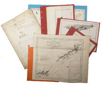
1755ABC_474521755. Manuscript of 24 pages 6 printed maps on cardboard. This wonderful logbook details the journey of a French captain from Manila to the Maluku Islands in todays Indonesia. The journey took place during the months of March to May of 1755. The captain of the ship recounted with great detail the events of every day of the journey with detailed daily accounts of the weather winds manoeuvres of the ship its departures anchorages and precise coordinates at every point of the journey. The captain furthermore had a keen eye for the geographical and nautical details along the journey. He recounted the exact locations of for example sandbanks and bays where ships and their crews can take provisions and fresh water. The accounts are detailed and captivating: "After our boats were back on board we set sail . in the afternoon to moor under the old Portuguese fort on the Solor island Indonesia the winds for the tide were fresh at 1:34 a.m. . sand and gravel and then I went back to mooring. The pavilion of the fort . the village is under the said fort at 3 cables from us .". The captain goes on to describe the geographical features of the islands as well as other places en route with great detail. Curiously we find inscriptions in Spanish and the names of one don Phelipe Qui who describes himself as el piloto and one Padre Don Estevan de Melo. The latter might be identical with Don Estevan Roxas y Melo a native of Lima Peru and secretary to the Archbishop of Manila Rodriguez since 1736. Roxas y Melo was part of the 1751 reconstruction of the Cathedral of Manila working under the auspice of the Italian architect Juan de Uguccioni.The logbook comes with six printed maps partly illustrating the journey of the captain pasted on contemporary cardboard. They depict the Bay of Sulavesi with the city of Bantang Pitcairn the coast of New Guinea the coast of Queensland the Santa Cruz Islands in the present-day Solomon Islands and Alejandro Selkirk Island. The plates stem from the French translation of James Hawkesworths An Account of the Voyages Hawkesworth Relation des voyages entrepris par ordre de sa Majesté Britannique actuellement regnante; pour faire des découvertes dans l'hemisphère meridional Paris 1774.Some holes on the first sheet not affecting the text. Small water damage some slighlty affecting the text. Remnants of seals on last page. Otherwise in good condition. unknown
56-0313San Francisco Calif.: Southern Pacific Company 1931 revised 1946. Map. Blueline print 24" x 36" with red and black pencilled notes. From city limits to Linden Ave and Bay Shore Highway. Includes South San Francisco Land and Improvement Co abandoned and open waterways Jonathan M Peel et al plot Union Oil Co Standard Oil Co. Scale 1" = 200'. San Francisco, Calif.: Southern Pacific Company, 1931, revised 1946. unknown
CORV-BBP-90548University of Sydney Australia. Paperback. Good. > Edition/Printing: Reprint of 1958 Original Small label to front cover o/w good. Staplebound 4to 120 pp. > Language: English > Size: 8vo > Media/Binding: Soft cover University of Sydney, Australia paperback
56-0278San Jose Calif.: Regal Map Co approved with additions 1961. Map. Purple on white print 17" x 21". Street map of Madera indicating U.S. highways state highways county roads schools and city limits. Backside includes tourist attractions. Pencil marks indicate zones 1 and 2 and the Southern Pacific rail lines. Scale 1 inch = 0.3 miles. San Jose, Calif.: Regal Map Co, approved with additions 1961. unknown
9290614846.Gpaperback. Good. Access codes and supplements are not guaranteed with used items. May be an ex-library book. paperback
1988785849PN. New. 1988. Soft Cover. Date is original print. This is a reprint edition. . PN paperback
191111665New York - London: MacMillan Co. Very Good. 1911. Hardcover. Clean reddish-brown pictorial cloth with black lettering. Text tight clean & intact. Pictorial frontispiece. Illustrated with B/W photographs. Several stories of early conditions and development of California. West; B&W Photo ; 12mo 7" - 7½" tall; 211 pages . MacMillan Co. hardcover
2013250801018REPUBLIC 2013-06-11. Audio CD. Used: Very Good. 4x5x0. Very good condition. From a private collection. Comes from non smoking home. REPUBLIC unknown
51-1101San Francisco and Oakland: 1866. Stock Certificate for one share July 20 1866 to Frank Buck. One of 74 shares at $300 each. Signed in ink by the officers. With 25 cent Washington revenue stamp. 5 x 8.5 inches in quadruple mats. San Francisco and Oakland: 1866 unknown
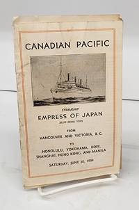
19341551261934. Booklet. Good. 14 p. 18 cm. Stapled. Some wrinkling soiling.Tucked inside is the passenger list of those embarking at Honolulu which is somewhat soiled and has a horizontal crease. <br/><br/>Includes information about sending telegrams reservations religious services ship's surgeon ship's stenographer officers passengers. Lists Canadian government offices in Far East passenger offices in Orient. unknown
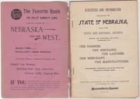
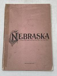
189246034St. Louis: Woodward & Tiernan Print. Co. 1892. Stapled paper wrappers. A good copy wrappers chipped soiled starting to detach seller stamp to front wrapper occasional soiling to contents. Lacking folding map. 64 pp. Illus. with b/w engravings. 12mo. Promotional booklet published by the Missouri Pacific Railway encouraging settlement in Nebraska. Lacks folding map. Woodward & Tiernan Print. Co. unknown
189287869St. Louis MO: Printed by Woodward and Tiernan Printing Co 1892. Second Edition. Staplebound Pamphlet. Good Plus. Stapled pamphlet. 7.5 in. x 5.25 in. pp. 64. Illustrated with in-text drawings and a fold-out map of Nebraska 21 in. x 26 in. Pink cardpaper wraps with black title to front. Light soiling to covers with chips to top/bottom of spine; older tape repairs to length of spine reattaching front cover and to left edge of rear cover. Fragile edges with chips to corners and several short closed tears to cover edges. Clean interior with very good plus map. This brochure was presented "With the Compliments of the General Passenger Department of the Missouri Pacific Railway." The text provides description and chart of information related to population geography geology weather land prices distances horticulture churches and more. Printed by Woodward and Tiernan Printing Co unknown
188933137St. Louis: Press of Woodward & Tiernan Printing Co. 1889. 1889. MISSOURI. First edition. 12mo. 7 1/2" x 5 1/4" printed wrappers 110 2 pp. engraved illustrations folding map advertisements. A detailed report of Missouri done county by county and discussing such subjects as location physical features and soil agriculture wheat corn grasses and pasturage stock raising and dairying wool growing mines and minerals coal iron lead zinc copper granite and other minerals fruit raising available lands for sale exemption and taxation laws timber lands manufacturing adaptability education and schools hunting and fishing labor wages and taxation etc. A discussion of each county is provided along with vital statistics pertaining to cattle hogs sheep et al county by county. The folding map of Missouri is in fine condition. Inked number "1889" on front cover else a very good clean tight copy. Press of Woodward & Tiernan Printing Co., 1889]. unknown
58-0472San Francisco Calif.: Southern Pacific Company 1924 rev. 1937. Blueprint 24 inches x 56 inches. From Winslow Avenue to Charter Street. Includes station points Redwood City and Redwood Junction Eastern Addition Hancock Addition Diller's Addition Horstman Chemical Company. Scale 1 inch = 100 feet. San Francisco, Calif.: Southern Pacific Company, 1924, rev. 1937. unknown
56-0311San Francisco Calif.: Southern Pacific Company 1924 revised 1947. Map. Blueline print 24" x 55" with 8" tear no missing material. From Grand Ave and Industrial Way to north line of Tanforan Ave. Includes Reichhold Chemicals Inc Bayshore Highway Standard Oil Co South San Francisco Land and Improvement plots. Scale 1" = 100'. San Francisco, Calif.: Southern Pacific Company, 1924, revised 1947. unknown