ROBERT de VAUGONDY (Didier).Livre Rare Book
11 983 résultats
1763LBW-6255Paris, Sr. Delamarche, 1763. Deux feuilles, chacune de 672 x 637 mm.
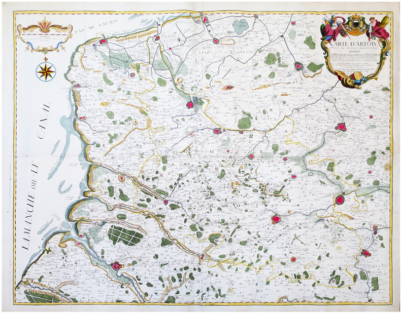
1741LBW-6681Arras, Barbier, 1741. En quatre feuilles jointes formant une carte de 97,3 x 119,6 cm.
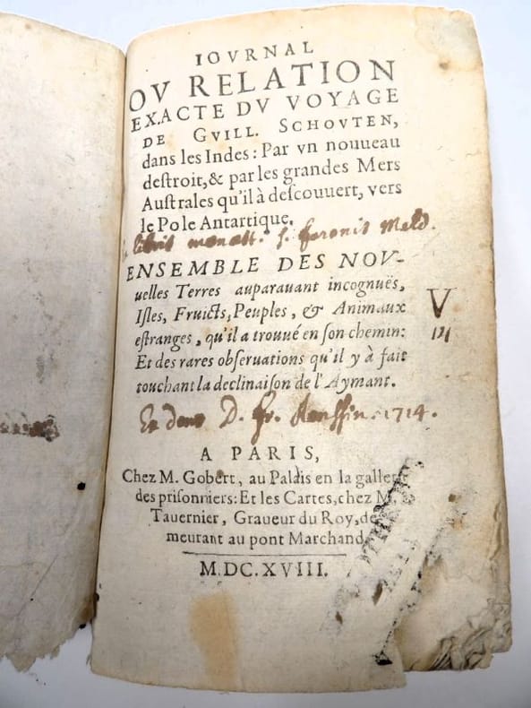
16182417Paris, Gobert (texte) & Tauernier (cartes), 1618. Petit in-8 – 11,5 x 17 cm. Reliure de l’époque en vélin, dos lisse muet. Dans une chemise-étui moderne. 7 ff., 232 pp., 4 pl. Première édition française du récit populaire de Schouten sur son voyage avec Jacob Le Maire à la recherche d’un passage alternatif au détroit de Magellan, qui a été traduit en français, allemand, latin et anglais moins d’un an après la première édition néerlandaise. Le voyage historique de Schouten n’était que le troisième tour du monde, « au cours duquel le Cap Horn fut découvert et contourné pour la première fois » (Hill). Exemplaire orné de 4 planches dépliantes (sur les 8 usuelles) : mappemonde ornée des portraits de Magellan et Schouten, carte du Cap Horn, gravure de l’Ile Horn, carte de la côte de Nouvelle Guinée. Lors d’un voyage, un ancien propriétaire a fait tamponner le dos de l’étui (XXe) au moment de son passage au Cap Horn.
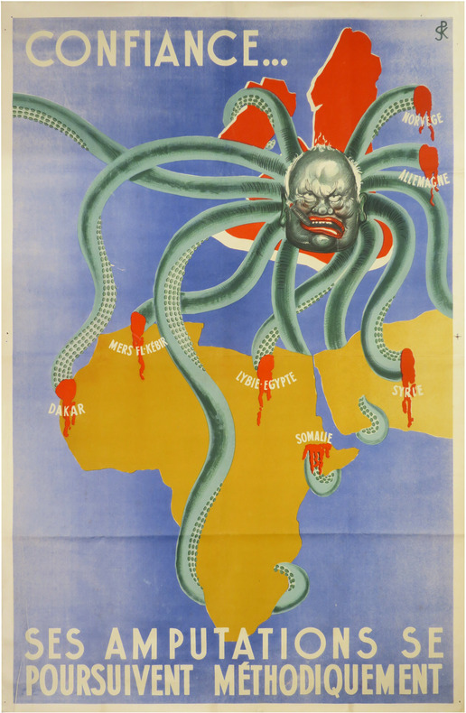
LBW-8634[entre 1941 et 1942]. Affiche en couleurs de 114,5 x 75 cm.
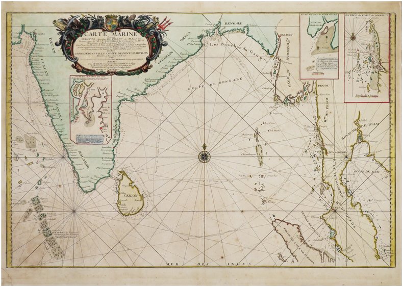
1742LBW-8191Paris, J.B. Nolin, 1742. 480 x 731 mm.
Bell'esemplare della rara mappa del doppio emisfero del mondo di Adam Freidrich Zurner, impreziosita da 26 scene decorative e proiezioni scientifiche dei cieli celesti e teorie e insegnamenti astronomici contemporanei.Il lavoro di Zürner è relativamente sconosciuto, di solito appare negli atlanti di altri editori, come l'Atlas Contractus di Schenk o della famiglia Ottens.Una mappa attraente e interessante ricca di dettagli che comprende la maggior parte della costa dell'Australia, la costa occidentale della Nuova Zelanda e le rotte e le scoperte degli esploratori Magellano, Dampier ("Nova Britannia" nel 1700), Tasman, Gaetani e Chaumont. Intorno alla mappa c'è un bordo elaborato che mostra venti e climi e lungo il bordo inferiore un panorama che illustra tempeste, terremoti, maree, vortici e un commento testuale su tutti i fenomeni naturali illustrati. Acquaforte, finemente colorata a mano in epoca, in ottimo stato di conservazione. Fine example of Adam Freidrich Zurner's scarce double hemisphere map of the World, embellished with 26 decorative scenes and scientific projections of the Celestial skies and contemporary astronomical theories and teachings.Zürner's work is relatively unknown, appearing usually in other publishers' atlases, such as Schenk's Atlas Contractus.An attractive and interesting map full of detail including most of the coast of Australia, the western coast of New Zealand, and the routes and discoveries of explorers Magellan, Dampier ("Nova Britannia" in 1700), Tasman, Gaetani and Chaumont. Surrounding the map is an elaborate border showing winds and climates, and along the bottom edge a panorama illustrating tempests, earthquakes, tides, vortices, and a textual commentary on all the natural phenomena illustrated.California is shown as an island, but very tentatively so, with the coloring suggesting that it may be a peninsula, suggesting early knowledge of Fra. Eusebio Kino's observations from California. Copperplate, fine original colouring, good condition. Shirley, The Mapping of the World, n. 639.
185546629Gotha, Julius Perthes, 1855-1874. 4to. Bound in 18 contemp. hcalf, some wear to the first 10 vols., some a bit rubbed. Some scattered brownspots to the first volumes. Gilt spines. Wear to top of spines. With a huge amount of original maps, plates, profiles etc., lithographed and engraved, large and folded and mainly in colour. This set does not include the ""Ergänzungsbände"".
Gotha, Julius Perthes, 1855-1874. 4to. Bound in 18 contemp. hcalf, some wear to the first 10 vols., some a bit rubbed. Some scattered brownspots to the first volumes. Gilt spines. Wear to top of spines. With a huge amount of original maps, plates, profiles etc., lithographed and engraved, large and folded and mainly in colour. This set does not include the ""Ergänzungsbände"".
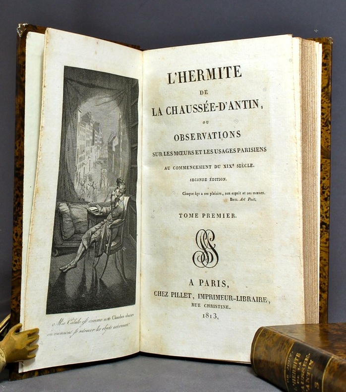
12496A Paris / A Londres / Bruxelles, chez Pillet / chez Ladvocat / chez Martin Bossange / Aug. Wahlen / Malepeyre, 1813 à 1827. 37 volumes in-12, cartonnage imitation veau marbré, dos lisses ornés de filets, titre et tomaison dorés, pièces de titre noires, tranches mouchetées. Nom de possesseur à la plume à certains volumes, quelques rousseurs.
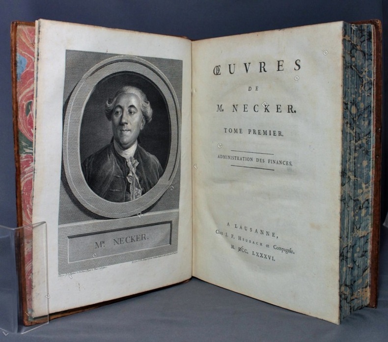
17868485Lausanne, J. P. Heubach et compagnie, 1786. 4 volumes in-4 de [6]-CVIII-408-[4]; [4]-546-[4]; [4]-314-[6]; [4]-360-[4] pages, plein veau écaille, dos à nerfs richement ornés de filets et fleurons dorés, pièces de titre et tomaison en maroquin vert, triples filets dorés encadrant les plats, double filets dorés sur les coupes, tranches jaspées bleues. Un petit manque à la coiffe supérieure du tome trois, deux coins frottés, premiers feuillets légèrement brunis au début des volumes.
17788670Paris, de l'Imprimerie Royale, 1778. 2 volumes in-4 de [4]-389-[1]-XIX-[3]; [8]-500-XXXII pages, plein veau marbré brun, dos à nerfs ornés de filets et fleurons dorés, pièces de titre en maroquin rouge, tranches mouchetées, petits accrocs aux coiffes supérieures, épidermures, coupes et coins frottés, tampon sur les pages de titre, quelques pâles rousseurs.
1692Alibris.0018045Francofurti Ad Moenum: Frederici Knochii 1692. Ultima editio cum optimis colla. Full leather. Good. No dust jacket as issued. . Good. Scarce edition. Worldcat locates only 1 copy. Spine well worn and chipped. Moderate foxing throughout Includes: illustrations diagrams. On the rear endpaper is an Armorial bookplate of the Princes of Liechtenstein "Ex Libris Liechtensteinianis" above arms with chain of the Order of the Golden Fleece associated with Prince Franz Joseph II 1906-1989. Frederici Knochii hardcover
105081 17 ff. de Titre (à double page) Paris, J. Goujon, 1817, in-folio de 17 feuilles, dont le Titre, montées sur onglets, reliure moderne demi-basane tabac glacée, titre or en long, gardes de papier marbré moderne, couvertures conservées, grande pièce de titre ornée contrecollée à la première de couverture ; fine restauration angulaire au titre, quelques pâles piqûres marginales à la planche 10.
1720AUB-5483A Amsterdam chez l'Honoré et Châtelain 1720-1721. 3 bons volumes reliés, reliures plein parchemin d'époque, forts in-12, XII + 629 pages + planches, VIII + 588 pages + planches et XXXIV + 632 pages + planches. Reliure usagée du vol. 1, manque de la page de titre et traces d'usage ; sinon minimes défauts.
177018491Paris, Panckoucke, 1770. In-4 de XIV-[2]- XIV-372 pages, demi-veau brun, dos à nerfs orné de filets dorés, pièce de titre en maroquin rouge, tranches rouges. Reliure pastiche XXème.
Veduta panoramica della città tratta dal celebre Liber Cronicarum del 1493."E' la più nota immagine di Roma data alle stampe alla fine del '400. Essendo stata inserita nella fortunatissima opera di Hartman Schedel comunemente nota con il nome di Cronaca di Norimberga può dirsi senz'altro comune. Si tratta di una derivazione dal prototipo comune a tutte le piante medioevali di Roma e noto come panorama di Mantova, a sua volta ripreso da un presunto ma tuttora sconosciuto panorama inciso nella bottega di Francesco Rosselli verso il 1485. La città è vista da nord-est a volo dìuccello per porre in evidenza la zona Vaticana oggetto di vari lavori tra cui le spine di Borgo, il Belvedere (1485/87), il Santo Spirito ed il palazzo del Papa. Sono inoltre riconoscibili le realizzazioni di Santa Maria del Popolo e ponte Sisto. Tra le antichità spiccano il Pantheon, il Colosseo, la colonna Antonina ed in primo piano i Dioscuri nella originaria collocazione presso le terme di Diocleziano. Manca curiosamente l'Isola Tiberina" (cfr. Marigliani p. 117).La monumentale opera di Schedel, il Liber Cronicarum, rappresenta uno “dei più straordinari lavori mai realizzati” dall’editoria del XV secolo. Gli incisori erano Michael Wolgemut, famoso maestro di Albrecht Dürer, e il figliastro Wilhelm Pleydenwurff. Wolgemut fu il tutore di Albrecht Dürer tra il 1486 e il 1490; recenti studi hanno dimostrato come Durer abbia collaborato alla realizzazione di quest’opera, poiché alcuni dei tratti hanno somiglianze stupefacenti con quelli dell’Apocalisse; alcune opere sono infatti attribuite al maestro di Norimberga. La stampa venne supervisionata dal grande stampatore Anton Koberger, le cui opere erano famose in tutta Europa. Xilografia, finemente colorata a mano, consuete tracce di restauro alla piega centrale, nel complesso in ottimo stato di conservazione.BibliografiaA. P. Frutaz, "Le piante di Roma", XCVI; C. Marigliani, "Le Piante di Roma delle collezioni private", n. 8; M. Gori Sassoli (a cura di), "Roma Veduta" p. 139, n. 5; Scaccia Scarafoni, "Le Piante di Roma", n. 125. It is the most famous image of Rome given to the prints at the end of '400. Having been inserted in the very fortunate work of Hartman Schedel commonly known with the name of Chronicle of Nuremberg can be said without doubt common. It is a derivation from the prototype common to all the medieval map of Rome and known as the Mantua panorama, in turn taken from a presumed but still unknown panorama engraved in the workshop of Francesco Rosselli around 1485. The city is seen from the northeast in a bird's eye view to highlight the Vatican area which has been the subject of various works including the Borgo thorns, the Belvedere (1485/87), the Santo Spirito and the Pope's palace. Also recognizable are the realizations of Santa Maria del Popolo and Ponte Sisto. Among the antiquities stand out the Pantheon, the Colosseum, the Antonine column and in the foreground the Dioscuri in the original location near the Baths of Diocletian. The Tiber Island is curiously missing. (see Marigliani p. 117).Schedel's monumental Liber Cronicarum was “one of the most extraordinary works ever produced” The woodblock cutters were Michael Wolgemut, the well-known teacher of Albrecht Dürer, and his stepson Wilhelm Pleydenwurff. Wohlgemut was Albrecht Dürer's tutor between 1486-90 and recent scholarship has shown, Albrecht Dürer may also have collaborated, since some of the cuts bear a remarkably close resemblance to the Apocalypse illustrations. The printing was carried out under the supervision of the great scholar-printer Anton Koberger, whose printing were famous throughout Europe. Woodcut, fine hand colouring, in good condition.BibliografiaA. P. Frutaz, "Le piante di Roma", XCVI; C. Marigliani, "Le Piante di Roma delle collezioni private", n. 8; M. Gori Sassoli (a cura di), "Roma Veduta" p. 139, n. 5; Scaccia Scarafoni, "Le Piante di Roma", n. 125.
16539Paris chez l'autheur, Rouen chez Martinot, 1655. En 6 feuilles émargées (38 x 44 cm), (110 x 88 cm une fois assemblé). Quelques minimes manques de papier en haut du plan.
1860LBW-8957Paris, A. Thomaron, [1860]. 40,5 x 80,7 cm, replié 40 x 48,8 cm, monté sur carton fort ; cabochons au dos du second plat.
1855LBW-8699Belleville, A. Appert, [1855]. 580 x 824 mm.
1910LBW-6846Paris, Librairie Chaix, 1910. 0,93 x 1,18 m.
17448781Paris, Piget; Durand, 1744. In-4 de [8]-238-[2] pages, plein veau marbré brun, dos à nerfs orné de filets et fleurons dorés, pièce de titre brune, tranches rouges.
1934158433Peiping.: Peiyang Press. circa1934. Coloured folding plan of Peking with original envelope. 60 x 50cm. A few neat repairs at folds two panels evenly browned on reverse. A very good copy of a scarce pictorial plan with its envelope. This delightful and scarce pictorial map of Peking with landmarks and streets in romanised Chinese with occasional Chinese characters is surprisingly scarce. Although apparently issued in several editions in the 1920s and 30s it appears relatively infrequently on the market. The divisions of the Legation District are indicated by their flags - this edition shows the German Legation by use of the black white and red bands of the German flag. This flag which was no longer used after 1935 helps date this edition. Other landmarks and attractions shown included theatres foreign shopping area adjacent to the legations quarter Liu Li Chang Curio District the racecourse the many city gates etc. . Peiyang Press. unknown
1860WRCAM48522Antigua but actually Philadelphia: R.B. Eldridge & Co. 1860. Lithographic sheet map 20 1/2 x 26 1/2 inches. Backed with contemporary blue paper. Light foxing and toning. A few small tears in margins. Very good. An unusual lithographic edition of Norie's 1827 revision of this handsome chart lithographed by Wagner & McGuigan in Philadelphia. A statement in the cartouche reads: "Presented by R.B. Eldridge Antigua to Captain Andrew Tyler." The captain's name is accomplished in manuscript. R.B. Eldridge is not listed in Tooley's DICTIONARY OF MAPMAKERS and appears to be unrelated to publisher of charts George Eldridge. It seems most likely that he was rather an Antigua merchant who commissioned a reprint of the chart for complimentary distribution to sea captains. A handsome piece. R.B. Eldridge & Co. unknown books
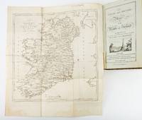
1783ST19355London: Engraved by G. Terry and Sold by T. Longman London and W. Wilson Dublin 1783. Second Corrected Edition. 260 x 155 mm. 10 1/4 x 6". XXVII 289 pp. 4 leaves index. <br/> Contemporary half calf over marbled boards flat spine divided into panels by gilt rules red morocco label very neat repair to head of front joint and top of spine. Engraved title page with vignette and dedication leaf large folding map of Ireland and 289 engraved maps. Title page with early ink signature of Jos. Sabine. Moreland & Bannister p. 190; Tooley "Maps and Mapmakers" p. 94. Small signs of age and wear to the binding including slight crackling and nicks to the spine folding map with faint dampstain to tail margin two negligible ink spots to blank area on the map of the Irish Sea but A VERY APPEALING COPY quite clean and remarkably fresh internally and in an entirely solid period binding.<br/> <br/> This is the second corrected edition of the first comprehensive road atlas of Ireland offered here in especially attractive condition. In response to increasing demand for accurate maps of the country's road system the Irish House of Commons commissioned George Taylor and Andrew Skinner who together had previously produced the first road atlas of Scotland among other works to undertake a survey of the land. Taylor and Skinner completed their work in 1777 and published the first edition of their findings in 1778. This second edition includes updates to the year 1783 as well as an additional map no. 289. Renowned for their precision and detail Taylor and Skinner's maps clearly show roads crossroads and bridges as well as topographical features such as hills lakes and rivers including the direction of the water flow; landmarks such as castles churches and ruins; and the names of local landlords and their homes. The maps appear either as half-page strips or in full-page and the distances are given in both Irish and English miles 11 Irish miles being equal to 14 British miles. The robust list of subscribers which includes a number of earls viscounts lords bishops and British and Irish army men demonstrates the great need for and widespread success of this important work. Our former owner may well be the famed and controversial naturalist Joseph Sabine 1770-1837 who often signed his name as "Jos. Sabine" as seen here. He certainly had good reason to own maps of Ireland. He was from an Anglo-Irish family himself and was Honorary Secretary of the Horticultural Society a position which at the time carried great clout in the botanical community and one that presupposed knowledge of geography across the realm. DNB tells us that "Sabine played a leading part in the establishment of the society's garden first at Hammersmith and afterwards at Chiswick; in sending out David Douglas and others as collectors; in starting local societies in connection with the Horticultural Society; and in growing and distributing new and improved varieties of flowers fruits and vegetables throughout the country." While not a rare book this is the kind of volume that would have normally encountered frequent and inevitably damaging use so to find a copy as well preserved as this one is a lucky occurrence. Engraved by G. Terry and Sold by T. Longman, London and W. Wilson, Dublin unknown
17504284Genève, Barillot et Fils, 1750. In-4 de XXIV-363p., pleine basane brune. Dos à nerfs orné de filets et fleurons dorés.