MOERENHOUT, J. A.Livre Rare Book
11 983 résultats
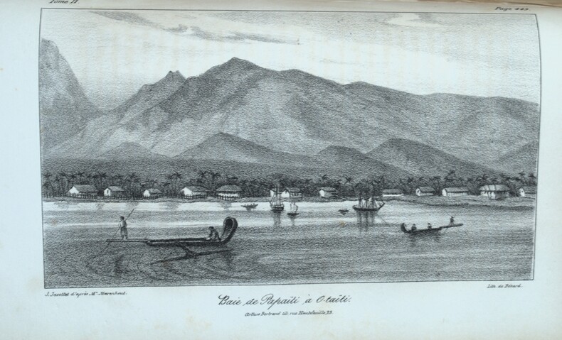
1837PHO-2283Paris, A. Bertrand, 1837. 2 volumes in-8 (21,5x13,5 cm), xv, [1], 574 ; [4], 520, vii pp., illustré de 4 gravures et une carte dépliante, relié demi chagrin époque, traces de réparations à la reliure, cachets répétés, rousseurs et brunissures.
1888J4KDIGIVEPWUFrance 1888. Brown and black ink watercolour chalk and gold paint on paper mounted on several laminated sheets of paper 69.5 x 52.5 cm. Charming trompe-l'oeil of maps of European countries on a decorated background somewhat reminiscent of a church ceiling. It contains a French inscription "to my beloved parents" which together with some inconsistencies in the use of perspective suggest a young French artist. The maps show some interesting departures from reality: in the Netherlands parts of the province of Gelderland are shifted 50 kilometres to the north replacing Zwolle with Arnhem and Sweden lacks Stockholm but includes Copenhagen in place of Malmö. However the most humorous is in the map of Germany which lacks its western neighbours - the Netherlands Belgium Luxemburg and France - giving it an extensive North Sea coast. The gothic lettering is inconsistent in style with the artist apparently improvising an alphabet for each inscription in the process forgetting Denmark.Somewhat soiled and browned at the edges with several white spots due to overpainting; the sheets are coming loose from one another. unknown
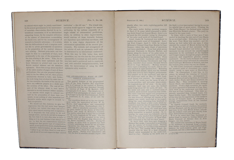
188558309(New York, 1885). 4to. In later half cloth with gilt lettering and stamp to front board. In ""Science"", Vol. 5, No. 108, Feb. 27. Paper label pasted on to front board. The two titles underlined in blue pencil. Stamp to verso of map and almost parted in two, long tear in foldings, otherwise internally fine and clean. Pp. iii-iv, 163-185 + large folded map: ""North America polar regions : Baffin Bay to Lincoln Sea, showing the most recent discoveries including those of U.S.S. Polaris Expedition in 1871-2, under Captain C.F. Hall, British Arctic Expedition in 1875-6, under Captain G.S. Nares, R.N., The Lady Franklin Bay Expedition in 1881-4, under Lieutenant A.W. Greely, U.S.A""
(New York, 1885). 4to. In later half cloth with gilt lettering and stamp to front board. In ""Science"", Vol. 5, No. 108, Feb. 27. Paper label pasted on to front board. The two titles underlined in blue pencil. Stamp to verso of map and almost parted in two, long tear in foldings, otherwise internally fine and clean. Pp. iii-iv, 163-185 + large folded map: ""North America polar regions : Baffin Bay to Lincoln Sea, showing the most recent discoveries including those of U.S.S. Polaris Expedition in 1871-2, under Captain C.F. Hall, British Arctic Expedition in 1875-6, under Captain G.S. Nares, R.N., The Lady Franklin Bay Expedition in 1881-4, under Lieutenant A.W. Greely, U.S.A""
15445Paris, Hôtel de Thou [et] Laporte, 1780 [et] 1786. 23 volumes in-8 et un volume in-4 pour l'atlas. Plein veau raciné brun, dos lisses ornés de filets et fleurons dorés, pièces de titre et tomaison en maroquin rouge. Accident de vers aux volumes 18 et 22, et une tache aux derniers feuillets du vol. 12. Menus défauts à quelques coiffes et quelques coins frottés.
4to [24.5 x 19 cm]; [xii], [i, directions for binder], 335, [ix, index] pp, 37 engraved plates, maps & charts by J. B. Scotin, N. Guerard & others after Frezier, complete with frontis and all plates including 36 & xxxvi, musical notation. contemporary full leather, rebacked with leather spine, gilt title lettering on spine leather labels, cover with blind design, light offsetting on frontis, minor foxing, mainly marginal, a fine copy in attractive binding. A picture of this book is availab Frezier's voyage was made on the orders of Louis XIV to obtain military information for a possible operation against Spanish colonies on the Pacific coast. He surveyed the Le Maire Strait and the west coast of Tierra de Fuego and produced the most accurate description of South America to date (including Chile, Peru). Sabin 25936. Cox II, 267: 'One of the most valuable of our early records of the Falkland Islands, and to Frezier we are indebted for the clearest contemporary account of the navigation of the French seamen there. This English edition contains Dr. Edmund Halley's Postscript, correcting certain Geographical errors made by Frezier. Halley is of course most famous now as the discoverer of Halley's Comet. At the end is a 13 pp. account of the Joint Settlement in Paraguay '. Hill 115: 'Frezier brought back information of considerable geographical and scientific value. Much data is included about the native inhabitants This first English translation contains the same engravings as the French original but is preferable to the latter because it contains Halley's postscript, which corrects certain geographical errors made by Frezier The frontispiece map, showing the route, was created for the English edition'. Borba de Moraes I 329: 'This English edition is much sought after because of Halley's postscript'. This edition also contains a section on the early settlement of Paraguay. A superb travel classic. Besides the fine maps and charts, there are plates of people, including natives in sea-kayak, early golf, natural history and botanical plates, etc.
186161812New York: W. Schaus; printed by Sarony Major & Knapp 1861. Second Edition. 59 x 76cm open. 19.5x19cm closed. Tinted lithographic map backed in brown silk in black slipcase with printed paper label. Bookseller's ticket of Rev. A. O. Brickman Baltimore. Two ownership inscriptions of "J. M. Deems Maj. 1st MD Cav" and inscribed "Deems" on the slipcase. Trimmed; splits along half of one horizontal fold; minor stains and discoloration to verso not affecting image which is bright and generally Very Good. Hand-made slipcase worn with portion cut out but with manuscript ownership label intact. <br /> <br /> Uncommon Civil War map used by a distinguished Union Army officer. James Monroe Deems 1818-1901 was a composer and music educator from Baltimore who secured a commission as a major in 1861. He was promoted to Lieutenant Colonel in spring 1863; led the First Maryland Cavalry during the Battle of Gettysburg; retired due to rheumatism in November 1863; and was brevetted Brigadier General in 1867. He likely acquired this map in Baltimore near the beginning of his military career and certainly before his promotion in 1863 given the use of "Maj." in his ownership inscriptions. <br /> <br /> The map itself is the second edition of this design by J. Schedler despite the title it is not a bird's-eye view. The more common first edition has two insets showing the Lower Mississippi Valley and the city of Richmond see Stephenson 17.3. This version has only one inset showing the eastern United States. Stephenson describes this edition as having a Washington DC bookseller's ticket; the present copy has a Baltimore bookseller's ticket instead. <br /> <br /> This copy was mounted for use in the field: it was trimmed down to the neatline the captions removed the image cut up into segments and mounted on linen. The printed label on the slipcase appears to be a portion of the original title. This may have been done by the bookseller Brickman possibly at Deems' request. <br /> <br /> Uncommon. OCLC records about 10 similarly titled maps but few listings distinguish between the first and second editions. STEPHENSON LC Civil War Maps 2nd ed 17.35. 61812. [W. Schaus; printed by Sarony, Major & Knapp] unknown
4to [24.5 x 19 cm]; [xii], [i, directions for binder], 335, [ix, index] pp, 37 engraved plates, maps & charts by J. B. Scotin, N. Guerard & others after Frezier, complete with frontis and all plates including 36 & xxxvi, musical notation. orig full leather boards with later spine and gilt title lettering on leather labels, light corner wear, joint cracked with repair but holding, map skillfully laid down, minor spotting, old bookplate of John Lenvis Petit, very good, interior clean & fine. Frezier's voyage was made on the orders of Louis XIV to obtain military information for a possible operation against Spanish colonies on the Pacific coast. He surveyed the Le Maire Strait and the west coast of Tierra de Fuego and produced the most accurate description of South America to date (including Chile, Peru). Sabin 25936. Cox II, 267: 'One of the most valuable of our early records of the Falkland Islands, and to Frezier we are indebted for the clearest contemporary account of the navigation of the French seamen there. This English edition contains Dr. Edmund Halley"s Postscript, correcting certain Geographical errors made by Frezier. Halley is of course most famous now as the discoverer of Halley"s Comet. At the end is a 13 pp. account of the Joint Settlement in Paraguay '. Hill 115: 'Frezier brought back information of considerable geographical and scientific value. Much data is included about the native inhabitants This first English translation contains the same engravings as the French original but is preferable to the latter because it contains Halley's postscript, which corrects certain geographical errors made by Frezier The frontispiece map, showing the route, was created for the English edition'. Borba de Moraes I 329: 'This English edition is much sought after because of Halley's postscript'. This edition also contains a section on the early settlement of Paraguay. A superb travel classic. Besides the fine maps and charts, there are plates of people, including natives in sea-kayak, early golf, natural history and botanical plates, etc.
186044546, , [1860-1861]. Dessin colorié, replié et entoilé (144 x 107,5 cm).
Farblithographie in 9 Blättern nach der kolorierten Originalfederzeichnung im Historischen Museum der Stadt Wien, bezeichnet "Alb: Camesina fe: 1856". Einzeln unter Passepartouts montiert. Jeweils 700:850 mm. Der von Albert Camesina (1806-1881) lithographierte und in kleiner Auflage gedruckte Plan erschien über zwei Jahre in einzelnen Lieferungen, was - neben dem übergroßen Format und der verhältnismäßig kleinen Auflage - einen der Hauptgründe für seine Seltenheit darstellt. Der Wienplan des Mitarbeiters Augustin Hirschvogels Bonifaz Wolmut “stellte eine Kombination von ausgeführten und projektierten Festungsanlagen zur Diskussion. Darüber hinaus ergeben die detaillierte Wiedergabe des Grundrisses der Innenstadt [...] und die in freier Perspektive festgehaltenen Vorstadtränder eine grundlegende Dokumentation Wiens (Wien im Mittelalter, Kat. des Historischen Museums der Stadt Wien, 1975/6, Nr. 364). - Tadelloses u. fleckenfreies, in den originalen Einzelsegmenten erhaltenes Exemplar. Fischler, Historischer Atlas des Wiener Stadtbildes, 12f. Oppl, Wien im Bild historischer Karten, Tafel 5.
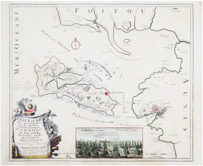
1700LBW-7612Amsterdam, chez l'auteur, et chez Covens & Mortier, [circa 1700]. 496 x 579 mm.
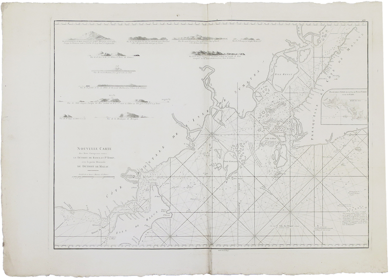
1775LBW-5180[1775-1781]. 494 x 668 mm.
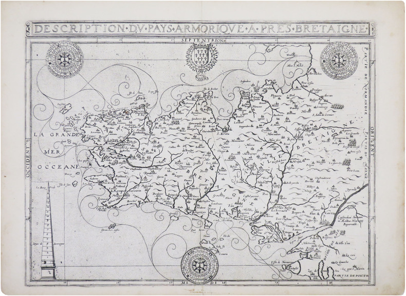
1618LBW-8329[Paris, Nicolas Buon, 1618. 352 x 463 mm.
1727LBW-41361727/1728. En deux feuilles jointes de 485 x 703 mm.
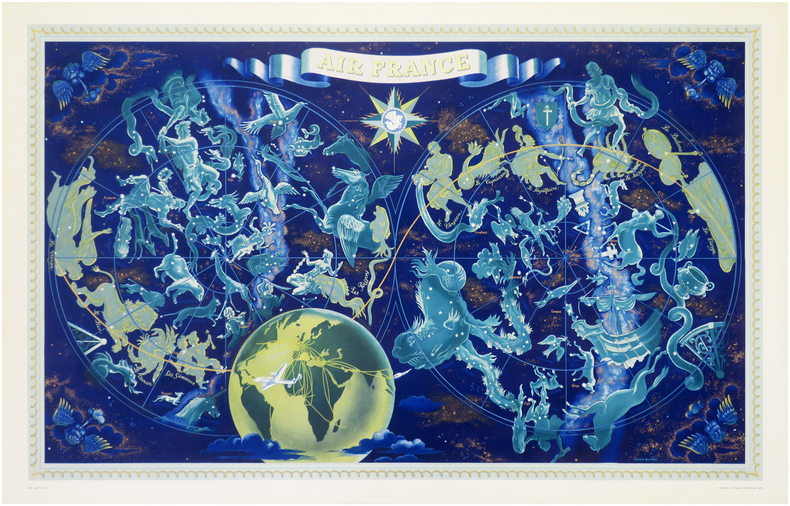
1962LBW-6279Paris, Perceval, [1962]. Lithographie en couleurs de 953 x 592 mm.
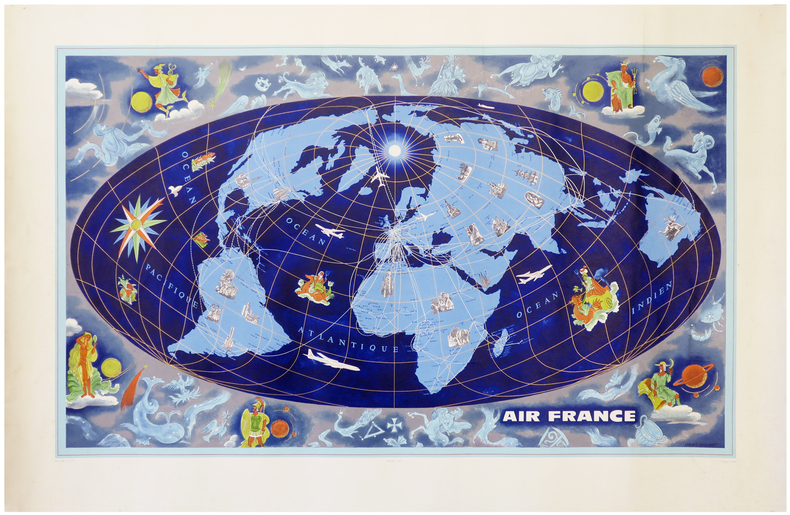
1953LBW-7934Paris, Perceval, 1953. Lithographie en couleurs de 0,65 x 1,02 m.
Grande pianta della città stampata su due fogli, ispirata alla celebre carta del Pirro Ligorio, tratta dal Civitates Orbis Terrarum. Questa straordinaria ricostruzione di Roma durante il regno di Augusto, arricchita da una cospicua legenda con 269 richiami, costituisce il lavorò più ambizioso contenuto nel Civitates Orbis Terrarum, del quale oltretutto è una delle sole tre mappe a doppio foglio. L’opera è inserita nel Civitates Orbis Terrarum, il primo atlante devoto esclusivamente alle piante e vedute delle principali città del mondo. Il primo volume delle Civitates Orbis Terrarum fu pubblicato a Colonia nel 1572. Il sesto e ultimo volume apparve nel 1617. Questo grande atlante di città – cartografia urbana - curato da Georg Braun e inciso in gran parte da Franz Hogenberg, conteneva 546 prospettive, vedute a volo d'uccello e vedute cartografiche di città di tutto il mondo. Franz Hogenberg realizzò le tavole dei primi quattro volumi e Simon van den Neuwel (Novellanus, attivo dal 1580) quelle dei volumi V e VI. Georg Braun (1541-1622), un ecclesiastico di Colonia, fu il principale redattore dell'opera e fu molto aiutato nel suo progetto dalla vicinanza e dal continuo interesse di Abraham Ortelius, il cui Theatrum Orbis Terrarum del 1570 fu, come raccolta sistematica e completa di mappe di stile uniforme, il primo vero atlante. Le Civitates, in effetti, erano destinate ad accompagnare il Theatrum, come indicato dalla somiglianza dei titoli e dai riferimenti contemporanei sulla natura complementare delle due opere. Tuttavia, le Civitates erano progettate per avere un approccio più popolare, senza dubbio perché la novità di una raccolta di piante e vedute di città rappresentava un'impresa commerciale più rischiosa di un atlante mondiale, per il quale c'erano stati diversi precedenti di successo. Franz Hogenberg (1535-1590) era figlio di un incisore di Monaco che si era stabilito a Malines. Incise la maggior parte delle tavole del Theatrum di Ortelius e la maggior parte di quelle delle Civitates, e potrebbe essere anche indicato come il responsabile dell'origine del progetto. Oltre un centinaio di artisti e cartografi diversi, il più importante dei quali fu l'artista di Anversa Georg Hoefnagel (1542-1600), fornirono i disegni per le tavole delle Civitates. Hoefnagel non solo contribuì alla maggior parte del materiale originale per le città spagnole e italiane, ma rielaborò e modificò anche quello di altri collaboratori. Dopo la morte di Hoefnagel, il figlio Jakob continuò il lavoro per le Civitates. Gli autori della raccolta si proponevano di raffigurare "non icones et typi urbium", cioè non immagini generiche e tipizzate, "sed urbes ipsae admirabili caelaturae artificio, spectantium oculis subiectae appareant": non intendeva alludere o idealizzare, ma rappresentare fedelmente sulla carta, riprodurre esattamente, e in tempo reale, ciò che l'occhio vede, come annunciato nella prefazione al primo volume delle Civitates Orbis Terrarum. Incisione in rame, bella coloritura coeva, leggeri restauri perfettamente eseguiti per il resto in buono stato di conservazione. A good example, with fine original colour, of the Braun & Hogenberg Plan of Rome, first published in the 1588 edition of the Civitates Orbis Terrarum.Braun & Hogenberg's view is based upon the work of Pirro Ligorio. However, the title banner and lower key embellishments are completely revised, the former lacking the strapwork used by Braun & Hogenberg and replaced with a tapestry style fringe, while the lower key is now embellished with images of two nobles.Rome is shown from the west in a bird's-eye view that was a major achievement in its day. It includes the most important buildings from antiquity, several aqueducts, the Aurelian Wall and large arterial streets. The three figures in Roman garb in the foreground underscore the aim of meticulous reconstruction.Mont Testaccio is shown on the far side of the Tiber in the lower right-hand edge of the picture, with the Pyramid of Cestius above it to the right. At the center of the illustration the Marcellus Theatre can be identified above the island in the Tiber, with the vast Circus Maximus, used for chariot races, just above it to the right. Above that is the Palatine represented with intricately detailed buildings, an indication of the confusion at the time about how the seat of imperial power actually looked.To the north the Coliseum flanks the Palatine. In the lower left-hand part of the picture field is the Campus Martius, with the stadium of Domitian at the center, site of the modern Piazza Navona. Slightly higher up is the Pantheon with its monumental dome, looking as it does today. On the lower left edge the two great imperial mausoleums are shown as they would have appeared during the Roman epoch. Above the mausoleum of Augustus and below, at the bend in the river, is that of Hadrian.In the lower left-hand corner, the Mons Vaticanus with the Circus built by Caligua and a Neronian palace are recognizable outside the city. The baths of Diocletan dominate the northeastern part of the city. The Castra Praetoria, the barracks of the Praetorian Guard, is shown below the city walls in the upper left-hand corner. The work is included in the Civitates Orbis Terrarum, the first atlas devoted exclusively to plans and views of the world's major cities. Printed in six volumes between 1572 and 1617 it was so successful and widespread that several editions translated into Latin, German and French were printed. The first volume of the Civitates Orbis Terrarum was published in Cologne in 1572. The sixth and the final volume appeared in 1617. This great city atlas, edited by Georg Braun and largely engraved by Franz Hogenberg, eventually contained 546 prospects, bird-eye views and map views of cities from all over the world. Fransz Hogenberg produced the plates for the first four books, and Simon van den Neuwel (Novellanus, active since 1580) those for volumes V and VI. Georg Braun (1541-1622), a cleric of Cologne, was the principal editor of the work, and was greatly assisted in his project by the close, and continued interest of Abraham Ortelius, whose Theatrum Orbis Terrarum of 1570 was, as a systematic and comprehensive collection of maps of uniform style, the first true atlas. The Civitates, indeed, was intended as a companion for the Theatrum, as indicated by the similarity in the titles and by contemporary references regarding the complementary nature of two works. Nevertheless, the Civitates was designs to be more popular in approach, no doubt because the novelty of a collection of city plans and views represented a more hazardous commercial undertaking than a world atlas, for which there had been a number of successful precedents. Franz Hogenberg (1535-1590) was the son of a Munich engraves who settled in Malines. He engraved most of the plates for Ortelius's Theatrum and the majority of those in the Civitates, and may have been responsible for originating the project. Over a hundred of different artists and cartographers, the most significant of w... Fauser, A. 11932; Huelsen (1915) n. 38; Caldana, Roma Antica, p. 84, n. I.17.
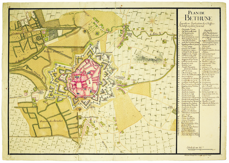
1700LBW-4186[circa 1700]. 490 x 640 mm.
1896LBW-7379London, J.D. Potter, 1896-1897. 0,66 x 1,11 m.
Litografia, 1839, firmata e datata in basso a destra e sinistra. Bellissima prova, impressa su quattro fogli di carta coeva uniti, leggere ossidazioni, per il resto in ottimo stato di conservazione. Questo panorama è idealmente preso dalla torre del Campidoglio ruotando da sinistra verso destra di 360 gradi, con una raffigurazione che inizia dal Pincio e si chiude a Piazza del Popolo. L’opera è stampata dalla litografia Kier di Venezia e nel margine inferiore reca una leggenda di 69 numeri. L’impianto della veduta è ancora quello di un pittore di tradizione settecentesca, in sintonia con la definizione che lo stesso Caffi, allora trentenne, dava di se stesso: “pittore prospettico”. Emilio Re nella biografia sull’artista della mostra romana del 1959 definisce, già allora, “rara” la veduta. Bibliografia: Vedute Romane, pp. 13, 50, n. 74; Roma Veduta, p. 221, 67; Le piante di Roma nelle collezioni private, p. 344, 276. Lithograph, 1839, signed and dated on lower right and left. Beautiful work, printed on four sheets of contemporary paper - joined together - light oxidations otherwise in excellent condition. This panorama is ideally seen from the tower of the Campidoglio, rotating towards the right side of 360 degrees, starting from the Pincio and ending in Piazza del Popolo. The work has been printed by the Kier lithography in Venice; on lower margin it bears 69 numbers. The setting of the view recalls that of an XVIII century painter, according to the definition that Caffi himself, at the age of thirty, gave of his art: “perspective painter”. In his biography of the artist, written on the occasion of the 1959 exhibition, Emilio Re defined this subject “rare”. Bibliografia: Vedute Romane, pp. 13, 50, n. 74; Roma Veduta, p. 221, 67; Le piante di Roma nelle collezioni private, p. 344, 276. Dimensioni 1450x145. Vedute Romane, pp. 13, 50, n. 74; M. Gori Sassoli (a cura di), "Roma Veduta", p. 221, s. 67; C. Marigliani, "Le Piante di Roma delle collezioni private", tav. 276.
1700LBW-4147[circa 1700]. En deux feuilles jointes de 720 x 970 mm.
1781LBW-7245Paris, 1781. En 4 feuilles jointes formant une carte de 0,87 x 1,14 m.
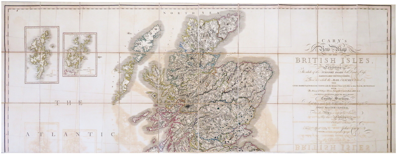
1819LBW-6802London, John Cary, 1819-1833. En trois feuilles coupées en 30 sections chacune, montées sur toile et pliées, pouvant être jointes pour former une carte de 1,91 x 1,71 m ; plats au dos de percaline prune, protégeant les feuilles une fois repliées, avec vignettes portant les titres de North, Center et South ; sous étui de percaline prune avec vignette de titre sur le premier plat.
1798LBW-7687[Paris, P.G. Chanlaire et E. Mentelle, An six de la République - 1798]. 343 x 448 mm.
Primo stato di questa non comune carta del mondo del XVIII secolo, successivamente ristampata nel 1775 e 1787. La carta mostra le numerose esplorazioni del secolo ed è altamente decorativa. La carta è largamente più conosciuta per la sua comune ristampa del 1787, curata dall'editore Louis Joseph Mondhare, che raffigura la scoperta delle Hawaii (Isole Sandwich o Why, come indicato sulla mappa), le esplorazioni nella costa nord-occidentale dell'America e quelle dei viaggi di Cook (1773,1775, 1776, 1777, 1777, 1778), Jean Baptiste Louis Clouet era membro dell'Accademie Royale des Sciences di Rouen e fu autore della Geographie Moderne (1767). Acquaforte, in ottimo stato di conservazione. Magnifico esemplare in piena coloritura coeva. First state of this uncommon World map with the major 18th century explorers. Rare separately published double hemisphere map of the world, issued by Clouet in Paris. The map is largerly known for his second and common issue by Louis Joseph Mondhare (1787) showing the discovery of Hawaii (Ile Sandwich ou Why, as named on the map) and explorations in the Northwest Coast of America are quite prominent, and the major 18th century explorers like Cook (1773,1775, 1776, 1777, 1778). Jean Baptiste Louis Clouet (born 1730) was a member of the Academie Royale des Sciences de Rouen and the author of Geographie Moderne (1767). Etching with full contemporary colour, very good conditions.