PETIT (Victor).Livre Rare Book
11 983 résultats
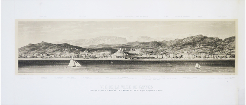
1865LBW-7695Cannes, Société de l'Avenir de Cannes, [1865]. 310 x 925 mm ; lithographie sur Chine monté.
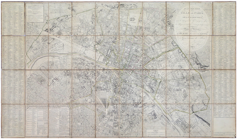
LBW-5881Paris, Ch.les Picquet, 1er Frimaire An 13-22 nov.bre 1804. En 40 sections montées sur toile et pliées, formant une carte de 0,83 x 1,39 m, étiquette de l'éditeur au dos de la carte.
1748145271748 entoilée. Carte en 4 feuilles assemblées, 113 x 179 cm, limites aquarellées, P. Jean Lattre 1748
1856LBW-8303Paris, Robiquet, 1856. En deux feuilles de 0,69 x 0,99 m et 0,68 x 1 m.
1710LBW-4193[circa 1710]. En 2 feuilles jointes de 510 x 715 mm.
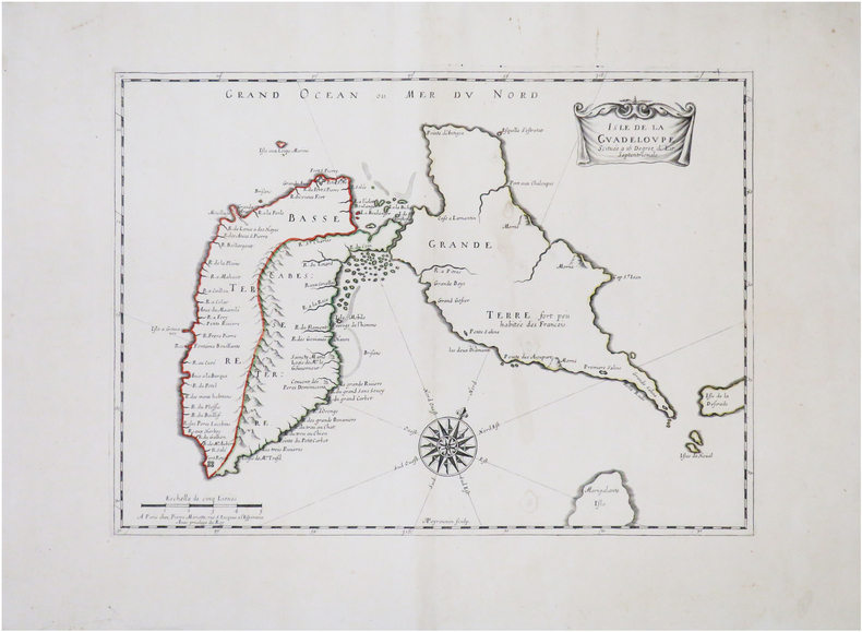
1650LBW-8846Paris, Pierre Mariette, [circa 1650]. 313 x 427 mm.
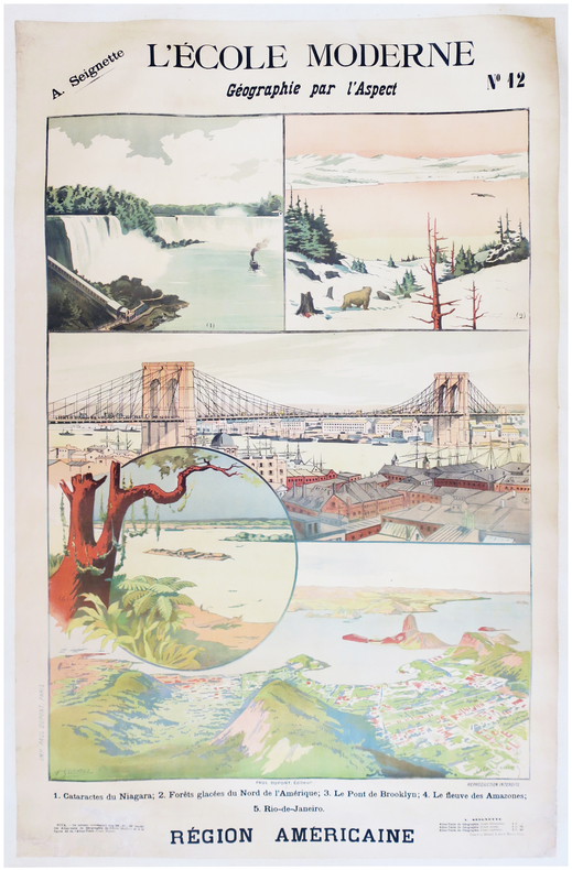
1900LBW-7872Paris, Paul Dupont, [1900]. 1,22 x 0,85 m ; montée sur toile.
1730LBW-8300Augsbourg, [circa 1730]. 573 x 491 mm.
Laminated folding map. Ca. 910 x 580 mm. Scale 1:1,500,000. Captions in English and Arabic. Road map of the Gulf region with 7 inset plans of Manama, Doha, Abu Dhabi, Kuwait, Dubai, Mutrah and Muscat. Apart from main and secondary roads and railways, the chart details larger and smaller towns, pipelines and oil fields. - Pierced near corners. Otherwise well preserved.
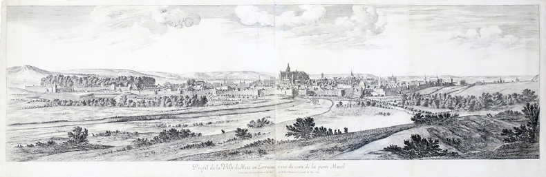
1667LBW-4500Paris, Israel Silvestre, 1667. En deux feuilles jointes de 400 x 1286 mm.
17218Paris, Atelier de lithographie de N. Gratia, 1839 - 1842. In-plano (53,5 x 74 cm), un feuillet de légendes indiquant les Routes royales, Routes départementales et les Chemins de grandes communications, 34 cartes topographiques des cantons gravées sur pierre par Eugène Rembielinski, un tableau d'assemblage des feuilles et une deuxième carte de Caen "Statistique générale" de 1836 (nommée 7ème feuille de l'atlas, avec les détails statistiques), ces deux derniers sont gravés par Bouffard. Quelques cartes aux contours rehaussés de bleu. Exemplaire très frais, monté sur onglets. Demi-basane havane, dos lisse orné de filets dorés et fleurons à froid. Eraflures, coiffe inférieure usée. Reliure de l'époque.
1696LBW00291[1696]. En 2 feuilles pouvant être jointes et former un plan d'environ 660 x 860 mm.
1640LBW-1382Paris circa 1640 367 x 516 mm.
1856LBW-8701Paris, Fatout, [1856]. 570 x 817 mm.
LBW00283circa 1760 498 x 1070 mm.
1824LBW-7761824. 455 x 554 mm.
1827LBW-41851827. En 18 sections montées sur toile et pliées, formant une carte de 620 x 930 mm.
899943Imprimerie De Didot Paris 1768 In-4 carré ( 250 X 195 mm. ) de: [5] ff. ( Titre, Titre gravé, Table des chapitres, Table des cartes et plans ), 152 pages, pleine basane fauve marbrée, dos à nerfs orné de caissons, fleurons et roulettes dorés, pièce de titre de maroquin vieux-rouge, chaînette dorée sur les coupes, tranches brique. Joli bandeau allégorique signé Jean CHOFFARD et 34 cartes gravées dont 16 doubles ( 2 dépliantes ) par Nicolas BELLIN. Parmi les 34 cartes qui illustrent louvrage, une carte générale du Nord de St Domingue et de ses cinq débouquements, une du Canal de Bahama représentant le sud du Golfe du Mexique. Rare édition originale de ce routier des Antilles par le premier hydrographe de la Marine royale française, Jacques-Nicolas BELLIN ( 1703-1772 ). ( J. Polak 591 Sabbin, 4552 ). Reliure un peu frottée, 2 coins émoussés, mouillure claire et petite galerie de vers marginale à quelques feuillets, bon exemplaire à grandes marges.
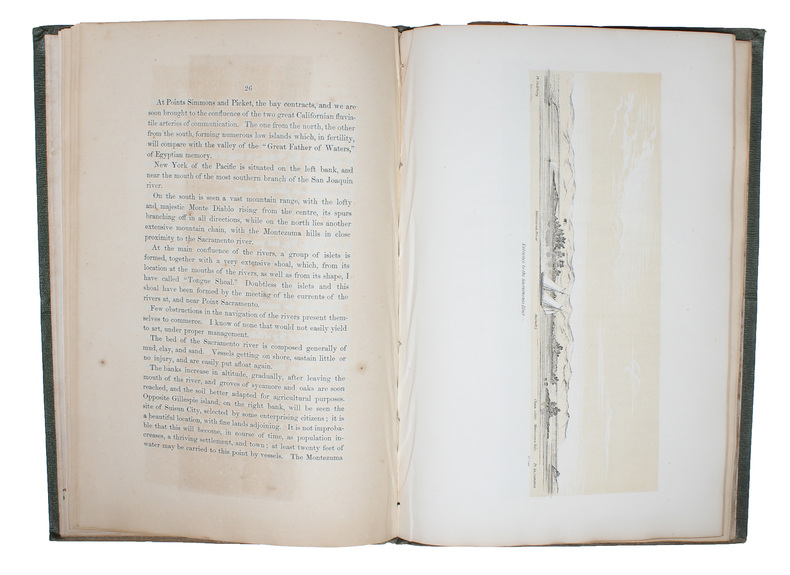
185153713Washington, Jno. T. Towers, 1851. 4to. In publishers original full pictoral green cloth. Front and back board with embossed title and ornamentation, showing an eagle holding a banner and anchor beneath whom Columbia sits holding the shield of California with a bear asleep at her feet. Front board in gold. Lower front board with gilt stamp. Stamp to front free end-paper and title-page. Light wear to extremities and internally with light occassional miscolouring. 44. pp. + 11 lithographic plates including frontispiece and 6 folding maps.
Washington, Jno. T. Towers, 1851. 4to. In publishers original full pictoral green cloth. Front and back board with embossed title and ornamentation, showing an eagle holding a banner and anchor beneath whom Columbia sits holding the shield of California with a bear asleep at her feet. Front board in gold. Lower front board with gilt stamp. Stamp to front free end-paper and title-page. Light wear to extremities and internally with light occassional miscolouring. 44. pp. + 11 lithographic plates including frontispiece and 6 folding maps.
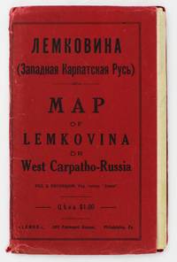
19295372Philadelphia: Lemko Press 1929. Very good. Lithographed folding map approximately 32 x 40 inches printed in pink and black. Housed in original red wrappers printed in black. Modest wear along folds a couple of small separations at crossfolds light marginal toning. Wrappers with minor spine and edge wear. An extremely rare map of "Lemkovina" the homeland of the Lemko an Eastern Slavic people from the Central Carpathian Mountains where Poland Slovakia and Ukraine meet in the present day. From the late-19th century to the 1920s tens of thousands of Lemkos immigrated to the Unites States and Canada -- fleeing war oppression and seeking better economic opportunities. Once in the United States Lemko intellectuals founded institutions to preserve and promote Lemko culture in the New World and to lobby for sovereignty of the Lemko homeland. The present large-format map is an intriguing artifact of the Lemko-American immigrant experience. The map was drafted by the Lemko-American activist Dmitriy Vislocky and published by the Lemko Press in Philadelphia in 1929; it showcases the areas where the Lemko population prevailed as well as areas of mixed Lemko-Slovakian and Lemko-Polish demographics; while it does not explicitly define Lemkovina as a sovereign state its rhetorical direction is nevertheless clear.<br /> <br /> The Lemko are an Eastern Slavic people who originate from a large area along both slopes of the Central Carpathian Mountains in a region traditionally often referred to as "West Carpatho-Russia" located along the eastern stretch of today's border of Poland and Slovakia and extending slightly east into Ukraine. The Lemko language is akin to Ukrainian and is written in Cyrillic. Traditionally many consider the Lemkos to be a subgroup of Russians or Ukrainians although many Lemkos have tended to self-identify as a distinct ethnicity. The Lemkos have vibrant and sophisticated cultural traditions with distinct music folklore clothing and customs. Most Lemkos are Eastern rite or Byzantine-rite Catholics although some have converted to the Eastern Orthodox faith. The period leading up to during and after World War I was traumatic for the Lemkos. The group splintered their loyalties with some supporting the Russians both Red and White factions while others were sympathetic to Ukrainian nationalism and some either voluntarily or under coercion were allied with Austria-Hungary. Lemkos caught on the wrong side of events often met with cruel fates. In the aftermath of the war Lemkos who supported the Red Russians formed the "Lemko-Rusyn People's Republic" which existed from December 1918 to March 1920 a state that took in part of the northern slope of the Central Carpathians of Lemkovina. Meanwhile further to the east was the pro-Ukrainian "Eastern Lemko Republic" November 1918 to January 24 1919. However these republics were soon extinguished with all Lemkovina being divided between Czechoslovakia and Poland. The Lemkos in Poland would have a very difficult time as the Polish state considered them disloyal. Eventually they were forcibly displaced from their homeland. <br /> <br /> Lemkos began to immigrate to the United States and Canada in the late 19th century in good part due to economic opportunities. The greatest center of activity for Lemko peoples in North America was in Pennsylvania although large communities could be found across the American Northeast and Midwest as well as in places such as Toronto Canada. Many Lemkos found decent jobs initially in the burgeoning manufacturing industry. Smaller but still significant Lemko communities developed as far away as Colorado and Alberta where they were engaged in the ranching and mining industries. Today hundreds of thousands of North Americans count Lemko ancestry. Lemkos adjusted very well to life across the Atlantic and generally met with success. The most famous of all Lemko-Americans was the artist Andy Warhol 1928-1987 who was born in Pittsburgh the son of Lemko immigrant parents. In the 1920s Lemko intellectuals in America largely based in Pennsylvania formed a movement to preserve Lemko culture while lobbying for the eventual resurrection of an autonomous if not sovereign Lemko homeland – Lemkovina. However there was a great deal of internecine dispute over the nature of this proposed state as some favored a pro-Ukraine sovereign entity while others wanted it to be Soviet satellite yet the dream of a future sovereign Lemko nation of any sort was never to be realized as powers ranging from the Czechoslovak and Polish governments to Hitler and Stalin would never allow it. Lemko culture flourished in the U.S. and Canada centered around Lemko halls and churches and beginning in the 1920s a handful of small printing presses were established to serve and educate the community issuing Lemko-language almanacs primers newspapers and pamphlets. One of the most important of these houses was the Lemko Press of Philadelphia which under the leadership of Dmitriy Vislocky published the Lemko Gazette. The circle of the Lemko Press had a pronounced Ukrainophone allegiance and was at odds with some other Lemko-North American groups.<br /> <br /> As a major part of their campaign to define "Lemkovina" and call for its eventual nationhood presumably as a pro-Ukrainian sovereign state in opposition to both the Soviets and Poland Dmitriy Vislocky and the Lemko Press produced the present map. As best as we are aware it is the only large format map of the period to specifically show Lemkovina as a distinct entity and being published in Philadelphia it stands as a remarkable feat of Lemko-American immigrant cartography. The large format map executed to the ample scale of 1:200000 with text in Cyrillic and lithographed from a hand-drawn template shows the Polish-Slovakian frontier region which today extends east into Ukraine along the Central Carpathian Mountains an area traditionally sometimes known as "West Carpatho-Russia." A very rugged and rural area it is roughly framed by the the Dunajec River in the west and the San and Uzh Rivers in the east and with the cities of Nowy S cz Poland to the northwest and Košice Slovakia to the southeast. The map delineates all major rivers roads and railways and locates cities towns and villages. The legend below the title explains the color-coding employed to define demographic areas. Territory shaded in bold pink are of majority ‘Russian’ meaning Lemko and Rusyn population i.e. core Lemkovina while the areas covered by southwest-northeast hashed lines are of mixed Lemko/Rusyn-Slovakian population and the areas with northwest-southeast hashed lines are of mixed Lemko/Rusyn-Polish population. Beyond are labeled the lands of Poland to the north Slovakia to the south Eastern Galicia to the northeast and Sub-Karpatsky Russia Ukraine to the southwest while the map defines the Polish-Czechoslovak border as it was then internationally recognized. While the map does not explicitly state that Lemkovina is a country Dmitriy Vislocky’s sovereignist direction of travel is nevertheless clear.<br /> <br /> The present map is extremely rare. It was likely issued in only a small print run and the survival rate of such fragile ephemeral American immigrant publications is very low. We can trace only a single institutional example of the map held by the David Rumsey Map Collection at Stanford University. Beyond that we are aware of only a single other example as having appeared on the market in the last twenty-five years.<br /> David Rumsey Map Collection Stanford University: 11153.000. Lemko Press unknown
1812PHO-1644Paris, A. Nepveu, 1812. Atlas in-folio oblong (420x280), pleine toile moderne, auteur et titre au dos, rousseurs, cachet de librairie, petite mouillure en début d’ouvrage, déchirures sur 2 planches en marge sans manque. Première édition, l'atlas comprend 45 planches et cartes, dessinées et gravées la plupart par l'auteur, certaines terminées par Coube, Hulk, Gossard ou Perdoux, (vue de la ville du Port Napoléon, vue du Cap de Bonne-Espérance, etc.). L'ouvrage traite de l'histoire de l'île Maurice, de sa population et de son administration, de géologie et de sciences naturelles.
Acquaforte e bulino, 1748, firmata sulla pietra con la scala in basso al centro "Piranesi e Nolli incisero". Celebre pianta di Roma, incisa da Giovanni Battista Nolli e Carlo Nolli, magnificamente arricchita da elementi decorativi incisi da Giovanni Battista Piranesi. La mappa descrive il centro di Roma su una grande quinta dispiegata dal putto in alto a destra. In alto a sinistra un putto sorregge lo stemma del cardinale Alessandro Albani, al quale l'opera è dedicata, come riportato nel cartiglio sottostante. Al lato sinistro, al di sotto del putto reggi stemma, si diparte una legenda con un elenco di centosettanta luoghi d'interesse, palazzi, monumenti e chiese, che prosegue sul bordo destro. In basso al centro, sui ruderi di un piedistallo, è riportato il titolo. Nella parte bassa della composizione si osservano un'immagine speculare della Basilica di San Pietro, la facciata della Basilica di Santa Croce in Gerusalemme di Pietro Passalacqua e Domenico Gregorini, la Fontana di Trevi di Nicola Salvi e la facciata della Basilica di Santa Maria Maggiore di Ferdinando Fuga. La pianta è conosciuta come "Pianta piccola" del Nolli; piccola per distinguerla dal celebre grande rilievo, impresso su 12 fogli (più 6 di indice), di cui questa pianta rappresenta la riduzione. È numerata 33-34 perché seguiva, nella pubblicazione completa, i 6 fogli di indice della pianta grande. Il titolo è riportato in basso, entro il piedistallo della colonna traiana. Accanto, entro un frammento architettonico su cui è riportata la "scala in palmi romani d'architettura", la sottoscrizione degli incisori C. Nolli e G.B. Piranesi. La dedica di G.B. Nolli al cardinale Alessandro Albani è datata "Roma il dì primo del 1748". L'indicazione di pubblicazione si trova nel lembo, ripiegato, del cartiglio sul lato destro. Acquaforte, impressa su carta vergata coeva, completa dei margini, leggera e diffusa brunitura, minime abrasioni, per il resto in buono stato di conservazione. Bibliografia Scaccia Scarafoni n. 227; Marigliani, 190; Frutaz CLXIX a-c; Wilton-Ely 1994, n. 1007. Etching and engraving, 1748, signed on stone with scale at bottom center "Piranesi e Nolli incisero". Famous map of Rome, engraved by Giovanni Battista Nolli and Carlo Nolli, beautifully enriched with decorative elements engraved by Giovanni Battista Piranesi. The map depicts the center of Rome on a large backdrop unfolded by the putto in the upper right. On the upper left a putto holds the coat of arms of Cardinal Alessandro Albani, to whom the work is dedicated, as shown in the cartouche below. On the left side, below the putto holding the coat of arms, departs a legend with a list of one hundred and seventy places of interest, palaces, monuments, and churches, which continues on the right border. At the bottom center, on the ruins of a pedestal, is the title. The lower part of the composition shows a mirror image of St. Peter's Basilica, the facade of the Basilica of Santa Croce in Gerusalemme by Pietro Passalacqua and Domenico Gregorini, the Trevi Fountain by Nicola Salvi, and the facade of the Basilica of Santa Maria Maggiore by Ferdinando Fuga. The map is known as Nolli's "Small Plan"; small to distinguish it from the famous large relief, imprinted on 12 sheets (plus 6 of index), of which this map represents the reduction. It is numbered 33-34 because it followed, in the complete publication, the 6 index sheets of the wall map. The title is given at the bottom, within the pedestal of the Trajan column. Next to it, within an architectural fragment on which is the "scala in palmi romani d'architettura", is the signature of engravers C. Nolli and G.B. Piranesi. G.B. Nolli's dedication to Cardinal Alessandro Albani is dated "Roma il dì primo del 1748." The indication of publication is in the flap, folded, of the cartouche on the right side. Etching, impressed on contemporary laid paper, complete with margins, light and diffuse browning, minimal abrasions, otherwise in good condition. Bibliografia Scaccia Scarafoni n. 227; Marigliani, 190; Frutaz CLXIX a-c; Wilton-Ely 1994, n. 1007.
Celebre pianta topografica di Roma, una rielaborazione, su invenzione di Giovanni Battista Nolli, della pianta xilografica di Leonardo Bufalini raffigurante la città nel 1551. La pianta era venduta insieme a quella grande e piccola del Nolli, di cui costituisce le tavv. 35 e 36. Fu incisa da Franco Monaco e Carlo Nolli, la cui sottoscrizione si legge in basso a sinistra. In alto a sinistra, entro un cartiglio, dedica del Nolli al cardinale Silvio Valenti Gonzaga. Nei due angoli inferiori, sono state inserite le vedutine del Pantheon a sinistra, e dell'Arco di Giano a destra. Orientamento con il nord in alto. Scalimetro in palmi romani. Ai lati, legenda di 307 voci. In basso a destra, le note tipografiche della pianta edita da Leonardo Bufalini nel 1551: "Edita per Mag[ist]r[u]mLeonardum Die XXVI. Men. Maij Anno Domini MDLI"; al centro, la notizia del privilegio e la data: "Romae cum privil. Sum. Pontificis, et Super. permissu anno 1748". Nolli non fece alcun tentativo di migliorare le incongruenze della mappa del Bufalini: gli angoli del Tridente di Piazza del Popolo sono ancora disuguali, e il Circo Massimo ha entrambe le estremità di forma, invece che una sola. Acquaforte e bulino, impressa su carta vergata coeva, con margini, in perfetto stato di conservazione. Bibliografia Frutaz, Le piante di Roma, CLXIX a-c. Famous topographical map of Rome, a reworking, on the invention of Giovanni Battista Nolli, of Leonardo Bufalini's xylographic plan depicting the city in 1551. The plan was sold together with Nolli's large and small plans, of which it constitutes Tables 35 and 36. It was engraved by Franco Monaco and Carlo Nolli, whose signature can be read at lower left. Nolli made no attempt to rectify inconsistencies of the Bufalini map when he prepared the reduced copy. The Popolo trivium still has its unequal angles, and the Circus Maximus is still semicircular at both ends instead of one. He did, however, give greater relief than the original to the densely populated part of the city by shading in the city blocks. This is the same graphical convention he used on his own map. He maintained Bufalini's emphasis on antiquity by copying them exactly as in the original. Indeed he acknowledges this aspect by including views of ancient buildings at the bottom, where the map appears to be scrolled up, so as to reveal the "Colonnacce," a broken aqueduct, and the Pantheon (with Baroque additions) in the lower left corner, and the three ruins of the Forum Boarium in the lower right hand corner: The round Temple of "Mater Matuta," the Arch of Janus (with Medieval additions) and the Temple of "Fortuna Virilis." The map was engraved, as signed, by Franco Monaco and Carlo Nolli. On the upper left, the cartouche with the dedication to the Cardinal Silvio Valenti Gonzaga. Etching with engraving, a fine impression on contemporary laid paper, with margins, perfect condition. Bibliografia Frutaz, Le piante di Roma, CLXIX a-c.