11 983 résultats
Acquaforte e bulino, circa 1561. Magnifica prova, impressa su carta vergata coeva, con margini, in perfetto stato di conservazione. Esemplare in meravigliosa coloritura coeva.La mappa di Ruscelli è molto interessante per la sua rappresentazione dei cinque continenti conosciuti, legati tra loro come una superficie continua. Questa mappa presenta una proiezione della superficie terrestre già piuttosto obsoleta ai tempi della sua pubblicazione. Già in precedenza, altri cartografi, partendo da Matrin Waldseemuller nel 1507, avevano messo in dubbio l’affermazione di Colombo secondo cui Asia e America formassero un unico continente. I viaggi di Magellano e di altri esploratori, che permisero di conoscere definitivamente la reale estensione dell’oceano Pacifico, diedero ulteriore sostegno a tali dubbi, sebbene lasciassero aperta la possibilità di una connessione America-Asia a settentrione. Intorno alla metà del XVI secolo, tuttavia, anche questa ultima ipotesi venne completamente screditata, per essere rimpiazzata dall’idea di un ipotetico “stretto di Anian”. Altra interessante caratteristica di questa mappa è l’intreccio di “linee dei sestanti” radianti da 16 punti focali. Il sestante era uno strumento indispensabile per misurare e tracciare, la rotta di navigazione. In questo caso, le linee tracciate sulla mappa sono esclusivamente ornamentali e illustrative, in quanto la carta è troppo piccola per poter essere funzionale. Carta tratta dalla "Geographia di Claudio Tolomeo", a cura del Ruscelli, pubblicata in Venezia in pù edizioni tra il 1561 ed il 1598. La carta è basata sulla "Geografia" di Giacomo Gastaldi, che probabilmente disegnò personalmente anche queste mappe, che vennero incise dai fratelli Sanuto. La peculiarità di queste mappe è che sono incise due per lastra e successivamente tagliate; questo il motivo per cui il segno del rame appare solo in tre lati della mappa. Il testo del Ruscelli e le sue carte sono considerate come il miglior atlante moderno fino alla prima versione del Thatrum di Ortelius, 1570. Solo la loro enorme diffusione ne impedisce una valutazione sostenuta nel mercato antiquario. L'opera infatti ebbe una prima stesura nel 1561, stampata da Vincenzo Valgrisi che ne curò anche la ristampa del 1562. Tre sono le edizioni firmate da Giordano Ziletti (due nel 1564 e una del 1574), mentre nel 1597 viene edita dai fratelli Calignani. Tutte queste edizioni contengono 64 tavole. Nel 1598 e 1599 vengono alla luce le due edizioni curate da Giuseppe Rosaccio e stampate dagli Eredi di Melchior Sessa. Queste ultime due edizioni comprendono 69 tavole; sono infatti aggiunte la carta del planisfero e dei continenti del Rosaccio.Gli esemplari delle carte del Ruscelli in coloritura coeva sono assolutamente rarissimi. - ORIGINAL COLOURING -Etching with engraving, about 1561. Magnificent proof, printed on contemporary laid paper, with margins, in perfect condition. Example in wonderful contemporary coloring.The map of Ruscelli is very interesting for its representation of the five known continents, linked together like a continuous surface. This map shows a projection of the Earth's surface rather obsolete already at the time of its publication. Previously, other cartographers, starting from Martin Waldseemuller in 1507, had questioned the assertion of Columbus that Asia and America form a single continent. The travels of Magellan and other explorers, which allowed him to finally know the true extent of the Pacific Ocean, gave further support to these concerns, although leave open the possibility of a free America-Asia to the north. Around the middle of the sixteenth century, however, this latter hypothesis was completely discredited, to be replaced by the idea of a hypothetical "Strait of Anian." Another interesting feature of this map is the plot of "lines of sextants" radiant 16 focal points. The sextant was an indispensable tool to measure and track, the navigation route. In this case, the lines drawn on the map are exclusively ornamental and illustrative, because the paper is too small to be functional. The map comes from Ptolemy's Geographia, edited by Ruscelli, published in Venice in multiple editions between 1561 and 1598. The map is based on the same work of Giacomo Gastaldi (1548), which probably also personally drew these maps, engraved by the brothers Livio and Giulio Sanuto. The peculiarity of these maps is that they are recorded two for plate and subsequently cut, consequently the sign of the copper appears only on three sides for each map. The text of Ruscelli and his maps are considered as the best modern atlas to the first version of the Theatrum Orbis Terrarum by Ortelius of 1570. Only their ubiquity prevents an assessment supported in the antique market.Girolamo Ruscelli (Viterbo 1504 - Venice 1566), scholar and polygraph native of Viterbo, was formed in Rome but soon moved in Veneto where he treated, for typography Valgrisi, numerous editions of Italian classics. Ruscelli was also the curator of the revised and expanded version of Ptolemy's Geographia, printed in Venice several times between 1561 and the end of the century. The maps are based on those by Giacomo Gastaldi for the Venetian edition of 1548, and engraved by the brothers Sanuto.Example of Ruscelli’s maps in contemporary coloring are absolutely rare. Shirley, The Mapping of the World, 111. Dimensioni 260x195.
La carta in esame appartiene a un progetto di atlante – in ambito antiquario noto come “Zattone” – mai portato a compimento, della così denominata Societè Calcographique, un’operazione commerciale messa su da due editori leader del mercato veneto del XVIII secolo, Antonio Zatta (1722-1804) e Giuseppe Antonio Remondini (1747-1811). La denominazione dell’impresa editoriale è nota attraverso una carta del mondo che, nella parte bassa del cartiglio, reca l’iscrizione a` Venise Chez la Societè Chalcographique 1799. (Sicilia 2014: 287). Il progetto sembra non sia stato portato a compimento poiché nessun atlante, con un proprio titolo, indice e frontespizio, contenente queste mappe, è noto in bibliografia. Probabilmente le carte venivano vendute singolarmente o a fascicoli come era comune per imprese editoriali di un certo costo. Le carte a tutt’oggi note sono realizzate mediante l’utilizzo di rami più antichi, appositamente modificati. Le matrici originali hanno molteplici origini: alcune appartengono a un altro sconosciuto Atlante d'Italia dedicato alli Augusti Viaggiatori il Conte, e la Contessa, Del Nort stampato con imprint Venezia MDCCLXXXII presso Vincenzo Formaleoni. Nessun esemplare completo di questa raccolta ci è noto, alcune di queste carte fanno parte di una raccolta fattizia conservata alla Biblioteca Nazionale Marciana di Venezia [284. c. 86], altre sono comparse di tanto in tanto nel mercato antiquario. Il frontespizio dell’atlante di Vincenzo Formaleoni (1752-1797) – che qui pubblichiamo e che ci ha consentito di formulare questa ipotesi – è recentemente apparso in una vendita all’asta Cambi di Genova. Altre mappe dello “Zattone” derivano da lastre di Paolo e Francesco Santini, riusate da Remondini per l’Atlas Universel nell’edizione degli anni 1782/84; altre da matrici impiegate da Antonio Zatta per il Nuovo Atlante pubblicato nel 1796. Le carte dei Santini sono abilmente arricchite, tramite la sovrapposizione di cartigli realizzati, nel classico stile di Zatta, su piccole lastre di rame le cui impronte calcografiche sono chiaramente visibili sulle mappe. I cartigli, realizzati dagli stretti collaboratori di Zatta Pasquali, Zuliani e Pitteri, spesso contengono brevi descrizioni storiche, e le mappe furono realizzate probabilmente per illustrare i notevoli cambiamenti geo-politici cui fu soggetta la penisola italiana durante il periodo napoleonico. Le 60 mappe di questa raccolta a tutt’oggi note, datate tra il 1795 e il 1805, sono principalmente dedicate a illustrare la penisola, ma anche altre regioni europee, i continenti e la già menzionata carta del mondo che riporta l’imprint editoriale della Societè Calcographique. Alcune di queste carte, raffiguranti la Repubblica Cisalpina, sono state descritte come parte di un Atlas très Nouveau del solo Remondini, edito a partire dal 1800: “In sostanza siamo di fronte a una semplice operazione commerciale che pensiamo sia stata operata dal Remondini, sebbene egli non si firmi come editore, poiché proprio nel 1799 egli stava acquisendo i rami dello Zatta” (Terre di Langobardia 2005:14). È molto più probabile che i due editori abbiano collaborato in questa avventura editoriale almeno fino alla morte di Antonio Zatta nel 1804, e che il progetto di un atlante completo non sia stato portato a termine anche per la morte, di pochi anni successiva, di Giuseppe Antonio Remondini. Acquaforte, finemente colorata a mano in epoca, in perfetto stato di conservazione. Bibliografia Il Piemonte nella Cartografia del Cinquecento e Seicento 1991, 75; Terre di Langobardia 2005:14; Le Grandi Alpi nella cartografia 2005: 147, 148; Sicilia 2014: 287. Zeno Davoli, Roberto Sanfelici, Terre di Langobardia - La "Lombardia" e il Ducato Estense nella cartografia a st... A large double-hemisphere map with ornate cartouches in each cusp. Published after Cook's first circumnaviation it has been updated with his discoveries: New Zealand is shown properly as two main islands and the east coast of Australia has been corrected, although still with Tasmania connected to the mainland. In the North Pacific the spurious North West Passage is shown. This very rare map belongs to a never finished project for the atlas of the so called Società Calcografia, a simple commercial trade realized by the two main Venetian publishers of the XVIII century, Antonio Zatta and Giuseppe Antonio Remondini. The term Società Calcografica has been deduced from the map of the world, which is part of the collection and bears in the lower cartouche the French writing “à Venise Chez la Societè Chalcographique 1799”. As already stated, the project was never finished for no atlas containing these maps has ever been listed in any bibliography. Very likely, then, the maps have been sold individually, or maybe as part of smaller, custom collections. The maps of the collection derive from Paolo and Francesco Santini’s plates, used by Remondini in his 1782/4 Atlas Universelle, and from the plates of Antonio Zatta’s Nuovo Atlante published in 1796. Santini’s maps have been beautifully enriched, using the system of small, masked plates which can be perceived through the platemarks on the paper, with great cartouches according to the classical style of Zatta and have been probably engraved by the members of his staff, Pasquali, Zuliani and Pitteri. The cartouches bear very often historical descriptions and maybe the maps have been realized to depict the great geographic changes of the peninsula during the Napoleonic period. The modern bibliography Terre di Langobardia describes some of the maps depicting the Repubblica Cisalpina, presenting them as part of Remondini’s “Atlas très Nouveau”, which was printed starting from 1800. In our opinion, the two publishers worked together to the realization of the project until Antonio Zatta died (1804), and the complete atlas was never finished because Giuseppe Antonio Remondini also died in 1811. I personally know 61 maps which were part of the project. Copper engraving, fine hand color, in excellent condition.
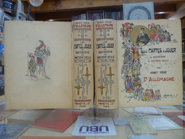
684269Librairie Hachette & Cie Paris 1906 2 volumes grands et forts in-4 ( 325 X 265 mm ) de XVI-504 et 640 pages, cartonnage éditeur illustré en couleurs, tête dorée. 3200 reproductions de cartes dont 956 en couleurs, 12 planches hors-texte coloriées à l'aquarelle, 25 phototypies, 116 enveloppes illustrées pour jeux de cartes & 340 vignettes & vues diverses. Edition originale et premier tirage. Minimes défauts aux mors et aux coiffes, ( comme toujours ), sinon très bel exemplaire, bien complet de ses serpentes, condition rare.
17088917London: John Nicholson 1708. Full Leather. Very Good binding. Octavo. xxxviii 2 412; 2 382 2 ads 32 index pp. maps. First edition. Contemporary paneled-calf boards with modern reback. Title page to Volume 1 and four of the eight maps are lacking but are supplied in tasteful facsimile. The maps in facsimile are the North America New England Virginia and Maryland and Carolina. Bindings are solid and presently nicely; contents are clean and bright; but for the maps and title page this is an exceptional set. <br /> <br /> Of this work William Reese writes: "This basic 18th-century reference work on British America . . . offers an excellent comprehensive survey of Great Britain's American colonies at the point when those on the mainland of North America had grown past their initial phase and were expanding rapidly in population and productivity. . . . This important contemporary work would probably have been the first point of reference for any Englishman at the time" Reese Struggle for North America 1. Usually attributed to Oldmixon who penned the dedication but occasionally gets attributed to Moll according to Sabin. A significant work by the British historian. Howes O-61 "aa"; European Americana 1708/95; ESTC T45485; Sabin 57156. John Nicholson unknown
16807Lyon 1757 in 12 (17,5x11) 1 volume reliure pleine basane fauve granitée de l'époque, dos lisse orné, pièce de titre de cuir vert, 163 pages [1]. Ex-libris gravé illustré de J.-B. Mercier (daté 1902). Bel exemplaire de ce très rare ouvrage
Colour printed map, ca. 810 x 608 mm. Scale: 1:1,000,000. Shows boundaries, highways and roads, railways, rivers and water features, and other details. Rare 4th GSGS edition of this map of Saudi Arabia, as part of the International Map of the World series, showing the western coastline as well as the cities Medina and Ha'il and the oasis of Al-Ula in the interior. - Stamp of ownership of Arizona State University, along with "withdrawn" and "superseded" stamps on top and next to it. - 56 mm piece of adhesive tape on top edge; pencil marks to lower right corner. OCLC 634944590. Cf. OCLC 35899626 (1962 ed.).
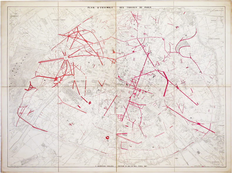
1867LBW-6483Paris, E. Andriveau-Goujon, 1867. En 8 sections montées sur toile et pliées, formant un plan de 0,99 x 1,30 m.
1750LBW-4142[circa 1750]. 304 x 458, monté sur papier fort.
1791LBW-6945Paris, M. de Belleyme, 1791-1800 [1802]. En 40 sections montées sur toile et pliées, formant une carte de 1,31 x 1,63 m ; onglet de vélin portant le titre manuscrit ; étiquette au dos de l'éditeur parisien Goujon ; sous étui de papier marbré vert avec titre à froid sur le premier plat.
LBW-8153Paris & Londres, Goupil & C.e & E. Gambart, 1er mai 1855. 390 x 970 mm.
1650LBW-5727[circa 1650]. 406 x 516 mm.
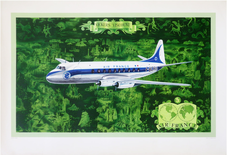
1953LBW-8611Paris, Perceval, 1953 Lithographie en couleurs de 597 x 957 mm.
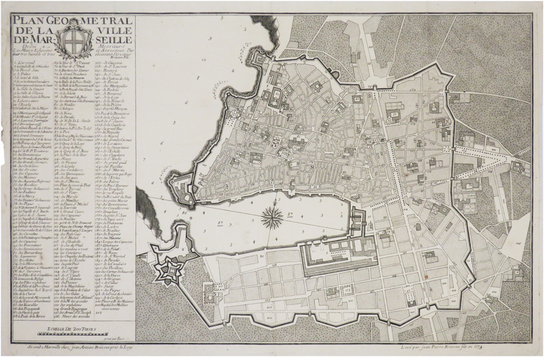
1773LBW-8847Marseille, Jean-Antoine Bresson, 1773. 352 x 554 mm.
1789LBW-7944[1789]. 530 x 882 mm.
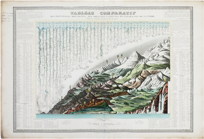
1828LBW-7709Paris, Bulla & Fontana, et chez Piquet, [1828]. 525 x 746 mm.
Nel cartiglio in basso a sinistra si legge: Il vero ordine et modo, tenuto dalle armate Cristiana et Turchesca, nella battaglia, che fu ali .7. Ottobrio .1571. il giorno di S.a Giustina, comincio lasalto a 4 hore et meza di giorno, et durò circa 4 hore; tra curzolari et cavo papa, loco poco discosto dal Golfo d[e] Lepa[n]to p[er] li havisi hauti dal Clar.mo Iustiniano venuto a Venetia, co[n] le nove de la vitoria, seguita in favor d[e] la Cristiana armata, con presa et rotta di galere 213, tra le quali erano 40 fano et 39 ne so[n] presi morti de nimici 40m in circa scihavi cristiani ricuperati, 18m in circa, turchi fatti schiavi 4m in circa. In basso, al centro della tavola, che è priva di orientazione, una bella vignetta allegorica mostra un drago con la mezzaluna sul capo - simbolo del nemico turco - assalito e sottomesso dal leone rampante di Venezia e dall’aquila asburgica. Opera molto rara, priva di indicazioni editoriali. Attribuita a Giovanni Francesco Camocio (cfr. Bifolco-Ronca, Cartografia e topografia italiana del XVI secolo, p. 1605). La presente tavola raffigura la Battaglia di Lepanto, la celebre battaglia navale del 1571 che si svolse di fronte a Lepanto, all’estremità occidentale del Golfo di Patrasso. Casus belli era stato l’attacco turco alla città di Famagosta, nel possedimento veneziano di Cipro, avvenuto l’anno precedente, il 22 agosto 1570. La vittoria cristiana contro le armate turche del 1571 ne fermò l’avanzata in Europa e verso Roma, segnando anche l’inizio della decadenza marittima ottomana. Vide coinvolte la flotta turca comandata da Mehmet Ali Pascià (un apostata di origini calabresi, convertitosi all’Islam) e quella della Lega Santa, creata il 20 maggio del 1571 da Papa Pio V: Stato Pontificio, Repubblica di Venezia, Repubblica di Genova, Ducato di Savoia, Granducato di Toscana, Ducato di Urbino, Ducato di Parma, Repubblica di Lucca, Ducato di Ferrara, Ducato di Mantova, Impero spagnolo (con il Regno di Napoli e di Sicilia) e Ordine di Malta, al comando del ventiseienne Don Giovanni d’Austria, figlio naturale di Carlo V e fratellastro del regnante Filippo II.La flotta cristiana era formata da circa 200 galere, di cui oltre la metà erano veneziane al comando del Capitano da Màr Sebastiano Venier, la flotta turca ne aveva circa 250. La prima linea della flotta cristiana era formata da galeazze mercantili veneziane (nell’incisione indicate come “galeaze” sul lato destro, sopra al cartiglio), trasformate per l’occasione, e in soli 100 giorni, in navi da guerra, impiegate per la prima volta proprio in questa battaglia, armate di cannoni non solo a prua, ma anche sui fianchi e a poppa, loro potenza di fuoco.La vittoria della flotta cristiana fu piuttosto rapida, anche perché i veneziani attaccarono e affondarono la galeotta del comandante in capo di tutta la potenza turca, Alì Pascià, uccidendolo. La flotta ottomana fu quasi completamente distrutta, con grandi perdite umane e un gran numero di prigionieri. Dieci giorni dopo, la galera di Onfré Zustinian, messaggero di Sebastiano Venier, entrava a Venezia trascinando nell’acqua le bandiere turche: la città sembrava impazzita dalla gioia. Lo stesso succederà poi in tutta Europa.Questo evento costituì un punto focale della storia europea sotto molteplici aspetti: politici, militari, religiosi e tecnologici. Solo poche battaglie sono state tanto celebrate e descritte come quella del 7 ottobre 1571, ed esercitò un poderoso effetto sui contemporanei, anche grazie al determinante contributo dato dagli artisti dell’epoca alla diffusione della sua rilevante e clamorosa importanza, in tempo quasi reale: fogli volanti nelle più diverse lingue diffusero in tutti i paesi d’Europa la notizia del grande avvenimento, sia con resoconti, sia con rappresentazioni di questa storica battaglia navale, ancor oggi considerata la più grande del Mediterraneo.Diverse sono le interpretazioni del soggetto che si ebbero a Venez... In the lower cartouche: Il vero ordine et modo, tenuto dalle armate Cristiana et Turchesca, nella battaglia, che fu ali .7. Ottobrio .1571. il giorno di S.a Giustina, comincio lasalto a 4 hore et meza di giorno, et durò circa 4 hore; tra curzolari et cavo papa, loco poco discosto dal Golfo d[e] Lepa[n]to p[er] li havisi hauti dal Clar.mo Iustiniano venuto a Venetia, co[n] le nove de la vitoria, seguita in favor d[e] la Cristiana armata, con presa et rotta di galere 213, tra le quali erano 40 fano et 39 ne so[n] presi morti de nimici 40m in circa scihavi cristiani ricuperati, 18m in circa, turchi fatti schiavi 4m in circa. At the bottom, in the center of the panel, a beautiful allegorical vignette shows a dragon with a crescent moon on his head - symbol of the Turkish enemy - attacked and subdued by the lion rampant of Venice and the Habsburg eagle. Very rare work, lacking editorial indications. Attributed to Giovanni Francesco Camocio (cfr. Bifolco-Ronca, Cartografia e topografia italiana del XVI secolo, p. 1605). The plate depicts the Battle of Lepanto, the naval engagement in the waters off southwestern Greece between the allied Christian forces of the Holy League and the Ottoman Turks during an Ottoman campaign to acquire the Venetian island of Cyprus, which took place on October 7, 1571.Early in 1570 the Ottoman sultan, Selim II, demanded that the Venetian hand over the island of Cyprus. When the Venetians refused to cede the island, invaded it in 1570.Pope Pius V persuaded Philip II of Spain to join with Venetians to defeat the Turkish attack on Cyprus. Genoa, Savoy, and the Knights of Saint John also agreed to send forces.The Holy League fleet consisted of 108 venetian galley, 81 Spanish galley, and 32 others provided by the pope and other allies. The Turkish fleet consisted of 270 galleys, which were faster and more maneuverable than the Christians'ship but were also smaller and less well protected. The Turkish commander was Uuuch Ali, a former Christian slave who had renounced his religion.The ability of the Christians to fire down onto the decks of the smaller Turkish ships placed the Turkish forces at a serious disadvantage. The two fleets made a magnificent sight as they closed. Each side hoped to overawe the other by its apperance and so gain a psychological advantage before the battle started. The galleys were richly decorated with gilded carvings and colorful banners, while the soldiers and naval officers wore striking uniforms and polished armor. After repulsing the first Turkish assault, the Christians gradually got the upper hand. When Müezzenzade Ali Pasha was shot and killed, Turkish resistance began to break. Seeing the collapse of the rest of theTurkish fleet, Uluch Ali broke off his fight against the Christian right flank and made good his escape with 47 galleys. The Turks lost over 200 ships, while 30.000 of their men was killed and 4000 taken prisoners. Christian losses included 12 galleys sunk, 7500 dead, and 8000 injured. In all, the battle had lasted just three hours.The victory against the Turkish army they stopped the advance in Europe, protecting Rome from invasion. The event at the time was really remarkable and sensational, even attracting the interest of many artists. There are different interpretations of the subject in Venice, due to all merchants, engravers and cartographers such as Nelli, Zenoi, Bertelli, Rota and Camocio same, which are known two more different depictions of the theme. Etching and engraving, impressed on contemporary paper and irregularly trimmed to the copperplate with partial loss of engraved portion; reconstructive restoration to lower margin, otherwise in good condition. Bibliografia Bifolco-Ronca, Cartografia e topografia italiana del XVI secolo, p. 1605, tav. 801; Gallo (1950): p. 99, n. 53; Zacharakis (2016): n. 813f.
Tre voll. I primi due sono stampati da Elzevirio nel 1668 (4 cc + 383 + 2 cc.; 2 cc. + 404 + 2 cc.; il terzo è stampato da Blaeu nell’83 (8 cc + 427). Piena pergamena, ottimi esemplari, raro e importante.
In -4° P. Pergamena, tre volumi rilegati assieme: B, (12) 191 (1 b.); 164 (appendix), 88 (epistola a Voetius, la numerazione riparte); 18 cc., 222, 3 cc. B. Nelle “Meditationes”, opera volta a stabilire cosa possa essere conosciuto con certezza, Cartesio adopera per la prima volta l’espressione “Cogito ergo sum”. L’“Appendix” si trova solitamente rilegata con le “Meditationes” ma ha un frontespizio e numerazione autonoma delle pp. così come autonoma è la numerazione della successiva Epistola al teologo olandese Voetius, suo avversario. Volume a sé (ma rilegato con questi) è i “Principia”, che fu peraltro stampato nell’anno successivo.
In -4° P. Pergamena, due volumi rilegati assieme: 8 cc + 248; 92 + 2 cc (Passiones)
1856LBW-6683Paris, Lemiere, [1856]. 445 x 568 mm.
1730PHO-2325Paris, Guérin, 1730-1731. 2 volumes in-4 (25,5 × 20 cm). XXVIII, 482 p., 29 ff. ; XIV, 506 p., 30 ff., reliures postérieures en demi-veau, pièces de titre et tomaison, coins et coupes légèrement frottés et émoussés, petits manques aux coiffes. Légèrement bruni, légères galeries de vers et traces d’humidité dans la marge intérieure au début du tome I ; les pages 17-20, 221/222, *19/*20 du tome I ainsi que les plans « Plan de la ville de San-Domingo » (tome I) et « Plan du Cap François » (tome II) sont déreliés ; petit déchirement restauré au pli de la garde de la « Carte de l’Isle de Saint-Domingue » (tome II). Ex-libris Jack Grout.
1870LBW-8919Lyon, Clappié et Fils, [circa 1870]. 517 x 667 mm.
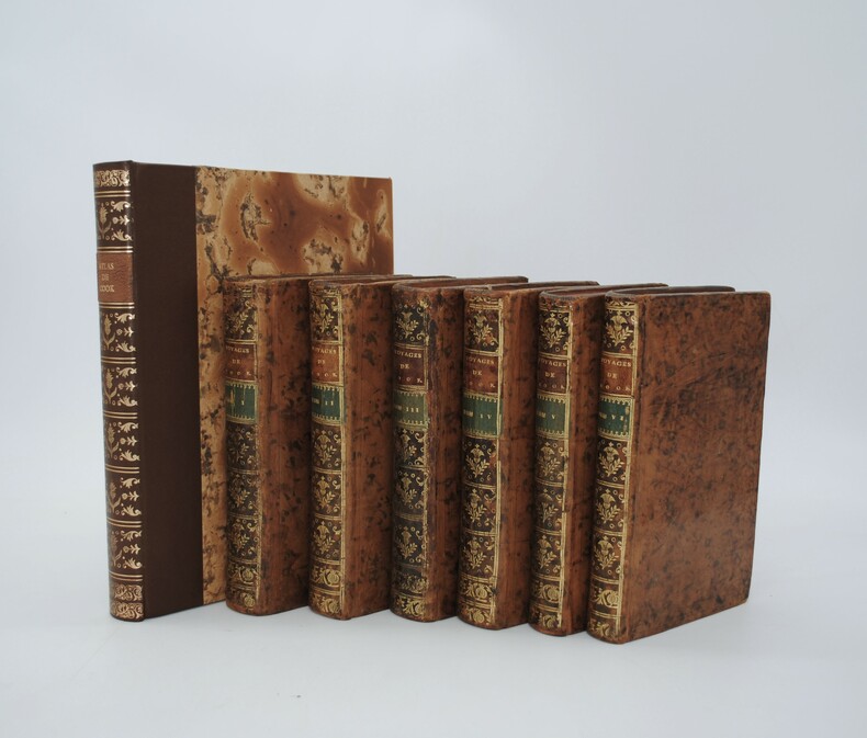
1778PHO-434Paris, Hôtel de Thou, 1778. 6 volumes in-8, veau marbré, dos lisse orné , pièce de titre et tomaison , tranches rouge (rel. de l'époque) avec son ATLAS (260x220mm) , relié demi cuir (reliure moderne) illustré de 65 planches H.T., nombreuses dépliantes,bords brunis , déchirure à une carte sans manque. Traduction française par Suard du récit du deuxième voyage de Cook (1772-1775), depuis l'Angleterre jusqu'aux îles de Pâques. Les Observations de Forster forment les deux derniers tomes. Ex libris C. Du Mesnil.
Rarissimo almanacco per l'anno bisestile del 1688 di Vincenzo Maria Coronelli. L'opera è dedicata all'Abate Rezzonico, il cui ritratto è in alto a sinistra. Membro di una nota famiglia comasca, eletto governatore dello Stato Pontificio, nel 1687 assunse anche il titolo di patrizio della Serenissima. Per ogni giorno dell'anno sono ricordati gli eventi più importanti legati alla storia della Republica di Venezia.Il calendario è circondato da una bella cornice ornamentale incisa, nel tipico stile del Coronelli, dove entro delle monete sono raffigurate le piante di 24 città della Grecia, sotto il controllo di Venezia.L'opera, una separata pubblicazione, si vendeva presso la bottega dell'editore Domenico Padoani, situata a Rialto.Coronelli aveva già realizzato un calendario simile nel 1666. L'opera è assai rara e ne abbiamo riscontrato un solo esemplare conservato alla Marciana di Venezia.Incisione in rame, in ottimo stato di conservazione. Extremely rare almanac for the year 1688 by Vincenzo Maria Coronelli. The work is dedicated to Abbot Rezzonico, whose portrait is in the upper left. Member of a famous family of Como, was elected governor of the Papal States, in 1687 he also assumed the title of patrician of Venice. This almanac, for each day of the year, remember the most important events related to the history of the Republic of Venice. The calendar is surrounded by a beautiful ornamental engraved frame, in the typical style of the Coronelli, where the coins are represented by plants of 24 cities of Greece, mostly in Morea, under the control of Venice. The work, a separate publication, was published by the workshop of Domenico Padoani, in Rialto. Coronelli had already made a similar work in 1666. The almanac is very rare and we have found only one example preserved in the Marciana of Venice. Copper engraving, in excellent condition.