11 983 résultats
(Antwerpen ca. 1580). 32 x 41 cm. Kobberstukket Danmarkskort i original håndkolorereing. Med Skåne, Halland og Blekinge samt den nordlige del af Tyskland.Foldningen fint forstærket på bagsiden med japanpapir.
A Paris, (but Amsterdam, Pierre Mortier), 1693. 58x88 cm. Kobberstukket søkort over Øresund med den Skånsk/Hallandske kystline og den Sjællandske fra Møn i syd til Hesselø i nord. I pragtfuld fuld håndkolorering. Øverst i midten er indsat Amager og Saltholm i større målestok. Kortet ""ligger ned"", er orienteret øst/vest. Med kompasrose og vindretninger angivet.
Weimar, Geographischen Institute, (1807-13). Folio-oblong. Loose sheets in a box. Containg 128 engraved maps, each measuring ca. 30 x 45 cm. Mostly clean and fine, but some with annotations, some with browning and some with traces of use.
Paris, Dépôt-Général de la Marine, 1852. Folio. (34,5 x 27 cm.). 2 uniform contemp. hcalf. Gilt spines with gilt lettering. Light wear to edges. Stamp on title-pages. Volume 1: Engraved title-page. (2) pp. and 24 engraved maps of islands of which 18 are double-page, numbered 1317-1340. - Volume II: Engraved title-page. 83 engraved maps, mostly double-page, numbered 1341-1423 and 1-83. Clean and fine.
196380578Wesleyan University Press. As New. 1963. Hardcover. FREE UPGRADE to Courier/Priority Shipping Upon Request - IN STOCK AND IMMEDIATELY AVAILABLE FOR SHIPMENT - AS NEW THE TEXT BLOCK IS PRISTINE CLEAN UNMARKED AND IN EXCELLENT CONDITION - - xiv 430 pp. 154 photos. bibliog. index 4to. -- with a bonus offer-- . Wesleyan University Press hardcover
196738237Maplewood NJ: Hammond Incorporated. As New. 1967. Hardcover. FREE UPGRADE to Courier/Priority Shipping Upon Request IN STOCK AND IMMEDIATELY AVAILABLE FOR SHIPMENT - TEXT PRISTINE Pages tight to spine -- with a bonus offer-- . Hammond Incorporated hardcover
2015114822Acanthus Press. New. 2015. Hardcover. 0926494910 . FREE UPGRADE to Courier/Priority Shipping Upon Request - IN STOCK AND IMMEDIATELY AVAILABLE FOR SHIPMENT - IN STOCK AND IMMEDIATELY AVAILABLE FOR SHIPMENT - Flawless copy brand new pristine never opened - -- with a bonus offer-- . Acanthus Press hardcover

9812Hachette Et Cie Editeur - Paris - 1906 - Edition Originale - Deux gros volumes épais- Complet - Volume 1 :504 pages, volume 2 :640 pages .Exceptionnel ouvrage contenant 3200 reproductions de cartes à jouer ,956 en couleurs,12 planches hors texte acquaréllées main ,25 phototypies,116 enveloppes de cartes à jouer ,340 vignettes et vues diverses, tables des matières complètes en fin de chaque volume - Serpentes protégeant bien les gravures - Volumes in folio non rogné demi veau rouge ,dos à nerfs ,couvertures conservées ,intérieur très frais,pas de rousseur .
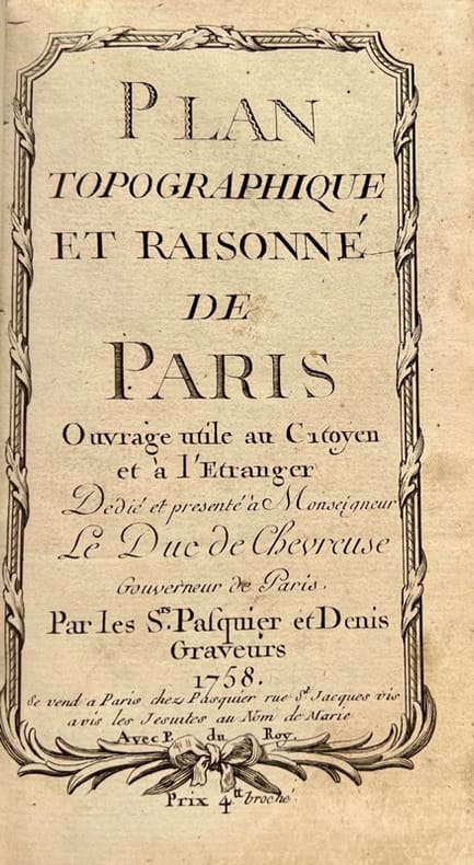
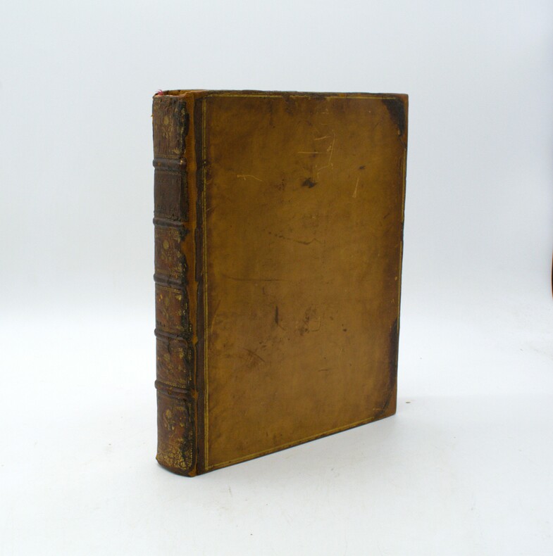
175842372Se vend à Paris, chez Pasquier et Denis, 1758. Petit in-8 de 3 ff.n.ch., 149 pp., 1 f.n.ch., veau lisse brun, dos orné, pièce de titre en maroquin rouge (reliure de l'époque).
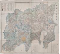
1418159850Shūseidō 衆星堂. Reprint. Tenpō 14 1843. Large folding handcoloured map of the thirteen provinces from which Mt. Fuji can be viewed. 159 x 178cm. Folds into paper covered card covers measuring 40 x 24cm. Title label upper cover. A little browning along folds occasional spotting and soiling. A little worming causing approximately 1cm of loss in places. Two chops in lower section. A very striking and attractive map. This very large handsome map is a detailed map of the thirteen provinces from which one can see Mt. Fuji. Provinces shown are the eight provinces of the Kantō region Sagami 相模 Musashi 武蔵 Kazusa 上総 Shimofusa 下総 Awa 安房 Kōzuke 上野 Shimotsuke 下野 and Hitachi 常陸 and five other provinces Izu 伊豆 Suruga 駿河 Tōtōmi 遠江 Kai 甲斐 and Shinano 信濃. The map offers a large amount of detailed information such as province and county borders rivers high ways post towns checkpoints villages and scenic spots. <br> <br>The cartographer Akiyama Einen or Nagatoshi 秋山永年 came from Edo and the editor Funakoshi Seizō 船越清蔵 studio name: Shugu 守愚 1805-62 a Confucian scholar from Nagato Province now the western half of present-day Yamaguchi Prefecture. A dedication by Funahashi Akira 舟橋徴 is dated 1843. . Shūseidō 衆星堂 unknown
Very Good Turkish Paperback. A manuscript notebook. Roy. 8vo. (23 x 16 cm). In Turkish (Modern). 145, [10] p., schemes. Toprak hukuku, 1942-1943. These extremely rare and unpublished manuscript notes on 'land law' or 'real property law', were taken by a student between the years of 1942-44 during Mardin's lessons in Istanbul University. Very legible script. Fine manuscript with extra papers inside. Mardin was a Turkish jurist, academician and politician. He was one of the ends of the Ottoman Empire and the firsts of Turkish Republic lawyers. He worked as a lecturer at Istanbul University during his whole life, where he graduated, and became a professor of the Civil Law. He ws born in Shkodra. Extremely rare.
1746LBW-7930Paris, chez l'auteur, 1746. En deux feuilles pouvant être jointes pour former une carte de 825 x 860 mm.
1735PHO-1902La Haye, Jean Neaulme, 1735. 2 Volumes en 1, grand in-4° (29x23 cm) relié plein veau époque, dos à nerfs avec pièce de titre, filets aux plats, tranches rouges, dos et coins restaurés, titre imprimé en rouge et noir. Imprimé et paginé sur 2 colonnes.
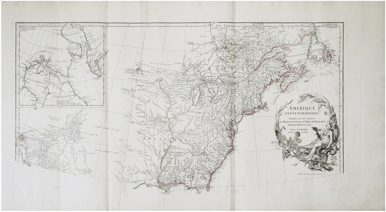
1785118031785 toilées, dans deux étuis en papier fort. Carte en 9 feuilles grand-aigle, 183 x 218 cms, 1 carte 64 x 73 cms et 1 petite 30 x 41, 1 carte de 42 x 43 cms. P. Dezauche, (ca. 1785),
1795PHO-1770Paris, Déterville, De l’Imprimerie de H. L. Perronneau, s.d. [1795] & Jansen et Compagnie, L’An IVe de la République, une et indivisible. Ensemble 2 ouvrages en 4 volumes in-4, reliure moderne jaune pour les 2 voyages et plein veau pour la carte, ex-libris en page de garde, quelques rousseurs.
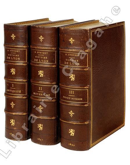
189519909Lyon, Bernoux et Cumin, 1895-1899 ; 3 tomes fort in 8, maroquin bordeaux, dos à nerfs décoré et doré du fer au lion debout, titre et tomaison dorés, encadrement d’un triple filet doré, double filet doré sur les coupes, large dentelle intérieure, tête dorée, non rogné (L. Guétant) ; 614; 668 ; 666 pp., 26 planches hors-texte, certaines sur page double, [2] pp. d’Index de ces planches ; XXIV pp. Liste des souscripteurs.
1679PHO-1772Paris, Dezallier, 1679, 2 volumes in-4 ,28ff.-686pp., 22ff-648pp , relié plein cuir époque, dos à nerfs orné avec pièce de titre et tomaison, tranches mouchetées rouge, réparations aux dos, pièces de titre et tomaison récentes au tome, illustré de 6 cartes dépliantes (7), ex-libris manuscrit en page de garde et au titre, traces de réparation aux cartes.
26975'Published by Survey Directorate G.H.Q. Paiforce 1944. All one page 20 x 33cms some stained but texts clear and complate. 1. Index map of Iraq and Iran for a 1:100000 scale survey series produced by the British military command PAIFORCE during World War II. All 20 x 32.5cm a couple sl. stained mainly good condition.1.Four Index maps of Iraq and Iran ¼ series I.D.R./X.D.R./G.S.G.S. 9002 3919 nos. 1-42.Index map of Iraq and Iran for a 1:100000 scale survey series produced by the British military command PAIFORCE during World War II. Index Map of 'Irq rn 1:100000 Series I.D.R. 9003'.3.Four Index Maps of places/areas of IRAN:a. Ahwaz 1:10000 series 1D MISC/563 to 573 stamped 11 June 1944b. Askaran and Sanandaj N.W. 1:25000 series …9005 stamped 25 June 1944c. Gach-I-Sar 1:50000 series stamped 11 June 1944d. Khurramshahr Abandan 1:12500 series4.Six Index Maps of places/areas of IRAQ all 1:25000 series ID 9005:a. Ba'qubab. Faidahc. Haffad. Hindiyae. Falluja f. MoselNo reference to other copies yet found. 'Published by Survey Directorate, G.H.Q. Paiforce [1944] unknown
177821875London, printed for J. Robson, 1778. In-4 de [2]; X; 584 pages, plein veau brun, dos lisseorné de filets dorés, pièce de titre en maroquin rouge, supra-libros armorié en queue, filet doré encadrant les plats.
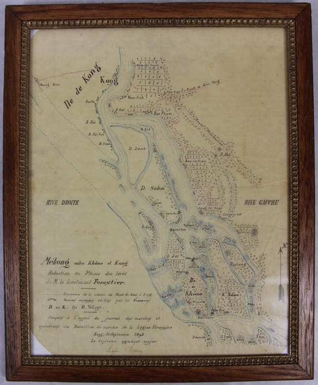
189331781Kong, 30 septembre 1893 Carte dessinée en couleurs 42,5 X 35 dans son cadre argenté. Bel état. Rare croquis exploratoire de ce secteur des Quatre mille îles du Mékong dont le franchissement nécessitera la construction d’une ligne de chemin de fer. L’officier reporte l’itinéraire de sa colonne de Hach-Ki-Koaï à Kong [Khong] et les anciens ouvrages édifiés par les Siamois.
1830LBW-7461[vers 1830]. En deux feuilles jointes de 52 x 118 cm.
1770LBW-7476[vers 1770]. 53 x 54,4 cm.
260 x 380 mm. Engraved map mounted on cloth. Matted. Early map of Russian Armenia, featuring the eight provinces annexed by Russia in 1828, with key in French and Russian. Following Qajar Iran's defeat in the Russo-Persian War (1826-28) and the 1828 Treaty of Turkmenchay, Eastern Armenia was, among other territories, ceded to Russia. It would remain part of the Russian Empire until its collapse in 1917. - Printed at the Mechitarists' press on the island of San Lazzaro, Venice, where the Armenian order had set up their colony in 1717. They began their editorial activities as early as the following year and set up a printing press, famed for its typographic capability in many languages and alphabets, in 1789. - Very rare; catalogues list a single specimen in the British Library. OCLC 556404373.
117927hachette 1875 - 1899 27 in-8 demi-chagrin Paris, Au siège social du Club Alpin Français, Librairie Hachette, 1875-1899, 27 volumes in-8 de 140x230 mm environ, environ 600 pages par volume, quelques gravures in-texte, nombreux hors-texte et planches dépliantes. Collationnés : quelques erreurs de placement des hors-textes mais il ne manque qu'une seule planche (Année 1874, manque une carte topographique du Mont Pelvoux), en revanche présence de figures, cartes et panoramas supplémentaires, non annoncés. Demi-chagrin aubergine, plats papier imitation chagrin assortis, dos à cinq nerfs portant titres et tomaisons dorées, gardes marbrées. Quelques marques sur le cuir, des frottements sur les dos et les plats, tranches piquées, un défaut d'impression p.68 de l'année 1899, un petit trou p.79 de la table, sinon intérieur propre, certains cahiers non coupés, bon état général, rare et bel ensemble. ATTENTION POUR EXPÉDITION : PLUS DE 35 kg.
Colour-printed map, ca. 750 x 610mm. Scale: 1:1,000,000. Rare 5th GSGS edition of this map of Qatar, Bahrain, and Ras Tanura in Saudi Arabia, as part of the International Map of the World series. Depicts Saudi Arabia from As Saffaniyah in the North over Hofuf, to Hidiba in the South. Shows boundaries, highways and roads, railways, airports, rivers and water features, and other details. - Two small brown spots to the image and a nick to the top edge, some creasing near margins. OCLC 34907145.