11 983 résultats
Carta tratta dalla "Geographia di Claudio Tolomeo", a cura del Ruscelli, pubblicata in Venezia in pù edizioni tra il 1561 ed il 1598. La carta è basata sulla "Geografia" di Giacomo Gastaldi, che probabilmente disegnò personalmente anche queste mappe, che vennero incise dai fratelli Sanuto. La peculiarità di queste mappe è che sono incise due per lastra e successivamente tagliate; questo il motivo per cui il segno del rame appare solo in tre lati della mappa. Il testo del Ruscelli e le sue carte sono considerate come il miglior atlante moderno fino alla prima versione del Thatrum di Ortelius, 1570. Solo la loro enorme diffusione ne impedisce una valutazione sostenuta nel mercato antiquario. L'opera infatti ebbe una prima stesura nel 1561, stampata da Vincenzo Valgrisi che ne curò anche la ristampa del 1562. Tre sono le edizioni firmate da Giordano Ziletti (due nel 1564 e una del 1574), mentre nel 1597 viene edita dai fratelli Calignani. Tutte queste edizioni contengono 64 tavole. Nel 1598 e 1599 vengono alla luce le due edizioni curate da Giuseppe Rosaccio e stampate dagli Eredi di Melchior Sessa. Queste ultime due edizioni comprendono 69 tavole; sono infatti aggiunte la carta del planisfero e dei continenti del Rosaccio.Buon esemplare. A nice example of Ruscelli's map of the world from his Geografia, the first double hemisphere world map to appear in an Atlas. One of two modern world maps in Ruscelli's Geografia, based upon Gastaldi's world map of 1548. The map is a copper plate engraving by Sanuto. The map is adapted from the oval projection used in Gastaldi's larger world map and is presented on Roger Bacon's circular projection, also used by Tramezzino's large world map of 1554. No southern continent is shown. The map clearly shows the broad mass of land joining Asia and America as Terra Incognita and the coastline as Littus Incongmitum. Map, taken from Ruscelli edition of Ptolemy's "Geographia", printed in Venice from 1561 to 1598. Ruscelli's Atlas is an expanded edition of Gastaldi's "Geografia" of 1548, which has been called the most comprehensive atlas produced between Martin Waldseemüller's Geographiae of 1513, and the Abraham Ortelius Theatrum of 1570. Ruscelli and Gastaldi's maps were beautifully engraved on copper, marking a turning point in the history of cartography. From that point forward, the majority of cartographic works used this medium. As it was a harder material than wood it gave the engraver the ability to render more detail. Gastaldi sought the most up-to-date geographical information available, making the modern maps in Ruscelli's Geographia among the best modern maps of the period. The maps are engraved by the Sanuto borthers.Only their enormous diffusion prevents a sustained evaluation in the antique market. The work in fact had a first issue in 1561, printed by Vincenzo Valgrisi who also edited the reprint of 1562. There are three editions signed by Giordano Ziletti (two in 1564 and one in 1574), while in 1597 it was edited by the Calignani brothers. All these editions contain 64 engraved maps. In 1598 and 1599 the two editions edited by Giuseppe Rosaccio and printed by the heirs of Melchior Sessa come to light. These last two editions include 69 plates; in fact the map of the planisphere and of the continents of Rosaccio are added.Small repairs at the white margins, otherwise very good. R. W. Shirley, "The Mapping of the world", 110
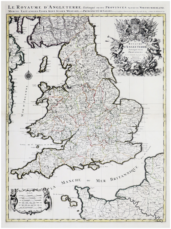
1693LBW-6390Paris, H. Jaillot, 1693. En deux feuilles jointes formant une carte de 785 x 584 mm.
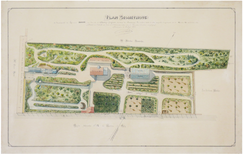
1875LBW-74291875. 45 x 70 cm ; monté sur carton fort.
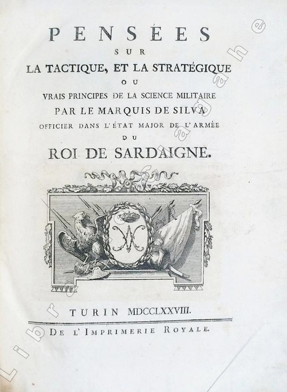
17786494Turin, Imprimerie Royale, 1778 ; in-4 ; demi-veau glacé havane, dos à faux-nerfs dorés et palettes décoratives, pièce de titre vert-pistache, tranches mouchetées de bleu (reliure de l'époque) ; (14), 359, (1 bl.) ; (4), 55, (1) pp. et 30 planches gravées dépliantes.SUIVI DE : "CONSIDERATIONS SUR LA GUERRE DE 1769 ENTRE LES RUSSES ET LES TURCS. Nouvelle édition corrigée et augmentée de plusieurs notes historiques."
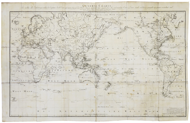
1785LBW-5889Berlin, Haude und Spener, 1785. 574 x 896 mm.
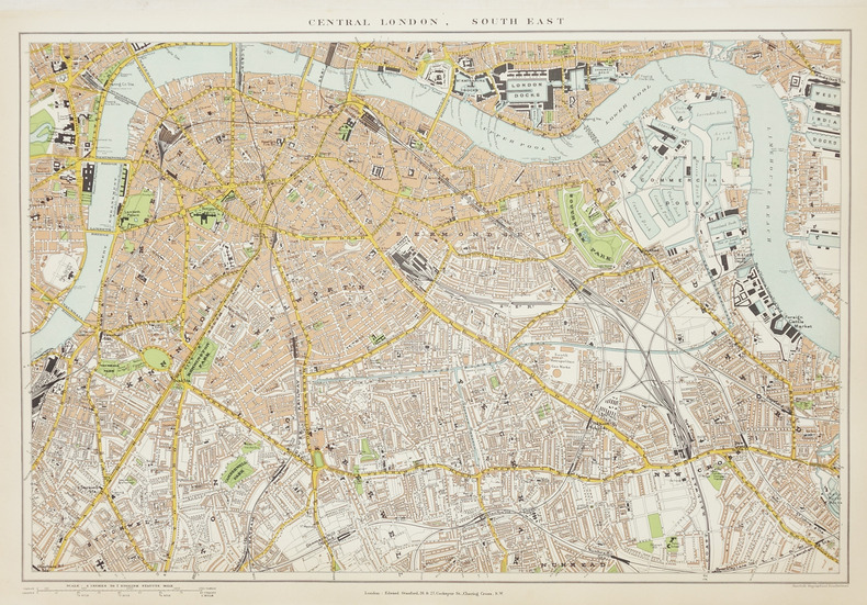
1896LBW-2866London, Edward Stanford, [1896]. En quatre feuilles séparées, chacune environ 350 x 505 mm.
2010030215Beijing 2010 National Library of China & Surveying and Mapping Press Hardcover 1st Edition
1737LBW-8977[Montpellier, Jean Martel, 1737]. 485 x 733 mm.
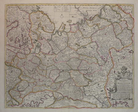
LBW04171London, Christopher Browne, [circa 1700]. 450 x 558 mm.
1882117250Paris Emile Lévy imprimeur, s.d. [1882] 1 vol. Broché Rare affiche annonçant la prépublication en feuilleton, entre décembre 1882 et mars 1883, du grand roman de Zola. "Cette affiche représente Denise Baudu, l'héroïne du Bonheur des dames, telle que Zola la décrit dans son roman : "Toutes [les vendeuses] avaient, entre deux boutonnières du corsage, comme piqué dans la poitrine un grand crayon qui se dressait, la pointe en l'air ; et l'on apercevait, sortant à demi d'une poche, la tache blanche du cahier de notes de débit". Cependant, les boucles d'oreille et la broche sont de trop car on peut lire au chapitre IX que "[Mouret] la regardait en souriant, dans sa robe de soie toute simple, sans un bijou". On peut expliquer cette inexactitude par le fait que le dessinateur ne disposait sans doute pas encore des derniers chapitres lorsqu'il composa cette affiche, Zola étant en retard sur son programme et le roman commençant à paraître sous forme de feuilleton avant d'être achevé." [Site pédagogique de la BnF]. Exemplaire entoilé, en parfaite condition.
1882117250Paris Emile Lévy imprimeur, s.d. [1882] 1 vol. Broché Rare affiche annonçant la prépublication en feuilleton, entre décembre 1882 et mars 1883, du grand roman de Zola. "Cette affiche représente Denise Baudu, l'héroïne du Bonheur des dames, telle que Zola la décrit dans son roman : "Toutes [les vendeuses] avaient, entre deux boutonnières du corsage, comme piqué dans la poitrine un grand crayon qui se dressait, la pointe en l'air ; et l'on apercevait, sortant à demi d'une poche, la tache blanche du cahier de notes de débit". Cependant, les boucles d'oreille et la broche sont de trop car on peut lire au chapitre IX que "[Mouret] la regardait en souriant, dans sa robe de soie toute simple, sans un bijou". On peut expliquer cette inexactitude par le fait que le dessinateur ne disposait sans doute pas encore des derniers chapitres lorsqu'il composa cette affiche, Zola étant en retard sur son programme et le roman commençant à paraître sous forme de feuilleton avant d'être achevé." [Site pédagogique de la BnF]. Exemplaire entoilé, en parfaite condition.
168942652London, William Berry, (1689). Ca 58x88 cm. Frame and under plexiglass. Large engraved map of Denmark in contemp.outline colouring. Perhaps the largest engraved map of Denmark from the 17th century.
159355185(Köln, 1593). Kobberstukket prospekt over Odense visende byen i fugleperspektiv. 32,5 x 47,5 cm. Prospektet er i fin stand og i samtidig håndkolorering og indrammet under glas i en smuk ældre guldramme (49 x 62 cm.).
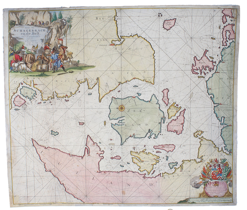
169647333(Amsterdam), 1696. 52x59,5 cm. Kobberstukket og håndkoloreret søkort visende Bælterne mellem Østjylland, Fyn, Sjælland, Lolland og Falster, Sydsverige, Rü Bornholm, Nordtyskland m.v. Med det danske rigsvåben i nederste højre hjørne" heri dedikation til Cornelis Tromp, den danske og hollandske flådes admiral. Den store kartouche i øverste venstre hjørne viser scener fra folkelivet og brydning af kalksten fra Møn eller Stevns. Fin reparation i højre margin.
178325418A Paris, chez le Sr Desnos, 1783. 46x64 cm. Engraved map of South America, contemporary handcoloured. The 2 large cartouches uncoloured. Right margin shaved, small tear showing into scale, of which a small part lost (1x1 cm.).
London, William Berry, (1689). Ca 58x88 cm. Frame and under plexiglass. Large engraved map of Denmark in contemp.outline colouring. Perhaps the largest engraved map of Denmark from the 17th century.
(Köln, 1593). Kobberstukket prospekt over Odense visende byen i fugleperspektiv. 32,5 x 47,5 cm. Prospektet er i fin stand og i samtidig håndkolorering og indrammet under glas i en smuk ældre guldramme (49 x 62 cm.).
(Amsterdam), 1696. 52x59,5 cm. Kobberstukket og håndkoloreret søkort visende Bælterne mellem Østjylland, Fyn, Sjælland, Lolland og Falster, Sydsverige, Rü Bornholm, Nordtyskland m.v. Med det danske rigsvåben i nederste højre hjørne " heri dedikation til Cornelis Tromp, den danske og hollandske flådes admiral. Den store kartouche i øverste venstre hjørne viser scener fra folkelivet og brydning af kalksten fra Møn eller Stevns. Fin reparation i højre margin.
A Paris, chez le Sr Desnos, 1783. 46x64 cm. Engraved map of South America, contemporary handcoloured. The 2 large cartouches uncoloured. Right margin shaved, small tear showing into scale, of which a small part lost (1x1 cm.).
186714955Paris et Genève, Victor Masson et filles, 1867. 3 volumes in-8 de XX-464 + [4]-437-[3] + [4]-587-[4]p. pour l'errata, demi-veau brun, dos à nerfs ornés de filets et fleurons dorés, coupes et coiffes inférieures frottées, quelques rousseurs. 1 volume in-folio pour l'atlas, relié en demi-vélin blanc à coins, pièces de titre rouge au premier plat.
17782141A Paris, Chez Panckoucke, 1778. 2 volumes in-8 de XX-540 + 526 pages, cartonnage rose à motifs, étiquette de titre noire. Mors fendus, dos et plats passés, coiffes manquantes, manques aux dos, plats tachés, coins frottés.
178519222Paris, Chez Onfroi, 1785, 1786. 3 volumes in-8 de X-395-[3]; [2]-310; [2]-310 pages. plein veau moucheté brun, dos à nerfs ornés de filets et fleurons dorés, pièces de titre et tomaison beige, tranches rouges.
1790CC136G.G.J. and J. Robinson in Pater-noster Row.: Charles Dilly in the Poultry 1790. Hardcover. Very Good. 101-928pp. Worn original full calf binding with the front board detached but present. LACKING THE REAR BOARD. Illustrated with a correct set of maps by Mr Kitchen. Double page folding maps three with colour BY A YOUNG HAND!. Unlisted chart of the world showing the latest Captain Cook's discoveries bound in at p867. finis. LACKING THE BACK BOARD But a complete text block and plates.215x130mm. 21 plates and the Sphere plate present. A couple of plates hand coloured in outline. An additional CHART OF THE WORLD bound in at the rear. Most maps map two or three creased. A NICE COLLECTION <br/> <br/> Charles Dilly in the Poultry hardcover
Lavierte Tuschzeichnung. Ca. 250 x 410 mm (Blattmaß). Blick nach Westen auf die Burg Greifenstein hoch über dem südlichen Donausteilufer auf ihrem Felsen im Wienerwald; rechts im Vordergrund im Wald lagernde Wanderer. Die wohl im 11. Jahrhundert errichtete Burg diente gemeinsam mit der gegenüberliegenden Burg Kreuzenstein der Überwachung des Donauknies bei der Wiener Pforte; Anfang des 19. Jahrhunderts wurden sie von Johann I. von Liechtenstein erworben und im Stil der Romantik renoviert. Im unteren Rand bezeichnet: "Vue du chateau de Greifenstein appartement au prince de Lichtenstein."
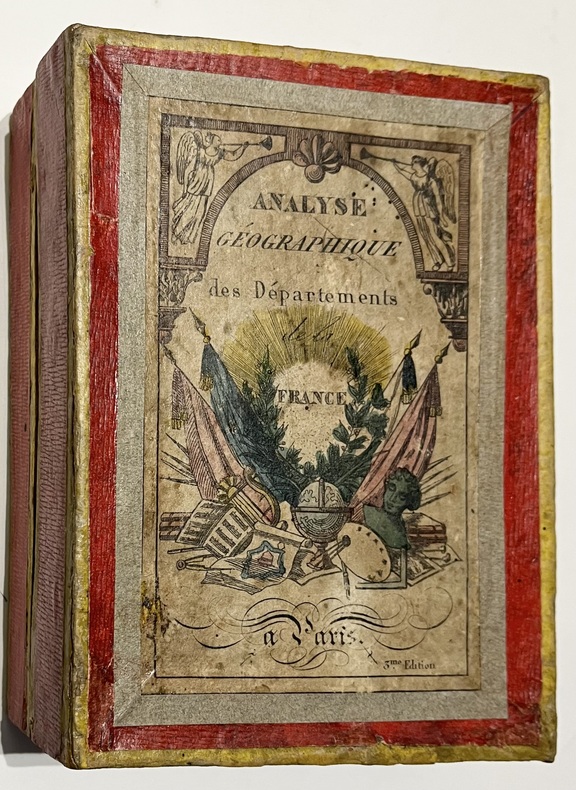
18365579Paris, Bourrut Lemerie, [circa 1836]. 1836 Jeu de 90 cartes (132 x 82 mm). (quelques rousseurs) 1 boite d'origine (160 x 120 mm) en carton recouverte de papier rouge, titre imprimé en couleur sur le couvercle. (défauts d'usage)