11 983 résultats
20120165162012 Davidsfonds Uitgeverij Hardcover
198688234(Hamburg, Vermessungsamt, 1986. Mehrfach gefalt., mehrfarbige Landkarte, Maßstab 1:20.000. Blattmaß 68,5 x 101 cm.
Format: 63 x 100 cm (Blattgröße: 75 x 104 cm). Mehrfach gefaltet. *Seltene großformatige Wandkarte des römischen Reiches, offenbar von 2 großen Steinplatten gedruckt. - Die Falze teils mit hinterlegten Einrissen. Insgesamt in guter Erhaltung mit Rand. Bücher de
195887000(Hamburg, Hamburger Sparkasse von 1827, 1958). 14 Bll. mit 12 doppelblattgr. Karten jeweils im Maßstab 1:50 000. Falzmaß 19 x 10 cm. .
194723719München 1947. Maßstab: 1:50.000. Mehrfarb. Karte. 62 x 89 cm. Gefaltet. Faltmaß 16 x 12 cm.
196088237Hamburg, Paul O. R. Grothe, [ca. 1960. Mehrfach gefalt. farbige Landkarte, Maßstab 1:50.000. Kartenmaß 50 x 73 cm, Blattmaß 52 x 75 cm. Deckelmaß 18 cm. In OKartumschlag geheftet.
1840848CG(um 1840). Kol. Aquatinta. Bildausschnitt: 7,2 x 11 cm. Rahmengrösse: 16 x 21 cm. + Wichtig: Für unsere Kunden in der EU erfolgt der Versand alle 14 Tage verzollt ab Deutschland / Postbank-Konto in Deutschland vorhanden +, Abb.
Book and jacket appear in as new unread condition. 246pp. A complete walk along the Border from Gretna to Lamberton, just north of Berwick on Tweed, filled with information on nature, literature, history and the people who lived there.
184463111London: J.&C. Walker 9 Castle Street Published by Longman & Co. ca. 1844. 16mo. 3.5 x 5 in. folding out to 13.25 x 16.5 in. dissected 15-panel hand-coloured steel-engraved map linen-backed w/ 3 leaf folding population and mileage distance chart from Dublin by County mounted on front pastedown. Dark gray-green publisher’s cloth portfolio pocket binding decorative borders in blind gilt lettering stamped on front cover a NF copy. First edition thus of this very scarce dissected pocket map of Ireland published against the backdrop of the full impact of the Great Potato Famine which from 1841-1851 resulted in the diaspora and death of nearly 30% of the Irish population and as reflected in the mileage table mounted with the map the population in 1845 had already dropped from 8.2 million in 1841 to 7.7 million by 1844 and it would plummet further to below 6.5 million by 1851. The bulk of these emigrated to the United States Canada and the United Kingdom resulting in the fact that Ireland’s current population still resides below the high of 1841 and nearly 38 million Irish-Americans claim descent from the successive waves of migration much of which channeled through New York’s Lower East Side and the Bowery in the 19th-Century. John Walker 1787-1873 was a British mapmaker engraver lithographer hydrographer draughtsman and publisher publishing nautical charts and geographical maps with his brothers Charles and Alexander in their firm J.&C. Walker located at 9 Castle Street Holborn from 1841-1847 and moving to 37 Castle St. in 1848 where they remained to 1875. Much of their work was published under the auspices of the Society for the Diffusion of Useful Knowledge or S.D.U.K. Worldcat locates 1 copy Yale. J.&C. Walker, 9 Castle Street, Published by Longman & Co., hardcover
1839782121839. Longman Rees and Co. 1839. Early Edition. Hardback. No DW. Brown textured cloth. 9cm x 12.5cm. Linen-backed fold-out map in colour 35cm x 42cm . Ownership signature to inside cover. A lovely copy. hardcover
FIRST EDITION, TWO VOLUMES BOUND TOGETHER. This is a detailed survey of the city of Jerusalem during the start of the British Mandate in Palestine. Includes a large number of drawings, photographs, schematics and fold-out maps of the city, accompanied by essays in English and French. Editor Charles Ashbee was an architect, and paid close attention to the many religious edifices in the city. 285x230mm, XV+87+XVI+109 pages (only text pages are numbered). Brown Quarter-leather hardcover with large black illustration on front board. [CONDITION:] Cover edges and corners worn. Cover boards slightly dirty. Previous owner's inscription in Hebrew (dated 1969) on front endpaper. Some pages slightly age-stained. [SUMMARY:] This tandem-bound copy of a fascinating collection of textual and visual information is overall in very good internal condition; good external condition.
0008328072.Gmap. Good. Access codes and supplements are not guaranteed with used items. May be an ex-library book. unknown
No marks or inscriptions. No creasing to covers or to spine. A very clean very tight copy with bright unmarked boards and no bumping to corners. 107pp. Very concise details of six-hundred and twenty-five walks in Wales, including grid references and OS map numbers.
1 folded map. Good. Scale 4 miles = 1 inch. (BP touring service). 14644. eng
No marks or inscriptions. A lovely clean very tight copy with bright unmarked boards and no bumping to corners. Dust jacket not price clipped or marked or torn or creased with slight indenting to front. 216pp. Superbly illustrated guide to and descriptions of the Lake District mountains from A Wainwright. Tucked in is a guide to a walk from Clapham - Gaping Gill & Ingleborough.
1760LBW-425Paris, Charpentier, [circa 1760]. 340 x 510 mm.
Bella e rara veduta panoramica di Roma presa dal monte Gianicolo.La litografia, come il disegno, è opera di C. Fichot. La veduta di Fichot compare nel Catalogue de fonds et d’assortiment dell'editore francese François Delarue, datato 1858 .Il nostro esemplare reca l'indirizzo dell'editore Lemercier.Litografia originale, finemente acquarellata, qualche piccolo strappo e qualche alone nei margini bianchi, senza interessare l'immagine, nel complesso in buono stato di conservazione. Nice large perspective view of Rome from Gianicolo, drawned and lithographed by C. Fichot.These Fichot litho is listed in the Catalogue de fonds et d’assortiment of the French editor François Delarue, dated 1858 .Our copy bears the Lemercier address.Orignal litho, finely hand-colored, some tears and soiling in the white margins, not affecting the image, otherwise in good condition.
1840781CGZürich, H. F. Leuthold, um 1840. Altkolorierte Aquatinta von Lukas Weber. Bildgrösse: 13 x 17,3 cm. Blattgrösse: 17,1 x 21,5 cm. + Wichtig: Für unsere Kunden in der EU erfolgt der Versand alle 14 Tage verzollt ab Deutschland / Postbank-Konto in Deutschland vorhanden +, Abb.
Kolorierte Umrissradierung. Unter Glas gerahmt. 630:840 mm. Prachtvolle Gesamtansicht der Stadt Wien, von der Westseite gezeichnet von Högl, gest. von Schwartz. - Ansprechendes, großformatiges Blatt im Originalkolorit der Zeit.
Acquaforte, 1646 circa, firmata in lastra in basso a sinistra. Bellissima prova, impressa su carta vergata coeva, con ampi margini, in perfetto stato di conservazione. Inusuale veduta panoramica della città, presa dal colle Vaticano. La Basilica, in primo piano, è disegnata con grande dettaglio, come pure il panorama della città, dove sono riconoscibili numerose opere architettoniche. “È insolita la scelta del punto di vista di questa veduta romano, presa dal colle Vaticano, dietro la Basilica di San Pietro. Anche in quest’opera, sempre molto particolareggiata secondo lo stile tipico dell’artista, è forte l’influsso delle incisioni di Callot, sia nel linguaggio che nella costruzione della veduta, come ci conferma la quinta in primo piano con le mura vaticane"(cfr. Barbara Jatta in "Roma Veduta" p. 168). Il Silvestre, incisore e disegnatore, nasce a Nancy nel 1621. Tra il 1638 e il 1641 viaggiò in Italia; si hanno notizie della sua presenza nella Penisola ancora nel 1643 e nel 1653. Il suo stile fu, all’inizio, piuttosto sciolto, ma dal 1643 in poi divenne più raffinato e delicato, acquisendo accuratezza e precisione senza essere asciutto, risultando a volte simile a quello di Jacques Callot o di Stefano della Bella, con i quali ebbe rapporti di amicizia. Accanto alle testimonianze per la Roma antica mostrò ben presto un grandissimo interesse per la città "moderna", divenendo uno dei precursori del vedutismo - non solo nel campo incisorio - anticipando artisti come Lievin Cruyl e Gaspar van Wittel. Bibliografia Le Blanc III, p. 508, 225; Roma Veduta, pp. 168-169, n. 27; L. E. Faucheux, Catalogue raisonné de toutes les estampes qui forment l'oeuvre d'Israel Silvestre: précédé d'une notice sur sa vie (1857), n. 29.1; F. Baré, Israël Silvestre et sa famille, suivi du catalogue de son oeuvre (1885), n. 766. Etching, circa 1646, signed in plate at lower left. Beautiful proof, printed on contemporary laid paper, with wide margins, in perfect condition. Unusual panoramic view of the city, taken from the Vatican Hill. The Basilica, in the foreground, is drawn with great detail, as well as the panorama of the city, where many architectural works are recognizable. The choice of the point of view of this Roman view, taken from the Vatican Hill, behind St. Peter's Basilica, is unusual. Also in this work, always very detailed according to the typical style of the artist, the influence of Callot's engravings is strong, both in the language and in the construction of the view, as confirmed by the foreground with the Vatican walls (see Barbara Jatta in "Roma Veduta" p. 168). Silvestre, engraver and draftsman, was born in Nancy in 1621. Between 1638 and 1641 he traveled in Italy; we have news of his presence in the Peninsula again in 1643 and 1653. His style was, at the beginning, rather loose, but from 1643 onwards became more refined and delicate, acquiring accuracy and precision without being dry, resulting sometimes similar to that of Jacques Callot or Stefano della Bella, with whom he had relationships of friendship. Alongside the evidence for ancient Rome soon showed a great interest in the city "modern", becoming one of the precursors of vedutismo - not only in the field of engraving - anticipating artists such as Lievin Cruyl and Gaspar van Wittel. Literature Le Blanc III, p. 508, 225; Roma Veduta, pp. 168-169, n. 27; L. E. Faucheux, Catalogue raisonné de toutes les estampes qui forment l'oeuvre d'Israel Silvestre: précédé d'une notice sur sa vie (1857), n. 29.1; F. Baré, Israël Silvestre et sa famille, suivi du catalogue de son oeuvre (1885), n. 766.
1811570BGLuzern, Xav. Meyer, 1811. Aquatinta von Franz Hegi nach Aug. Schmid. Bildgrösse: 45 x 58 cm. + Wichtig: Für unsere Kunden in der EU erfolgt der Versand alle 14 Tage verzollt ab Deutschland / Postbank-Konto in Deutschland vorhanden +, bild
1820778CGBâle, Berne et Genève, Publié par J. P. Lamy, um 1820. Altkolorierte Aquatinta. Bildgrösse: 11,8 x 16 cm. Blattgrösse: 19,8 x 27, 3 cm. + Wichtig: Für unsere Kunden in der EU erfolgt der Versand alle 14 Tage verzollt ab Deutschland / Postbank-Konto in Deutschland vorhanden +, Abb.
Acquaforte e bulino, firmata in lastra in basso a destra. Da un disegno del Canaletto, oggi conservato al British Museum [1858,0626.221].Magnifica prova, impressa su carta vergata coeva, con ampli margini, in perfetto stato di conservazione. Il Museo Correr possiede una raccolta di quindici fogli raffiguranti vedute di Roma incise da Brustolon su disegno del Canaletto; il frontespizio, manoscritto, reca l’iscrizione Vari Prospetti di Roma Antica e Moderna. Il catalogo della tipografia Remondini del 1817 elenca sempre 15 soggetti “romani”. Tuttavia secondo il Moschini le vedute di Roma del Brustolon sarebbero addirittura venticinque. Il nostro esemplare differisce nel titolo - in francese - rispetto a quello pubblicato nel catalogo della mostra "Roma Veduta" (Roma, 2000).Rarissima. View of the Tiber and Rome from the Basilica of St Valentino on the Via FlaminiaEtching and engraving, signed on lower right plate. After a drawing of Canaletto, today at the British Museum [1858,0626.221].Magnificent work, printed on contemporary laid paper with wide margins, in perfect condition. The Correr Museum owns a collection of fifteen sheets depicting views of Rome engraved by Brustolon after drawings of Canaletto; the front page, handwritten, bears the inscription Vari Prospetti di Roma Antica e Moderna. The 1817 catalogue of the typography of Remondini lists 15 “Roman” subjects; nonetheless, according to Meschini, Brustolon’s views of Rome are not less than twenty five. Very rare. Succi, Da Carlevarijs ai Tiepolo, p. 82; Maria Catelli Isola, in "I ponti di Roma" (1975): p. 76, n. 120; Roma Veduta (2000): pp. 181-182, n. 37 (variante).
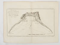
1774174257Paris.: Chez Saillant et Nyon rue Saint-Jean-de-Beauvais Chez Panckoucke Hotel de Thou rue des Poitevins. 1774. Engraved map on laid paper 18.5 x 31cm 25.6 x 34.4cm sheet size central fold slight marginal toning but a very good dark impression. Map of Bonthain Bay situated southeast of Macassar on the island of Celebes finely re-engraved for the French edition of Captain James Cook's First Voyage 1768-1771 "Relation des voyages.pour faire des decouvertes dans l'hemisphere meridional et successivement executes par le commodore Byron le capitaine Carteret le capitaine Wallis & le capitaine Cook.". . Chez Saillant et Nyon, rue Saint-Jean-de-Beauvais, [Chez] Panckoucke, Hotel de Thou, rue des Poitevins. unknown
0365890855.Gpaperback. Good. Access codes and supplements are not guaranteed with used items. May be an ex-library book. paperback