11 983 résultats
34,5 x 50 cm. (Blatt: 42 x 53 cm). *Sauber und sehr gut erhalten. Landkarten de
62 pages. Features: How to have your own gold rush; coins found at old railroad spur; selenite chrystals on the salt plains; the wonderful world of lost wax - making fine jewelry; Food bottles from the past; Good old Long Island; Looking for Arrowheads? Try Nevada; Better understanding why treasures were buried; Mid-America Treasure hunters; How deep do coins sink?; Treasure hunters turn to 'topo' maps; Searching out clues aids coin, relic hunting - how to be a 'Sherlock Holmes'. Average wear. Book
82 pages. Features: Recognizing meteorites as treasure; Heinz Kaiser lapidary; Gold panning ski country; Coinshooting - do the unusual; search military bases carefully - safety precautions to obsreve; Flavor of the orient - exotic finds are being made; Montserrat; Public awareness; Observations of a prospector's and treasure hunter's convention, 1980; Finding old sites - new ways to use maps; Hidden rocks, hidden riches - a logical place for gold along Florida's coast; Hints on beachcombing; The forgetton bedstead; Found - treasure cache under the floor. Average wear. Book
Folio in light blue cloth with gilt-stamped titles; xx, 170, 80 pages maps (chefly color) 30 cm In German. Maps beautifully printed in many colors. / Historical geography -- Maps. Historical geography. Atlas Weltgeschichte Maps. Maps. Cartes gÈographiques.Cartography / **A large book. Extra shipping charges may apply for international & expedited orders. Please inquire.**
1850KART0157Gotha, Justus Perthes (um 1850). Grenzkol. Kupferstichkarte, mit Längen- u. Breitegradangaben in Rahmenleiste, Bildausschnitt 24x18,5 cm, Blattgröße: 31,5x25 cm, im w. Rand schwach stockig, 2 minim. Randläs., eine Ecke mit Knitterspuren. (= Stieler's Schul-Atlas No. 30).
No marks or inscriptions. No creasing to covers, faint crease to spine. A very clean very tight copy with bright unmarked boards and no bumping to corners. Fold-out map intact and in good condition. 156pp. Local authority guide to the newly created county of West Yorkshire covering Leeds, Bradford, Huddersfield, Wakefield and Halifax as major towns/cities. Undated ca 1975. .
14" wide x 10.5" tall book in excellent condition.with very handsome blue spine and grey cloth covers with large gilt print. Binding is solid and square, covers have sharp corners, exterior shows no blemishes, text/interior is clean and free of marking of any kind with full page very detailed maps on heavy paper, text on opposite page. Dust jacket shows edge wear, small tears, price clipped. From flyleaf: "Utilizing a technique revolutionary in military writing, that of combined map and adjoining text, Col. Esposito and his staff present clearly and concisely, ., the events of the military campaigns and the factors that influenced the course of action and the outcome of the civil War. The battle maps do not merely portray static situations; they are dynamic, with many map sequences clearly showing the movements of the opposing forces from day to day, sometimes from hour to hour. Moreover, each map is accompanied by text on the opposite page; while the theme is developed in the map, this supplementary narrative explains and comments on the situation pictured. The nineteen major campaigns of the war are carefully detailed in this manner. Explanatory symbols in color make clear troop movements, time sequences, numerical strength of units, boundaries, fortifications, and all the other elements necessary for an understanding of the strategies and tactics involved in the campaigns and specific battles." Chronological chart, large bibliography, plus maps of the Colonial wars, Revolutionary War, 1812, Mexicqn war,
Format (Bildbereich): 17,5 x 23,5 cm. Leicht gebräunt, insgesamt gut erhalten. Landkarten de
8vo, 88 pages, illustrated with photographs. Ex public library copy. Tape marks to the endpapers. eng
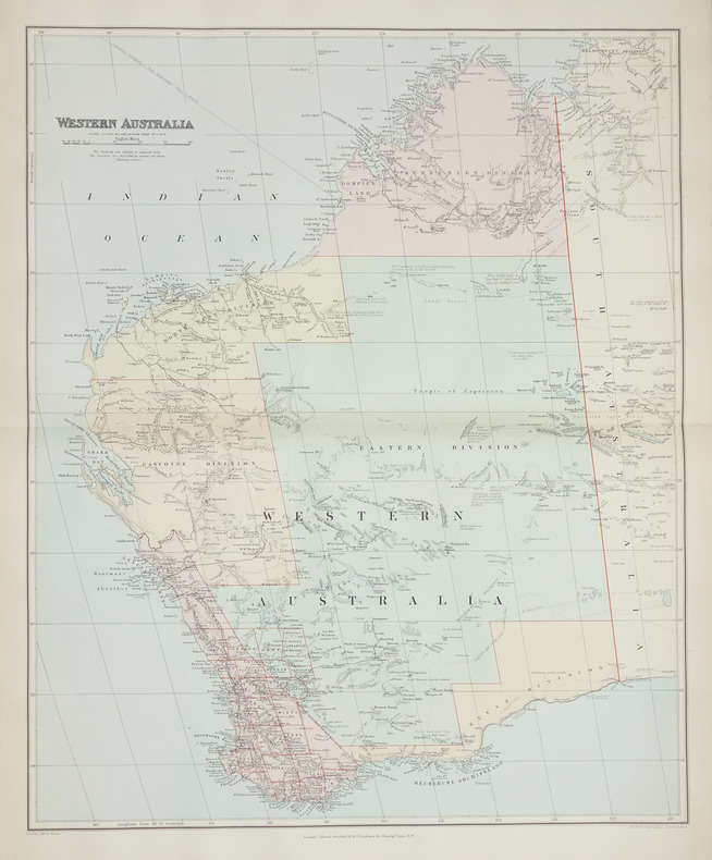
1896LBW-2708London, Edward Stanford, [1896]. 508 x 628 mm.
193491870[Darmstadt, [ 1934]. Farbig gedruckte Werbekarte, doppelseitig bedruckt (DRGM-Nr. 1289521). 15 x 11 cm.
no publication date (1970s), scale 1: 25000 eng
1822KART0032o. O. u. J. (um 1822). Kupferst., altkol., 26 x 36 cm. Kartenbild mit wenigen Braunfl., w. Rand etwas stärker braunfl., einige Gebrauchsspuren, Knickstelle an re. ob. Ecke. Planiglob der östlichen und westlichen Hemisphäre.
Bildformat: 22 x 42 cm. Blattgröße: 40 x 56 cm. Landkarten de
1981146393Brockhaus / Antiquarium Stuttgart 1981. 22 Textseiten und eine vielfach gefaltete, farbige Karte, gefalzt in 3 Teilen. (linker Teil, mittlerer Teil und rechter Teil) zusammen in Original-Leinwand-Einband mit farbig mont. Abbildung. (Geringe Gebrauchsspuren. Einband etwas randfleckig) 33x25,5 cm
198889895Kulmbach, Freunde der Plassenburg, 1988. 240 S. Mit 181 tls. farb. Abb und Karten. (= "Die Plassenburg" für Heimatforschung und Kulturpflege in Ostfranken, Bd. 47). 34 cm. OLn. m. SU.
20022083002116200896Industrial Maps Supervised by Hiroyasu Funakubo and others 2002. Soft Cover. Fine. The book is in fine condition. Industrial Maps Supervised by Hiroyasu Funakubo and others paperback
No marks or inscriptions. No creasing to covers. A very clean very tight boklet with bright unmarked boards, minor traces of storage and no bumping to corners. 20pp. Brochure for the town of Stockbridge in Massachusetts, North America with history, what to see and adverts. Scarce.
Expressive inscrption in Spanish to front end paper. No other marks or inscriptions. No creasing to covers or to spine. A very clean very tight copy with bright unmarked boards and no bumping to corners. 210pp. Lavish guide to Acapulco.
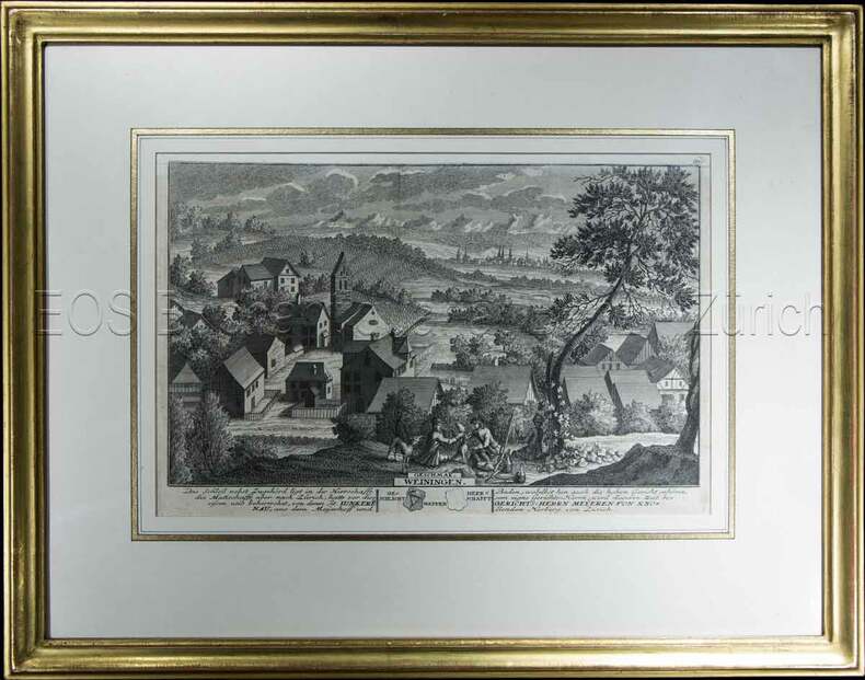
1743605BG1743. Kupferstich. Bildausschnitt: 20 x 28 cm. Rahmen: 33,5 x 42 cm. + Wichtig: Für unsere Kunden in der EU erfolgt der Versand alle 14 Tage verzollt ab Deutschland / Postbank-Konto in Deutschland vorhanden +, Abb.
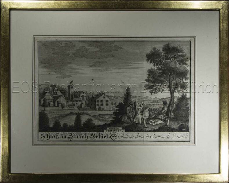
1741604BG1741. Kupferstich. Bildausschnitt: 119 x 28,5 cm. Rahmen: 34,5 x 44 cm. + Wichtig: Für unsere Kunden in der EU erfolgt der Versand alle 14 Tage verzollt ab Deutschland / Postbank-Konto in Deutschland vorhanden +, Abb.
696DGo.J. Kol. Lithographie von T. Rey. Bildausschnitt: 19 x 22 cm. Rahmen: 33,5 x 35 cm. + Wichtig: Für unsere Kunden in der EU erfolgt der Versand alle 14 Tage verzollt ab Deutschland / Postbank-Konto in Deutschland vorhanden +, Abb.
1850603BG(um 1850). Lithographie von R. Rey. Bildausschnitt: 16,3 x 21 cm. Rahmen: 31 x 35 cm. + Wichtig: Für unsere Kunden in der EU erfolgt der Versand alle 14 Tage verzollt ab Deutschland / Postbank-Konto in Deutschland vorhanden +, Abb.
1741604BG1741. Kupferstich. Bildausschnitt: 119 x 28,5 cm. Rahmen: 34,5 x 44 cm.
1743605BG1743. Kupferstich. Bildausschnitt: 20 x 28 cm. Rahmen: 33,5 x 42 cm.