Staff of Heligan Gardens LtdMareMagnum

11 983 résultats
No marks or inscriptions. Small crease to upper corner of rear cover. A very clean very tight copy with bright unmarked boards and no bumping to corners. 73pp. The essential guide to the Gardens & wider estate near St Austell in Cornwall.
197256368Charles Scribners 1972-01-01. Hardcover. Like New. 7x5x1. Pristine Hardcover in Fine dust jacket. Clean tight and square. Appears to be unused. Prompt shipping from Colorado. Choose Expedited/Priority 2-6 days.~ "Buy with Confidence Satisfaction Guaranteed! Charles Scribners hardcover
58p. + Full page plates. Age stained. Small 4to. Original pictorial wraps, soiled. PA PAMPH 20_3 BX3
303p. + Plus frontis, maps and photographs. 8vo. Original full cloth binding, somewhat soiled. The story of various explorations and discoveries with chapters on: Lhasa; the gorges of the Brahmaputra; the North Pole; the Mountains of the Moon; the South Pole, Mt. McKinley; the Holy Cities of Islam; the Exploration of New Guinea; and Mount Everest. **PRICE JUST REDUCED! POLAR 2
No marks or inscriptions. A very clean very tight copy with bright unmarked boards, very minor traces of foxing to page edges and no bumping to corners. Dust jacket not price clipped or marked or creased with one cm enclosed tear to spine and rubbing to top of spine. 240pp. This book takes the reader through the geographical area of Thomas Hardy's novels region by region, pointing out the association of each place in its geographical order.
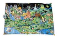
19589265Holland MI: Charles R. Sligh Co 1958. Third edition. Large color map 26x37" The image remains bright but there is moderate wrinkling throughout more severe at the edges. There are several tape repairs to the margins and corners and several other edge tears one extending about 2" into the image. A good copy that has seen much use. Will ship rolled as was found. <br /> <br /> This is an original 1958 printing of this iconic pictorial fantasy map from Czech-born Michigan landscape painter Jaro Hess 1889-1979. Hess painted and first published this in 1930 the map showing some 60 references to nursery rhymes fairy tales and children's stories and offering escapism during the Great Depression. The first edition of the map shows a figure "The Wandering Jew" which was later as here changed to "The Wanderer." This third edition was published by the furniture magnate Charles R. Sligh and printed by Dickinson Brothers a lithography firm in Grand Rapids Michigan. Hagstrom co. acquired the rights to the image about 1982 and issued reprints.<br /> <br /> A bright and as typical heavily worn example of this beautiful and whimsical map. Charles R. Sligh Co unknown
Name/date to front end paper. No other marks or inscriptions. A very clean very tight copy with bright unmarked boards and no bumping to corners. Dust jacket not price clipped or marked or torn with minor creasing to edges and a little indenting. 189pp. Circular walks to the 100 highest peaks in England's Lake District. Well illustrated.
No marks or inscriptions. A very clean very tight copy with bright unmarked boards and no bumping to corners. Dust jacket not price clipped with dusty rear, piece missing around spine foot and a few small tears. 124pp. A guide to England's Lake District. Undated ca 1958.
Previous owner's name to front end paper. No other marks or inscriptions. No creasing to covers or to spine. A very clean very tight copy with bright unmarked boards, no sunning to spine, extremely minor rubbing to spine ends and no bumping to corners. 316pp. Concise tour of the Lake District plus a 110 page gazetteer.
Inscription on ffep. No other marks. A lovely clean crisp very tight copy with bright boards and gilt lettering and with no bumping to corners. Dust jacket not price clipped or torn or creased. The delightful slip-case with gilt English and Arabic writing and design on a dark green vellum-type background is in excellent condition. 256pp.
168947354London, William Berry, (1689). 56x87 cm. Large engraved map of Denmark in original outline colouring. Perhaps the largest engraved map of Denmark from the 17th century.
London, William Berry, (1689). 56x87 cm. Large engraved map of Denmark in original outline colouring. Perhaps the largest engraved map of Denmark from the 17th century.
168942652London, William Berry, (1689). Ca 58x88 cm. Frame and under plexiglass. Large engraved map of Denmark in contemp.outline colouring. Perhaps the largest engraved map of Denmark from the 17th century.
London, William Berry, (1689). Ca 58x88 cm. Frame and under plexiglass. Large engraved map of Denmark in contemp.outline colouring. Perhaps the largest engraved map of Denmark from the 17th century.
1979Q-0827601166Jewish Publication Society of America 1979-01-01. Hardcover. New. In shrink wrap. Looks like an interesting title! Jewish Publication Society of America hardcover
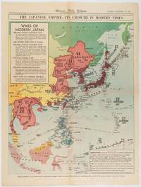
1619180755Chicago.: Chicago Daily Tribune. December 161941. Printed colour map on a single newspaper leaf 50 x 41.5 cm; 60 x 45 cm sheet two inset legends marginal browning and at the folds but remarkably bright in very good condition. Map of the Japanese Empire published in the Chicago Daily Tribune "The World's Greatest Newspaper" on December 16th 1941 9 days after the bombing of Pearl Harbour. The two legends list the "Wars of Modern Japan" from 1894 with territorial gains marked noting that "Each seizure of mainland areas has given Japan new field of raw materials." <br> <br>"… the historic Chicago Tribune was an innovator in color inks and printing but also a pioneer in bringing colorful art in the form of illustrations photographs cartoons and advertisements to the average person in an everyday medium." see The Janet A. Ginsburg Chicago Tribune Collection Michigan State University Libraries. . Chicago Daily Tribune. unknown
12mo [20.5 x 13 cm]; vi, 238, 4 [ads dated Feb 1853] pp, 4 folding colored maps complete. original blind-stamped cloth, gilt title lettering on spine and cover, spine faded but lettering clear, light stains on cover, some minor foxing on title and few other leaves, but very good overall. A picture of this book is available upon request by emai Welch 188. Sabin 27512. A narrative of the author's travels in northern Columbia, Panama, Darien, with observations of social customs, native life, the Panama railway, gold mines, climate, topography, Cartagena, forests, conditions, etc.
18952308London, Dulau & Co, 1895. In-8 de X-[4]-96 pages, pleine percaline rouge d'éditeur ornée à froid, dos lisse. Coins supérieur du second plat frotté.
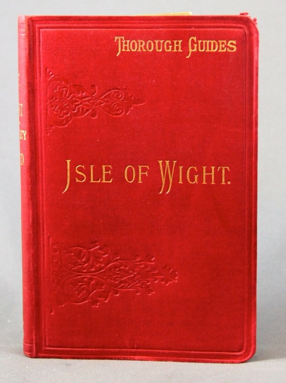
No marks or inscriptions. No creasing to covers or to spine. Very clean very tight pages with bright unmarked boards, a little foxing to page edges and end papers and no bumping to corners. Front map slighlty torn, others in excellent condition. 160pp. Red Guide to the Isle of Wight. We do not use stock photos, the picture displayed is of the actual book for sale. Every one of our books is in stock in the UK ready for immediate delivery.
No marks or inscriptions. No creasing to covers or to spine. A very clean very tight copy with bright unmarked boards and no bumping to corners. Dust jacket price clipped but not marked or torn or creased with slight rubbing to upper edge. Jacket now protected in fully-removable transparent sleeve. 78pp. First edition, first printing of the classic Shell Guide to the Isle of Wight.
No marks or inscriptions. Tiny crease to foot of spine. A very clean very tight copy with bright unmarked boards and no bumping to corners. 32pp. Guide to the Scottish Island.
No marks or inscriptions. No creasing to covers or to spine. A very clean very tight copy with bright unmarked boards, very slightly tanned pages, very minor bump to spine foot and no bumping to corners. Dust jacket clipped but not price clipped and not marked or torn with a little rubbing to upper edge. Fold-out map in excellent condition. 128pp. Red Guide to the Isle of Man. Twelfth edition.
1860WRCAM48522Antigua but actually Philadelphia: R.B. Eldridge & Co. 1860. Lithographic sheet map 20 1/2 x 26 1/2 inches. Backed with contemporary blue paper. Light foxing and toning. A few small tears in margins. Very good. An unusual lithographic edition of Norie's 1827 revision of this handsome chart lithographed by Wagner & McGuigan in Philadelphia. A statement in the cartouche reads: "Presented by R.B. Eldridge Antigua to Captain Andrew Tyler." The captain's name is accomplished in manuscript. R.B. Eldridge is not listed in Tooley's DICTIONARY OF MAPMAKERS and appears to be unrelated to publisher of charts George Eldridge. It seems most likely that he was rather an Antigua merchant who commissioned a reprint of the chart for complimentary distribution to sea captains. A handsome piece. R.B. Eldridge & Co. unknown books
128 pages including index. Black and white illustrations throughout. From signals intelligence and code-cracking breakthroughs to the daring exploits of agents in the field, this work vividly chronicles the covert activities that comprised the secret war of 1939 through 1945. Written by intelligence expert Donald P. Steury, illustrated with full-color maps and period photographs, and featuring an introduction by series editor and respected WWII historian Lt. Col. Roger Cirillo, United States Army, Retired, this evocative history provides an insightful account of the significance of intelligence during World War II. Clean, bright and unmarked. Very light wear. Excellent copy. Book
No marks or inscriptions and no creasing to covers. A very clean very tight copy with bright unmarked boards and no bumping to corners. 96pp. The first in a series of guides for outdoor enthusiasts and budget travellers.