5 782 résultats
64728Paris, Librairie Chapelot, 1922. 14 x 23, 148 pp., 118 figures, broché, bon état (papier légèrement jauni).
3628Paris, Roret, 1837. In-18° broché de 346 + 90 pages. 3 planches dépliantes en fin de volume. Le haut du dos est absent sinon trés bel état pour ces livres si fragiles.
Ingenaaid boek, 494 pp met illustraties, nieuw staat !!. ISBN 9789460581120. Simon Garfields belangstelling voor kaarten wordt gewekt wanneer hij als kind dagelijks de metrokaart in de Londense subway bestudeert. Zijn fascinatie is sindsdien alleen maar toegenomen. In Op de kaart onderzoekt hij hoe kaarten, vanaf de eerste schetsen van de oude Grieken tot aan Google Maps, onze geschiedenis hebben gemaakt en beinvloed. Garfield verhaalt over de onmogelijke opdracht om Afrika in kaart te brengen, over het maken van de perfecte globe, over Ptolemeus en Johannes Blaeu, over de ontdekkers van de Zuidpool en de Star Maps in Hollywood. En waarom heet Amerika eigenlijk niet Columbus? Op de kaart is een onweerstaanbare zoektocht, rijk geillustreerd en vol vermakelijke anekdotes, naar waar we waren, waar we zijn en waar we naartoe gaan. Een verrukkelijk boek over letterliefde, schreef De Morgen over het veelgeprezen Precies mijn type, waarin Simon Garfield de geschiedenis van de typografie belicht. Op dezelfde enthousiasmerende, onnavolgbare wijze schrijft hij in Op de kaart over landkaarten en atlassen. Simon Garfield (1960) is journalist en schrijft voor The Independent en The Observer. Hij heeft vele non-fictieboeken op zijn naam staan. Recent verscheen van hem het reeds herdrukte Precies mijn type, een boek over letters.
(Codice AV/6381) Edizione ciclostilata. Tre parti rilegate in un solo volume in 4° (33 cm) 141+52+11 pp. e 10 tavole fuori testo, 1 ripiegata. Grosso volume, legatura dell'epoca in tela muta. Lievi segni del tempo, minima rosicatura marginale alle ultime pagine, ma ottimo stato. Molto raro. ~~~ SPEDIZIONE IN ITALIA SEMPRE TRACCIATA
In-8 gr., brossura, pp. 131,(3), con carte e figure nel testo e 9 tavole in b.n. fuori testo. “Phéniciens et Grecs - Les Romains - Les Arabes - Théories, cartes du XIII au XV siècle”. Timbro di appartenenza al piatto anteriore, ma testo ben conservato.
91895Paris, ADAPT Editions, 1999. 16 x 24, 235 pp., quelques illustrations en N/B, broché, très bon état (cachet d'ex-propriétaire).
46500, Luster uitgeverij, 2014 Ingenaaid boek, 494 pp met illustraties, nieuw staat !!. ISBN 9789460581120.
Mm 170x240 Volume nella sua brossura originale, 144 pagine con numerose illustrazioni in nero e a colori nel testo e fuori testo, Copia in ottime condizioni. Spedizione in 24 ore dalla conferma dell'ordine.
In 4', br. ed. con sovrac., pp. nn., CXXX tavv. in n. molte ripiegate; opera pubblicata in occasione del XVI Congresso Nazionale dei Distretti Lions 108 Italia, copia fuori commercio numerata 401/2400, premessa di Giuseppe Pittorino, presentazione di Adriano Prandi.Segni d'uso e di sporco alla sovrac. e dorso brunito, cop. e interni in ottimo stato.
5 volumes Hardcover in-4° (22x28 cm), + de 2500 pages, BW & colour illustrations. Bibliography & indexes. Text in French. Très bel ensemble, état proche du NEUF ! DEDICACE des auteurs et collaborateurs. [P-48] Vol.I: Cartes de Belgique. Vol.II: Carte topographique de la Belgique au 1:20000. Vol. III: Villes et communes de Belgique (hors Bruxelles). Vol IV: Bruxelles. Vol. V: L'Atlas universel (1825-1827)
IN 8° CARRE' ( cm.22 X 24,5 ), pp.273, COPERTINA EDITORIALE PATINATA ILLUSTRATA A COLORI CON TITOLO. 95 ILLUSTRAZIONI DI PIANTE E PARTICOLARI DELLA' CITTA' DI PALMANOVA CON RELATIVE SCHEDE. SEGUE BIBLIOGRAFIA. IL VOLUME HA IL PREGIO DI RACCOGLIERE I CONTRIBUTI DI DUE SPECIALISTI, UNO IN CARTOGRAFIA URBANA E L'ALTRO IN ARCHITETTURA MILITARE VENEZIANA SULLA STORIA DELLA CITTA' - FORTEZZA DI PALMANOVA. PERFETTA CONSERVAZIONE. ID 5023
91651Bruxelles, Bibliothèque Royale Albert 1er, 1994-2000. 21 x 28, 4 volumes, xxviii-563 + 335 + xxx-466 + xxx-546 pages, très nombreux figures, plans et cartes en N/B et en couleurs, reliure d'édition pleine toile bleue, très bon état (1 cachet d'ex-propriétaire au bas de la page de garde dans chaque volume).
First Edition, 4to, 73 plates (some coloured), orig. cloth, d.w. Catalogue of the Society's manuscript portolan charts covering material from the fifteenth through the seventeenth century.
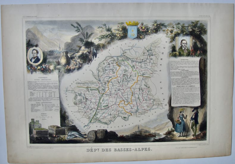
185011398Planche de l'Atlas National Illustré. Dressé par Levasseur. Pas de couverture Très bon Paris Pelissier Vers 1850 35 x 50 cm
1980017928London: Holland Press 1980. Brand New in perfect condition. NO rubbing. NO fading. Bright clean square and tight. Sharp corners. NO owner's name or bookplate. NO remainder mark. Fresh and crisp -- obviously never read. Revised Edition. 1980. 88 plates. In 1973 a preliminary version of this work appeared in 5 issues of the periodical MAP COLLECTORS' CIRCLE. For this 1980 revision an index has been added as well as 97 new or corrected entries. Described and commented on are over 700 maps of the period. A final chronological listing identifies the cartographer date of publication and gives an estimate of rarity for each map's principal edition or first state. Volume #5 in The Holland Press Cartographica series. Bound in the original gilt-stamped dark green boards. 7.5" wide by 10" tall. 1980 Revised Edition. Hardcover. New/No jacket. xxv 188pp. Great Packaging Fast Shipping. Holland Press Hardcover
1980018076London: Holland Press 1980. Near Fine condition. Bright clean square and tight. Sharp corners. NO owner's name or bookplate. NO remainder mark. Fresh and crisp -- probably never read. Revised Edition. 1980. 88 plates. In 1973 a preliminary version of this work appeared in 5 issues of the periodical MAP COLLECTORS' CIRCLE. For this 1980 revision an index has been added as well as 97 new or corrected entries. Described and commented on are over 700 maps of the period. A final chronological listing identifies the cartographer date of publication and gives an estimate of rarity for each map's principal edition or first state. Volume #5 in The Holland Press Cartographica series. Bound in the original gilt-stamped dark green boards. 7.5" wide by 10" tall. 1980 Revised Edition. Hardcover. Near Fine condition/No jacket. xxv 188pp. Great Packaging Fast Shipping. Holland Press Hardcover
England, Antique Atlas Publications, 1991, 4to (cm. 30,5 x 21,5) legatura tutta tela con titoli dorati al piatto anteriore e al dorso e sovraccopertina illustrata a colori, pp. XX-233 con 160 carte nel testo.
Ril. in tela con sovr.ill. a col., cm 34,5x24,5, pp 669, moltissime ill. a col. e b/n.. Come nuovo. - ISBN: o946323038
IN 4° gr.( cm.26 X 35 ), pp.669. LEGATURA EDITORIALE TELATA RIGIDA + SOVRACOPERTINA ILLUSTRATA A COLORI CON TITOLO. SGUARDIE FIGURATE. 440 ILLUSTRAZIONI in b/n/col. DI PLANISFERI DELLE VARIE EPOCHE. OPERA FONDAMENTALE PER LA CATALOGAZIONE DEI PLANISFERI E DEI LORO AUTORI, DAL 1472 AL 1700. NUOVA EDIZIONE AGGIORNATA.<BR>OTTIMA CONSERVAZIONE. RARO. ID, 6767
190570145- Carte 40 x 50 cm, pliée en 2.
190570139- Carte 40 x 50 cm, pliée en 2.
190570138- Carte 40 x 50 cm, pliée en 2.
190570137- Carte 40 x 50 cm, pliée en 2.
59009BBo.J. Matthäus Seutter (Matthias Seutter), geboren 1678 in Augsburg; gestorben 1757 ebenda. [3 Warenabbildungen]
59008BBo.J. Matthäus Seutter (Matthias Seutter), geboren 1678 in Augsburg; gestorben 1757 ebenda. [3 Warenabbildungen]