333 résultats
1758W204Dublin: John Exshaw Dame Street 1758. 1st Edition . No Binding. Fine. 8vo. 131-192pp. A disbound copy of the Dublin version of the Gentleman's Magazine for the month of April 1758. Fine fresh paper with no foxing wear or marks. The title-page lists 24 articles on the title-page. Articles include History of the last campaign in North America 214-221; The Idler A New Paper; Account of the pilgrimages to Mecca; Temoray foot bridge over the Thames is consumed by fire; etc Please email for photos. <br/> <br/> John Exshaw, Dame Street unknown
1627Map218London: George Humble 1627. 1st Edition . No Binding. Fine. An original uncoloured issue of Van Der Keere's map of Glamorganshire. Lovely dark impression of this 'miniature Speede map'. 5 x 3.5 inches Nice wide margins <br/> <br/> George Humble unknown
1627Map331London: George Humble 1627. 1st Edition . No Binding. Fine. An original uncoloured issue of Van Der Keere's map of Linster. Lovely dark impression of this 'miniature Speede map'. 5 x 3.5 inches. Nice wide margins <br/> <br/> George Humble unknown
1627Map861London: George Humble 1627. 1st Edition . No Binding. Fine. An original uncoloured issue of Van Der Keere's map of Huntingtonshire. Lovely dark impression of this 'miniature Speede map'. 5 x 3.5 inches. Nice wide margins <br/> <br/> George Humble unknown
1627Map419London: George Humble 1627. 1st Edition . No Binding. Fine. An original uncoloured issue of Van Der Keere's map of Northamptonshire. Lovely dark impression of this 'miniature Speede map'. 5 x 3.5 inches <br/> <br/> George Humble unknown
1627Map635London: George Humble 1627. 1st Edition . No Binding. Fine. An original uncoloured issue of Van Der Keere's map of Westmoreland and Cumberland Lovely dark impression of this 'miniature Speede map'. 5 x 3.5 inches. Nice wide margins <br/> <br/> George Humble unknown
1961020975New York: The Bibliographical Society of America 1961. Fine condition. The spine is square and flat with NO creases. NO owner's name or bookplate. NOT a library discard. Pages are clean and unmarked. NO foxing. THE PAPERS OF THE BIBLIOGRAPHICAL SOCIETY OF AMERICA Volume Fifty-Five Vol. 55 LV Fourth 4th Quarter 1961. 1300 copies printed. Contains: A STONE THROWN AT THE MAP MAKER by Kenneth Nebenzahl; plus contributions by G. Thomas Tanselle; George N. Belknap; etc. Includes the title-page laid-in and index bound-in for the whole of Volume 55. Composed and printed by the Anthoensen Press Portland Maine. Bound in the original wraps. 6.25" wide by 9.5" tall. First Edition. Softcover. Fine condition. xiv pp. 283-426. Great Packaging Fast Shipping. The Bibliographical Society of America Paperback
1962021562Iowa City: The Prairie Press 1962. A beautiful copy. Fine condition in a Fine dust jacket. The jacket is protected by a removable Brodart clear-plastic sleeve. NOT price clipped $4.00. NO rubbing. NO fading. NO chips. NO tears. NO creases. NO owner's name or bookplate. Sharp corners. First Edition Limited to 550 copies. Frontispiece features a hand-mounted genuine 3 cent stamp from 1955 showing a diagram of Fort Ticonderoga. Illustrated with numerous facsimiles of stamps showing maps or plans. Tells their stories. Printed by Carroll Coleman at The Prairie Press in Iowa City Iowa. Bound in the original blue patterned paper-covered boards with a black cloth spine and printed paper spine label. Complete with dust jacket. First Edition 1/550 copies. Hardcover. Fine condition/Fine dust jacket. 83pp. Great Packaging Fast Shipping. The Prairie Press Hardcover
2015054404El Dorado Hills CA: Savas Beatie. Fine in Near Fine dust jacket. 2015. 1st Edition; 1st Printing. Hardcover. 1611212006 . Hardcover with dustjacket first printing as stated on copyright page signed by both authors book has a mild lean to the spine the binding remains tight the contents are fine and there are no other remarkable flaws the jacket is in excellent condition with no remarkable flaws the original price is present and a professional removable mylar cover is included nice gift copy of this "first battlefield guide for this celebrated assault"; ; 310 pages; Signed by Author . Savas Beatie hardcover

1643Map275bLondon: Thomas Jenner 1643. Original Map . printed Map. Vg. An uncoloured original map of Dorsetshire with a distance grid showing the miles between the principal towns 125x130mm. A nice dark copy with a couple of worm holes <br/> <br/> Thomas Jenner unknown
Map4771695. No Binding. Very Good. HAND COLOURED 16.5 X 13.75 <br/> <br/> 1695. unknown
48555National Library of Australa. Canberra. 2014 Reprint. Large 4to 256pp. Printed card covers with flaps; excellent condition. Covers the journey of Australia's exploration with over 100 maps atlases globes and scientific instruments written to accompany an exhibition in 2013-2014. National Library of Australa. Canberra. 2014 (Reprint) unknown
1995018575Staten Island New York: Maurizio Martino Publisher 1995. Volumes 1-4. BRAND NEW HARDCOVERS. Three of the four volumes are STILL SEALED in the publisher's clear plastic SHRINKWRAP. Volume 1 has a small spot on its rear cover. Volume 2 has a mild bump at the head of its spine NO pages are affected. Bright clean square and tight. Sharp corners. NO owner's name or bookplate. NOT a remainder. Fresh and crisp -- obviously never read. The standard reference. No date but 1995 First Martino printing "strictly limited to 100". Reprint of the 1909-1920 Library of Congress originals. The four volumes are uniformly bound in the original gilt-stamped green cloth. Sheehy CL286: "An important catalog of an outstanding collection." Hodgkiss/Tatham KEYGUIDE 11: "The most comprehensive work on historical atlases." This heavy 4 volume set will require extra postage for Priority and International shipments. But for media mail you pay only our standard charge for 1 volume and we ship the other 3 volumes at no extra cost. First Martino printing. Hardcover. New/in publisher's shrinkwrap. Illus. by We ship all 4 volumes for cost of 1. 4 volumes. Great Packaging Fast Shipping. Maurizio Martino Publisher Hardcover
1842Map 806Edinburgh: A&C Black 1842. No Binding. Fine/uncoloured. World map with Australia at the middle 140 degrees. Beautiful steel engraving from Encyclopaedia Britanica Seventh edition dated 1842. Plate CCLXIII. Fine example with no wear. Australia is named 'Australia and New Holland'. 410x260mm. Relief is shown by hachures. Engraved by S. Hall Bury Strt. Bloomsbury. Published by A. & C. Black. Engd. by G. Aikman Edinr. <br/> <br/> A&C Black unknown
1818Map912London: Longman Hurst Rees Orme and Brown 1818. 1st Edition . No Binding. Fine. 4to. DOUBLE-PAGE FOLDING MAP engraved by Alexander Hindlay. Published as the Act directs May 1st 1818 by Longman Hurst Rees Orme and Brown. Clean folding plate with no toning to the fold 395x250mm. Cover the whole mainland of Britain with details of routes of rivers and canals. Bold margin border. PLEASE EMAIL FOR PHOTOS. Published in Abraham Ree's 'Cyclopedia or Universal Dictionary'. <br/> <br/> Longman, Hurst, Rees, Orme and Brown unknown
1912Map888London: G. W. Bacon 1912. 1st Edition . Hardback. Vg. Folding map. .Showing Railways Steamship Routes Ports Rivers Canals Main Roads & Rainfall.ND c1912. Very large folding map with two halves each folded into nine sections laid on linen. Burgany boards gilt mottled edges. Full colour printing with an un-usual binding arrangement in that the northern and southern plates unfold around the boards to make a very large single map 125 x 96 cms. Scale 1:950 000. With statistical tables and diagrams to the borders. Some foxing to the rear of the folds but a nice item. This chart was later published by Richardsons of Manchester.1916 <br/> <br/> G. W. Bacon hardcover
Map4351695. No Binding. Very Good. UNCOLOURED 16.5X14.25 <br/> <br/> 1695. unknown
Map6331695. No Binding. Very Good. UNCOLOURED V.G. 14.25 X16.75 <br/> <br/> 1695. unknown
1627Map864London: George Humble 1627. 1st Edition . No Binding. Fine. An original uncoloured issue of Van Der Keere's map of Anglesey and Carnarvon. Lovely dark impression of this 'miniature Speede map'. 5 x 3.5 inches <br/> <br/> George Humble unknown
1627Map082London: George Humble 1627. 1st Edition . No Binding. Fine/No Jacket. An original uncoloured issue of Van Der Keere's map of Cambridgeshire. Lovely dark impression of this 'miniature Speede map'. 5 x 3.5 inches <br/> <br/> George Humble unknown
1627Map863London: George Humble 1627. 1st Edition . No Binding. Fine. An original uncoloured issue of Van Der Keere's map of Somerset. Lovely dark impression of this 'miniature Speede map'. 5 x 3.5 inches <br/> <br/> George Humble unknown
Map617George Humble. 1st Edition . No Binding. Fine. An original uncoloured issue of Van Der Keere's map of Warwickshire. Lovely dark impression of this 'miniature Speede map'. 5 x 3.5 inches <br/> <br/> George Humble unknown
1880S218London: Hakluyt Society 1880. 1st Edition . No Binding. Vg. Folio. A single sheet folding map based on the map in Richard Hakluyt's ' Principall Navigations Voyages and Discoveries of the English Nation' associated with Edward Wright map-maker. The Wright Molyneux map. Called by Shakespeare in Twelth Night ' the new map with augmentation of the Indies'. To illustrate the Voyages of John Davies'. Map only lacks the 16pp booklet. 29 x 21 inches. One small repair. A trifle foxed. PLEASE EMAIL FOR PHOTO. Produced by THE TYPOGRAPHICAL PRINTING COMPANY. <br/> <br/> Hakluyt Society unknown
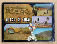
94117La Habana 1978. Quer-Gr8° 143 S. mehrfarbige Karten 3 Bl. 9 Bl. Indice OLwd. m. OU in Schuber Min. fleckig TADELL. Text: spanisch. 010 La Habana, 1978 unknown
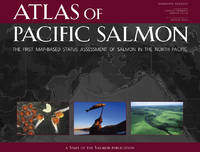
2005b1150<p>University of California Press 2005. XIV150 pages. New Hardcover. NearFine DJ. Oblong. 12.0"x9.25"x1.0". be6</p> University of California Press hardcover