333 résultats
1963016870Tegucigalpa Honduras: Secretaria de Economica y Hacienda Republica de Honduras 1963. Good 11"X 14" staple-bound paperback with yellowing to edges of wraps light soiling to wraps edgewear to wraps staple holes in front wrap traces of erased pencil in top corner of front wrap creased corners on wraps and soft creasing to corner tips of most pages in text block. Book has six-page introduction and 158 pages of maps. Trade Paperback. Good. 4to - over 9¾" - 12" tall. Secretaria de Economica y Hacienda, Republica de Honduras Paperback
1807Map949Paternoster Row London: Longman Hurst Rees & Orme 1807. 1st Edition 1st Printing. No Binding. Fine. Folio - over 12 - 15" tall. Original early 19th century uncoloured MAP OF THE SEVEN UNITED PROVINCES BY AARON ARROWSMITH. A FINE CLEAN AND DARK IMPRESSION. Original folding plate covering HOLLAND printed on heavy paper dated 1807. A scarce example and in fine un-coloured original condition. An occasional light foxing mark. 41x27cms. Double-page folding map. engraved by COOPER.A LOVELY COPY. paper watermark dated 1808 <br/> <br/> Longman, Hurst, Rees & Orme unknown
1903Map928London: John Bartholomew 1903. Original issue . No Binding. Fine. Large Folding Map. 21x16 inch folding Bartholomew colour printed map in 36 dissected sections laid on linen. Sheet Number 24 Oxford. A RARE example of a pre-WW1 foxing hunting map. The map has been over laid with hand-coloured boundary lines showing the areas at the turn of the century. The local fox hunts covered north of Oxford and south of Stratford Upon Avon and between Cheltenham in the west and Aylesbury in the east. Each pack hunting area shown with bright and bold water-coloured lines and their titles hand printed in black type. A large folding map cased within a pebble-grained red unmarked case. North Cotswold Cotswold V.W.H. South Oxfordshire Biscester Hey Throp Grafton and Warwickshire. Many of the samll village names under-lined in ink. <br/> <br/> John Bartholomew unknown
1695Map480Robert Morden 1695. No Binding. Very Good. HAND COLOURED V.G. 13.75 X 16.5 <br/> <br/> Robert Morden unknown
1848Map 822London: George Virtue 1848. re-issue . No Binding. Vg. 21 x 27 cms. Original un-coloured state first issue in 1832. Finely engraved views of Cambridge. A nice original dark impression steel engraving. Arms of the colleges and vignette of Trinity College <br/> <br/> George Virtue unknown
1848Map 819London: George Virtue 1848. re-issue . No Binding. Vg. 21 x 27 cms. Original un-coloured state with the later railway lines added since the first issue in 1832. Finely engraved views of Oxford and decorative cartouche. Small closed tear to upper left edge 2cms and a little edge soiled to reverse. A nice original dark impression steel engraving. Wide margins <br/> <br/> George Virtue unknown
1758T372Dublin: John Exshaw Dame Street 1758. 1st Edition . No Binding. Fine. 8vo. 313-368pp. A disbound copy of the Dublin version of the Gentleman's Magazine for the month of June 1758. Fine fresh paper with no foxing wear or marks. The title-page lists 24 articles on the title-page and includes a fine copy of the rare folding map 'A NEW MAP OF THE ENGLISH CHANNEL' engraved by Ridge 25 x 17 cms. Map engraved by Ridge. Title contents calls for a Sheet map of Germany and not the English Channel. Please email for photos. <br/> <br/> John Exshaw, Dame Street unknown
1758T373Dublin: John Exshaw Dame Street 1758. 1st Edition . No Binding. Fine. 8vo. 3-64pp. A disbound copy of the Dublin version of the Gentleman's Magazine for the month of January 1758. Fine fresh paper with no foxing wear or marks. The title-page lists 21 articles on the title-page and includes a fine copy of the rare folding map 'Island Rathlin showing the Ballycastle Colleries 21x18 cms. Also A PLAN OF THE CITY OF BRESLAU Capital of Silesia 18x12 CMS.Please email for photos. <br/> <br/> John Exshaw, Dame Street unknown
1758W196Dublin: John Exshaw Dame Street 1758. 1st Edition . Audio Book DVD. Fine. 8vo. 595-648pp. A disbound copy of the Dublin version of the Gentleman's Magazine for the month of November 1758. Fine fresh paper with no foxing wear or marks. The title-page lists 25 articles on the title-page and includes a fine copy of the rare map 'A Plan of Milford Haven' by Ridge; 19 x 12 cms. Articles include the capture of Fort Frontemac. Major Grant debacle at Fort Quesne. Please email for photos. <br/> <br/> John Exshaw, Dame Street unknown
1627Map054London: George Humble 1627. 1st Edition . No Binding. Fine. An original uncoloured issue of Van Der Keere's map of Berkshire. Lovely dark impression of this 'miniature Speede map'. 5 x 3.5 inches <br/> <br/> George Humble unknown
1627Map859London: George Humble 1627. 1st Edition . No Binding. Fine. An original uncoloured issue of Van Der Keere's map of Dorset. Lovely dark impression of this 'miniature Speede map'. 5 x 3.5 inches <br/> <br/> George Humble unknown
1627Map860London: George Humble 1627. 1st Edition . No Binding. Fine. An original uncoloured issue of Van Der Keere's map of Huntingtonshire. Lovely dark impression of this 'miniature Speede map'. 5 x 3.5 inches. Nice wide margins <br/> <br/> George Humble unknown
1973018834Ottawa: National Map Collection Public Archives of Canada 1973. Very Good condition. Covers lightly rubbed. NOT a library discard. NO owner's name or bookplate. Pages are clean and unmarked. NO underlining. NO highlighting. NO margin notes. A descriptive carto-bibliography with full collations contents notes lists of maps map measurements etc. Foreword by Theodore E. Layng Keeper of Maps in French and English. Subtitle: "No. 1 in a provisional series describing the atlases in the National Map Collection by country of origin." Bound in the original dark pink wraps stamped in white. 8.5" wide by 11" tall. . First Edition. Softcover. Very Good condition. xvii 132pp. Great Packaging Fast Shipping. National Map Collection, Public Archives of Canada Paperback
1997Q-0679777121Random House Reference 1997-01-28. Hardcover. New. In shrink wrap. Looks like an interesting title! Random House Reference hardcover

1995018565Staten Island New York: Maurizio Martino Publisher 1995. Volumes 1-4. BRAND NEW HARDCOVERS in perfect condition. STILL SEALED in the publisher's clear plastic SHRINKWRAP. NO rubbing. NO fading. Bright clean square and tight. Sharp corners. NO owner's name or bookplate. NOT a remainder. Fresh and crisp -- obviously never read. The standard reference. No date but 1995 First Martino printing "strictly limited to 100". Reprint of the 1909-1920 Library of Congress originals. The four volumes are uniformly bound in the original gilt-stamped green cloth. Sheehy CL286: "An important catalog of an outstanding collection." Hodgkiss/Tatham KEYGUIDE 11: "The most comprehensive work on historical atlases." This heavy 4 volume set will require extra postage for Priority and International shipments. But for media mail you pay only our standard charge for 1 volume and we ship the other 3 volumes at no extra cost. First Martino printing. Hardcover. New/in publisher's shrinkwrap. Illus. by We ship all 4 volumes for cost of 1. 4 volumes. Great Packaging Fast Shipping. Maurizio Martino Publisher Hardcover
Z1-W-029-02214Architectural Press. Used - Good. Ships from UK in 48 hours or less usually same day. Your purchase helps support Sri Lankan Children's Charity 'The Rainbow Centre'. Ex-library so some stamps and wear but in good overall condition. 100% money back guarantee. We are a world class secondhand bookstore based in Hertfordshire United Kingdom and specialize in high quality textbooks across an enormous variety of subjects. We aim to provide a vast range of textbooks rare and collectible books at a great price. Our donations to The Rainbow Centre have helped provide an education and a safe haven to hundreds of children who live in appalling conditions. We provide a 100% money back guarantee and are dedicated to providing our customers with the highest standards of service in the bookselling industry. Architectural Press unknown
1980018076London: Holland Press 1980. Near Fine condition. Bright clean square and tight. Sharp corners. NO owner's name or bookplate. NO remainder mark. Fresh and crisp -- probably never read. Revised Edition. 1980. 88 plates. In 1973 a preliminary version of this work appeared in 5 issues of the periodical MAP COLLECTORS' CIRCLE. For this 1980 revision an index has been added as well as 97 new or corrected entries. Described and commented on are over 700 maps of the period. A final chronological listing identifies the cartographer date of publication and gives an estimate of rarity for each map's principal edition or first state. Volume #5 in The Holland Press Cartographica series. Bound in the original gilt-stamped dark green boards. 7.5" wide by 10" tall. 1980 Revised Edition. Hardcover. Near Fine condition/No jacket. xxv 188pp. Great Packaging Fast Shipping. Holland Press Hardcover
1816Map694Edinburgh: John Thomson 1816. No Binding. Fine. Original hand-colour fine scarce unfolded copy 490 X 620 From John Thomsons New General Atlas 1817 beautifully hand-coloured on thick paper. <br/> <br/> John Thomson unknown
1817Map706Edin`: John Thomson 1817. 1st Edition . No Binding. Fine. Original hand-colour fine scarce unfolded copy one edge sl. Stain 410 x 520 From John Thomsons New General Atlas 1817 beautifully hand-coloured on thick paper <br/> <br/> John Thomson unknown
1980017928London: Holland Press 1980. Brand New in perfect condition. NO rubbing. NO fading. Bright clean square and tight. Sharp corners. NO owner's name or bookplate. NO remainder mark. Fresh and crisp -- obviously never read. Revised Edition. 1980. 88 plates. In 1973 a preliminary version of this work appeared in 5 issues of the periodical MAP COLLECTORS' CIRCLE. For this 1980 revision an index has been added as well as 97 new or corrected entries. Described and commented on are over 700 maps of the period. A final chronological listing identifies the cartographer date of publication and gives an estimate of rarity for each map's principal edition or first state. Volume #5 in The Holland Press Cartographica series. Bound in the original gilt-stamped dark green boards. 7.5" wide by 10" tall. 1980 Revised Edition. Hardcover. New/No jacket. xxv 188pp. Great Packaging Fast Shipping. Holland Press Hardcover
1995018317Storrs-Mansfield Connecticut: Maurizio Martino Publisher 1995. 1995 Enlarged edition. BRAND NEW in perfect condition. NO rubbing. NO fading. Bright clean square and tight. Sharp corners. NO owner's name or bookplate. NOT a remainder. Fresh and crisp -- obviously never read. No date but 1995 First Martino printing "strictly limited to 350". This 1995 edition has all the content of the 1942 original plus is updated and enlarged. There is a new introduction by Gary Kurutz that places Wheat's work in historical context and offers information on the book's production and initial reception. Also new are descriptions by Warren Heckrotte of 27 Gold Rush maps or variants that Wheat missed. Another plus is the frontispiece Map of the Southern Mines 1852 which did not appear in the 1942 trade edition but only in 22 deluxe presentation copies. Including the frontispiece there are a total of 27 full-page and double-page map facsimiles. This is an attractively produced book handsomely bound in the original tan cloth stamped in bright red and black over a cream color spine label. Oversize Hardcover. 9.25" wide by 12.25" tall. This large heavy book will require SUBSTANTIAL extra postage for international shipments but only the standard charge for priority or media mail. Updated and Expanded Edition. Oversize Hardcover. New/No jacket as issued. xlii 153pp. plates 262 total pages. Great Packaging Fast Shipping. Maurizio Martino Publisher Hardcover
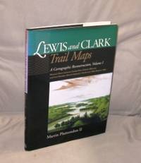
200027054<p>Pullman:: Washington State University Press 2000. First Printing of the First US Edition. A Fine tight copy in a Fine dust jacket. A Vancouver Washington cartographer based his unique maps on Clark's untapped survey notes excerpted on the maps. Taking into account nearly 200 years of changes to key geographic features of the 7000 miles that the Corps of Discovery covered Plamondon's 153 full-page maps precisely depicting the 1804-6 roundtrip permit comparison of the geography past and present from the Missouri River from Illinois to Fort Mandan in North Dakota. The book includes an introductory essay with notes on expedition mapping methods. Indexed by outbound and return camps dates locations and events and place names.</p> Washington State University Press, hardcover
1893013891Washington D. C.: Government Printing Office 1893. Very Fine condition. Beautiful full-color folding map of the United States that measures 30" wide by 19" tall when unfolded. Ideal for framing. This is the map only. It was removed from the rear pocket of FOURTEENTH ANNUAL REPORT OF THE U. S. GEOLOGICAL SURVEY 1892-1893 PART II by J. W. Powell. Note that the map shows the boundary lines in the United States as it was in the 1890s e.g. "Indian Territory" is shown where Oklahoma is today. First Edition. Softcover. Very Fine condition. 30" wide by 19" tall when unfolded. Government Printing Office Paperback
1929013898New York Chicago San Francisco: Rand McNally & Company 1929. 1929 edition No date on title page; 1929 on copyright page; no other printings listed. Very Good condition. 11.25" wide by 14.25" tall. Inner hinges are perfectly sound. Pages are clean and unmarked. Illustrated green endpapers feature scenes labeled Occident/Orient. First blank page has one vertical crease. Contains more than 125 pages of full-color maps. This 1929 edition is apparently quite scarce. Bound in the original dark green cloth lettered in gold on the front cover. Keywords: Atlases Map Reference Geography Maps. 1st ed No additional printings listed. Oversize Hardcover heavy. Very Good condition/No jacket probably as issued. 279pp. Rand McNally & Company Hardcover
19900101284Toronto: University of Toronto Press 1990. Hardcover. pp. 198; 184; 197. Large 4to. Uniformly bound in green/blue/black cloth with gilt lettering to front board and spine. All contain colour maps and diagrams. Light shelfwear and dust-soiling to extremities; else very good in very good dustjacket volume III showing crease to rear flap. University of Toronto Press hardcover