333 résultats
1868016331New York: F. W. Beers; A.D. Ellis; G.G. Soule 1868. Near Fine condition. NO chips. NO tears. A bright clean tight copy. The spine is square and flat with NO creases. NO owner's name or bookplate. Pages are bright white clean and crisp. This is an undated modern facsimile of the 1868 original. Oversize Softcover with black cloth spine. 10.75" wide by 14" tall. This atlas consists of a printed title-page; an outline map of Morris County; 31 single and double-page maps; a Table of Distances for Morris County; and 2 pages of lithographic views of 6 buildings George Washington's Headquarters in 1779/80; Boonton Academy; Schooley's Mountain Seminary; etc. Included are maps of: Washington; Chester; Mendham; Brookside; Stephensburg; Whippany; Morris; Morristown; Passaic; Green Village; New Vernon; Chatham; Madison; Troy; Hanover; Chatham Long Hill; Parsippany; Roxbury; Drakesville; Randolph; Dover; Oram; Jefferson; Flanders; Milton; German Valley; Schooley's Mountain; Rockaway; McCainsville; Succasunny; Hanover; Boonton; Montville; Boonton Borough; and Pequannock. Laid in is a facsimile of an old map of Morristown scale: 20 rods to the inch that unfolds to 22" wide by 25" tall. The map is keyed to the locations of Morristown businesses such as livery stables markets boot and shoe sellers manufactures physicians hotels editors merchants etc. This large book will require extra postage for Priority and International shipments but only the standard charge for media mail. Facsimile Edition. Oversize Softcover. Near Fine condition. Unpaged but 64 pages. F. W. Beers; A.D. Ellis; G.G. Soule Paperback
1781Map904London: W. Strachen and T. Cadell 1781. printed Map. Fine. 41.5 x 48.5 cms. Nice wide margins. Folding map uncoloured and printed on heavy paper. One small hole on a fold. PLEASE EMAIL FOR PHOTOS. <br/> <br/> W. Strachen and T. Cadell unknown
1823Map921London: C. Smith 1823. Corrected 3rd Edition . No Binding. Fine. Folding map. Original hand-coloured map dated 1823 58x50 cms. Double-page folding plate printed on fine paper and original hand-colour. With a numbered list of the Wapontakes including 8 examples found on this plate. A lovely example of the 3rd 1823 issue of the Jan 6th 1804 map by C. Smith of 172 The Strand London. Smith's County Altas being a complete set of County Maps divided into Hundreds. Wide margins no wear and very clean example with no marks or wear to the centre-fold. <br/> <br/> C. Smith unknown
1814Map710Edinburgh: John Thomson 1814. 1st Edition . No Binding. Fine. Original hand-colour fine scarce unfolded copy 510 x 610 From John Thomsons New General Atlas 1817 beautifully hand-coloured on thick paper <br/> <br/> John Thomson unknown
1817Map687Edinburgh: John Thomson 1817. 1st Edition . No Binding. Fine. Original hand-colour fine scarce unfolded copy 620 X 490 From John Thomsons New General Atlas 1817 beautifully hand-coloured on thick paper <br/> <br/> John Thomson unknown
1846008628Philadelphia: Lea and Blanchard 1846. PHOTOS UPON REQUEST. 3 volumes complete. Very Good condition. Bound in the publisher's brown cloth lettered in shiny gold on the spine. All gilt is as bright and shiny as new. A very nice set -- solid clean square and tight. Inner hinges are perfect. Corners are NOT bumped. Moderate rubbing/fraying to spine ends. Previous owner's name. A few small brown speckles foxing on the endpapers. Text pages are clean and crisp with little or no foxing. NO underlining. NO highlighting. NO margin notes. This 1846 edition is largely a reprint of the edition first published in 1837 which was copyright 1836. The only apparent change here is a 24-page addition to vol. 3 entitled: SUPPLEMENT TO THE ENCYCLOPAEDIA OF GEOGRAPHY CONTAINING STATISTICAL AND OTHER MATTER BRINGING DOWN THE WORK TO THE YEAR 1842." Among other things the supplement includes county-by-county population records from the 1840 census plus updated statistics on agriculture steam power imports/exports etc. Based on paginations found in Sabin this supplement was probably first published in 1843. The set is well-illustrated with 82 maps and about 1100 other engravings on wood. There are sections on astronomy by William Wallace botany by William Jackson Hooker geology by Robert Jameson and zoology by William Swainson. Volume III has a nice 2-page multi-color steel-engraved map of the U.S. It was drawn by J. Drayten after Tanner and features neatly hand-colored borders around each state and territory. Index Index to Supplement. Subtitle: "Comprising a Complete Description of the Earth Physical Statistical Civil and Political; Exhibiting Its Relation to the Heavenly Bodies Its Physical Structure The Natural History of Each Country and the Industry Commerce Political Institutions and Civil and Social State of All Nations." Oversize Hardcover. This heavy 3 volume set will require extra postage for Priority and International shipments. But for media mail you pay only our standard charge for 1 volume and we ship the other 2 volumes at no extra cost. Sabin 51499. New Edition with Supplement. Oversize Hardcover heavy. Very Good condition. Illus. by Drayten J hand-colored steel-engraved map of the U.S. 8vo. 597 592 648 pages. Great Packaging Fast Shipping. Lea and Blanchard Hardcover
1953003010New York: American Society of Civil Engineers 1953. Fine condition. Bright clean square and tight. Sharp corners. Gilt on cover is still bright and shiny. No owner's name or bookplate. Pages are fresh and crisp. No underlining. No highlighting. No margin notes. Illustrations throughout. Author Index. Subject Index. Includes: A HUNDRED YEARS OF AMERICAN CIVIL ENGINEERING 1852-1952 by J. K. Finch pp. 28-96; AN ENGINEERING CENTURY IN CALIFORNIA by Walter L. Huber pp. 97-111; SURVEYING AND MAPPING IN CANADA 1852-1952 by F. H. Peters pp. 857- 871; WATERWAY GROWTH IN THE UNITED STATES by William L. Hartley pp. 976-1041; HISTORY AND FUTURE OF FLOOD CONTROL by George R. Schneider pp. 1042- 1099; etc. There are also papers on Civil Engineering - History and Practice; Engineering Education; City Planning; Construction; Irrigation; Power Sanitary Engineering; Soil Mechanics; Structural; Surveying; Transportation; Waterways; Allied Interests Metals in the Economy; Synergism between Engineering and Petroleum; Iron and Steel Production 1851-1951. Bound in the original black cloth. . First Edition. Hardcover. Fine condition/No dust jacket. 8vo. xii 1330pp. American Society of Civil Engineers Hardcover
1760Map1001London: T. Bowen 1760. Original First Edition . No Binding. Fine. c1760 A fine example of Bowens map of Portugall. Title within an oval frame. An uncoloured example and printed of thick paper. 2 vertical folds to the page but nice clean margins and a dark impression. Some minor foxing reflecting its age but a nice example. 'Prepared for Barlow's General History of Europe'. Blank reverse. 33x34cms Barlows volume is often very damp stained and foxed. This map is however a fine example. Thomas Bowen 1714-1767 <br/> <br/> T. Bowen unknown
1847GT028London: Charles F. Cheffins 1847. fifth Edition . No Binding. Vg. FOLDING MAP c1847. Lithographic folding map mounted on linen with 20 dissected sections with an additional section for Cornwall attached at the lower left corner. An inset map at the top of Scottish lines.Outline blue colour to the coast-line and colouring to the railways in black and red with additional hand-coloured marks and amendments to the details by a previous owner please email for photos. Encased in simple green cloth card covers with a pasted title and an engraved inside cover. 71x57cms. A grubby map but scarce in all editions. <br/> <br/> Charles F. Cheffins unknown
1914GE130England: The Ordnance Survey 1914. 3rd Edition . No Binding. Vg. Folding Sheet. Sheet 100. 3rd edition temporary. Large folding Geological Map of the Sheffield area of Yorkshire. One inch to the mile. Laid on cloth with fine printed colouring. 65x50cms. with eight sections. An attractive and scarce map. <br/> <br/> The Ordnance Survey unknown
1900GT244Oxford: Chart Publishing Company 1900. Slip Case. Fine. Folding map. 2 Folding Charts and an index booklet encased in a blue slipcase. All contents fine Slipcase a trifle toned.Priced at 47/6. Two linen backed LARGE 18 section colour maps. 75x100 and 75x100cms PLEASE EMAIL FOR PHOTOGRAPHS <br/> <br/> Chart Publishing Company unknown
1851Map920London: The London Printing And Publishing Co Ltd 1851. Original printed issues 1st Editions . No Binding. Fine. quarto. An original map of BRITISH INDIA originally pub. by John Tallis in this issue by The London Printing Company. Original out-line hand colour showing the borders and boundaries and with fine vignette scenes of cities and an Indian Procession. Enclosed within a highly decorative border with nice wide margins. A fine copy printed on thick paper folded to the centre with no wear. PLEASE EMAIL FOR PHOTOS <br/> <br/> The London Printing And Publishing Co Ltd unknown
1814Map702Edinburgh: John Thomson 1814. 1st Edition . No Binding. Fine. Original hand-colour fine scarce unfolded copy some chipping to top edge 510 x 610 From John Thomsons New General Atlas 1817 beautifully hand-coloured on thick paper <br/> <br/> John Thomson unknown
1817Map684Edinburgh: John Thomson 1817. 1st Edition . No Binding. Fine. Original hand-colour fine scarce unfolded copy 530 x 670mm From John Thomson's New General Atlas 1817 beautifully hand-coloured on thick paper wide margins <br/> <br/> John Thomson unknown
1999018413Mansfield Centre Connecticut: Martino Publishing 1999. 2 volumes bound as 1 complete. BRAND NEW HARDCOVER in perfect condition. STILL SEALED in the publisher's clear plastic SHRINKWRAP. NO rubbing. NO fading. Bright clean square and tight. Sharp corners. NOT a library discard. NO owner's name or bookplate. NOT a remainder. Fresh and crisp -- obviously never read. No date but 1999 First Martino printing "Limited Edition Facsimile". Reprint of the 1937 two volume set. 2 vols. in 1: xii pp. 1-270; iv pp. 271-543 13 maps not included in the pagination. Well illustrated with 41 map reproductions including 13 that fold-out. Bound in the original pale yellow cloth stamped in bright gold over a handsome dark green spine panel. "Although emphasis is on the Northwest Coast of America this is a useful reference work for the student of the cartographic history of America. It contains an extensive index bibliography and list of place names as well as a list of maps. An exhaustive and scholarly publication which includes a note on practically every important map. 1507-1794." -- Ristow GUIDE TO THE HISTORY OF CARTOGRAPHY #377. Howes USIANA W7. Oversize Hardcover. 8.75" wide by 11" tall. This large heavy book will require extra postage for international shipments but only the standard charge for priority or media mail. First Martino printing. Oversize Hardcover. New/in publisher's shrinkwrap. 2 vols. in 1: xii pp. 1-270; iv pp. 271-543. Great Packaging Fast Shipping. Martino Publishing Hardcover

197240342Chicago: Rand McNally & Company 1972. Collection of 14 company Christmas cards one each for the years 1972 through 1985 plus year three undated. Near fine overall. Printed in modest quantities and intended for distribution only to top vendors suppliers and distributors this delightful collection ranges in size from narrow 4to to wide 8vo some bigger and some smaller. All are handsomely and colorfully printed on fine heavy stock. Most are at least three panels and many are more and all open up to reveal superb reproductions of famed antiquarian maps from around the world. Some open up to small poster size and two contain separate folded maps that open to full poster size. Several have been signed by various company executives. Most unusual and attractive -- a collection that would be near-impossible to duplicate. Rand McNally & Company unknown
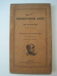
1861016428Bern Switzerland: Hans Körber Koerber Huber & Comp. 1861. Very Good condition. SEE PHOTOS. Karten etwas fleckig maps somewhat spotted. This is Blatt VIII Aarau - Luzern Zug - Zürich Zurich. The map is dated 1861 and has 21 sections. It is printed on paper then mounted on cloth i.e. backed with linen. When folded the map measures 19 cm tall x 11 cm wide. When unfolded 57 cm tall x 79 cm wide. SEE PHOTOS. Linen-backed steel-engraved folding map in 21 segments. Scale 1:100000. 1861 edition. Hardcover. Very Good somewhat spotted. Hans Körber [Koerber] (Huber & Comp.) Hardcover
1959031767New York: Frederick A. Praeger 1959. Two volumes complete with original slipcase published in 1959 at $47.50. Both volumes are first printings of the first edition with "First published. in 1959" so stated on the copyright pages and no indication of any other printings. Volume I: 1689-1900 Volume II: 1900-1953." Both books are in Fine condition and appear seldom if ever read. They are square and tight with sharp corners. NO owner's name or bookplate. NOT a library discard. NO dust jackets as issued. The original slipcase is in only Good condition entirely intact with minor soil and several edge cracks that have been securely and neatly glue reinforced. PHOTOS UPON REQUEST. With an introductory letter by Dwight D. Eisenhower. Pages are crisp clean and unmarked. There are approximately 600 total pages nearly half consisting of mostly full page maps printed in multiple colors. The maps cover the battles of American Colonial wars Revolutionary war War of 1812 Mexican war American civil war Spanish American war WW1 WW2 and Korean war. The two volumes are uniformly bound in the original gilt-stamped black cloth with oatmeal cloth spines with gilt-stamping over black spine panels. Oversize Oblong Hardcover. Altogether the measurements are 14.5" wide by 11" tall by 3" thick This large very heavy set will require SUBSTANTIAL extra postage for International shipments but only the standard one book charge for priority or media mail. We ship 2 volumes for cost of 1 via priority or media mail. First printings of the first edition. Oversize Hardcover. Fine condition/Good original slipcase. Illus. by NOT a library discard. 2 vols: irregular pagination but about 600 pages. Great Packaging Fast Shipping. Frederick A. Praeger Hardcover
1911Pa511London: George Philip & Son Ltd. The London Geographical Institute 1911. revised Issue . No Binding. Vg. Large folding map dissected into 30 sections and laid on linen. 10 inches to the statute mile. Reduced from the four mile map. A scarce folding Edwardian map with the sea coastline coloured in blue. A few red ink lines indicating the route of a journey. The map covers all of Endland Wales and the southern part of Scotland as far as Invernesshire. Finely printed. Enclosed in the original green cloth slip-case with a printed label rubbed. Marbled end-papers. <br/> <br/> George Philip & Son Ltd., The London Geographical Institute unknown
1832Pa402London: A. Arrowsmith and B. Fellowes 1832. 1st Edition . Hardback. Vg. 12mo. Engraved title engraved index and 19 engraved maps with outline colour lower half of Italy lacking. Double page and folding maps. Some edges of folds split. Original binding with detached front board. The ancient world by Arrowsmith 'Hydrographer to the King' William IV <br/> <br/> A. Arrowsmith and B. Fellowes hardcover
1808Map948Paternoster Row London: Longman Hurst Rees & Orme 1808. 1st Edition 1st Printing. No Binding. Fine. Folio - over 12 - 15" tall. Original early 19th century uncoloured MAP OF PERSIA BY AARON ARROWSMITH. A FINE CLEAN AND DARK IMPRESSION. Original folding plate covering PERSIA printed on heavy paper dated 1808. A scarce example and in fine un-coloured original condition. An occasional light foxing mark. 41x27cms. Double-page folding map. engraved by COOPERl.A LOVELY COPY. paper watermark dated 1806 <br/> <br/> Longman, Hurst, Rees & Orme unknown
1964P266Amsterdam: Meridian Publishing Company 1964. facimile reprint . Hardback. Fine/V G Chipped. small folio. 192pp including 19 double page maps in black and white and an introduction by R.A. Skelton. A facsimile edition of the first atlas entirely devoted separately to the Americas. Originally published in 1597. A series of atlases in Facsimile. First series volume V. Original d.j. now proected by a clear mylar wrapper <br/> <br/> Meridian Publishing Company hardcover
1830Map914London: Longman Rees Orme Brown and Green Paternoster Row 1830. 1st Edition . printed Map. Fine. Folio. ND c1850 Plate XXX double page folding original map with outline hand coloured boundaries and relief shown by hachures. Finely engraved decorative wide border and wide margins to three sides. Strengthened hinge to the rear centre fold. PLEASE EMAIL FOR PHOTOS 42x53 cms <br/> <br/> Longman, Rees, Orme, Brown and Green, Paternoster Row unknown
1814Map699Edinburgh: John Thomson 1814. 1st Edition . No Binding. Fine. Original hand-colour fine scarce unfolded copy 610 x 510 From John Thomsons New General Atlas 1817 beautifully hand-coloured on thick paper <br/> <br/> John Thomson unknown
1817Map693Edinburgh: John Thomson 1817. 1st Edition . No Binding. Fine. Original hand-colour fine scarce unfolded copy 510 X 620 From John Thomsons New General Atlas 1817 beautifully hand-coloured on thick paper <br/> <br/> John Thomson unknown