333 résultats
1839TH327London: Longman Orme Brown Green & Longmans 1839. a new Edition Considerably Improved . Hardback. Vg. 8vo. ND but preface dated Walworth 1839. xxiv 364pp 7 folding plates at the rear.12pp pub. cat. dated August 1841 London. Bound in the pub. green fine pebble gren cloth with gilt titles to the spine. Pasted -down end-papers list Longmans 'New School Books'/ Neat owners sig. dated 1842. Thomas Keith 1759-1824. The first edition was pub. in 1805 <br/> <br/> Longman, Orme, Brown, Green & Longmans hardcover
1814Map689Edinburgh: John Thomson 1814. No Binding. Fine. Original hand-colour fine scarce unfolded copy 520 X 650 From John Thomsons New General Atlas 1817 beautifully hand-coloured on thick paper <br/> <br/> John Thomson unknown
1806Map954Paternoster Row London: Longman Hurst Rees & Orme 1806. 1st Edition 1st Printing. No Binding. Fine. Original early 19th century map MAP OF ASIA BY AARON ARROWSMITH.A FINE CLEAN AND DARK IMPRESSION. Original folding plate printed on heavy paper A scarce example and in fine un-coloured original condition. An occasional light foxing mark. 41x27cms. Double-page folding map. Engraved by Edw. Jones.A LOVELY COPY. Imprint date May 6th 1806. <br/> <br/> Longman, Hurst, Rees & Orme unknown
1906Map 753Sampson Low Marston & Co. Ltd. 1906. 2nd Edition . No Binding. Fine. 67x106 cms. 42 x 26 inches. A large folding map laid on linen. The first issue of the map was 1902 and this is the second edition. The Franco-British Exhibition site is included on what became White City and covered 140 acres. The tube lines are updated and include approved and those under construction. A beautifully coloured map in green red and blue. The tube lines are inserted onto a geographical map. It covers a wide area of London and the Home Counties. Unfaded colour and in fine condition. Some folds a trifle split but not worn. The map folds to be enclosed in the original pictorial boardswhich is complete and sound but a trifle foxed and faded. PLEASE EMAIL FOR PHOTOS. <br/> <br/> Sampson Low, Marston & Co. Ltd. unknown
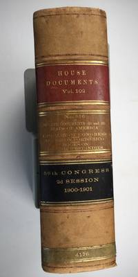
1901025183Washington: Government Printing Office 1901. SEE PHOTOS. A handsome example of the 1901 first edition in quite scarce original leather binding with 3 titles bound together as sometimes seen -- NOT print on demand edition or modern reprint. Very Good condition. NOT a library discard. NO owner's name or bookplate. Hinges are perfect. Minor offset as usual from the leather binding to edges of the endpapers. Front free endpaper has light soil and 4 small edge chips. Pages are otherwise clean and unmarked. NO foxing. 1901. First Edition. 1137pp. Bound in the original full leather calf binding we say "original" because we have seen other first editions in an identical leather binding including its 3 attractive leather spine labels -- in red black and brown -- although none of them were in condition as nice as this one. Leather is only moderately rubbed. SEE PHOTOS. All gilt stamping is still bright and shiny. This is House of Representatives Document No. 516 1901. Also bound in are: A LIST OF BOOKS WITH REFERENCES TO PERIODICALS ON PORTO RICO by A. P. C. Griffin. Senate Document No. 222. 55pp. 1901.; and A LIST OF BOOKS WITH REFERENCES TO PERIODICALS ON THE DANISH WEST INDIES by A. P. C. Griffin. Senate Document No. 223. 18 pp. 1901. Oversize Hardcover. 7.25" wide by 10.25" tall by 3" thick. This large heavy book will require extra postage for Priority and International shipments but only the standard charge for media mail. Sheehy 1986 CL287: "Lists maps to be found in books and atlases as well as those separately issued. Describes many old state and country maps and city plans.". First Edition. Oversize Hardcover. Very Good condition. Illus. by NOT a library discard. 1137pp. 55pp. 18pp. Great Packaging Fast Shipping. Government Printing Office Hardcover
1809Map939Paternoster Row London: Longman Hurst Rees & Orme 1809. 1st Edition 1st Printing. No Binding. Fine. Original early 19th century map MAP OF CHINA BY AARON ARROWSMITH. A FINE CLEAN AND DARK IMPRESSION. Original folding plate covering THE WHOLE OF CHINA AND THE EASTERN SEA Watermarked heavy paper dated 1808. A scarce example and in fine un-coloured original condition. An occasional light foxing mark. 41x27cms. Double-page folding map.Engraved by Russell. <br/> <br/> Longman, Hurst, Rees & Orme unknown
1808Map930Paternoster Row London: Longman Hurst Rees & Orme 1808. 1st Edition 1st Printing. No Binding. Fine. Original early 19th century map CHART OF THE PACIFIC OCEAN BY AARON ARROWSMITH. A FINE CLEAN AND DARK IMPRESSION. Original folding plate including New Holland Australia with an incomplete southern coastline with a complete New Zealand. Watermarked paper 1811. A scarce example and in fine un-coloured original condition.41x27cms. Double-page. <br/> <br/> Longman, Hurst, Rees & Orme unknown
1807Map936Paternoster Row London: Longman Hurst Rees & Orme 1807. 1st Edition 1st Printing. No Binding. Fine. Original early 19th century map MAP OF THE EMPIRE OF JAPAN BY AARON ARROWSMITH. A FINE CLEAN AND DARK IMPRESSION. Original folding plate covering North Florida to Lower Canada. A scarce example and in fine un-coloured original condition.41x27cms. Double-page. <br/> <br/> Longman, Hurst, Rees & Orme, unknown
1805Map935Paternoster Row London: Longman Hurst Rees & Orme 1805. 1st Edition 1st Printing. No Binding. Fine. Original early 19th century map MAP OF THE EASTERN COAST AND LANDS OF THE UNITED STATES BY AARON ARROWSMITH. A FINE CLEAN AND DARK IMPRESSION. Original folding plate covering North Florida to Lower Canada Watermarked heavy paper 1804. A scarce example and in fine un-coloured original condition.41x27cms. Double-page. <br/> <br/> Longman, Hurst, Rees & Orme unknown
1804Map934Paternoster Row London: Longman Hurst Rees & Orme 1804. 1st Edition 1st Printing. No Binding. Fine. Original early 19th century map CHART OF THE PACIFIC WEST INDIES BY AARON ARROWSMITH. A FINE CLEAN AND DARK IMPRESSION. Original folding plate including Honduras Watermarked paper 1804. A scarce example and in fine un-coloured original condition.41x27cms. Double-page. <br/> <br/> Longman, Hurst, Rees & Orme unknown
1808Map946Paternoster Row London: Longman Hurst Rees & Orme 1808. 1st Edition 1st Printing. No Binding. Fine. Original early 19th century map MAP OF AFRICA BY AARON ARROWSMITH. A FINE CLEAN AND DARK IMPRESSION. Original folding plate covering THE WHOLE OF AFRICA printed on heavy paper dated 1808. A scarce example and in fine un-coloured original condition. An occasional light foxing mark. 41x27cms. Double-page folding map. SUMATRA CELEBES.PAPUA NEW GUINEA MALAYA TIMORE etc etc.engraved by Cooper.A LOVELY COPY <br/> <br/> Longman, Hurst, Rees & Orme unknown
1908013882Washington D. C.: Government Printing Office GPO 1908. Very Good condition. Bound in sturdy green cloth with a gilt lettered spine. All text pages maps and plates are clean and unmarked. NO foxing. 9.5" wide by 11.5" tall. "United States Geological Survey Professional Paper 60." 84pp 170 leaves 340 pages of maps and plates mostly in full-color many double-page one fold-out. All 170 plates are printed on the rectos only right-hand side of each page with the versos being blank. There are also 34 maps and figures in the text. This volume includes well over 100 beautiful full-color maps with examples from nearly every State and Territory of the United States Geology Survey. The maps also cover topics such as glaciation coast lines volcanism faulting lakes stream piracy alluviation wind and river erosion cycles etc. This copy is from the library of geologist and author Robert B. Sosman with his small ink-stamp on the front endpaper. Keywords: Cartography. Geology. First Edition. Oversize Hardcover heavy. Very Good condition. 84pp 170 leaves 340 pages . Government Printing Office (GPO) Hardcover
1964P268Amsterdam: Theatrum Orbis Terrarum Ltd 1964. facimile reprint . Hardback. Fine/Fine. Oblong 4to. xiii 60 114 118 s. : illus maps 41 fold. port. Fascimile of the first edition printed in English. Theatrum Orbis Terrarum. Series of Atlases in Facsimile. First Series Volume VI <br/> <br/> Theatrum Orbis Terrarum Ltd hardcover
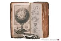
178078258Bruxelles: Benoît Le Francq 1780. Full leather hardcover. xx240 pp. illustrated with a black-and-white frontispiece showing Atlas as a child holding up the celestial sphere and 24 old hand-colored folding maps/plates after G. Dellisle. Rare Brussels pocket atlas based on the 5th Amsterdam edition published by B. Vlam in the same year 1780. Includes B. Vlam's bookseller's list at the end. One map has a repaired taped tear and some maps have frayed edges. Bound in a leather cover with various damages. The book is complete and the maps remain visually attractive. Text in French / Français. See pictures. Benoît Le Francq hardcover
1809Map931Paternoster Row London: Longman Hurst Rees & Orme 1809. 1st Edition 1st Printing. No Binding. Fine. Original early 19th century uncoloured MAP OF BRITISH POSSESSIONS IN NORTH AMERICA BY AARON ARROWSMITH. A FINE CLEAN AND DARK IMPRESSION. Original folding plate including Northern United States and gREENELAND DOWN TO WASHINGTON IN THE SOUTH. A scarce example and in fine un-coloured original condition.41x27cms. Double-page. <br/> <br/> Longman, Hurst, Rees & Orme unknown
1839TH225London: Aldam and Co. Et al. 1839. 1st Edition . Hardback. Fine. 8vo. 100pp. Large folding table of distances frontis. A wonderful early Victorian geography in the orginal stiff card cover with fine buckram cloth cover and a lozenge label pasted to the front cover. A RARE ITEM. Copac 1 copy only 1839. A second edition was published in 1850. <br/> <br/> Aldam and Co. Et al. hardcover
1985024925Toms River New Jersey: Ocean County Historical Society 1985. Near Fine condition. NO cover wear or fraying. Hinges inner and outer are PERFECT. Brief gift note on endpaper. 1985. Reprint of the 1878 Woolman & Rose Philadelphia original. Limited to 700 numbered copies this being #121. The hand inked number "121" has bled through to adjoining pages as usual. All other pages are clean and unmarked. Profusely illustrated with more than 70 maps and prints of New Jersey Shore towns and architectural landmarks in Cape May Atlantic Ocean and Monmouth Counties. Many fold out maps. Tipped-in after the title page is a HUGE folding map THE STATE OF NEW JERSEY 1877 from US Coast Guard Survey Records. It measures a whopping 18" wide by 31.5" tall when unfolded and is imprinted with the populations of major cities in each NJ county from the 1875 Census. Bound in the original maroon cloth stamped in bright gold. Oversize Hardcover. 12" wide by 14.25" tall. This very large extremely heavy book will require extra postage for Priority and International shipments but only the standard charge for media mail. Reprint Limited to 700 numbered. Oversize Hardcover. Near Fine condition/No dust jacket as issued. Illus. by Rose T. F. . 374pp. Great Packaging Fast Shipping. Ocean County Historical Society Hardcover
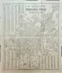
1910List3117Los Angeles California: Bekins Van & Storage 1910. Map measuring 15 ¼ x 13 ¼ inches. Folded with some wrinkling; Near Fine. A map of Los Angeles between Aldama Street South Indiana Street Slauson Ave and Arlington Street published by Bekins Van & Storage. The map is undated but based on the city’s population listed on the map—a mere 125000—it was created some time between 1900 when the population was about 103000 and 1910 when it had ballooned to over 319000. Bekins Van & Storage unknown
1807Map942Paternoster Row London: Longman Hurst Rees & Orme 1807. 1st Edition 1st Printing. No Binding. Fine. Original early 19th century MAP OF THE WORLD On MERCATORS PROJECTION BY AARON ARROWSMITH. A FINE CLEAN AND DARK IMPRESSION. Original folding plate covering THE WHOLE WORLD printed on heavy paper dated 1807. A scarce example and in fine un-coloured original condition. 41x27cms. Double-page folding map.Engraved by Lodge.A LOVELY COPY <br/> <br/> Longman, Hurst, Rees & Orme unknown
1920Map889London: Geographia Ltd 1920. 1st Edition . paperback. Fine. Folding map. FOLDING MAP: Lithographic colour map MOUNTED ON LINEN c1920 measuring 1460x950 mm 37.5 x 57.25 inches. A fine copy of a scarce map. Green board covers gilt spine worn but complete. A very attractive map of the world and British Empire just after the first world war. <br/> <br/> Geographia Ltd paperback
1871Pa586St Gallen 1871. Hardback. Fine. SAENTIS-PANORAMA HERAUSGEGEBEN VON DER SECTION ST GALLEN DES S.A.C.Folding lithographic panorama of the Alps. RUNDISCHT VOM GIPFEL DES SENTIS The View Round the Summit Sentis. 4.45m in length. One extra flap on lower edge present. A lithographic printing of a drawing of the mountains of the Alps drawn between October 1870 and July 1871 showiing a beautiful vista with each peak indentified at the top of the sheet with a faint dotted line down to each location. Santis is the highest mountain in Apline area of North-East Switzerland. A lovely copy in fine condition. No splits foxing marks or wear. Original covers trifle sunned to the red spineand fold creases a trifle toned. Attractive lithographic illustrations of Alpine wildlife to the boards. PLEASE EMAIL FOR PHOTOS. <br/> <br/> hardcover
1845GT070London: J&C Walker 9 Castle Street Holborn 1845. 1st Edition . No Binding. Vg. Fine hand-coloured map of the Isle of Wight and the Solent with 18 sections. Coloured boundaries sands roads woods etc. Some handling. ND c 1845. 65x44cms. Folding map covered with green boards with an original Walker's Map of the Isle of Wight label soiled but complete pasted to the front cover which is detached but present. Nice 'Tours in the Isle of Wight' pasted page to the reverse of the cover. Shows miles destinations and stops 15 x 11.5cms. Nicely hand-coloured. Title to the head of the plate with a scale of 1 inch to the mile. J&C Walker traded from 1841-1847 9 Castle Street Holborn from 1841-1847. <br/> <br/> J&C Walker, 9 Castle Street, Holborn unknown
1758T371Dublin: John Exshaw Dame Street 1758. 1st Edition . No Binding. Fine. 8vo. 481-536pp. A disbound copy of the Dublin version of the Gentleman's Magazine for the month of Sept 1758. Fine fresh paper with no foxing wear or marks. The title-page lists 25 articles on the title-page and includes a fine copy of the rare 'Plan of the Country from the LANDING PLACE with the Encampments and Marches of the Troops under Major General ABERCROMBIE to the Attack of TICONDEROGA . 19 x11 cms. Together with an account from the action. Also a fine plan of St Malo with map of part of French Coast inset 19 x 11cms together with an account of shipping lost in recent action. Also a PLAN of Cherburg with Channel map inset 19 x 11cms with an account. All 3 plans engraved by Ridge. Please email for photos. <br/> <br/> John Exshaw, Dame Street unknown
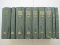
1995018560Staten Island New York: Maurizio Martino Publisher 1995. 9 volumes complete. BRAND NEW HARDCOVER in perfect condition just removed from the publisher's shrinkwrap so we could write this description. NO rubbing. NO fading. Bright clean square and tight. Sharp corners. NO owner's name or bookplate. NOT a remainder. Fresh and crisp -- obviously never read. The standard reference complete in 9 volumes. Vols. 1-4 by Philip Lee Phillips. No date but 1995 First Martino printing "strictly limited to 100". Reprint of the 1909-1920 Library of Congress originals. Vols 5-9 by Clara Egli Le Gear. No date but 1996 First Martino printing "strictly limited to 150". Reprint of the 1958-1992 Library of Congress originals in continuation of volumes 1-4 by Philip Lee Phillips. These 9 volumes fully describe thousands of atlases including imprint collation details of publication measurements content typographical and numbering errors comparisons with foreign and later editions reference citations reviews etc. There are also useful biographical sketches of explorers mapmakers engravers and lithographers. For most atlases before 1870 complete tables of contents are listed. Volume 9 is the comprehensive author index to both Phillips and LeGear with listings for 18435 atlases. The nine volumes are uniformly bound in the original gilt-stamped green cloth. Sheehy CL286: "An important catalog of an outstanding collection." Hodgkiss/Tatham KEYGUIDE 11: "The most comprehensive work on historical atlases." This heavy 9 volume set will require extra postage for Priority and International shipments. But for media mail you pay only our standard charge for 1 volume and we ship the other 8 volumes at no extra cost. . First Martino printing. Hardcover. New/No jackets as issued. Illus. by We ship all 9 volumes for cost of 1. 9 volumes complete. Great Packaging Fast Shipping. Maurizio Martino Publisher Hardcover
1995018557Staten Island New York: Maurizio Martino Publisher 1995. SEE PHOTO. 9 volumes complete. BRAND NEW HARDCOVERS in perfect condition. STILL SEALED in the publisher's clear plastic SHRINKWRAP. NO rubbing. NO fading. Bright clean square and tight. Sharp corners. NO owner's name or bookplate. NOT a remainder. Fresh and crisp -- obviously never read. The standard reference complete in 9 volumes. Vols. 1-4 by Philip Lee Phillips. No date but 1995 First Martino printing "strictly limited to 100". Reprint of the 1909-1920 Library of Congress originals. Vols 5-9 by Clara Egli Le Gear. No date but 1996 First Martino printing "strictly limited to 150". Reprint of the 1958-1992 Library of Congress originals in continuation of volumes 1-4 by Philip Lee Phillips. These 9 volumes fully describe thousands of atlases including imprint collation details of publication measurements content typographical and numbering errors comparisons with foreign and later editions reference citations reviews etc. There are also useful biographical sketches of explorers mapmakers engravers and lithographers. For most atlases before 1870 complete tables of contents are listed. Volume 9 is the comprehensive author index to both Phillips and LeGear with listings for 18435 atlases. The nine volumes are uniformly bound in the original gilt-stamped green cloth. SEE PHOTO. Sheehy CL286: "An important catalog of an outstanding collection." Hodgkiss/Tatham KEYGUIDE 11: "The most comprehensive work on historical atlases." This heavy 9 volume set will require extra postage for Priority and International shipments. But for media mail you pay only our standard charge for 1 volume and we ship the other 8 volumes at no extra cost. First Martino printing. Hardcover. New/in publisher's shrinkwrap. Illus. by We ship all 9 volumes for cost of 1. 9 volumes complete. Great Packaging Fast Shipping. Maurizio Martino Publisher Hardcover