Rand McNally & CompanyBiblio.com
333 résultats
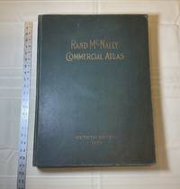
1929028276Chicago: Rand McNally & Company 1929. Good condition. Tears and creases to the title page. Vertical and corner creases up to page 6. SEE PHOTOS. Includes double page full color maps and other maps printed in yellow red and black. SEE PHOTOS. The double page maps open to an impressive 27.75" across. Contents: Part I: The World pp.4 - 23; Part II: The United States pp. 24 - 481; Part III: Foreign Countries pp. 482 - 537; Supplementary Maps: Canada Mexico China and Japan Polar Regions pp. 538 - 550. Bound in the original gilt-stamped green cloth. Oversize Hardcover. 15.50" wide by 20.75" tall by 2.25" thick at the spine. This massive extremely heavy book will require SUBSTANTIAL extra postage at our cost based on your locatuion. Sixtieth Edition 60th edition. Oversize Hardcover. Good condition. Illus. by NOT a library discard. 550 pages. Great Packaging Fast Shipping. Rand McNally & Company Hardcover
1809Map938Paternoster Row London: Longman Hurst Rees & Orme 1809. 1st Edition 1st Printing. No Binding. Fine. Original early 19th century map MAP OF NORTH AMERICA BY AARON ARROWSMITH. A FINE CLEAN AND DARK IMPRESSION. Original folding plate covering from Baffin Bay down to the Caribbean SeaWatermarked heavy paper 1804. A scarce example and in fine un-coloured original condition. An occasional light foxing mark. 41x27cms. Double-page.Engraved by Russell <br/> <br/> Longman, Hurst, Rees & Orme unknown
MASTER361054IParsippany NJ.: Maurizio Martino. VG In Green Cloth With Gilt Lettering. 5 Books In 6 Volumes Complete. Oversize. All Pages Clean Bindings Tight. Pub. 1995 Reprint Of 1957 I.H.C. Edition. Pages: 1378. Undated. Reprint. Hardcover. Maurizio Martino hardcover
1839Map908London: John Betts 1839. 1st Edition . No Binding. Fine. Folio. Lithographic double page folding map with original outline colour and wash with an inset of Jamacia to the left of California the atlas 'THE LONDON SERIES OF MODERN MAPS' of c1839. Attractive decorative floral border with Texas still an independant state. A fine copy of a scarce map from John Betts Modern Altas of c1839. Nice original colour unfaded and a near mint copy of the map. PLEASE EMAIL FOR PHOTOS.14x16 inches 34x41cms. <br/> <br/> John Betts unknown
19871201030076Madison Wisc. : Juniper Press 1987. Hardcover. Like New. Signed. Maroon cloth portfolio clamshell case that contains 24 facsimiles sheets 24" x 9" unbound. Case is in near fine condition with very minor scuffing. Facsimiles in fine condition. Also includes descriptive booklet Cloth 8vo hardcover with marbled boards. Cover and binding are in fine condition text has clear/unmarked pages. Booklet is signed by David Woodward on its limitation leaf. - Published in a limited edition of 150 copies no. 64.This is an oversized or heavy book that requires additional postage for international delivery outside of Canada and the US. <br><br> Madison [Wisc.] : Juniper Press hardcover
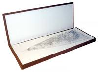
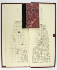
1987ST20505-11Madison Wisconsin: The Juniper Press 1987. No. 116 OF 150 COPIES. 632 x 250 mm. 25 x 9 3/4". 2p.l. 19 1 pp. <br/> Black quarter buckram over maroon marbled paper boards spine lettered in gilt. In a custom maroon buckram clamshell box. WITH 24 FACSIMILE GLOBE GORES. Signed by Woodward on the limitation page. Just a hint of use to the box booklet corners just a touch rubbed otherwise as new.<br/> <br/> This sizable attractive publication reproduces one of the largest complete sets of 16th century globe gores. Dating from around 1574 the original gores which when assembled would make a globe measuring just under 70 centimeters in diameter have been attributed to brothers Livio and Giulio Sanuto Venetian cartographers and engravers. Little is known about the gores' origin; the accompanying essay suggests they may have never made it to the final stages of publication and production possibly stopped by an outbreak of plague. This facsimile was created from the only extant set in the collection of Arthur Holzheimer 1932-2025 and was produced by his research foundation along with the Newberry Library. The gores are accompanied by a booklet by noted cartography scholar David Woodward 1942-2004 which provides background and the evidence supporting the attribution of the gores to the Sanuto brothers. The Juniper Press unknown
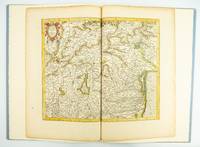
1985ST20505-12Fullerton California: Stone & Lorson 1985. ONE OF 89 COPIES in quarter vellum of a total edition of 115. 490 x 325 mm. 19 1/4 x 13". viii 23 1 pp. 1 leaf. <br/> Publisher's quarter vellum over gray paper boards covers with device in gilt smooth spine lettered in gilt. In just slightly chafed black buckram slipcase. WITH A MAP FROM THE ORIGINAL 1619 ATLAS bound in with period hand coloring. Map 293 "Tarvisina Marchia Et Tirolis Comitatus". De Hamel & Silver "Disbound and Dispersed" 186. One corner a bit bumped otherwise the main volume flawless; the map edges a bit browned and just slightly frayed a few light spots but still excellent with good color and strong general appeal.<br/> <br/> This attractive oversized production includes an original map of an important region of northeastern Italy taken from the 1619 edition of the Mercator-Hondius atlas. A pioneer in commercial cartography and a founder of the Netherlandish school of cartography and geography Mercator 1512-94 produced maps used around the world that were informed by his brilliant "Mercator Projection" which allowed the round Earth to be accurately depicted on a flat map. Near the end of his life he began work on an ambitious cosmography that would contain an account of the creation of the world a description of the universe descriptions of the countries and oceans of the world genealogies and political histories of the several countries and a chronology of the cosmos. Only the account of creation the chronology and maps of the known regions of the world came to fruition. Mercator having died before the work came to press it was completed by his heirs and published in 1595 with 107 maps. Leading Amsterdam map publisher Jodocus Hondius 1563-1612 acquired the plates in 1604 and issued the first Mercator-Hondius "Atlas" in 1606 with 37 maps he had engraved added to the original 107. Teacher and Hondius' brother-in-law Pieter van den Berg wrote the introduction and the descriptive text that appears on the versos of the maps. A 1611 edition increased the number of maps to 150 and another six were added in 1619. The hand-colored map included in our copy depicts the South Tyrol and Veneto regions including Lake Garda Verona Padua and Venice. It is accompanied with an essay by Norman J. W. Thrower 1919-2020 UCLA geography professor and cartographer describing the historical background of the atlas. Joel Silver in "Disbound and Dispersed" tells us that "the physical production of this leaf book is superb from the design by Vance Gerry to the presswork of Patrick Reagh.". Stone & Lorson unknown
1817Map688Edinburgh: John Thomson 1817. 1st Edition . No Binding. Fine. Original hand-colour fine scarce unfolded copy small damp stain to bottom edge 510 X 610 From John Thomsons New General Atlas 1817 beautifully hand-coloured on thick paper <br/> <br/> John Thomson unknown
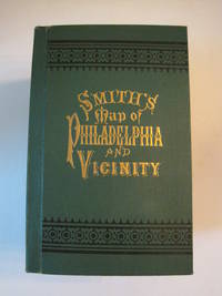
1894016609Philadelphia: J. L. Smith 1894. Fine condition. SEE PHOTOS. A very attractive well preserved copy of this detailed two-part map of Philadelphia and vicinity published in 1894 copyright 1893. Tough-to-find in collectible condition as nice as this. A bright clean copy. NO chips. NO tears. NO creases. NO owner's name or bookplate. Clean and unmarked. Drawn on a scale of 1 inch to the mile. The map consists of two parts. The eastern half unfolds to 23" wide by 27" tall. The western part is 21.5" wide by 27" tall. Both are skillfully and attractively hand colored. The maps are backed in linen as issued. They are housed in the publisher's original green cloth portfolio which is printed in black and embossed in gold on the front cover and in blind on the rear. Gilt lettering is still as bright and shiny as new. 1st ed No additional printings listed. Hardcover. Fine condition. J. L. Smith Hardcover
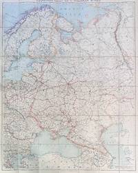
192284192London: Edward Stanford Ltd 1922. Large folding map. Lithograph in colors on uncoated paper dissected and laid down on linen as issued; overall dimensions 123cm x 97cm ca 48" x 38" folding to 20cm x 14cm 8" x 5-1/2"; card covers with publisher's slipcase of maroon cloth with printed paper title label. A bright clean well-preserved example Very Good to Near Fine. In the original slipcase cloth lightly rubbed at corners and a bit of soil to title label still easily Very Good.<br /> <br /> An impressive Revolutionary-era map of Russia in 42 sections scaled 1 inch to 50 miles. This revision dated March 1922 would appear to be the fourth and final edition of the map - it was preceded by editions in 1915 1917 and 1919. By December 1922 the Soviet Union would be formally established with Azerbaijan Georgia Belarus and Armenia which all appear here as independent states being absorbed into the Union of Soviet Socialist Republics. Edward Stanford, Ltd unknown
9818English; circa 1790. 8vo 6 pp. Two bifoliums sewn together. On laid paper with Britannia watermark. Text clear and complete. Neatly written out at approximately 38 lines to the page. On aged paper with slight damage to the first bifolium the leaves of which are detaching at the spine. Some of the items have been lightly scored through in pencil but are still legible. The inclusion of such items as '149 Blank Silk Paper for copying Maps' would appear to indicate that the document is an inventory for probate of a cartographer's stock. Last two entries read '165 Blank Sheets of Paper for copying Maps. A Bond relating to the Honble. Thomas Howe. Prints to copy from. Several Plans of the River and Sound of Dawfoskee in South Carolina survey'd by Captn. Gascoigne. 166 Draught of Falklands Islands. Map of the Province of New York. La Cours de la Meuse. The Circle of the Inferior Rhine. Plans of Port Royal in South Carolina. Les Duchés de Lorraine & De Bar. Plans of the River & Sound of Dawfoskee in South Carolina.' The first two entries list items by John Hamilton Moore a Scottish cartographer who according to his obituary in the Gentleman's Magazine was 'late teacher of Navigation on Tower-Hill author of Moore's Navigation Seaman's Daily Assistant the Monitor &c.' English; circa 1790. unknown
1645Map910Amsterdam: Joan Blaeu 1645. Original printed issues 1st Editions . No Binding. Vg. Large folio. ND c1645-. 410 x 495mm Double page folding map of the county of Gloucestershire with attractive original hand-colour outline and wash. Nice wide margins and German text to the reverse. One lateral paper crease but no loss. PLEASE EMAIL FOR PHOTOS. <br/> <br/> Joan Blaeu unknown
1587Map906Antwerp: Abraham Ortelius 1587. French Edition . Hardback. Vg. Early map of SWITZERLAND. No 62 and FRENCH TEXT TO VERSO. 38x 51 cms 15.5 x 20 inches. Lower blank margin cropped but leaving margin below the plate mark. HAND-COLOURED Finely hand coloured in wash and outline. Decorated with a title cartouche. Scarce item. PLEASE EMAIL FOR PHOTOS. <br/> <br/> Abraham Ortelius hardcover
1829Map887London: Greenwood 13 Regent Street Pall Mall 1829. 1st Edition . No Binding. Fine. Folding map. A fine large folding double page map with the original centre hinge present. Clean paper with no off-setting foxing tanning or marks. Decorative double page engraved map of the county with an uncoloured vignette view of Lambeth Castle & Church engraved by R. Creighton. Fine elegant title to the top left. Original hand-colour block and outline. 65 x 80.5 cms 25 1/2 x 31 3/4 inches printed on thick paper with wide clean and fine margins. Printed July 4th 1829 and published in the C& J Greenwoods "Atlas of The Counties of England" dated 1834. PLEASE EMAIL FOR PHOTOS. WE have many more Greenwoods from this atlas in stock all individually priced. Please email for details. <br/> <br/> Greenwood , 13 Regent Street, Pall Mall unknown
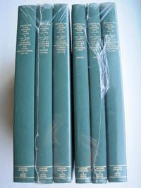
1995018762Storrs-Mansfield CT / Parsippany New Jersey: Martino Fine Books / About Books 1995. 6 separate volumes complete 5 volumes bound in 6 books WITH LARGE FOLD-OUT MAPS -- just like the first edition. SEE PHOTOS. Each of the 6 books in this 1995 large format edition measures 9.25" wide by 12.25" tall. This is NOT the later smaller format 3-volume reprint in which the maps are reduced in size. Unlike later reduced-size editions the maps in this 1995 six-volume edition measure as large as 21" by 33" when unfolded. SEE PHOTOS. As original co-publisher we are pleased to offer the few remaining sets of the 1995 large-format 6-volume edition recently rediscovered in our warehouse. They are BRAND NEW in perfect condition. STILL SEALED in the publisher's clear plastic SHRINKWRAP and the PUBLISHER'S CARDBOARD SHIPPING BOX. NO rubbing. NO fading. Bright clean square and tight. NO owner's name or bookplate. NOT a remainder. Fresh and crisp -- obviously never read. No date but 1995 First Martino/About Books printing "strictly limited to 350". Reprint of the original 1957-1963 six separate volumes: xiv 264; xiii 281; xiii 349; xiii 260; xix 222; iv 223-487pp. MAPPING THE TRANSMISSISSIPPI WEST is a monumental and exceptionally thorough work that is unlikely to be surpassed. The set is illustrated with a total of 376 maps including several that fold out. In this standard carto-bibliography are full descriptions of some 1300 maps from the year 1540 to about 1880. Wheat discusses each map showing the origins of its date and weighing its significance and accuracy. He also identifies the atlases and books in which the maps can be found. Norman Thrower: "Scholars and others who are interested in the American west have found Wheat's work indispensable." Ristow 382: "A comprehensive cartobibliography with many fine reproductions." The 6 volumes are uniformly bound in the original gilt-stamped green cloth. SEE PHOTOS. Oversize Hardcover. All 6 volumes measure 9.25" wide by 12.25" tall. This heavy set will require extra postage for Priority and International shipments. But for media mail you pay only our standard charge for 1 volume and we ship the other 5 volumes at no extra cost. First Martino/About Books printing. Oversize Hardcover. New/in publisher's shrinkwrap. Illus. by We ship all 6 volumes for cost of 1. 6 volumes: 9.25" wide by 12.25" tall. Great Packaging Fast Shipping. Martino Fine Books / About Books Hardcover
1892016610Chicago and New York: Rand McNally & Company 1892. Very Good condition but for short tears at 3 or 4 of the map folds which have been neatly reinforced with archival tape on the blank side. SEE PHOTOS. A very attractive well preserved copy. 60 pages of text including brief information on 78 railroads a detailed 39-page index and ads for Rand McNally publications. Attached at the rear is a full color map that unfolds to 13'' wide by 21" tall. Bound in the publisher's tan-color stiff printed wraps. Cover title: Rand McNally & Co's Indexed County and Township Pocket Map and Shippers' Guide of New Jersey Showing in Detail the Entire Railroad System The Express Company Doing Business over Each Road and Accurately Locating All Cities Towns Post Offices Railroad Stations Villages Counties Islands Lakes Rivers etc Locating the Nearest Mailing Point of All Local Places; Designating Telegraph Stations Population is Given According to the Latest Official Census" i.e. 1890. 1st ed No additional printings listed. Stiff card covers. Very Good condition. 60 pages a full color fold-out map. Rand McNally & Company Paperback
1849GT072London: E.S. Mogg 14 Great Russell Treet Covent Garden 1849. 1st Edition . No Binding. Vg. Exhibiting a Circle of Three Miles from the General Post Office to Which is Added A COPIOUS INDEX Containing Upwards of 1500 Places with Reference to Their Several Situations.Large folding un-dissected oblong map laid on linen 54x70cms Original hand-colour to the circle parks and main routes. A very nice dark impression generally dusty but a rare map. Fine engraved map title to the upper right-hand corner. Upper lateral fold triflle cracked but sound with no loss. Index in attached case 30pp with upwards of 2000 places. v adspp. PLEASE EMAIL FOR PHOTOS <br/> <br/> E.S. Mogg, 14 Great Russell Treet, Covent Garden unknown
1773Map922London: H. Turpin 1773. 3rd Edition . No Binding. Fine. Single map of Lincolnshire. A fine uncoloured copy of the last issue of Robert Moderns playing card maps. Approx 55x90mms. Title to the head wth Roman numeral VIII and the uncoloured map to the main section enclosed with double ruled lines above and below with county dimensions and distances at the foot. Harry Turpin published a 52 sheet set of these maps between 1764 and 1787 but no exact date is known for publication. RARE. Please email for photos. <br/> <br/> H. Turpin unknown
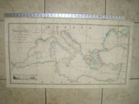
1853020822London: James Wyld Geographer to Her Majesty Charing Cross East 1853. Very Good condition only a little light soil SEE PHOTOS. This huge detailed map of the Mediterranean measures 99.5cm by 54cm when unfolded. The image itself is 93.5cm by 47.5cm. There is a finely engraved view of the entrance of Gibraltar Bay in the lower left corner. The map is a linen-backed copper engraving with original hand coloring. The map has handsome marbled paper endsheets and when folded-up measures 18cm by 12.5cm. SEE PHOTOS. Published by James Wyld Geographer to Her Majesty Charing Cross East London. A New General Atlas of Modern Geography Consisting of a Complete Collection of Maps of the Four Quarters of the Globe; Delineating their Physical Features and Coloured to Show the Limits of Their Respective States 1853. First Edition. Linen-backed hand-colored map. Very Good condition. 99.5cm by 54cm when unfolded. Great Packaging Fast Shipping. James Wyld, Geographer to Her Majesty, Charing Cross East Paperback
1646Map735London: John Sudbury and George Humble 1646. No Binding. Vg. Folio. 1611-1646. An original map of the county of Gloucestershire. Nice old hand-colouring a dark impression. One or two tiny holes near the centre-fold repaired. 39.5 x 52cms. 15.5 x 20.5 inches. The margins are all about 1cm outside the plate. ENGLISH TEXT to the reverse. The imprint is John Sudbury and George Humble. Floral initial letter to reverse in the style of John Legett. PLEASE EMAIL FOR PHOTOS <br/> <br/> John Sudbury and George Humble unknown
1823Map926London: Robt. Wilkinson 1823. 1st Edition . Hardback. Vg. Folio. 52 coloured plates - 45 maps 7 chrono-geological charts 7 maps double-page. Orignal boards and spine. Fine contents with hand-coloured maps thoughout. Rubbed and worn boards but a sound binding needing new paper covering pasted to the boards.The fine map plates are dated between 1800 and 1823 <br/> <br/> Robt. Wilkinson hardcover
1788GT789London: Charles Dilly in the Poultry et al 1788. eleventh edition . Hardback. Vg. 8vo. x 2 928pp. 20 map plates : 2 engeaved illustrations charts maps ; Damp staining to the plates and map in some but compete and tight copy in the original binding. A New System of Modern Geography: or A geographical historical and commercial grammar; and present state of the several kingdoms of the world. : Containing I. the figures motions and distances of the planets according to the Newtonian system and the latest observations. II. A general view of the Earth considered as a planet; with several useful geographical definitions and problems. III. The grand divisions of the globe into land and water continents and islands. IV. The situation and extent of empires kingdoms states provinces and colonies. V. Their climates air soil vegetable productions metals minerals natural curiosities seas rivers bays capes promontories and lakes. VI. The birds and beasts peculiar to each country . XII. The longitude latitude bearings and distances of principal places from London. To which are added I. A geographical index with the names and places alphabetically arranged. II. A table of the coins of all nations and their value in English money. III. A chronological table of remarkable events from the Creation to the present time. Original full calf with red morocco label to the spine. <br/> <br/> Charles Dilly in the Poultry et al hardcover
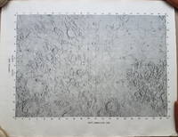
19693792<p>A very uncommon map of the Sea of Tranquility area that would be the site of the first moon landing in 1969. According to a description of a related larger-scale map in a 2020 Bonham's auction "NASA mission planners created this internal Manned Spacecraft Center chart a few months before the flight in 1969."</p><p>The map encompasses the area from 14 degrees South to 14 degrees North Latitude and from 0 degrees to 42 degrees East Longitude. The coordinates of the Eagle's landing site were 0.675 degrees Latitude North and 23.47 degrees Longitude East – very near the center of the mapped area.</p><p>The map is numbered "MSC – 6238 – 69" in the lower right margin. As it was meant for internal use only the map appears to be significantly less common than the LAC Lunar Chart series and the USGS geologic chart series. We were unable to locate an online reference to the map on the Lunar and Planetary Institute website.</p><p><strong>Condition: </strong>Rolled never folded. Some crinkling in the lower margin. Tear at extreme lower right corner with map number has been closed with archival tape on the reverse. Good.</p><p>ICN 7706.1.</p> NASA Manned Spacecraft Center
1740TH228London: Printed for Thomas Wright Mathematical Instrument-Maker. And E. Cushee Globe-Make 1740. fifth Edition . Hardback. Vg. 8vo. THE DESCRIPTION AND USE OF THE GLOBES AND THE ORRERY To which is prefixed by way of introduction a brief Account of the Solar System.viii 190pp. 6 folding plates. Pub. advert to the reverse of the title-page. Index of the astronomical terms. Original full calf polished calf binding with gilt dbl. ruled border to the boards. Five raised band and neat owners to the top edge of the title-page. A tight clean and fresh copy with a plain but period binding Near fine Nicholson Calvert 1816 an English Whig politicain who fought at the Battle of Waterloo. <br/> <br/> Printed for Thomas Wright, Mathematical Instrument-Maker. And E. Cushee, Globe-Make hardcover
1745TH352London: Printed for Thomas Wright Mathematical Instrument-Maker. And E. Cushee Globe-Make 1745. sixth edition . Hardback. Vg. 8vo. To which is prefixed by way of introduction a brief Account of the Solar System.viii 190pp. 6 folding plates. Pub. advert to the reverse of the title-page. Index of the astronomical terms. Original full calf calf binding. Five raised bands. A tight clean and fresh copy with a plain but period bindng/ Original binding intact but worn to the extremities and joints cracked but the boards attached. A tight and clean text with beautiful crisp plates. <br/> <br/> Printed for Thomas Wright, Mathematical Instrument-Maker. And E. Cushee, Globe-Make hardcover