333 résultats
1616Map 752London: Thomas Bassett and Richard Chiswell 1616. No Binding. Fine. Folio. 1611-1676 An original map of the county of Suffolk. Nice old hand-colouring a dark impression. 41.5 x 54cms. 16.25 x 21.5 inches. Wide margins outside the plate. ENGLISH TEXT to reverse. The imprint is by Thomas Bassett and Richard Chiswell in St Pauls Yard. London Floral initial letter to reverse in the style of Hall and Beale. PLEASE EMAIL FOR PHOTOS. Basset and Chiswell joined forces and purchase the original Speede plates and re-issued the maps in a fine edition in 1676. Only this issue was produced and is dated 1676 <br/> <br/> Thomas Bassett and Richard Chiswell unknown
1875Pa620London: William Blackwood 1875. New Edition . Hardback. Fine. Elephant Folio - over 15" - 23" tall. 20 x 135 inches. 48 double page folding colour maps and the North Polar Chart as a frontis. Fine original red half calf binding with gilt titles. Specail; index after each map. The fourth edition with each map updated to reflect the ever changing speed of the changes taking place in the industrail age. Dedication page to Queen Victoria. Each map as an adjacent index bound in and a prospectus for the companion book to the atlas is bound in at the front Atlas Geographicus' pub. separately. A complete and fine copy <br/> <br/> William Blackwood hardcover
1880NY068London: Mappin 1880. Original . No Binding. Fine. Metal dial and clasp with a small built in compass and a fine dial arm that is hinged to work out measurements. The compass dial pointer is loose but present within the bubble. A strong clasp ring 50mm surrounds the dial from the rear and the face is finely engraved with roman numerals of the hours of the day.The rear is finely stamped 1644 in minute type. The metal is not hall marked. A VERY ATTRACTIVE AND RARE ITEM c1880 <br/> <br/> Mappin unknown
1830TH346London: Greenwood & Co. 1830. 1st Edition . No Binding. Vg. Dissected Map. A very large folding colour hand-washed map pub. 24th February 1830 and dissected into 40 sections and laid on a linen sheet. Massive size and covering the eastern half of the county of Lincolnshire. 79 x 204 cms. Green marbled covers and a small printed label 'EAST' to the upper cover. Sewn linen edges a trifle worn and some off-setting but a very scarce map in nice condition. The map was published as the whole county but this copy is covering the eastern section only. The map was dissecting into 72 sections when complete. SCALE 1:65000. 1 inch to 1 mile. Map 87 Carroll: The Printed Maps of Lincolnshire 1576-1900 PLEASE EMAIL FOR PHOTOS. <br/> <br/> Greenwood & Co. unknown
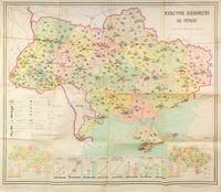
55306Kyiv: Vydavnytstvo politychnoi literatury Ukrainy 1965. Single leaf measuring 95 × 80 cm color offset lithograph. Creases from folding; light fading due to stock; else about very good. A colorful infographics map showcasing cultural development of Soviet Ukraine in 1965 likely published ahead of the celebrations planned for the 50th anniversary of the October Revolution in 1967. The map promotes the Ukrainian SSR as having exceptional educational and cultural resources showing the size and locations of universities trade schools theatres museums as well as TV and radio towers print runs of magazines newspapers and educational literature. Two inserts at the lower corners show locations of libraries and archives left corner and culture clubs and cinemas right corner. Eight additional graphs at the bottom show consistently growing numbers of students enrolled in technical schools universities and other secondary education institutions as well as the number of scientific workers. The graphs also show a growing number of theatres and museums print runs of magazines newspapers and books as well as retail sales of books in millions of rubles. <br /> <br /> The map was published by the Political Literature publishing house of Ukraine rather than by the Academy of Sciences and the scale is not mentioned on the map but is likely 1:1750000 to 1:1500000 typical for Soviet maps of this period suggesting that this publication was made primarily for propaganda purposes. Likely for this reason no mention of this map is made in the Ukrainian cartographic references such as Rostyslav Sossa's "Political and Administrative maps of Ukraine 1918-2008 Politiyko-administratyvni i administratyvni karty Ukrainy 1918-2008 which does mention several other maps by Teledido as map designer and Povolots'kyi as editor. In addition to this map the authors collaborated on other statistical/cartographic projects which mapped and diagrammed the five-year plans of the 1960s-1970s. <br /> <br /> Rare despite the 33000 copies printed. As of December 2025 KVK OCLC show two copies worldwide both in North America. unknown
1821Map884Blundtisham St Ives: R.G. Baker 1821. 1st Edition . No Binding. Vg./Fine. Rolled wall map from four engraved sheets laid on a single roll of strong linen. Surveys by R.G. Allen in the Years 1816 17 18 19 & 20. Engraved by J.Allen 17 Poplar Row New Kent Road Surrey. Dedication to 'The Right Honorable Philip Earl of Hardwicke Lord Lieutenant and Custos Rotorum of the County of Cambridge. B.L. 004813374 One inch to one mile. The first large large scale survey and map of the county of Cambridge one of the last to be surveyed in England. This map was funded by public subscription. Hand -coloured and comprising 4 sheets joined and mounted on two wooden rolls to display lacking one roll. <br/> <br/> R.G. Baker unknown
1828GT100London: Richard Holmes Laurie 1828. 1st Edition . No Binding. Fine. A fine and very rare printed folding map of IRELAND by Richard Holmes Laurie 53 Fleet Street London 84 x 64 cms 33 x 25 inches with original fine hand-colouring and enclosed in the original green calf slipcase with gilt title embossed to the case edge. Divided into 18 panels on a linen sheet. No recorded copy at auction and no copy in Copac a similar dated 1817 in the BL Published 8th April 1828. No copies in WorldCat. Richard Holmes Laurie 1777-1835 was the son of Robert Laurie who whom he apprenticed as a mezzotinter who went into partnership with his fathers old partner Whittle until the latters death in 1818. Laurie and Whittle were one of the leading British Cartographic publishers in the 18th and 19th century. Richard Holmes Laurie used Captain Powell's observations of Laurie Island in the South Atlantic and printed the first map of the island which was then named after him. <br/> <br/> Richard Holmes Laurie unknown
161910Amsterdam Theatrum Orbis Terrarum Ltd. 1967. Original publisher's black cloth hardback gilt title on spine and frontcover small 4to: Each volume ca. 500 pages - several essays with illustrations maps references bibliographical notes. Very fine copies - as new. Volumes XIII & XIV missing. Amsterdam, Theatrum Orbis Terrarum Ltd. 1967 hardcover
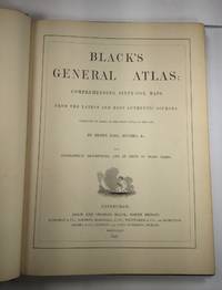
1844026815Edinburgh / London / Dublin: Adam and Charles Black / Longman / Simpkin / Whittaker / Hamilton / Cumming 1844. Good - Very Good condition. Bound in green cloth with black leather spine and corners elaborately gilt decorated. The leather is surprisingly well preserved. The cloth is faded and soiled with frayed edges. SEE PHOTOS. NO owner's name or bookplate. NOT a library discard. Imprinted "MDCCCXLIV" at the foot of the title page with "1844" hand inked beneath. All other pages are crisp clean and umarked with almost no foxing. Full title; "Black's General Atlas: Comprehending Sixty-One Maps from the Latest and Most Authentic Sources Engraved on Steel in the First Style of the Art by Sidney Hall Hughes etc. with Geographic Descriptions and an Index of 56000 Names." The maps several double page are tissue guarded and most are handcolored in red yellow and green. SEE PHOTOS. With the binder's ticket of Smith & Son 306 Lawnmarket Edinburgh. All edges gilt. Oversize hardcover. 13.25" wide by 17.75" tall. This large heavy book will require SUBSTANTIAL extra postage depending on destination that will be charged at our cost. 1844 edition. Oversize Hardcover. Good - Very Good condition. Illus. by NOT a library discard. 12pp. 61 maps 57 page Index. Great Packaging Fast Shipping. Adam and Charles Black / Longman / Simpkin / Whittaker / Hamilton / Cumming Hardcover
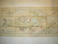
1912016735Borough of Hopatcong New Jersey 1912. Near Fine condition. SEE PHOTO. This is a beautiful and very scarce color map of Lake Hopatcong New Jersey. When unfolded it measures 18" tall by 38" wide. Some folds have been neatly reinforced on the blank side with archival-quality document repair tape. Buildings are represented by red squares water in green. Some of the properties and locations depicted are: Port Morris Landing Roxbury Township Borough of Mount Arlington Byram Township Nolans Point Atlas Powder Co. Brookland Borough of Hopatcong Byram Cove Henderson Bay Byram Bay Maxim Park Jefferson Township Woodport Hurdtown Hurd Mining Co. W. M. Force Estate John P. Lawless Mary Ingram estate Aaron Peck estate Raccoon Island Halsey Island Bertrand Island Theodore King Gertrude Otten Violet Littell Robert Dunlap estate etc. Full title: "Property Map of Lake Hopatcong New Jersey Prepared by Hudson Maxim for the Morris Canal Investigation Commission November 16 1912 Compiled from Various Maps and Actual Surveys by P. E. Boomer C. E.". First Edition. Folded map. Near Fine condition. 18" tall by 38" wide when unfolded. Borough of Hopatcong, New Jersey? Paperback
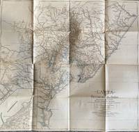
1928List1922Bahia 1928. Folded map. Fine condition. Fine. Teodoro Sampaio was an Afro-Brazilian cartographer engineer politician and historian who was very active in Brazil particularly in Bahia during the late nineteenth and early twentieth century. Offered here is Sampaio’s map of Bahia from 1928 which updates a map he produced in 1899 of the same region with updates of the settlement of the region including a detailed inset of the city of BBahio de Todos os Santos on the lower right corner. At the time of the map’s production Sampaio was an authority on Brazilian geography being a member of the Instituto Geográfico e Histórico da Bahia serving as president in 1922 and a member of the Instituto Histórico e Geográfico Brasileiro and the Instituto Geográfico e Histórico da Bahia and publishing several books on Brazilian geography. The period between 1899 when the first edition of this map was published and 1928 saw the development of rubber plantations in Bahia and the map provides detail on the region’s roads and population centers. We find no publicly held examples of this edition and one copy of the 1899 edition at Princeton though we do find a reference to this edition at the Brazilian National Archives. unknown
1875Map877London: Edward Stanford 55 Charing Cross 1875. 1st issue . paper wrappers. Fine. Folding map. 78.5 x 66.5 cms. The rare first issue of Stanford's April 19th 1875 map of the North Pole. Laid on cloth in 12 dissected sections. Coloured printing. Pasted to the lower left corner is a contemporary inset map of the Kennedy Channel entering ther 'frozen Polar Ocean' text to the reverse of the inset map.The voyages and journeys of the Artic explorers throughout the centeries are neatly printed in red throughout the map with dates including up to Austrian Exped. Payer 1874. Neatly enclosed in cloth covers when folded with a hand-written original label 'North Pole'. A lovely copy of a very scarce item. PLEASE EMAIL FOR PHOTOS. <br/> <br/> Edward Stanford, 55 Charing Cross unknown
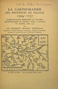
190827846Various places.: Various publishers 1908 to 1923. 10 volumes bound together in one volume. First Editions and all but one are inscribed by the author. Illustrated with cartographic cover art re-impressions of important works cartographic decorations and a number of maps including a number that are folding. 8vo the original printed wraps to each pamphlet are present and all are bound into the one cloth covered volume brown morocco label gilt. Each pamphlet can be considered fine and in exemplary condition some evidence of use and a bit of age to the cloth covers. A fine collection. A FINE COLLECTION OF INSCRIBED FIRST EDITIONS. Ranging from the cartography of the provinces of France 1594 to British and Irish Itineraries and Road-Books English Counties Welsh a pamphlet on the Evolution of the Maps of the Bristish Isles on the great engraver and mapmaker John Cary and two on France cartography and routes from the mid-1500's until the middle of the 19th century. ALL BOOKS ARE INSCRIBED BY THE AUTHOR. Various publishers paperback
1802Le534London: C. Cooke 1802. Extra Illustrated Fine Edition . Hardback. Vg. 4to. : containing an accurate and entertaining description of Europe Asia Africa and America being a complete and universal history and description of the whole world as divided into Empires. 2 volumes. 'Upwards of 100 engravings'. All plates and maps present as per the binders list. 24 MAPS SOME FOLDING ALL HAND-COLOURED. The two North American plates have small fold splits with a trifle loss otherwise all plates are fine and lovely dark impressions with fine hand-colouring to the maps. Undated but presumed 1802 first edition. Hand-coloured maps and copper-plate engraving throughout. Rubbed and worn full calf original binding with black calf labels gilt. Armorial bookplates in each volumes of T. Grimshaw with marbled end-papers. The fine world map was engraved by A. Arrowsmith and engraved by J. Lodge. The anon. large folding Pacific Ocean is complete but torn to the lower centre fold. The plate list calls for 8 extra plates given in the 'Fine' edition. These are all present and are beautiful strong dark impressions. PLEASE EMAIL FOR PHOTOS. <br/> <br/> C. Cooke hardcover
1850Map883Edinburgh and London: William Blackwood & Sons 1850. 1st edition 2nd issue . Hardback. Fine. Imperial Folio. 22 x 14.5 inches 57x38cms published simultaneously with divisions concerning the Geology Meteorology Phytology and Zoology of the world WITH a total of 30 maps AS CALLED-FOR. ALL DOUBLE PAGE AND HAND-COLOURED each plate measures 67x45cms. Bound in the orginal half-calf binding with cloth boards. Attractive sound spine but some wear. The 1st edition as published 1848 but with 1850 to the title-page. The large orignal edition with 30 beautiful hand-coloured engraved plates hinged. The first 1848 issue was engraved with some plates hand-coloured. This slightly later issue has all the plates engraved and with hand-colouring and the second issue of 1856 had lithographic plates with some printed colour and some hand-colour. A SCARCE ITEM. The best set of plates. <br/> <br/> William Blackwood & Sons hardcover
1689Map867London: P.Lea 1689. Original printed issues 1st Editions . No Binding. Fine. Folio. 1579-1689. The rare re-issue with amendments by P.Lea of Saxtons original plate of 1579. Hand out-line colour in fine condition of the copperplate engraving. Paper size 54.5 c 42.8 cms. Plate size 49.5 x 34.0 cms. No splits or holes and attractive early colouring. Plain verso and hinge still present. Inset plan of Norwich. PLEASE EMAIL FOR PHOTOS. <br/> <br/> P.Lea unknown
1713Map868London: Henry Overton 1713. Original printed issues 1st Editions . No Binding. Fine. Folio. 1603-1713 The rare re-issue with amendments by Henry Overton of Smiths original plate of 1603. Based on the map by Saxton in 1573. Un-coloured example in fine condition of the copperplate engraving. Paper size 55 x 46 cms. Plate size 48 x 33 cms. No splits or holes. Plain verso and part of the original hinge still present. Table with a list of the hundreds. One of the original 'anonymous' maps that were identified as being by Smith in recent times.PLEASE EAMIL FOR PHOTOS. <br/> <br/> Henry Overton unknown
1610Map903London: John Sudbury and George Humble 1610. 1st Edition . No Binding. Vg. Folio. 44x52 cms. 38.5x51 cms The rare first edition of Speed's Kingdome of Scotland map with original outline colouring and printed on thick paper. Portraits of the Scottish Royal family border the side margins and the imprint reads' Performed by John Speed and are to be sold in 'Popeshead alley by John Sudbury and George Humble Cum Privilego 1610'. In the upper right corner is the inset ' The Yles of Orkney'. The map reverse has the text description in English. The map is complete to the margins but has been rather crudely repaired to the rear in past times and is generally a trifle grubby. Edges and centre fold repaired from the back.The top and bottom margins are wide but the side margin are close to the plate mark.The impression however being the first edition is very good with dark and clean lines throughout. The faded colouring is original with very understated with subtle lines and wash to the portraits and sea creatures. The Inital letter to the text is the first issue and by William Hall 1611-12. PLEASE EMAIL FOR PHOTOGRAPHS. <br/> <br/> John Sudbury and George Humble unknown
1744Map918London: Eman. Bowen 1744. 1st Edition . Hardcover. Fine. Double hemisphere map of the world with four seated allogorical women in each corner of the plate. Uncoloured state with a trimmed right hand side but no loss to the map. Plate impress 31.5 x 53.5 cms with sheet size 36.5 x 54 cms. Centre fold. Pre-Cook outlines of Australia and New Zealand. PLEASE EMAIL FOR PHOTOS. <br/> <br/> Eman. Bowen hardcover
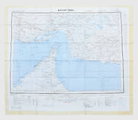
1957182684London: War Office; Printed for D. Survey WO and AM by Balding and Mansell Ltd 1957. A bright example of this detailed Gulf map Classified "restricted" and issued for military use at the time of the Jebel Akhdar War this double-sided sheet shows much of the modern-day UAE extending northwards from the latitude of Abu Dhabi and the Buraimi Oasis as well as the eastern Arabian Peninsula from the Trucial Coast to Jubail. As with other contemporary GSGS maps the sheet covers six degrees of longitude and highlights towns of significance and other standout features for example oil pipelines and wells water systems and roads and railways. Rayon sheet 630 x 710 mm printed both sides in colour folded as issued. A fine example. unknown
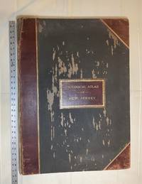
1889028277New York: Julius Bien & Co 1889. Condition of the binding is only Fair with pest damage. Leather over the spine has perished. Front and rear outer hinges cracks have been neatly reinforced with high quality clear flexible glue. Inner hinges are OK having been reinforced by the publisher/bookbinder with sturdy maroon cloth. SEE PHOTOS. Condition of all maps is NEAR FINE - FINE. NO foxing or toning. Pages are clean and unmarked. SEE PHOTOS. Includes a title page map of New Jersey Key to the System of Mapping and 19 linen-backed double page maps. Collated and complete per table of contents -- SEE PHOTOS. The maps are lithographically printed in blue red yellow and black. The double page maps open to an impressive 26.50" across by 36.50" tall. No year of publication is stated but Phillips 2149 in A LIST OF GEOGRAPHIC ATLASES Vol. 1 says 1889. The maps themselves are variously dated up to 1888. Titles of Sheets: No. 0. New Jersey State Map Geographic; No. 1. Kittatinny Valley and Mountain No. 2. Southwestern Highlands; No. 3. Central Highlands; No. 4. Northeastern Highlands; No. 5.Vicinity of Flemington; No. 6. Valley of the Passaic; No. 7. The Counties of Bergen Hudson Essex No. 8. Vicinity of Trenton; No. 9. Monmouth Shore; No. 10. Vicinity of Salem No. 11. Vicinity of Camden; No. 12. Vicinity of Mount Holly; No. 13. Vicinity of Barnegat Bay; No. 14. Vicinity of Bridgeton; No. 15. Southern Interior; No. 16. Egg Harbor and Vicinity; No. 17. Peninsula of Cape May; Unnumbered map. "New Jersey from Original Surveys based on the Triangulation of the U.S. Coast and Geodetic Survey Relief Map." Scale of first and last doublepage maps: 5 miles to an Inch. Scale of maps No. 1 to No. 17: 1 mile to an Inch. Bound in black pebble-grain cloth with gilt-stamped brown leather title label leather spine and corners leather backstrip has perished. SEE PHOTOS. The textblock could be easily rebacked or recased with no re-sewing required since all pages/maps are still securely bound together. Oversize Hardcover. 19.50" wide by 27" tall. This massive extremely heavy book will require SUBSTANTIAL extra postage at our cost based on your location. LeGear ATLASES OF THE UNITED STATES L5609. See also Schwartz and Ehrenerg's THE MAPPING OF AMERICA pp. 310-311. Phillips 2149. This massive extremely heavy book will require SUBSTANTIAL extra postage at our cost based on your location. Second Edition. Oversize Hardcover. Fair - FINE condition. Illus. by NOT a library discard. Atlas folio. Great Packaging Fast Shipping. Julius Bien & Co Hardcover
1584Map1002Cologne: Goldefridi Kempensis 1584. 2nd Edition . No Binding. Fine. Folio. AN ORIGINAL MAP. Original hand colouring. 47x40cms Folding double page.PLEASE EMAIL FOR PHOTOS. <br/> <br/> Goldefridi Kempensis unknown
1799TS431Paris: De L'imprimerie De La Republique 1799. 1st Edition . Hardback. Fine. quarto. Pendant Les Annees 17901791et 1792 par Etienne MARCHAND; precede d'une introduction historique auquel on a joint des recherches sur les terres Australes de DRAKE et un examen critique du .ii viii 158pp Tables 141-158pp. 15 fine condition plates complete. 30cm The title-page has a contemporary printed slip pasted over the volume number reading 'Tome Sixieme'. This is because the 4 volume quarto issue and the six volume octavo edition were published at the same time and both used the same quarto last volume offered here. The 15 plates are all as called for and in printed on thick paper and all in fine condition The World map is particularily attractive. PLEASE EMAIL FOR PHOTOS. NB An VIII was the result of the date changing to Year 0 in post-revolution France and spans the old years of 1799-1780. Original half calf binding with the distinctive brown 'marbled' boads and gilt decorative spine similar to the copy in the National Library of France. Rather worn and splits but the contents fine. LISTE DES CARTES. No I. Carte générale. World map No 2 . Fragmeiu de la Carie rcduiie d'une partie de I'Ameriqu Septentrionale par le Capitaine John AIeares. No 3. Carie Systéinaiique d'une partie de I'Amerique du nord-Ouest pour l'intelligence des Découvertes de l'Amiral de Fuente par J. N. De L'Isle 1752. N0 4. Deux Cartes sur la même feuille des Marques as de Mendoça déco-'vertes en 1595 par Mendana et des îles de la Révolution découver en 1791 par le Capitaine Marchand. No 5. Échasses de WahÎtahô ou Santa-Christin a une des Mar- quesas de Mendoça vues de face et de profil grandeur de moitié. No 6. Carte des îles de la Révolution situées dans le Nord-Ouest des Marquesas de Mendoça. Levée ar le Capitaine Prosper Chanel en 1791. No.6b Copie de la Carte du Groupe DU Nord-Ouest des Mar- quesas De Mendoça nommé par les Anglais en 1792 Mergest's Islands telle qu'elle a été publiée par Vancou v ER en 1798 dans la Relation de son Voyage. No 7. Partie Orientale de la Carte de Tupia. N.B. La Carte de cet Insulaire de l'Archipel de LA SOCIÉTÉ présente les Iles Équinoxiales du Grand Océan. No 8. Plan de la Baie de Tchinkitane la Baya de Guadalupa des Espagnols en 1775 et Norfolk-Bav des Anglais en 17S7 située à la Côte du NoRD-OuEST de I'Amerique par 57 4.' de Latit. N. Levée en 1791 par le Capitaine Prosper Chanal. No9. Esquisse de Cloak-Bay et du Détroit de Cox à 54 10' de Latit. N. Iles de ueen-Charlotte Côte du Nord-Ouest de I'Amerique. Par le Capitaine Prosper Chanal en 1791. No 10. Carte réduite d'une partie de la Côte Occidentale d'une des îles de Queen-Charlotte. Levée en 1791 par le Capitaine Prosper Chanal. No 11 Carte comparative des Iles Sandwich et du Groupe de la Mesa qui se voit sur la Carte du Galion de Manille. No 12 Carte gtiicrale du Détroit d'entre Banca et Bil'.iton comprenant les Detroit de Gaspar et de Cléments depuis la Pointe Pesant de Banca au Nord jusqu'aux îles de la. Reconnoissance au Sud. No13 Carte particulicre des mêmes dtroits sur une Échelle plus gr.mde. No 14 Carte du Détroit de Magellan Magalhaens et de la Tierra Del Fuego pour l'intelligence sur les Recherches des Terres Australes de Drake. No15. Carte d'une partie du Grand-Océan Équinoxial pour l'intelligence de YLxamen critique des Relations du Voyage. The Atlas volume of the account of the second French circumnavigation and the first French commercial voyage to the PacificNorth West. <br/> <br/> De L'imprimerie De La Republique hardcover
1780Map724Bassano Del Grappa: Giovanni Remondini 1780. 1st ediiton . No Binding. Fine. Folio. ND c1780. 36 x 50cms. Original hand-colour. Dusty condition. Very rare town view of Marseille engraved by the Venitian Francesco Ambrosi 1713-173. A numbered key in French to the lower margin of places of interest in the city 1-19. A dark impression printed on heavy paper with a strong plate mark and clear chain lines but no watermarks. <br/> <br/> Giovanni Remondini unknown
1963153757London: Geographical Section General Staff 1963. Scarce charts of Bahrain and the Straits of Hormuz A rare and historically interesting pair of adjacent maps of the Arabian Gulf covering six degrees of longitude each the geographical area encompassing the whole of Qatar Bahrain and part of what was to become the United Arab Emirates Al-Hofuf being the major city in the Al-Ahsa Oasis Eastern Province Saudi Arabia; sixth and fifth editions respectively. Maps of the period issued by the GSGS Geographical Section General Staff use a 7-colour tint scale to distinguish altitude and a glossary that highlights towns of significance and other standout features which provided steady references for army personnel to aid navigation in the challenging conditions of the region. The Bander Abbas map was compiled by the US Army Map Service Corps of Engineers from a number of sources including USAF Aeronautical Approach Charts of 1951-55 and the US Geological Survey of the Arabian Peninsula 1958. The Hofuf chart is based inter alia on 512 Field Survey Royal Engineers charts 1942-4. WorldCat lists just three individual copies for Hofuf NG39 SUNY at Buffalo University of Notre Dame and Eastern Illinois University alongside four copies of Bandar Abbas NG40 University of Exeter University of Notre Dame Eastern Illinois University and University of South Florida. It should be noted that major national institutions - BL for example - will have holdings of these maps within the complete GSGS series. Most copies would be discarded on supersession making these an important record of cartographic progress in the region. Two two-colour printed maps 1:1000000 scale 690 x 610 & 750 x 610 mm respectively. Ex- libris stamp of Arizona State Library both stamped "superseded" in blank margin and "withdrawn" on verso some pencilled marginalia; both in excellent condition. unknown