5 783 résultats
11075Paris, Dezauche, 4 cartes géographiques horizontales, réhaussées en couleurs, de 165 x 48.5 cm., entoilées sur un beau tissu saumon, au format plié de 14 x 21.5 cm., chacune avec l'étiquette de Goujon (marchand de géographie ancienne et moderne) contrecollée, languette de vélin portant le nom des cartes. Emboîtage en bois imitant la forme d'un volume in-4, demi-veau blond, dos lisse orné de décors dorés, étiquettes de titre ("Zélande") et tomaison noires avec décors dorés, plats saumon encadrés de roulettes dorées avec "Bibliothèque V. Perdonet" en lettres dorées au premier plat. Quelques frottements à l'emboîtage, les cartes étant quant à elles en parfaite condition.
177111076[Narbone?], sans nom, 1771-1774. 2 volumes comprenant 14 cartes géographiques en noir réparties comme suit: Volume I: 7 cartes (Carte générale du Canal: 3 cartes, deux horizontales au format 92.5 x 53 5, la 3e 46 x 43.5 cm. - Carte des rivières, ruisseaux, et rigoles: 4 cartes au format 59.5 x 76). Volume II: 7 cartes au format 90.5 x 57 cm. Première carte : 3e partie, N° 9. Les cartes sont entoilées, présentées pliée, chacune avec une languette de vélin portant le nom de la carte. Emboîtages cartonnés imitant la forme de livres in-8, demi-veau moucheté, dos lisses ornés de fleurons dorés, étiquettes de titre bordeaux avec encadrements dorés. "Bibliothèque V. Perdonet" en lettres dorées au bas des dos. Étuis un peu frottés, quelques piqûres aux toiles, rares rousseurs sur les cartes.
181520379circa 1808-1815. Grande carte murale, eau-forte imprimée sur papier vergé, découpée en 64 rectangles (8 par feuilles) montés sur toile de lin (138,5 x 144 cm.), rempliée et sous étui.
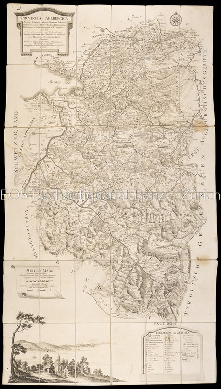
17831804AGWien, Johann Ernst Mansfeld, 1783. Kupferstichkarte, gestochen von Johann Anton Pfaundler. 115 x 66 cm.
Rara carta geografica raffigurante la città di Tunisi con l’antica Goletta e le coste settentrionali del Nord Africa, con le rovine di Cartagine. Esemplare nel quarto stato, stampato a Roma dall’editore Giovanni Orlandi nel 1602.La carta è priva del titolo, ma reca una estesa legenda, con la data e la firma dell’autore:“Benigni Lettori, per rappresentarui piu particulari della Città di / Tunesi, holla tenuta alquanto piu larga di quello che importa la / pianta di essa Città secondo la mesura, ò scala delli miglia, laquale / solamente ui seruirà à sapere le distantie da un luogho all'altro: / Piu altra i monti che sono alla sinestra dello stagno per la loro asprez= / za no[n] si possono cultiuare, le Colline alla destra sono tutti fruttifere, / lo stagno non è nauigabile se no[n] per lo canale. La Torre appresso la Go= / letta è per la difesa de' pozzi da quali si ha l'acqua per uso della Città: / Le Mura che abbracciano i borghi sono di altezza di tre braccia, / et debolossime, et solo fatte per reparar all'improuiso assalto de gli / Arabi; Bardo, Mescia, et Restabia sono serragli del Re: jl Borgo / Rabat è habitato da Soldati Christiani: jl Borgo Nifet da gli Arabi: / jl Mercator del bestiame si fa nella piazza appresso la Meschita: / La Piazza de' Christiani è alli Magazeni: il porto appresso le ruine / di Cartagine è quasi ripieno, et no si usa piu: / Venetijs ex æneis formis Bolognini Zalterij / Anno . M . D . LXVI”.Bell’esemplare, in coloritura antica, applicato su antico supporto di collezione, con piccoli margini, minime abrasioni, per il resto perfetto stato di conservazione. Rare map showing the city of Tunis with the old Goletta and the northern coasts of North Africa, with the ruins of Carthage. A very rare example of the third state, printed in Rome by Giovanni Orlandi in 1602. The original edition by Zaltieri is printed in Venice; thi is one of the few plates that was printed by both of the leading publishers town of Italy.Fine example, in ancient colouring, laid down on a collection cardboard, with small margins, minimum abrasion, otherwise perfect condition. Tooley 558.
Carta geografica incisa in rame (cm. 48,5x57,5 e margini) con bellissima colorazione coeva. Classica carta eseguita sul modello dei portalani. In De Wit si combinano magistralmente la precisione geografica e il dettaglio artistico. Gli Olandesi apprezzavano molto anche il fattore estetico e l'incantevole gusto decorativo di Wit fu un ulteriore elemento per il suo successo. Dopo la morte di De Wit e di suo figlio, le lastre vennero acquistate da Louis Renard, che le diede di nuovo alle stampe con un suo testo. Reiner e Josua Ottens ristamparono l'atlante di Renard nel 1739 con testo in francese e di nuovo nel 1745 con testo in olandese e i loro nomi incise sulle lastre per la prima volta.. .
Very Good Turkish, Ottoman (1500-1928) Original b/w map from Kitab-i Cihannuma which is one of the most important Turkish incunabula. Oblong large 4to. (31 x 37 cm). In Ottoman script. It shows Venice and Venetian Bay and Algerian shores at North Africa (Maghrib). Toponyms are in Turkish with Arabic letters. Written directions (Simal, Cenûb, Sark and Garb) on corners of the map, and decorative compass on Mediterranean Sea. Scale can be seen at left upper side (El-mikyas: Mil-i Islâmiyân Mil-i Frençe, and Mil-i Italiya]. It's one of the thirteen maps and plates from the book of Cihannuma. The story of Cihannuma can be considered as an effort to keep up with the speed that knowledge spread around the world at a time when literacy was highly limited. Kâtip Çelebi began to rewrite Cihannuma in 1654. During the next six years, he added to his books the knowledge he gained from the books he read. Kâtip Çelebi was vastly influenced by nonreligious positive knowledge, especially by the Atlas and later the Atlas Minor of Gerardus Mercator. He had the book translated from Latin to Turkish by a French recruit andenriched his own book with the new information. He brought together in Cihannuma the knowledge of geography and astronomy existing in Western sources (1654). Cihannüma has 13 charts and 27 maps. Mercator's maps are distinguished by their distinct properties. However, there are such maps which depict Istanbul, Anatolia, the Caucasus and the Orient that have to have been borrowed from other sources and there are those with relatively less detail that might have been prepared by Muslim geographers. Sources cite Ahmed El Kirimî (Ahmed the Crimean) and Galatali Migirdich as mapmakers for Cihannüma. Their names are placed on the maps. Another name that is mentioned is Tophaneli Ibrahim. Researchers agree on the fact that he is Ibrahim Müteferrika. Perhaps he wished to hasten the printing of the book. Perhaps he enjoyed making this contribution to a book he half owned. There is one map in Cihannüma which definitely does not belong to Mercator. Nor is there any information that it was originally charted by Müteferrika's team. Historians state that the 'invertedness' can be found in other maps made by Muslim cartographers. Since it is amap of Turkey, the difference can easily be perceived. The Mediterranean coasts of Turkey are at the top of the map while the Black Sea coasts are at the bottom. The compass on the map correctly indicates the North. The map seems to be inverted but it is not considered scientifically wrong to draw maps in this fashion...". (Source: Boyut; Kitab-i Cihannuma). Extremely rare.
(370 X 300) mm dimensione della tavola. (157 X 252) mm dimensione della veduta. Filigrana con lettera B sormontata da giglio. Incisore anonimo. Proviene da "La Cosmographie universelle de tout le monde". Belle Forest Francois (1530-1585). Cassini N.21: "La pianta è inserita in una sontuosa cornice architettonica, ricca di elementi araldici, putti, animali, ecc. In alto, al centro in caratteri tipografici "Pourtraict de la magnique Citè de Venise". Nell'interno della cornice e al di sopra della pianta:"Venise". Lungo il lato inferiore, entro il riquadro, 71 rimandi in italiano, segnati da lettere. Al centro del lato sinistro della cornice, entro uno scudo, il monogramma dell'editore Nicolas Chesneau che esercitò pure l'attività di incisore in alcune opere uscite a Parigi tra il 1556 e il 1583. Al centro del lato opposto, entro uno scudo, il monogramma di un artista ignoto, probabilmente un disegnatore tedesco della seconda metà del XVI secolo." Moretto N. 31.
Prima edizione molto rara, completa delle 16 pagine di aggiunte dopo la pagina 324, che quasi mai si riscontrano negli esemplari. Choix 21206; Lozzi I, 2955; Moreni I, 171: "questa edizione che oggi può esser detta rarissima". 2 parti in 1 volume in 4to, mm 235x180. Pagine XX, 340; 99, 1 bianca + 1 tavola fuori testo più volte ripiegata. Esemplare perfetto, in barbe e parzialmente intonso. Legatura coeva in cartonato con titolo manoscritto al dorso. Codice inv.1031036
Nella parte inferiore della tavola troviamo il titolo: Il vero ritrato della Forteza di Bichat asituata in mezo del Fiume Una in Crovatia asediata da Turchi il mese de Giugno 1592. Nell’angolo in basso a sinistra si legge: Intagliata per Gioanbatista de Caualleri in Roma 1592. Orientazione con simboli e lettere iniziali dei venti, il nord-est è in alto. La pianta prospettica fu realizzata in occasione dell’assedio turco alla città di Bihać (nell’attuale Bosnia), del giugno del 1592. All’epoca, Bihać era l’ultima fortezza che l’Austria possedeva ancora sul fiume. La città cadde sotto la giurisdizione della corona, quando fu eletto re di Croazia Ferdinando d’Asburgo, nel 1527; data la sua posizione prossima al confine con i territori conquistati dai Turchi, il governatore del re pose un Capitano nella fortezza. Già dal 1591 con l’arrivo del generale Hasan Pasha Predojević, la tensione ai confini tra Croazia e Impero Ottomano era aumentata, nonostante l’anno precedente fosse stata rinnovata la tregua tra Rodolfo II d’Asburgo e il sultano Murad III. Hasan radunò un esercito per attaccare la Croazia; dopo il fallimentare attacco di Sisak dell’agosto del 1591, nel maggio del 1592 con un esercito di 5.000 uomini e numerosi cannoni, mosse alla volta di Bihać. La fortezza era difesa dal generale Joseph Lamberg, che aveva a disposizione un numero esiguo di soldati. Gli aiuti richiesti non arrivarono, e il 14 giugno iniziò il bombardamento della città: dopo 10 giorni di sanguinosi bombardamenti, la fortezza fu conquistata e divenne la più importante roccaforte dell’impero ottomano della Bosnia Erzegovina. Come si evince anche da questa pianta, la città era ben fortificata, con le sue doppie mura, le sue torri quadrate e circolari e la difesa naturale costituita dall’acqua del fiume Una che la circondavano. Giovan Battista de Cavalleris sembra essere in questo caso sia l’incisore che l’editore della lastra. Acquaforte e bulino, stampata su carta vergata coeva, con margini, in perfetto stato di conservazione. Opera rarissima conosciuta in pochissimi esemplari (cfr. Bifolco-Ronca p. 1305) Bibliografia Bifolco-Ronca, Cartografia e topografia italiana del XVI Secolo (2018): p. 1305, Tav. 570; Christie’s (2012): n. 70; Ganado (1994): VI, n. 40 & p. 210, n. 12; Tooley (1939): n. 137. A medium-high oblique view of the siege of the Imperial fortress of Bihać by the Turks, commanded by Telli Hasan Pasha (Hasan Predojević; ca 1530-22 June 1593), resulting in a Turkish victory. Ottoman-Habsburg Wars: The Long War (1591/3-1606). Oriented with north-east to top. Orientation is indicated by a boldly engraved arrow for north, and the letters O[riens], P[onente], and L[evante] which are written to the edges of the sheet. In response to the refusal by Rudolf II to pay the annual tribute to the Sultan, the Turks, commanded by Hasan Pasha, responded by taking the last imperial fortress of Bihać in June 1592. It became the westernmost Turkish acquisition, prompting the recently elected Pope Clement VIII to propose the formation of a league against the Turks. It was reported that the Turks killed 5,000 Christians and abducted 800 children when they took the city.
Serie di 28 tavole incise in rame di mm 545 x 405 su carta di cellulosa a comporre una grande carte dell'Italia di mm 1980 x 2500. Confini acquarellati a mano. Ottimo esemplare. Questa notevole carta venne dedicata dall'editore ad Adriano Balbo.
Nel cartiglio a forma di nastro posto nel mare, è inciso il titolo: ANCONA. Lungo il margine inferiore, distribuita su undici colonne, troviamo una legenda alfanumerica (A-Z, AA-RR e 1-45) con rimandi a luoghi e monumenti notabili. Segue l’imprint Romae Claudij Ducheti formis 1585 e la firma Ambrosius Bram. fe. Orientazione fornita da una rosa dei venti nel mare, il nord è a sinistra. Pianta prospettica della città di Ancona incisa da Ambrogio Brambilla per l’editore Claudio Duchetti. Si tratta di una replica, di formato ridotto, dell’opera di Giacomo Fontana. Le sole modifiche riguardano l’assenza del cartiglio con la dedica, in alto a destra, rimpiazzato da due golette, e l’aggiunta di tre voci nella legenda. Nipote di Antonio Lafrery, Claude Duchet o Duchetti ne eredita il patrimonio cartografico in lastre e prosegue l’attività di editore dello zio, morto nel 1577, incrementando la serie di piante e carte a stampa. Duchetti incaricò il suo principale collaboratore, l’incisore milanese Ambrogio Brambilla, di realizzare una copia della carta del Fontana, della quale perse il possesso nella divisione ereditaria tra lui e il cugino Stefano. L’opera viene stampata per la prima volta proprio nell’anno della scomparsa di Claudio Duchetti (1585) e la lastra fu ereditata da Giacomo Gherardi. Possiamo identificarla con l’Ancona, n. 431 dell’inventario della vedova di Gherardi, Quintilia Lucidi del 17-19 ottobre 1598. La matrice, nel 1602, venne acquisita da Giovanni Orlandi che la ristampò inalterata con la sola aggiunta del proprio imprint. Acquaforte e bulino, 1585, firmata in lastra dall’editore. Esemplare del secondo stato di due recante l’indirizzo di Giovanni Orlandi, e la data Roma 1602. Magnifica prova, impressa su carta vergata coeva, con margini, in ottimo stato di conservazione. Bellissimo esemplare di questa rara pianta. Bibliografia Bifolco-Ronca, Cartografia e topografia italiana del XVI secolo, p. 2120, tav. 1075, II/II; Bonasera (1979): p. 87, n. 17; Cartografia Rara (1986): n. 7; Christie’s (1998): n. 1078; Christie’s (2012): n. 54; Destombes (1970): n. 67; Ganado (1994): II, n. 94 & III, n. 119 & VI, n. 65 & p. 213, n. 57; Shirley (2004): III, n. 3; Sotheby’s (2000): n. 238; Marinelli (1902): p. 160; Pagani (2012): p. 82; cfr. Rubach (2016): p. 264; Tooley (1939): nn. 107, 109; Tooley (1983): n. 109a. Perspective plan of the city of Ancona engraved by Ambrogio Brambilla for the publisher Claudio Duchetti. This is a replica, in a reduced format, of the work of Giacomo Fontana. The only changes are the absence of the cartouche with the dedication, at the top right, replaced by two schooners, and the addition of three entries in the legend. Grandson of Antonio Lafrery, Claude Duchet or Duchetti inherited the cartographic heritage in plates and continued the activity of publisher of his uncle, who died in 1577, increasing the series of plants and maps in print. Duchetti commissioned his main collaborator, the Milanese engraver Ambrogio Brambilla, to make a copy of Fontana's map, of which he lost possession in the hereditary division between him and his cousin Stefano. The work was printed for the first time in the year of Claudio Duchetti's death (1585) and the plate was inherited by Giacomo Gherardi. Etching and engraving, 1585, signed on the plate by the publisher. Specimen of the second state of two bearing the address of Giovanni Orlandi, and the date Rome 1602. Magnificent proof, printed on contemporary laid paper, with margins, in excellent condition. Bibliografia Bifolco-Ronca, Cartografia e topografia italiana del XVI secolo, p. 2120, tav. 1075, II/II; Bonasera (1979): p. 87, n. 17; Cartografia Rara (1986): n. 7; Christie’s (1998): n. 1078; Christie’s (2012): n. 54; Destombes (1970): n. 67; Ganado (1994): II, n. 94 & III, n. 119 & VI, n. 65 & p. 213, n. 57; Shirley (2004): III, n. 3; Sotheby’s (2000): n. 238; Marinelli (1902): p. 160; Pagani (2012): p. 82; cfr. Rubach (2016): p. 264; Tooley (1939): nn. 107, 109; Tooley (1983): n. 109a.
1720973DGNürnberg, J.B. Homann, ca. 1720. Altkolorierter Kupferstich. Bildformat: 56 x 65 cm. Blattformat: 51 x 60 cm. + Wichtig: Für unsere Kunden in der EU erfolgt der Versand alle 14 Tage verzollt ab Deutschland / Postbank-Konto in Deutschland vorhanden +, 973DG
LA GUERRA DELL'INTERDETTO Rara pianta prospettica della città incisa da Georg Keller nel 1607. La tavola è pubblicata nella Relationis Historicae Semestralis Continuatio… del 1607. L’opera, meglio conosciuta anche come “Messrelationen”, edita a Francoforte a partire dal 1591, veniva stampata in occasione delle fiere di primavera ed autunno, per fornire notizie sui principali avvenimenti internazionali il cui autore era Jacobus Francus, uno pseudonimo usato da diversi scrittori, inclusi Conrad Lautenbach e Conrad Memmius. “Georg Keller di Francoforte fu uno dei maggiori interpreti del cambiamento di gusto grafico della fine del ‘500, quando l’illustrazione eseguita su piastra di rame prese il sopravvento sulla silografia. Le sue numerose vedute di città risalgono senza eccezioni a modelli precedenti e spesso stranieri” (cfr. Cassini, Piante e vedute prospettiche di Venezia, 1970, p. 69). “La pianta della città con numerosi toponimi si rifà alle piante prospettiche della fine del XVI secolo riprendendo i motivi iconografici della pianta prospettica di F. Hogenberg. L’estensione nella raffigurazione della terraferma che comprende a sud la foce dell’Adige e del Po deriva dalla pianta di C. Stimmer. G. Keller (1568-1634) fu autore di numerose vedute di città incise a Berlino su lastre di rame” (cfr. Romanelli-Biadene, Venezia, Piante e Vedute, 1982 p. 37, n. 24). “Nella parte superiore è illustrato un trasferimento militare. Nella parte inferiore fa bella mostra una vistosa parata di navi” (cfr. Moretto, Venetia, Le immagini della Repubblica, 2001, p. 114, scheda 49). Come correttamente affermato da Moretto, rispetto alla tradizionale iconografia della città, la pianta presenta la raffigurazione di “elementi” militari. Come detto, la pianta è inserita nelle “Messerelationen”, ed è quindi una cosiddetta carta d’occasione, nata per descrivere un determinato avvenimento. In questo caso l’opera viene realizzata per documentare la cosiddetta guerra dell'interdetto (1606 – 21 aprile 1607). Fu una vertenza fra la Repubblica di Venezia e lo Stato Pontificio, scoppiata nel 1606 a causa dell'arresto a Venezia di due preti cattolici accusati di reati comuni e dell'adozione da parte della Serenissima di una serie di leggi volte al contenimento della proprietà ecclesiastica. Il pontefice Paolo V (1605 - 1621) minacciò di porre l'interdetto sulla città, ossia di colpirla con una sorta di scomunica collettiva che avrebbe posto Venezia al di fuori della Chiesa, impedendo ogni forma di amministrazione dei sacramenti: l'ultimatum papale fu respinto e il Papa mise in atto quanto aveva minacciato. Grazie alla mediazione della Francia, tuttavia, si giunse ad un compromesso: Venezia fu liberata dall'interdetto. Il foglio è pubblicato nella Relationis Historicae Semestralis Continuatio, Jacobi Franci Historische Beschreibung aller Denckwürdigen Geschichten, so sich hin und wider in Europa, Hoch- und Nider Teutschland, auch in Franckreich. L’opera, meglio conosciuta anche come “Messrelationen”, edita a Francoforte a partire dal 1591, veniva stampata in occasione delle fiere di primavera ed autunno, per fornire notizie sui principali avvenimenti internazionali. Le prime edizioni della raccolta erano firmate a nome di Jacobus Francus, che era lo pseudonimo usato da diversi scrittori, inclusi Conrad Lautenbach e Conrad Memmius. Una Messrelation era una pubblicazione stampata in occasione delle fiere del libro di Francoforte e Lipsia (le più grandi d'Europa all'epoca) che riportava notizie sulle novità politiche e militari dall'ultima fiera. Le Messrelationen sono viste come precursori dei moderni giornali, poiché furono i primi mezzi di informazione stampati ad essere pubblicati periodicamente. Lo studioso austriaco Michael von Aitzing (ca. 1530-1598) è comunemente considerato il loro inventore, avendo pubblicato per la prima volta una Relatio Historica (stampata a Colonia... THE WAR OF THE INTERDICT Rare perspective map of the city engraved by Georg Keller in 1607. The plate is published in the Relationis Historicae Semestralis Continuatio... of 1607. The work, also better known as "Messerelationen" published in Frankfurt beginning in 1598, was printed at spring and autumn fairs to provide news of major international events whose author was Jacobus Francus, a pseudonym used by several writers, including Conrad Lautenbach and Conrad Memmius. "Georg Keller of Frankfurt was one of the major interpreters of the change in graphic taste at the end of the 1500s, when illustration executed on copperplate took over from silography. His numerous views of cities go back without exception to earlier and often foreign models" (cf. Cassini, Piante e vedute prospettiche di Venezia, 1970, p. 69). "The plan of the city with numerous place names refers to the perspective plans of the end of the sixteenth century taking up the iconographic motifs of the perspective plan of F. Hogenberg. The extension in the depiction of the mainland, which includes the mouth of the Adige and the Po to the south, is derived from the plan of C. Stimmer. G. Keller (1568-1634) was the author of numerous views of cities engraved in Berlin on copper plates" (cf. Romanelli-Biadene, Venezia, Piante e Vedute, 1982 p. 37, n. 24). "In the upper part a military transfer is illustrated. In the lower part a showy parade of ships is on display" (cf. Moretto, Venetia, Le immagini della Repubblica, 2001, p. 114, plate 49). As correctly stated by Moretto, compared to the traditional iconography of the city, the map presents the representation of military "elements". As mentioned, the plan is included in the "Messerelationen", and is therefore a so-called "occasion" map, created to describe a specific event. In this case the work is made to document the so-called war of the interdict (1606 - April 21, 1607). It was a dispute between the Republic of Venice and the Papal State, which broke out in 1606 because of the arrest in Venice of two Catholic priests accused of common crimes and the adoption by the Serenissima of a series of laws aimed at the containment of ecclesiastical property. The pope Paul V (1605 - 1621) threatened to put an interdict on the city, that is to say to strike it with a sort of collective excommunication that would have placed Venice outside the Church, preventing any form of administration of the sacraments: the papal ultimatum was rejected and the Pope put into effect what he had threatened. Thanks to the mediation of France, however, a compromise was reached: Venice was freed from the interdict. The sheet is published in the Relationis Historicae Semestralis Continuatio, Jacobi Franci Historische Beschreibung aller Denckwürdigen Geschichten, so sich hin und wider in Europa, Hoch- und Nider Teutschland, auch in Franckreich. The work, also known as "Messerelationen", published in Frankfurt since 1598, was printed on the occasion of spring and autumn fairs, to provide news about major international events. Early editions of the collection were signed in the name of Jacobus Francus, which was the pseudonym used by several writers, including Conrad Lautenbach and Conrad Memmius. A Messrelation was a print published in the 16th to 18th century for the book fairs in Frankfurt and Leipzig (the largest in Europe at their time) which reported news about political and military news since the last fair. Messrelationen are seen as precursors to modern newspapers as they were the first printed news media to be published periodically. The Austrian scholar Michael von Aitzing (ca. 1530–1598) is commonly seen as their inventor, having published for the first time a Relatio Historica (printed in Cologne) at the autumn 1583 book fair in Frankfurt, in which he related the events in the Low Countries since February 1580. This was a huge success and from 1588 Aitzing published his "relations" twice a year, for the Easter book fair ...
ORD-12168Etabli d'après les ordres de Mr le Directeur Général des Postes et des Télégraphes Sous la direction de Mr Jacquez, Bibliothécaire de l'Administration Par Adh. Kermabon, Commis principal des Postes et des Télégraphes. Paris. 1892. In-plano (360 x 502 mm) cartonnage rouge d'éditeur imprimé et orné en noir, gardes bleues, 3ff., 48 cartes planimétriques en couleurs, montées sur onglets et très grande carte (ca 428 x 770 mm) des lignes télégraphiques aériennes de France 1793-1852. Mors du 1er plat fendu sur 21 cm, planche 33 (Gironde entièrement et uniformément brunie, sinon bel exemplaire malgré de tout petits défauts. De toute rareté.
Prototipo delle piante a volo d’uccello della città, commissionato da Angelo Rocca, disegnato da Ercole Ramazzani ed inciso da Giacomo Lauro nel 1594. L’opera viene dedicata al Cardinale Rastucci. In basso, a sinistra, lo stemma di Rocca Contrada, in basso a destra lo stemma di Angelo Rocca. Esemplare di secondo stato, con la data 1608, che reca in alto lo stemma del Cardinale Bandini, nuovo dedicatario. “Nel 1594 l’autorevole Angelo Rocca (1545-1620), agostiniano vescovo di Tagaste, biblista e bibliofilo, nativo di Rocca Contrada (oggi Arcevia), commissiona per motivi celebrativi un suo rilievo al pittore Ercole Ramazzani, arceviese, allievo di Lorenzo Lotto” (cfr. Giorgio Mangani, Geopolitica del paesaggio, p. 71). La città di Rocca Contrada, oggi Arcevia, nella Diocesi di Senigallia, quindi parte del Ducato di Urbino, ma in qualche maniera sottoposta al controllo pontificio, nonostante le sue modeste dimensioni, svolse, soprattutto tra XV e XVI secolo, un certo ruolo nel controllo di un'area collegata all’accesso della strada per Roma. Per questo motivo era stata fortificata e risultava come luogo "inespugnabile" nelle trattazioni corografiche e geografiche, che ne lodavano il clima e si cimentavano con costante ripetitività nell'interpretazione etimologica del nome geografico. È probabile, tuttavia, che la città non avrebbe avuto l'attenzione cartografica che invece ha avuto, se uno dei suoi più autorevoli figli, lo studioso agostiniano Angelo Rocca (Rocca Contrada, 1545 - Roma 1620), filologo, biblista e, dal 1605, vescovo di Tagaste, grande collezionista di libri che furono al l'origine della biblioteca Angelica di Roma, che da lui prende il nome, non avesse commissionato, al pittore locale Ercole Ramazzani (Rocca Contrada, 1530-1598), un disegno della città. Ramazzani, arceviese, lavorava tra Marche e Umbria nello stile del manierismo degli Zuccari con una particolare sensibilità paesaggistica che tradisce evidentemente anche un'attività cartografica e vedutistica, all'epoca naturale complemento dell'attività pittorica. Suo fu infatti il disegno del rilievo di Rocca Contrada commissionato da Rocca ed eseguito nel 1594. Un nuovo stato dell'incisione del 1608 fu invece dedicato a Ottavio Bandini, divenuto cardinale protettore di Rocca Contrada quando era Legato della Marca, succedendo nel 1603 al Rusticucci, dopo la sua morte. Opera rarissima, il cui solo esemplare noto di primo stato (1594) è quello conservato alla Biblioteca Angelica di Roma, fondata proprio da Angelo Rocca. Acquaforte e bulino, impressa su carta vergata coeva con filigrana “ancora nel cerchio con stella”, con margini, piccolo foro di bruciatura nel lato destro, per il resto in eccellente stato conservativo. Bibliografia Anselmo Anselmi, La pianta panoramica di Roccacontrada, oggi Arcevia, disegnata da Ercole Ramazzani nel 1594, in “La Bibliofilía” Vol. 8, No. 10/11 (Gennaio-Febbraio 1907), pp. 366-372. Prototype of the bird's eye view of the city, commissioned by Angelo Rocca, designed by Ercole Ramazzani and engraved by Giacomo Lauro in 1594. The work is dedicated to Cardinal Rastucci. Bottom left, the coat of arms of Rocca Contrada, bottom right the coat of arms of Angelo Rocca. Example of the second state, dated 1608, with the coat of arms of Cardinal Bandini at the top, the new dedicatee. “Nel 1594 l’autorevole Angelo Rocca (1545-1620), agostiniano vescovo di Tagaste, biblista e bibliofilo, nativo di Rocca Contrada (oggi Arcevia), commissiona per motivi celebrativi un suo rilievo al pittore Ercole Ramazzani, arceviese, allievo di Lorenzo Lotto” (cfr. Giorgio Mangani, Geopolitica del paesaggio, p. 71). Rocca Contrada, today called Arcevia, a very small town which in fifteenth and sixteenth centuries experienced a brief period of political and military importance. It is probable, however, that the city would not have had the cartographic attention that it had, if one of its most authoritative sons, the Augustinian scholar Angelo Rocca (Rocca Contrada, 1545 - Rome 1620), philologist, biblical scholar and, from 1605, bishop of Tagaste, great collector of books that were at the origin of the Biblioteca Angelica of Rome, which takes its name from him, had not commissioned a drawing of the city to the local painter Ercole Ramazzani (Rocca Contrada, 1530-1598). Ramazzani, arceviese, worked between Marche and Umbria in the style of the mannerism of the Zuccari with a particular landscape sensibility that evidently betrays also an activity cartographic and vedutistica, to the epoch natural complement of the pictorial activity. His was in fact the sketch of the relief of Rocca Contrada commissioned by Rocca and executed in 1594. A new state of the engraving of 1608 was instead dedicated to Ottavio Bandini, who became cardinal protector of Rocca Contrada when he was Legate of the Marca, succeeding Rusticucci in 1603, after his death. A very rare work, whose only known exemplar of the first state (1594) is the one preserved in the Biblioteca Angelica in Rome, founded by Angelo Rocca himself. Literature Anselmo Anselmi, La pianta panoramica di Roccacontrada, oggi Arcevia, disegnata da Ercole Ramazzani nel 1594, in “La Bibliofilía” Vol. 8, No. 10/11 (Gennaio-Febbraio 1907), pp. 366-372.
11470Genève, sans nom (probablement Pellet), 1781 ; 10 tomes in-12 et Atlas in-4 (1780) ; demi-basane fauve, dos à faux-nerfs dorés, pièces de titre et de tomaison bleu-canard, tranches jaunes ; ON AJOUTE : Atlas : demi-veau glacé vert-Empire, dos décoré de fleurons dorés, titre doré (reliure début du XIXe siècle) ; XII, 452 ; VIII, 516 ; VIII, 471 ; VIII, 391 ; VIII, 352 ; VIII, 404 ; XII, 471 ; 426 ; VIII, 362 ; IV, 447 ; portrait de Raynal par F.G. Lardy en frontispice du tome Ier et 9 frontispices gravés, un à chaque tome, eux aussi par Lardy ; Atlas : (4), 22 pp., (1) f. blanc, 50 cartes dépliantes (49 + 17 bis).
In alto al centro, con caratteri grandi, si legge: THIONVILLE. In basso a sinistra, in un cartiglio di forma rettangolare: Vera Thiomvillae effigies sum, reddita docti Artificis manibus, quam modo Galli tenes, Dum tamen expugnor, cecidit fortissimus ille Stroza Italum Petrus gloria summa ducum. Anno domini. M.D.LVIII Die 22 Iunij. Sulla destra del cartiglio troviamo la firma: Nicolaus Beatrizet Lotaringus incidit: et formis. Orientazione nei quattro lati al centro con il nome dei punti cardinali: SEPTENTRIO, MERIDIES, ORIENS, OCCIDENS, il nord è in alto. Sono invertiti l’est e l’ovest. Pianta prospettica che raffigura la città durante la conquista del duca di Guisa. Possiamo dedurre dalla firma in lastra Nicolaus Beatrizet Lotaringus incidit: et formis, che venga incisa e pubblicata dall’artista lorenese. L’opera sembra essere il prototipo delle stampe dedicate all’avvenimento. L’assedio di Thionville si svolse dal 17 aprile al 23 giugno 1558. Si concluse con la vittoria dell’esercito francese comandato da Francesco di Guisa sull’esercito spagnolo. Il 17 aprile, le prime truppe del signore di Vieilleville arrivano sotto le mura di Thionville per prevenire l’arrivo delle razioni. Il 28 maggio arrivarono anche le truppe del duca di Guisa e Pietro Strozzi, nominato Maresciallo di Francia. Gli spagnoli tentarono di salvare le loro truppe intrappolate a Thionville, ma dopo due fallimenti, abbandonarono il presidio stesso. Il 21 giugno - come riportato nel cartiglio - il maresciallo Strozzi morì in seguito ad una ferita. Il 23 giugno, le truppe francesi presero possesso della città, ma il duca si oppone allo smantellamento delle fortificazioni. La città divenne francese, ma era completamente vuota perché a nessun residente fu permesso di rimanere. L’occupazione di Thionville dei francesi fu breve. Il 2 aprile 1559, Enrico II firma il trattato di Cateau-Cambrésis: Spagna e Francia si restituivano le conquiste fatte l’una a danno dell’altra negli ultimi otto anni, ma la Francia mantenne però Metz, Toul e Verdun. La prima tiratura è quella più diffusa nelle raccolte cinquecentesche. Attraverso un percorso che non siamo riusciti a ricostruire - come analoghe opere del Beatrizet, infatti, l’opera non è elencata nel catalogo Lafreri - la lastra fu acquistata da Giovanni Orlandi che ne realizzò una ristampa (1602) e quindi ceduta al fiammingo van Schoel (1614) autore dell’ultima edizione nota. Bulino, impresso su carta vergata coeva, con margini, in eccellente stato di conservazione. Esemplare del secondo stato di quattro, con l’indirizzo di Giovanni Orlandi e la data 1602. Bibliografia Bifolco-Ronca, Cartografia e topografia italiana del XVI secolo, pp. 1082-1083, tav. 446, II/IV; Destombes (1970): H.I. n. 12; Ganado (1994): p. 211, n. 26; Adhémar (1938): p. 94; Arrigoni-Bertarelli (1932): n. 24; Bartsch (1813): vol. XV, p. 271, n. 106 (TIB 29, p. 374); Bianchi (2003): n. 121; Robert-Dumesnil (1865) vol. IX, p. 178, n. 113. Top center, in large letters, reads: THIONVILLE. In the lower left corner, in a cartouche of rectangular shape: Vera Thiomvillae effigies sum, reddita docti Artificis manibus, quam modo Galli tenes, Dum tamen expugnor, cecidit fortissimus ille Stroza Italum Petrus gloria summa ducum. Anno domini. M.D.LVIII Die 22 Iunij. On the right of the cartouche we find the signature: Nicolaus Beatrizet Lotaringus incidit: et formis. Orientation in the four sides in the center with the name of the cardinal points: SEPTENTRIO, MERIDIES, ORIENS, OCCIDENS, the north is at the top. East and west are reversed. Perspective plan that represents the city during the conquest of the Duke of Guise. We can deduct from the signature on the plate Nicolaus Beatrizet Lotaringus incidit: et formis, which is engraved and published by the artist Lorraine. The work seems to be the prototype of the prints dedicated to the event. The siege of Thionville took place from April 17 to June 23, 1558. It ended with the victory of the French army commanded by Francis of Guise over the Spanish army. On April 17, the first troops of the Lord of Vieilleville arrived under the walls of Thionville to prevent the arrival of rations. On May 28, the troops of the Duke of Guise and Pietro Strozzi, appointed Marshal of France, also arrived. The Spanish tried to save their troops trapped in Thionville, but after two failures, they abandoned the garrison itself. On June 21 - as reported in the cartouche - Marshal Strozzi died following a wound. The 23 June, French troops took possession of the city, but the duke opposed to the dismantling of the fortifications. The city became French, but it was completely empty because no residents were allowed to stay. The occupation of Thionville by the French was brief. On April 2, 1559, Henry II signed the Treaty of Cateau-Cambrésis: Spain and France returned to each other the conquests made to the detriment of the other in the last eight years, but France kept Metz, Toul and Verdun. The first issue is the most common in sixteenth-century collections. Through a path that we have not been able to reconstruct - as similar works of Beatrizet, in fact, the work is not listed in the catalog Lafreri - the plate was purchased by Giovanni Orlandi who made a reprint (1602) and then sold to the Flemish Hendrick van Schoel (1614) author of the last known edition. Engraving, impressed on contemporary laid paper, with margins, in excellent condition. Exemple of the second state of four, with the address of Giovanni Orlandi and the date 1602. Literature Bifolco-Ronca, Cartografia e topografia italiana del XVI secolo, pp. 1082-1083, tav. 446, II/IV; Destombes (1970): H.I. n. 12; Ganado (1994): p. 211, n. 26; Adhémar (1938): p. 94; Arrigoni-Bertarelli (1932): n. 24; Bartsch (1813): vol. XV, p. 271, n. 106 (TIB 29, p. 374); Bianchi (2003): n. 121; Robert-Dumesnil (1865) vol. IX, p. 178, n. 113.
1720973DGNürnberg, J.B. Homann, ca. 1720. Altkolorierter Kupferstich. Bildformat: 56 x 65 cm. Blattformat: 51 x 60 cm.
1957182684London: War Office; Printed for D. Survey WO and AM by Balding and Mansell Ltd 1957. A bright example of this detailed Gulf map Classified "restricted" and issued for military use at the time of the Jebel Akhdar War this double-sided sheet shows much of the modern-day UAE extending northwards from the latitude of Abu Dhabi and the Buraimi Oasis as well as the eastern Arabian Peninsula from the Trucial Coast to Jubail. As with other contemporary GSGS maps the sheet covers six degrees of longitude and highlights towns of significance and other standout features for example oil pipelines and wells water systems and roads and railways. Rayon sheet 630 x 710 mm printed both sides in colour folded as issued. A fine example. unknown
Splendida veduta a volo d’uccello della città, edita a Siena alla fine del XVI secolo. Allievo di Antoine de Lafrery e Claude Duchet, il Florimi si trasferisce a Siena dove inizia la sua fiorente attività di editore fino al 1612. Per le caratteristiche peculiari delle opere del Florimi e per la loro rarità, queste vengono classificate tra le carte di scuola lafreriana. Incisione in rame, in ottime condizioni. Molto rara. Il Florimi (1581-1613), commmerciante di libri e di stampe, fu anche editore. Di origini calabresi, si stabilì a Siena nel 1581, con un negozio in Banchi. La prima testimonianza della sua attività indipendente si ha nel 1589. Nel 1591 pubblicò un libro di schemi per fiori di ricami, a Venezia; la seconda edizione dello stesso venne edita in Siena nel 1593.Nel 1597 pubblicò la Vita di Santa Caterina, incisa da De Jode su opera del Vanni, e la Passione di Cristo, sempre di De Jode su ispirazione di Andrea Boscoli. Pubblicò un grande numero di mappe e soggetti religiosi. Si avvalse dell’aiuto di incisori del calibro di Agostino Carracci, Cornelis Galle, Pieter De Jode e Thomassin. Splendid bird’s eye of the city, printed in Siena during the first years of the XVII century. A pupil of Antoine de Lafrery and Claude Duchet, Florimi moved to Siena where he started his flourishing business as publisher until 1612. Due to the peculiar characteristics of Florimi’s works, and also to their rareness, these are classified among the maps of the lafrerian school. Copper engraving, in excellent condition, very rare. Florimi (1581-1613), book and prints trader, was also a publisher. He was born in the Calabria region but then moved to Siena where he established his shop in Banchi. The first evidence of his independent activity is in 1589. In 1591 he published in Venice a book of schemes to embroider flowers; the second edition of the same book was published in Siena, in 1593. In 1597 he published the Vita di Santa Caterina, engraved by De Jode after Vanni, and the Passione di Cristo, always engraved by De Jode after Andrea Boscoli. Florimi published a great number of maps and religious subjects, helped by famous engravers such as Agostino Carracci, Cornelis Galle, Pieter De Jode and Thomassin. Dimensioni 465x340. Tooley Dictionary p. 216.; Bella, Cartografia Rara p. 32, 24.
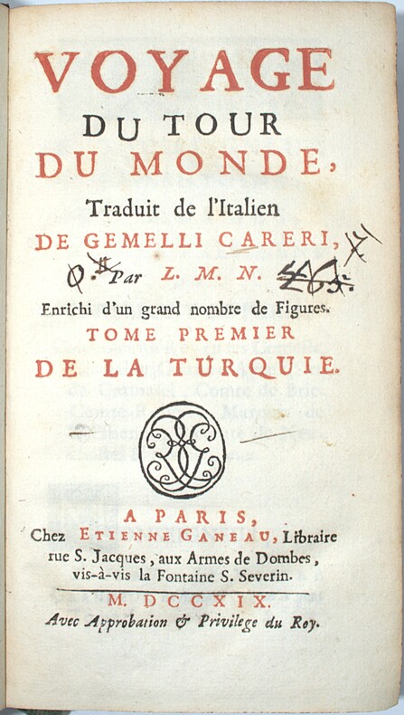
1719PHO-2391Paris, chez Étienne Ganeau, 1719. 6 vol. in-12 (17x9,5cm), 4ff.-xxvii-2ff.-454pp.-5ff. (table), 4ff.-354pp.-3ff., 4ff.-402pp., 4ff.-532pp., 4ff.-374pp., 4ff.-512pp., veau moucheté, dos à nerfs orné avec tomaison et pièce de titre, tranches jaspées, exlibris verso 1er plat, écritures aux titre, dos et charnières frottés, coins usés, petit manque plat tome 1 Édition originale L'illustration entièrement gravée sur cuivre h.-t. se compose d'un frontispice, un portrait, et 60 planches, dont dépliantes. Sabin signale 60 planches sans mentionner le frontispice et le portrait. I ; De la Turquie : Frontispice, portrait, mappemonde, 4 pl. dont 1 dépliante ; II. De la Perse : 3 pl. ; III. L'Indostan, 24 pl. ; IV. De la Chine 8 pl. dont 2 dépliantes ; V. Des Isles Philippines 2 pl. ; VI. De la Nouvelle Espagne, 18 pl. dont 3 dépliantes.
Very Good Turkish, Ottoman (1500-1928) Extremely rare huge chromo-lithograph map in 24 sheets mounted on canvas, showing a large zone including Midyat (Mardin), Mosul, Mt. Cilo (Resko-Buzul) on the southeast; Kahta (Adiyaman), Munzur Mt., Divrigi (Sivas) on the west; the Black Sea on north and Turkish borders to Armenia, Azerbaijan on the east, and to Russia on the northeast. In addition shows in separate little portions, roads, mountains and hills, lakes, and telegraph and post ways and borders in that zone. Not in any libraries and any collection. An attractive map with its huge size and decorative surface. Several toponyms are underlined in red ink. Otherwise a very good example. Original folded map mounted on canvas. 118x112 cm. In Ottoman script (Turkish with Arabic letters). Scale: 1/630.000.
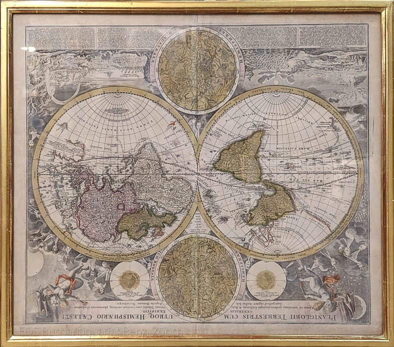
1744Map918London: Eman. Bowen 1744. 1st Edition . Hardcover. Fine. Double hemisphere map of the world with four seated allogorical women in each corner of the plate. Uncoloured state with a trimmed right hand side but no loss to the map. Plate impress 31.5 x 53.5 cms with sheet size 36.5 x 54 cms. Centre fold. Pre-Cook outlines of Australia and New Zealand. PLEASE EMAIL FOR PHOTOS. <br/> <br/> Eman. Bowen hardcover
1st edition. Original illustrated publisher's boards, 8vo, xxii, (2), 17-518, (1), (1 blank).Illustrated With Maps and Numerous Engravings. English interspersed with Hebrew. Frontispiece portrait of author, foldout maps of Land of Israel, lithographed views of Holy Places. Singerman 1161. The nineteenth century saw a dramatic growth in interest in the Holy Land due to new directions in Bible studies and the growing popularity of visiting the region. This renewed attention was reflected in the expanding body of literature of geographies and travelogues. One such Hebrew work was Joseph Schwarz's Tevuot ha-Aretz, published in Jerusalem in 1845. When Schwarz visited the United States, four years later, as a rabbinical emissary from the Holy Land he arranged for Isaac Leeser to translate and publish Tevuot ha-Aretz. When it appeared the following year as this work, "A Descriptive Geography and Brief Historical Sketch of Palestine," it was recognized as one of the most important Jewish works published in America up to that time. Leeser proudly stated in his introduction: "The execution of the whole (book] is the work of Jewish writers and artists, the drawings being executed by Mr. S. Shuster, a lithographer belonging to our Nation." Leeser further expressed his hope that the publication of the volume might "extend the knowledge of Palestine, and also to enkindle sympathy and kind acts for those of our brothers, who cling to the soil of our ancestors." Isaac Leeser was an American rabbi, educator, and author, founder of the Jewish press of America. "Leeser participated in all Jewish movements. He was the earnest promoter of all the national enterprises-the first congregational union, the first Hebrew day-schools, the first Hebrew college, the first Jewish publication society-and of numberless local undertakings. [His monthly magazine] "The "Occident" acquired a national and even an international reputation; the Maimonides' College, of which he was president, paved the way for future Jewish colleges in the United States; and his translation of the Bible became an authorized version for the Jews of America. " (JE) An ex-library copy in later boards with more staining sold in 2019 at auction for over $6800. Our copy with original publisher's decorated boards, lacking the first map but all other plates and maps present. Wear to boards, especially at spine, Good Condition over all. (AMR-57-11A)