5 782 résultats
185721645Paris, Perrotin, 1857 ; 9 tomes in-8°, demi-veau glacé rouge, dos lisse à faux nerfs dorés, fleurons romantiques à froid (reliure de l’époque) ; 454 ; 413 ; 520; 481 ; 400; 431 ; 419 ; 441 ; 456 pp., portrait du duc de Reischtadt en couleurs, portrait du duc de Raguse, 4 fac-similés, 1 tableau dépliant et 2 cartes dépliantes.
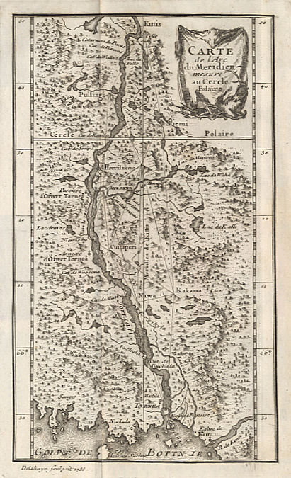
173814503Paris, Imprimerie Royale, 1738 ; in-8 ; plein veau brun marbré, dos à nerfs décoré et doré, pièce de titre grenat, tranches rouges (reliure de l'époque) ; XXIV, (4), 184 pp., carte de l'arc du Méridien mesuré au Cercle Polaire et 9 planches gravées dépliantes, de triangulations et calculs géométriques.
190827846Various places.: Various publishers 1908 to 1923. 10 volumes bound together in one volume. First Editions and all but one are inscribed by the author. Illustrated with cartographic cover art re-impressions of important works cartographic decorations and a number of maps including a number that are folding. 8vo the original printed wraps to each pamphlet are present and all are bound into the one cloth covered volume brown morocco label gilt. Each pamphlet can be considered fine and in exemplary condition some evidence of use and a bit of age to the cloth covers. A fine collection. A FINE COLLECTION OF INSCRIBED FIRST EDITIONS. Ranging from the cartography of the provinces of France 1594 to British and Irish Itineraries and Road-Books English Counties Welsh a pamphlet on the Evolution of the Maps of the Bristish Isles on the great engraver and mapmaker John Cary and two on France cartography and routes from the mid-1500's until the middle of the 19th century. ALL BOOKS ARE INSCRIBED BY THE AUTHOR. Various publishers paperback
Very Good Turkish, Ottoman (1500-1928) An extremely rare litho propaganda map published as an extra supplement to the Tercümân-i Hakîkat [i.e. The Translator of Truth] newspaper just before the proclamation of Republic in Turkey in 1923 by Mustafa Kemal Atatürk (1881-1938), showing the front in West Anatolia during the War of Independence (or National Struggle) between 1919-1922 against Greek forces. The upside of the map between the note as title 'Gift to the readers of 'Tercümân-i Hakîkat', Mustafa Kemal Atatürk's portrait among decorated heroic lithographed drawings. In the lower right corner, can be seen legends of the map, scale, and mapmaker's signature. Tercümân-i Hakîkat was a daily newspaper published in Istanbul between 1878-1921 during the Ottoman Empire. Tercüman-i Hakîkat, the most important newspaper published during the reign of Sultan Abdülhamid II, was founded by novelist Ahmed Midhat Efendi, (1844-1912). In the beginning, most of the articles were written by Ahmed Midhat Efendi. It was an encyclopedic newspaper with the aim of inculcating and educating reading habits among the Turks and it played an important role in the training of many famous Ottoman journalists. Its first issue was published on June 26, 1878. After Ahmed Midhat's death in 1913, the newspaper changed owners, and the last issue was published on February 11, 1921. Ibrahim Alaettin Gövsa, (1889-1949), was an Ottoman / Turkish journalist, educator, and intellectual who supported the War of Independence the most. This propaganda map published in Tercümân-i Hakîkat, during the war in 1920 or 1921, is a propaganda tool that calls on the literate people belonging to a certain class, especially those living in Istanbul, to support the war, and aims to spread the word that Turkey is winning the war. Original lithograph map. 50x35,5 cm. In Ottoman script (Turkish with Arabic letters). Scale: 1: 250.000. Occasionally foxing and slight stains on paper, folded traces. Otherwise a very good copy.
1875Map877London: Edward Stanford 55 Charing Cross 1875. 1st issue . paper wrappers. Fine. Folding map. 78.5 x 66.5 cms. The rare first issue of Stanford's April 19th 1875 map of the North Pole. Laid on cloth in 12 dissected sections. Coloured printing. Pasted to the lower left corner is a contemporary inset map of the Kennedy Channel entering ther 'frozen Polar Ocean' text to the reverse of the inset map.The voyages and journeys of the Artic explorers throughout the centeries are neatly printed in red throughout the map with dates including up to Austrian Exped. Payer 1874. Neatly enclosed in cloth covers when folded with a hand-written original label 'North Pole'. A lovely copy of a very scarce item. PLEASE EMAIL FOR PHOTOS. <br/> <br/> Edward Stanford, 55 Charing Cross unknown
Carta geografica incisa in rame (cm. 48,8x58 e margini) con bellissima colorazione coeva. Bella carta geografica raffigurante il Polo Nord, che inclde l'Europa Settentrionale, parte della Siberia, della Groenlandia e del Canada Orientale (Baie di Baffins, di Button e di Hudson). L'altra metà del circolo è denominata "Americae Septentrionalia incognita" e "Tartaria Maritima incognita". Gli angoli del quadrato entro cui è inscritto il cerchio sono decorati da scene con navi, cetacei ed animali artici. In De Wit si combinano magistralmente la precisione geografica e il dettaglio artistico. Dopo la morte di De Wit e di suo figlio, le lastre vennero acquistate da Louis Renard, che le diede di nuovo alle stampe con un suo testo. Carta molto inusuale e decorativa.. .
Carta geografica incisa in rame (cm. 48,8x58 e margini) con bellissima colorazione coeva. Bella carta geografica raffigurante il Polo Nord, che inclde l'Europa Settentrionale, parte della Siberia, della Groenlandia e del Canada Orientale (Baie di Baffins, di Button e di Hudson). L'altra metà del circolo è denominata "Americae Septentrionalia incognita" e "Tartaria Maritima incognita". Gli angoli del quadrato entro cui è inscritto il cerchio sono decorati da scene con navi, cetacei ed animali artici. In De Wit si combinano magistralmente la precisione geografica e il dettaglio artistico. Dopo la morte di De Wit e di suo figlio, le lastre vennero acquistate da Louis Renard, che le diede di nuovo alle stampe con un suo testo. Carta molto inusuale e decorativa.. .
New Persian Original bdg. HC. Folio. (34 x 24 cm). In Persian with abstracts in English. 392 p., color and b/w ills. Tehran became a major city of Iran after 1554 A.D. during the Safavid period when Shah Tahmasb I, son of Shah Ismail, ordered the implementation of two large-scale public works. The first project was the construction of ramparts and moats surrounding the entire city, which defined the city's perimeters and increased its defense. The rampart consisted of 114 towers, representing the 114 chapters within the Holy Quran and enclosed an area of 4.35 km2. The second project was the establishment of the bazaar, the heart of the industrial and commercial activities of the city, surrounded by numerous holy shrines. However, it was 240 years later in the Spring of 1796 A.D. that Tehran became the national capital of Iran, during Agha Mohammad Khan Qajar's reign. 2016 A.D. actually marks the 220th year since Tehran became the political centre of Iran. The first known map of Tehran (page 18), a Russian spy map, dates back to 1826 A.D. The next Russian map of Tehran (page 24) from 1852 A.D. was translated into Persian and presented as a gift to Naser al-Din Shah Qajar (page 29). After the establishment of the military polytechnic school in 1851 A.D. and the arrival of Europe an military instructors, the importance of accurate topographical maps was recognized by the nation's leaders. The Austrian artillery trainer for cannons, August Karl Krziz, coordinated in 1858 A.D. the preparation of the maps of Tehran (page 39) and its surrounding area (page 35). This was the beginning of scientific cartography in Iran. By 1863 A.D., maps of Tehran Province for the purpose of tax collection (page 58) were being produced by engineer Abdul Rasool Khan. Tehran dramatically expanded after a huge flood in 1867 A.D. destroyed a large portion of the Safavid period ramparts and moats, after which Alexander Bohler, a French military instructor, designed a new and enlarged rampart and moat enclosure. Within four years between 1867 A.D. and 1871 A.D., Tehran grew from 4 .35 km2 to 19.75 km2 with these new constructions. By 1891 A.D., a highly detailed and technical map of Tehran (page 64) had been produced by Abdul Ghafar Najmolmoq. During the reigning years of Mozafar al-Din Shah, Mohammad Ali Shah, and Ahmad Shah, maps for Tehran postal services (page 126) and Tehran provincial delineation (page 127) were produced. During these years, the Russian, British and French prepared several geopolitical maps of the region including Tehran. For example, the map on page 323 reproduces a map prepared in 1892 A.D. by the British Survey of India at the scale of 1:506,880. In 1914 A.D., German publisher Wagner & Debes prepared a touristic map of Tehran (page 134). In 1922 A.D. the Ministry of Culture's Investigation Section prepared a map of schools in Tehran (page 138). During the Pahlavi I period (1925~1941 A.D.), modernization of Tehran became a national priority. By 1930 A.D. a map for street enlargement in Tehran (page 158) had been published. In 1932 A.D., the demolition of the Naser al-Din Shah Qajar period ramparts began simultaneous to further expansion of urbanized Tehran. The 1936 A.D. military map of Tehran (page 169) is testimony to the changes in the urban morphology of this period. The creation of a dedicated military cartographic service in 1935 A.D. marked an important milestone in the history of cartography in Iran. The 1937 A.D. urban development plan of Tehran (page 170) clearly shows the new streets, squares and urban development envisioned. The first known aerial photograph of Tehran dating from 1940 A.D. (page 177) displays the realization of this urban development plan. After the invasions by the Russians, British and Americans in 1941 A.D., cartographic activities in Iran suddenly increased. Sergeant Mohammad Reza Ghaffari privately published maps of Tehran [.] The above mentioned maps are a few representative samples of the over 270 maps
1661248607Amsterdam, Janssonius, 1661. M. 45 gef. gest. Ktn. u. 1 gef. Kpfr.-Taf. 4 Bl., 142 S., 1 Bl., 31 S. Prgt. d. Zt. Einbd. minimal angestaubt. Leicht gebräunt, teils etwas braunfl., sonst wohlerhalten. Titel in Rot u. Schwarz, unten überklebt.
Incisione in rame su doppio foglio (cm.50x57 circa) con bellissima colorazione coeva, verso velato da finissimo foglio di carta Giappone. Bella e rara carta nautica, tratta dal celebre atlante di De Witt ''Orbis Maritimus ofte Zee Atlas", che copre le coste dell'America Centrale, Perù, Cile, Jamaica e parte di Cuba e Porto Rico. . Le indicazioni toponimiche e le caratteristiche geografiche sono strettamente limitate alle coste. Rosa dei venti, linee lossodromiche e splendido cartiglio, in basso a destra, con titolo in latino, con ricche decorazioni colorate raffiguranti varie figure, anche allegoriche. "Frederick de Wit deve essere considerato uno dei più importanti editori di mappe della seconda metà del XVII secolo. La maggior parte delle sue mappe sono di ottima qualità, sono caratterizzate da un'incisione chiara e bella, dall'attualità e ricchezza dell'immagine cartografica nonché dall'equilibrio delle decorazioni cartografiche". (Lexikon der Kartographie II, p. 899), Koeman M. Wit 1, 27. Koeman, Atlantes Neerlandici, IV, pp.191 e 518-519. Shirley 444. Putnam, Early sea charts, 75.. .
Marseille, Laurens Bremond, avec Privilege du Roy, 1718. Incisione in rame, b/n, cm 48,5 x 69,5 (alla lastra) più margini. Bella carta nautica del Golfo di Napoli tratta dal portolano del Mediterraneo realizzato da Michelot e Bremond, geografi marini attivi tra il 1715 e il 1730. Finemente incisa da Peter Starckman, la carta si estende dal Golfo di Napoli fino a punta Campanella, limite con il Golfo di Salerno; compaiono Procida, Ischia e Capri. Bel cartiglio in alto a sn., quasi al centro, ricco di elementi decorativi e araldici (editore e luogo di edizione compaiono anche in bs. a ds.); in bs. a sn. scale di luoghi francesi e inglesi e di miglia italiane. Rara. (Piloni, LIII; Principe, pp. 112). Minimi strappetti marginali fuori dalla lastra, buon esemplare. .
Rarissima carta dell’isola, datata il lastra 1570. Rappresentata circondata dalla flotta di navi della Repubblica di Venezia la carta è orientata con il Sud in alto. Carta anonima e priva di dati editoriali, che segue nella morfologia la carta del monogrammista PS e tutte le sue derivazioni. L’aspetto interessante che mostra questa carta, è dovuto al contesto storico; l’isola è rappresentata con la flotta veneziana chierata a difesa contro gli assalti dei turchi. L’opera, datata al 1570, viene attribuita a Nicolò Nelli per evidenti ragioni stilistiche e per le analoghe carte su Cipro e Creta, che recano la sua firma. La mappa si trova inserita in alcune raccolte cinquecentesche, e viene di seguito pubblicata nel Isole che son da Venetia nella Dalmatia et per tutto l’arcipelago fino a Costantinopoli, edito da Simone Pinargenti a Venezia nel 1573. L’opera fu realizzata in stretta concorrenza con l’analoga raccolta del Camocio Isole Famose, e raccoglie carte incise da Nicolò Nelli, Natale Bonifacio e dal Pinargenti stesso. I pochi esemplari noti della raccolta sono spesso diversi tra loro, e contengono un numero variabile di carte. Magnifico esemplare, in straordinario stato conservativo. This very-rare loose-sheet map of Corfu carries at the lower right hand corner the date of the publication, 1570. Like the larger maps of The IATO these smaller ones were first issued for a loose sheet circulation, and then assembled in booklet form for interested customer. The island is shown surrounded by an armada of Venetian war ships. The map is oriented with south at the top and its shape is based on the Ferrando Bertelli map of Kerkyra (1564). Sometimes the map appear in the rare collection by Simone Pinargenti “Isole che son da Venetia nella Dalmatia et per tutto l’arcipelago fino a Costantinopoli” (1573). Nicolò Nelli (1530 ca – 1573) was venetian engraver of maps, portraits, religious subject and prints. He also traded in prints and published the works of Giovanni Battista Fontana and Giorgio Ghisi and had a business relationship with Bertelli en Zaltieri. Copperplate, with full margins, very good condition. Very rare. Tavernari (2014): n. 65; Zacharakis (1992): n. 1756; Zacharakis (2009): n. 2692.
Carta geografica dell’isola di Creta firmata e datata in lastra dal Nelli. La carta dell’isola di Creta di Nicolò Nelli è basata sul modello di Zorzi/Pagano del 1538. Differisce per l’orientazione, qui con l’est in alto come in molte altre carte veneziane del periodo. L’isola è rappresentata con la flotta veneziana chierata a difesa contro gli assalti dei turchi. La carta venne in seguito inserita nel Isole che son da Venetia nella Dalmatia et per tutto l’arcipelago fino a Costantinopoli, edito da Simone Pinargenti a Venezia nel 1573. L’opera fu realizzata in stretta concorrenza con l’analoga raccolta del Camocio Isole Famose, e raccoglie carte incise da Nicolò Nelli, Natale Bonifacio e dal Pinargenti stesso. I pochi esemplari noti della raccolta sono spesso diversi tra loro, e contengono un numero variabile di carte. Bellissima prova, impressa su carta vergata coeva con filigrana “sirena in uno scudo con stella”, in perfetto stato di conservazione. This very-rare loose-sheet map of Crete carries at the lower right hand corner the name of the Venetian engraver Nicolò Nelli, and the date of the publication, 1570. Like the larger maps of The IATO these smaller ones were first issued for a loose sheet circulation, and then assembled in booklet form for interested customer. The island is shown surrounded by an armada of Venetian war ships. The map is oriented with east at the top and its shape is based on the Matteo Pagano map of the island (1538). Sometimes the map appear in the rare collection by Simone Pinargenti “Isole che son da Venetia nella Dalmatia et per tutto l’arcipelago fino a Costantinopoli” (1573). Nicolò Nelli (1530 ca – 1573) was venetian engraver of maps, portraits, religious subject and prints. He also traded in prints and published the works of Giovanni Battista Fontana and Giorgio Ghisi and had a business relationship with Bertelli en Zaltieri. Copperplate, wide margins, perfect condition. Very rare. Tavernari (2014): n. 75; Zacharakis (1992): n. 1601; Zacharakis (2009): n. 2469.
Serie di 9 (su 10) incisioni all'acquaforte di mm 670 x 340 alla battuta su carta di gran corpo. Tutti i foglio a grandi margini in perfetto stato di conserazione. Carta in scala 1:30 000. Magnifica e molto rara opera cartografica sul Corso del Reno, purtroppo mancante dell'ottavo (8) foglio.
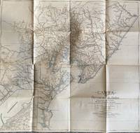
1928List1922Bahia 1928. Folded map. Fine condition. Fine. Teodoro Sampaio was an Afro-Brazilian cartographer engineer politician and historian who was very active in Brazil particularly in Bahia during the late nineteenth and early twentieth century. Offered here is Sampaio’s map of Bahia from 1928 which updates a map he produced in 1899 of the same region with updates of the settlement of the region including a detailed inset of the city of BBahio de Todos os Santos on the lower right corner. At the time of the map’s production Sampaio was an authority on Brazilian geography being a member of the Instituto Geográfico e Histórico da Bahia serving as president in 1922 and a member of the Instituto Histórico e Geográfico Brasileiro and the Instituto Geográfico e Histórico da Bahia and publishing several books on Brazilian geography. The period between 1899 when the first edition of this map was published and 1928 saw the development of rubber plantations in Bahia and the map provides detail on the region’s roads and population centers. We find no publicly held examples of this edition and one copy of the 1899 edition at Princeton though we do find a reference to this edition at the Brazilian National Archives. unknown
1844026815Edinburgh / London / Dublin: Adam and Charles Black / Longman / Simpkin / Whittaker / Hamilton / Cumming 1844. Good - Very Good condition. Bound in green cloth with black leather spine and corners elaborately gilt decorated. The leather is surprisingly well preserved. The cloth is faded and soiled with frayed edges. SEE PHOTOS. NO owner's name or bookplate. NOT a library discard. Imprinted "MDCCCXLIV" at the foot of the title page with "1844" hand inked beneath. All other pages are crisp clean and umarked with almost no foxing. Full title; "Black's General Atlas: Comprehending Sixty-One Maps from the Latest and Most Authentic Sources Engraved on Steel in the First Style of the Art by Sidney Hall Hughes etc. with Geographic Descriptions and an Index of 56000 Names." The maps several double page are tissue guarded and most are handcolored in red yellow and green. SEE PHOTOS. With the binder's ticket of Smith & Son 306 Lawnmarket Edinburgh. All edges gilt. Oversize hardcover. 13.25" wide by 17.75" tall. This large heavy book will require SUBSTANTIAL extra postage depending on destination that will be charged at our cost. 1844 edition. Oversize Hardcover. Good - Very Good condition. Illus. by NOT a library discard. 12pp. 61 maps 57 page Index. Great Packaging Fast Shipping. Adam and Charles Black / Longman / Simpkin / Whittaker / Hamilton / Cumming Hardcover
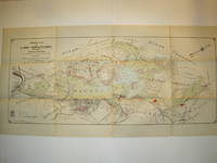
1912016735Borough of Hopatcong New Jersey 1912. Near Fine condition. SEE PHOTO. This is a beautiful and very scarce color map of Lake Hopatcong New Jersey. When unfolded it measures 18" tall by 38" wide. Some folds have been neatly reinforced on the blank side with archival-quality document repair tape. Buildings are represented by red squares water in green. Some of the properties and locations depicted are: Port Morris Landing Roxbury Township Borough of Mount Arlington Byram Township Nolans Point Atlas Powder Co. Brookland Borough of Hopatcong Byram Cove Henderson Bay Byram Bay Maxim Park Jefferson Township Woodport Hurdtown Hurd Mining Co. W. M. Force Estate John P. Lawless Mary Ingram estate Aaron Peck estate Raccoon Island Halsey Island Bertrand Island Theodore King Gertrude Otten Violet Littell Robert Dunlap estate etc. Full title: "Property Map of Lake Hopatcong New Jersey Prepared by Hudson Maxim for the Morris Canal Investigation Commission November 16 1912 Compiled from Various Maps and Actual Surveys by P. E. Boomer C. E.". First Edition. Folded map. Near Fine condition. 18" tall by 38" wide when unfolded. Borough of Hopatcong, New Jersey? Paperback
Firenze, Istituto Geografico Militare, 1924-1936, fasc. 140 complessivi (9 annate complete + altri 32), raccolti in voll. 24, copp. fittizie (ma conservate le br. edit. dei fasc.), pp. 571, da 617 a 947 - 1064 - 1072 - 1407 - da 617 a 1321 - 729, da 765 a 888, da 995 a 1067 - 1347 - 742 - da 507 a 978 - 1089 - 1106 - 960. Numerose ill. in b.n. e cartine. Ampia bibliografia (incluse le riviste) e notiziario. Alcune adesioni. Contributi di: R. Almagià, R. Biasutti, C. Basevi, C. Casamorata, A. Loperfido, G. Pullè G. Abetti, E. Masini, G. Boffito, L. Arditi, A. Neppi Modona, L. Giannitrapani, L. Cipriani, ecc. Interessante rivista che tratta di geografia, esplorazioni, etnologia, cartografia, topografia, geologia, astronomia, ecc; numerosi articoli monografici su Oriente (Giappone, Manciuria, Cina, India), America Latina (Brasile, Perù, Bolivia, Cile, Argentina, ecc.), U.R.S.S. e sulle colonie italiane (Libia, Eritrea, Somalia); resoconti di Convegni e congressi: I Convegno Naz. Etrusco a Firenze (1926), II/III Assemblea dell'Unione Astronomica Internaz. (1925, 1928), Congresso Internaz. di Geografia a Cambrige (1928), XIX Riunione della Società Italiana per il progresso delle Scienze (1930), Congresso di studi coloniali di Firenze (1931), ecc.
Carta geografica della Penisola Iberica edita a Siena verso il 1600 circa e fedele derivazione della carta di Abraham Ortelius dal titolo Regni Hispaniae Postomnivm Editiones Locvpletissima Descriptio pubblicata per la prima volta ad Anversa nel 1570. Sebbene non firmata la carta è attribuita, senza ordine di dubbio, alla bottega di Matteo Florimi. La lastra sembra riconducibile alla mano dell’incisore fiammingo Arnoldo di Arnoldi, che lavorava già per Giovanni Antonio Magini. Il periodo di collaborazione tra il Florimi e l’Arnoldi è riconducibile agli anni 1600 – 1602 e produsse un discreto numero di mappe. In basso: a destra in una targa ornata con fregi figure e mascheroni HISPANIAE nova descriptio. a sinistra in una piccola targa Scala di miglia Italiane 90. (90 = mm 50) e Scala leucarum 30. (30 = mm 60). Orientazione nei quattro lati al centro con il nome dei punti cardinali in latino Septentrio, Meridies, Oriens, Occidens. Graduazione ai margini di 10’ in 10’ va da 34° 30’ a 44° 42’ lat. e da 10° a 26° 12’ margine in basso (da 9° 10’ a 26° 55’ margine in alto) lat. Acquaforte e bulino, mm 357 x 478. Non sono note ristampe, tuttavia alcuni esemplari della mappa, di tiratura più tarda, possono essere attribuiti ai torchi dell’editore senese Pietro Petrucci, che acquisì gran parte delle lastre del Florimi. Map of the Iberian Peninsula by Matteo Florimi, published in Siena aroun 1600. The map is a copy of Abraham Ortelius Regni Hispaniae Postomnivm Editiones Locvpletissima Descriptio, first edition published in Anversa, 1570.The engraving could be attribued to the Flemish engraver Arnoldo di Arnoldi, who had already worked for Giovanni Antonio Magini. The partnership between Florimi and Arnoldi dates back to yeras 1600-1602, and together realized a certain number of maps.Etching and engraving, trimmed to the platemark, good condition.No other editions are known, however, some later examples of the map, can be attributed to the publisher Pietro Petrucci, who acquired most of the Florimi's plates. Van der Heijden (1993): n. 17.
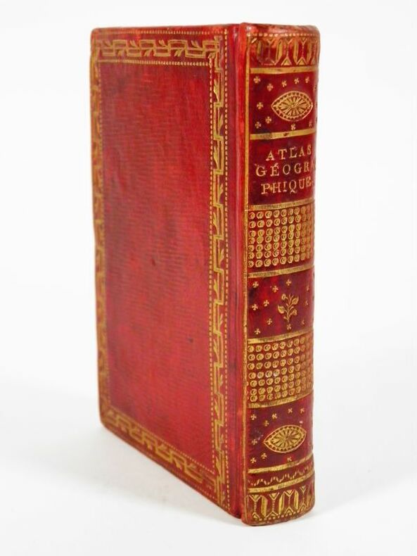
2191Paris, chez Lattré, 1762. In-16, 8,5 x 12 cm. Reliure de l’époque en plein maroquin rouge à grain long, dos lisse richement orné de filets, caissons, dentelle et fers dorés, dentelle et pointillés dorés en encadrement des plats, roulette dorée sur les coupes, les coiffes et en encadrement des contre-plats, toutes tranches dorées. Titre, 31 planches doubles montées sur onglet ; 2 f., 55 pp. Exemplaire entièrement rehaussé à l’aquarelle, orné d’une page de titre encadrée d'un décor gravé par Legrant, d’une planche de sphères, de 2 mappemondes et de 28 cartes. Table des cartes contenues dans cet ouvrage reliée après la page de titre de l’Idée de la Sphère.
20066129BBZürich, Wolfsberg, (2006). Klein-Folio. (1) S., (2) S. Mit 9 doppelblattgr. Lithographien u. 1 Tafel (Offset). Orig.-Leinenbd. + Wichtig: Für unsere Kunden in der EU erfolgt der Versand alle 14 Tage verzollt ab Deutschland / Postbank-Konto in Deutschland vorhanden +, 6129B
Carta dettagliata del territorio, disegnata da Carlo Mayr e incisa dai Fratelli Stucchi. E’ una grande carta in b.n. (cm. 78,6 x 100), montata su tela e suddivisa in 24 riquadri, contenuta in un astuccio mod. (cm. 20,5x17,5). In basso a sinistra, entro cartiglio, dedica all’Em.mo e Rev.mo Principe il Sig. Cardinale Tommaso Arezzo, Vescovo di Sabina, Legato della città e provincia di Ferrara, dall’Ing. in Capo Tommaso Barbantini. Qualche alone marginale ma certamente un buon esemplare.
In alto, lungo il margine superiore ed impresso a caratteri cubitali, troviamo il titolo: LA GRAN CITTA DEL CAIRO. In basso si legge: Descrittione d’i nomi della Città del Cairo. Segue una legenda numerica di 54 rimandi a luoghi e monumenti notabili disposta su sei colonne. In basso a destra troviamo l’imprint editoriale: Appresso Donato Bertelli. Orientazione nei quattro lati al centro con i nomi dei venti: TRAMONTANA, LEVANTE, PONENTE, mentre non indicato il vento meridionale. Il nord è a sinistra. Pianta prospettica a volo d’uccello, priva di data, pubblicata dalla tipografia di Donato Bertelli. Si tratta di una derivazione dell’opera attribuita a Ferrando Bertelli (1568), a sua volta basata su quella più grande di Zorzi-Pagano, alla quale viene aggiunta l’orientazione. Nel 1549 Matteo Pagano, in collaborazione con il pittore e cartografo Giovanni Domenico Zorzi, produce un grande mappa del Cairo, composta da ventuno blocchi silografici. La prospettiva adottata, obliqua dall’alto, detta “a volo d’uccello”, segue la tradizione rinascimentale della rappresentazione delle città. Il formato è orizzontale, con la città vista dalla riva occidentale del Nilo. Sono indicati in maniera chiara sia aree individuali che monumenti della città, come il distretto di Azbakiya, la porta di Bab Zuwayla, l’acquedotto e le vie principali, il Vecchio Cairo, sviluppato intorno alla fortezza di Babilonia, la torre di Giza, le celebri Piramidi e la Sfinge in sembianze femminili. Alcuni esemplari di questa pianta prospettica si trovano inseriti nella raccolta Le vere imagini et descritioni delle piu nobili città del mondo, edita a Venezia da Donato Bertelli nel 1569. Altre ancora sono inseriti in raccolte fattizie cinquecentesche di formato più grande. “In assoluta concorrenza con le raccolte di Forlani e di Ferrando Bertelli, fu pubblicata a Venezia, sempre a cura di Donato Bertelli nel 1569, la raccolta Le vere imagini et descritioni delle piu nobilli città del mondo. Verae illustrissimae cuiusque urbis imagines nunc prim[um] typis impressae. Venetiis, Apud Donatum Bertellii ad signum divii Marci MDLXIX. Come quella di Ferrando, l’opera contiene un frontespizio allegorico inciso, con un titolo bilingue in italiano e latino, e con la dedica a Iohan Jacob Fugger von Kirhberg (1514-1575), banchiere tedesco mecenate delle arti: Illustri, ac generoso heroi d. Ioanni Iacobo Fuggero Kirchbergae, Weissenhorni, et c. domino caesareae maiestatis consiliario dicatae. La raccolta, che conobbe una ristampa nel 1574 e una nel 1578, comprende il titolo e 21 piante o vedute di città. Si tratta, dunque, solo di una selezione incentrata sulle città principali, rappresentate da tavole derivate dal “Primo Libro”, già replicate nel Civitatum aliquot insigniorum et locorum del 1568. Vengono escluse le immagini delle città fortificate ungheresi e dei luoghi minori, in una sorta di prodotto elitario, meno innovativo ma più curato dal punto di vista grafico. Valerio (cfr. Piante e vedute di Napoli dal 1486 al 1599, 1998, p. 45) descrive l’esemplare conservato alla Jerome & Ann Fisher Fine Arts Library della University of Pennsylvania [711.4 B486], datato 1569, e la ristampa del 1578 conservata alla Public Library di New York. Entrambi differiscono, per contenuto e ordinamento delle tavole, da quello conservato alla Biblioteca Angelica di Roma [BB-12-9] e da quello alla Stanford University, che recano entrambi la data 1578. L’unico elemento comune a tutte le edizioni è la presenza della pianta di Venezia (come prima tavola. Non è raro trovare le tavole di Bertelli conservate in raccolte fattizie di grande formato: in quella della Universiteto Biblioteka di Vilnius (cfr. Dzikowski, Katalog atlasów Biblioteki Uniwersyteckiej Stefana Batorego, 1940) sono presenti la quasi totalità delle tavole che compongono la raccolta, come pure nel cosiddetto “Atlante Aragona” (conservato in un’anonima collezion... At the top, along the upper margin and printed in block letters, is the title LA GRAN CITTA DEL CAIRO. At the bottom we read: Descrittione d'i nomi della Città del Cairo. Follows a numerical legend of 54 references to places and monuments placed on six columns. At lower right is the editorial imprint: Appresso Donato Bertelli. Orientation in the four sides to the center with the names of the winds: TRAMONTANA, LEVANTE, PONENTE, while not indicated the southern wind. The north is on the left. Perspective bird's eye plan, undated, published by the typography of Donato Bertelli. This is a derivation of the work attributed to Ferrando Bertelli (1568), in turn based on the larger one by Zorzi-Pagano, to which the orientation is added. In 1549 Matteo Pagano, in collaboration with the painter and cartographer Giovanni Domenico Zorzi, produced a large map of Cairo, consisting of twenty-one silographic blocks. The perspective adopted, oblique from above, called "bird's eye", follows the Renaissance tradition of the representation of cities. The format is horizontal, with the city seen from the west bank of the Nile. Both individual areas and monuments of the city are clearly indicated, such as the Azbakiya district, the Bab Zuwayla gate, the aqueduct and main streets, Old Cairo, developed around the Babylon fortress, the Giza tower, the famous Pyramids, and the Sphinx in female likeness. Some examples of this perspective plant are included in the collection Le vere imagini et descritioni delle piu nobili città del mondo, published in Venice by Donato Bertelli in 1569. Still others are included in sixteenth-century factual collections of larger format. “In absolute competition with the collections of Forlani and Ferrando Bertelli, was published in Venice, again edited by Donato Bertelli in 1569, the collection Le vere imagini et descritioni delle più nobilli città del mondo. Verae illustrissimae cuiusque urbis imagines nunc prim[um] typis impressae. Venetiis, Apud Donatum Bertellii to signum divii Marci MDLXIX. Like Ferrando's, the work contains an engraved allegorical frontispiece, with a bilingual title in Italian and Latin, and a dedication to Iohan Jacob Fugger von Kirhberg (1514-1575), a German banker and patron of the arts: Illustri, ac generoso heroi d. Ioanni Iacobo Fuggero Kirchbergae, Weissenhorni, et c. domino caesareae maiestatis consiliario dicatae. The collection, which was reprinted in 1574 and again in 1578, includes the title and 21 plans or views of cities. It is, therefore, only a selection focused on the main cities, represented by tables derived from the "Primo Libro", already replicated in the Civitatum aliquot insigniorum et locorum of 1568. Images of Hungarian fortified cities and minor places are excluded, in a sort of elitist product, less innovative but more accurate from the graphic point of view. Valerio (cf. Piante e vedute di Napoli dal 1486 al 1599, 1998, p. 45) describes the copy preserved at the Jerome & Ann Fisher Fine Arts Library of the University of Pennsylvania [711.4 B486], dated 1569, and the reprint of 1578 preserved at the Public Library of New York. Both differ in content and arrangement of plates from the one preserved at the Angelica Library in Rome [BB-12-9] and the one at Stanford University, both of which bear the date 1578. The only common element in all editions is the presence of the plan of Venice (as the first plate. It is not uncommon to find Bertelli's plates preserved in large-format factual collections: in the collection of the Universiteto Biblioteka of Vilnius (cf. Dzikowski, Katalog atlasów Biblioteki Uniwersyteckiej Stefana Batorego, 1940) almost all the plates that make up the collection are present, as well as in the so-called "Atlas Aragon" (preserved in an anonymous private American collection and of which we have been able to obtain images). Numerous plates are present in the collection of the Bertarelli Collection [VOL EE 46 (1-240)], preserved at t...
Paris, Dezauche succ. De l'Isle et Buache, 1783. (Parte incisa mm. 480 x 630). Bella carta geografica, in coloritura coeva, proveniente da Atlas géographique des quatre parties du monde par Guillaume De L'Isle et P. Buache.
Bella e rara carta nautica, tratta dal celebre atlante di De Witt ''Orbis Maritimus ofte Zee Atlas", che mostra l'Africa occidentale con le Isole Canarie e Capo Verde nell'Oceano Atlantico. La mappa è dotata di due rose dei venti e battaglie navali. L'immagine della mappa è orientata con il Nord verso l'Est. Cartiglio ricco e dettagliato con titolo in latino, con immagini di nativi e di commercianti occidentali, oltre ad animali del luogo. "Frederick de Wit deve essere considerato uno dei più importanti editori di mappe della seconda metà del XVII secolo. La maggior parte delle sue mappe sono di ottima qualità, sono caratterizzate da un'incisione chiara e bella, dall'attualità e ricchezza dell'immagine cartografica nonché dall'equilibrio delle decorazioni cartografiche". (Lexikon der Kartographie II, p. 899), Koeman M. Wit 1, 27. Koeman, Atlantes Neerlandici, IV, pp.191 e 518-519. Shirley 444. Putnam, Early sea charts, 75.. .