5 782 résultats
179446191794 London, Laurie & Whittle, 1794 Carte gravée sur cuivre (50,5 x 57 cm hors marges, 54 x 73 cm toutes marges comprises). Tirage de l'époque. Quelques traces d'une autre carte en surimpression. Map on copperplate (50,5 x 57 cm without the margins, 54 x 73 cm with the margins). Contemporary printing. Several light printed marks of another map.
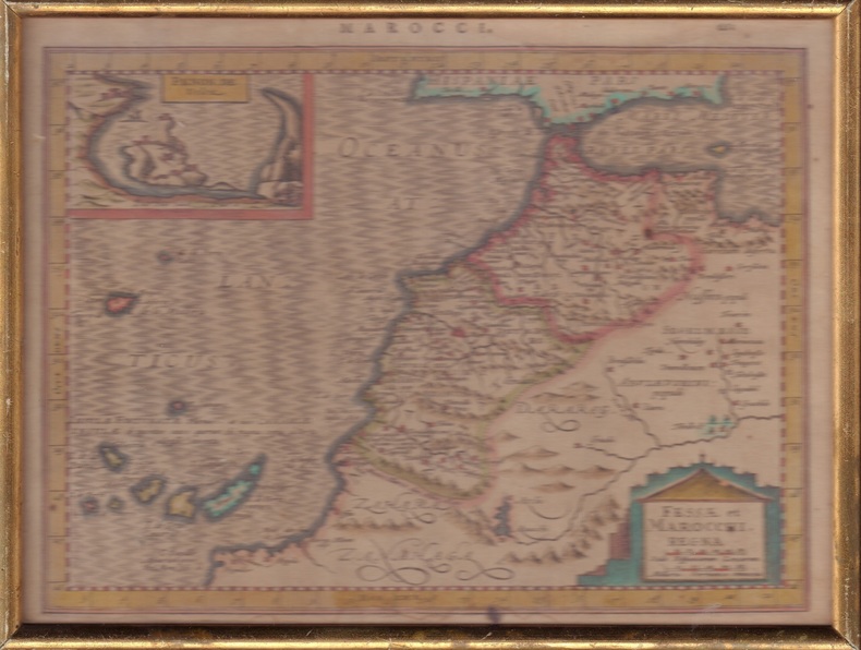
ORD-1849Sans nom d'auteur, d'éditeur et sans date, sans doute vers 1600. Carte de ca 257 x 192 mm (à la cuvette) mention MAROCCI. et le nombre 662 au dessus de la carte. Vue de Penon de Velez dans un rectangle réservé en haut et à gauche de la carte, cartouche rectangulaire placé à l'intérieur d'une construction mauresque en silhouette. Coloris apparemment d'époque, texte en latin imprimé au verso. Encadrement ancien de baguette dorée. Bel exemplaire.
576935Rouen, 1876-78. Carte en coul. entoilée, (1,40 x 0,93 m - éch.: 1/100000) dépl., sous emboîtage pleine percaline aubergine, titre doré.
162016204Carte gravée sur cuivre (cuvette 38 x 49 cm environ), non identifiée ; probablement Blaeu ou Hondius à Amsterdam, circa début XVIIe siècle, coloris et gommage d'époque.
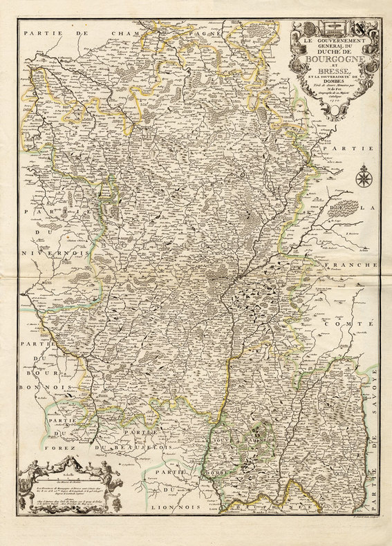
171216203Paris, chez l'Auteur, 1712 ; grande carte (cuvette du cuivre : 67,5 x 49 cm), coloris d'époque.
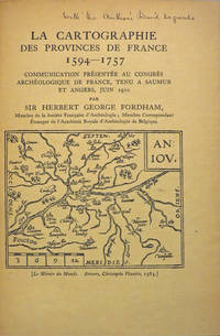
190827846Various places.: Various publishers 1908 to 1923. 10 volumes bound together in one volume. First Editions and all but one are inscribed by the author. Illustrated with cartographic cover art re-impressions of important works cartographic decorations and a number of maps including a number that are folding. 8vo the original printed wraps to each pamphlet are present and all are bound into the one cloth covered volume brown morocco label gilt. Each pamphlet can be considered fine and in exemplary condition some evidence of use and a bit of age to the cloth covers. A fine collection. A FINE COLLECTION OF INSCRIBED FIRST EDITIONS. Ranging from the cartography of the provinces of France 1594 to British and Irish Itineraries and Road-Books English Counties Welsh a pamphlet on the Evolution of the Maps of the Bristish Isles on the great engraver and mapmaker John Cary and two on France cartography and routes from the mid-1500's until the middle of the 19th century. ALL BOOKS ARE INSCRIBED BY THE AUTHOR. Various publishers paperback
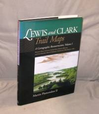
200027054<p>Pullman:: Washington State University Press 2000. First Printing of the First US Edition. A Fine tight copy in a Fine dust jacket. A Vancouver Washington cartographer based his unique maps on Clark's untapped survey notes excerpted on the maps. Taking into account nearly 200 years of changes to key geographic features of the 7000 miles that the Corps of Discovery covered Plamondon's 153 full-page maps precisely depicting the 1804-6 roundtrip permit comparison of the geography past and present from the Missouri River from Illinois to Fort Mandan in North Dakota. The book includes an introductory essay with notes on expedition mapping methods. Indexed by outbound and return camps dates locations and events and place names.</p> Washington State University Press, hardcover
48555National Library of Australa. Canberra. 2014 Reprint. Large 4to 256pp. Printed card covers with flaps; excellent condition. Covers the journey of Australia's exploration with over 100 maps atlases globes and scientific instruments written to accompany an exhibition in 2013-2014. National Library of Australa. Canberra. 2014 (Reprint) unknown
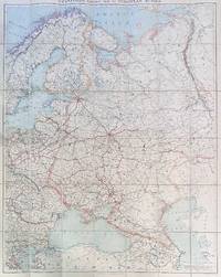
192284192London: Edward Stanford Ltd 1922. Large folding map. Lithograph in colors on uncoated paper dissected and laid down on linen as issued; overall dimensions 123cm x 97cm ca 48" x 38" folding to 20cm x 14cm 8" x 5-1/2"; card covers with publisher's slipcase of maroon cloth with printed paper title label. A bright clean well-preserved example Very Good to Near Fine. In the original slipcase cloth lightly rubbed at corners and a bit of soil to title label still easily Very Good.<br /> <br /> An impressive Revolutionary-era map of Russia in 42 sections scaled 1 inch to 50 miles. This revision dated March 1922 would appear to be the fourth and final edition of the map - it was preceded by editions in 1915 1917 and 1919. By December 1922 the Soviet Union would be formally established with Azerbaijan Georgia Belarus and Armenia which all appear here as independent states being absorbed into the Union of Soviet Socialist Republics. Edward Stanford, Ltd unknown
198283789Baltimore: Johns Hopkins University Press 1982. First Edition. First printing. Oblong quarto 11" x 14-1/2"; cloth-backed boards hardcover in pictorial dustjacket; 128pp; illus. Mild soil to board edges else tight and clean; internally free of markings or soil; Very Good or better in the original dustwrapper. Johns Hopkins University Press unknown
195282192Minneapolis:: Printed for the Author by the Voyageur Press 1952. First edition; one of Sixty Copies Printed. Two looseleaf albums . Generally fine. 8vo. A comprehensive album for collecting postage stamps featuring maps from around the world with spaces to affix specimens and information about each stamp. In this example there are approximately 150 affixed stamps and 133 blank spaces for stamps. Printed for the Author by the Voyageur Press, unknown
1988109904Turnhout-Belgium, Brepols, coll. « Typologie des sources du Moyen âge occidental ; 51 » 1988 Livre en allemand. In-8 broché 24 cm sur 16. 117 pages. 9 pages de planches. Très bon état d’occasion.
23256Paris, Dumont, 1916. Deux volumes in-8 de XIV, 566 et 597 pages. Quatre planches hors-texte et figures in-texte. Préface de l'Amiral Buchard. Bon état intérieur. Broché, couverture beige imprimée en noir illustrée d'une vignette. En bon état .
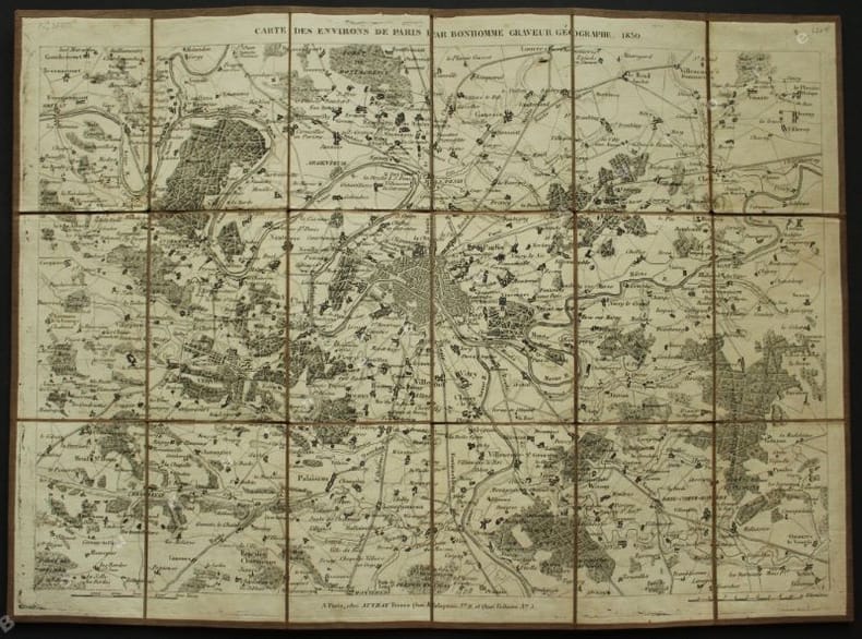
1830140501830 P., chez Auvray, 1830, 1 carte gravée et découpée en 18 parties collées sur une toile (395 x 287 mm dépliée, 93 x 65 mm repliée). Petites déchirures aux pliures, très bel état.
ORD-2081Dressée d'après la carte d'état-major par J. Cde. BILLIARD, gravée sur pierre par E. PERROT. Nouvelle édition revue et augmentée des nouvelles lignes de fer, des chemins vicinaux ordinaires classés, etc. Angoulème. Perrot. s.d. (milieu XIX°) Très grande carte couleurs (1 mètre x 0,76 mètres) rempliée au format in-12 (96 x 190mm) collée sur toile par Auguste Logerot à Paris sous chemise et étui en carton marbré, étiquette de titre saumon au dos. Bel exemplaire malgré qq. rousseurs visibles seulement côté toile.
ORD-14407Missions Catholiques. 5 Février 1875. Feuille de 283 x 405 mm, carte en noir et blanc de 284 x 317 mm. Bon exemplaire.
ORD-14408Missions Catholiques. 20 Juin 1873. Feuille de 545 x 360 mm, carte en noir et blanc de 380 x 300 mm. Fissures aux points de pliages réparées, mais assez bon exemplaire.
ORD-14417Paris. Imp. Robelin. S.d. vers 1880. Feuille de 440 x 304 mm, carte en noir et blanc de 337 x 253 mm. Fissures aux points de pliages réparées, mais assez bon exemplaire.
ORD-14421Dressée, héliographiée et publiée par le Service Géographique de l'Armée en 1927. Dimensions de la feuille ca 1010 x 735 mm, de la carte ca 867 x 685 mm. Carte pliée en 16, rehaussée de vert, références X-19.N°3-4.7-8.XI-19 N°1.5. Très bon état.
9790Paris, George Lang, Imprimeur, 1931. 1 volume in-4, 208 pp., reliure moderne plein cuir bleu, couvertures conservées, enrichi de XL planches hors texte, cartes et reproductions photographiques, quelques tampons, sinon très bon état.
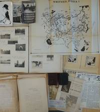
1950List2425Europe and California 1950. Includes two small diaries from 1901 and 1917 with sporadic entries a large photo album measuring 14 x 11 with appx. 400 small photographs from 1906-1909 attached to album pages most measuring 3 x 2 as well as a few larger format images laid in. With 100 plus pages of typed pages including retained correspondence story ideas and various other manuscripts. With eleven maps produced for his “Of Men and Maps†series including five copies of a large map entitled “Whither Russia†in varied states and in large sizes up to 30 by 36 inches and a handful of small ephemeral pieces. Generally near fine condition with the exception of the album which is missing its rear board and has some pages loose and torn. Very Good. J.M. de Beaufort a war correspondent for the London Daily Telegraph and New York American during World War I recounted his wartime adventures in the 1917 book "Behind the German Veil: A Record of a Journalistic War Pilgrimage." Originally arriving in Chicago in 1909 he married a steel magnate's daughter and pursued a career in show business. However by 1912 he had gone through a divorce and transitioned to newspaper work earning the moniker of the "Dude Reporter." Originally born in the Netherlands as Jacques Albert Uilenbroek he was thought to be a deserter. He spent the latter part of his life in the United States apparently jailed in San Francisco for a stint in the 1920s and eventually settled in Los Angeles. <br /> Offered here is an interesting smattering of material from the life of the mysterious De Beaufort which bookends his most unusual career and life with a large visual photographic record of his life in Europe as a young man and over a hundred pages of manuscript material from late in his life with a highlight being several maps in draft form for an apparently unpublished project called “Of Men and Maps.†As a group the material shows the work of an ex-con artist and war correspondent trying to regain his form while living in Los Angeles. He was still writing as a “Special Correspondent†at this point though the title seems to have been fully honorary. Also included are two small pocket journals with sporadic notations from his life in Europe in 1900 and in 1917. In its entirety the group gives an interesting visual and manuscript record of a literary fraudulent and imaginative transatlantic life and intellect. <br /> The cartographic highlight of the group is several iterations of a large map called “Whither Russia†in varied forms which show an interesting interpretation of the sphere of influence of the USSR and its growth from 1939 to 1946. Also included are two drafts of a map of Operation Market-Garden in the Netherlands in 1944 an unidentifed tactical map of a military battlefield a map called “Middle East Jackpot†showing the division of territory between the Allied and Axis powers a map called “Dawn’s Early Light some reproduced small format maps from the De Beaufort’s and a small map called “Gifts from Yalta.†De Beaufort was working on these maps for a column called “Of Men Maps and Memories†that was published in the East Los Angeles Tribune. He also sent the columns out in newsletter form from his address at 1635 N. Ogden Drive in Los Angeles. <br /> The collection of manuscripts drafts and retained correspondence tackle a range of subjects perhaps most interestingly those detailing De Beaufort’s creative process - drafts of stories lists of ideas for stories and letters. His over the top style is on display in a lot of the writings some of which are of unknown origin and purpose. The documents contain correspondence between De Beaufort and Edwin Pauley the oil man and presidential advisor. In one untitled essay he asks himself the question “What has been your most thrilling experience†and his reply is “ Silly questions. Who or at least what newspaperman of some 25 turbulent years standing - and falling - could answer such a question. A reporter’s life has a thousand thrills. There was that rainy day in Marcy 1915 in the fortress of Loetzen when I stood face to face with Hindenburg. Hm yes that was quite a thrill…†De Beaufort was entrenched in the Los Angeles journalistic scene at this point and the documents show the degree to which he relied on his former glories to attempt various career revitalizations endeavors. <br /> The album of photographs from 1906-1909 over 400 in total give a visual record of the young Uilenbroek’s life in Europe. The star of the collection is his bulldog Bob who travels throughout Europe with him and eventually comes to America by 1907. Mary who we presume to be his future wife is featured heavily in the images. It is unclear whether he was working at this point the images show affluent young people and their dog in varied cities and are purely of a personal nature. Other photographs laid in are relics from his war correspondent period. The loose photographs and ephemera are a mix of portraits from different periods from his life including two pictures of Sydney Turing Barlow Lawson one signed by his widow. The journals are sporadically filled and hard to decipher though one legible passage says “drinking all day.â€<br /> Overall the group gives evidence of this intriguing life and is the only extant group of material relating to Beaufort to our knowledge with the exception of a single journal from his time in Belgium during WWI that was sold at Bonhams and is still available in the trade as of this writing. unknown
Plan format 100 x 105 cm (Echelle 1/1.000.000). Bon état général. [ARCH]
ORD-16657Tiré de l'Atlas des Ports étrangers. Paris. Imprimerie Nationale. 1886. Plan de 243 x 330 mm, gravé par A. Simon, publié par le Ministère des Travaux Publics. Impression en noir et bleu. Marge droite un peu pIquetée de gris sinon bon état.
Carte dépliante lithographique en couleurs (85 x 67 cm) Très bon état. [ARCH]
ORD-16664Tiré de l'Atlas des Ports étrangers. Paris. Imprimerie Nationale. 1886. Grand plan de 49 x 33 cm plié en 2 volets, gravé par A. Simon, publié par le Ministère des Travaux Publics. Impression en noir et bleu. Bon état.