[Lunar Cartography] NASABiblio.com
5 782 résultats
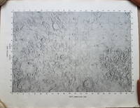
19693792<p>A very uncommon map of the Sea of Tranquility area that would be the site of the first moon landing in 1969. According to a description of a related larger-scale map in a 2020 Bonham's auction "NASA mission planners created this internal Manned Spacecraft Center chart a few months before the flight in 1969."</p><p>The map encompasses the area from 14 degrees South to 14 degrees North Latitude and from 0 degrees to 42 degrees East Longitude. The coordinates of the Eagle's landing site were 0.675 degrees Latitude North and 23.47 degrees Longitude East – very near the center of the mapped area.</p><p>The map is numbered "MSC – 6238 – 69" in the lower right margin. As it was meant for internal use only the map appears to be significantly less common than the LAC Lunar Chart series and the USGS geologic chart series. We were unable to locate an online reference to the map on the Lunar and Planetary Institute website.</p><p><strong>Condition: </strong>Rolled never folded. Some crinkling in the lower margin. Tear at extreme lower right corner with map number has been closed with archival tape on the reverse. Good.</p><p>ICN 7706.1.</p> NASA Manned Spacecraft Center
Very Good Turkish, Ottoman (1500-1928) Original color map. Folded. Oblong atlas folio. (50 x 60 cm). In Ottoman script. Shows Southeastern parts of Asia Minor and Syria; Siverek, Sard (Iraq) and Ras Al-Ayn (Rasulayn - Resualyn) in Syria. Hegira: 1333 = Gregorian: 1917. Not description on map-maker. Scale: 1: 200.000. This is one the serie of the Bonn projection maps which are the first map series in modern techniques in Turkey and the Ottoman Empire. In order to produce these maps covering Turkish territory, Reconnaissance Branch was incorporated into The Mapping Commission. The maps were produced in the datum based on the latitude and longitude of Ayasofya Mosque in equal area Bonn Projection. The field works for the 123 sheets covering the country were conducted by 76 staff. The production was completed in 18 years starting from east west. Field works continued without stopping except in years 1914 and 1920. This map series called also reconnaissance maps contributed a lot to producing 1:25.000 scale maps. According to Türkezer & Çobanoglu: History of Mapping in Turkey-1:200.000 Scale Maps, last cartographer of Diyarbakir regio is M. Sait Malatyali. No his biographic material and info in 'Savaslarda Haritacilar'. Rare.
Folio (430 x 320 mm), [4], 373, [3], liii, [1]pp., printed for private circulation only in 200 copies, early armorial bookplate to front paste-down, cont. half blue morocco, marbled boards, slightly rubbed otherwise a very good copy indeed. Printed uniformly with the catalogue of books and, like that work, printed only for presentation. The map collection was an important constituent of the Royal library (Samuel Johnson recommended buying maps locally in his famous letter to Barnard); The King's Topographical Collection of around 50,000 maps, charts, prints and drawings formerly owned by George III and donated to the Library by George IV, included antiquarian drawings by William Stukeley, large collections of views by Samuel Hieronymus Grimm, the Bucklers and Edward Blore, and the drawings from Captain Cook's voyages or Robert Hay's of Egypt. It was reprinted in 2 vols. 8vo in the same year for commercial distribution. Martin, Privately Printed Books, p. 259.
Very Good Turkish Original manuscript color map of Middle East including Syria, Palestine and Transjordan. Signed by cartographer. 28x20 cm. In Turkish (with Latin letters). The Mapping Department, which moved to Ankara from Istanbul after the Independence War, settled in the Attar Basi Khan in Koyunpazari and the press section also started its studies in the building which is the Art School in Ulus today. In 1924, the department, which is still inside the General Directorate Garrison, moved to the hut-shaped buildings with single floor between the Military Sewinghouse and the General Directorate. On the other hand, the production of maps and plans, which were to be used in development services carried out in parallel to the revolutions starting with the declaration of the Republic and following each other, was considered to be based on a legal arrangement. Because of the necessity of an urgent legal arrangement, the bill of law concerning to the General Directorate of Mapping, whose preparations were initiated by Lieut. Gen. M. Sevki (Ölçer) who knew the importance of the subject, was sent to the Ministry of Defense at the beginning of 1925. After the approval of Ministry of Defense, the bill, which was sent to the Prime Ministry, was discussed in the Council of Ministers and presented to the Grand National Assembly of Turkey. As a result; the Mapping Department was re-organized as the General Directorate of Mapping affiliated with the Ministry of Defense with the law bearing the number 657 on May 2, 1925 in order to do all mapping works and meet the needs of maps and plans of all ministries, institutions and organizations. [.] The first application of photogrammetry was made in Kayas, Ankara with the Wild Autograph plotting apparatus which was purchased in that year. Captain Ömer Kadri and Captain Niyazi came back from their photogrammetry education in Germany. Major Halit and Major Nüzhet were sent to France for photogrammetry education and Captain Ishak and Captain Bahri were sent to Germany. Captain Ahmet (Denkmen) and Captain Ömer Kadri attended the Congress of Photogrammetry assembled in Berlin. (Source: The Illustrated History Of Turkish Cartography). Halid Ziya was born in Izmir, Tire. He went to Istanbul and continued to Hendese-i Mülkiye and Engineer Mekteb-i Âlîsi for seven years. After starting with "Aydin Province Umur-i Nafia Third Class Engineering", Halid Ziya Bey, who continued to work as a deputy chief engineer on 14 March 1910, left Aydin and returned to Istanbul after continuing this duty for about six and a half months. As a teacher, he taught Accounting, Algebra, Geometry, and Topography at Halkali Ziraat Mekteb-i Âlîsi and Darussafaka. Halid Ziya Bey, who was appointed as a teacher of Hendese and Cosmography in Kabatas High School, started to practice the profession of engineering and cadastral, which was his main specialty in 1327. After the First World War, the Istanbul Government started its activities in order to capture and neutralize Halid Ziya Bey and his friends. Upon the harsh measures taken, Halid Ziya Bey had to live as a fugitive in the Hasirci Mountains of Eskisehir for a while with the armed force attached to him. Halid Ziya Bey, who was involved in the movement in Anatolia until the end of the National Liberation Struggle, returned to his engineering duty after the proclamation of the Republic and was included in the cadastral works again. In 1925, Halid Ziya Bey was appointed as the Head of the Science Committee of the new cadastre organization. He wrote 5 books on cadastre, photogrammetry, trigonometry, and cadastral tools in 1928 and 1929. In addition, as a result of personal work in 1928, the road between the provincial division of the Republic of Turkey with cities has prepared a comprehensive map to show up in the forest and mining. (Source: Kadastro ne idi, nedir, ne olacaktir, Kadioglu - Yildirir. From Preface.). No scale.
Carte dépliante lithographique en couleurs (85 x 67 cm) Bon état. [ARCH]
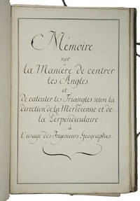
1750ABC_46337France 1750. Folio. Sewn in quires and stored loose in a portfolio covered with grey paper grey cloth ties paper label on the front board. Manuscript in French on thick paper written in a neat 18th-century cursive hand. With 5 manuscript plates showing 14 geometrical figures. 2 blank 1 1 blank 61 3 blank pp. Cartographic manuscript intended to teach engineer-geographers how to in the authors words centrer les angles bisect angles and to triangulate to calculate locations on a map as precisely as possible. The author remains unidentified but probably taught cartography. He the field was hardly open to women gives many examples to explain his methods all richly illustrated in the manuscripts geometric figures and with tables. He quotes the methods of the important French mathematician physician and hydrographer Pierre Bouguer 1698-1758 who was also geometer at the Académie des Sciences in Paris for the means to centrer les angles though we have not found Bouguer using that phrase and those of the French astronomer and cartographer César-François Cassini de Thury 1714-1784 also member of the Académie for triangulation. Altogether the work is a practical guideline for engineer-geographers in which the author not only describes methods for bisecting angles and for triangulation but for example also how to use his own tables on pp. 29-44. A highly interesting cartographic manuscript with a strong geometrical focus quoting two of the foremost French cartographers of the 18th century.With the library stamp of the Danish national library Det Kongelige Bibliothek in Copenhagen. Portfolio a little worn dust-soiled and somewhat stained but the leaves are still in good condition.l Katalog der Bibliothek und Kartensammlung der Königlichen Allgemeinen Kriegsschule 1851 56. hardcover
Very Good Turkish, Ottoman (1500-1928) Original color map on cloth. Oblong: 67x75 cm. In Ottoman script. Folded originally. A very detailed map. Scale: 1:210.000. Shows Shkodra Lake, its shores, Bog Mountains, Karadag (Montenegro), Iakoh, Has etc. [MAP of OTTOMAN PROVINCE of BALKANS-ALBANIA] 52 Ipek (Peja). 53 Yakoh. 59 Akola. 60 Iskodra (Shkodra).
Very Good Turkish, Ottoman (1500-1928) Original color map. Folded. Very good. Large oblong 8vo. (21 x 26 cm). In Ottoman script. [MAP of OTTOMAN PROVINCE of DIYAR-I BEKR] Diyarbakir Vilâyeti. Province of Diyarbekir in Southeast Anatolia and its around. Many sandjaks and provinces with their detailed place names. Scale: 1/500.000.
Very Good Turkish, Ottoman (1500-1928) Original color map. Folded. Very good. Large oblong 8vo. (21 x 26 cm). In Ottoman script. [MAP of OTTOMAN PROVINCE of DIYAR-I BEKR] Diyarbakir Vilâyeti. Province of Diyarbekir in Southeast Anatolia and its around. Many sandjaks and provinces with their detailed place names. Scale: 1/1.500.000.
Very Good Turkish, Ottoman (1500-1928) Original color map. Folded. Very good. Large oblong 8vo. (21 x 26 cm). In Ottoman script. [MAP of OTTOMAN PROVINCE of EASTERN ROUMELI] Rumeli-yi Sarkî Vilâyeti, Bulgaristan Eyâleti, Edirne Vilâyeti, [Trakya], Selânik Vilâyeti. [East Roumeli, Salonica, Adrianople provinces; Old Zagra Sandjak, Bulgarian State]. Scale: 1/1.500.000. Ottoman Provinces in the Balkan Peninsula.
Very Good Turkish, Ottoman (1500-1928) Original color map. Folded. Very good. Large oblong 4to. (19 x 37 cm). In Ottoman script. [MAP of OTTOMAN PROVINCE of ERZURUM] Erzurum Vilâyeti. Province of Erzurum of east Anatolia and its around. Many sandjaks and provinces with their detailed place names. Scale: 1/1.500.000.
Very Good Turkish, Ottoman (1500-1928) Original color map. Folded. Very good. Oblong 4to. (21 x 42 cm). In Ottoman script. [MAP of OTTOMAN PROVINCE of KONIA] Konya Vlâyeti and around; Burdur, Isparta, Teke sandjaks, Hüdavendigâr Province Tozlu Ova, Tuz Gölü etc. Scale: 1/500.000.
Very Good Turkish, Ottoman (1500-1928) Original color map. Folded. Very good. Large oblong 8vo. (26 x 26 cm). In Ottoman script. [MAP of OTTOMAN PROVINCE of SIVAS] Sivas Vilâyeti, Trabzon Vilâyeti, Tokat Sancagi. [Sivas and Trabzon Provinces, Tokat Sandjak]. Scale: 1/1.500.000.
Very Good Turkish, Ottoman (1500-1928) Original color map. Folded. Very good. Large oblong 8vo. (26 x 26 cm). In Ottoman script. [MAP of OTTOMAN PROVINCE of SIVAS] Sivas Vilâyeti, Trabzon Vilâyeti, Tokat Sancagi. [Sivas and Trabzon Provinces, Tokat Sandjak]. Scale: 1/1.500.000.
Very Good Turkish, Ottoman (1500-1928) Original color map. Folded. Very good. Obblong 4to. (21 x 38 cm). In Ottoman script. Scale:: 1/500.000. [MAP of OTTOMAN PROVINCE of TREBIZOND] Trabzon Vilâyeti, Trabzon Sancagi, Canik Sancagi, Sivas Vilâyeti. [Provinces of Trabzon and Sivas; Canik and Trebizond Sandjak]. Black Sea at north.
Very Good Turkish, Ottoman (1500-1928) Original color map. Folded. Very good. Large oblong 8vo. (21 x 26 cm). In Ottoman script. [MAP of OTTOMANT SALONICA -THESSALONIKI-] Selânik Vilâyeti. Ottoman Greece. Scale: 1/1.500.000. It shows Thessaloniki and its around. Manastir Vilayat, At north Kosovo, Siroz Sandjak etc.
193560001New York: John Day Reynal & Hitchcock 1935. 4to. xiv 351 1 pp. With 56 maps most full-page numerous text illustrations. Blue publisher’s cloth silver lettering front cover & spine minor shelfwear light rubbing at head & foot of spine corners w/ d.j. striking Art Deco cover art of ships voyaging minor creasing edgewear couple closed tears on back cover wear to corners still NF/VG- copy inscribed by author on half-title. First edition inscribed of this unashamedly Eurocentric voyages and exploration history detailing “all the great adventurers by land and sea from Hannu 2750 B.C. to Piccard 1935.†The specially prepared maps specifically show the ground and oceans covered by each explorer with the contemporary “Known World†starkly defined. The maps and histories sequentially “unroll†from the very small area around the Mediterranean to the World. Outhwaite 1892-1979 was an anthropologist who worked on American race relations at the Laura Spelman Rockefeller Memorial from 1923-1028 worked for the Rockefeller Foundation through the 1930’s and organized “Outhwaite Exhibits†for museums World’s Fairs and window displays. He also was an adventurer who sailed 14000 miles on the Atlantic Ocean from 1929-1930 onboard the yacht “Kinkajou†visiting Mt. Pelee Martinique. John Day, Reynal & Hitchcock, hardcover
ORD-7180Andriveau-Goujon. 1864. Carte d'État-Major au 1/80000° repliée sous cartonnage vert de l'éditeur.
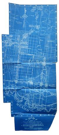
1917List2530VP 1917. Scrapbook measuring 15 ½ x 10 ½ inches. With forty leaves most with newspaper clippings and varied ephemera attached. Boards detached contents generally fine. Laid in is a blueprint map entitled Map of Part of Hidalgo County Texas Showing Line of March in my Mexican Border Service 1916. Made from Survey Notes taken on the march by Corp. C.A. Rice 74 Inf. N.G.U.S. Buffalo N.Y. Armory. Map measuring 33 ½ x 14 ¾ inches irregularly shaped and apparently complete. Very Good. A scrapbook documenting the military service of 1st Sergeant Samuel Gaffney of the 74th National Guard New York in the Mexican Border Service. Gaffney documents the campaign in great detail through printed matter - with each of the forty leaves containing material affixed including panoramic photographs advertisements from local businesses along the routes programs from entertainment offered to the troops military orders and official correspondence and many affixed newspaper articles and photographs. <br /> <br /> The scrapbook is most notable for the inclusion of an unrecorded map by Charles A. Rice the Buffalo native who would eventually map the campaign in larger fashion in a map entitled Map Showing Lines and March and Border Patrols in my Mexican Border Service 1916-1917. The map here just showing the route through Hidalgo County is unrecorded. The larger map - which was produced as souvenirs for the other members of the 74th - is quite scarce as well with five copies known to exist per OCLC with two different numbers. This blueprint map which appears to be complete cartographically and missing only the ornamental border on one portion shows the route taken early in the campaign in 1916. The Buffalo native Rice 1885-1931 who would eventually settle in Texas after the conflict also wrote a history of the 74th during the campaign. Rice published the maps and memoir himself. The map shows the route in great detail showing the location of wells farms roads and identifying landowners. Water quality and abundance is understandably a common theme in Rice’s notes. Some notes show the location of bandits smugglers and the like. We find no other examples of blueprint maps by Rice. <br /> <br /> Other highlights from the scrapbook include seven panoramic photographs of the 74th encamped at Pharr; a broadside advertisement for the shop of Agustin Acevedo in Pharr listing prices of goods; a handbill advertising the 74th’s Minstrels and Great Entertainment show on September 16 1916; an advertisement for a production entitled Glorious Liberty at the National Theatre in Pharr; two circulars instructing troop movement issued by Headquarters Brownsville District; several postcards with songs about the campaign; several snapshots; a mounted albumen photograph of troops at rest with the notation “Corp Frederick Paid†verso; a typed poem entitled “Home Again†and a notebook page describing his activities from January 1917 onward; and a thanksgiving menu for 1916 for the holiday spent at Pharr. The remainder of the scrapbook is composed of affixed newspaper clippings which provide extensive information on the 74th collected in a single volume. <br /> <br /> Overall a significant scrapbook with much information to glean for students of the 74th’s activities with the map providing a unique cartographic reference of the early days of the campaign. unknown
Very Good Turkish, Ottoman (1500-1928) Original color map. 65,5x63 cm. In Ottoman script. This rare and decorative Gallipoli map including Hellespont, Gallipoli Peninsula, Suvla Bay, Seddülbahir, and Tenedos, the places of Gallipoli Aar in 1915 (Dardanelles Campaign) during World War 1, separated two map views. Seddulbahir and Suvla Bay at north and Straight, Peninsula, and its shores with Tenedos (now Bozcaada) at the southwest of the map. It's a very detailed and rare map printed with the series of "History of the Dardanelles Campaign" after the seven years of war. The Gallipoli campaign, also known as the Dardanelles campaign, the Battle of Gallipoli or the Battle of Çanakkale (Turkish: Çanakkale Savasi, or, Muharebâti), was a military campaign in the First World War that took place on the Gallipoli peninsula (Gelibolu in modern Turkey), from 17 February 1915 to 9 January 1916. The Entente powers, Britain (with Anzacs), France, and Russia, sought to weaken the Ottoman Empire, one of the Central Powers, by taking control of the Turkish straits.
ORD-15302Ministère de l'Intérieur. 1890. Grande carte couleurs de 565 x 447 mm de dimensions totales et pour la carte 465 x 340 mm, repliée au format in-12 sous couverture cartonnée rouge (102 x 162mm), titre or sur le 1er plat. Couverture lgt abîmée, carte en excellent état.
ORD-14586Missions Catholiques. 4 Juin 1875. Feuille de 445 x 324 mm, carte en noir et blanc de 343 x 284 mm. Fissures aux points de pliages réparées, mais assez bon exemplaire.
ORD-14585Missions Catholiques. 15 Octobre 1875. Feuille de 500 x 336 mm, carte en noir et blanc de 430 x 272 mm. Fissures aux points de pliages réparées, mais assez bon exemplaire.
Carte dépliante lithographique en couleurs (85 x 67 cm) Bon état. [ARCH]
Firenze, Biblioteca Medicea Laurenziana, 1981, in-8, br. editoriale, pp. VI, 111, [3]. Con 40 tavole comprese nella paginazione, di cui 8 a colori e bibliografia. Esposizione realizzata in occasione della IX Conferenza Internazionale di Storia della Cartografia.