5 782 résultats
Carte dépliante lithographique en couleurs (85 x 67 cm) Bon état. [ARCH]
Firenze, Biblioteca Medicea Laurenziana, 1981, in-8, br. editoriale, pp. VI, 111, [3]. Con 40 tavole comprese nella paginazione, di cui 8 a colori e bibliografia. Esposizione realizzata in occasione della IX Conferenza Internazionale di Storia della Cartografia.
ORD-16835Tiré de l'Atlas des Ports étrangers. Paris. Imprimerie Nationale. 1886. Grand plan de 88 x 33 cm plié en 4 volets, gravé par A. Simon, publié par le Ministère des Travaux Publics. Impression en noir et bleu. Bords de feuille lgt poussiéreux sinon bon état.
2005LFA-126722605N° 233 (Juin 2005) 67 pages, format 220 x 280 mm, illustré, broché couverture couleurs, bon état
ORD-7863Carte couleurs dessinée à la main à l'échelle 1/5000e, accompagnée de notes manuscrites, signées par le Lieutenant de Vaisseau Léon CHAMBEYRON, datée de août 1863. Grande feuille de 242 x 385mm, la carte occupant la partie supérieure et le texte la partie inférieure. Travail de vers marginal affectant seulement 4 lettres, document un peu sali sur les bords. Il s'agit sans doute d'une page originale des instructions nautiques que CHAMBEYRON fit paraître à partir de 1867.
Multi-color, multi-folded map glued to paper printed and illus paper wraps. Unfolded, map is 20 x 27 inches. Printed in black. blue and green on offwhite paper. Maps of "Boston and vicinity" to both sides Rare. No copy located in World Cat. "Production under the direction of Alexander Gross. F.R.G.S" Appears to be from the 1920s or 1930s.
Very Good Turkish, Ottoman (1500-1928) Contemporary red cloth. Roy. 8vo. (24 x 16 cm). In Ottoman script (Old Turkish with Arabic letters). [1], 229, [1] p., many b/w and color ills., 30 chromo-lithographed maps. Wear and fading on spine, some ex-library stamps on the colophon and several blank pages, ownership ink inscription and signature on the first page-overall a good copy. First edition of this rare Ottoman atlas for the primary schools in the late Ottoman Empire, including beautiful 30 chromo-lithographed maps of the Ottoman land according to administrative regions (provinces) and richly illustrated with b/w plates of the cities and provinces in the Middle East. Map list: 1. World map 2. Complete Imperial Ottoman 3. Arabian Peninsula 4. Anatolia 5. Asia Minor 6. Marmara and Black Sea 7. Aegean (The Archipelago) 8. Demography of Anatolia and Syria, Libya, etc 9. Administrative map of Anatolia 10. Map of mines of Anatolia 11. Agricultural map of the Imperial Ottoman 12. Arabian Peninsula 13. Map of the Edirne Vilayat [Adrianople Province of the Ottoman Empire] 14. Map of the Bosphorus 15. Map of the Hüdavendigâr Vilayat [Brusa Province] 16. Maps of Izmit and Biga Sanjaks 17. Map of Aydin Vilayat and Mentese Sanjak 18. Map of the Konya Vilayat 19. Maps of the Adana Vilayat and the Mediterranean Sea 20. Maps of the Erzurum and Ankara Vilayats 21. MAps of Kastamonu Vilayat and Bolu Sanjak 22. Map of the Trebizond Vilayat 23. Maps of the Van and Bitlis Vilayats 24. Maps of the Sivas and Harput Vilayats 25. Maps of the Bagdad and Basrah Vilayats 26. Map of the Mosul Vilayat and Day al-Zor Sanjak 27. Map of the Aleppo Vilayat and Urfa Sanjak 28. Map of the Syria and Beirut Vilayats 29. Map of the Arabia 30. Maps of the Yemen vilayat and Asir Sanjak. This atlas was printed four times for the different classes of the early Turkish / Ottoman schools, during World War 1 (two times in 1916) and the National Struggle (two times in 1921). Geylangil was born in Istanbul in 1887 and studied in Aleppo and Baghdad. Geylangil, who also studied economic geography, taught geography at many schools, including Galatasaray High School. Until his death, he wrote 14 books on geography, most of which were geographical atlases. In 1941, he was among the founding members of the Turkish Geographical Society. Özege 23216.; TBTK 11481.; We couldn't find any copy of this edition worldwide.
175046405149Paris, Jombert, 1750 ; in-12, veau fauve marbré, dos à nerfs et ornements dorés, tranches rouges. (Reliure de l’époque) 6 ff., 144 pp., 4 ff. n. ch. (approbation par Belidor, privilège et annonces) - 16 planches gravées dépliantesLa première édition de ce traité est de 1693. Cette nouvelle édition comporte des changements, corrections et additions par Charles-Antoine Jombert. Barbier III, 292 - Polak. Bibl. maritime 7231. Au sujet du mathématicien J. Ozanam voir la notice dans D. S. B. tome X, pp. 263-265. Bel exemplaire frais et bien relié.
ORD-8079Plan garanti complet ou le Guide dans Paris dressé par Lallemand. Nouvelle méthode. Paris, rue Serpente. 1865. Grand plan couleurs (90x62cm), replié sous cartonnage rouge avec étiquette illustrée. Dos de reliure refait. 2 petites réparations aux plis sinon bel état. Cachet de colportage.
ORD-8080P.Marie et A.Bernard. 1858. Gd et beau plan couleurs (86x59cm) replié sous couverture cartonnée de 9x15cm (malheureusement très abîmée). Plan présentant quelques défauts et déchirures sans perte qui peut et mérite d'être restauré.
ORD-14611Supplément du Journal des Missions Catholiques. 1896. Feuille de ca 1060 x 730 mm, pliée en 16, carte de ca 970 x 660 mm. Carte générale centrale de ca 490 x 420 mm, entourée de 24 cartes des différentes îles et archipels. Tirage en rouge sur fond vert pâle. Réparations aux croisements des plis d'origine sans dommage pour la carte. Bon exemplaire.
ORD-16517France Tourisme. EPOC. Tirage de Janvier 1930. Très grande carte couleurs de 972 x 648 mm repliée en 18 volets de 162 x 216 mm. Publicités et légendes au dos de la carte. Carte sous étui imprimé et un peu insolé. Bon exemplaire.
21203Paris, Emery, 1823, 1 f. 80,5 x 102 cm, cartonnage rose, étiquette manuscrite (cartonnage défraîchi mais solide, petites déchirures et trous, papier bruni d'un côté, empoussiéré de l'autre).
ORD-16872Tiré de l'Atlas des Ports étrangers. Paris. Imprimerie Nationale. 1886. Grand plan de 62,5 x 33 cm plié en 3 volets, gravé par A. Simon, publié par le Ministère des Travaux Publics. Impression en noir et bleu. Bon état.
ORD-9050(Paris). C. L. F. Panckoucke. 1815-1821. Grande carte de 650 mm de hauteur et 960mm de largeur en 36 parties assemblées et collées sur toile, rempliée sous étui de 116 x 173mm. Donne la carte de l'Europe et, dans la partie inférieure gauche les Plans des capitales conquises et des principales villes assiégées par les Français (16 plans). Etui de carton avec étiquette de papier, titre manuscrit. Etui un peu abîmé, carte en très bon état.
2001LFA-126741215Une revue de 12 pages, format 220 x 285 mm, illustrée, brochée couverture couleurs, Editions Atlas, bon état
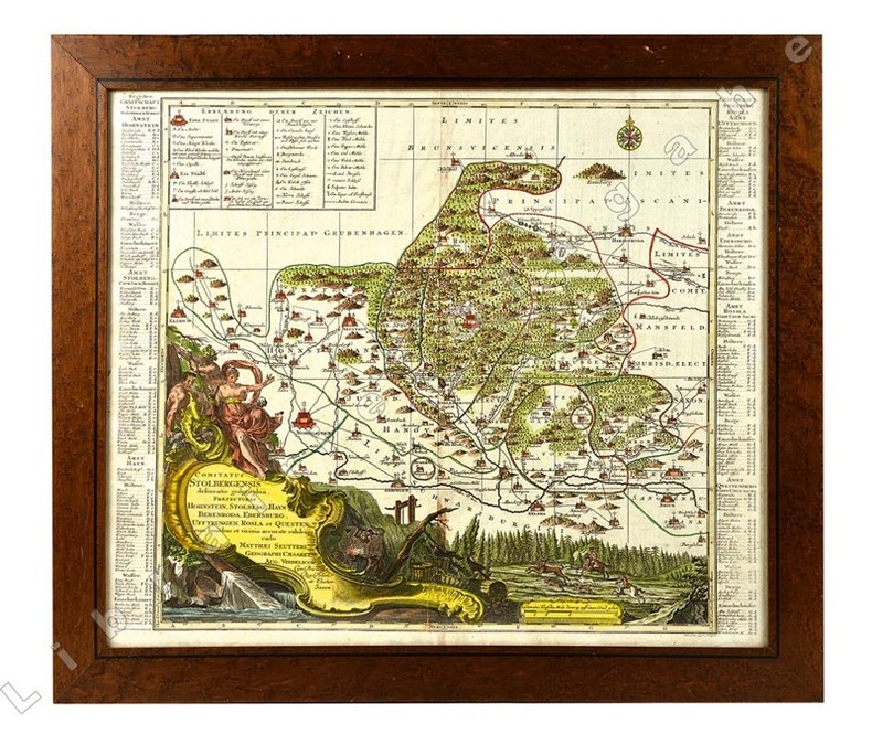
20921Cartouche du titre en bas à gauche avec figures allégoriques, scènes de forge et de chasse à courre. Légende en haut à gauche.
ORD-16890Tiré de l'Atlas des Ports étrangers. Paris. Imprimerie Nationale. 1886. Plan de 24,4 x 33 cm plié, gravé par A. Simon, publié par le Ministère des Travaux Publics. Impression en noir et bleu. Bord droit lgt insolée sinon bon état.
Very Good Arabic Original chromo-lithograph map in brown tones. On a special paper with an ongoing blindstamped "Regestre Robur" during the borders. Folded. 70x100 cm. In Arabic. Scale: 1 /1.000.000. Chipped on margins, split on folded traces. Slight discoloration and one stain on lower margin. Otherwise a good copy. An attractive and detailed map of Syria shows the capital (as Aleppo n that map), other cities like Damascus, Raqqa, Homs, Latakia, Ayn al-Arab, Idlib, Hama, Deir Ez-Zor, Jarabulus, et alli. And it shows Turkey on the north (as Turkey containing Hatay and Alexandrette), The Mediterranean shores of the land as well as Lebanon and Palestine (and Jerusalem) on the west, Sharq al-Urdun (Jordan) and Iraq on the south and east. It's very detailed on showing the roads spread throughout the land like railways and ancient roads from the Roman period. Additionally this roads can be followed to the other Arabic countries and regions on the map. This map was calligraphed by Kamel Al-Baba, (1905-1991), who was a Lebanese contemporary / modern calligrapher. He is the son of famous calligrapher Mokhtar Al-Baba. Cannot be found in WorldCat.; Not in Library of Congress Map Collection. Very scarce.
ORD-14663Publiée par les Missions Catholiques, 4 Juillet 1874. Feuille de 444 x 328 mm, carte de 353 x 268 mm situant le Tong-King Occidental, l'Oriental, le Central et le Méridional. Fissure au point de pliage réparée, bord inférieur de la feuille un peu grignoté mais assez bon exemplaire.
ORD-14662Lithographie St Augustin. 1889. Feuille de 334 x 562mm, carte couleurs de 250 x 412 mm indiquant la Résidence Épiscopale, celle des Missionnaires, les lieux de Chrétienté, les Chrétiens, le Chef-lieu de Province, la préfecture et la sous-préfecture annamite,, les routes et les limites de la Mission. Papier bruni, qq. fissures aux points de pliages réparées, traces de trous de punaises mais assez bon exemplaire.
Carte dépliante lithographique en couleurs (85 x 67 cm) Très bon état. [ARCH]
ORD-10863au 1/80000 levée par les Officiers du Corps d'Etat-Major et publiée par le Dépôt de la Guerre en 1857. Imp.Lith. Lemercier Report sur pierre 1875. Gde carte en 4 pièces collées sur toile (645x930mm).
Very Good Turkish, Ottoman (1500-1928) Original engraved map on the silk handkerchief made in Yildiz Palace for the 'Iane Sergisi' [i.e. Exhibition of the Social Assistance] in the period of Sultan Abdülhamid II. In its decorative frame. Frame size: 53,5x53,5 cm; map size: 38x38 cm. In Ottoman script. Scale: 1/600.000. Several minimal splits, minor foxing, and slight stains on cloth. Otherwise in good condition. A rare and decorative 1897 silk handkerchief map of the Greco-Turkish War in 1897, which was the only war in which the Ottoman army was victorious during the reign of Abdulhamid 2, is a fine example of Ottoman / Turkish cartographic textiles made in Ottoman court (Yildiz Palace textile workshops). This beautiful map depicts an attractive war scene from the 1313 Greek War on the upper half, and it's engraved a map of Balkan & Greek lands on its lower half. War painting has 'Melona' signature in Ottoman script. The map shows Thessaloniki [i.e. Salonica] Bay on the west; Yanya [i.e. Ioanna] Vilayat on the east; lands of Greece, Galos Bay, Uzi Strait on the south and Dimetoka and Avalonia areas in the Serefiye, Ergiri sanjaks on the north in its period. Written on the map, "Baht-i himâye-yi feyzvâne-i cenâb-i hilâfetpenâhide evlad-i süheda ve mecrûhin-i asakir-i sâhâne", [i.e. It was printed for the "Iane Sergisi" (i.e. The Social Help Exhibition) in the high memory of our soldiers who were martyred and veterans in the Greek War under the patronage of the Sultan.]. The Greco-Turkish War of 1897, also called the Thirty Days' War and known in Greece as the Black '97 (Mauro '97), or the Unfortunate War (Atychis polemos), was a war fought between the Kingdom of Greece and the Ottoman Empire. Its immediate cause was the question over the status of the Ottoman province of Crete, whose Greek majority long-desired union with Greece. Despite the Ottoman victory on the field, an autonomous Cretan State under Ottoman suzerainty was established the following year (as a result of the intervention of the Great Powers after the war), with Prince George of Greece and Denmark as its first High Commissioner. This was the first war effort in which the military and political personnel of Greece were put to test since the Greek War of Independence in 1821. For the Ottoman Empire, this was also the first war effort in which the reorganized military personnel were put to test. The Ottoman army was under the guidance of a German military mission led by Colmar Freiherr von der Goltz, who had reorganized it after the defeat in the Russo-Turkish War (1877-1878). The conflict proved Greece was wholly unprepared for war. Plans, fortifications and weapons were non-existent, the mass of the officer corps was unsuited to its tasks, and training was inadequate. As a result, the numerically superior, better organized, equipped and led Ottoman forces pushed the Greek forces south out of Thessaly. Almost all of the aids made to the families or disabled people of those who were martyred in the 1897 Ottoman-Greek War (such as printing this map) were made within the framework of the donations of "Evlâd-i Süheda and Malûlîn-i Guzât-i Asâkir-i Sahane". People and citizens of all classes and beliefs, including members of the Ottoman court, ministers, bureaucrats, civil servants, merchants and tradesmen, participated in this aid campaign at the end of the 19th, beginning of the 20th century. Not in OCLC.