Almagià RobertoMareMagnum

5 783 résultats
15 carte a colori, 195 in nero e 1020 illustrazioni nel testo
9 carte a colori, 140 in nero e 710 illustrazioni nel testo
12 carte a colori, 147 in nero e 795 illustrazioni nel testo
In-8° (cm. 24x17), pp. 3 (da p. 745 a p. 747) + la riproduzione della CARTA GEOGRAFICA delle isole greche dell'Egeo e della tra Macedonia e Turchia , (cm. 41x24) dedicata dal Coronelli ell'ex Bailo di Costantinopoli.
In folio piccolo, pp. 13 e grande carta geografica ripiegata che riproduce il planisfero. Non comune.
Mm 175x255 Collana "Orientamenti e problemi geografici". Brossura editoriale di 283 pagine. Esemplare parzialmente intonso (= a fogli chiusi), firma d'appartenenza alla prima carta, lievi segni del tempo alla copertina, peraltro buona copia. SPEDIZIONE IN 24 ORE DALLA CONFERMA DELL'ORDINE.
Mm 180x270 Brossura editoriale, xi-692 pagine con illustrazioni in nero nel testo ed una carta a colori ripiegata f. t. Cinque pagine di un capitolo recano sottolineature a penna blu, peraltro ci tratta di una ottima copia nelle sue legature ben salde. SPEDIZIONE IN 24 ORE DALLA CONFERMA DELL'ORDINE.
3 voll.in 6 tomi. <br/> TITOLO: Il mondo attuale. Descrizione geografica degli Stati mondiali nel loro quadro naturale ed umano. <br/> AUTORE: Almagià,Roberto.<br/> EDITORE: UTET<br/> DATA ED.: 1953-1960,<br/>
M., Patronato "Alonso de Herrera", 1972, 26'5 x 20 cm., 365 págs. - 16 mapas en negro y color.
ORD-240Nice. Grasse. Imbert. 1906. Carte topographique couleur au 250000° de 390 x 475mm. (24).
Mm 145x220 Collana "Saggi" - Presentazione di Enrico Castelnuovo. Volume rilegato in tela nera, sovraccoperta originale, XVIII-416 pagine, numerose le illustrazioni in nero e a colori.. Esemplare in condizioni pari al nuovo. SPEDIZIONE IN 24 ORE DALLA CONFERMA DELL'ORDINE.
<p>30 cm, cartoncino editoriale illustrato . Cartografia storica del territorio del Comune di Bondeno</p>
Firenze, 1999, 8vo stralcio con copertina posticcia muta, pp. 407/414 con un grafico e due carte a colori. - !! ATTENZIONE !!: Con il termine estratto (o stralcio) intendiamo riferirci ad un fascicolo contenente un articolo, completo in se, sia che esso sia stato stampato a parte utilizzando la stessa composizione sia che provenga direttamente da una rivista. Le pagine sono indicate come "da/a", ad esempio: 229/231 significa che il testo è composto da tre pagine. Quando la rivista di provenienza non viene indicata é perché ci è sconosciuta. - !! ATTENTION !!: : NOT A BOOK : “extract” or “excerpt” means simply a few pages, original nonetheless, printed in a magazine. Pages are indicated as in "from” “to", for example: 229/231 means the text comprises three pages (229, 230 and 231). If the magazine that contained the pages is not mentioned, it is because it is unknown to us.
tavole a colori fuori testo
Firenze, 1996, 8vo stralcio con copertina posticcia muta, pp. 241/272 con numerose carte a colori. - !! ATTENZIONE !!: Con il termine estratto (o stralcio) intendiamo riferirci ad un fascicolo contenente un articolo, completo in se, sia che esso sia stato stampato a parte utilizzando la stessa composizione sia che provenga direttamente da una rivista. Le pagine sono indicate come "da/a", ad esempio: 229/231 significa che il testo è composto da tre pagine. Quando la rivista di provenienza non viene indicata é perché ci è sconosciuta. - !! ATTENTION !!: : NOT A BOOK : “extract” or “excerpt” means simply a few pages, original nonetheless, printed in a magazine. Pages are indicated as in "from” “to", for example: 229/231 means the text comprises three pages (229, 230 and 231). If the magazine that contained the pages is not mentioned, it is because it is unknown to us.
(Roma, Barbera, 1879), stralcio con copertina posticcia muta, pp. 367/380 con bella tavola litografica a colori, quadrupla, ripiegata - !! ATTENZIONE !!: Con il termine estratto (o stralcio) intendiamo riferirci ad un fascicolo contenente un articolo di rivista, sia che esso sia stato stampato a parte utilizzando la stessa composizione sia che provenga direttamente da una rivista. Le pagine sono indicate come "da/a", ad esempio: 229/231 significa che il testo è composto da tre pagine. Quando la rivista di provenienza non viene indicata é perchè ci è sconosciuta. - !! ATTENTION !!: : NOT A BOOK : “estratto” or “stralcio” means simply a few pages, original nonetheless, printed in a magazine. Pages are indicated as in "from” “to", for example: 229/231 means the text comprises three pages (229, 230 and 231). If the magazine that contained the pages is not mentioned, it is because it is unknown to us.
8°, pp. 479, completo delle 12 tavole incise fuori testo che illustrano alcuni monumenti e le carte geografiche di alcuni percorsi intrapresi. Rilegatura novecentesca in mezza tela, ex libris privato applicato al contropiatto, esemplare molto buono e con barbe. L'opera descrive un viaggio intorno al San Bernardo, da Torino ad Aosta, da Aosta a Chamounix, e intorno al San Bernardo, dal Gran San Bernardo a Losanna; inoltre il viaggio da Losanna a Friburgo e Ginevra, da Ginevra a Lione, da Lione a Parigi e da Parigi a Londra, infine da Ginevra a Milano, passando per il Sempione e con sosta sul Lago Maggiore
1780Map724Bassano Del Grappa: Giovanni Remondini 1780. 1st ediiton . No Binding. Fine. Folio. ND c1780. 36 x 50cms. Original hand-colour. Dusty condition. Very rare town view of Marseille engraved by the Venitian Francesco Ambrosi 1713-173. A numbered key in French to the lower margin of places of interest in the city 1-19. A dark impression printed on heavy paper with a strong plate mark and clear chain lines but no watermarks. <br/> <br/> Giovanni Remondini unknown
Carta di cm 36 x 50 alla battuta, più i margini, su tav. piegata a metà. Tratta da 'Atlante storico, geografico, genealogico, cronologico e letterario di M. A. Le Sage in ogni sua parte corretto, ampliato e proseguito sino all'anno corrente. Prima Veneta Edizione'.
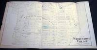
18738953New York NY: Beers Comstock & Cline 1873. Original Hand-colored Map of Part of Whitestone Village Southern Part from the Beers Comstock & Cline Atlas of Long Island New York. Three sections folded 15 1/2" x 27 1/2" approx. overall size; somewhat age-toned; top edge with a little scraping; old creasing; in very good condition. . First Edition. Not Bound. Very Good. Beers, Comstock & Cline Paperback books
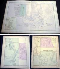
18738957New York NY: Beers Comstock & Cline 1873. Original Hand-colored Map of Woodhaven with Inset Map of South Woodhaven from he Beers Comstock & Cline Atlas of Long Island New York. 15 1/2" x 24 1/4" approx. overall size; somewhat age-toned; on reverse are maps of Springfield Store Willow Tree Station Inglewood Freeport Greenwich Point; left margin edge-chipped right margin with a few nicks; in very good condition. PLEASE NOTE: Shipped rolled for safety. First Edition. Not Bound. Very Good. Beers, Comstock & Cline Paperback books
192913924New York New York: U.S. Geographical Survey 1929. Department of the Interior U.S. Geological Survey Hempstead Quadrangle; 1929 version of a map edition of 1903 depicting a partially revised shoreline of 1923. Showing contours topography waterways train lines roads and locations of homes; printed in three colors. The back of the map with information on map standard symbols. 20" x 16 1/2" approximate size; some edge tips wear closed edge tear at bottom edge little wrinkling; & back with a darkened panel. In good condition decorative and interesting perspective on Long Island real estate development patterns in the area. PLEASE NOTE: Shipped rolled for safety. . Map. Not Bound. Good. U.S. Geographical Survey Paperback books
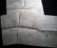
196526508Southold Long Island N.Y.: No Publisher Noted 1965. Three folded sectional maps of the Town of Southold Long Island NY. Approx. 14 1/2" x 18" size; printed black on cream paper stock. Section I depicting western portion Laurel Mattituck Cutchogue Nassau Point Robin's Island; Section II Peconic Southold village Bay View Hashamomack Greenport; Section III East Marion Oysterponds - Orient & a Fisher's Island map inset. Each map with its own numbered key-list of locations and short historical notes on them. Some edge tips-wear and soiling little spotting; old fold lines; in good condition. First Edition. Not Bound. Good. No Publisher Noted paperback books
198424561New York New York: Photo By Bill Ray 1984. Black and white photograph 8" x 10" on heavy photographic paper; on back is handwritten "For my old and valued friend Bob Greene" and with Harrison's name and the date of April 1984 at the lower border; with the studio stamp of Photo by Bill Ray 350 Central Park West New York. with A group of copy-pages of drawings from the New Yorker by Harrison and presented "for Bob Greene Richard Edes Harrison on his 66th Birthday" with the black and white illustrated memorial service pamphlet for R. E. Harrison 1901 - 1994 Cartographer-Artisan-Birder-Raconteur on the 93rd Anniversary of his Birth March 11 1994. in good condition. Robert S. Greene 1922 - 2013 American writer jazz musician documentarian and historian friend of the artist who innovated U.S. cartography in the 20th century. see Timothy Barney "Richard Edes Harrision and the Cartographic Perspective of Modern Internationalism" U. of Richmond 2012 for his more on his contributions to cartography. Photograph. Soft Cover. Very Good. Photo By Bill Ray Paperback books
197825656Nantes Imprimerie Marthe Chantreau et Compagnie 1978 -in-4 broché revue (magazine) in-quarto, première de couverture illustrée (front cover illustrated), illustrations : bien documenté (well-documented), sans pagination (unpaginated), sans date (1978) à Nantes Imprimerie Marthe Chantreau et Compagnie,