333 résultats
1964Map 793London: Director General of the Ordnance Survey 1964. revised edition . No Binding. Fine. Double unfolded sheet. 25 inches to the mile. 89 x 58.5cms. College stamp to lower margin not affecting the plate. ROYAL BOTANIC GARDENS/ BROUGHTON Edinburgh on a large double sheet. PLEASE EMAIL FOR PHOTO. <br/> <br/> Director General of the Ordnance Survey unknown
1969Map 790London: Director General of the Ordnance Survey 1969. revised edition . No Binding. Fine. Double unfolded sheet. 25 inches to the mile. 89 x 58.5cms. College stamp to lower margin not affecting the plate. HOLYROOD PARK/ST LEONARDS on a large double sheet. PLEASE EMAIL FOR PHOTO. <br/> <br/> Director General of the Ordnance Survey unknown
1964Map 792London: Director General of the Ordnance Survey 1964. revised edition . No Binding. Fine. Double unfolded sheet. 25 inches to the mile. 89 x 58.5cms. College stamp to lower margin not affecting the plate. TRINITY Edinburgh on a large double sheet. PLEASE EMAIL FOR PHOTO. <br/> <br/> Director General of the Ordnance Survey unknown
1968Map 791London: Director General of the Ordnance Survey 1968. revised edition . No Binding. Fine. Double unfolded sheet. 25 inches to the mile. 89 x 58.5cms. College stamp to lower margin not affecting the plate. NEWINGTON Edinburgh on a large double sheet. PLEASE EMAIL FOR PHOTO. <br/> <br/> Director General of the Ordnance Survey unknown
1969Map789London: Director General of the Ordnance Survey 1969. revised edition . No Binding. Fine. Double unfolded sheet. 25 inches to the mile. 89 x 58.5cms. College stamp to lower margin not affecting the plate. Quarryhills Edinburgh on a large double sheet. Leith links to the east and Pilrig ot the west. PLEASE EMAIL FOR PHOTO. <br/> <br/> Director General of the Ordnance Survey unknown
1967Map 798London: Director General of the Ordnance Survey 1967. revised edition . No Binding. Fine. Double unfolded sheet. 25 inches to the mile. 89 x 58.5cms. N.W. Ross-On-Wye and Wilton with the A449 crossing the area with surrounding countryside on a large double sheet. Centre fold crease. PLEASE EMAIL FOR PHOTO. <br/> <br/> Director General of the Ordnance Survey unknown
1970Map788London: Director General of the Ordnance Survey 1970. revised edition . No Binding. Fine. Double unfolded sheet. 25 inches to the mile. 89 x 58.5cms. College stamp to lower margin not affecting the plate. PORTOBELLO PROMONADE AND Shore on a large double sheet. PLEASE EMAIL FOR PHOTO. <br/> <br/> Director General of the Ordnance Survey unknown
1969Map 797London: Director General of the Ordnance Survey 1969. revised edition . No Binding. Fine. Double unfolded sheet. 25 inches to the mile. 89 x 58.5cms. Ross-On-Wye and surrounding countryside to the west on a large double sheet. Centre fold crease. PLEASE EMAIL FOR PHOTO. <br/> <br/> Director General of the Ordnance Survey unknown
1890Map 726Scotland: Ordnance Survey Office 1890. 1st Edition . Hardback. Vg. Folding map. Folding map dissected in 18 sections the rare first series edition laid on linen and cased in the original green cloth boards 6.75 x 4.5 inches with a hand-written paper label. Surveyed 1855-1861 and published in1890. Small grid of adjoining maps for the one inch and six inch series pasted to inside cover. 25x19 inches with hand-coloured roads. A nice copy with no wear or loss. There were 132 sheets for the complete Scottish ordnance maps and a second edition appeared in in 1898-1904 with coloured parishes. The one inch maps were based on larger scale surveys of 1843-1878 and published between 1856 and 1895. <br/> <br/> Ordnance Survey Office hardcover
1890Map 728Scotland: Ordnance Survey Office 1890. 1st Edition . Hardback. Vg. Folding map. Folding map dissected in 18 sections the rare first series edition laid on linen and cased in the original green cloth boards 6.75 x 4.5 inches with a hand-written paper label. Surveyed 1859 -1863 and published in1890. Small grid of adjoining maps for the one inch and six inch series pasted to inside cover. 25x19 inches with hand-coloured roads. A nice copy with no wear or loss. There were 132 sheets for the complete Scottish ordnance maps and a second edition appeared in in 1898-1904 with coloured parishes. The one inch maps were based on larger scale surveys of 1843-1878 and published between 1856 and 1895. <br/> <br/> Ordnance Survey Office hardcover
1867Map 731Scotland: Ordnance Survey Office 1867. 1st Edition . Hardback. Vg. Folding map. Folding map dissected in 18 sections the rare first series edition laid on linen and cased in the original green cloth boards 6.75 x 4.5 inches with a hand-written paper label. Surveyed 1859-1864 and published in1867. Small grid of adjoining maps for the one inch and six inch series pasted to inside cover. 25x19 inches with hand-coloured roads. A nice copy with no wear or loss. There were 132 sheets for the complete Scottish ordnance maps and a second edition appeared in in 1898-1904 with coloured parishes. The one inch maps were based on larger scale surveys of 1843-1878 and published between 1856 and 1895. <br/> <br/> Ordnance Survey Office hardcover
1876Map 729Scotland: Ordnance Survey Office 1876. 1st Edition . Hardback. Vg. Folding map. Folding map dissected in 18 sections the rare first series edition laid on linen and cased in the original green cloth boards 6.75 x 4.5 inches with a hand-written paper label. Surveyed 1860-1871 and published in1876. Small grid of adjoining maps for the one inch and six inch series pasted to inside cover. 25x19 inches with hand-coloured roads. A nice copy with no wear or loss. There were 132 sheets for the complete Scottish ordnance maps and a second edition appeared in in 1898-1904 with coloured parishes. The one inch maps were based on larger scale surveys of 1843-1878 and published between 1856 and 1895. <br/> <br/> Ordnance Survey Office hardcover
1869Map 725Ordnance Survey Office 1869. 1st Edition . Hardback. Vg. Folding map. Folding dissected map in 18 sections the rare first series edition laid on linen and cased in the original green cloth boards 6.75 x 4.5 inches with a hand-written paper label. Surveyed 1860-1871 and published in1869. Small grid of adjoining maps for the one inch and six inch series pasted to inside cover. 25x19 inches with hand-coloured roads. A nice copy a couple of small red ink marks otherwise clean with no wear or loss. There were 132 sheets for the complete Scottish ordnance maps and a second edition appeared in in 1898-1904 with coloured parishes. The one inch maps were based on larger scale surveys of 1843-1878 and published between 1856 and 1895. <br/> <br/> Ordnance Survey Office hardcover
1939P278London: Alexander Duckham 1939. facsimile reprint . Hardback. Vg./No Jacket. Oblong 4to. 108 pp including 100 pp of facsimile road maps plus a general map of England and Wales Facsimile edition of the 1675 edition. Red cloth labels. Internally clean and tight. Trifle foxing to the fore-edge. A nice copy. or an Illustration of the Kingdom of England and Dominion of Wales. a. Description of the Principal Roads <br/> <br/> Alexander Duckham hardcover
1909014713Albany: University of the State of New York 1909. Original green cloth gilt is in Very Good condition. The book's inner hinges are badly cracked and nearly separated. However since the text block is secure entirely intact it could be easily re-cased without any re-sewing required. Thick 8vo. 234pp. 51pp. 66pp. 41pp. approx. 100 plates inserted. Complete with all of the maps as called for by the table of contents. A tough-to-find book especially complete with all the BEAUTIFUL MULTI-COLOR FOLDING MAPS IN PERFECT CONDITION. Any of them would look magnificent framed. This amazing miscellany contains the Fifth Report to the Director 1908 and Museum Bulletins 126-128 and 133 and Report of the State Paleontologist for 1908. A particularly useful contribution is: One Hundred Years of New York State Geologic Maps 1809-1909 by Henry Leighton. It includes a CARTO-BIBLIOGRAPHY that describes 329 New York Geologic Maps and has its own index. Some other contributions: A Peculiar Landslip in the Hudson River Clays by D. H. Newland; Some Items Concerning a New and an Old Coast Line of Lake Champlain by George H. Hudson; Types of Inliers Observed in New York by Rudolf Ruedemann; The Last of the Iroquois Potters by M. R. Harrington; etc. There are several other articles on the same subjects as and supporting the maps described below. Bound into Museum Bulletin 127 are NINE MULTI-COLOR FOLDING MAPS #34-42: showing 9 stages of Glacial Lake Succession in New York State 1908. In a pocket at the end are SEVEN BEAUTIFUL MULTI-COLOR FOLDING MAPS most by H. L. Fairchild as follows: Museum Bulletin 126: Geologic Map of the Remsen Quadrangles unfolds to 17" wide by 21" tall; Museum Bulletin 127: Plate 2: Channels and Deltas of Ice-Border Drainage between Leroy and Fishers 1906. 39" wide by 17.5" tall; Museum Bulletin 127: Plate 3: Channels and Deltas of Ice-Border Drainage between Irondequoit and Cayuga Valleys 1906. 39" wide by 20" tall; Museum Bulletin 127: Plate 4: Channels and Deltas of Ice-Border Drainage between Jordan and Chittenango Valleys 1906. 36" wide by 20" tall; Museum Bulletin 127: Plate 5: Channels and Deltas of Ice-Border Drainage between Chittenango and Oneida 1906. 17" wide by 12" tall; Museum Bulletin 128: Geologic Map of the Geneva-Ovid Quadrangles 17" wide by 38" tall; Museum Bulletin 128: East-West Section on Ovid and Genoa Quadrangles. Showing the Low Synclines of the Lake Basins. 17" wide by 8" tall. This copy has the small ink stamp of C. Wesley Yeakel in 4 places. First Edition. Hardcover. VG inner hinges cracked/No jacket. Illus. by Fairchild H. L. maps. Thick 8vo. University of the State of New York Hardcover
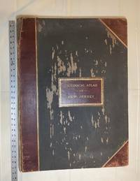
1889028277New York: Julius Bien & Co 1889. Condition of the binding is only Fair with pest damage. Leather over the spine has perished. Front and rear outer hinges cracks have been neatly reinforced with high quality clear flexible glue. Inner hinges are OK having been reinforced by the publisher/bookbinder with sturdy maroon cloth. SEE PHOTOS. Condition of all maps is NEAR FINE - FINE. NO foxing or toning. Pages are clean and unmarked. SEE PHOTOS. Includes a title page map of New Jersey Key to the System of Mapping and 19 linen-backed double page maps. Collated and complete per table of contents -- SEE PHOTOS. The maps are lithographically printed in blue red yellow and black. The double page maps open to an impressive 26.50" across by 36.50" tall. No year of publication is stated but Phillips 2149 in A LIST OF GEOGRAPHIC ATLASES Vol. 1 says 1889. The maps themselves are variously dated up to 1888. Titles of Sheets: No. 0. New Jersey State Map Geographic; No. 1. Kittatinny Valley and Mountain No. 2. Southwestern Highlands; No. 3. Central Highlands; No. 4. Northeastern Highlands; No. 5.Vicinity of Flemington; No. 6. Valley of the Passaic; No. 7. The Counties of Bergen Hudson Essex No. 8. Vicinity of Trenton; No. 9. Monmouth Shore; No. 10. Vicinity of Salem No. 11. Vicinity of Camden; No. 12. Vicinity of Mount Holly; No. 13. Vicinity of Barnegat Bay; No. 14. Vicinity of Bridgeton; No. 15. Southern Interior; No. 16. Egg Harbor and Vicinity; No. 17. Peninsula of Cape May; Unnumbered map. "New Jersey from Original Surveys based on the Triangulation of the U.S. Coast and Geodetic Survey Relief Map." Scale of first and last doublepage maps: 5 miles to an Inch. Scale of maps No. 1 to No. 17: 1 mile to an Inch. Bound in black pebble-grain cloth with gilt-stamped brown leather title label leather spine and corners leather backstrip has perished. SEE PHOTOS. The textblock could be easily rebacked or recased with no re-sewing required since all pages/maps are still securely bound together. Oversize Hardcover. 19.50" wide by 27" tall. This massive extremely heavy book will require SUBSTANTIAL extra postage at our cost based on your location. LeGear ATLASES OF THE UNITED STATES L5609. See also Schwartz and Ehrenerg's THE MAPPING OF AMERICA pp. 310-311. Phillips 2149. This massive extremely heavy book will require SUBSTANTIAL extra postage at our cost based on your location. Second Edition. Oversize Hardcover. Fair - FINE condition. Illus. by NOT a library discard. Atlas folio. Great Packaging Fast Shipping. Julius Bien & Co Hardcover
1990S266London: Times Books 1990. 1st ediiton . Hardback. Fine/V G rubbed. Folio. 168pp. 50 plates each with a text description. D.j. a little torn to the edges on the rear cover. Pictorial wrapper. A nice copy. 37.5 x 29 cms <br/> <br/> Times Books hardcover
1995S245New York: Abbeville Press Inc. 1995. 1st Edition . Hardback. Fine/Fine. Folio. 164pp. . Maps in colour & b/w. 4 fold-out map illustrations. A fine clean copy. Uncommon in the UK. <br/> <br/> Abbeville Press Inc. hardcover
008732Connecticut: Mystic River Historical Society Very Good condition. Cover soil. NO owner's name or bookplate. NO ink stamps. NO underlining. NO highlighting. NO margin notes. This undated portfolio has reproductions of 16 historic maps of Connecticut and vicinity. Most are single sheets although five measure 20" wide by 16" tall when unfolded. The maps are laid-in loose except for one which is printed on the front cover of the portfolio. Also included are 3 loose sheets of text that give background information on each map. Subtitle: A Bicentennial Project of the Mystic River Historical Society. The maps included are: Captain John Smith's Map of New England 1614; Map of Connecticut circa 1625; A Map of New England 1677; Connecticut and Parts Adjacent 1777; Old Homes and Homesites of Groton Connecticut; Benedict Arnold at New London 1781; Our Corner of Connecticut in 1833; Borough of Stonington in 1851; Our Corner of Connecticut in 1854; The Present-day Mystic Area in 1854; Groton Bank in 1868; Noank Poquonoc and Old Mystic in 1868; The Town of Stonington in 1868; Our Corner of Connecticut in 1868. Oversize Softcover. 10.5" wide by 14.5" tall This large book will require extra postage for Priority and International shipments but only the standard charge for media mail. . First Edition Thus presumed. Softcover portfolio. Very Good condition. Illus. by NOT a library discard. Oversize Softcover. Great Packaging Fast Shipping. Mystic River Historical Society Paperback
1846008628Philadelphia: Lea and Blanchard 1846. PHOTOS UPON REQUEST. 3 volumes complete. Very Good condition. Bound in the publisher's brown cloth lettered in shiny gold on the spine. All gilt is as bright and shiny as new. A very nice set -- solid clean square and tight. Inner hinges are perfect. Corners are NOT bumped. Moderate rubbing/fraying to spine ends. Previous owner's name. A few small brown speckles foxing on the endpapers. Text pages are clean and crisp with little or no foxing. NO underlining. NO highlighting. NO margin notes. This 1846 edition is largely a reprint of the edition first published in 1837 which was copyright 1836. The only apparent change here is a 24-page addition to vol. 3 entitled: SUPPLEMENT TO THE ENCYCLOPAEDIA OF GEOGRAPHY CONTAINING STATISTICAL AND OTHER MATTER BRINGING DOWN THE WORK TO THE YEAR 1842." Among other things the supplement includes county-by-county population records from the 1840 census plus updated statistics on agriculture steam power imports/exports etc. Based on paginations found in Sabin this supplement was probably first published in 1843. The set is well-illustrated with 82 maps and about 1100 other engravings on wood. There are sections on astronomy by William Wallace botany by William Jackson Hooker geology by Robert Jameson and zoology by William Swainson. Volume III has a nice 2-page multi-color steel-engraved map of the U.S. It was drawn by J. Drayten after Tanner and features neatly hand-colored borders around each state and territory. Index Index to Supplement. Subtitle: "Comprising a Complete Description of the Earth Physical Statistical Civil and Political; Exhibiting Its Relation to the Heavenly Bodies Its Physical Structure The Natural History of Each Country and the Industry Commerce Political Institutions and Civil and Social State of All Nations." Oversize Hardcover. This heavy 3 volume set will require extra postage for Priority and International shipments. But for media mail you pay only our standard charge for 1 volume and we ship the other 2 volumes at no extra cost. Sabin 51499. New Edition with Supplement. Oversize Hardcover heavy. Very Good condition. Illus. by Drayten J hand-colored steel-engraved map of the U.S. 8vo. 597 592 648 pages. Great Packaging Fast Shipping. Lea and Blanchard Hardcover
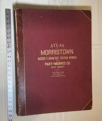
1910028278Philadelphia Pennsylvania: A. H. Muller Publisher 1910. Condition of the binding is Good but for rubbing at the corners and outer hinges cracked. SEE PHOTOS. Inner hinges are PERFECT having been reinforced by the publisher/bookbinder with sturdy maroon cloth. Housed in a Fine custom-made maroon cloth-covered clamshell case. SEE 2 PHOTOS its outside and both inner halves when opened. Condition of all maps is NEAR FINE - FINE. Pages are clean and unmarked. NO tears or foxing. SEE PHOTOS. This atlas consists of 25 i. e. 26 counting the Index map hand-colored lithographic linen-backed double page maps. The maps are color-keyed to the locations of each of the following: stone buildings brick buildings frame or half frame buildings stables or barns green houses steam railroads electric railroads water pipes sewers improved roads and fire hydrants. SEE PHOTOS. The double page maps open to an impressive 31.50" across by 22.25" tall. Each map did have a maroon leather numbered tab i. e. Index and 1-25 however the numbers for tabs 15-19 are broken/missing. SEE PHOTOS. Full title: "Atlas of Part of Morris Co. N. J. Embracing Town of Morristown The Boroughs of Madison Florham Park Chatham and Mendham: Morris Township and Parts of Chatham Hanover Mendham and Passaic Townships compiled from actual surveys official records and private plans by J. M. Lathrop and Thomas Flynn Civil engineers. Under the direct management and supervision of A. H. Muller Publisher 530 Locust Street Philadalphia PA. 1910." Collated and complete per table of contents. Includes a STREET INDEX. Bound in the original maroon cloth with maroon leather spine and corners. Gilt-stamping is still bright. SEE PHOTOS. The textblock could be easily rebacked with no re-sewing required since all pages/maps are still securely bound together. Oversize Hardcover. 17" wide by 22.50" tall. This massive extremely heavy book will require SUBSTANTIAL extra postage at our cost based on your location. LeGear ATLASES OF THE UNITED STATES L2343. Phillips A LIST OF GEOGRAPHIC ATLASES 3834. First Edition. Oversize Hardcover. Good - Fine condition/Fine clamshell case. Illus. by NOT a library discard. Atlas folio. Great Packaging Fast Shipping. A. H. Muller, Publisher Hardcover
1705Map901London: Richard Blome 1705. re-issue . No Binding. Vg. Folio. 50x42cms. Nice dark impression printed on thick paper. Single original plain red ink hand drawn crossing borders to the image edges and repeated in the blank verso. Uncoloured map. Originally engraved by Joseph Moxon in 1671 this later issue of 1705 by Richard Blome has the cartouche and coats of arms and lower engraving re-engraved and the lower part of the plate removed and replaced with a irnage of small hills! The Jonas and his whale engraving has also been re-engraved at the centre top of the image. Now measuring 27x45cms. Very wide margins. Joseph Moxn 1627-1699. The map was first designed by Nicolas Visscher. <br/> <br/> Richard Blome unknown
1705Map902London: Richard Blome 1705. re-issue . No Binding. Vg. Folio. 50x42cms. Nice dark impression printed on thick paper. Single original plain red ink hand drawn crossing borders to the image edges and repeated in the blank verso. Uncoloured map. Originally engraved by Joseph Moxon in 1660 this later issue of 1705 by Richard Blome has the cartouche and corner engraving removed and rplaced by a compass and pair of dividers. Very wide margins. Joseph Moxn 1627-1699. The map was first designed by Nicolas Visscher. <br/> <br/> Richard Blome unknown
1848Map 822London: George Virtue 1848. re-issue . No Binding. Vg. 21 x 27 cms. Original un-coloured state first issue in 1832. Finely engraved views of Cambridge. A nice original dark impression steel engraving. Arms of the colleges and vignette of Trinity College <br/> <br/> George Virtue unknown
1848Map 255London: George Virtue No 26 Ivy Lane 1848. No Binding. Vg. 10.75"x 8.25" Later hand-colour <br/> <br/> George Virtue No 26 Ivy Lane unknown