333 résultats
1848Map 303London: George Virtue 1848. No Binding. Vg. 10.75"x 8.25" Later hand-colour. Original steel engraving <br/> <br/> George Virtue unknown
1848Map 353London: George Virtue 1848. No Binding. Vg. 10.75"x 8.25" Later hand-colour. Original steel engraving <br/> <br/> George Virtue unknown
1848Map 824London: George Virtue 1848. re-issue . No Binding. Vg. 21 x 27 cms. Original un-coloured state with the later railway lines added since the first issue in 1832. Finely engraved views of Norfolk. A nice original dark impression steel engraving. <br/> <br/> George Virtue unknown
1848Map 825London: George Virtue 1848. re-issue . No Binding. Vg. 21 x 27 cms. Original un-coloured state with the later railway lines added since the first issue in 1832. Finely engraved views of Northamptonshire. A nice original dark impression steel engraving. <br/> <br/> George Virtue unknown
1848Map 399London: George Virtue 1848. No Binding. Vg. 10.75"x 8.25" Later hand-colour. Original steel engraving <br/> <br/> George Virtue unknown
1848Map 474London: George Virtue 1848. No Binding. Vg. 10.75"x 8.25" Later hand-colour. Original steel engraving <br/> <br/> George Virtue unknown
1848Map 819London: George Virtue 1848. re-issue . No Binding. Vg. 21 x 27 cms. Original un-coloured state with the later railway lines added since the first issue in 1832. Finely engraved views of Oxford and decorative cartouche. Small closed tear to upper left edge 2cms and a little edge soiled to reverse. A nice original dark impression steel engraving. Wide margins <br/> <br/> George Virtue unknown
1848Map 492London: George Virtue 1848. No Binding. Vg. 10.75"x 8.25" Later hand-colour. Original steel engraving <br/> <br/> George Virtue unknown
1848Map 595London: George Virtue 1848. No Binding. Fine. 10.75"x 8.25" Later hand-colour. Original steel engraving <br/> <br/> George Virtue unknown
1848Map 821London: George Virtue 1848. re-issue . No Binding. Vg. W. Hughes. 27 x 21 cms. Original un-coloured state first issue in 1832. Finely engraved map of London spanning Harrow in the west to Barking in the east Wimbledon in the south to Finchley in the north. A nice original steel engraving with a dark impression. Some pencil lines on the reverse not affecting map <br/> <br/> George Virtue unknown
1695Map723London: Abel Swal and Amsham & John Churchill 1695. No Binding. Fine. Folio. ND 1695- 43x36 cms 16.5 x 14 inches. Uncoloured copy with a margin and no clipping. Nice dark impression printed on thick paper. PLEASE EMAIL FOR PHOTO <br/> <br/> Abel Swal and Amsham & John Churchill unknown
1773Map922London: H. Turpin 1773. 3rd Edition . No Binding. Fine. Single map of Lincolnshire. A fine uncoloured copy of the last issue of Robert Moderns playing card maps. Approx 55x90mms. Title to the head wth Roman numeral VIII and the uncoloured map to the main section enclosed with double ruled lines above and below with county dimensions and distances at the foot. Harry Turpin published a 52 sheet set of these maps between 1764 and 1787 but no exact date is known for publication. RARE. Please email for photos. <br/> <br/> H. Turpin unknown
Map2791695. No Binding. Fine. COLOURED F 16x11 <br/> <br/> 1695. unknown
Map2781695. No Binding. Fine. UNCOLOURED F 16x11 <br/> <br/> 1695. unknown
Map3561720. No Binding. Very Good. UNCOLOURED V.G. 14.25 X 16.5 <br/> <br/> 1720. unknown
Map4771695. No Binding. Very Good. HAND COLOURED 16.5 X 13.75 <br/> <br/> 1695. unknown
Map6331695. No Binding. Very Good. UNCOLOURED V.G. 14.25 X16.75 <br/> <br/> 1695. unknown
Map4351695. No Binding. Very Good. UNCOLOURED 16.5X14.25 <br/> <br/> 1695. unknown
1695Map480Robert Morden 1695. No Binding. Very Good. HAND COLOURED V.G. 13.75 X 16.5 <br/> <br/> Robert Morden unknown
1849GT072London: E.S. Mogg 14 Great Russell Treet Covent Garden 1849. 1st Edition . No Binding. Vg. Exhibiting a Circle of Three Miles from the General Post Office to Which is Added A COPIOUS INDEX Containing Upwards of 1500 Places with Reference to Their Several Situations.Large folding un-dissected oblong map laid on linen 54x70cms Original hand-colour to the circle parks and main routes. A very nice dark impression generally dusty but a rare map. Fine engraved map title to the upper right-hand corner. Upper lateral fold triflle cracked but sound with no loss. Index in attached case 30pp with upwards of 2000 places. v adspp. PLEASE EMAIL FOR PHOTOS <br/> <br/> E.S. Mogg, 14 Great Russell Treet, Covent Garden unknown
1584Map1002Cologne: Goldefridi Kempensis 1584. 2nd Edition . No Binding. Fine. Folio. AN ORIGINAL MAP. Original hand colouring. 47x40cms Folding double page.PLEASE EMAIL FOR PHOTOS. <br/> <br/> Goldefridi Kempensis unknown
1893013891Washington D. C.: Government Printing Office 1893. Very Fine condition. Beautiful full-color folding map of the United States that measures 30" wide by 19" tall when unfolded. Ideal for framing. This is the map only. It was removed from the rear pocket of FOURTEENTH ANNUAL REPORT OF THE U. S. GEOLOGICAL SURVEY 1892-1893 PART II by J. W. Powell. Note that the map shows the boundary lines in the United States as it was in the 1890s e.g. "Indian Territory" is shown where Oklahoma is today. First Edition. Softcover. Very Fine condition. 30" wide by 19" tall when unfolded. Government Printing Office Paperback
1912016735Borough of Hopatcong New Jersey 1912. Near Fine condition. SEE PHOTO. This is a beautiful and very scarce color map of Lake Hopatcong New Jersey. When unfolded it measures 18" tall by 38" wide. Some folds have been neatly reinforced on the blank side with archival-quality document repair tape. Buildings are represented by red squares water in green. Some of the properties and locations depicted are: Port Morris Landing Roxbury Township Borough of Mount Arlington Byram Township Nolans Point Atlas Powder Co. Brookland Borough of Hopatcong Byram Cove Henderson Bay Byram Bay Maxim Park Jefferson Township Woodport Hurdtown Hurd Mining Co. W. M. Force Estate John P. Lawless Mary Ingram estate Aaron Peck estate Raccoon Island Halsey Island Bertrand Island Theodore King Gertrude Otten Violet Littell Robert Dunlap estate etc. Full title: "Property Map of Lake Hopatcong New Jersey Prepared by Hudson Maxim for the Morris Canal Investigation Commission November 16 1912 Compiled from Various Maps and Actual Surveys by P. E. Boomer C. E.". First Edition. Folded map. Near Fine condition. 18" tall by 38" wide when unfolded. Borough of Hopatcong, New Jersey? Paperback
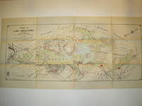
1853F0209London: Longman and Co. Etc 1853. Twenty-first edition . Brown cloth gilt. Vg. 8vo - over 7¾" - 9¾" tall. viii4004 pp. Revised and augmented by Maunders. Folding double page map of the world showing twin world hemispheres. 3 plates including fine Armillary sphere. Very clean and tight copy bound inoriginal cloth with attractive weave pattern. gilt lettering. A little rubbed on corners. World map complete and intact but crumbled along folds. <br/> <br/> Longman and Co. Etc hardcover
19900101284Toronto: University of Toronto Press 1990. Hardcover. pp. 198; 184; 197. Large 4to. Uniformly bound in green/blue/black cloth with gilt lettering to front board and spine. All contain colour maps and diagrams. Light shelfwear and dust-soiling to extremities; else very good in very good dustjacket volume III showing crease to rear flap. University of Toronto Press hardcover