333 résultats
1799TS431Paris: De L'imprimerie De La Republique 1799. 1st Edition . Hardback. Fine. quarto. Pendant Les Annees 17901791et 1792 par Etienne MARCHAND; precede d'une introduction historique auquel on a joint des recherches sur les terres Australes de DRAKE et un examen critique du .ii viii 158pp Tables 141-158pp. 15 fine condition plates complete. 30cm The title-page has a contemporary printed slip pasted over the volume number reading 'Tome Sixieme'. This is because the 4 volume quarto issue and the six volume octavo edition were published at the same time and both used the same quarto last volume offered here. The 15 plates are all as called for and in printed on thick paper and all in fine condition The World map is particularily attractive. PLEASE EMAIL FOR PHOTOS. NB An VIII was the result of the date changing to Year 0 in post-revolution France and spans the old years of 1799-1780. Original half calf binding with the distinctive brown 'marbled' boads and gilt decorative spine similar to the copy in the National Library of France. Rather worn and splits but the contents fine. LISTE DES CARTES. No I. Carte générale. World map No 2 . Fragmeiu de la Carie rcduiie d'une partie de I'Ameriqu Septentrionale par le Capitaine John AIeares. No 3. Carie Systéinaiique d'une partie de I'Amerique du nord-Ouest pour l'intelligence des Découvertes de l'Amiral de Fuente par J. N. De L'Isle 1752. N0 4. Deux Cartes sur la même feuille des Marques as de Mendoça déco-'vertes en 1595 par Mendana et des îles de la Révolution découver en 1791 par le Capitaine Marchand. No 5. Échasses de WahÎtahô ou Santa-Christin a une des Mar- quesas de Mendoça vues de face et de profil grandeur de moitié. No 6. Carte des îles de la Révolution situées dans le Nord-Ouest des Marquesas de Mendoça. Levée ar le Capitaine Prosper Chanel en 1791. No.6b Copie de la Carte du Groupe DU Nord-Ouest des Mar- quesas De Mendoça nommé par les Anglais en 1792 Mergest's Islands telle qu'elle a été publiée par Vancou v ER en 1798 dans la Relation de son Voyage. No 7. Partie Orientale de la Carte de Tupia. N.B. La Carte de cet Insulaire de l'Archipel de LA SOCIÉTÉ présente les Iles Équinoxiales du Grand Océan. No 8. Plan de la Baie de Tchinkitane la Baya de Guadalupa des Espagnols en 1775 et Norfolk-Bav des Anglais en 17S7 située à la Côte du NoRD-OuEST de I'Amerique par 57 4.' de Latit. N. Levée en 1791 par le Capitaine Prosper Chanal. No9. Esquisse de Cloak-Bay et du Détroit de Cox à 54 10' de Latit. N. Iles de ueen-Charlotte Côte du Nord-Ouest de I'Amerique. Par le Capitaine Prosper Chanal en 1791. No 10. Carte réduite d'une partie de la Côte Occidentale d'une des îles de Queen-Charlotte. Levée en 1791 par le Capitaine Prosper Chanal. No 11 Carte comparative des Iles Sandwich et du Groupe de la Mesa qui se voit sur la Carte du Galion de Manille. No 12 Carte gtiicrale du Détroit d'entre Banca et Bil'.iton comprenant les Detroit de Gaspar et de Cléments depuis la Pointe Pesant de Banca au Nord jusqu'aux îles de la. Reconnoissance au Sud. No13 Carte particulicre des mêmes dtroits sur une Échelle plus gr.mde. No 14 Carte du Détroit de Magellan Magalhaens et de la Tierra Del Fuego pour l'intelligence sur les Recherches des Terres Australes de Drake. No15. Carte d'une partie du Grand-Océan Équinoxial pour l'intelligence de YLxamen critique des Relations du Voyage. The Atlas volume of the account of the second French circumnavigation and the first French commercial voyage to the PacificNorth West. <br/> <br/> De L'imprimerie De La Republique hardcover
1880NY068London: Mappin 1880. Original . No Binding. Fine. Metal dial and clasp with a small built in compass and a fine dial arm that is hinged to work out measurements. The compass dial pointer is loose but present within the bubble. A strong clasp ring 50mm surrounds the dial from the rear and the face is finely engraved with roman numerals of the hours of the day.The rear is finely stamped 1644 in minute type. The metal is not hall marked. A VERY ATTRACTIVE AND RARE ITEM c1880 <br/> <br/> Mappin unknown
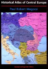
2002027737Seattle: University of Washington Press 2002. Flat uncreased spine. A solid reading / reference copy but rated only Good because something perhaps coffee was spilled leaving a light brown discoloration in part of the book's outer margin along the fore-edge. NO maps are affected. Almost no text is affected either except in the index where the discoloration reaches a few words on several pages and many words on the last page of the index. NOT as bad as it sounds -- PHOTOS UPON REQUEST. Oversize Softcover. 9" wide by 12" tall. This large heavy book may require extra postage for International shipments but only the standard charge for priority or media mail. Bound in the original black wraps lettered in white red and blue with a full color map on the front. Choice Outstanding Academic Title for 2003. From the rear cover: "THE HISTORICAL ATLAS OF CENTRAL EUROPE covers the area from Poland Lithuania and the eastern part of Germany to Greece and western Turkey and extends in time from the early fifth century to the present. This new edition of the HISTORICAL ATLAS OF EAST CENTRAL EUROPE first published in 1993 to great acclaim incorporates the enormous political changes that have taken place since 1989 taking into account comments from seventy-five reviewers from seventeen countries. The final third of the volume has been completely reconceptualized and reconfigured with new maps text and statistical tables. The bibliography has been updated and expanded. New Features: Twenty-one new maps; Forty-one revised maps; Eleven maps of newly independent countries; Eleven new chapters; Eight new thematic maps covering twentieth-century population changes distribution education and Catholic and Orthodox churches." Volume I in the series: A History of East Central Europe. Revised and Expanded Edition. Oversize Softcover. Good condition. Illus. by NOT a library discard. xiv 274pp. Great Packaging Fast Shipping. University of Washington Press Paperback
1884GT602London: Lett's Son & Co. 1884. No Binding. Vg. Large original folding plan of London. Please email for photos. Green card covers with a printed label. Rather grubby but an attractive map. <br/> <br/> Lett's Son & Co. unknown
1958018590Washington D. C.: Library of Congress 1958. 1958. First Edition. Volume 5. Very Good condition. Clean square and tight. Hinges are perfect. Previous owner's small armorial bookplate on the pastedown endpaper. All other pages are crisp and unmarked. NO underlining. NO highlighting. NO margin notes. Preface. Author List. List of Geographical Atlases Titles 5325-7623. Comprehensive Index pp. 487-666. Subtitle: "With Bibliographical Notes A Continuation of Four Volumes by Philip Lee Phillips." Bound in the original blue cloth stamped in bright gold over a maroon panel on the spine. 7" wide by 10" tall by 1.75" thick. First Edition. Hardcover. Very Good condition/No jacket as issued. xlvii 666pp. Great Packaging Fast Shipping. Library of Congress Hardcover
1974019878Washington D. C.: Library of Congress / U. S. Government Printing Office 1974. Very Good EX-LIBRARY. Hinges are perfect. Pages are clean and crisp. NO underlining. NO highlighting. NO margin notes. 1974. First Edition. Volume 8 comprising the Index to Volume 7 titles 10255-18435. From the preface: "Indexed in this volume are areas subjects map authors engravers lithographers publishers etc. and atlas titles with distinctive words." Subtitle: "A Continuation of Four Volumes by Philip Lee Phillips." Bound in the original blue cloth gilt-stamped over a red spine panel. This First Edition measures 7" wide by 10" tall which is a larger format than the 1996 Martino reprint. BIBLIOGRAPHICAL NOTE: Volume 8's ISBN listed here was mistakenly duplicated for Volume 9 The Comprehensive Author List when it was published in 1992. First Edition. Hardcover. Very Good EX-LIBRARY/No jacket as issued. v 190pp. Great Packaging Fast Shipping. Library of Congress / U. S. Government Printing Office Hardcover
1997017766Mansfield Centre Connecticut: Martino Fine Books 1997. Brand New in perfect condition. 2 vols in 1. STILL SEALED in the publisher's clear plastic SHRINKWRAP. NO rubbing. NO fading. Bright clean square and tight. Sharp corners. NO owner's name or bookplate. NOT a remainder. Fresh and crisp -- obviously never read. n. d. but 1997. HARDCOVER reprint limited to 150 copies of the 1950 and 1953 Library of Congress originals. 2 volumes bound as 1 with a total of 767 pages. Because this edition is bound in sturdy cloth it is much better suited to heavy use than the paper bindings of the original editions. A welcome reprint of an important and scarce reference. Described here are 6696 atlases. Entries are first arranged geographically and by subject national; state; and within the various states by county/parish city and region; special subject atlases include agriculture aviation canals climate coal geology history languages railroads etc. Then the atlases are re-listed by author/publisher in the index. A typical entry includes the atlas title; cartographer; publisher; city and date of first publication; dimensions in centimeters; number of pages plates and maps; the number that are colored etc. Occasional notes on contents. In the second part copies of the atlases held by some 180 libraries are located. Hodgkiss/Tatham KEYGUIDE TO INFORMATION SOURCES IN CARTOGRAPHY: "An indispensable reference for students of American history or of the development of American cartography." Bound in the original gilt-stamped blue cloth. Besterman 6267. Sheehy CL288. KEYGUIDE 94. 1997 reprint of 1950/53 originals. Hardcover. New/in publisher's shrinkwrap. 2 vols in 1: viii445pp. xiii301pp. 767 total. Great Packaging Fast Shipping. Martino Fine Books Hardcover
1828GT100London: Richard Holmes Laurie 1828. 1st Edition . No Binding. Fine. A fine and very rare printed folding map of IRELAND by Richard Holmes Laurie 53 Fleet Street London 84 x 64 cms 33 x 25 inches with original fine hand-colouring and enclosed in the original green calf slipcase with gilt title embossed to the case edge. Divided into 18 panels on a linen sheet. No recorded copy at auction and no copy in Copac a similar dated 1817 in the BL Published 8th April 1828. No copies in WorldCat. Richard Holmes Laurie 1777-1835 was the son of Robert Laurie who whom he apprenticed as a mezzotinter who went into partnership with his fathers old partner Whittle until the latters death in 1818. Laurie and Whittle were one of the leading British Cartographic publishers in the 18th and 19th century. Richard Holmes Laurie used Captain Powell's observations of Laurie Island in the South Atlantic and printed the first map of the island which was then named after him. <br/> <br/> Richard Holmes Laurie unknown
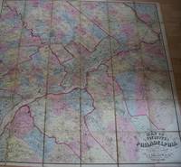
1861TS430Philadelphia: J.E. Gillette & Co. 1861. 1st Edition . printed Map. Fine. A very rare large folding map of Philadelphia divided into 36 sections each 22x23 cms and laid on a single linen sheet 132x 138cms 52x54 inches. Hand coloured. Enclosed with marbled paper covers. Only one copy traced. City of Philadelphia Parks and Recreation Historic Archives. No copy traced at auction. PLEASE EMAIL FOR PHOTOS <br/> <br/> J.E. Gillette & Co. unknown
1963016870Tegucigalpa Honduras: Secretaria de Economica y Hacienda Republica de Honduras 1963. Good 11"X 14" staple-bound paperback with yellowing to edges of wraps light soiling to wraps edgewear to wraps staple holes in front wrap traces of erased pencil in top corner of front wrap creased corners on wraps and soft creasing to corner tips of most pages in text block. Book has six-page introduction and 158 pages of maps. Trade Paperback. Good. 4to - over 9¾" - 12" tall. Secretaria de Economica y Hacienda, Republica de Honduras Paperback
1978021557La Crosse Wisconsin: Sumac Press 1978. NEW in a NEW dust jacket. The jacket is protected by a removable Brodart clear-plastic sleeve. Sharp corners. First Edition Limited to 300 copies. Includes a hand-mounted genuine 13 cent Ben Franklin The Theatre of War USA bicenntenial stamp from 1976. Illustrated with numerous facsimiles of stamps showing maps. Tells their stories. Published by Emerson Wulling at the Sumac Press. Bound in the original red cloth stamped in bright gold. Complete with errata page and dust jacket. First Edition 1/300 copies. Hardcover. New/New. 8vo. 67pp. Great Packaging Fast Shipping. Sumac Press Hardcover
1962021562Iowa City: The Prairie Press 1962. A beautiful copy. Fine condition in a Fine dust jacket. The jacket is protected by a removable Brodart clear-plastic sleeve. NOT price clipped $4.00. NO rubbing. NO fading. NO chips. NO tears. NO creases. NO owner's name or bookplate. Sharp corners. First Edition Limited to 550 copies. Frontispiece features a hand-mounted genuine 3 cent stamp from 1955 showing a diagram of Fort Ticonderoga. Illustrated with numerous facsimiles of stamps showing maps or plans. Tells their stories. Printed by Carroll Coleman at The Prairie Press in Iowa City Iowa. Bound in the original blue patterned paper-covered boards with a black cloth spine and printed paper spine label. Complete with dust jacket. First Edition 1/550 copies. Hardcover. Fine condition/Fine dust jacket. 83pp. Great Packaging Fast Shipping. The Prairie Press Hardcover
1781Map904London: W. Strachen and T. Cadell 1781. printed Map. Fine. 41.5 x 48.5 cms. Nice wide margins. Folding map uncoloured and printed on heavy paper. One small hole on a fold. PLEASE EMAIL FOR PHOTOS. <br/> <br/> W. Strachen and T. Cadell unknown
1769MAP1047London: Russell and Price 1769. Original Map . No Binding. Vg. 4to. Single page map of DEVONSHIRE. T.Kitchen. Published in ENGLAND DISLAYED Being a New Complete and Accurate Survey and Description of the Kingdom of England and Principality of Wales. Plate 19x27 cm sheet 243 x 160mm Fine original map printed on laid paper. Uncoloured. 2ND EDITION pub. 1769. OTHER COUNTIES ARE AVAILABLE FROM THIS ISSUE. <br/> <br/> Russell and Price unknown
1769MAP1045London: Russell and Price 1769. Original Map . No Binding. Vg. 4to. Single page map of OXFORDSHIRE T.Kitchen. Published in ENGLAND DISLAYED Being a New Complete and Accurate Survey and Description of the Kingdom of England and Principality of Wales. Plate 19x27 cm sheet 243 x 160mm Fine original map printed on laid paper. Uncoloured. 2ND EDITION pub. 1769. OTHER COUNTIES ARE AVAILABLE FROM THIS ISSUE. <br/> <br/> Russell and Price unknown
1769MAP1043London: Russell and Price 1769. Original Map . No Binding. Vg. 4to. Single page map of Yorkshire T.Kitchen. Published in ENGLAND DISLAYED Being a New Complete and Accurate Survey and Description of the Kingdom of England and Principality of Wales. Plate 19x27 cm sheet 243 x 160mm Fine original map printed on laid paper. Uncoloured. 2ND EDITION pub. 1769. OTHER COUNTIES ARE AVAILABLE FROM THIS ISSUE. <br/> <br/> Russell and Price unknown
1769MAP1048London: Russell and Price 1769. Original Map . No Binding. Vg. 4to. Single page map of DORSETSHIRE. T.Kitchen. Published in ENGLAND DISLAYED Being a New Complete and Accurate Survey and Description of the Kingdom of England and Principality of Wales. Plate 19x27 cm sheet 243 x 160mm Fine original map printed on laid paper. Uncoloured. 2ND EDITION pub. 1769. OTHER COUNTIES ARE AVAILABLE FROM THIS ISSUE. <br/> <br/> Russell and Price unknown
1769MAP1040London: Russell and Price 1769. Original Map . No Binding. Vg. 4to. Single page map of CARDIGANSHIRE T.Kitchen. Published in ENGLAND DISLAYED Being a New Complete and Accurate Survey and Description of the Kingdom of England and Principality of Wales. Plate 19x27 cm sheet 243 x 160mm Fine original map printed on laid paper. Uncoloured. 2ND EDITION pub. 1769. OTHER COUNTIES ARE AVAILABLE FROM THIS ISSUE. <br/> <br/> Russell and Price unknown
1769MAP1046London: Russell and Price 1769. Original Map . No Binding. Vg. 4to. Single page map of CORNWALL T.Kitchen. Published in ENGLAND DISLAYED Being a New Complete and Accurate Survey and Description of the Kingdom of England and Principality of Wales. Plate 19x27 cm sheet 243 x 160mm Fine original map printed on laid paper. Uncoloured. 2ND EDITION pub. 1769. OTHER COUNTIES ARE AVAILABLE FROM THIS ISSUE. <br/> <br/> Russell and Price unknown
1769MAP1042London: Russell and Price 1769. Original Map . No Binding. Vg. 4to. Single page map of Cheshire T.Kitchen. Published in ENGLAND DISLAYED Being a New Complete and Accurate Survey and Description of the Kingdom of England and Principality of Wales. Plate 19x27 cm sheet 243 x 160mm Fine original map printed on laid paper. Uncoloured. 2ND EDITION pub. 1769. OTHER COUNTIES ARE AVAILABLE FROM THIS ISSUE. <br/> <br/> Russell and Price unknown
1769MAP1049London: Russell and Price 1769. Original Map . No Binding. Vg. 4to. Single page map of SOMERSETSHIRE. T.Kitchen. Published in ENGLAND DISLAYED Being a New Complete and Accurate Survey and Description of the Kingdom of England and Principality of Wales. Plate 19x27 cm sheet 243 x 160mm Fine original map printed on laid paper. Uncoloured. 2ND EDITION pub. 1769. OTHER COUNTIES ARE AVAILABLE FROM THIS ISSUE. <br/> <br/> Russell and Price unknown
1799Map913London: G.G.& J. Robinson Paternoster Row 1799. Original Map . No Binding. Fine. Folio. Folding folio map of Asia with outline hand-colour. An attractive map of Asia at the end of the eighteenth century probably engraved by Thomas Kitchen. Nice hand-coloured to the boundaries of the countries stretching from Arabia to Japan and down to Java and New Guinea Nice wide margins 38 x 47.5 cms. image 34 x39 cms. This large scarce map appeared in several publicatons including Clement Cruttwells 1799 Atlas. see House of Commons Map Collection. PLEASE EMAIL FOR PHOTOS <br/> <br/> G.G.& J. Robinson, Paternoster Row unknown
198120395University of Glasgow 1981. Scale 1:63360. V.g. Folded map and cross-section sheet Two sheets the first showing a plan of the geology the second showing cross-sections at the same scale. University of Glasgow unknown
1839TH327London: Longman Orme Brown Green & Longmans 1839. a new Edition Considerably Improved . Hardback. Vg. 8vo. ND but preface dated Walworth 1839. xxiv 364pp 7 folding plates at the rear.12pp pub. cat. dated August 1841 London. Bound in the pub. green fine pebble gren cloth with gilt titles to the spine. Pasted -down end-papers list Longmans 'New School Books'/ Neat owners sig. dated 1842. Thomas Keith 1759-1824. The first edition was pub. in 1805 <br/> <br/> Longman, Orme, Brown, Green & Longmans hardcover
1850Map883Edinburgh and London: William Blackwood & Sons 1850. 1st edition 2nd issue . Hardback. Fine. Imperial Folio. 22 x 14.5 inches 57x38cms published simultaneously with divisions concerning the Geology Meteorology Phytology and Zoology of the world WITH a total of 30 maps AS CALLED-FOR. ALL DOUBLE PAGE AND HAND-COLOURED each plate measures 67x45cms. Bound in the orginal half-calf binding with cloth boards. Attractive sound spine but some wear. The 1st edition as published 1848 but with 1850 to the title-page. The large orignal edition with 30 beautiful hand-coloured engraved plates hinged. The first 1848 issue was engraved with some plates hand-coloured. This slightly later issue has all the plates engraved and with hand-colouring and the second issue of 1856 had lithographic plates with some printed colour and some hand-colour. A SCARCE ITEM. The best set of plates. <br/> <br/> William Blackwood & Sons hardcover