333 résultats
1769MAP1006London: Russell and Price 1769. Original Map . No Binding. Fine. 4to. Single page map of the County of HAMPSHIRE John Roque.Published in ENGLAND DISLAYED Being a New Complete and Accurate Survey and Description of the Kingdom of England and Principality of Wales. Plate 16 x20cm sheet 160 x 243mm. Fine original map printed on laid paper. Uncoloured. 2ND EDITION pub. 1769. OTHER COUNTIES ARE AVAILABLE FROM THIS ISSUE. <br/> <br/> Russell and Price unknown
1840Map871London: Longman Hurst Row Orme & Co. 1840. 1st issue . Cloth. Vg. WALKERS COUNTY MAP SERIES. nd C1840. Folding map of Hampshire and The Isle of Wight laid on linen and dissected into 15 sections. Out-line hand-colour coloured woods and railway lines. Enclosed in a card case with a decorative paper label. Stain to the lower margin and affecting some folds otherwise an attractive travellers map in a v.g. condition. 41 x 34cms. <br/> <br/> Longman, Hurst, Row, Orme & Co. hardcover
1769Map1009London: Russell and Price 1769. Original Map . No Binding. Fine. 4to. Single page map of the County of HERTFORDSHIRE John Roque. Published in ENGLAND DISLAYED Being a New Complete and Accurate Survey and Description of the Kingdom of England and Principality of Wales. Plate 16 x20cm sheet 160 x 243mm. Fine original map printed on laid paper. Uncoloured. 2ND EDITION pub. 1769. OTHER COUNTIES ARE AVAILABLE FROM THIS ISSUE. <br/> <br/> Russell and Price unknown
1805Map947Paternoster Row London: Longman Hurst Rees & Orme 1805. 1st Edition 1st Printing. No Binding. Fine. Folio - over 12 - 15" tall. Original early 19th century uncoloured MAP OF HINDOOSTAN BY AARON ARROWSMITH. A FINE CLEAN AND DARK IMPRESSION. Original folding plate covering THE WHOLE OF HINDOOSTAN printed on heavy paper dated 1808. A scarce example and in fine un-coloured original condition. An occasional light foxing mark. 41x27cms. Double-page folding map. engraved by J. Russell.A LOVELY COPY. paper watermark dated 1811 <br/> <br/> Longman, Hurst, Rees & Orme unknown
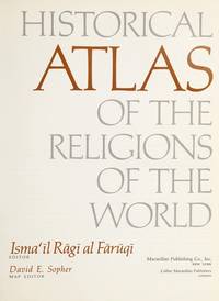
1974012035New York: Macmillan 1974. 8.75" wide by 11" tall. Previous owner's blindstamp. Otherwise a bright clean square tight unmarked copy. Not a book club edition. Not price clipped 15.00. No remainder mark. Illustrated with photos drawings and 65 maps. From the Dust Jacket: "Here is the most extensive historical atlas of religion ever published." Essays photos and maps illuminate the origins and distribution of religions; their movement; locations of sacred cities sites and temples; growth; the relation of one religion with another; places associated with leading rabbis theologians and writers; Jewish emigration; Muslim rule; religious use of narcotics; Chinese religions; 18th century Christianity; Islamic schools of law sects and reform movements; spread of Orthodox law schools; etc. Appendix 38 pages long gives detailed chronologies of the religions of the past. Subject Index. Name Index. First Printing of the First Edition. Oversize Hardcover. Near Fine condition/VG DJ tiny closed tears. xviii 346pp . Macmillan Hardcover
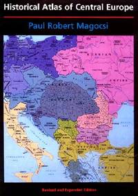
2002027737Seattle: University of Washington Press 2002. Flat uncreased spine. A solid reading / reference copy but rated only Good because something perhaps coffee was spilled leaving a light brown discoloration in part of the book's outer margin along the fore-edge. NO maps are affected. Almost no text is affected either except in the index where the discoloration reaches a few words on several pages and many words on the last page of the index. NOT as bad as it sounds -- PHOTOS UPON REQUEST. Oversize Softcover. 9" wide by 12" tall. This large heavy book may require extra postage for International shipments but only the standard charge for priority or media mail. Bound in the original black wraps lettered in white red and blue with a full color map on the front. Choice Outstanding Academic Title for 2003. From the rear cover: "THE HISTORICAL ATLAS OF CENTRAL EUROPE covers the area from Poland Lithuania and the eastern part of Germany to Greece and western Turkey and extends in time from the early fifth century to the present. This new edition of the HISTORICAL ATLAS OF EAST CENTRAL EUROPE first published in 1993 to great acclaim incorporates the enormous political changes that have taken place since 1989 taking into account comments from seventy-five reviewers from seventeen countries. The final third of the volume has been completely reconceptualized and reconfigured with new maps text and statistical tables. The bibliography has been updated and expanded. New Features: Twenty-one new maps; Forty-one revised maps; Eleven maps of newly independent countries; Eleven new chapters; Eight new thematic maps covering twentieth-century population changes distribution education and Catholic and Orthodox churches." Volume I in the series: A History of East Central Europe. Revised and Expanded Edition. Oversize Softcover. Good condition. Illus. by NOT a library discard. xiv 274pp. Great Packaging Fast Shipping. University of Washington Press Paperback
19900101284Toronto: University of Toronto Press 1990. Hardcover. pp. 198; 184; 197. Large 4to. Uniformly bound in green/blue/black cloth with gilt lettering to front board and spine. All contain colour maps and diagrams. Light shelfwear and dust-soiling to extremities; else very good in very good dustjacket volume III showing crease to rear flap. University of Toronto Press hardcover
1985024925Toms River New Jersey: Ocean County Historical Society 1985. Near Fine condition. NO cover wear or fraying. Hinges inner and outer are PERFECT. Brief gift note on endpaper. 1985. Reprint of the 1878 Woolman & Rose Philadelphia original. Limited to 700 numbered copies this being #121. The hand inked number "121" has bled through to adjoining pages as usual. All other pages are clean and unmarked. Profusely illustrated with more than 70 maps and prints of New Jersey Shore towns and architectural landmarks in Cape May Atlantic Ocean and Monmouth Counties. Many fold out maps. Tipped-in after the title page is a HUGE folding map THE STATE OF NEW JERSEY 1877 from US Coast Guard Survey Records. It measures a whopping 18" wide by 31.5" tall when unfolded and is imprinted with the populations of major cities in each NJ county from the 1875 Census. Bound in the original maroon cloth stamped in bright gold. Oversize Hardcover. 12" wide by 14.25" tall. This very large extremely heavy book will require extra postage for Priority and International shipments but only the standard charge for media mail. Reprint Limited to 700 numbered. Oversize Hardcover. Near Fine condition/No dust jacket as issued. Illus. by Rose T. F. . 374pp. Great Packaging Fast Shipping. Ocean County Historical Society Hardcover
1903Map928London: John Bartholomew 1903. Original issue . No Binding. Fine. Large Folding Map. 21x16 inch folding Bartholomew colour printed map in 36 dissected sections laid on linen. Sheet Number 24 Oxford. A RARE example of a pre-WW1 foxing hunting map. The map has been over laid with hand-coloured boundary lines showing the areas at the turn of the century. The local fox hunts covered north of Oxford and south of Stratford Upon Avon and between Cheltenham in the west and Aylesbury in the east. Each pack hunting area shown with bright and bold water-coloured lines and their titles hand printed in black type. A large folding map cased within a pebble-grained red unmarked case. North Cotswold Cotswold V.W.H. South Oxfordshire Biscester Hey Throp Grafton and Warwickshire. Many of the samll village names under-lined in ink. <br/> <br/> John Bartholomew unknown
1769MAP1012London: Russell and Price 1769. Original Map . No Binding. Fine. 4to. Single page map of the County of HUNTINGHAMSHIRE John Roque. Published in ENGLAND DISLAYED Being a New Complete and Accurate Survey and Description of the Kingdom of England and Principality of Wales. Plate 16 x20cm sheet 160 x 243mm. Fine original map printed on laid paper. Uncoloured. 2ND EDITION pub. 1769. OTHER COUNTIES ARE AVAILABLE FROM THIS ISSUE <br/> <br/> Russell and Price unknown
1970TS343Amsterdam: N. Israel 1970. reprint . paper wrappers. Fine. large 4to. 125pp. Pale blue heavy paper cover. Trifle toned to the spine but a fine copy with no annotations or marks. From the fine reprint series 1960-. Imago Mundi is the only English language periodical dedicated to fine and rare maps and the history of cartography. MORE COPIES ARE AVAILABLE FROM THIS SERIES. Please email. <br/> <br/> N. Israel unknown
1990Map891London: Imago Mundi King's College 1990. Original issue . Hardback. Fine/No d.j. 4to. 180pp.Pub. blue cloth gilt. A fine copy in the original blue cloth. Trifle shelf rubbed. No inscriptions or stamps. Medieval manuscript maps; The map of Bahamas; Maps in 16th century bibles; Land Company mapping in North America in the 'new republic'. etc etc. Imago Mundi is a scholarly journal on the history of maps and was first pub. in 1935. <br/> <br/> Imago Mundi King's College hardcover
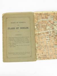
18935233Leipsic: Karl Baedeker 1893. Stiff Printed Wraps. Good. Wagner & Debes. 16mo. Pp. 11 street index 6 fold-out color maps. Saddle stapled green-gray printed wrap. Wrap fold split effaced pencil notes edges rubbed and soiled. Map corners creased. Pocket-size visitor's street guide in English with superb cartography by the firm of Eduard Wagner & Ernst Debes from the publisher's golden age under Fritz Baedeker. Preserved in a clear archival sleeve. Karl Baedeker unknown
1808Map940Paternoster Row London: Longman Hurst Rees & Orme 1808. 1st Edition 1st Printing. No Binding. Fine. Original early 19th century map MAP OF IRELAND BY AARON ARROWSMITH. A FINE CLEAN AND DARK IMPRESSION. Original folding plate covering THE WHOLE OF IRELAND printed on heavy paper dated 1808. A scarce example and in fine un-coloured original condition. An occasional light foxing mark. 41x27cms. Double-page folding map.Engraved by Cooper.A LOVELY COPY <br/> <br/> Longman, Hurst, Rees & Orme unknown
1842Map 809Edinburgh: A&C Black 1842. No Binding. Fine/uncoloured. Beautiful steel engravings from Encyclopaedia Britanica Seventh edition dated 1842. Plates CCLXXVIII -1 and 2 .Fine example with no wear. 410x260mm. Engraved by Sidney Hall Bloomsbury. Published by A. & C. Black. <br/> <br/> A&C Black unknown
1828GT100London: Richard Holmes Laurie 1828. 1st Edition . No Binding. Fine. A fine and very rare printed folding map of IRELAND by Richard Holmes Laurie 53 Fleet Street London 84 x 64 cms 33 x 25 inches with original fine hand-colouring and enclosed in the original green calf slipcase with gilt title embossed to the case edge. Divided into 18 panels on a linen sheet. No recorded copy at auction and no copy in Copac a similar dated 1817 in the BL Published 8th April 1828. No copies in WorldCat. Richard Holmes Laurie 1777-1835 was the son of Robert Laurie who whom he apprenticed as a mezzotinter who went into partnership with his fathers old partner Whittle until the latters death in 1818. Laurie and Whittle were one of the leading British Cartographic publishers in the 18th and 19th century. Richard Holmes Laurie used Captain Powell's observations of Laurie Island in the South Atlantic and printed the first map of the island which was then named after him. <br/> <br/> Richard Holmes Laurie unknown
1842mAP 813Edinburgh: A&C Black 1842. No Binding. Fine/uncoloured. Beautiful steel engravings from Encyclopaedia Britanica Seventh edition dated 1842. Plates CCCXVIII and CCCXIX .Fine example with no wear. 270x380mm. Engraved by Sidney Hall Bloomsbury. Published by A. & C. Black. <br/> <br/> A&C Black unknown
1843Map872London: Longman Hurst Row Orme & Co. 1843. 1st issue . Cloth. Vg. WALKERS COUNTY MAP SERIES. nd c1843. Folding map of KENTlaid on linen and dissected into 15 sections. Out-line hand-colour coloured woods and railway lines. Enclosed in a card case with a decorative paper label. Covers worn otherwise an attractive travellers map in a very clean condition. 34 x41 cms.13 x 16 inches <br/> <br/> Longman, Hurst, Row, Orme & Co. hardcover
1769MAP1023London: Russell and Price 1769. Original Map . No Binding. Fine. 4to. Single page map of the County of LANCASHIRE SHIRE John Roque. Published in ENGLAND DISLAYED Being a New Complete and Accurate Survey and Description of the Kingdom of England and Principality of Wales. Plate 16 x20cm sheet 160 x 243mm. Fine original map printed on laid paper. Uncoloured. 2ND EDITION pub. 1769. OTHER COUNTIES ARE AVAILABLE FROM THIS ISSUE. <br/> <br/> Russell and Price unknown
Z1-W-029-02214Architectural Press. Used - Good. Ships from UK in 48 hours or less usually same day. Your purchase helps support Sri Lankan Children's Charity 'The Rainbow Centre'. Ex-library so some stamps and wear but in good overall condition. 100% money back guarantee. We are a world class secondhand bookstore based in Hertfordshire United Kingdom and specialize in high quality textbooks across an enormous variety of subjects. We aim to provide a vast range of textbooks rare and collectible books at a great price. Our donations to The Rainbow Centre have helped provide an education and a safe haven to hundreds of children who live in appalling conditions. We provide a 100% money back guarantee and are dedicated to providing our customers with the highest standards of service in the bookselling industry. Architectural Press unknown
1884GT602London: Lett's Son & Co. 1884. No Binding. Vg. Large original folding plan of London. Please email for photos. Green card covers with a printed label. Rather grubby but an attractive map. <br/> <br/> Lett's Son & Co. unknown
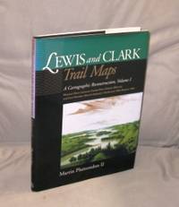
200027054<p>Pullman:: Washington State University Press 2000. First Printing of the First US Edition. A Fine tight copy in a Fine dust jacket. A Vancouver Washington cartographer based his unique maps on Clark's untapped survey notes excerpted on the maps. Taking into account nearly 200 years of changes to key geographic features of the 7000 miles that the Corps of Discovery covered Plamondon's 153 full-page maps precisely depicting the 1804-6 roundtrip permit comparison of the geography past and present from the Missouri River from Illinois to Fort Mandan in North Dakota. The book includes an introductory essay with notes on expedition mapping methods. Indexed by outbound and return camps dates locations and events and place names.</p> Washington State University Press, hardcover
1769MAP1014London: Russell and Price 1769. Original Map . No Binding. Fine. 4to. Single page map of the County of NORTHAMPTON SHIRE John Roque. Published in ENGLAND DISLAYED Being a New Complete and Accurate Survey and Description of the Kingdom of England and Principality of Wales. Plate 16 x20cm sheet 160 x 243mm. Fine original map printed on laid paper. Uncoloured. 2ND EDITION pub. 1769. OTHER COUNTIES ARE AVAILABLE FROM THIS ISSUE. A fine dark impression with a trifle staining to the left side paper edge.not near the image. <br/> <br/> Russell and Price unknown
1967018898London: Map Collectors' Circle 1967. Complete with errata slip laid in. Near Fine condition. Clean and unmarked. NOT a library discard. NO owner's name or bookplate. Describes in detail 23 main entries plus variants. Includes collations. Lists all charts and maps. Cross referenced to Phillips. Illustrated with 22 plates 1 fold-out. Bound in the original tan wraps printed in black. 7.25" wide by 9.75" tall. First Edition. Softcover. Near Fine condition. 50pp. Great Packaging Fast Shipping. Map Collectors' Circle Paperback
1627Map864London: George Humble 1627. 1st Edition . No Binding. Fine. An original uncoloured issue of Van Der Keere's map of Anglesey and Carnarvon. Lovely dark impression of this 'miniature Speede map'. 5 x 3.5 inches <br/> <br/> George Humble unknown