333 résultats
1873GT173Exeter: H. Besley & Son 1873. 1st Edition . No Binding. Vg. Folding map. 54x41 cms.A single sheet folding bl/wh. map of Dartmoor laid on white linen backing within a small booklet. Pasted label 'DARTMOOR' Nd but National Lib. of Scotland states 1873. Scarce local map 2 only Copac with local names and details to the locations on the moor. <br/> <br/> H. Besley & Son unknown
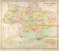
55306Kyiv: Vydavnytstvo politychnoi literatury Ukrainy 1965. Single leaf measuring 95 × 80 cm color offset lithograph. Creases from folding; light fading due to stock; else about very good. A colorful infographics map showcasing cultural development of Soviet Ukraine in 1965 likely published ahead of the celebrations planned for the 50th anniversary of the October Revolution in 1967. The map promotes the Ukrainian SSR as having exceptional educational and cultural resources showing the size and locations of universities trade schools theatres museums as well as TV and radio towers print runs of magazines newspapers and educational literature. Two inserts at the lower corners show locations of libraries and archives left corner and culture clubs and cinemas right corner. Eight additional graphs at the bottom show consistently growing numbers of students enrolled in technical schools universities and other secondary education institutions as well as the number of scientific workers. The graphs also show a growing number of theatres and museums print runs of magazines newspapers and books as well as retail sales of books in millions of rubles. <br /> <br /> The map was published by the Political Literature publishing house of Ukraine rather than by the Academy of Sciences and the scale is not mentioned on the map but is likely 1:1750000 to 1:1500000 typical for Soviet maps of this period suggesting that this publication was made primarily for propaganda purposes. Likely for this reason no mention of this map is made in the Ukrainian cartographic references such as Rostyslav Sossa's "Political and Administrative maps of Ukraine 1918-2008 Politiyko-administratyvni i administratyvni karty Ukrainy 1918-2008 which does mention several other maps by Teledido as map designer and Povolots'kyi as editor. In addition to this map the authors collaborated on other statistical/cartographic projects which mapped and diagrammed the five-year plans of the 1960s-1970s. <br /> <br /> Rare despite the 33000 copies printed. As of December 2025 KVK OCLC show two copies worldwide both in North America. unknown
1842Map 807Edinburgh: A&C Black 1842. No Binding. Fine/uncoloured. Folding MAP OF DENMARK. Beautiful steel engraving from Encyclopaedia Britanica Seventh edition dated 1842. Plate CCLXXXIV. Fine example with no wear. 410x260mm. Relief is shown by hachures. Engraved by S. Hall Bury Strt. Bloomsbury. Published by A. & C. Black. <br/> <br/> A&C Black unknown
1871Pa586St Gallen 1871. Hardback. Fine. SAENTIS-PANORAMA HERAUSGEGEBEN VON DER SECTION ST GALLEN DES S.A.C.Folding lithographic panorama of the Alps. RUNDISCHT VOM GIPFEL DES SENTIS The View Round the Summit Sentis. 4.45m in length. One extra flap on lower edge present. A lithographic printing of a drawing of the mountains of the Alps drawn between October 1870 and July 1871 showiing a beautiful vista with each peak indentified at the top of the sheet with a faint dotted line down to each location. Santis is the highest mountain in Apline area of North-East Switzerland. A lovely copy in fine condition. No splits foxing marks or wear. Original covers trifle sunned to the red spineand fold creases a trifle toned. Attractive lithographic illustrations of Alpine wildlife to the boards. PLEASE EMAIL FOR PHOTOS. <br/> <br/> hardcover
1869Le273London: Trubner & Co. 1869. 2nd Edition . Hardback. Fine. Oblong 4to. 26 Coloured plate maps engraved on copper each with a description. Original brown blind-stamped decorative borders gilt titles. head and tail of the spine rubbed otherwises a fine copy. Karl Spruner von Merz 1803-92 <br/> <br/> Trubner & Co. hardcover
1769MAP1026London: Russell and Price 1769. Original Map . No Binding. Fine. 4to. Single page map of the County of DURHAM John Roque. Published in ENGLAND DISLAYED Being a New Complete and Accurate Survey and Description of the Kingdom of England and Principality of Wales. Plate 16 x20cm sheet 160 x 243mm. Fine original map printed on laid paper. Uncoloured. 2ND EDITION pub. 1769. <br/> <br/> Russell and Price unknown
1980017928London: Holland Press 1980. Brand New in perfect condition. NO rubbing. NO fading. Bright clean square and tight. Sharp corners. NO owner's name or bookplate. NO remainder mark. Fresh and crisp -- obviously never read. Revised Edition. 1980. 88 plates. In 1973 a preliminary version of this work appeared in 5 issues of the periodical MAP COLLECTORS' CIRCLE. For this 1980 revision an index has been added as well as 97 new or corrected entries. Described and commented on are over 700 maps of the period. A final chronological listing identifies the cartographer date of publication and gives an estimate of rarity for each map's principal edition or first state. Volume #5 in The Holland Press Cartographica series. Bound in the original gilt-stamped dark green boards. 7.5" wide by 10" tall. 1980 Revised Edition. Hardcover. New/No jacket. xxv 188pp. Great Packaging Fast Shipping. Holland Press Hardcover
1980018076London: Holland Press 1980. Near Fine condition. Bright clean square and tight. Sharp corners. NO owner's name or bookplate. NO remainder mark. Fresh and crisp -- probably never read. Revised Edition. 1980. 88 plates. In 1973 a preliminary version of this work appeared in 5 issues of the periodical MAP COLLECTORS' CIRCLE. For this 1980 revision an index has been added as well as 97 new or corrected entries. Described and commented on are over 700 maps of the period. A final chronological listing identifies the cartographer date of publication and gives an estimate of rarity for each map's principal edition or first state. Volume #5 in The Holland Press Cartographica series. Bound in the original gilt-stamped dark green boards. 7.5" wide by 10" tall. 1980 Revised Edition. Hardcover. Near Fine condition/No jacket. xxv 188pp. Great Packaging Fast Shipping. Holland Press Hardcover
1842Mao 810Edinburgh: A&C Black 1842. No Binding. Fine/uncoloured. Beautiful steel engraving from Encyclopaedia Britanica Seventh edition dated 1842. Plate CCCVII -1 Fine example with no wear. 410x260mm. Engraved by Sidney Hall Bloomsbury. Published by A. & C. Black. An area extending from Birmah Indonesia and the Straits of Malacca to China and the Philippines. <br/> <br/> A&C Black unknown
1807Map936Paternoster Row London: Longman Hurst Rees & Orme 1807. 1st Edition 1st Printing. No Binding. Fine. Original early 19th century map MAP OF THE EMPIRE OF JAPAN BY AARON ARROWSMITH. A FINE CLEAN AND DARK IMPRESSION. Original folding plate covering North Florida to Lower Canada. A scarce example and in fine un-coloured original condition.41x27cms. Double-page. <br/> <br/> Longman, Hurst, Rees & Orme, unknown
1842Map 818Edinburgh: A&C Black 1842. No Binding. Fine/uncoloured. Beautiful steel engravings from Encyclopaedia Britanica Seventh edition dated 1842. Plates CCCXVIII and CCXIX 1-2 . Fine examples with no wear. Trifle foxing. 270x380mm. Engraved by Sidney Hall Bloomsbury. Published by A. & C. Black. <br/> <br/> A&C Black unknown
9818English; circa 1790. 8vo 6 pp. Two bifoliums sewn together. On laid paper with Britannia watermark. Text clear and complete. Neatly written out at approximately 38 lines to the page. On aged paper with slight damage to the first bifolium the leaves of which are detaching at the spine. Some of the items have been lightly scored through in pencil but are still legible. The inclusion of such items as '149 Blank Silk Paper for copying Maps' would appear to indicate that the document is an inventory for probate of a cartographer's stock. Last two entries read '165 Blank Sheets of Paper for copying Maps. A Bond relating to the Honble. Thomas Howe. Prints to copy from. Several Plans of the River and Sound of Dawfoskee in South Carolina survey'd by Captn. Gascoigne. 166 Draught of Falklands Islands. Map of the Province of New York. La Cours de la Meuse. The Circle of the Inferior Rhine. Plans of Port Royal in South Carolina. Les Duchés de Lorraine & De Bar. Plans of the River & Sound of Dawfoskee in South Carolina.' The first two entries list items by John Hamilton Moore a Scottish cartographer who according to his obituary in the Gentleman's Magazine was 'late teacher of Navigation on Tower-Hill author of Moore's Navigation Seaman's Daily Assistant the Monitor &c.' English; circa 1790. unknown
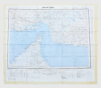
1957182684London: War Office; Printed for D. Survey WO and AM by Balding and Mansell Ltd 1957. A bright example of this detailed Gulf map Classified "restricted" and issued for military use at the time of the Jebel Akhdar War this double-sided sheet shows much of the modern-day UAE extending northwards from the latitude of Abu Dhabi and the Buraimi Oasis as well as the eastern Arabian Peninsula from the Trucial Coast to Jubail. As with other contemporary GSGS maps the sheet covers six degrees of longitude and highlights towns of significance and other standout features for example oil pipelines and wells water systems and roads and railways. Rayon sheet 630 x 710 mm printed both sides in colour folded as issued. A fine example. unknown
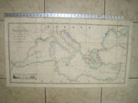
1853020822London: James Wyld Geographer to Her Majesty Charing Cross East 1853. Very Good condition only a little light soil SEE PHOTOS. This huge detailed map of the Mediterranean measures 99.5cm by 54cm when unfolded. The image itself is 93.5cm by 47.5cm. There is a finely engraved view of the entrance of Gibraltar Bay in the lower left corner. The map is a linen-backed copper engraving with original hand coloring. The map has handsome marbled paper endsheets and when folded-up measures 18cm by 12.5cm. SEE PHOTOS. Published by James Wyld Geographer to Her Majesty Charing Cross East London. A New General Atlas of Modern Geography Consisting of a Complete Collection of Maps of the Four Quarters of the Globe; Delineating their Physical Features and Coloured to Show the Limits of Their Respective States 1853. First Edition. Linen-backed hand-colored map. Very Good condition. 99.5cm by 54cm when unfolded. Great Packaging Fast Shipping. James Wyld, Geographer to Her Majesty, Charing Cross East Paperback
1853F0209London: Longman and Co. Etc 1853. Twenty-first edition . Brown cloth gilt. Vg. 8vo - over 7¾" - 9¾" tall. viii4004 pp. Revised and augmented by Maunders. Folding double page map of the world showing twin world hemispheres. 3 plates including fine Armillary sphere. Very clean and tight copy bound inoriginal cloth with attractive weave pattern. gilt lettering. A little rubbed on corners. World map complete and intact but crumbled along folds. <br/> <br/> Longman and Co. Etc hardcover
1914GE130England: The Ordnance Survey 1914. 3rd Edition . No Binding. Vg. Folding Sheet. Sheet 100. 3rd edition temporary. Large folding Geological Map of the Sheffield area of Yorkshire. One inch to the mile. Laid on cloth with fine printed colouring. 65x50cms. with eight sections. An attractive and scarce map. <br/> <br/> The Ordnance Survey unknown
2010GT396New York: Walker Publishing Co. 2010. 1st edition 1st impression . Hardback. Fine/Fine. Folio. 303pp. Full colour d.j. No wear inscriptions fading or marks. A sumptuous production and very heavy. <br/> <br/> Walker Publishing Co., hardcover
20587<p>Atlanta: Georgia Dept. of Natural Resources. 1976. 33pp. illus. paperback oblong folio: Very Good. An unusual study in black and white photos and maps.</p> Atlanta: Georgia Dept. of Natural Resources paperback
1842Map 816Edinburgh: A&C Black 1842. No Binding. Fine/uncoloured. Beautiful steel engravings from Encyclopaedia Britanica Seventh edition dated 1842. Plates CCCXVIII and CCLXIV-V .Fine examples with no wear. 270x380mm. Engraved by Sidney Hall Bloomsbury. Published by A. & C. Black. <br/> <br/> A&C Black unknown
1807Map960Paternoster Row London: Longman Hurst Rees & Orme 1807. 1st Edition 1st Printing. No Binding. Fine. Original early 19th century MAP of ALPINE COUNTRY from The North Sea to the border of AUSTRIA On MERCATORS PROJECTION BY AARON ARROWSMITH. A FINE AND DARK IMPRESSION. Original folding plate printed on heavy paper dated 1804. A scarce example and in fine un-coloured original condition. SOME FOXING. 41x27cms. Double-page folding map. <br/> <br/> Longman, Hurst, Rees & Orme unknown
1807Map959Paternoster Row London: Longman Hurst Rees & Orme 1807. 1st Edition 1st Printing. No Binding. Good. Original early 19th century MAP of ALPINE COUNTRY from The North Sea to the border of Switzerland On MERCATORS PROJECTION BY AARON ARROWSMITH. A FINE AND DARK IMPRESSION. Original folding plate printed on heavy paper dated 1804. A scarce example and in fine un-coloured original condition. SOME FOXING. 41x27cms. Double-page folding map. <br/> <br/> Longman, Hurst, Rees & Orme unknown
1769MAP1020London: Russell and Price 1769. Original Map . No Binding. Fine. 4to. Single page map of the County of GLOUCESTER SHIRE John Roque. Published in ENGLAND DISLAYED Being a New Complete and Accurate Survey and Description of the Kingdom of England and Principality of Wales. Plate 16 x20cm sheet 160 x 243mm. Fine original map printed on laid paper. Uncoloured. 2ND EDITION pub. 1769. OTHER COUNTIES ARE AVAILABLE FROM THIS ISSUE. <br/> <br/> Russell and Price unknown
1646Map735London: John Sudbury and George Humble 1646. No Binding. Vg. Folio. 1611-1646. An original map of the county of Gloucestershire. Nice old hand-colouring a dark impression. One or two tiny holes near the centre-fold repaired. 39.5 x 52cms. 15.5 x 20.5 inches. The margins are all about 1cm outside the plate. ENGLISH TEXT to the reverse. The imprint is John Sudbury and George Humble. Floral initial letter to reverse in the style of John Legett. PLEASE EMAIL FOR PHOTOS <br/> <br/> John Sudbury and George Humble unknown
8424139070.Gpaperback. Good. Access codes and supplements are not guaranteed with used items. May be an ex-library book. paperback
1904150900Berlin: Kartographische Abteilung der Königlich Preußischen Landesaufnahme 1904. One of just two known complete sets An exceedingly rare large 15-sheet map of China's strategically pivotal Liaodong Peninsula printed for senior German military commanders during the Russo-Japanese War and the Japanese siege of Port Arthur. We have traced one complete set at the Berlin State Library and the University and State Library Darmstadt has an incomplete set of six sheets. For the German army possessing up-to-date information on Liaodong was pressingly essential. Despite being officially neutral during the conflict Germany had significant geopolitical interests in north-eastern China having acted with Russia and France in 1895 to curtail Japanese expansion in East Asia after the First Sino-Japanese War. Russian-Japanese hostilities in particular the gruelling engagements around Port Arthur also threatened to spill over into Germany's nearby maritime territorial concession Qingdao. This highly detailed cartographic production printed at a scale of 1:42000 from Russian military maps from 1898-99 shows settlements of every size topography and spot-heights roads railway lines and other information of use in any potential military operation. 16 untrimmed photolithographed sheets 670 x 630 mm to 170 x 510 mm colour and black and white including 15 map sheets combining to form one large map as well as one key sheet with contemporary supplementary annotations. Generally clean and bright several sheets with fraying in margins 1 sheet with few tape repairs on verso 2 sheets with small loss at head in 1 case just crossing neatline occasional creases. A well-preserved set. unknown