333 résultats
1799TS431Paris: De L'imprimerie De La Republique 1799. 1st Edition . Hardback. Fine. quarto. Pendant Les Annees 17901791et 1792 par Etienne MARCHAND; precede d'une introduction historique auquel on a joint des recherches sur les terres Australes de DRAKE et un examen critique du .ii viii 158pp Tables 141-158pp. 15 fine condition plates complete. 30cm The title-page has a contemporary printed slip pasted over the volume number reading 'Tome Sixieme'. This is because the 4 volume quarto issue and the six volume octavo edition were published at the same time and both used the same quarto last volume offered here. The 15 plates are all as called for and in printed on thick paper and all in fine condition The World map is particularily attractive. PLEASE EMAIL FOR PHOTOS. NB An VIII was the result of the date changing to Year 0 in post-revolution France and spans the old years of 1799-1780. Original half calf binding with the distinctive brown 'marbled' boads and gilt decorative spine similar to the copy in the National Library of France. Rather worn and splits but the contents fine. LISTE DES CARTES. No I. Carte générale. World map No 2 . Fragmeiu de la Carie rcduiie d'une partie de I'Ameriqu Septentrionale par le Capitaine John AIeares. No 3. Carie Systéinaiique d'une partie de I'Amerique du nord-Ouest pour l'intelligence des Découvertes de l'Amiral de Fuente par J. N. De L'Isle 1752. N0 4. Deux Cartes sur la même feuille des Marques as de Mendoça déco-'vertes en 1595 par Mendana et des îles de la Révolution découver en 1791 par le Capitaine Marchand. No 5. Échasses de WahÎtahô ou Santa-Christin a une des Mar- quesas de Mendoça vues de face et de profil grandeur de moitié. No 6. Carte des îles de la Révolution situées dans le Nord-Ouest des Marquesas de Mendoça. Levée ar le Capitaine Prosper Chanel en 1791. No.6b Copie de la Carte du Groupe DU Nord-Ouest des Mar- quesas De Mendoça nommé par les Anglais en 1792 Mergest's Islands telle qu'elle a été publiée par Vancou v ER en 1798 dans la Relation de son Voyage. No 7. Partie Orientale de la Carte de Tupia. N.B. La Carte de cet Insulaire de l'Archipel de LA SOCIÉTÉ présente les Iles Équinoxiales du Grand Océan. No 8. Plan de la Baie de Tchinkitane la Baya de Guadalupa des Espagnols en 1775 et Norfolk-Bav des Anglais en 17S7 située à la Côte du NoRD-OuEST de I'Amerique par 57 4.' de Latit. N. Levée en 1791 par le Capitaine Prosper Chanal. No9. Esquisse de Cloak-Bay et du Détroit de Cox à 54 10' de Latit. N. Iles de ueen-Charlotte Côte du Nord-Ouest de I'Amerique. Par le Capitaine Prosper Chanal en 1791. No 10. Carte réduite d'une partie de la Côte Occidentale d'une des îles de Queen-Charlotte. Levée en 1791 par le Capitaine Prosper Chanal. No 11 Carte comparative des Iles Sandwich et du Groupe de la Mesa qui se voit sur la Carte du Galion de Manille. No 12 Carte gtiicrale du Détroit d'entre Banca et Bil'.iton comprenant les Detroit de Gaspar et de Cléments depuis la Pointe Pesant de Banca au Nord jusqu'aux îles de la. Reconnoissance au Sud. No13 Carte particulicre des mêmes dtroits sur une Échelle plus gr.mde. No 14 Carte du Détroit de Magellan Magalhaens et de la Tierra Del Fuego pour l'intelligence sur les Recherches des Terres Australes de Drake. No15. Carte d'une partie du Grand-Océan Équinoxial pour l'intelligence de YLxamen critique des Relations du Voyage. The Atlas volume of the account of the second French circumnavigation and the first French commercial voyage to the PacificNorth West. <br/> <br/> De L'imprimerie De La Republique hardcover
19466825Washington DC: U.S. Department of State 1946-1947. fair. 47 maps cardboard covers 47 fold-out maps stain on fore-edge covers worn & scuffed: small tears creases ink name on front cover. Oversized volume measuring approximately 14.25" 36 cm by 20.5" 52.5 cm. This volume was an appendix to "Administrative Subdivisions of Japan " Department of State Publications 2749 Far Eastern Series 19. There is one map for each of the 47 subdivisions on Hokkaido Honshu Shikoku and Kyushu. U.S. Department of State unknown
1973018834Ottawa: National Map Collection Public Archives of Canada 1973. Very Good condition. Covers lightly rubbed. NOT a library discard. NO owner's name or bookplate. Pages are clean and unmarked. NO underlining. NO highlighting. NO margin notes. A descriptive carto-bibliography with full collations contents notes lists of maps map measurements etc. Foreword by Theodore E. Layng Keeper of Maps in French and English. Subtitle: "No. 1 in a provisional series describing the atlases in the National Map Collection by country of origin." Bound in the original dark pink wraps stamped in white. 8.5" wide by 11" tall. . First Edition. Softcover. Very Good condition. xvii 132pp. Great Packaging Fast Shipping. National Map Collection, Public Archives of Canada Paperback
1963153757London: Geographical Section General Staff 1963. Scarce charts of Bahrain and the Straits of Hormuz A rare and historically interesting pair of adjacent maps of the Arabian Gulf covering six degrees of longitude each the geographical area encompassing the whole of Qatar Bahrain and part of what was to become the United Arab Emirates Al-Hofuf being the major city in the Al-Ahsa Oasis Eastern Province Saudi Arabia; sixth and fifth editions respectively. Maps of the period issued by the GSGS Geographical Section General Staff use a 7-colour tint scale to distinguish altitude and a glossary that highlights towns of significance and other standout features which provided steady references for army personnel to aid navigation in the challenging conditions of the region. The Bander Abbas map was compiled by the US Army Map Service Corps of Engineers from a number of sources including USAF Aeronautical Approach Charts of 1951-55 and the US Geological Survey of the Arabian Peninsula 1958. The Hofuf chart is based inter alia on 512 Field Survey Royal Engineers charts 1942-4. WorldCat lists just three individual copies for Hofuf NG39 SUNY at Buffalo University of Notre Dame and Eastern Illinois University alongside four copies of Bandar Abbas NG40 University of Exeter University of Notre Dame Eastern Illinois University and University of South Florida. It should be noted that major national institutions - BL for example - will have holdings of these maps within the complete GSGS series. Most copies would be discarded on supersession making these an important record of cartographic progress in the region. Two two-colour printed maps 1:1000000 scale 690 x 610 & 750 x 610 mm respectively. Ex- libris stamp of Arizona State Library both stamped "superseded" in blank margin and "withdrawn" on verso some pencilled marginalia; both in excellent condition. unknown
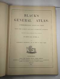
1844026815Edinburgh / London / Dublin: Adam and Charles Black / Longman / Simpkin / Whittaker / Hamilton / Cumming 1844. Good - Very Good condition. Bound in green cloth with black leather spine and corners elaborately gilt decorated. The leather is surprisingly well preserved. The cloth is faded and soiled with frayed edges. SEE PHOTOS. NO owner's name or bookplate. NOT a library discard. Imprinted "MDCCCXLIV" at the foot of the title page with "1844" hand inked beneath. All other pages are crisp clean and umarked with almost no foxing. Full title; "Black's General Atlas: Comprehending Sixty-One Maps from the Latest and Most Authentic Sources Engraved on Steel in the First Style of the Art by Sidney Hall Hughes etc. with Geographic Descriptions and an Index of 56000 Names." The maps several double page are tissue guarded and most are handcolored in red yellow and green. SEE PHOTOS. With the binder's ticket of Smith & Son 306 Lawnmarket Edinburgh. All edges gilt. Oversize hardcover. 13.25" wide by 17.75" tall. This large heavy book will require SUBSTANTIAL extra postage depending on destination that will be charged at our cost. 1844 edition. Oversize Hardcover. Good - Very Good condition. Illus. by NOT a library discard. 12pp. 61 maps 57 page Index. Great Packaging Fast Shipping. Adam and Charles Black / Longman / Simpkin / Whittaker / Hamilton / Cumming Hardcover
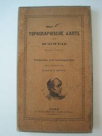
1861016428Bern Switzerland: Hans Körber Koerber Huber & Comp. 1861. Very Good condition. SEE PHOTOS. Karten etwas fleckig maps somewhat spotted. This is Blatt VIII Aarau - Luzern Zug - Zürich Zurich. The map is dated 1861 and has 21 sections. It is printed on paper then mounted on cloth i.e. backed with linen. When folded the map measures 19 cm tall x 11 cm wide. When unfolded 57 cm tall x 79 cm wide. SEE PHOTOS. Linen-backed steel-engraved folding map in 21 segments. Scale 1:100000. 1861 edition. Hardcover. Very Good somewhat spotted. Hans Körber [Koerber] (Huber & Comp.) Hardcover
1991018014London: Studio Editions 1991. Fine condition in a Near Fine dust jacket. NO chips. NO tears. Bright clean square and tight. Sharp corners. NO owner's name or bookplate. Not a remainder. Pages are crisp and unmarked. 1991 First Studio edition. For this production the most decorative plates were selected from Braun & Hogenberg's CIVITATES ORBIS TERRARUM which was first published in 6 volumes between 1572 and 1617. Sixty gorgeous full-color maps are reproduced each spread across two folio pages. Full annotations provide facts about the maps their makers and history of the various cities. Bound in the original gilt-stamped green boards. Complete with dust jacket. Oversize Hardcover. 11.25" wide by 15.25" tall 285mm x 380mm. This large heavy book will require extra postage for Priority and International shipments but only the standard charge for media mail. First Edition Thus. Oversize Hardcover. Fine condition/Near Fine dust jacket. 128pp. Great Packaging Fast Shipping. Studio Editions Hardcover
1939P278London: Alexander Duckham 1939. facsimile reprint . Hardback. Vg./No Jacket. Oblong 4to. 108 pp including 100 pp of facsimile road maps plus a general map of England and Wales Facsimile edition of the 1675 edition. Red cloth labels. Internally clean and tight. Trifle foxing to the fore-edge. A nice copy. or an Illustration of the Kingdom of England and Dominion of Wales. a. Description of the Principal Roads <br/> <br/> Alexander Duckham hardcover
1851Map920London: The London Printing And Publishing Co Ltd 1851. Original printed issues 1st Editions . No Binding. Fine. quarto. An original map of BRITISH INDIA originally pub. by John Tallis in this issue by The London Printing Company. Original out-line hand colour showing the borders and boundaries and with fine vignette scenes of cities and an Indian Procession. Enclosed within a highly decorative border with nice wide margins. A fine copy printed on thick paper folded to the centre with no wear. PLEASE EMAIL FOR PHOTOS <br/> <br/> The London Printing And Publishing Co Ltd unknown
1808Map932Paternoster Row London: Longman Hurst Rees & Orme 1808. 1st Edition 1st Printing. No Binding. Fine. Original early 19th century map of the BRITISH ISLES BY AARON ARROWSMITH. A FINE CLEAN AND DARK IMPRESSION. Original folding map. A scarce example and in fine un-coloured original condition.41x27cms. Double-page. <br/> <br/> Longman, Hurst, Rees & Orme unknown
1584Map1002Cologne: Goldefridi Kempensis 1584. 2nd Edition . No Binding. Fine. Folio. AN ORIGINAL MAP. Original hand colouring. 47x40cms Folding double page.PLEASE EMAIL FOR PHOTOS. <br/> <br/> Goldefridi Kempensis unknown
1809Map931Paternoster Row London: Longman Hurst Rees & Orme 1809. 1st Edition 1st Printing. No Binding. Fine. Original early 19th century uncoloured MAP OF BRITISH POSSESSIONS IN NORTH AMERICA BY AARON ARROWSMITH. A FINE CLEAN AND DARK IMPRESSION. Original folding plate including Northern United States and gREENELAND DOWN TO WASHINGTON IN THE SOUTH. A scarce example and in fine un-coloured original condition.41x27cms. Double-page. <br/> <br/> Longman, Hurst, Rees & Orme unknown
1848Map 822London: George Virtue 1848. re-issue . No Binding. Vg. 21 x 27 cms. Original un-coloured state first issue in 1832. Finely engraved views of Cambridge. A nice original dark impression steel engraving. Arms of the colleges and vignette of Trinity College <br/> <br/> George Virtue unknown
1695Map723London: Abel Swal and Amsham & John Churchill 1695. No Binding. Fine. Folio. ND 1695- 43x36 cms 16.5 x 14 inches. Uncoloured copy with a margin and no clipping. Nice dark impression printed on thick paper. PLEASE EMAIL FOR PHOTO <br/> <br/> Abel Swal and Amsham & John Churchill unknown
1818Map912London: Longman Hurst Rees Orme and Brown 1818. 1st Edition . No Binding. Fine. 4to. DOUBLE-PAGE FOLDING MAP engraved by Alexander Hindlay. Published as the Act directs May 1st 1818 by Longman Hurst Rees Orme and Brown. Clean folding plate with no toning to the fold 395x250mm. Cover the whole mainland of Britain with details of routes of rivers and canals. Bold margin border. PLEASE EMAIL FOR PHOTOS. Published in Abraham Ree's 'Cyclopedia or Universal Dictionary'. <br/> <br/> Longman, Hurst, Rees, Orme and Brown unknown
1807Map937Paternoster Row London: Longman Hurst Rees & Orme 1807. 1st Edition 1st Printing. No Binding. Fine. Original early 19th century MAP OF THECAPE OF GOOD HOPE BY AARON ARROWSMITH. A FINE CLEAN AND DARK IMPRESSION. Original folding plate. A scarce example and in fine un-coloured original condition.41x27cms. Double-page. Please email for photos <br/> <br/> Longman, Hurst, Rees & Orme, unknown
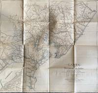
1928List1922Bahia 1928. Folded map. Fine condition. Fine. Teodoro Sampaio was an Afro-Brazilian cartographer engineer politician and historian who was very active in Brazil particularly in Bahia during the late nineteenth and early twentieth century. Offered here is Sampaio’s map of Bahia from 1928 which updates a map he produced in 1899 of the same region with updates of the settlement of the region including a detailed inset of the city of BBahio de Todos os Santos on the lower right corner. At the time of the map’s production Sampaio was an authority on Brazilian geography being a member of the Instituto Geográfico e Histórico da Bahia serving as president in 1922 and a member of the Instituto Histórico e Geográfico Brasileiro and the Instituto Geográfico e Histórico da Bahia and publishing several books on Brazilian geography. The period between 1899 when the first edition of this map was published and 1928 saw the development of rubber plantations in Bahia and the map provides detail on the region’s roads and population centers. We find no publicly held examples of this edition and one copy of the 1899 edition at Princeton though we do find a reference to this edition at the Brazilian National Archives. unknown
1808Map946Paternoster Row London: Longman Hurst Rees & Orme 1808. 1st Edition 1st Printing. No Binding. Fine. Original early 19th century map MAP OF AFRICA BY AARON ARROWSMITH. A FINE CLEAN AND DARK IMPRESSION. Original folding plate covering THE WHOLE OF AFRICA printed on heavy paper dated 1808. A scarce example and in fine un-coloured original condition. An occasional light foxing mark. 41x27cms. Double-page folding map. SUMATRA CELEBES.PAPUA NEW GUINEA MALAYA TIMORE etc etc.engraved by Cooper.A LOVELY COPY <br/> <br/> Longman, Hurst, Rees & Orme unknown
1808Map930Paternoster Row London: Longman Hurst Rees & Orme 1808. 1st Edition 1st Printing. No Binding. Fine. Original early 19th century map CHART OF THE PACIFIC OCEAN BY AARON ARROWSMITH. A FINE CLEAN AND DARK IMPRESSION. Original folding plate including New Holland Australia with an incomplete southern coastline with a complete New Zealand. Watermarked paper 1811. A scarce example and in fine un-coloured original condition.41x27cms. Double-page. <br/> <br/> Longman, Hurst, Rees & Orme unknown
1847GT028London: Charles F. Cheffins 1847. fifth Edition . No Binding. Vg. FOLDING MAP c1847. Lithographic folding map mounted on linen with 20 dissected sections with an additional section for Cornwall attached at the lower left corner. An inset map at the top of Scottish lines.Outline blue colour to the coast-line and colouring to the railways in black and red with additional hand-coloured marks and amendments to the details by a previous owner please email for photos. Encased in simple green cloth card covers with a pasted title and an engraved inside cover. 71x57cms. A grubby map but scarce in all editions. <br/> <br/> Charles F. Cheffins unknown
1809Map939Paternoster Row London: Longman Hurst Rees & Orme 1809. 1st Edition 1st Printing. No Binding. Fine. Original early 19th century map MAP OF CHINA BY AARON ARROWSMITH. A FINE CLEAN AND DARK IMPRESSION. Original folding plate covering THE WHOLE OF CHINA AND THE EASTERN SEA Watermarked heavy paper dated 1808. A scarce example and in fine un-coloured original condition. An occasional light foxing mark. 41x27cms. Double-page folding map.Engraved by Russell. <br/> <br/> Longman, Hurst, Rees & Orme unknown
197240342Chicago: Rand McNally & Company 1972. Collection of 14 company Christmas cards one each for the years 1972 through 1985 plus year three undated. Near fine overall. Printed in modest quantities and intended for distribution only to top vendors suppliers and distributors this delightful collection ranges in size from narrow 4to to wide 8vo some bigger and some smaller. All are handsomely and colorfully printed on fine heavy stock. Most are at least three panels and many are more and all open up to reveal superb reproductions of famed antiquarian maps from around the world. Some open up to small poster size and two contain separate folded maps that open to full poster size. Several have been signed by various company executives. Most unusual and attractive -- a collection that would be near-impossible to duplicate. Rand McNally & Company unknown
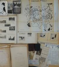
1950List2425Europe and California 1950. Includes two small diaries from 1901 and 1917 with sporadic entries a large photo album measuring 14 x 11 with appx. 400 small photographs from 1906-1909 attached to album pages most measuring 3 x 2 as well as a few larger format images laid in. With 100 plus pages of typed pages including retained correspondence story ideas and various other manuscripts. With eleven maps produced for his “Of Men and Maps†series including five copies of a large map entitled “Whither Russia†in varied states and in large sizes up to 30 by 36 inches and a handful of small ephemeral pieces. Generally near fine condition with the exception of the album which is missing its rear board and has some pages loose and torn. Very Good. J.M. de Beaufort a war correspondent for the London Daily Telegraph and New York American during World War I recounted his wartime adventures in the 1917 book "Behind the German Veil: A Record of a Journalistic War Pilgrimage." Originally arriving in Chicago in 1909 he married a steel magnate's daughter and pursued a career in show business. However by 1912 he had gone through a divorce and transitioned to newspaper work earning the moniker of the "Dude Reporter." Originally born in the Netherlands as Jacques Albert Uilenbroek he was thought to be a deserter. He spent the latter part of his life in the United States apparently jailed in San Francisco for a stint in the 1920s and eventually settled in Los Angeles. <br /> Offered here is an interesting smattering of material from the life of the mysterious De Beaufort which bookends his most unusual career and life with a large visual photographic record of his life in Europe as a young man and over a hundred pages of manuscript material from late in his life with a highlight being several maps in draft form for an apparently unpublished project called “Of Men and Maps.†As a group the material shows the work of an ex-con artist and war correspondent trying to regain his form while living in Los Angeles. He was still writing as a “Special Correspondent†at this point though the title seems to have been fully honorary. Also included are two small pocket journals with sporadic notations from his life in Europe in 1900 and in 1917. In its entirety the group gives an interesting visual and manuscript record of a literary fraudulent and imaginative transatlantic life and intellect. <br /> The cartographic highlight of the group is several iterations of a large map called “Whither Russia†in varied forms which show an interesting interpretation of the sphere of influence of the USSR and its growth from 1939 to 1946. Also included are two drafts of a map of Operation Market-Garden in the Netherlands in 1944 an unidentifed tactical map of a military battlefield a map called “Middle East Jackpot†showing the division of territory between the Allied and Axis powers a map called “Dawn’s Early Light some reproduced small format maps from the De Beaufort’s and a small map called “Gifts from Yalta.†De Beaufort was working on these maps for a column called “Of Men Maps and Memories†that was published in the East Los Angeles Tribune. He also sent the columns out in newsletter form from his address at 1635 N. Ogden Drive in Los Angeles. <br /> The collection of manuscripts drafts and retained correspondence tackle a range of subjects perhaps most interestingly those detailing De Beaufort’s creative process - drafts of stories lists of ideas for stories and letters. His over the top style is on display in a lot of the writings some of which are of unknown origin and purpose. The documents contain correspondence between De Beaufort and Edwin Pauley the oil man and presidential advisor. In one untitled essay he asks himself the question “What has been your most thrilling experience†and his reply is “ Silly questions. Who or at least what newspaperman of some 25 turbulent years standing - and falling - could answer such a question. A reporter’s life has a thousand thrills. There was that rainy day in Marcy 1915 in the fortress of Loetzen when I stood face to face with Hindenburg. Hm yes that was quite a thrill…†De Beaufort was entrenched in the Los Angeles journalistic scene at this point and the documents show the degree to which he relied on his former glories to attempt various career revitalizations endeavors. <br /> The album of photographs from 1906-1909 over 400 in total give a visual record of the young Uilenbroek’s life in Europe. The star of the collection is his bulldog Bob who travels throughout Europe with him and eventually comes to America by 1907. Mary who we presume to be his future wife is featured heavily in the images. It is unclear whether he was working at this point the images show affluent young people and their dog in varied cities and are purely of a personal nature. Other photographs laid in are relics from his war correspondent period. The loose photographs and ephemera are a mix of portraits from different periods from his life including two pictures of Sydney Turing Barlow Lawson one signed by his widow. The journals are sporadically filled and hard to decipher though one legible passage says “drinking all day.â€<br /> Overall the group gives evidence of this intriguing life and is the only extant group of material relating to Beaufort to our knowledge with the exception of a single journal from his time in Belgium during WWI that was sold at Bonhams and is still available in the trade as of this writing. unknown
1875Z032London: William Collins Sons and Company 1875. Second Edition . Hardback. Vg. small 8vo. BEING A CONCISE DESCRIPTIONS OF THE CHIEF PLACES OF INTEREST IN THE METROPOLIS ii 192 iipp. 58 illustrations by Sargent and Others and a Clue-Map by Bartholomew one section has a long closed tear with no loss. Advert end-papers. Orig. dec. brown cloth blocked in black and gilt. The British Library has an earlier edition of 1871. <br/> <br/> William Collins, Sons, and Company hardcover
1920Map889London: Geographia Ltd 1920. 1st Edition . paperback. Fine. Folding map. FOLDING MAP: Lithographic colour map MOUNTED ON LINEN c1920 measuring 1460x950 mm 37.5 x 57.25 inches. A fine copy of a scarce map. Green board covers gilt spine worn but complete. A very attractive map of the world and British Empire just after the first world war. <br/> <br/> Geographia Ltd paperback