5 783 résultats
Second edition, 12mo (173 x 105 mm), viii, 350pp., with half-title, 2 folding hand-coloured maps, a couple of gatherings sprung, small spot stain to prelims, cont. calf, a little rubbed, head and foot of spine worn, red morocco spine label. Provenance: Ownership signature to front endpaper 'Matilda Farquhaison 1782.' Scarce, ESTC returns just 3 locations (British Library, National Library of Scotland and University of Minnesota.
Grande carta applicata su carta blu, dimensioni cm 68x188. pubblicata a Londra presso Charles Wilson nel 1882. Bella carta in cui sono descritte le varie località della costa che si affaccia sul Mare Adriatico e riquadri con dettagli su alcuni porti e baie ( Durazzo , Zante, Argostoli, Vostitza, Navarino, Venezia, Brindisi…….... lievi tracce del tempo nel complesso buono stato di conservazione
Dal “Voyage round the word, in the years MDCCXL” (in quattro tomi). London, John e Paul Knapton, 1749. Incisa da R. W. Seale, incisione in rame all'acquaforte, b/n, cm 56 x 73 (il foglio), piccolo cartiglio in alto a destra, margine graduato sul laterale sinistro. Fra le principali isole dell'arcipelago delle Filippine, che comprende nel suo insieme oltre settemila isole, sono segnalate la Terra di Luzon o Luconia, la Laguna de Bay, Manila, Myndoro, Panay, Masbate, la Ysl De Negros, Zebu, Leyte e Samal. L'insieme della Luconia, il Shoals Luconia, la cui giurisdizione ricade sotto la Malaysia, rappresenta uno dei complessi più grandi e meno conosciuti della barriera corallina del Mar Cinese Meridionale, situato a sud-ovest dalle Isole Spratly e a cento chilometri al largo della costa del Borneo; non c'è terra emergente al Shoals Luconia, e le scogliere sono completamente sommerse. Anson George (1697 – 1762). Esemplare rinforzato al verso con carta di Cina, margini stretti e poco regolari, una piega marcata accanto al cartiglio, nell'insieme discreto lo stato di conservazione. .
Tratta dal “A Voyage round the word. In the Years MDCCXL, I, II, III, IV. By George Anson, Esq; Now Lord Anson...” (London, printed for the Author, 1749). Incisione in rame all'acquaforte (incisa da R. W. Seale), b/n, cm 52 x 50 circa (alla lastra), cartiglio in basso a destra, margine graduato su tutti i lati. Sono segnalate tutte le località che dal Brasile scendono fino alla Patagonia e alla Terra del Fuoco con Cape Horn e le Isole Falkland. Anson George (1697 – 1762). Usuali pieghe editoriali, strettissimi margini, molto buono lo stato di conservazione. .
1st edition thus. Later limp cloth, 8vo, pages 1185- 1546 [ie. 361 pages this volume, as issued]. Many illustrations, portfolios, maps (some folded) ; 21 cm. Includes 6 fold out maps: Map of Kerguelens Land called by C. Cook Island of Desolation; Chart of Van Diemens Land; Plan of Adventure Bay on Van Diemens Island; Wanooaette Island, Wateeoo I., Mangeea Isalnd, Toobuai Island; Sketch of Tongataboo Harbour; Chart of the Friendly Island. 27 full page illustrations. From title page: This edition is compiled from the authentic journals of several Principal Officers and other Gentlemen of the most distinguished naval and philosophical abilities, who failed in the various ships. These works which detail the experiences of the voyages of Captain James Cook from 1772 until his untimely death in the Hawaiian Islands in early 1779. These volumes were written not by Cook, but by those who accompanied him. OCLC: 2547038. SUBJECT(S): Voyages around the world -- Early works to 1800. Originally issued in eighty unbound parts. Bit of foxing Very Good Condition. (AMR-67-2)
1839W043Eton: E. Williams 1839. New and improved edition . Hardback. Fair. large 8vo. xviii 847 i adpp. Folding frontis. plate of the Solar system.; astronomical folding plate; folding plate of Athens. Lacks Rome and Syracuse plates. Title-page and frontis. loose and binding worn. READING/ REFERENCE COPY ONLY. <br/> <br/> E. Williams hardcover
8vo., First Edition, with 10 plates (a number folding and coloured in outline), and folding table in pocket at end; original printed wrappers, a near fine copy. VERY SCARCE IN THIS CONDITION.
1st edition. Original illustrated publisher's boards, 8vo, xxii, (2), 17-518, (1), (1 blank).Illustrated With Maps and Numerous Engravings. English interspersed with Hebrew. Frontispiece portrait of author, foldout maps of Land of Israel, lithographed views of Holy Places. Singerman 1161. The nineteenth century saw a dramatic growth in interest in the Holy Land due to new directions in Bible studies and the growing popularity of visiting the region. This renewed attention was reflected in the expanding body of literature of geographies and travelogues. One such Hebrew work was Joseph Schwarz's Tevuot ha-Aretz, published in Jerusalem in 1845. When Schwarz visited the United States, four years later, as a rabbinical emissary from the Holy Land he arranged for Isaac Leeser to translate and publish Tevuot ha-Aretz. When it appeared the following year as this work, "A Descriptive Geography and Brief Historical Sketch of Palestine," it was recognized as one of the most important Jewish works published in America up to that time. Leeser proudly stated in his introduction: "The execution of the whole (book] is the work of Jewish writers and artists, the drawings being executed by Mr. S. Shuster, a lithographer belonging to our Nation." Leeser further expressed his hope that the publication of the volume might "extend the knowledge of Palestine, and also to enkindle sympathy and kind acts for those of our brothers, who cling to the soil of our ancestors." Isaac Leeser was an American rabbi, educator, and author, founder of the Jewish press of America. "Leeser participated in all Jewish movements. He was the earnest promoter of all the national enterprises-the first congregational union, the first Hebrew day-schools, the first Hebrew college, the first Jewish publication society-and of numberless local undertakings. [His monthly magazine] "The "Occident" acquired a national and even an international reputation; the Maimonides' College, of which he was president, paved the way for future Jewish colleges in the United States; and his translation of the Bible became an authorized version for the Jews of America. " (JE) An ex-library copy in later boards with more staining sold in 2019 at auction for over $6800. Our copy with original publisher's decorated boards, lacking the first map but all other plates and maps present. Wear to boards, especially at spine, Good Condition over all. (AMR-57-11A)
1978021557La Crosse Wisconsin: Sumac Press 1978. NEW in a NEW dust jacket. The jacket is protected by a removable Brodart clear-plastic sleeve. Sharp corners. First Edition Limited to 300 copies. Includes a hand-mounted genuine 13 cent Ben Franklin The Theatre of War USA bicenntenial stamp from 1976. Illustrated with numerous facsimiles of stamps showing maps. Tells their stories. Published by Emerson Wulling at the Sumac Press. Bound in the original red cloth stamped in bright gold. Complete with errata page and dust jacket. First Edition 1/300 copies. Hardcover. New/New. 8vo. 67pp. Great Packaging Fast Shipping. Sumac Press Hardcover
Original red full cloth binding. Limited to only 300 copies. The second in a remarkable series of books that describes stamps that use cartography in their design. With spaces provided for the owner to tip in the actual stamps. REF 7
Engraved map with contemporary hand-colouring, (1010 x 660 mm), divided into 25 sections and laid on linen, scale approximately 12 miles to the inch, occasional minor handling and age marks but overall in good condition, in restored orig. slip-case, orig. gold printed label on upper cover. A colour coded key provides information on 26 types of rock, with two horizontal sections beneath the map showing rocks and soils from Lands End to the German Ocean along an east-west line and a line north-south from St. Georges Channel to the English Channel.
8vo., First Edition, with illustrations in the text; laminated card covers, a near fine copy. Includes much new material, particularly relating to the Fifth (Relief) Edition.
8vo., First Edition, with illustrations in the text; printed wrappers, wire-stitched as issued, a near fine copy.
8vo., Second Edition; wrappers, wire-stitched as issued, a near fine copy. The Seventh Series (1952-1961) was the final stage in the development of the OS one-inch map before its replacement in 1974-6 by 1:50,000. Revised and expanded version of the orignal edition of 1991
8vo., First Edition, with 8 coloured plates and 12 plates in monochrome; laminated boards, a near fine copy. Includes a bibliography of all of third edition coloured maps
1828PHO-2111Paris, Baudry, 1828. 4 volumes in-8 (18,5 x 10,5 cm), reliés plein cartonnage d’époque, dos lisse avec pièces de titre et tomaison, quelques frottements aux pièces, coins légèrement usés, très peu de rousseurs. Illustré d’une carte dépliante en frontispice du premier volume.
New English Original bdg. HC. Folio. (32 x 24 cm). In English, Turkish, and Arabic. 240 p., richly ills., and folded Palestine maps on the end-pocket. A handbook of the Ottoman Palestine place names and atlas, 1516-1917.= Osmanli Filistini yer isimleri kilavuzu ve atlasi, 1516-1917. Edited by Esra Karadag.
1794025454Hartford Connecticut: Elisha Babcock 1794. Good - Very Good condition. SEE PHOTOS. Hinges are sound with only a single half inch hairline crack. NOT a library discard. NO owner's name or bookplate. Foxing mostly light to moderate to several pages. Slight age toning. Bound in full leather sprinkled calf with 5 raised spine bands. Brown leather spine label mostly chipped away. Gilt spine decorations and gilt double ruled borders on the front and rear covers. Handsome gilt inside dentelles i.e. borders decorated with gilt lacy pattern at inner edges. SEE PHOTOS. Frontispiece portrait of the author engraved by Amos Doolittle. This copy includes plates 1 2 4 5 6 8 also engraved Amos Doolittle. Of these 6 plates 5 are folding some copies have only 3 plates that are folding. Plate 1 is a map of New Haven and Its Environs Wheat 281. Plate 4 shows 3 maps one of which shows Hadley Mass Wheat 276 278 280. Plate 5 is a map of the City of New Haven Wheat 275. Plate 8 is another map of Hadley Massachusetts Wheat 279. Lacks pages 145-156 plates 3 and 9 which apparently were not bound in. Plate 7 does not exist in any copy per Howes and Sabin: "there is no plate 7 in any of the copies seen and it is probable none was made." This is a history of three members of the tribunal which had Charles I beheaded in 1649. The author Ezra Stiles was president of Yale College from 1778 until his death in 1795. No errata slip is present in this copy so presumably it is Howes' second issue. Includes the "Advertisement" at the end on an unnumbered page that offers subscribers the option to cancel if dissatisfied with the change in the dimensions of this book from what was described in the prospectus not present. Full title: "A history of three of the judges of King Charles I. Major-General Whalley Major-General Goffe and Colonel Dixwell: Who at the Restoration 1660 fled to America; and were secreted and concealed in Massachusetts and Connecticut for near thirty years. With an account of Mr. Theophilus Whale of Narragansett supposed to have been also one of the judges." Howes S-999. Evans 27743. Sabin 91742. Trumbull Connecticut 1425. ESTC W20469. Church 1264. Wheat and Brun 275-283. First Edition Second Issue. Hardcover. Good - Very Good condition. Illus. by NOT a library discard. 12mo. 358pp. "Advertisement". Great Packaging Fast Shipping. Elisha Babcock Hardcover
First edition, folio, 276pp., 14 coloured facsimile folding maps, 336 text illustrs., orig. cloth, d.w. (lamination peeling).
In 4', cart. ed., con sovrac., pp. 240, ill. col. n.t.; volume in buono stato
197660413Tucson: Southwestern Mission Research Center 1976. 50p. 8.5x11 inches illustrations photos maps reading guide very good later revised printing booklet in stapled pictorial wraps. Southwestern Mission Research Center unknown books
1942WOC-1675Dessin de A. Boekholt, P. Joubert et D. Ragonneau. Hors-texte gravés par l'Institut National de Géographie. 2 ème édition revue. Cahors, A. Coueslant, «Éclaireurs Unionistes de France», 1942. In-8 (21,7x14cm) broché, couverture illustré d'un paysage. 83pp.
<br/> TITOLO: A la recherche du Cathay. Découverte de la Chine par l'Europe et de l'Occident par la Chine. <br/> AUTORE: Sykes,Sir Percy (Général).<br/> CURATORE: Traduit de l'anglais par Robert Godet.<br/> EDITORE: Payot<br/> DATA ED.: 1938,<br/> COLLANA: Collection Bibliothèque Géographique.<br/>
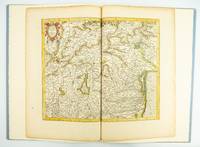
1985ST20505-12Fullerton California: Stone & Lorson 1985. ONE OF 89 COPIES in quarter vellum of a total edition of 115. 490 x 325 mm. 19 1/4 x 13". viii 23 1 pp. 1 leaf. <br/> Publisher's quarter vellum over gray paper boards covers with device in gilt smooth spine lettered in gilt. In just slightly chafed black buckram slipcase. WITH A MAP FROM THE ORIGINAL 1619 ATLAS bound in with period hand coloring. Map 293 "Tarvisina Marchia Et Tirolis Comitatus". De Hamel & Silver "Disbound and Dispersed" 186. One corner a bit bumped otherwise the main volume flawless; the map edges a bit browned and just slightly frayed a few light spots but still excellent with good color and strong general appeal.<br/> <br/> This attractive oversized production includes an original map of an important region of northeastern Italy taken from the 1619 edition of the Mercator-Hondius atlas. A pioneer in commercial cartography and a founder of the Netherlandish school of cartography and geography Mercator 1512-94 produced maps used around the world that were informed by his brilliant "Mercator Projection" which allowed the round Earth to be accurately depicted on a flat map. Near the end of his life he began work on an ambitious cosmography that would contain an account of the creation of the world a description of the universe descriptions of the countries and oceans of the world genealogies and political histories of the several countries and a chronology of the cosmos. Only the account of creation the chronology and maps of the known regions of the world came to fruition. Mercator having died before the work came to press it was completed by his heirs and published in 1595 with 107 maps. Leading Amsterdam map publisher Jodocus Hondius 1563-1612 acquired the plates in 1604 and issued the first Mercator-Hondius "Atlas" in 1606 with 37 maps he had engraved added to the original 107. Teacher and Hondius' brother-in-law Pieter van den Berg wrote the introduction and the descriptive text that appears on the versos of the maps. A 1611 edition increased the number of maps to 150 and another six were added in 1619. The hand-colored map included in our copy depicts the South Tyrol and Veneto regions including Lake Garda Verona Padua and Venice. It is accompanied with an essay by Norman J. W. Thrower 1919-2020 UCLA geography professor and cartographer describing the historical background of the atlas. Joel Silver in "Disbound and Dispersed" tells us that "the physical production of this leaf book is superb from the design by Vance Gerry to the presswork of Patrick Reagh.". Stone & Lorson unknown