5 783 résultats
1958018590Washington D. C.: Library of Congress 1958. 1958. First Edition. Volume 5. Very Good condition. Clean square and tight. Hinges are perfect. Previous owner's small armorial bookplate on the pastedown endpaper. All other pages are crisp and unmarked. NO underlining. NO highlighting. NO margin notes. Preface. Author List. List of Geographical Atlases Titles 5325-7623. Comprehensive Index pp. 487-666. Subtitle: "With Bibliographical Notes A Continuation of Four Volumes by Philip Lee Phillips." Bound in the original blue cloth stamped in bright gold over a maroon panel on the spine. 7" wide by 10" tall by 1.75" thick. First Edition. Hardcover. Very Good condition/No jacket as issued. xlvii 666pp. Great Packaging Fast Shipping. Library of Congress Hardcover
1974019878Washington D. C.: Library of Congress / U. S. Government Printing Office 1974. Very Good EX-LIBRARY. Hinges are perfect. Pages are clean and crisp. NO underlining. NO highlighting. NO margin notes. 1974. First Edition. Volume 8 comprising the Index to Volume 7 titles 10255-18435. From the preface: "Indexed in this volume are areas subjects map authors engravers lithographers publishers etc. and atlas titles with distinctive words." Subtitle: "A Continuation of Four Volumes by Philip Lee Phillips." Bound in the original blue cloth gilt-stamped over a red spine panel. This First Edition measures 7" wide by 10" tall which is a larger format than the 1996 Martino reprint. BIBLIOGRAPHICAL NOTE: Volume 8's ISBN listed here was mistakenly duplicated for Volume 9 The Comprehensive Author List when it was published in 1992. First Edition. Hardcover. Very Good EX-LIBRARY/No jacket as issued. v 190pp. Great Packaging Fast Shipping. Library of Congress / U. S. Government Printing Office Hardcover
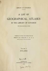
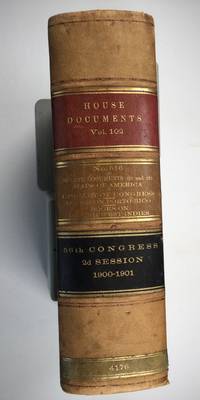
1901025183Washington: Government Printing Office 1901. SEE PHOTOS. A handsome example of the 1901 first edition in quite scarce original leather binding with 3 titles bound together as sometimes seen -- NOT print on demand edition or modern reprint. Very Good condition. NOT a library discard. NO owner's name or bookplate. Hinges are perfect. Minor offset as usual from the leather binding to edges of the endpapers. Front free endpaper has light soil and 4 small edge chips. Pages are otherwise clean and unmarked. NO foxing. 1901. First Edition. 1137pp. Bound in the original full leather calf binding we say "original" because we have seen other first editions in an identical leather binding including its 3 attractive leather spine labels -- in red black and brown -- although none of them were in condition as nice as this one. Leather is only moderately rubbed. SEE PHOTOS. All gilt stamping is still bright and shiny. This is House of Representatives Document No. 516 1901. Also bound in are: A LIST OF BOOKS WITH REFERENCES TO PERIODICALS ON PORTO RICO by A. P. C. Griffin. Senate Document No. 222. 55pp. 1901.; and A LIST OF BOOKS WITH REFERENCES TO PERIODICALS ON THE DANISH WEST INDIES by A. P. C. Griffin. Senate Document No. 223. 18 pp. 1901. Oversize Hardcover. 7.25" wide by 10.25" tall by 3" thick. This large heavy book will require extra postage for Priority and International shipments but only the standard charge for media mail. Sheehy 1986 CL287: "Lists maps to be found in books and atlases as well as those separately issued. Describes many old state and country maps and city plans.". First Edition. Oversize Hardcover. Very Good condition. Illus. by NOT a library discard. 1137pp. 55pp. 18pp. Great Packaging Fast Shipping. Government Printing Office Hardcover
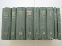
1995018557Staten Island New York: Maurizio Martino Publisher 1995. SEE PHOTO. 9 volumes complete. BRAND NEW HARDCOVERS in perfect condition. STILL SEALED in the publisher's clear plastic SHRINKWRAP. NO rubbing. NO fading. Bright clean square and tight. Sharp corners. NO owner's name or bookplate. NOT a remainder. Fresh and crisp -- obviously never read. The standard reference complete in 9 volumes. Vols. 1-4 by Philip Lee Phillips. No date but 1995 First Martino printing "strictly limited to 100". Reprint of the 1909-1920 Library of Congress originals. Vols 5-9 by Clara Egli Le Gear. No date but 1996 First Martino printing "strictly limited to 150". Reprint of the 1958-1992 Library of Congress originals in continuation of volumes 1-4 by Philip Lee Phillips. These 9 volumes fully describe thousands of atlases including imprint collation details of publication measurements content typographical and numbering errors comparisons with foreign and later editions reference citations reviews etc. There are also useful biographical sketches of explorers mapmakers engravers and lithographers. For most atlases before 1870 complete tables of contents are listed. Volume 9 is the comprehensive author index to both Phillips and LeGear with listings for 18435 atlases. The nine volumes are uniformly bound in the original gilt-stamped green cloth. SEE PHOTO. Sheehy CL286: "An important catalog of an outstanding collection." Hodgkiss/Tatham KEYGUIDE 11: "The most comprehensive work on historical atlases." This heavy 9 volume set will require extra postage for Priority and International shipments. But for media mail you pay only our standard charge for 1 volume and we ship the other 8 volumes at no extra cost. First Martino printing. Hardcover. New/in publisher's shrinkwrap. Illus. by We ship all 9 volumes for cost of 1. 9 volumes complete. Great Packaging Fast Shipping. Maurizio Martino Publisher Hardcover
1995018560Staten Island New York: Maurizio Martino Publisher 1995. 9 volumes complete. BRAND NEW HARDCOVER in perfect condition just removed from the publisher's shrinkwrap so we could write this description. NO rubbing. NO fading. Bright clean square and tight. Sharp corners. NO owner's name or bookplate. NOT a remainder. Fresh and crisp -- obviously never read. The standard reference complete in 9 volumes. Vols. 1-4 by Philip Lee Phillips. No date but 1995 First Martino printing "strictly limited to 100". Reprint of the 1909-1920 Library of Congress originals. Vols 5-9 by Clara Egli Le Gear. No date but 1996 First Martino printing "strictly limited to 150". Reprint of the 1958-1992 Library of Congress originals in continuation of volumes 1-4 by Philip Lee Phillips. These 9 volumes fully describe thousands of atlases including imprint collation details of publication measurements content typographical and numbering errors comparisons with foreign and later editions reference citations reviews etc. There are also useful biographical sketches of explorers mapmakers engravers and lithographers. For most atlases before 1870 complete tables of contents are listed. Volume 9 is the comprehensive author index to both Phillips and LeGear with listings for 18435 atlases. The nine volumes are uniformly bound in the original gilt-stamped green cloth. Sheehy CL286: "An important catalog of an outstanding collection." Hodgkiss/Tatham KEYGUIDE 11: "The most comprehensive work on historical atlases." This heavy 9 volume set will require extra postage for Priority and International shipments. But for media mail you pay only our standard charge for 1 volume and we ship the other 8 volumes at no extra cost. . First Martino printing. Hardcover. New/No jackets as issued. Illus. by We ship all 9 volumes for cost of 1. 9 volumes complete. Great Packaging Fast Shipping. Maurizio Martino Publisher Hardcover
1995018575Staten Island New York: Maurizio Martino Publisher 1995. Volumes 1-4. BRAND NEW HARDCOVERS. Three of the four volumes are STILL SEALED in the publisher's clear plastic SHRINKWRAP. Volume 1 has a small spot on its rear cover. Volume 2 has a mild bump at the head of its spine NO pages are affected. Bright clean square and tight. Sharp corners. NO owner's name or bookplate. NOT a remainder. Fresh and crisp -- obviously never read. The standard reference. No date but 1995 First Martino printing "strictly limited to 100". Reprint of the 1909-1920 Library of Congress originals. The four volumes are uniformly bound in the original gilt-stamped green cloth. Sheehy CL286: "An important catalog of an outstanding collection." Hodgkiss/Tatham KEYGUIDE 11: "The most comprehensive work on historical atlases." This heavy 4 volume set will require extra postage for Priority and International shipments. But for media mail you pay only our standard charge for 1 volume and we ship the other 3 volumes at no extra cost. First Martino printing. Hardcover. New/in publisher's shrinkwrap. Illus. by We ship all 4 volumes for cost of 1. 4 volumes. Great Packaging Fast Shipping. Maurizio Martino Publisher Hardcover
1995018565Staten Island New York: Maurizio Martino Publisher 1995. Volumes 1-4. BRAND NEW HARDCOVERS in perfect condition. STILL SEALED in the publisher's clear plastic SHRINKWRAP. NO rubbing. NO fading. Bright clean square and tight. Sharp corners. NO owner's name or bookplate. NOT a remainder. Fresh and crisp -- obviously never read. The standard reference. No date but 1995 First Martino printing "strictly limited to 100". Reprint of the 1909-1920 Library of Congress originals. The four volumes are uniformly bound in the original gilt-stamped green cloth. Sheehy CL286: "An important catalog of an outstanding collection." Hodgkiss/Tatham KEYGUIDE 11: "The most comprehensive work on historical atlases." This heavy 4 volume set will require extra postage for Priority and International shipments. But for media mail you pay only our standard charge for 1 volume and we ship the other 3 volumes at no extra cost. First Martino printing. Hardcover. New/in publisher's shrinkwrap. Illus. by We ship all 4 volumes for cost of 1. 4 volumes. Great Packaging Fast Shipping. Maurizio Martino Publisher Hardcover
19711247911Amsterdam, Theatrum Orbis Terrarum, 1971. 13, 1659 S. u. 1 Bl., 137, 1030; 163, 639 S. OLwdbd (Kanten u. Gelenke teils stärker bestoßen, erste u. letzte Blätter etwas knickfaltig).
large scale engraved map (1165 x 1440 mm), with contemporary outline colouring, dissected into 32 sections and laid on linen, calligraphic title and dedication and mileage scale, slight browning and faint offsetting, folding into contemporary slipcase which is worn and torn, manuscript label pasted on upper cover "Hunting Map, H. Lowe". The first issue of this rare map of Belvoir Castle and the surrounding area, King issued a corrected edition in 1836 which is of similar rarity.
1781Map904London: W. Strachen and T. Cadell 1781. printed Map. Fine. 41.5 x 48.5 cms. Nice wide margins. Folding map uncoloured and printed on heavy paper. One small hole on a fold. PLEASE EMAIL FOR PHOTOS. <br/> <br/> W. Strachen and T. Cadell unknown
179446191794 London, Laurie & Whittle, 1794 Carte gravée sur cuivre (50,5 x 57 cm hors marges, 54 x 73 cm toutes marges comprises). Tirage de l'époque. Quelques traces d'une autre carte en surimpression. Map on copperplate (50,5 x 57 cm without the margins, 54 x 73 cm with the margins). Contemporary printing. Several light printed marks of another map.
1744Map918London: Eman. Bowen 1744. 1st Edition . Hardcover. Fine. Double hemisphere map of the world with four seated allogorical women in each corner of the plate. Uncoloured state with a trimmed right hand side but no loss to the map. Plate impress 31.5 x 53.5 cms with sheet size 36.5 x 54 cms. Centre fold. Pre-Cook outlines of Australia and New Zealand. PLEASE EMAIL FOR PHOTOS. <br/> <br/> Eman. Bowen hardcover
1747Map882London: E. Bowen 1747. 1st Edition . printed Map. Fine. . Drawn from the Most approv'd Foreigners Mpas and Charts and Regulated By Astron'l Observations. An original printed map with outline hand-colour to the coast-line and cartouche in the lower right corner. A lovely plate impressed map with sharp clear engraving and title cartouche to the lower right-hand corner. Emanuel Bowen 1694- 1767. Plate 31.7x22.0 paper 38.5 x 26.5 cms. Nice margins. From the 1747 'A Complete System of Geography'. <br/> <br/> E. Bowen unknown
1788GT789London: Charles Dilly in the Poultry et al 1788. eleventh edition . Hardback. Vg. 8vo. x 2 928pp. 20 map plates : 2 engeaved illustrations charts maps ; Damp staining to the plates and map in some but compete and tight copy in the original binding. A New System of Modern Geography: or A geographical historical and commercial grammar; and present state of the several kingdoms of the world. : Containing I. the figures motions and distances of the planets according to the Newtonian system and the latest observations. II. A general view of the Earth considered as a planet; with several useful geographical definitions and problems. III. The grand divisions of the globe into land and water continents and islands. IV. The situation and extent of empires kingdoms states provinces and colonies. V. Their climates air soil vegetable productions metals minerals natural curiosities seas rivers bays capes promontories and lakes. VI. The birds and beasts peculiar to each country . XII. The longitude latitude bearings and distances of principal places from London. To which are added I. A geographical index with the names and places alphabetically arranged. II. A table of the coins of all nations and their value in English money. III. A chronological table of remarkable events from the Creation to the present time. Original full calf with red morocco label to the spine. <br/> <br/> Charles Dilly in the Poultry et al hardcover
1830Le601London: G.G. and J. Robinson 1830. 3rd Edition . Hardback. Vg. 8vo. :Containing a Comprehensive System of Modern Geography After a New and Curious Methodlxiii 567 viii pp appendix. Original full plain calf gilt ruled compartments. 5 engraved plates in the Introduction A double hemisphere world map worn but complete as a frontis. and 6 folding maps Europe creased in the main section. "Corrected and considerably enlarged". New descriptions of America and Cook's Voyages I. A General View of the Terraqueous Globe: Being a Description of the Figure Motion and Magnitude of the Earth; The Theory of the Air Winds and Tides; the Doctrine of the Sphere; the Use of the Globes etc etc. II. A particular View of the Terraqueous Globe: Being an accurate Description of all the Empires Kingdoms States Provinces and Colonies in the known World; shewing the Extent of their Situation Extent Climate Air Soil Animal Vegetable and Mineral Productions . To which is added An Appendix: Containing a Geographical Table with the Names and Situations of the Chief Cities Towns &c. etc etc.The first edition of this educational book was <br/> <br/> G.G. and J. Robinson hardcover
1839TH225London: Aldam and Co. Et al. 1839. 1st Edition . Hardback. Fine. 8vo. 100pp. Large folding table of distances frontis. A wonderful early Victorian geography in the orginal stiff card cover with fine buckram cloth cover and a lozenge label pasted to the front cover. A RARE ITEM. Copac 1 copy only 1839. A second edition was published in 1850. <br/> <br/> Aldam and Co. Et al. hardcover
1713Map868London: Henry Overton 1713. Original printed issues 1st Editions . No Binding. Fine. Folio. 1603-1713 The rare re-issue with amendments by Henry Overton of Smiths original plate of 1603. Based on the map by Saxton in 1573. Un-coloured example in fine condition of the copperplate engraving. Paper size 55 x 46 cms. Plate size 48 x 33 cms. No splits or holes. Plain verso and part of the original hinge still present. Table with a list of the hundreds. One of the original 'anonymous' maps that were identified as being by Smith in recent times.PLEASE EAMIL FOR PHOTOS. <br/> <br/> Henry Overton unknown
In folio (46x25 cm); esemplare in buone-ottime condizioni di conservazione. Prima edizione di questa bella carta del centro Italia con fine coloritura coeva che descrive i territori della Toscana, dell'Umbria, delle Marche, del Lazio, della Campania ed una parte della capitanata. Edward Wells, il cartografo che realizzò la stampa, era un sacerdote della Chiesa d'Inghilterra e sostenitore dell'istruzione. Durante la sua vita pubblicò numerose carte, tra cui diversi atlanti del mondo antico e contemporaneo. Wells era figlio di un vicario ed entrò alla Christ Church di Oxford alla fine del 1686. Si laureò nel 1690 e lavorò come tutore nel suo college dal 1691 al 1702. Quindi, si spostò a Cotesbach, nel Leicestershire, da dove continuò a pubblicare i suoi lavori. Dal 1698 in poi, Wells compilò molti sermoni, diversi libri ed alcunbi atlanti. Tradusse anche testi classici e cristiani, aggiungendo talvolta annotazioni geografiche. Le sue “geografie descrittive” non erano opere eccessivamente originali, ma furono molto popolari al suo tempo per la bellezza ed eleganza del tratto. Nel 1701 pubblicò un Trattato di geografia antica e moderna che riscosse un notevole successo e che vide quattro edizioni successive. A quest'opera, seguì una Geografia storica del Nuovo Testamento pubblicata nel 1708, accompagnata da una Geografia storica dell'Antico Testamento edita tra il 1711 ed il 1712. Opera in buone-ottime condizioni di conservazione.
1839TH327London: Longman Orme Brown Green & Longmans 1839. a new Edition Considerably Improved . Hardback. Vg. 8vo. ND but preface dated Walworth 1839. xxiv 364pp 7 folding plates at the rear.12pp pub. cat. dated August 1841 London. Bound in the pub. green fine pebble gren cloth with gilt titles to the spine. Pasted -down end-papers list Longmans 'New School Books'/ Neat owners sig. dated 1842. Thomas Keith 1759-1824. The first edition was pub. in 1805 <br/> <br/> Longman, Orme, Brown, Green & Longmans hardcover
1962021562Iowa City: The Prairie Press 1962. A beautiful copy. Fine condition in a Fine dust jacket. The jacket is protected by a removable Brodart clear-plastic sleeve. NOT price clipped $4.00. NO rubbing. NO fading. NO chips. NO tears. NO creases. NO owner's name or bookplate. Sharp corners. First Edition Limited to 550 copies. Frontispiece features a hand-mounted genuine 3 cent stamp from 1955 showing a diagram of Fort Ticonderoga. Illustrated with numerous facsimiles of stamps showing maps or plans. Tells their stories. Printed by Carroll Coleman at The Prairie Press in Iowa City Iowa. Bound in the original blue patterned paper-covered boards with a black cloth spine and printed paper spine label. Complete with dust jacket. First Edition 1/550 copies. Hardcover. Fine condition/Fine dust jacket. 83pp. Great Packaging Fast Shipping. The Prairie Press Hardcover
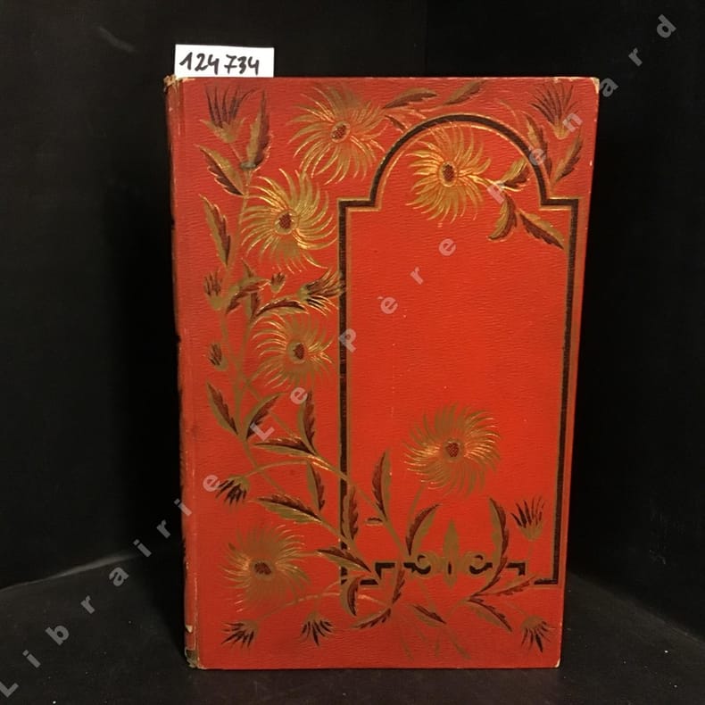
18871247341887 Alfred Mame et fils, Editeurs, Tours - M DCCC LXXXVII (1887) - Deuxième édition - Un volume In-4, cartonnage rouge orné de décors en noir et doré sur le premier plat et au dos, décors en noir sur le quatrième plat, toutes tranches dorées, frontispice - 368 pages - Ouvrage orné de 45 gravures et d'une carte en N&B, hors-texte
Second edition, corrected and enlarged, [8], 242, [8], 40pp., additional engraved title in Latin with allegorical border, laid-down with two closed tears to fore-edge, title lightly stained with a couple of marginal chips, some general age-toning, engravings and woodcuts in the text including one full page, orig. calf, rebacked, joints rubbed, head of spine chipped. Joseph Moxon (1627?1691) established himself as a printer and globe and instrument maker in London. After visiting Amsterdam to study printing, Moxon brought back W. J. Blaeu's handbook of globes, then just published, and translated it into English as "A tutor to astronomy and geography" in 1659. The work was superseded when Moxon published a totally new handbook in 1659, "A tutor to astronomie and geographie". This work was specially designed for an English market rather than Dutch, and became Moxon's most popular work relating to globes. This second edition is corrected and greatly enlarged. A variant second edition which is not listed in Wing, it varies from Wing M3023 in having a separate pagination for the 40-page "Antiquity, Progress, and Augmentation of Astronomie."; ESTC finds 3 copies located at Cambridge, Wellcome and Staatsbibliothek zu Berlin.
In 4° piccolo; 11, (5) pp. e una grande tavola più volte ripiegata. Brossura editoriale. Perfetto stato di conservazione. Prima ed unica edizione di questo repertorio bibliografico-cartografico dedicato agli spicchi componenti un globo terrestre realizzato a Venezia intorno al 1570.
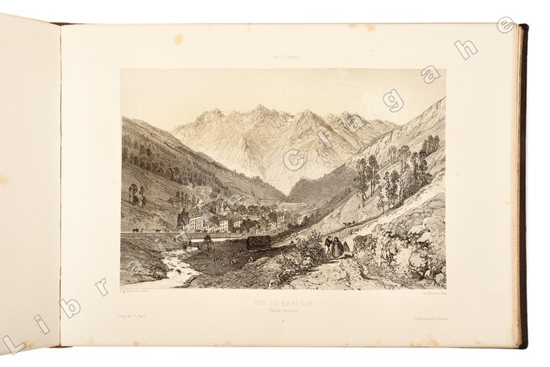
21335soit 2 tomes, reliés en un volume in folio oblong, cartonnage de percaline marron à fers dorés spéciaux et à froid sous le titre “Souvenir des Pyrénées” par Eug. Ciceri. Lafont-libraire-Editeur 40 allées d’Etigny-Luchon, dos chagrin marron foncé, nerfs, caissons de filets dorés, titre doré, tranches dorées ; s.d. [1870 ou 1873, BNF] ; a) [1] f. de Titre, 8 pp. sur 2 colonnes, 1 plan et une carte dépliante lithographiés par Salette à Toulouse, 28 lithographies dont 8 dépliantes (2 ou 4 panneaux), tirées par Becquet à Paris pour l’éditeur Goupil. b) [1] f. de titre, 12 pp. de texte sur 2 colonnes, 32 lithographies dont 9 dépliantes (2 panneaux), idem. Soit en tout 60 lithographies dessinées et mises sur pierre par Eugène Ciceri, dont 17 dépliantes, non compris le plan et la carte également lithographiés.