333 résultats
1848Map 821London: George Virtue 1848. re-issue . No Binding. Vg. W. Hughes. 27 x 21 cms. Original un-coloured state first issue in 1832. Finely engraved map of London spanning Harrow in the west to Barking in the east Wimbledon in the south to Finchley in the north. A nice original steel engraving with a dark impression. Some pencil lines on the reverse not affecting map <br/> <br/> George Virtue unknown
1846008628Philadelphia: Lea and Blanchard 1846. PHOTOS UPON REQUEST. 3 volumes complete. Very Good condition. Bound in the publisher's brown cloth lettered in shiny gold on the spine. All gilt is as bright and shiny as new. A very nice set -- solid clean square and tight. Inner hinges are perfect. Corners are NOT bumped. Moderate rubbing/fraying to spine ends. Previous owner's name. A few small brown speckles foxing on the endpapers. Text pages are clean and crisp with little or no foxing. NO underlining. NO highlighting. NO margin notes. This 1846 edition is largely a reprint of the edition first published in 1837 which was copyright 1836. The only apparent change here is a 24-page addition to vol. 3 entitled: SUPPLEMENT TO THE ENCYCLOPAEDIA OF GEOGRAPHY CONTAINING STATISTICAL AND OTHER MATTER BRINGING DOWN THE WORK TO THE YEAR 1842." Among other things the supplement includes county-by-county population records from the 1840 census plus updated statistics on agriculture steam power imports/exports etc. Based on paginations found in Sabin this supplement was probably first published in 1843. The set is well-illustrated with 82 maps and about 1100 other engravings on wood. There are sections on astronomy by William Wallace botany by William Jackson Hooker geology by Robert Jameson and zoology by William Swainson. Volume III has a nice 2-page multi-color steel-engraved map of the U.S. It was drawn by J. Drayten after Tanner and features neatly hand-colored borders around each state and territory. Index Index to Supplement. Subtitle: "Comprising a Complete Description of the Earth Physical Statistical Civil and Political; Exhibiting Its Relation to the Heavenly Bodies Its Physical Structure The Natural History of Each Country and the Industry Commerce Political Institutions and Civil and Social State of All Nations." Oversize Hardcover. This heavy 3 volume set will require extra postage for Priority and International shipments. But for media mail you pay only our standard charge for 1 volume and we ship the other 2 volumes at no extra cost. Sabin 51499. New Edition with Supplement. Oversize Hardcover heavy. Very Good condition. Illus. by Drayten J hand-colored steel-engraved map of the U.S. 8vo. 597 592 648 pages. Great Packaging Fast Shipping. Lea and Blanchard Hardcover
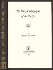
1999017926Mansfield Centre Connecticut: Martino Publishing 1999. Brand New HARDCOVER in perfect condition. STILL SEALED in the publisher's clear plastic SHRINKWRAP. NO rubbing. NO fading. Bright clean square and tight. Sharp corners. NO owner's name or bookplate. NOT a remainder. Fresh and crisp -- obviously never read. 1999 reprint of the 1944 original. A standard work. Illustrated with 22 FOLD-OUT maps. "An excellent study of those maps from Ptolemy to 1798 important in the development of the cartography of the Pacific area with facsimiles of 22 of the 104 maps described." -- Ristow 393 in GUIDE TO THE HISTORY OF CARTOGRAPHY. Hodgkiss/Tatham 137 in KEYGUIDE TO INFORMATION SOURCES IN CARTOGRAPHY. Bound in the original gilt-stamped brown cloth. Because this edition is bound in sturdy cloth it is much better suited to repeated use than the paper binding of the original edition. 1999 reprint of the 1944 original. Hardcover. New/in publisher's shrinkwrap. 8vo. vi pp. 87-268 22 folding plates. Great Packaging Fast Shipping. Martino Publishing Hardcover
1740TH228London: Printed for Thomas Wright Mathematical Instrument-Maker. And E. Cushee Globe-Make 1740. fifth Edition . Hardback. Vg. 8vo. THE DESCRIPTION AND USE OF THE GLOBES AND THE ORRERY To which is prefixed by way of introduction a brief Account of the Solar System.viii 190pp. 6 folding plates. Pub. advert to the reverse of the title-page. Index of the astronomical terms. Original full calf polished calf binding with gilt dbl. ruled border to the boards. Five raised band and neat owners to the top edge of the title-page. A tight clean and fresh copy with a plain but period binding Near fine Nicholson Calvert 1816 an English Whig politicain who fought at the Battle of Waterloo. <br/> <br/> Printed for Thomas Wright, Mathematical Instrument-Maker. And E. Cushee, Globe-Make hardcover
1745TH352London: Printed for Thomas Wright Mathematical Instrument-Maker. And E. Cushee Globe-Make 1745. sixth edition . Hardback. Vg. 8vo. To which is prefixed by way of introduction a brief Account of the Solar System.viii 190pp. 6 folding plates. Pub. advert to the reverse of the title-page. Index of the astronomical terms. Original full calf calf binding. Five raised bands. A tight clean and fresh copy with a plain but period bindng/ Original binding intact but worn to the extremities and joints cracked but the boards attached. A tight and clean text with beautiful crisp plates. <br/> <br/> Printed for Thomas Wright, Mathematical Instrument-Maker. And E. Cushee, Globe-Make hardcover
1999018413Mansfield Centre Connecticut: Martino Publishing 1999. 2 volumes bound as 1 complete. BRAND NEW HARDCOVER in perfect condition. STILL SEALED in the publisher's clear plastic SHRINKWRAP. NO rubbing. NO fading. Bright clean square and tight. Sharp corners. NOT a library discard. NO owner's name or bookplate. NOT a remainder. Fresh and crisp -- obviously never read. No date but 1999 First Martino printing "Limited Edition Facsimile". Reprint of the 1937 two volume set. 2 vols. in 1: xii pp. 1-270; iv pp. 271-543 13 maps not included in the pagination. Well illustrated with 41 map reproductions including 13 that fold-out. Bound in the original pale yellow cloth stamped in bright gold over a handsome dark green spine panel. "Although emphasis is on the Northwest Coast of America this is a useful reference work for the student of the cartographic history of America. It contains an extensive index bibliography and list of place names as well as a list of maps. An exhaustive and scholarly publication which includes a note on practically every important map. 1507-1794." -- Ristow GUIDE TO THE HISTORY OF CARTOGRAPHY #377. Howes USIANA W7. Oversize Hardcover. 8.75" wide by 11" tall. This large heavy book will require extra postage for international shipments but only the standard charge for priority or media mail. First Martino printing. Oversize Hardcover. New/in publisher's shrinkwrap. 2 vols. in 1: xii pp. 1-270; iv pp. 271-543. Great Packaging Fast Shipping. Martino Publishing Hardcover
1906Map 753Sampson Low Marston & Co. Ltd. 1906. 2nd Edition . No Binding. Fine. 67x106 cms. 42 x 26 inches. A large folding map laid on linen. The first issue of the map was 1902 and this is the second edition. The Franco-British Exhibition site is included on what became White City and covered 140 acres. The tube lines are updated and include approved and those under construction. A beautifully coloured map in green red and blue. The tube lines are inserted onto a geographical map. It covers a wide area of London and the Home Counties. Unfaded colour and in fine condition. Some folds a trifle split but not worn. The map folds to be enclosed in the original pictorial boardswhich is complete and sound but a trifle foxed and faded. PLEASE EMAIL FOR PHOTOS. <br/> <br/> Sampson Low, Marston & Co. Ltd. unknown
1997018336Mansfield Centre Connecticut: Martino Fine Books 1997. 2 volumes complete bound as 1. BRAND NEW HARDCOVER in perfect condition. STILL SEALED in the publisher's clear plastic SHRINKWRAP. NO rubbing. NO fading. Bright clean square and tight. Sharp corners. NO owner's name or bookplate. NOT a remainder. Fresh and crisp -- obviously never read. No date but 1997 First Martino printing limited to 150 copies published @ $95. Facsimile reprint of the 1921 two-volume Hispanic Society of America/Yale University Press edition. 2 vols. in 1: xxvi 218pp. xi 291pp. 143 plates mostly photos of important globes. The standard reference on the subject. According to Ristow this is "a comprehensive work including an extensive bibliography an index of globemakers with locations of globes and a general index." -- #317 GUIDE TO THE HISTORY OF CARTOGRAPHY. Keyguide 316: "A comprehensive work that includes a bibliographical listing. Valuable for astronomers as well as carto-historians and geographers." Handsomely bound in the original blue cloth stamped in bright gold over a red spine panel. First Martino printing Limited to 150. Hardcover. New/in publisher's shrinkwrap. 2 vols. in 1: xxvi 218pp. xi 291pp. 143 plates. Great Packaging Fast Shipping. Martino Fine Books Hardcover
1806Map952Paternoster Row London: Longman Hurst Rees & Orme 1806. 1st Edition 1st Printing. No Binding. Fine. Folio - over 12 - 15" tall. Original early 19th century uncoloured MAP OF THE SWITZERLAND BY AARON ARROWSMITH. A FINE CLEAN AND DARK IMPRESSION. Original folding plate covering HOLLAND printed on heavy paper dated 1807. A scarce example and in fine un-coloured original condition. An occasional light foxing mark. 41x27cms. Double-page folding map. engraved by COOPER.A LOVELY COPY. paper watermark dated 1808 <br/> <br/> Longman, Hurst, Rees & Orme unknown
1810Map944Paternoster Row London: Longman Hurst Rees & Orme 1810. 1st Edition 1st Printing. No Binding. Fine. Original early 19th century MAP of SWEDEN DENMARK AND NORWAY On MERCATORS PROJECTION BY AARON ARROWSMITH. A FINE CLEAN AND DARK IMPRESSION. Original folding plate printed on heavy paper dated 1807. A scarce example and in fine un-coloured original condition. 41x27cms. Double-page folding map.A NICE COPY <br/> <br/> Longman, Hurst, Rees & Orme unknown
1769Map1007London: Russell and Price 1769. Original Map . No Binding. Fine. 4to. Single page map of the County of SUSSEX John Roque. Published in ENGLAND DISLAYED Being a New Complete and Accurate Survey and Description of the Kingdom of England and Principality of Wales. Plate 16 x20cm sheet 160 x 243mm. Fine original map printed on laid paper. Uncoloured. 2ND EDITION pub. 1769. OTHER COUNTIES ARE AVAILABLE FROM THIS ISSUE. <br/> <br/> Russell and Price unknown
1769MAP1010London: Russell and Price 1769. Original Map . No Binding. Fine. 4to. Single page map of the County of SURREY John Roque. Published in ENGLAND DISLAYED Being a New Complete and Accurate Survey and Description of the Kingdom of England and Principality of Wales. Plate 16 x20cm sheet 160 x 243mm. Fine original map printed on laid paper. Uncoloured. 2ND EDITION pub. 1769. OTHER COUNTIES ARE AVAILABLE FROM THIS ISSUE. <br/> <br/> Russell and Price unknown
1880NY068London: Mappin 1880. Original . No Binding. Fine. Metal dial and clasp with a small built in compass and a fine dial arm that is hinged to work out measurements. The compass dial pointer is loose but present within the bubble. A strong clasp ring 50mm surrounds the dial from the rear and the face is finely engraved with roman numerals of the hours of the day.The rear is finely stamped 1644 in minute type. The metal is not hall marked. A VERY ATTRACTIVE AND RARE ITEM c1880 <br/> <br/> Mappin unknown
1616Map 752London: Thomas Bassett and Richard Chiswell 1616. No Binding. Fine. Folio. 1611-1676 An original map of the county of Suffolk. Nice old hand-colouring a dark impression. 41.5 x 54cms. 16.25 x 21.5 inches. Wide margins outside the plate. ENGLISH TEXT to reverse. The imprint is by Thomas Bassett and Richard Chiswell in St Pauls Yard. London Floral initial letter to reverse in the style of Hall and Beale. PLEASE EMAIL FOR PHOTOS. Basset and Chiswell joined forces and purchase the original Speede plates and re-issued the maps in a fine edition in 1676. Only this issue was produced and is dated 1676 <br/> <br/> Thomas Bassett and Richard Chiswell unknown
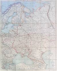
192284192London: Edward Stanford Ltd 1922. Large folding map. Lithograph in colors on uncoated paper dissected and laid down on linen as issued; overall dimensions 123cm x 97cm ca 48" x 38" folding to 20cm x 14cm 8" x 5-1/2"; card covers with publisher's slipcase of maroon cloth with printed paper title label. A bright clean well-preserved example Very Good to Near Fine. In the original slipcase cloth lightly rubbed at corners and a bit of soil to title label still easily Very Good.<br /> <br /> An impressive Revolutionary-era map of Russia in 42 sections scaled 1 inch to 50 miles. This revision dated March 1922 would appear to be the fourth and final edition of the map - it was preceded by editions in 1915 1917 and 1919. By December 1922 the Soviet Union would be formally established with Azerbaijan Georgia Belarus and Armenia which all appear here as independent states being absorbed into the Union of Soviet Socialist Republics. Edward Stanford, Ltd unknown
1875Map877London: Edward Stanford 55 Charing Cross 1875. 1st issue . paper wrappers. Fine. Folding map. 78.5 x 66.5 cms. The rare first issue of Stanford's April 19th 1875 map of the North Pole. Laid on cloth in 12 dissected sections. Coloured printing. Pasted to the lower left corner is a contemporary inset map of the Kennedy Channel entering ther 'frozen Polar Ocean' text to the reverse of the inset map.The voyages and journeys of the Artic explorers throughout the centeries are neatly printed in red throughout the map with dates including up to Austrian Exped. Payer 1874. Neatly enclosed in cloth covers when folded with a hand-written original label 'North Pole'. A lovely copy of a very scarce item. PLEASE EMAIL FOR PHOTOS. <br/> <br/> Edward Stanford, 55 Charing Cross unknown
1769MAP1024London: Russell and Price 1769. Original Map . No Binding. Fine. 4to. Single page map of the County of STAFFORD SHIRE John Roque. Published in ENGLAND DISLAYED Being a New Complete and Accurate Survey and Description of the Kingdom of England and Principality of Wales. Plate 16 x20cm sheet 160 x 243mm. Fine original map printed on laid paper. Uncoloured. 2ND EDITION pub. 1769. OTHER COUNTIES ARE AVAILABLE FROM THIS ISSUE. <br/> <br/> Russell and Price unknown
1807Map951Paternoster Row London: Longman Hurst Rees & Orme 1807. 1st Edition 1st Printing. No Binding. Fine. Folio - over 12 - 15" tall. Original early 19th century uncoloured MAP OF THE SEVEN UNITED PROVINCES BY AARON ARROWSMITH. A DARK IMPRESSION. BUT DAMP EVIDENCE TO THE PAPER. Original folding plate covering SPAIN AND PORTUGAL printed on heavy paper dated 1807. A scarce example and in fine un-coloured original condition. An occasional light foxing mark. 41x27cms. Double-page folding map. engraved by COOPER.A LOVELY COPY. paper watermark dated 1808 <br/> <br/> Longman, Hurst, Rees & Orme unknown
1769MAP1018London: Russell and Price 1769. Original Map . No Binding. Fine. 4to. Single page map of the County of SHROP SHIRE John Roque. Published in ENGLAND DISLAYED Being a New Complete and Accurate Survey and Description of the Kingdom of England and Principality of Wales. Plate 16 x20cm sheet 160 x 243mm. Fine original map printed on laid paper. Uncoloured. 2ND EDITION pub. 1769. OTHER COUNTIES ARE AVAILABLE FROM THIS ISSUE. <br/> <br/> Russell and Price unknown
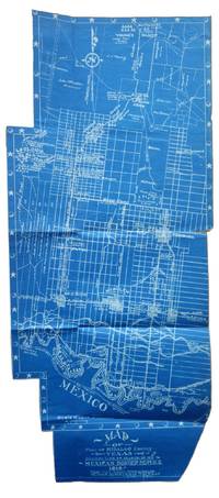
1917List2530VP 1917. Scrapbook measuring 15 ½ x 10 ½ inches. With forty leaves most with newspaper clippings and varied ephemera attached. Boards detached contents generally fine. Laid in is a blueprint map entitled Map of Part of Hidalgo County Texas Showing Line of March in my Mexican Border Service 1916. Made from Survey Notes taken on the march by Corp. C.A. Rice 74 Inf. N.G.U.S. Buffalo N.Y. Armory. Map measuring 33 ½ x 14 ¾ inches irregularly shaped and apparently complete. Very Good. A scrapbook documenting the military service of 1st Sergeant Samuel Gaffney of the 74th National Guard New York in the Mexican Border Service. Gaffney documents the campaign in great detail through printed matter - with each of the forty leaves containing material affixed including panoramic photographs advertisements from local businesses along the routes programs from entertainment offered to the troops military orders and official correspondence and many affixed newspaper articles and photographs. <br /> <br /> The scrapbook is most notable for the inclusion of an unrecorded map by Charles A. Rice the Buffalo native who would eventually map the campaign in larger fashion in a map entitled Map Showing Lines and March and Border Patrols in my Mexican Border Service 1916-1917. The map here just showing the route through Hidalgo County is unrecorded. The larger map - which was produced as souvenirs for the other members of the 74th - is quite scarce as well with five copies known to exist per OCLC with two different numbers. This blueprint map which appears to be complete cartographically and missing only the ornamental border on one portion shows the route taken early in the campaign in 1916. The Buffalo native Rice 1885-1931 who would eventually settle in Texas after the conflict also wrote a history of the 74th during the campaign. Rice published the maps and memoir himself. The map shows the route in great detail showing the location of wells farms roads and identifying landowners. Water quality and abundance is understandably a common theme in Rice’s notes. Some notes show the location of bandits smugglers and the like. We find no other examples of blueprint maps by Rice. <br /> <br /> Other highlights from the scrapbook include seven panoramic photographs of the 74th encamped at Pharr; a broadside advertisement for the shop of Agustin Acevedo in Pharr listing prices of goods; a handbill advertising the 74th’s Minstrels and Great Entertainment show on September 16 1916; an advertisement for a production entitled Glorious Liberty at the National Theatre in Pharr; two circulars instructing troop movement issued by Headquarters Brownsville District; several postcards with songs about the campaign; several snapshots; a mounted albumen photograph of troops at rest with the notation “Corp Frederick Paid†verso; a typed poem entitled “Home Again†and a notebook page describing his activities from January 1917 onward; and a thanksgiving menu for 1916 for the holiday spent at Pharr. The remainder of the scrapbook is composed of affixed newspaper clippings which provide extensive information on the 74th collected in a single volume. <br /> <br /> Overall a significant scrapbook with much information to glean for students of the 74th’s activities with the map providing a unique cartographic reference of the early days of the campaign. unknown
1808Map933Paternoster Row London: Longman Hurst Rees & Orme 1808. 1st Edition 1st Printing. No Binding. Fine. Original uncoloured early 19th century map century MAP OF SCOTLAND BY AARON ARROWSMITH. A FINE CLEAN AND DARK IMPRESSION. Original folding map. A scarce example and in fine un-coloured original condition.41x27cms. Double-page. <br/> <br/> Longman, Hurst, Rees & Orme unknown
1769MAP1017London: Russell and Price 1769. Original Map . No Binding. Fine. 4to. Single page map of the County of RUTLAND SHIRE John Roque. Published in ENGLAND DISLAYED Being a New Complete and Accurate Survey and Description of the Kingdom of England and Principality of Wales. Plate 16 x20cm sheet 160 x 243mm. Fine original map printed on laid paper. Uncoloured. 2ND EDITION pub. 1769. OTHER COUNTIES ARE AVAILABLE FROM THIS ISSUE. <br/> <br/> Russell and Price unknown
1893013891Washington D. C.: Government Printing Office 1893. Very Fine condition. Beautiful full-color folding map of the United States that measures 30" wide by 19" tall when unfolded. Ideal for framing. This is the map only. It was removed from the rear pocket of FOURTEENTH ANNUAL REPORT OF THE U. S. GEOLOGICAL SURVEY 1892-1893 PART II by J. W. Powell. Note that the map shows the boundary lines in the United States as it was in the 1890s e.g. "Indian Territory" is shown where Oklahoma is today. First Edition. Softcover. Very Fine condition. 30" wide by 19" tall when unfolded. Government Printing Office Paperback
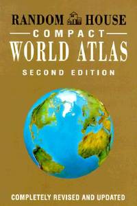
1997Q-0679777121Random House Reference 1997-01-28. Hardcover. New. In shrink wrap. Looks like an interesting title! Random House Reference hardcover
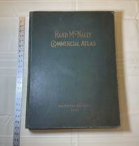
1929028276Chicago: Rand McNally & Company 1929. Good condition. Tears and creases to the title page. Vertical and corner creases up to page 6. SEE PHOTOS. Includes double page full color maps and other maps printed in yellow red and black. SEE PHOTOS. The double page maps open to an impressive 27.75" across. Contents: Part I: The World pp.4 - 23; Part II: The United States pp. 24 - 481; Part III: Foreign Countries pp. 482 - 537; Supplementary Maps: Canada Mexico China and Japan Polar Regions pp. 538 - 550. Bound in the original gilt-stamped green cloth. Oversize Hardcover. 15.50" wide by 20.75" tall by 2.25" thick at the spine. This massive extremely heavy book will require SUBSTANTIAL extra postage at our cost based on your locatuion. Sixtieth Edition 60th edition. Oversize Hardcover. Good condition. Illus. by NOT a library discard. 550 pages. Great Packaging Fast Shipping. Rand McNally & Company Hardcover