Rand McNally and CompanyBiblio.com

333 résultats
1892016610Chicago and New York: Rand McNally & Company 1892. Very Good condition but for short tears at 3 or 4 of the map folds which have been neatly reinforced with archival tape on the blank side. SEE PHOTOS. A very attractive well preserved copy. 60 pages of text including brief information on 78 railroads a detailed 39-page index and ads for Rand McNally publications. Attached at the rear is a full color map that unfolds to 13'' wide by 21" tall. Bound in the publisher's tan-color stiff printed wraps. Cover title: Rand McNally & Co's Indexed County and Township Pocket Map and Shippers' Guide of New Jersey Showing in Detail the Entire Railroad System The Express Company Doing Business over Each Road and Accurately Locating All Cities Towns Post Offices Railroad Stations Villages Counties Islands Lakes Rivers etc Locating the Nearest Mailing Point of All Local Places; Designating Telegraph Stations Population is Given According to the Latest Official Census" i.e. 1890. 1st ed No additional printings listed. Stiff card covers. Very Good condition. 60 pages a full color fold-out map. Rand McNally & Company Paperback
1929013898New York Chicago San Francisco: Rand McNally & Company 1929. 1929 edition No date on title page; 1929 on copyright page; no other printings listed. Very Good condition. 11.25" wide by 14.25" tall. Inner hinges are perfectly sound. Pages are clean and unmarked. Illustrated green endpapers feature scenes labeled Occident/Orient. First blank page has one vertical crease. Contains more than 125 pages of full-color maps. This 1929 edition is apparently quite scarce. Bound in the original dark green cloth lettered in gold on the front cover. Keywords: Atlases Map Reference Geography Maps. 1st ed No additional printings listed. Oversize Hardcover heavy. Very Good condition/No jacket probably as issued. 279pp. Rand McNally & Company Hardcover
1808Map957Paternoster Row London: Longman Hurst Rees & Orme 1808. 1st Edition 1st Printing. No Binding. Fine. Original early 19th century MAP of PRUSSIA. On MERCATORS PROJECTION BY AARON ARROWSMITH. A FINE CLEAN AND DARK IMPRESSION. Original folding plate printed on heavy paper dated 1808. A scarce example and in fine un-coloured original condition. 41x27cms. Double-page folding map.A NICE COPY <br/> <br/> Longman, Hurst, Rees & Orme unknown
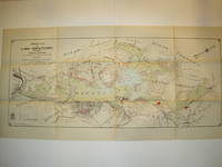
1912016735Borough of Hopatcong New Jersey 1912. Near Fine condition. SEE PHOTO. This is a beautiful and very scarce color map of Lake Hopatcong New Jersey. When unfolded it measures 18" tall by 38" wide. Some folds have been neatly reinforced on the blank side with archival-quality document repair tape. Buildings are represented by red squares water in green. Some of the properties and locations depicted are: Port Morris Landing Roxbury Township Borough of Mount Arlington Byram Township Nolans Point Atlas Powder Co. Brookland Borough of Hopatcong Byram Cove Henderson Bay Byram Bay Maxim Park Jefferson Township Woodport Hurdtown Hurd Mining Co. W. M. Force Estate John P. Lawless Mary Ingram estate Aaron Peck estate Raccoon Island Halsey Island Bertrand Island Theodore King Gertrude Otten Violet Littell Robert Dunlap estate etc. Full title: "Property Map of Lake Hopatcong New Jersey Prepared by Hudson Maxim for the Morris Canal Investigation Commission November 16 1912 Compiled from Various Maps and Actual Surveys by P. E. Boomer C. E.". First Edition. Folded map. Near Fine condition. 18" tall by 38" wide when unfolded. Borough of Hopatcong, New Jersey? Paperback
1760Map1001London: T. Bowen 1760. Original First Edition . No Binding. Fine. c1760 A fine example of Bowens map of Portugall. Title within an oval frame. An uncoloured example and printed of thick paper. 2 vertical folds to the page but nice clean margins and a dark impression. Some minor foxing reflecting its age but a nice example. 'Prepared for Barlow's General History of Europe'. Blank reverse. 33x34cms Barlows volume is often very damp stained and foxed. This map is however a fine example. Thomas Bowen 1714-1767 <br/> <br/> T. Bowen unknown
1808Map950Paternoster Row London: Longman Hurst Rees & Orme 1808. 1st Edition 1st Printing. No Binding. Fine. Folio - over 12 - 15" tall. Original early 19th century un-coloured MAP OF PORTUGAL BY AARON ARROWSMITH. A FINE CLEAN AND DARK IMPRESSION. Original folding plate covering HOLLAND printed on heavy paper dated 1806. A scarce example and in fine un-coloured original condition. An occasional light foxing mark. 41x27cms. Double-page folding map. engraved by LOWRY.A LOVELY COPY. paper watermark dated 1806 <br/> <br/> Longman, Hurst, Rees & Orme unknown
1773Map922London: H. Turpin 1773. 3rd Edition . No Binding. Fine. Single map of Lincolnshire. A fine uncoloured copy of the last issue of Robert Moderns playing card maps. Approx 55x90mms. Title to the head wth Roman numeral VIII and the uncoloured map to the main section enclosed with double ruled lines above and below with county dimensions and distances at the foot. Harry Turpin published a 52 sheet set of these maps between 1764 and 1787 but no exact date is known for publication. RARE. Please email for photos. <br/> <br/> H. Turpin unknown
1880GT058Edinburgh: John Bartholomew & Co. 1880. 1st Edition . Hardback. Fine. Folio. ND 1880 The Royal Horticultural Society Gardens in Kensington are still mapped but closed in 1882 being the Royal Albert Hall and Royal College of Music so this scarce map is published prior to that date. 23.5 x 33 x 23.5 inches 80x60 cms Folded and enclosed with a green cloth booklet 31pp with index of the streets etc. A nice copy with a few pin-holes where the folds intersect. A single un-dissected sheet pasted on linen with 36 panels when folded. From Hampstead to south of Battersea and Shepherd's Bush to Greenwich with printed and hand-colouring. The map has grid-lines each covering half mile suares with grid letters and numbers in the margins. Tower Bridge is not present. <br/> <br/> John Bartholomew & Co. hardcover
201537931El Dorado Hills CA: Savas Beatie. Fine in Fine dust jacket. 2015. Second Edition. Hardcover. 1611212006 . Illus. color maps jacket now in a clear protector ; 310 pages . Savas Beatie hardcover
2015054404El Dorado Hills CA: Savas Beatie. Fine in Near Fine dust jacket. 2015. 1st Edition; 1st Printing. Hardcover. 1611212006 . Hardcover with dustjacket first printing as stated on copyright page signed by both authors book has a mild lean to the spine the binding remains tight the contents are fine and there are no other remarkable flaws the jacket is in excellent condition with no remarkable flaws the original price is present and a professional removable mylar cover is included nice gift copy of this "first battlefield guide for this celebrated assault"; ; 310 pages; Signed by Author . Savas Beatie hardcover
1808Map948Paternoster Row London: Longman Hurst Rees & Orme 1808. 1st Edition 1st Printing. No Binding. Fine. Folio - over 12 - 15" tall. Original early 19th century uncoloured MAP OF PERSIA BY AARON ARROWSMITH. A FINE CLEAN AND DARK IMPRESSION. Original folding plate covering PERSIA printed on heavy paper dated 1808. A scarce example and in fine un-coloured original condition. An occasional light foxing mark. 41x27cms. Double-page folding map. engraved by COOPERl.A LOVELY COPY. paper watermark dated 1806 <br/> <br/> Longman, Hurst, Rees & Orme unknown
1911Pa511London: George Philip & Son Ltd. The London Geographical Institute 1911. revised Issue . No Binding. Vg. Large folding map dissected into 30 sections and laid on linen. 10 inches to the statute mile. Reduced from the four mile map. A scarce folding Edwardian map with the sea coastline coloured in blue. A few red ink lines indicating the route of a journey. The map covers all of Endland Wales and the southern part of Scotland as far as Invernesshire. Finely printed. Enclosed in the original green cloth slip-case with a printed label rubbed. Marbled end-papers. <br/> <br/> George Philip & Son Ltd., The London Geographical Institute unknown
1970Map 787London: Director General of the Ordnance Survey 1970. revised edition . No Binding. Fine. Double unfolded sheet. 25 inches to the mile. 89 x 58.5cms. College stamp to lower margin not affecting the plate. LEITH with the docks to the top of the large double sheet. PLEASE EMAIL FOR PHOTO. <br/> <br/> Director General of the Ordnance Survey unknown
1964Map 793London: Director General of the Ordnance Survey 1964. revised edition . No Binding. Fine. Double unfolded sheet. 25 inches to the mile. 89 x 58.5cms. College stamp to lower margin not affecting the plate. ROYAL BOTANIC GARDENS/ BROUGHTON Edinburgh on a large double sheet. PLEASE EMAIL FOR PHOTO. <br/> <br/> Director General of the Ordnance Survey unknown
1969Map 790London: Director General of the Ordnance Survey 1969. revised edition . No Binding. Fine. Double unfolded sheet. 25 inches to the mile. 89 x 58.5cms. College stamp to lower margin not affecting the plate. HOLYROOD PARK/ST LEONARDS on a large double sheet. PLEASE EMAIL FOR PHOTO. <br/> <br/> Director General of the Ordnance Survey unknown
1964Map 792London: Director General of the Ordnance Survey 1964. revised edition . No Binding. Fine. Double unfolded sheet. 25 inches to the mile. 89 x 58.5cms. College stamp to lower margin not affecting the plate. TRINITY Edinburgh on a large double sheet. PLEASE EMAIL FOR PHOTO. <br/> <br/> Director General of the Ordnance Survey unknown
1968Map 791London: Director General of the Ordnance Survey 1968. revised edition . No Binding. Fine. Double unfolded sheet. 25 inches to the mile. 89 x 58.5cms. College stamp to lower margin not affecting the plate. NEWINGTON Edinburgh on a large double sheet. PLEASE EMAIL FOR PHOTO. <br/> <br/> Director General of the Ordnance Survey unknown
1969Map789London: Director General of the Ordnance Survey 1969. revised edition . No Binding. Fine. Double unfolded sheet. 25 inches to the mile. 89 x 58.5cms. College stamp to lower margin not affecting the plate. Quarryhills Edinburgh on a large double sheet. Leith links to the east and Pilrig ot the west. PLEASE EMAIL FOR PHOTO. <br/> <br/> Director General of the Ordnance Survey unknown
1967Map 798London: Director General of the Ordnance Survey 1967. revised edition . No Binding. Fine. Double unfolded sheet. 25 inches to the mile. 89 x 58.5cms. N.W. Ross-On-Wye and Wilton with the A449 crossing the area with surrounding countryside on a large double sheet. Centre fold crease. PLEASE EMAIL FOR PHOTO. <br/> <br/> Director General of the Ordnance Survey unknown
1970Map788London: Director General of the Ordnance Survey 1970. revised edition . No Binding. Fine. Double unfolded sheet. 25 inches to the mile. 89 x 58.5cms. College stamp to lower margin not affecting the plate. PORTOBELLO PROMONADE AND Shore on a large double sheet. PLEASE EMAIL FOR PHOTO. <br/> <br/> Director General of the Ordnance Survey unknown
1969Map 797London: Director General of the Ordnance Survey 1969. revised edition . No Binding. Fine. Double unfolded sheet. 25 inches to the mile. 89 x 58.5cms. Ross-On-Wye and surrounding countryside to the west on a large double sheet. Centre fold crease. PLEASE EMAIL FOR PHOTO. <br/> <br/> Director General of the Ordnance Survey unknown
1890Map 726Scotland: Ordnance Survey Office 1890. 1st Edition . Hardback. Vg. Folding map. Folding map dissected in 18 sections the rare first series edition laid on linen and cased in the original green cloth boards 6.75 x 4.5 inches with a hand-written paper label. Surveyed 1855-1861 and published in1890. Small grid of adjoining maps for the one inch and six inch series pasted to inside cover. 25x19 inches with hand-coloured roads. A nice copy with no wear or loss. There were 132 sheets for the complete Scottish ordnance maps and a second edition appeared in in 1898-1904 with coloured parishes. The one inch maps were based on larger scale surveys of 1843-1878 and published between 1856 and 1895. <br/> <br/> Ordnance Survey Office hardcover
1890Map 728Scotland: Ordnance Survey Office 1890. 1st Edition . Hardback. Vg. Folding map. Folding map dissected in 18 sections the rare first series edition laid on linen and cased in the original green cloth boards 6.75 x 4.5 inches with a hand-written paper label. Surveyed 1859 -1863 and published in1890. Small grid of adjoining maps for the one inch and six inch series pasted to inside cover. 25x19 inches with hand-coloured roads. A nice copy with no wear or loss. There were 132 sheets for the complete Scottish ordnance maps and a second edition appeared in in 1898-1904 with coloured parishes. The one inch maps were based on larger scale surveys of 1843-1878 and published between 1856 and 1895. <br/> <br/> Ordnance Survey Office hardcover
1867Map 731Scotland: Ordnance Survey Office 1867. 1st Edition . Hardback. Vg. Folding map. Folding map dissected in 18 sections the rare first series edition laid on linen and cased in the original green cloth boards 6.75 x 4.5 inches with a hand-written paper label. Surveyed 1859-1864 and published in1867. Small grid of adjoining maps for the one inch and six inch series pasted to inside cover. 25x19 inches with hand-coloured roads. A nice copy with no wear or loss. There were 132 sheets for the complete Scottish ordnance maps and a second edition appeared in in 1898-1904 with coloured parishes. The one inch maps were based on larger scale surveys of 1843-1878 and published between 1856 and 1895. <br/> <br/> Ordnance Survey Office hardcover
1876Map 729Scotland: Ordnance Survey Office 1876. 1st Edition . Hardback. Vg. Folding map. Folding map dissected in 18 sections the rare first series edition laid on linen and cased in the original green cloth boards 6.75 x 4.5 inches with a hand-written paper label. Surveyed 1860-1871 and published in1876. Small grid of adjoining maps for the one inch and six inch series pasted to inside cover. 25x19 inches with hand-coloured roads. A nice copy with no wear or loss. There were 132 sheets for the complete Scottish ordnance maps and a second edition appeared in in 1898-1904 with coloured parishes. The one inch maps were based on larger scale surveys of 1843-1878 and published between 1856 and 1895. <br/> <br/> Ordnance Survey Office hardcover