Kwon, George, I & Magpiong, PacificoBiblio.com
2 675 résultats
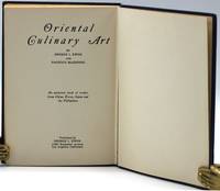
193311145Los Angeles: George I Kwon 1933. Second-hand hardcover. <p>Kwon George I & Magpiong Pacficio: Oriental Culinart Artan authentic book of recipes from China Korea Japan & the Philippines. FIRST EDITION George I Kwon: Los Angeles 1933. 8vo 185x130mm blue cloth gilt dec bds 1151pp.</p> <p><br /> KWON George I George Iel-Choong & MAGPIONG Pacifico Victor Pacifico 1906-1967<br /> <br /> Oriental Culinary art: an authentic book of recipes from China Korea Japan & the Philippines. <br /> <br /> Los Angeles : George I Kwon 1933. First Edition. Printed by Wetzel Publishing Co Los Angeles. Foreword by Essie L Elliott.<br /> <br /> Octavo 185x130mm reverse binding and pagination publisher's original dark blue linen grain cloth gilt decorated and titled upper board and spine 1151pp : 1-68 710. Spine head and foot very faintly rubbed; gift inscription to the rear free end-paper "June 21 1933 Paul R Jones to his sweet sulsi-yalsi wife Estrellita" ¹; very faint offset toning to endpapers. <br /> <br /> ¶ An intriguing collection of 110 Chinese Korean Japanese and Filipino recipes. The recipes are grouped by course rather than cuisine and are written in a mixture of longhand and ingredients/method formats. <br /> <br /> Although over half the recipes are Chinese or Chinese-American e.g. 21 recipes for chop-suey Oriental Culinary Art is notable as one of the first American cookbooks to include Korean and Filipino recipes. In contrast to the the Chinese recipes which were compiled by the authors the Korean and Filipino recipes are quite traditional and authentic and appear drawn from the authors' personal experience and families. The recipes include kim-chi Korean pickled cabbage Korean rice cake tteokbokki"kot-choo-jang jige" gochujang jjigae a spicy Korean paste made into a stew mando Mandu or Korean dumplings lechon Filipino roast pig adobo and Dinogo-An Filipino fried blood and organs of a pig. <br /> <br /> The authors graduated from UCLA in 1932 at the height of the Depression. Unable to find work as graduates in their fields of political science and education they worked in a cafe and grocery store before entrepreneurially self-publishing Oriental Culinary Art². Unusually printed with reverse pagination in the oriental fashion. <br /> <br /> Scarce. A near fine copy of one of the earliest American collections of Korean and Filipino recipes<br /> <br /> § OCLC records 23 holdings in the United States but no holdings anywhere else.<br /> § Bitting p.266; Cagle & Stafford 426; Brown 178; Axford p.309; Newman.<br /> ¹ Jones 1885 -1957 was an entomologist working for the California Department of Agriculture his wife Estrellita was an illustrator in the film industry.<br /> ² "Asian American Heroes and Pioneers Bruins" UCLA Alumni Connect May 2017.<br /> <br /> <br /> </p> George I Kwon unknown
1912118402Grand Trunk Pacific Railway / Allan Royal Mail 1912. Poster. very good. Original un-mounted Royal Mail Service Sailings Poster. 22" X 36". Slight trimming to top border. Some buckling with very light staining at edges but overall in good condition. Poster shows sailing dates of various steamers from St. John - Halifax - Liverpool and Boston - Portland - Glasgow as well as ticket rates. The Allan Shipping Line was started in 1819 and in 1917 sold to the Canadian Pacific Ocean Services LTD CPOS now CP Ships 1912 Grand Trunk Pacific Railway / Allan Royal Mail unknown
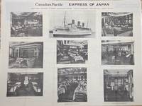
1930P2627Montreal: Canadian Pacific c.1930. Very Good laid down on acid free canvas for long term preservation. Image Size : Platemark Size : Paper Size : 760x1015 mm 29.92x39.96 Inches Coloring: Black & White Medium: Offset Lithograph Categories: Posters;Transportation Ships; Canadian Pacific unknown
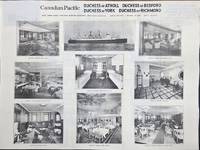
1930P2626Montreal: Canadian Pacific c.1930. Very Good laid down on acid free canvas for long term preservation. Image Size : Platemark Size : Paper Size : 765x1015 mm 30.12x39.96 Inches Coloring: Black & White Medium: Offset Lithograph Categories: Posters;Transportation Ships; Canadian Pacific unknown
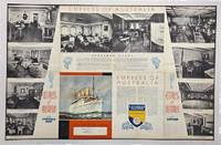
1936P3290Canada: Canadian Pacific c. 1936. Very Good backed on tissue paper for long term preservation. Image Size : 582x898 mm 22.91x35.35 Inches Platemark Size : Paper Size : Coloring: Printed in Color Medium: Offset Lithograph Categories: Transportation Ships; Advertising; Posters; Canadian Pacific unknown
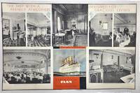
1930P3291Canada: Canadian Pacific c. 1930. Very Good backed on acid free tissue paper for long term preservation. Image Size : 581x895 mm 22.87x35.24 Inches Platemark Size : Paper Size : Coloring: Printed in Color Medium: Offset Lithograph Categories: Advertising; Transportation Ships; Posters; Canadian Pacific unknown
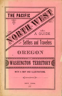
188250958New York: Land Dept. Northern Pacific Railroad Co. 1882. 1882. PACIFIC NORTHWEST. First edition. 8vo. Printed wrappers 81 pp. introductory illustrated large folding map at the rear. Scarce Western promotional travel guide to the Pacific North-West. Addressed to prospective settlers and travelers alike this guide consists of historical geographical and agricultural information and discusses at length matters such as commerce climate education taxes prices and the regions of the Pacific North-West. Each county is described and suggestions are provided to prospective emigrants such as "In mercantile pursuits the opening is good for men of enterprise and capital; but the chances for mere clerks are not good." Farm labor wages in these parts are recorded as being between $25 and $30 per month and lumber mills wages between $60 and $90 per month for first-class hands. It is also noted that "Chinamen work for the railroads and boards themselves at $1.00 a day and in winter take contracts for grubbing brush land." There are ten full-page illustrations which include a two-page "Bird's Eye View of Portland Oregon" "Saw Mill on Puget Sound W.T." "Astoria Oregon Entrance to Columbia River" "First Street Portland Oregon" and "Commercial Street Seattle W.T." with folding map of the region Unfolded 28 1/2 x 18 inches in the back. Spine and outer edges of wrappers sunned else very good copy. Land Dept., Northern Pacific Railroad Co., 1882. hardcover
51-0842Sacramento Division: 1936-1946. Original blueprints dated 1936-46. 2 sheets each 24 x 55 inches. Shows all the industrial buildings between Beamer St. and Cross St. 5th St. and B. St. The second map shows the Standard Oil facility at Gum Ave. and the Union Oil Co. tanks near Pendergast. 24 x 55 inches. Scale 1"=100'. Plans of the buildings. Very useful for Phase 1 EIRs. Sacramento Division: 1936-1946. unknown
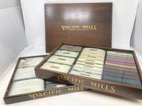
87968Lawrence Massachusetts: Pacific Mills Late 19th C. Very Good Plus. Two separate dark wood cases 12 in. x 16.4 in with glass covering displaying wool and cotton fiber and cloth salesperson samples. These cases highlight the three stages of the production of wool and cotton: the raw product the wound yarns and the finished dyed or printed cloth. <br /> <br /> Gold "Pacific Mills Lawrence Massachusetts" decal to front. Left sides have three brass screws for glass removal. Wooden fitted lid with gold company logo to top fits either box cases do not stack. Light wear and scratches to cases. Contemporary stickers to sides of cases indicating the type of display.<br /> <br /> May require additional shipping fee. The Pacific Mills was incorporated in 1853 with capital of $1 million. The original mills and print works were built by the Essex Company remodeled in 1882 and enlarged and added to over the many years of its operation. In the latter part of the 19th century it was considered one of the foremost corporations in the world. Abbot Lawrence the city's namesake was the first president. The company started as a producer of women's dress goods in wool and cotton and included a print house and dye works. By the 1890s the mills were producing calicos lawns shirtings and a large variety of other products. By 1895 there were over 200000 spindles turning. Pacific Mills unknown
1970151354N.p.: N.p. 1970. Archive of 32 vintage photographs documenting the October 20 1970 collision of two trains along the Chicago Rock Island and Pacific Railroad line in Raytown Missouri. Also included in the archive is a single broadside reward poster offering $5000 for information pertaining to the accident. <br /> <br /> According to a contemporary newspaper article which appeared in nearby Jackson County's Independence Examiner the accident was believed to have been caused by juvenile vandalism to a nearby track switch. The collision and subsequent derailment resulted in the death of one engineer whose partial body is visible in several photographs. <br /> <br /> The photographs in the archive range from close-up shots of the mangled train cars and tracks to distance views of the surrounding woods. Frequently displayed in the images is a small handwritten police chalkboard noting the date location and case numbers. A vivid and interesting look at investigative photography and railway disasters in the late twentieth century. <br /> <br /> Photographs 10 x 8 inches housed in a manila envelope with the logo of Chicago Rock Island and Pacific Railroad Co. on the top left corner. Reward poster 9 x 12 inches. Poster and photographs Near Fine overall envelope Very Good plus. N.p. unknown
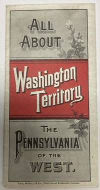
188853587Chicago: Rand McNally & Co. 1888. 1888. 20 3/4" x 13 1/2" sheet folded to 24 panels. Map. One cover panel; one panel showing N.P.R.R. route from Minneapolis to Washington Territory; and 10 panels of information to include information on the area's location and physical features climate agriculture stock raising manufacturing mining public schools cities and towns etc. Opposite 12 panels offer a map of Washington Territory printed in red and black. A rare promotional piece to encourage sales of Northern Pacific Railroad lands in Washington Territory. Light soling a few small splits to creases and with minor wear to the extremities. Very good. Rand, McNally & Co., 1888. unknown
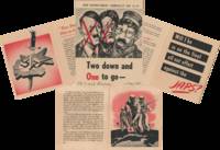
1945List2747Paris France; and Washington D.C. 1945. Six 8 x 10 inch and smaller typed pages; one 4 x 5 inch card with two tickets; one twenty-six page 4 x 5.5 inch pamphlet; one six page 6 x 8.5 inch pamphlet; six 2.5 x 3.5 photographs and two 3 x 4.5 inch photographs. Of the printed matter most is affixed to paper some small tears and folds; overall excellent; photographs near fine. Mary J. Bremer 1917–2019 was a Technician fourth grade from Grant Township Nebraska. Her correspondents here include June Miller 1920–deceased an aviation cadet from Michigan and John Melotte 1919–deceased an artilleryman from Philadelphia. Bremer and Miller were members of the Women’s Army Corps WAC. Established in May of 1942 as the Women’s Army Auxiliary Corps the WAC converted to active duty in July of 1943. The women of WAC known as Wacs served in noncombatant roles across the various theaters of World War II.<br /> <br /> Offered here is a small archive of Bremer’s documents and photographs relating to WAC: a few letters including a description of Paris the day after the Nazi surrender; two pamphlets including the War Department pamphlet Two down and One to go –; and a collection of photographs of Eisenhower’s victory parade and Roosevelt’s funeral procession.<br /> <br /> On April 12 1945 President Roosevelt died of a stroke in Warm Springs Georgia. His body was returned to Washington two days later and a military procession escorted it from the train station to the White House. Two photographs of the funeral procession are included in the archive. One showing a woman at the start of a section of the parade is identified verso as “WACs led by Capt. Machenâ€.<br /> <br /> The following month the Nazis surrendered. Bremer’s friend June Miller was stationed in Paris at the time. She wrote to Bremer the next day describing the celebration:<br /> “It began the night before when we stood on the roof and watched the flares go off all over the city--just like the 4th of July; the Sacred Couer was blazing with lights and it looked like a miniature fairy-land. Last night all the famous old buildings including the Arc d’Triumph was all lit up the fountains in the parks at Concord in front of the Trocadero--they were all going and the kids were wading and splashing around having the time of their life. It was really something to see--something the French had been waiting a long time for. “Fini le guerre†they kept saying--the end of the war!â€<br /> <br /> Miller also claims to have witnessed a bomber flying a celebratory loop through the Eiffel Tower:<br /> <br /> “When we came out of the Trocadéro the fountains were on and what a sight that is. Looking down over the water that looks like a miniature waterfall to the Eiffel Tower at the bottom of a small hill. And if I hadn’t seen it with my own eyes I would never have believed that I saw a small bomber come through the bottom but that’s just what it did--and just did clear it too. The planes seemed to be going as wild as the people on the ground--they were so thick up there that pretty soon we thought surely something would happen.â€<br /> In June Dwight Eisenhower returned from Europe and a homecoming parade was held for him in Washington D.C. Six photographs of this parade are included in the archive including a shot of his plane arriving at the airport and one where he is visible standing in the back of a Jeep.<br /> <br /> Miller notes in her letter from Paris that “you wondered what was coming next; where we would go from here ‘cause in a sense there is still a war very definitely going onâ€. In fact John Melotte who seems to be Miller’s partner writes to Bremer that he “May be slated for that place they call the CBI but don’t tell June please. She does not want me to even mention the place in my letters so I let well enough alone†July 15 1945. Hostilities would continue in the CBI—the China-Burma-India theater—until September of that year.<br /> The process by which soldiers were selected to be sent to the Asia-Pacific theater is laid out in the War Department pamphlet Two down and One to go –. The pamphlet reminds them that there are still “a couple of big jobs ahead†the primary one being to “crush†or “smash†the “Japs†and the second one being to occupy and police “conquered lands . until the peril of future aggression is gone.†It is a visually striking piece with illustrations in a bold black and red color palette; its cover is a reproduction of a caricature of Hitler Mussolini and Hirohito by Polish-Jewish artist Arthur Szyk.<br /> <br /> Also included in the archive are a card from a friend with tickets to an American League baseball game; a humorous poem congratulating Wacs Ruth O.B. and Lenore I. Nier on new work assignments; and a Christmas 1945 WAC pamphlet with a dinner menu and list of WAC officers. The pamphlet assures the Wacs with a note from Colonel Kenton Cooley “Before another Christmas you all will have returned to civilian life and each of you will take with you my appreciation and my sincere admiration for a great job well done.â€<br /> Of interest to scholars of women’s history especially in the military; and of the events leading up to the end of the Second World War. unknown
18717912San Francisco: A. L. Bancroft & Company 1871. First Edition. Hardcover. Good . 12mo. 256 pp. original green cloth lettered in gilt index to advertisers advertisements i-lvii. -- Moderate wear to the extremities some fraying to the spine tips & corner edges corners bumped. Blank paste-down and first free end-paper paper a little separated but hinges still strong. Rear hinges strong. Rear paste-down has an advertisement pasted on and a small stamp at bottom near the gutter of "H. K. Van Siclen Bibliophile 133 Nassau St. Ny". --. "This tourist guide for visitors of San Francisco and the Yosemite Valley offers a look at travel and accommodations in the late 19th century".-googlebks. A. L. Bancroft & Company hardcover
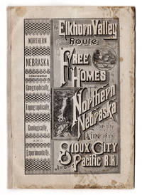
7236Battle Creek Mich.: Review & Herald Steam Printing house 1883. 8vo 8.5" x 5.75" printed wrappers. 46 pp. Folding map 12.75" x 18.25" plus margins. CONDITION: Good dampstaining at covers and the top of the second half of the pamphlet. Light vertical crease at middle throughout. Map good one minor tear at margin. <p>A promotional pamphlet for land along the Sioux City and Pacific Railroad including former Indian reservation lands with an appealing map of the rail line and its spurs.</p> <br /> <p>The text begins with a message to the public advertising the Elkhorn Valley Route on the Sioux City and Pacific Railroad the railroad having recently extended to Fort Niobrara Nebraska and thereby placing within reach of home-seekers millions of acres of free government lands. This is followed by an exhaustive overview of Northern Nebraska and its attractions geographical outlines physical geography topography and neighboring areas including Indian camps and more. A good portion of the text is devoted to Northern Nebraska's geology covering the Old Forest Bed Epoch the origins of "modern Nebraska" "How Came that Grand Old Forest" and so forth. Also included are testimonials from dozens of farmers who settled in Northern Nebraska including "exceptional cases" and highlighted is a large buffalo flat "8 miles long by 3 miles wide". The prospective settler is advised on how to reach these lands how to make a profitable investment in Nebraska lands and Omaha Reserve lands formerly home to the Omaha tribe and how to acquire them. A letter from the U.S. Land Office in Nebraska to the General Passenger Agent of the Sioux City & Pacific R.R. is printed here as well. Ads are included for the Land Agency of I. N. Taylor of Oakdale and Neligh Nebraska and real estate dealers Richards & Keene of Nebraska. The text concludes with a price list of commodities in Northern Nebraska.</p> <br /> <p>The map entitled "Sioux City & Pacific R.R. and connections to the Free Homes for the Million" by Rand McNally & Co. of Chicago spans from Council Bluffs Omaha in the east to the Black Hills in the west and from Pierre South Dakota in the north to a portion of Colorado in the south. The Sioux City and Pacific Railroad and its connections are shown in bold connecting with other railroad routes across the midwest. </p> Battle Creek, Mich.: Review & Herald Steam Printing house, 1883 unknown
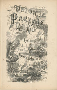
186849559New York: Published by the Union Pacific Railroad Company 1868. 1868. RAILROAD. First edition. 8vo. Original pictorial printed wrappers 32 pp. frontispiece Map of the Union Pacific Rail Road and its Connections introduction. Details the formation of the company and the progress of the work including the topography character of the country and distances along the line. Much information is provided regarding agricultural resources timber minerals etc. Branches and connecting roads along with the needed resources for construction are discussed as is information on actual earnings anticipated earnings and the issuance of the company's first mortgage bonds. A wonderful advertisement on the rear cover panel offers First Mortgage Bonds at par principal and interest Payable In Gold. A faint vertical crease and very lightly toned at the cover edges else a near fine bright copy. Published by the Union Pacific Railroad Company, 1868. unknown
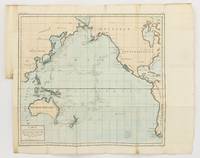
1790143934Paris: F. Dufart 1790. Very Good. Paris F. Dufart circa 1790. A hand-coloured engraved map printed surface 378× 415 mm sheet size approximately 420 × 540 mm. 'Gravée par Tardieu l'Ainé . Dessiné par Poirson . Ecrit par Beaublé'. Original folds as issued; some minor uneven tanning; in very good condition. An uncommon chart of the Pacific Ocean and Australia showing magnetic variation and dip drawing on observations made in the course of Pacific voyages after 1775 most notably Cook's third voyage. It is most likely from a duodecimo edition of Buffon's 'Histoire naturelle générale et particulière' around the end of the eighteenth century 'PL. III. Tome XVI' and 'Page 58' are printed in the top margin. It is based on a larger chart in four sheets attributed to Jean-Charles de Borda. The engraver Tardieu is one of half a dozen members of the family working as engravers at the period one of whom P.A.F. Tardieu would engrave the charts published in the official account of the Baudin voyage. F. Dufart unknown
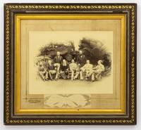
1888134827Sydney: Kerry & Jones 308 George Street 1888. Sydney Kerry & Jones 308 George Street 1888. A high-gloss gelatin silver photograph 222 × 296 mm laid down within a gilt border on the original cardboard mount with the photographic studio's details in gilt in the bottom margin. Also mounted there is a small gelatin silver photograph 47 × 165 mm of the signatures of the eight participants 'Government House Sydney Jan. 25 1888' is written below the original signatures. The item is in a contemporary frame wood with gilt-decorated plaster a little chipped now lacking the original glass visible image size 315 × 350 mm external dimensions 423 × 458 mm. The contemporary label of Cole's Book Arcade Melbourne is mounted on the verso. The main photograph has a couple of tiny surface chips to the top edge and a few tiny marks to the bottom right-hand corner; the mount is a little marked possibly lightly water-streaked but fortunately the photograph is untouched; these trifling blemishes have little impact on this fine portrait. This informal group portrait features the Governors of each of the Australian colonies along with the Governors of Fiji and New Zealand. It was taken on 25 January 1888 the day before the centenary of the arrival of the First Fleet at Port Jackson the main reason for their presence in Sydney. It features left to right Sir Robert George Crookshank Hamilton 1836-1895 KCB LLD Governor and Commander in Chief of Tasmania and its dependencies; Sir Anthony Musgrave 1828-1888 GCMG Governor of Queensland; Sir Charles Bullen Hugh Mitchell 1836-1899 Governor of Fiji; Henry Brougham Loch 1st Baron Loch 1827-1900 GCP GCMG PC Governor and Commander in Chief of Victoria; Charles Robert Wynn-Carrington 1st Marquess of Lincolnshire 1843-1928 KG GCMG PC JP DL Governor of New South Wales; Sir Frederick Napier Broome 1842-1896 KCMG Governor of Western Australia; Lieutenant General Sir William Francis Drummond Jervois 1821-1897 GCMG CB FRS Governor of New Zealand; and Sir William Cleaver Francis Robinson 1834-1897 GCMG FRGS Governor of South Australia. <p>Extensive research notes come with this item; they were compiled with the assistance of Dr John Fahey author of 'Australia's First Spies' Sydney 2018 and 'Traitors and Spies: Espionage and Corruption in High Places in Australia 1901-1950' Sydney 2018. Among much else the notes have identified a slightly variant photograph taken at the same time as this one held by the Blue Mountains City Library; the identity of the sitters comes from a letter and diagram sent to them from the Mitchell Library in 1929. 'From the various sources available most notably the title given by the State Library of New South Wales this photograph commemorates an unofficial side-meeting of these Governors to discuss Australia's interests in the South Pacific'. Dr Fahey puts it more succinctly when he says it likely offers 'evidence of one of our earliest "secret" off to the side policy conferences'. The notes provide a lot more background information for the purchaser. A few incidentals not mentioned there: Sir Anthony Musgrave was Governor of South Australia from 1873 to 1877 and he died on 9 October 1888; Sir William Jervois was Governor of South Australia from 1877 to 1883; Sir William Robinson was Governor of Western Australia three times between 1875 and 1895 1875-1877 1880-1883 and 1890-1895. Provenance: the Sloane Pastoral Family of the Riverina purchased at the estate clearing sale in April 2021. Kerry & Jones, 308 George Street unknown
MA05F-00383U. S. Government Printing Office. Collectible - Good. Washington D.C.: U. S. Government Printing Office 1946. Sm 4to. viii158pp. Folded illustrations maps. Good book. strategic bombing Japan electric utilities Inquire if you need further information. U. S. Government Printing Office unknown
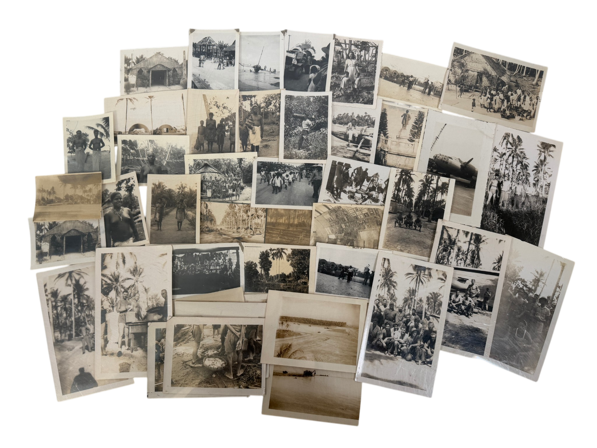
1944231791944. WWII Indigenous Peoples U.S. soldier photographs recording military occupation transport and daily movement across the Admiralty Islands Samar and the Philippines during World War II and its immediate aftermath establishing how American forces operated through island bases coastal landings aircraft facilities and encounters with local indigenous communities. Made and retained by an unidentified American serviceman the group follows the circulation of personnel through several linked wartime zones rather than a single camp with local captions on the versos anchoring parts of the sequence to "Admiralty Islands" "Samar Island" and the "Philippines." This archive showcases soldiers posed at encampments and beside aircraft landing craft and small boats military vehicles moved through settlements and photographs of Indigenous and Filipino civilians showing the human landscape through which U.S. forces advanced occupied and remained into the surrender period.<br /> Photo archive of 45 likely silver gelatin photographs ranging from 2.5 x 3 to 3.5 x 5.75 inches Admiralty Islands Samar and the Philippines circa 1944 to 1945. Numerous versos carry manuscript identifications including "on Admiralty Islands" "Natives on admiralty Islands" "Samar Island" "Samar Philippines" "Philippine" and "chapel in philippines" while several prints bear circular "Passed by Naval Censor" stamps and one caption reads "Jap bomber Betty Sept. 1945 Samar" fixing at least one portion of the group to the post surrender occupation moment. The images include shirtless American servicemen posed in palm lined camps group portraits outside Quonset huts or temporary structures a parked twin engine military aircraft a beached or near shore vessel soldiers gathered around tables and equipment and an Asian soldier who looks to possibly be in Japanese uniform standing in front a monument. Many photos show the local community with views of thatched buildings colonial era religious structures village crowds market or street scenes women and children gathered before huts and several close portraits of Indigenous islanders.<br /> The photographs belong to the final phase of the Pacific war when the Admiralty Islands served as a major Allied base complex after the 1944 campaign and Samar remained part of the wider Philippine theater retaken from Japanese control and held through the end of the war. This on the ground perspective shows how soldiers' photos moved through censorship channels recorded the built infrastructure of island warfare and fixed the asymmetrical encounter between U.S. servicemen and local populations. Minor surface and edgewear album glue residue en verso images remain clear and writing legible; overall very good condition. The combination of location notes naval censor stamps aircraft and coastal transport scenes and sustained views of local communities offer a raw visual representation of American military presence across the Southwest Pacific. unknown
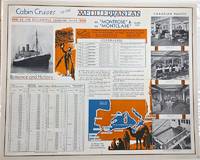
1930P2619Montreal: Canadian Pacific c. 1930. Very Good laid-down on acid-free paper for long-term preservation. Notes: A charming view of Canadian Pacific Montrose and Montclare. Image Size : 470x568 mm 18.50x22.36 Inches Platemark Size : Paper Size : 479x601 mm 18.86x23.66 Inches Coloring: Printed in Color Medium: Offset Lithograph Categories: Advertising; Transportation Ships; Canadian Pacific unknown
189132829St. Louis: Woodward & Tiernan Printing Co. n.d. 1891. 1891. First edition. Third edition. 12mo. Original orange wrappers printed in black ink 82 2 pp. illustrated map. advertising. Issued by the general passenger department of the Missouri Pacific Railway. A general description of the state and its place in history is provided. Plus soil rainfall churches schools higher educational opportunities newspapers population and wealth corn wheat oats stock farming wild flowers orchards and vineyards salt lead and zinc stone brick and lime coal gas hunting and fishing cities irrigation etc. Views are offered of farms and ranches parade grounds city parks etc. of various cities. Herd 1204 says "Issued by the Missouri Pacific Railway Company this book appeared in many editions though all are now rare." Prior to this copy the earliest edition of a similar booklet was a 13th edition and that was 15 years ago. Fine clean copy with a fine folding map. An exceptional copy of a rare item. Woodward & Tiernan Printing Co., n.d. (1891)]. unknown
191264223Portland OR: American Map and Reproducing Company Corner E. Stark & E. 43rd 1912. One double atlas folio colour lithograph map sized 28 x 40.5 professionally mounted on archival linen sized 32 x 45 in. w/ scale of 1:24000 minor edgewear slight age toning at fore-edges and lower corner still a VG bright copy. First edition of this very uncommon Progressive Era map of Portland Oregon in the years between the Lewis & Clark Centennial Exposition and World War I. The map depicts public lands including township range and section grids along with neighborhood and addition place names steam & electric interurban railroads and electric streetcar lines along with parks city limits and radial distances from point in downtown Portland included. Place names included Zion Town the old steel bridge built in 1888 followed by a new Steel bridge which opened later in 1912 the Plank/Old Canyon Road Laurelhurst and others. Of particular interest beyond most maps of Portland during the era this map delineates a significant portion of Vancouver Washington prior to the construction of the Interstate Bridge across Hayden Island as well as inroads into portions of Northwest Portland and Washington County in the Southwest. Fritsche 1877-1928 was an intrepid German-American photo-lithographer architect printer and later photographer who first arrived in New York before coming West to the Pacific Northwest in 1907 where he set up an architecture and engraving firm with his brother Rudolph Fritsche. Wenzel is perhaps best remembered as architect of the historic Henry C. & Wilhemina Bruening House Craftsman bungalow located at 5919 North Williams in Portland’s Humboldt neighborhood erected in 1910. However by 1914 Wenzel had returned to Manhattan with his family including one son and three daughters. Worldcat locates 5 copies U of IL Boston Pub. OHS Reed U of O. American Map and Reproducing Company, [Corner E. Stark & E. 43rd], unknown
650067Very Good. Softcover. Circa 1855. No title page -- appears to be assembled collection of bird plates from various U.S.P.R.R. Exp. & Surveys publications bound into a nice three-quarter leather album. Contains 31 linen-backed color plates. Most plates are not identified by species. All plates are Birds: California Plates II III IV V VII 2 plates with slight variation in background VIII 2 plates with slight variation in background; Cal & Oregon Plate IX; 32nd Parallel West Plates IV VI XIV; 32nd Parallel East Plates XV XXXI; 35th Parallel Plates XIV XX XXVII XXX XXXIII XXXVI; 38th-39th-41st Parallels Plates XII 2 identical plates XIII XVII XXXII XXXV; 47th Parallel Plates XI XVI; 47th-35th Parallels Plate XVIII 2 identical plates; 47th-32nd Parallels Plate XXVIII. Plates are very good. The covers show some rubbing spotting but binding is generally very sound and attractive. ; Trade PB; Oblong Small 4to 9" - 11" tall . paperback
1850DEMO014460IPhiladelphia: Printed by C. Sherman 1850. Popular Edition. Hardcover. Good. 64 excellent steel-plate engravings with 12 of 13 maps Samoa map apparently never inserted many vignettes and woodcuts. Octavos half brown calf blue marbled boards edges and endpapers; vol. 1 rebacked retaining original back and leather labels scuffing and wear to other spines corners worn. <br/><br/>Wilkes' expedition was the first American scientific exploring expedition by sea voyage. His six ships sailed south around South America along Antarctica causing Wilkes to decide that Antarctica was indeed a separate continent. Other stops were at the Pacific islands of Tahiti the Samoas Australia and New Zealand. Maps of Tahiti & Australia and New South Wales Along the way they charted the coasts of California Washington and Oregon. Howes W414; Palau 375505; Sabin 103994 note; see Cowan p.683; Taylor PACIFIC BIBLIOGRAPHY p.13. "Wilkes' spectacular Antarctic and South Sea explorations - Goetzmann ARMY EXPLORATION IN THE . WEST p.61" 64 excellent steel-plate engravings many vignettes and woodcuts. Unlike the 1844 edition the following Sherman editions did not have a 6th volume - the Atlas but have 3 Tables and 11 maps Printed by C. Sherman hardcover
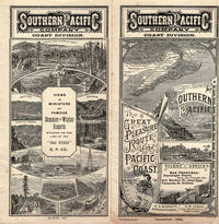
189046165San Francisco: Crocker & Co. December 1890. 1890. 7" x 21" sheet on cream-colored stock folded to 12 panels each 7" x 3 1/2." 2 pictorial cover panels. Ticket rates from San Francisco to Monterey Pacific Grove or Santa Cruz along with excursion rates. 2 panels offering "Schedule of Stage Connections Showing Routes Distances Rates of Fare Etc." Black and white illustration showing bird's eye view of Hotel del Monte. Time schedules for the Monterey Line Pacific Grove Extension Santa Cruz Line Almaden Line Tres Pinos Line and Sta. Margarita Line. Light soiling to cover panels else near fine. Crocker & Co., December, 1890. unknown