6 261 résultats
56-0405Oakland Calif.: Southern Pacific Company. Blackline print 16" x 12.5". Right-hand portion of map of Berkeley railroad yard incomplete. Left strip of map yellowed by adhesive. Includes Tracks 1 and 2 Boxcar loading buildings Acid Hause Mack Shop Hard Butter Bldg Mill Building Margarine Bldg Boiler Room. Scale 1" = 25'. Oakland, Calif.: Southern Pacific Company. unknown
58-0558San Francisco Calif.: Southern Pacific Company 1952. Blueline print 24 inches x 33 inches red and green ink indicate present and proposed pickup and delivery limits. From State Highway 117 and Salinas-Monterey Road to Sherwood Lane Salinas Municipal Airport. Includes City of Salinas. Not drawn to scale. San Francisco, Calif.: Southern Pacific Company, 1952. unknown
56-0364Sacramento Calif.: Pacific Motor Trucking Company 1948. Revised 1961. Map. Blueline print 12" x 56". Along West Railroad Ave near Power Inn Road intersection. Includes Brighton Park Black Diamond Lumber Co Alex Enghardt Roofing Valley Crane Service. Scale approx 1" = 100'. Sacramento, Calif.: Pacific Motor Trucking Company, 1948. Revised 1961. unknown
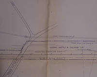
56-0271San Francisco Calif.: Southern Pacific Company 1962. Map. Blueline print 24" x 83" From Belle Haven to Spring Valley Water Co. Includes Midway Supply and Salvage Co. Minimal details besides power lines and railroad line measurements and signs. Scale 1" = 100'. San Francisco, Calif.: Southern Pacific Company, 1962. unknown
58-0473San Francisco Calif.: Southern Pacific Company 1938 rev. 1952. Blueline print 16 inches x 21 inches. Yard limits indicated in red highlighting. From approx 1/2 mile beyond yard limits east and west two miles north. Scale 5 inches = 1 mile. San Francisco, Calif.: Southern Pacific Company, 1938, rev. 1952. unknown
56-0294San Francisco Calif.: Southern Pacific Company 1926 revised 1942. Map. Blueline print 24" x 36". From North Ninth St to Seventeenth St along Berryessa Road including approx 2 1/2 blocks in each direction. Includes California Packing Corp Modern Ice and Cold Storage Co. Scale 1" = 100'. San Francisco, Calif.: Southern Pacific Company, 1926, revised 1942. unknown
56-0313San Francisco Calif.: Southern Pacific Company 1931 revised 1946. Map. Blueline print 24" x 36" with red and black pencilled notes. From city limits to Linden Ave and Bay Shore Highway. Includes South San Francisco Land and Improvement Co abandoned and open waterways Jonathan M Peel et al plot Union Oil Co Standard Oil Co. Scale 1" = 200'. San Francisco, Calif.: Southern Pacific Company, 1931, revised 1946. unknown
56-0456San Francisco Calif.: Southern Pacific Company 1939. Blueline print from 24" x 55" to 30" x 55". Two maps cut and joined to detail switching limits in red pencil. Includes station point Lathrop. With two incomplete Schedules of Purchase approx 20 transfers missing information. Scale not indicated. San Francisco, Calif.: Southern Pacific Company, 1939. unknown
58-0480San Francisco Calif.: Southern Pacific Company 1945. Blueline print 19 to 24 inches x 78 inches. Two maps joined with red pencil indicating switching limits. From Clear Creek at Girvan to beyond City of Redding. With City of Redding station point Girvan discontinued Standard Oil station. With Schedule of Property listing approx 30 transfers 1872 - 1945. Scale 1 inch = 400 feet. San Francisco, Calif.: Southern Pacific Company, 1945. unknown
58-0494San Francisco Calif.: Southern Pacific Company 1936. Blueline print switching zones map14 inches x 32 inches switching zones indicated in red purple green yellow brown with red pencil. File cover indicating "Switiching Limits of San Francisco" dated 1962. Three pages of Switching Charges effective 1960 attached. San Francisco, Calif.: Southern Pacific Company, 1936. unknown
56-0443San Francisco Calif.: Southern Pacific Company 1964. Blackline print 24" x 38". Topographical map of area around Giant with present and proposed railroad tracks indicated. From Pablo Bay to Richmond Golf Course extending approx 1 mile north and 1 1/2 miles east of Richmond Golf Course. Scale 1" = 300'. San Francisco, Calif.: Southern Pacific Company, 1964. unknown
58-0561San Francisco Calif.: Southern Pacific Company 1932 rev. 1942. Blueline print 24 inches x 48 inches red pencilling indicates station points and spur tracks. From Fairview Home and Geer to beyond Fairgrounds. Includes Salem Pringle Pinckney Asylum Spur. Position of many industries indicated. Scale 1 inch = 800 feet. San Francisco, Calif.: Southern Pacific Company, 1932, rev. 1942. unknown
58-0487Ogden Utah: Southern Pacific Company 1932 rev. 1945. Blueline print 21 inches x 48 inches. From two miles west of Reno yard to two miles east of Sparks yard. Both railway yards outlines in moderate detail. With red pencilling indicating switching limits. No industries indicated with listing of spurs and signals. Scale 1 inch = 800 feet. Ogden, Utah: Southern Pacific Company, 1932, rev. 1945. unknown
190812650The Pacific Telephone and Telegraph Co. Fine with no dust jacket. 1908. First Edition. Softcover. Still has the original string to hang it from. ; 8vo 8" - 9" tall; 488 pages . The Pacific Telephone and Telegraph Co. paperback
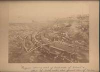
190042650Miles City Montana: Wiley Bros. Photographers Successors to L. A. Huffman 1900. Photograph. Very Good. Large format photograph 18.5 x 24 cm on a tan mount 25 x 30 cm. Wiley Bros. backstamp "Wiley Bros. Photographers Successors to L. A. Huffman. Miles City - Montana.". Mount edges are lightly bumped and chipped. Photograph is gently rubbed and lightly faded but still showing good detail and contrast. Shows many workers constructing the bridge with Northern Pacific Railroad cars visible in the background. Photograph taken from above looking down. In ink by hand on the front of the mount "Progress showing detail of bench walls of Culvert detail of brick arch; also general view of Coulee Bridge 148. Yellowstone Riv. River. Wiley Bros., Photographers, Successors to L. A. Huffman unknown
Roy. 8vo., First Edition, with numerous illustrations; original dark green cloth, gilt back, gilt top, bevelled boards, covers very lightly age-marked, corners lightly bruised, some mild cockling (mainly at margins) else a good, clean copy. EXTREMELY SCARCE
Ancient and original map of Malekula (Mallicolo) Island Southern part - The East Coast surveyed by Lieut. & Comm. G.C. Frederick, assisted by Lieut.ts H.J. Gedge, E.A. Day & H.B.T. Somerville, H.M. Surveying Ship "Dart" 1891. The South and Ambrym I surveyed by Lieut. & Comm. H.E. Purey-Cust, assisted by Lieut. s W. Pudsey-Dawson, F.C.C. Pasco & A.E.H. Marescaux H.M.Surveying Ship "Dart" 1893. The West Coast North of South West Bay from a Sketch Survey by Lieut. K. Dixon, assisted by M.r G.J. Pacey, Gunner, H.M.S. "Arker", 1903. Additions to Ambrym I. from a Survey by Lieut. Comm. R.L. Hancock and the Officers of H.M. Surveying Ship "Sealark" 1914. In the left side insert of Pangkumu Bay From a French Government Plan 1906. London Published at the Admiralty, 26th June 1893, under the Superintendence of Captain W.J.L. Wharton, Hydrographer. Small corrections: 1931. Folded editorially. Autore: Admiralty Charts. Luogo: Pacific Ocean South - Malekula Island. Anno: '900. Tecnica: incisione. Dimensioni: 650x985 mm
Sketches of Anchorages in the Tuamotu or Low Archipelago chiefly taken from the French Government charts to 1907. In the left side of the chart insert of Lagoon Entrance, Manihi Entrance, Avatoru Entrance, Tiputa Entrance, North passage to Rotoava , Passes into Amanu Atoll From the United States Goverment Chart, 1902, Pakaka Pass From the United States Government Chart, 1902. In the right side of the chart Lagoon Entrance, Amyot Bay, Mururoa Island, Fangahina I. From the United States Government Chart, 1902, Pakaka to Seignelay P.t.London Published at the Admiralty 9th July 1907, under the Superintendence of Rear Admiral A. Mostyn Field, Hydrographer. Small corrections: 1931. Autore: Admiralty Charts. Luogo: Tuamotu Islands - Polynesia - Pacific Ocean. Anno: 1907 [1931]. Tecnica: incisione. Dimensioni: 595x480 mm
Tonga Islands From British surveys between 1888 and 1898. Washington D.C., published Jan. 1903, at the Hydrographic Office, under the authority of the Secretary of the Navy. Small corrections: Printed Oct. 1930. Folded editorially. Autore: Admiralty Charts. Luogo: Tonga Islands - Pacific ocean. Anno: '900. Tecnica: incisione. Dimensioni: 988x657 mm
Madrid, 1852. Un mapa de 80 x 107 cm., plegado a 17 x 11 cm., coloreado, con planos particulares de Islas Marianas : Mapas de todas las Islas en la escala de 1:1.000.000 para la comparación de sus magnitudes, con las de otras posesiones españolas, Palaos y Carolinas Centrales, Carolinas Orientales, Archipielago de Gilbert ó Grupo Kingsmill, Isla de Rota, Guajan, Puerto de Umata, Farallon de Medinilla, Bahia y Ciudad de Agaña, Rada de la Isla de Tinian, Isla de Guguan, Puerto de Tarofofo, Farallon de Torres, y Puerto de San Luis de Apra. Encuadernación original en cartoné y media tela.
106 pages. Oblong 7" x 10". Undated but appears to be circa 1945. Profusely illustrated with wonderful vintage black and white photos. "This is the story of Pacific Mills Limited and the most northerly located paper mill on the North American continent at Ocean Falls, B.C." - page 3. Name stamped atop title page otherwise unmarked with moderate external wear and soiling. A sound vintage copy of this important history. HALE 1230, EDWARDS & LORT 2700. Book
43165Paris A. Franck, Libraire 1848 grand in 8 (27,5x19,5) 1 volume reliure demi chagrin vert à coins de l'époque, dos lisse orné d'un riche décor doré (fer au singe et à l'oiseau), tranches dorées, II et 3266 pages, avec de nombreuses illustrations, dont 17 hors texte, un plan dépliant de la baie de Papaete (folding map of the Bay of Papaete), et une grande carte gravée dépliante in fine (large folding map of the world). Ex-dono manuscrit signé par le père de l'auteur sur la page de faux-titre. Eugène Delessert, 1819-1877. Edition originale (First edition). Bel exemplaire ( Photographies sur demande / We can send pictures of this book on simple request )
Rara carta dell'Oceania tratta da "Atlas Universel " edita a Parigi e pubblicata del Dufour. Bella coloritura coeva. Scarce map of Oceana and the Pacific Ocean, from Dufour's Atlas Universel. Centered on Hawaii. Includes ocean currents and other details. Inset maps of New Caledonia, Tahiti, and the Marquesas.This is an impressive 1860 elephant folio map of Australia, New Zealand, Polynesia and the Pacific Ocean by A. H. Dufour. It covers from Burma (Myanmar) east as far as Chile and from Japan south to New Zealand. Although the interiors of the continents remain blank, the coastal regions are highly detailed. Numerous islands of Polynesia, Melanesia and Micronesia are noted. Five insets are features along the bottom border of the map. These include an inset of New South Wales, Australia, showing gold locations, New Caledonia, Martinique Island, Tahiti and the Gambier Archipelago.The map shows extraordinary detail throughout noting European possessions in Australia and southeast Asia, cities, islands, rivers, lakes, mountains, oceans and ocean currents, sea routes of explorers and a host of other geographical, topographical and physical features. Rumsey 5020.044.
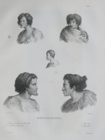
1833LBW061abParis, [1833]. 332 x 275 mm.