Weicht, ChrisMareMagnum

6 262 résultats
282 pages. Index. References. Dozens of black and white reproductions of archival photos in text. "During WWII the RCAF developed five flying boat stations between Victoria and Prince Rupert for the defense of the Pacific Coast. It would be well into 1943 before airfields were built on the west coast in both Alaska and British Columbia suitable for serving the needs of military aircraft. It would be these airfields, developed in a time of intense need, that would evolve into the future airfields that exist along the entire Pacific Coast today. This, then, is the story of both these airfields and the air harbours that preceded them." - from Preface. This copy was presented by a daughter to her father and contains her lengthy and heartfelt gift greetings to him inside the front cover. Few other markings to contents. Average wear. A sound copy. Book
1987BN173868Kluwer Academic Publishers Group 1987. 1987. Hardcover. Issues in Diagnostic Research <br/><br/>Issues in Diagnostic Research Pacific University Forest Grove OR USA Michel Hersen School of Professional Psychology Kluwer Academic Publishers Group hardcover
151959504London; New York: Grant Richards Ltd.; Dodd Mead & Co. 1915-1916. Two vols. Tall 8vo. 1st - 304 pp. Photo frontisp. 23 photo plates. Red publisher’s buckram black lettering front cover & spine t.e.g. minor shelfwear minor soot soiling head of spine lower fore-edges w/ d.j. cover art photo & lettering in red printed price label of 12/6 front cover & spine minor soiling spotting to spine chipping & minor tear head of spine upper corner front cover affecting a few letters; 2nd - 327 1 pp. Photo frontisp. 15 photo plates. Dark burgundy publisher’s cloth black lettering front cover & spine w/ illustrated d.j. cover art photo & lettering in red remnants of printed price labels front cover & spine of 12/6 soot soiling to fore-edges darkening & spotting to spine minor chipping head & foot of spine still a VG/VG- set. First British edition of vol. 1 & first American edition of vol. 2 of this uncommon set of travel memoirs through Australia the South Pacific New Zealand and West Africa. He recounts his adventures running away to Sea living in the Bush adventuring with Robert Louis Stevenson both books surviving cannibals tramping through Fiji Samoa Tahiti the Marquesas and the Australian gold fields. The sequel memoir focuses again on adventures with Robert Louis Stevenson songs he composed voyages to Honolulu and the Territory of Hawaii Japan and recounts time with an exceptional Sierra Leone African violinist. Safroni-Middleton 1873-1950 was a British composer violnist harpist writer and astronomer and composed the “Imperial Echoes†theme music which for years was played on the “Radio Newsreel†of the BBC. He would also later pen the science fiction novel “Under Many Names†1937 describing the adventures of his hero traveling through the stars via thought waves to meet an advanced extraterrestrial civilization. Grant Richards, Ltd.; Dodd, Mead & Co., hardcover
1910302511Pacific Electric Railway ca. 1910. 1910. Original photograph depicting 43 passengers men and women dressed in coats and hats at the Echo Mountain Terminal 3200 feet above sea level with printed descriptive information on the mount with pictorial green borders. 4 11/16" x 7 1/2" image on stiff 6 1/16" x 9" pictorial folder. No Binding. Fine. Pacific Electric Railway [ca. 1910]. unknown
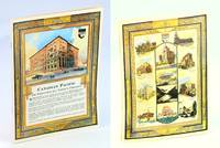
1930652j1093Canada: Canadian Pacific - Hotel Department. Good. 1930. First Edition. Paperback. A glorious memento of Winnipeg's famed Royal Alexandra Hotel once the social centre of the city. "Designed for the Canadian Pacific Railway by Montreal architects Edward and William Maxwell and built by contractor Alexander A. Woodward in 1906 the 'Royal Alex' was considered one of the finest hotels in western Canada. It closed its doors in 1967 and was torn down in 1971." - Manitoba Historical Society Archives. Undated but cover illustration includes a horse-drawn wagon suggesting a printing date circa 1930 or prior. A half-page black and white aerial photo of the hotel shows it environs at the north-east corner of Higgins Avenue and Main with Canadian Pacific railway station adjoining. Beneath this photo Winnipeg's winter climate is described as having a 'crisp tingling cold that sets eyes asparkle and sends the blood racing.' Includes very detailed information about the hotel's many amenities and capacities plus four pages of floor plans. A one-page map of the city vividly reveals the subsequent growth of the city. Includes black and white photos of the Gold Room Ball Room Vice-Regal Suite Lobby Dining Room and Library. 12 stapled pages including color-illustrated covers. 11" x 8". A fabulouse piece of Winnipeg ephemera.; Sm 4to . Canadian Pacific - Hotel Department paperback
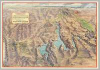
6276Glendale CA: Gerald A. Eddy; Union Pacific Railroad 1958. Folding color process map 22" x 31" 18 panels of illus. and text on verso folded size 7.5" x 5.25". <p>A striking post-WWII panoramic map of the Southwest including portions of Nevada and Arizona as well as California's Death Valley and Utah's Zion Bryce and Cedar Breaks areas depicting the vast region accessible via the Union Pacific Railroad including its mountains cliffs washes plateaus mines Hoover and other dams Nellis Air Force Base the Atomic Energy Commission testing grounds Indian reservations Valley of Fire state park numerous national parks forests and monuments the Colorado River supplying Lake Mead and Boulder City and Las Vegas with street grids showing hotel locations. The map ranges from the Grand Canyon in the East to Death Valley and the Yucca Flats in the West; and from Boulder City in the south to Salt Lake City in the North. The Union Pacific Railroad lines are delineated in red; elevations are indicated for mountains and terrain within state and national parks; and bodies of water show depths and state boundaries. Promotional text and colorful illustrations of Las Vegas appear on the verso.</p> <br /> <br /> <p>An engineering marvel Hoover Dam and Lake Mead became a tourist attraction during the post-war boom. The project opened up the west for development providing water from the once-wild Colorado River to the arid Southwest leading to the expansion of such major cities as Los Angeles Las Vegas and Phoenix as well as the growth of railroad lines national recreational areas and military installations.</p> <br /> <br /> <p>CONDITION: Good blue ink routes discreetly traced on Rt. 95 and Rt 89.</p> Glendale, CA: Gerald A. Eddy; Union Pacific Railroad, 1958 unknown
188933137St. Louis: Press of Woodward & Tiernan Printing Co. 1889. 1889. MISSOURI. First edition. 12mo. 7 1/2" x 5 1/4" printed wrappers 110 2 pp. engraved illustrations folding map advertisements. A detailed report of Missouri done county by county and discussing such subjects as location physical features and soil agriculture wheat corn grasses and pasturage stock raising and dairying wool growing mines and minerals coal iron lead zinc copper granite and other minerals fruit raising available lands for sale exemption and taxation laws timber lands manufacturing adaptability education and schools hunting and fishing labor wages and taxation etc. A discussion of each county is provided along with vital statistics pertaining to cattle hogs sheep et al county by county. The folding map of Missouri is in fine condition. Inked number "1889" on front cover else a very good clean tight copy. Press of Woodward & Tiernan Printing Co., 1889]. unknown
1910302511Pacific Electric Railway ca. 1910. 1910. Original photograph depicting 43 passengers men and women dressed in coats and hats at the Echo Mountain Terminal 3200 feet above sea level with printed descriptive information on the mount with pictorial green borders. 4 11/16" x 7 1/2" image on stiff 6 1/16" x 9" pictorial folder. No Binding. Fine. Pacific Electric Railway [ca. 1910]. unknown books
1894R320056427CHALLAMEL A. / CHAILLEY LEON. 1894. In-8. Broché. Etat d'usage, Plats abîmés, Dos abîmé, Intérieur acceptable. 124 pages + 1 carte depliante en noir et blanc + environ 15 pages publicitaires -. . . . Classification Dewey : 996-Autres régions du pacifique
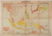
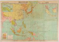
1719219230東京. Tokyo.: 日本放送協会. Nihon Hōsō Shuppan Kyōkai. Showa 17 1942. Colour folding map scale 1: 10000000 54.7cm x 79.5cm chronology of building the Greater East Asia Co-Prosperity Sphere on reverse. Some light browning a little darker at folds and reverse washi repairs to folds on reverse. This colour map of Asia and the Pacific published on 30 January 1942—just one month after Japan's attack on Pearl Harbor—offers a striking glimpse into wartime strategy and propaganda. Remarkably despite being produced at the war's outset it accurately anticipated key battlegrounds that would define the conflict. The main map is supplemented by two inset maps: one in the upper right highlighting Japan the Hawaiian Islands and Honolulu and another in the lower left focusing on Singapore with Darwin marked along the lower edge. <br> <br>The reverse side features a revealing chronological chart titled "Building Great East Asia" documenting Japan's military expansion from the 1931 Manchurian Incident through January 1942 as troops advanced across Southeast Asia. Notably two blank rows were intentionally left at the chart's end anticipating future victories to be recorded as the war progressed—a telling detail that underscores the map's dual role as both strategic document and propaganda tool. An interesting map which combines geographical precision with ideological messaging. . 日本放送協会. [Nihon Hōsō Shuppan Kyōkai]. unknown
1997__3110147920De Gruyter 1997. Hardcover. New. reprint 2011 ed. edition. 431 pages. 9.75x7.25x1.00 inches. De Gruyter hardcover
1968012500Sparks NV: Western Printing and Publishing 1968. First Edition . Hardcover. Very Good. Edition limited to 1000 copies. Tan cloth with gilt lettering. Map endpapers. 147 pages. Illustrated. Signed by the author. No dust jacket. Has some stains to cloth. Contents clean and tight. <br/> <br/> Western Printing and Publishing hardcover
In-16 p. (mm. 163x95), 2 volumi in 1 tomo, mz. pelle coeva, fregi e titolo oro su tassello al dorso, pp. XXII,231; 246,(2); corredato fuori testo, come da Indice, di un ritratto dell'A., 1 carta geografica, più volte ripiegata, delle isole Pelew e 8 belle tavole a colori fuori testo, inc. in rame. “Composta sui giornali, e sulle notizie comunicate dal capitano Enrico Wilson e da alcuni de' suoi uffiziali che in Agosto del 1783 vi fecero naufragio sull'Antelope, nave mercantile della compagnia inglese delle Indie Orientali”. L’opera fa parte della “Raccolta di viaggi dopo quelli di Cook” eseguiti tanto per mare quanto per terra, e non pubblicati finora in lingua italiana (Tomi V-VI). Esempl. ben conservato.
658577780Springer pp. 424 . Papeback. New. Springer unknown
18348783Paris, L. Tenré et Henri Dupuy, 1834. 2 volumes in-4 de [4]-VIII-576 et [4]-584 pages, demi-basane verte, dos lisses ornés de filets dorés, traces d'étiquette dans la partie supérieure des dos, petite fente à un mors, coiffes, coupes et coins frottés, premier cahier du tome second légèrement déboîté, avec une petite mouillure.
194030946ABOxford, Clarendon Pewaa, 1940. XXIV, 464 Seiten, 62 Blatt. zahlreiche Illustrationen, graphische Darstellungen und Karten. Leinenband mit geprägter Rückenbeschriftung. Mit Schutzumschlag.
2017x-3319416634Springer 2017. Hardcover. New. 646 pages. 9.25x6.10x1.22 inches. Springer hardcover
large 8vo [23.5 x 16 cm]; xxiv, 328 pp, photogravure frontis of the ship, 98 illustrations on 58 plates, folding map, bibliog, tables, index. later green morocco-backed boards, gilt spine title lettering, gilt decorations on raised bands, very lightly foxed on few leaves, mostly marginal, near fine sound copy in handsome binding. A picture of this book is available upon request by email. Wood p. 184. Most of the book is a quality narrative of the voyage in the Indian Ocean, including Laccadive Sea, Bay of Bengal and Andaman Sea. Also included is a history of the ship "Investigator" and its use in gathering information on natural history over more than a decade, with the final section being on the marine biology of the Indian seas. The illustrations are of fish and other marine creatures, An important study and interesting narrative.
12mo [21 x 14 cm]; 6 [ads], [i], xiv, 239, [ii] pp, 5 tinted lithographed plates including plates with orig hand-coloring & color frontis, one foldout plate, 2 folding maps, table including foldout table of 11 dialects, other engraved illus. original red blind-stamped cloth, with gilt spine title lettering, spine ends chipped with tear, corners a little worn, lightly foxed on few leaves but clean copy, very good. A picture of this book is available upon request by email. Ferguson 9339. The author describes the peoples of New Guinea, the Arru Islands, Ceram, the Moluccas, the Philippines, Mindanao, Sulu, Borneo, Malay Peninsula, the Adamans, the Sunda Chain as well as Melville Island and North Australia, Port Essington, Carpentaria (Australian aboriginees).
12mo [19 x 13 cm]; vii, 427 pp, 8 plates including frontis, 2 double-page maps (one with damage in blank margin), other illus. original brown cloth, decorated in blind and gilt, with gilt spine title lettering, internal hinges strengthened, lacks rear blank endpaper, old owner's stamp on title erased, good copy. A picture of this book is available upon request by email. Taylor 306. Hill 101: "First edition of a significant book on Tongan history, which has chapters on the discovery of the South Seas, Captain Cook's visits to Tonga, the Methodist mission, the civil war in Tonga and the reign of King George." One of the plates is on the different types of coral found there, another plate shows two types of canoes used by the natives.
8vo [23.5 x 16 cm]; 2 volumes complete, xx, 392; xxvi, 627 pp, frontis in each volume with tissue guard, plates from photos and drawings, other illustrations from drawings, 7 maps and charts (most colored, some folding), tables, indexes. original red cloth, gilt spine title lettering, partly unopened, spines a little faded but lettering clear, cover lightly spotted, light foxing on endpaper, else near fine set. A picture of this book is available upon request by email. A massive undertaking by this renowned naturalist. Volume I is on Vanua Levu, Fiji, with a description of its leading physical and geographical characters, including volcanic, hot springs, magnetic rocks, coral, etc; volume II is on plant dispersal, the latter being a detailed and pioneering study on the movement and drift of seeds and fruit in the tropics and across the Pacific. An important work and major contribution.
8vo [21.5 x 15 cm]; xi, 298 pp, 14 plates including frontis, including 9 tinted lithographed plates, 5 engraved plates, other engraved illus, folding map showing route of ship, plan of ruins at Ascension, appendix. original pebbled cloth, gilt spine title lettering, edge lightly rubbed, light wear of lower corner, internal hinge cracked but firm, interior clean, frontis with tissue guard, very good+, complete with all plates, etc, as per list. A picture of this book Taylor 113. Ferguson 10528. The Fawn sailed from Sydney Australia and visited Niue, Samoa, Tutuila, Pago-Pago, Upolu, Apia, Savail, Uea, Moa, Fiji, Kunaie, Norfolk Island, Pitcairn, etc and provides interesting information on the peoples, geography, conditions, customs, etc. The appendix is on fossils in New Zealand, treatment of females in Niue, cannibalism in Fiji, Tokilau, etc.
large and thick 8vo [26 x 18 cm]; xv, 552 pp, 86 fine illustrations from drawings, mostly full-page, 4 folding colored maps, appendix of words, index. original green cloth, gilt spine title lettering, top edge gilted, external joints lightly rubbed, first 50 leaves with light dampstain in upper margin, mostly small, else very good+, sound and solid copy. A picture of this book is available upon request Wood 562: 'They form important contributions to the vertebrate zoology of the explored regions'. Originally printed in German and published over a 10 year period, they are reproduced without any major changes here in English for the first time. Besides the descriptions of natural history, especially birds and mammals, there is much on the peoples, conditions and overall narrative of his travels.
8vo [22.5 x 15 cm]; xiv, 685, [ii, publisher's ads] pp, 28 plates, other illus, index, bibliog. original cloth with gilt decoration and spine title lettering, rubbed, preface leaf chipped, otherwise a solid very good copy. A picture of this book is available upon request by email. A detailed work with sections on supernatural, magicians, rites, spirits, demons, ghosts, magic rites in all its aspects with good illustrations and appendices.
1719176771東京. Tokyo.: 日本放送出版会社. Nihon Hōsō Shuppan Kaisha. Showa 17 1942. Colour folding map scale 1:14500000 55cm x 80cm naval warship photographic illustrations on reverse. The wartime paper is browned and friable but small closed tears along fold lines and edges have been neatly repaired with archival washi on the verso. 79 x 53cm This colour map of Asia and the Pacific was published as a supplement to a magazine Hoso 放送 on January 1942 less than one month after the Pearl Harbor attack by the Japanese Forces. The war had just started but amazingly the map accurately predicted where the fighting would take place throughout the war. An inset map on upper right shows Singapore Borneo Sumatra and Java where battles took place in the area in early 1942. An inset chart on lower left shows various resources and their location including coal tin and iron ore clearly showing that the war was fought over securing resources. On reverse eleven photographic illustrations of war ships from Germany Britain the US and Japan are shown including the Prince of Wales and Enterprise. . 日本放送出版会社. [Nihon Hōsō Shuppan Kaisha]. unknown