11 983 résultats
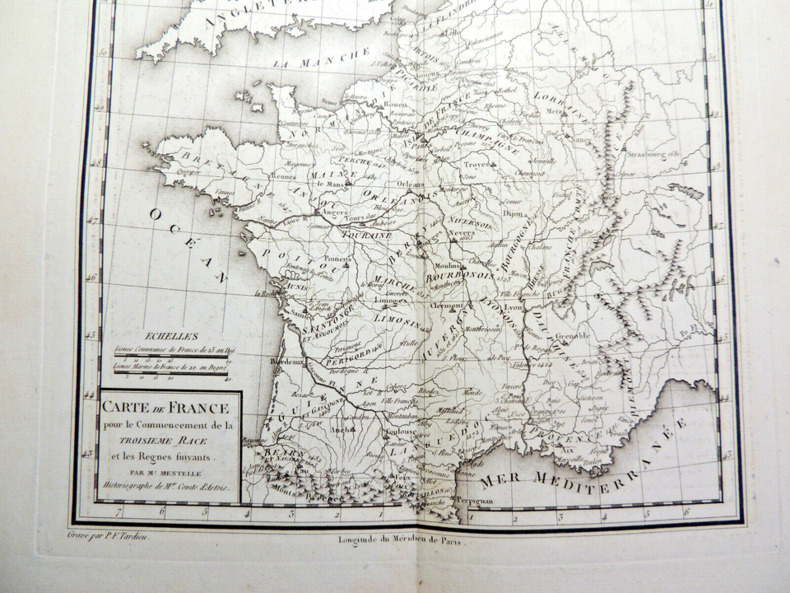
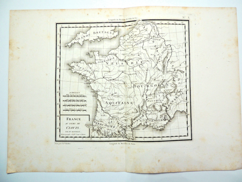
CZC-11676Gravée par P.F. Tardieu, authentique datée vers 1790, sur papier fort, recto uniquement, pliable, dimensions : 39 cm x 27 cm, parfait état. Classeur 3
CZC-11677Gravée par P.F. Tardieu, authentique datée vers 1790, sur papier fort, recto uniquement, pliable, dimensions : 39 cm x 27 cm, parfait état. Dynastie de rois de France, la dynastie des Capétiens est issue du roi Hugues Ier Capet, auquel elle doit son nom. Celui-ci, en mettant en place l’hérédité dynastique, est devenu la souche commune des trois dynasties de souverains – Capétiens, Valois, Bourbons – qui se sont succédé sur le trône de France jusqu'en 1848 (c'est-à-dire pendant près d'un millénaire), et dont les branches collatérales ont régné sur les royaumes de Naples, de Hongrie et d'Espagne. Classeur 3
CZC-11677Gravée par P.F. Tardieu, authentique datée vers 1790, sur papier fort, recto uniquement, pliable, dimensions : 39 cm x 27 cm, parfait état. Dynastie de rois de France, la dynastie des Capétiens est issue du roi Hugues Ier Capet, auquel elle doit son nom. Celui-ci, en mettant en place l’hérédité dynastique, est devenu la souche commune des trois dynasties de souverains – Capétiens, Valois, Bourbons – qui se sont succédé sur le trône de France jusqu'en 1848 (c'est-à-dire pendant près d'un millénaire), et dont les branches collatérales ont régné sur les royaumes de Naples, de Hongrie et d'Espagne. Classeur 3
189576430Leipzig, F. A. Brockhaus, 1895. Bildgröße 13 x 21,5 cm. Unter Feinkartonpassepartout.
8vo., folding coloured map on cloth measuring 31.5 x 22.5 inches (approx. 80 x 57 cms) folding in 20 panels to 7 x 4 inches (approx. 18 x 10 cms); tragically wanting front pasted wrapper (rare wrapper intact), some mild age-soiling else a very good, clean copy. Produced specifically for British military staff; the map is overprinted in red denoting the Positions of British Advancing Columns. RARE.
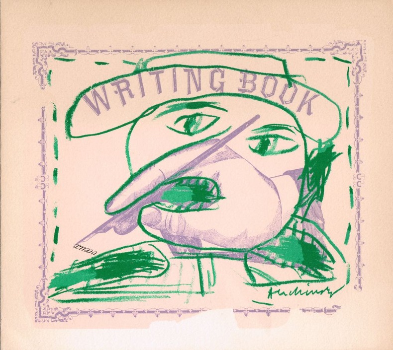
19803405Paris Maeght 1980 aucune reliure 20 x 22,5 cm. 2ff. Lithographie originale en couleurs signée dans la planche. En page 2 la mention imprimée "Pierre Alechinsky, lithographie originale", en page 3 les voeux imprimés de Aimé Maeght et ses adresses à Paris, Zurich et Barcelone.
34.5" x 26.5" reinforced paper. N.W. 48/2. Geographical Section, General Staff, No. 4072. Compiled and drawn at War Office, 1940. Heliographed and printed at Ordnance Survey, 1940. Identifies Land Aerodromes, Landing Grounds, Water Aerodromes, Radioelectric Stations, Explosives Areas, and more. Average wear and soiling. Name in ink in upper right corner. Name in pencil along top edge. Cover not included. Book
1944144301944. Collection of German produced maps created during World War II documenting military geography industrial targets and occupied territories across Europe. Printed between approximately 1939 and 1945 the maps reflect the cartographic infrastructure used by the German military and administrative authorities during the conflict. They include operational target mapping of industrial facilities in Britain as well as broader geographic maps of Central and Western Europe produced during the period of German expansion and occupation. The materials illustrate the strategic importance of cartography in wartime planning intelligence gathering and territorial administration.<br /> <br /> Archive of ten German language maps printed circa 1939-1945. The group includes a German aerial bombing target map of the Chesterfield Tube Works in Great Britain dated December 1942 showing an aerial photographic image of the factory area overlaid with roads bridges and designated target points. The document bears the warning "Nur für den Dienstgebrauch" translated as "For Internal Use Only." The Chesterfield Tube Works produced industrial cylinders and compressors important to the Allied war effort and German bombing raids targeted the factory and nearby rail lines; one recorded bombing attempt reportedly missed the intended target and struck a golf course several miles away. The archive also includes a map titled Karte der ehemaligen Tschechoslowakei "Map of the Former Czechoslovakia" printed with red elevation markings and bearing the headline "Sonderausgabe!" "Special Edition!" produced during the period of German occupation following the annexation of the Sudetenland in 1938 and the subsequent occupation of the remainder of Czechoslovakia in 1939. Additional maps depict the city of Plzeň located at the edge of the Sudetenland and occupied by German forces during the war along with maps of Köln Cologne Umgebung von Wien surroundings of Vienna and broader geographic overview maps labeled Deutsches Reich Frankreich and Italien. One large overview sheet titled Blatt Südost includes a color printed regional map with scale 1:1000000.<br /> <br /> During World War II the production of detailed maps formed a central component of military planning aerial reconnaissance and territorial administration across Europe. German cartographic units compiled aerial imagery industrial intelligence and geographic data to support bombing operations and to administer occupied territories. Maps such as the Chesterfield industrial target sheet demonstrate how aerial photography and cartographic overlays were combined to identify transportation networks and industrial infrastructure vulnerable to bombing campaigns. Other maps in the archive reflect the shifting political geography of Europe under Nazi occupation including representations of territories incorporated into or controlled by the German Reich. The group contains ten maps of varying sizes including large wall maps exceeding 50 inches in width. Several maps show signs of use including wear and annotations; the Plzeň map lacks the original key section. Overall condition ranges from good to very good with occasional handling wear consistent with wartime cartographic materials. A substantial group of World War II German maps documenting both strategic planning and the geography of occupied Europe. unknown
197110980Bartholomew, Edinburgh 1971. Farbige gefaltete Karte. Ca. 66 x 86 cm (bxh). Geringe Gebrsp.
Q-0756604818Covent Garden Books. Hardcover. New. New. In shrink wrap. Looks like an interesting title! Covent Garden Books hardcover
20131-0792283090National Geographic Maps 2013. Map. New. lam map edition. 1 pages. 31.25x2.00x1.50 inches. National Geographic Maps unknown
A9780792250012Sheet map. New. unknown
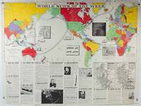
1942202620Army Orientation Course. / News Map of the Week Inc. Volume 4 No. 32. 13 April1942. Folding colour pictorial map on sheet 88 x 119 cms blank on verso inset maps two photographic diagrams and black and white photographic illustrations descriptive text top edge chipped a few short edge tears and lower corner torn no loss pinholes at the corners inoffensive tidemark at a lower corner in good condition. Colour world map showing political boundaries and military events of World War II from April 3 to 9 1942. with descriptive text beneath including: the loss of two British Cruisers off Ceylon; the occupation of Bataan by the Japanese and their landing on Manus; Japanese war tactics revealed by Malay prisoners and the increasing importance of Central Africa to the Allied war effort. The. Map is indexed according to these notes. Two inset maps of Europe chart Hitler's gains in 1941 and activity on the Russian Front. Additional diagrams on the main world map show war spending and the civilian and war output of US industries. . Army Orientation Course. / News Map of the Week, Inc. unknown
0008271755.Gpaperback. Good. Access codes and supplements are not guaranteed with used items. May be an ex-library book. paperback
20131-1597752096Natl Geographic Society Maps 2013. Map. New. lam map edition. 1 pages. 24.50x2.00x2.00 inches. Natl Geographic Society Maps unknown
A9781597751360Sheet map rolled. New. unknown
A9780792280873Sheet map rolled. New. unknown
2012BN200358National Geographic Maps 2012. 2012. World Classic Enlarged & Tubed <br/><br/>World Classic Enlarged & Tubed National Geographic Maps National Geographic Maps unknown
12mo, 64 pages, over 35 colour maps. eng
ria9780008696061_inpHardcover. New. New Book; Fast Shipping from UK; Not signed; Not First Edition; This atlas presents a complete view of the world bringing it to life through innovative maps stunning images and detailed content. hardcover
(København, 1767). Kobberstukket prospekt af Vordingborg. (17,5x25 cm.). Stukket af J. Haas, på skrivepapir.
176734570(København, 1767). Kobberstukket prospekt af Vordingborg. (17,5x25 cm.). Stukket af J. Haas, på skrivepapir.
(København, 1764). Kobberstukket prospekt af kirken med omgivende ejsendomme. (17x24,5 cm.). Stukket af J. Haas. På skrivepapir. Et par svage brunpletter.
176453298(København, 1764). Kobberstukket prospekt af kirken med omgivende ejsendomme. (17x24,5 cm.). Stukket af J. Haas. På skrivepapir. Et par svage brunpletter.
Petit in-8 oblong, 76 cartes en n&b., reliure cartonnage editeur illustrée.- RARE Tres bon état. [BU-11]