Smith, J LBiblio.com
5 782 résultats
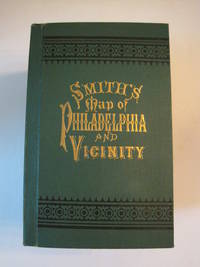
1894016609Philadelphia: J. L. Smith 1894. Fine condition. SEE PHOTOS. A very attractive well preserved copy of this detailed two-part map of Philadelphia and vicinity published in 1894 copyright 1893. Tough-to-find in collectible condition as nice as this. A bright clean copy. NO chips. NO tears. NO creases. NO owner's name or bookplate. Clean and unmarked. Drawn on a scale of 1 inch to the mile. The map consists of two parts. The eastern half unfolds to 23" wide by 27" tall. The western part is 21.5" wide by 27" tall. Both are skillfully and attractively hand colored. The maps are backed in linen as issued. They are housed in the publisher's original green cloth portfolio which is printed in black and embossed in gold on the front cover and in blind on the rear. Gilt lettering is still as bright and shiny as new. 1st ed No additional printings listed. Hardcover. Fine condition. J. L. Smith Hardcover
Due mappe disegnate a china con acquarellatura coeva cm. 104 x 78 cadauna, ) della frazione della valle di Lamen, datata 20 dicembre 1847. Piu vv. ripiegata. Leggermente impolverata al verso, restauro ad una cerniera, gora di umidità, note a matita. Bella (4805/ FELTRE - BELLUNO CARTOGRAFIA)
Amsterdam, 1660 circa. Incisione in rame, colore d’epoca, cm 38 x 49,8 (alla lastra). Esemplare con rialzo in oro alla corona e al cartiglio. Bell’esemplare a pieni margini e con piccole finiture oro.
Incisione in rame, colorata da mano coeva (cm 38,3 x49,7 e ampi margini). Tratta dall'edizione latina dell'Atlas Novus pubblicato ad Amsterdam nel 1640 ca. Esemplare fresco e marginoso. (Blavius o Guilielmus Caesius o Guilielmus Jansonius). Cartografo olandese (Uitgeest 1571-Amsterdam 1638). Allievo a Praga dell'astronomo Tycho Brahe, nel 1599 si stabilì ad Amsterdam, dove iniziò la pubblicazione di atlanti e carte geografiche e la costruzione di mappamondi. Nel 1633 fu nominato cartografo della Repubblica. Alla sua morte l'azienda proseguì per opera dei suoi due talentuosi figli Cornelius (1616-1648) e Johannes (1596-1673) che ampliarono l'ambizioso progetto cartografico del padre. L'Atlas Major è il risultato dell'immenso lavoro dei Blaeu ed è riconosciuto unanimamente come uno dei momenti più alti nella storia della cartografia. Il lavoro dei Blaeu si interruppe nel 1672 quando il grande incendio di Amsterdam distrusse l'officina e gran parte delle lastre. L'anno seguente Johannes morì e le lastre rimanenti vennero disperse e acquistate dai rivali Frederick De Wit, Schenk e Valk. La casa editrice chiuse definitivamente nel 1695.. .
183051752BBParis, Felix Delamarche, 1830. 4°. 33 cm. 2 Blatt, 36 Doppelblätter mit Karten. Halblederband der Zeit mit Titel auf Deckelschild.
61878BBo.J. [5 Warenabbildungen] (Kaspar oder Caspar Henne(n)berg(er), geboren am 1529, gestorben am 29. Februar 1600 in Königsberg. Deutscher Kartograf
61886BBo.J. [3 Warenabbildungen] (Clement De Jonghe, geboren 1624 in Brunsbüttel, gestorben 1677 in Amsterdam. Niederländischer Kupferstecher, Verleger u
Amsterdam, 1589 ca. Incisione in rame, colore d’epoca, cm 35 x 47,5 (alla lastra). Testo francese al verso, indice della probabile edizione di Amsterdam. Esemplare a pieni margini ma con un uniforme brunimento della carta e con alcune macchiette più marcate in lastra.
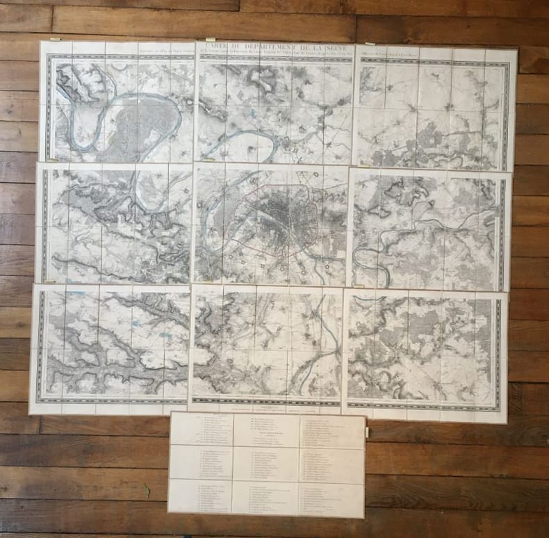
19428Paris, Ch. Piquet, 1839. 9 plans, 30 x 58,7 cm et 40 x 50 cm, étui de l'éditeur de papier marbré.
Dalla “Cartes générales de toute les parties du Monde”, Parigi, 1654. Paris, H. Iaillot primi anni del XVIII secolo. Incisione in rame, confini in col. d’epoca, cm 55 x 73,5 (alla lastra). Sopra l’originale didascalia, è stata riportata, fuori del margine superiore della parte incisa e a ricoprire la battuta della lastra, entro la quale si trova l’originale didascalia, una ulteriore scritta esplicativa. Una lieve gora d’umido all'angolo superiore bianco, peraltro esemplare fresco, in bella coloritura, con una bella impressione e grandi margini, in ottimo stato di conservazione.
Incisione su rame all'acquaforte e bulino; foglio di 550 x 770 mm, 570 x 475 mm (impronta della matrice). Bella vergata veneziana. Filigrana non rilevata. Ottimo foglio a larghi margini. Due restauri per strappi ai margini bianchi laterali. Titolo entro ricco cartiglio in basso a sinistra. Toponimi e descrizioni geografiche nella mappa. Proveniente da: "Atlas universel dressé sur les meilleures cartes modernes. Deuxième partie", Venezia 1776. Gli Atlanti stampati da Francesco Santini, che, come indicato spesso nelle carte, teneva bottega a Santa Giustina, nel Sestiere di Castello, riutilizzano le lastre incise da Lattrè e disegnate da Janvier per l'"Atlas Moderne" stampato a Parigi nel 1771. Vaugondy ‹vogõdì›, Gilles-Robert. - Cartografo e geografo (Parigi 1688 - ivi 1766), geografo ufficiale del re di Francia, autore di varî atlanti, tra cui un Atlas universel (1758; ed. più completa, 1786).
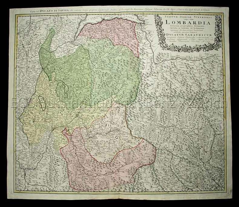
1749620CG(Nürnberg), Homanns Erben, 1749. Kolorierte Kupferstichkarte. Plattengrösse: 51 x 59 cm. Blattgrösse: 52,5 x 61 cm.
Mm 330x430 Opera completa. Saggio cartografico di Leonardo Rombai. Indice analitico a cura di Lodovico Branca e Matteo Barbarulo. Consulenza di Gian Carlo Garfagnini. Due volumi rilegati in uniforme tela verde oliva con titoli in oro ed immagine applicata al piatto di ciascun tomo, sovraccoperta trasparente,.652 pagine complessive con 574 belle riproduzioni di terrilogi e cabrei. Ottime condizioni di conservazione. Spedizione in 24 ore dalla conferma dell'ordine
Very Good Turkish, Ottoman (1500-1928) Original pictorial wrappers. Chromo-lithographed photo-montage collage cover with seven b/w photos of African buildings and natives, and a red map of Africa. Complete in wrappers and folded huge Africa map (size: 57 x 82 cm). Cover size: 28.5 x 20.5 cm. In Turkish. Scale: 1/20,000,000. A very rare chromo-lithographed Africa map, prepared for the geography lessons about foreign countries in Turkey in 1930. The map shows the territories of the African continent, which was still politically under European colonialism as of the 1930s. It includes Rio de Oro (Spanish territory), Fas [i.e. Morocco], Algeria, Sahara, Cameroon (French territories), Trabulus [i.e. Libya] as Italian territory; and Liberia, Egypt, East Sudan, Eritre [i.e. Eritrea], Habesistan [i.e. Ethiopia], Somali, Kenya, Belgian Kongo, Angola, Mozambique and South African land including Rhodesia (equivalent in the territory to modern Zimbabwe), Transvaal, The Orange Free State [Oranje-Vrystaat], Natal and Kap [Cape] with Madagascar. An extra panel for the same scale map showing the Suez Canal, Nile Delta, and North Egypt in the lower-left corner. Duran studied in Istanbul and Paris. He worked as a geography teacher in various high schools and afterward he undertook the positions of lecturer and administrator in Ankara Gazi Education Institute for a time. He was known for his writings on various topics and particularly for his works on geography. Born in the imperial period, Duran conducted the first cartographic studies of the Republic of Turkey after the transition to the Republican administration. Sealed. Slight foxing. Otherwise a fine copy. Not in OCLC.
Very Good French Original decorated map. Hand-coloured. Oblong elephant folio. (54 x 76 cm). In French. Shows Greece, Archipelago, Isle de Candie, Asia Minor (Western side), and East Mediterranean. Delisle od de l'Isle was a French cartographer known for his popular and accurate maps of Europe and the newly explored Americas. At 27, Delisle was admitted into the French Académie Royale des Sciences, an institution financed by the French state. After that date, he signed his maps with the title of "Géographe de l'Académie". Five years later, he moved to the Quai de l'Horloge in Paris, a true publishing hub where his business prospered. Delisle's progress culminated in 1718 when he received the title of Premier Géographe du Roi. He was appointed to teach geography to the Dauphin, King Louis XIV's son, a task for which he received a salary. Again, his father's reputation as a man of science probably helped the younger Delisle. Historian Mary Sponberg Pedley says, 'once authority was established, a geographer's name might retain enough value to support two or three generations of mapmakers'. Delisle's case, it could be said that his accomplishments surpassed his father's. Up to that point, he had drawn maps not only of European countries, such as Italy, Spain, Germany, Great Britain, Poland, and regions such as the Duchy of Burgundy, but he had also contributed to the empire's claims to recently explored continents of Africa and the Americas. Like many cartographers of his day, Delisle did not travel with the explorers. He drew maps mostly in his office, relying on a variety of data. The quality of his maps depended on a solid network to provide him first-hand information. Given his family's and his own reputation, Delisle had access to fairly recent accounts of travellers who were returning from the New World, which gave him an advantage over his competitors. Being a member of the Académie, he also kept current with recent discoveries, especially in astronomy and measurement. When he could not confirm the accuracy of a source, he would indicate it clearly on his maps. For instance, his Carte de la Louisiane shows a river that the baron of Lahontan claimed he discovered. As no one else could validate it, Delisle noted a warning to the viewer that it might not exist. (Source: Wikipedia). Tooley, p.43.
Very Good Turkish, Ottoman (1500-1928) Original color map on cloth. A little foxing on cloth. Very good. Folded. Oblong atlas folio. (66 x 72 cm). In Ottoman script. Scale: 1/210.000. Ottoman sanjaks in Albania and Greece. A rare Ottoman map of Balkans with Turkish place names for the period of pre-Balkan Wars, (1912-1913). Very important for onomastics and historical geography. Written 'Paris -French meridian- was accepted as the 0 meridian'. The Paris meridian is a meridian line running through the Paris Observatory in Paris, France-now longitude 2°20'14.03" east. It was a long-standing rival to the Greenwich meridian as the prime meridian of the world. Personal stamp of Muhiddin Pasha on cloth, under the printed descriptive texts. It's from the collection of him. Hasan Muhiddin Pasha [Çanga], (1866-1944), who was a lieutenant in Hedjaz Army of the Ottoman Empire in 1887. After he suppressed the rebellion in Yemen, 1891, his rank was promoted to the 'major'. After the Imam Yahya rebellion in Yemen, 1904, he prepared a report for the Ottoman government. He also took part in Ethiopia, Sudan, Yemen, Arabian Peninsula for various military duties. After promotion to division command, he was provincial president of CHP (Republican People's Party). He was a very important politic and diplomatic figure for the last period of Ottoman and early Republican Turkey. Not in Tooley. Extremely rare.
Very Good Turkish, Ottoman (1500-1928) Original color map on cloth. A little foxing on cloth. Very good. Folded. Oblong atlas folio. (66 x 72 cm). In Ottoman script. Scale: 1/210.000. Ottoman cities in Bulgaria. A rare Ottoman map of Balkans with Turkish place names for the period of pre-Balkan Wars, (1912-1913). Very important for onomastics and historical geography. Written 'Paris -French meridian- was accepted as the 0 meridian'. The Paris meridian is a meridian line running through the Paris Observatory in Paris, France-now longitude 2°20'14.03" east. It was a long-standing rival to the Greenwich meridian as the prime meridian of the world. Personal stamp of Muhiddin Pasha on cloth, under the printed descriptive texts. It's from the collection of him. Hasan Muhiddin Pasha [Çanga], (1866-1944), who was a lieutenant in Hedjaz Army of the Ottoman Empire in 1887. After he suppressed the rebellion in Yemen, 1891, his rank was promoted to the 'major'. After the Imam Yahya rebellion in Yemen, 1904, he prepared a report for the Ottoman government. He also took part in Ethiopia, Sudan, Yemen, Arabian Peninsula for various military duties. After promotion to division command, he was provincial president of CHP (Republican People's Party). He was a very important politic and diplomatic figure for the last period of Ottoman and early Republican Turkey. Not in Tooley. Extremely rare.
Very Good Turkish, Ottoman (1500-1928) Original color map on cloth. A little foxing on cloth. Very good. Folded. Oblong atlas folio. (66 x 72 cm). In Ottoman script. Scale: 1/210.000. Ottoman sanjaks in Greece, mostly in Greek Macedonia. A rare Ottoman map of Balkans with Turkish place names for the period of pre-Balkan Wars, (1912-1913). Very important for onomastics and historical geography. Written 'Paris -French meridian- was accepted as the 0 meridian'. The Paris meridian is a meridian line running through the Paris Observatory in Paris, France-now longitude 2°20'14.03" east. It was a long-standing rival to the Greenwich meridian as the prime meridian of the world. Personal stamp of Muhiddin Pasha on cloth, under the printed descriptive texts. It's from the collection of him. Hasan Muhiddin Pasha [Çanga], (1866-1944), who was a lieutenant in Hedjaz Army of the Ottoman Empire in 1887. After he suppressed the rebellion in Yemen, 1891, his rank was promoted to the 'major'. After the Imam Yahya rebellion in Yemen, 1904, he prepared a report for the Ottoman government. He also took part in Ethiopia, Sudan, Yemen, Arabian Peninsula for various military duties. After promotion to division command, he was provincial president of CHP (Republican People's Party). He was a very important politic and diplomatic figure for the last period of Ottoman and early Republican Turkey. Not in Tooley. Extremely rare.
Very Good Turkish, Ottoman (1500-1928) Original color map on cloth. A little foxing on cloth. Very good. Folded. Oblong atlas folio. (66 x 72 cm). In Ottoman script. Scale: 1/210.000. Ottoman sanjaks in Greece, mostly in Greek Macedonia. A rare Ottoman map of Balkans with Turkish place names for the period of pre-Balkan Wars, (1912-1913). Very important for onomastics and historical geography. Written 'Paris -French meridian- was accepted as the 0 meridian'. The Paris meridian is a meridian line running through the Paris Observatory in Paris, France-now longitude 2°20'14.03" east. It was a long-standing rival to the Greenwich meridian as the prime meridian of the world. Personal stamp of Muhiddin Pasha on cloth, under the printed descriptive texts. It's from the collection of him. Hasan Muhiddin Pasha [Çanga], (1866-1944), who was a lieutenant in Hedjaz Army of the Ottoman Empire in 1887. After he suppressed the rebellion in Yemen, 1891, his rank was promoted to the 'major'. After the Imam Yahya rebellion in Yemen, 1904, he prepared a report for the Ottoman government. He also took part in Ethiopia, Sudan, Yemen, Arabian Peninsula for various military duties. After promotion to division command, he was provincial president of CHP (Republican People's Party). He was a very important politic and diplomatic figure for the last period of Ottoman and early Republican Turkey. Not in Tooley. Extremely rare.
Very Good Turkish, Ottoman (1500-1928) Original color map on cloth. A little foxing on cloth. Very good. Folded. Oblong atlas folio. (66 x 72 cm). In Ottoman script. Scale: 1/210.000. Ottoman sanjaks in Greece, mostly in Thessaly. A rare Ottoman map of Balkans with Turkish place names for the period of pre-Balkan Wars, (1912-1913). Very important for onomastics and historical geography. Written 'Paris -French meridian- was accepted as the 0 meridian'. The Paris meridian is a meridian line running through the Paris Observatory in Paris, France-now longitude 2°20'14.03" east. It was a long-standing rival to the Greenwich meridian as the prime meridian of the world. Personal stamp of Muhiddin Pasha on cloth, under the printed descriptive texts. It's from the collection of him. Hasan Muhiddin Pasha [Çanga], (1866-1944), who was a lieutenant in Hedjaz Army of the Ottoman Empire in 1887. After he suppressed the rebellion in Yemen, 1891, his rank was promoted to the 'major'. After the Imam Yahya rebellion in Yemen, 1904, he prepared a report for the Ottoman government. He also took part in Ethiopia, Sudan, Yemen, Arabian Peninsula for various military duties. After promotion to division command, he was provincial president of CHP (Republican People's Party). He was a very important politic and diplomatic figure for the last period of Ottoman and early Republican Turkey. Not in Tooley. Extremely rare.
Very Good Turkish, Ottoman (1500-1928) Original color map on cloth. A little foxing on cloth. Very good. Folded. Oblong atlas folio. (66 x 72 cm). In Ottoman script. Scale: 1/210.000. Ottoman sanjaks in Greece, mostly in Thessaly. A rare Ottoman map of Balkans with Turkish place names for the period of pre-Balkan Wars, (1912-1913). Very important for onomastics and historical geography. Written 'Paris -French meridian- was accepted as the 0 meridian'. The Paris meridian is a meridian line running through the Paris Observatory in Paris, France-now longitude 2°20'14.03" east. It was a long-standing rival to the Greenwich meridian as the prime meridian of the world. Personal stamp of Muhiddin Pasha on cloth, under the printed descriptive texts. It's from the collection of him. Hasan Muhiddin Pasha [Çanga], (1866-1944), who was a lieutenant in Hedjaz Army of the Ottoman Empire in 1887. After he suppressed the rebellion in Yemen, 1891, his rank was promoted to the 'major'. After the Imam Yahya rebellion in Yemen, 1904, he prepared a report for the Ottoman government. He also took part in Ethiopia, Sudan, Yemen, Arabian Peninsula for various military duties. After promotion to division command, he was provincial president of CHP (Republican People's Party). He was a very important politic and diplomatic figure for the last period of Ottoman and early Republican Turkey. Not in Tooley. Extremely rare.
Very Good Turkish, Ottoman (1500-1928) Original color map on cloth. A little foxing on cloth. Very good. Folded. Oblong atlas folio. (66 x 72 cm). In Ottoman script. Scale: 1/210.000. Ottoman sanjaks in Greece. A rare Ottoman map of Balkans with Turkish place names for the period of pre-Balkan Wars, (1912-1913). Very important for onomastics and historical geography. Written 'Paris -French meridian- was accepted as the 0 meridian'. The Paris meridian is a meridian line running through the Paris Observatory in Paris, France-now longitude 2°20'14.03" east. It was a long-standing rival to the Greenwich meridian as the prime meridian of the world. Personal stamp of Muhiddin Pasha on cloth, under the printed descriptive texts. It's from the collection of him. Hasan Muhiddin Pasha [Çanga], (1866-1944), who was a lieutenant in Hedjaz Army of the Ottoman Empire in 1887. After he suppressed the rebellion in Yemen, 1891, his rank was promoted to the 'major'. After the Imam Yahya rebellion in Yemen, 1904, he prepared a report for the Ottoman government. He also took part in Ethiopia, Sudan, Yemen, Arabian Peninsula for various military duties. After promotion to division command, he was provincial president of CHP (Republican People's Party). He was a very important politic and diplomatic figure for the last period of Ottoman and early Republican Turkey. Not in Tooley. Extremely rare.
Very Good Turkish, Ottoman (1500-1928) Original color map on cloth. A little foxing on cloth. Very good. Folded. Oblong atlas folio. (66 x 72 cm). In Ottoman script. Scale: 1/210.000. Ottoman sanjaks in Greece. A rare Ottoman map of Balkans with Turkish place names for the period of pre-Balkan Wars, (1912-1913). Very important for onomastics and historical geography. Written 'Paris -French meridian- was accepted as the 0 meridian'. The Paris meridian is a meridian line running through the Paris Observatory in Paris, France-now longitude 2°20'14.03" east. It was a long-standing rival to the Greenwich meridian as the prime meridian of the world. Personal stamp of Muhiddin Pasha on cloth, under the printed descriptive texts. It's from the collection of him. Hasan Muhiddin Pasha [Çanga], (1866-1944), who was a lieutenant in Hedjaz Army of the Ottoman Empire in 1887. After he suppressed the rebellion in Yemen, 1891, his rank was promoted to the 'major'. After the Imam Yahya rebellion in Yemen, 1904, he prepared a report for the Ottoman government. He also took part in Ethiopia, Sudan, Yemen, Arabian Peninsula for various military duties. After promotion to division command, he was provincial president of CHP (Republican People's Party). He was a very important politic and diplomatic figure for the last period of Ottoman and early Republican Turkey. Not in Tooley. Extremely rare.
Very Good Turkish, Ottoman (1500-1928) Original color map on cloth. A little foxing on cloth. Very good. Folded. Oblong atlas folio. (66 x 72 cm). In Ottoman script. Scale: 1/210.000. Ottoman sanjaks in Greece, mostly in Thessaly and Macedonian Greece. A rare Ottoman map of Balkans with Turkish place names for the period of pre-Balkan Wars, (1912-1913). Very important for onomastics and historical geography. Written 'Paris -French meridian- was accepted as the 0 meridian'. The Paris meridian is a meridian line running through the Paris Observatory in Paris, France-now longitude 2°20'14.03" east. It was a long-standing rival to the Greenwich meridian as the prime meridian of the world. Personal stamp of Muhiddin Pasha on cloth, under the printed descriptive texts. It's from the collection of him. Hasan Muhiddin Pasha [Çanga], (1866-1944), who was a lieutenant in Hedjaz Army of the Ottoman Empire in 1887. After he suppressed the rebellion in Yemen, 1891, his rank was promoted to the 'major'. After the Imam Yahya rebellion in Yemen, 1904, he prepared a report for the Ottoman government. He also took part in Ethiopia, Sudan, Yemen, Arabian Peninsula for various military duties. After promotion to division command, he was provincial president of CHP (Republican People's Party). He was a very important politic and diplomatic figure for the last period of Ottoman and early Republican Turkey. Not in Tooley. Extremely rare.
Very Good Turkish, Ottoman (1500-1928) Original color map on cloth. A little foxing on cloth. Very good. Folded. Oblong atlas folio. (66 x 72 cm). In Ottoman script. Scale: 1/210.000. Ottoman sanjaks in Balkans. A rare Ottoman map of Balkans with Turkish place names for the period of pre-Balkan Wars, (1912-1913). Very important for onomastics and historical geography. Written 'Paris -French meridian- was accepted as the 0 meridian'. The Paris meridian is a meridian line running through the Paris Observatory in Paris, France-now longitude 2°20'14.03" east. It was a long-standing rival to the Greenwich meridian as the prime meridian of the world. Personal stamp of Muhiddin Pasha on cloth, under the printed descriptive texts. It's from the collection of him. Hasan Muhiddin Pasha [Çanga], (1866-1944), who was a lieutenant in Hedjaz Army of the Ottoman Empire in 1887. After he suppressed the rebellion in Yemen, 1891, his rank was promoted to the 'major'. After the Imam Yahya rebellion in Yemen, 1904, he prepared a report for the Ottoman government. He also took part in Ethiopia, Sudan, Yemen, Arabian Peninsula for various military duties. After promotion to division command, he was provincial president of CHP (Republican People's Party). He was a very important politic and diplomatic figure for the last period of Ottoman and early Republican Turkey. Not in Tooley. Extremely rare.