Gyger, H.C.GygerAntiquariat.de

5 782 résultats
1635993DG(1635). Kuperstich von Matthäus Merian. Blattgrösse: 28,5 x 37 cm. + Wichtig: Für unsere Kunden in der EU erfolgt der Versand alle 14 Tage verzollt ab Deutschland / Postbank-Konto in Deutschland vorhanden +, 993DG Bildgrösse: 40 x 49 cm.
Norimberga, 1737. Incisione in rame all'acquaforte, coeva coloritura a mano, cm 51 x 61 circa (il foglio) più margini. Ricco cartiglio in basso a sinistra, con figure di schiavi, mendicanti, santi, studiosi e guerrieri. Esemplare rifilato ai margini superiore e inferiore, sciupature agli estremi della brachetta (visibile al superiore), bella e vivace coloritura, nell'insieme buono stato di conservazione. .
Carta in b/n- dimensioni foglio cm 50,5x 59.7- lievi abrasioni ai margini- ed. francese - lievi bruniture ai margini - nel complesso buono stato di conservazione
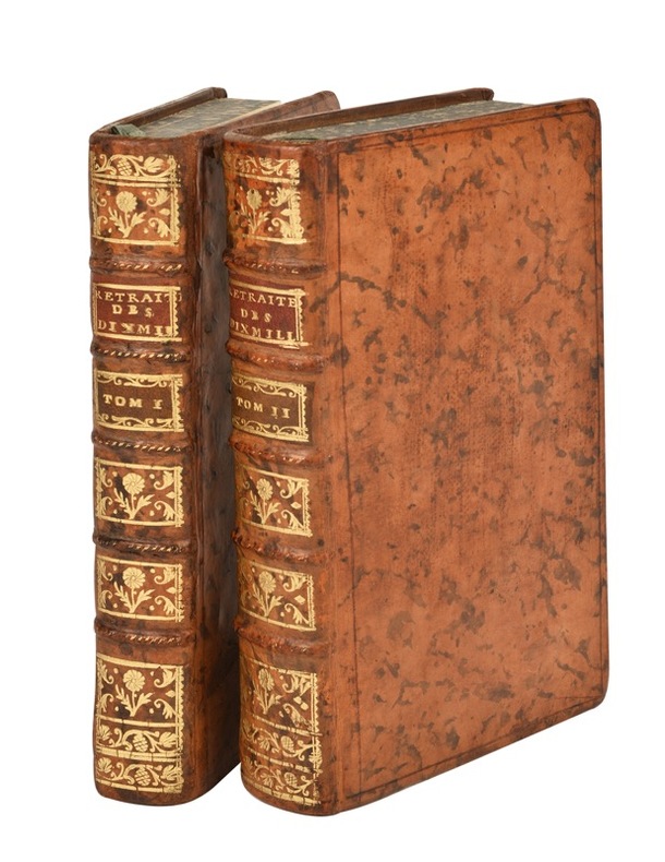
176621691Paris, Nyon, Saillant, Desaint, 1766 ; 2 tomes in-12, veau marbré, dos à nerfs décoré et doré, pièces de titre grenat, tranches marbrées (reliure de l’époque) ; [2], LII, 357, [1]p., 1 planche dépliante (bataille de Counaxa) ; 52], 580, [4] pp., (1 carte dépliante, trajet des Dix-mille) ; (sign. : a-b12, c2, A-P12 [pl.1] ; A, 2A12, B4, [pl.2]).
1831197784Carlsruhe, (1826-1831). Fol. M. lith. Titel- u. Widmungsblatt sowie 43 teilkolor. doppelblattgr. Tab., davon 24 m. teilkolor. lith. Ktn. Tab. 13 mit einem Anhangbl. 3 Bl. (2 Bl. vom Inh.-Verz. sind doppelt eingeb.). Hldr. m. aufgezog. OU. Dieser aber teils nicht mehr vorhanden. Rücken nur noch zur knappen Hälfte vorhanden. Einbd. berieben u. bestoßen. Innen teils etwas braun- bzw. stockfl.
18541171231854 A Paris, Garnier Frères, Libraires-éditeurs - 1854 - Sixième édition - 7 volumes in-4, demi basane marron; filets à froid au dos; titres, auteur et fleurons dorés - 611 + 649 + 691 + 667 + 773 + 631 pages pour les 6 volumes + 86 planches pour l'Atlas - Quelques illustrations en N&B hors texte + Quelques planches dépliantes à la fin du premier volume
Giacomo De Rossi alla Pace, Roma, 1690 circa. Incisione in rame all’acquaforte, b/n, cm 39,5 x 52 (alla lastra) più margini. Stemma in alto a sinistra, semplice ma bel cartiglio in alto a destra, un grande compasso in basso a destra e sotto il motto “Stipite de nitido terras, mare, sidera librat”; sono segnalati a grandi lettere la Spiaggia romana con Capo D'Anzio e il Mare Tirreno. Bella carta, ben dettagliata. Esemplare in buono stato di conservazione.
50385BBo.J. Gerhard Mercator , geboren am 5. März 1512 in Rupelmonde, Grafschaft Flandern, gestorben am 2. Dezember 1594 in Duisburg, Mathematiker, Geograph und Kartograf.
191652205ABStuttgart, Strecker und Schröder, 1916. 4° (35x25), LXXV, 960 Sp, S. [961] - 992 (Register), mit 317 Kartenskizzen und Textbildern, OHln mit LnEcken, dreiseitiger Rotschnitt, [3 Warenabbildungen] (1. Aufl.) Einband mit marginalen Lagerspuren, sauber und gepflegt, nahezu ungelesen, schönes Exemplar,
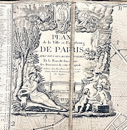
179015849Mondhare et Jean Paris 1790 1 vol. Feuille de 98 x 63 cm, entoilée et repliée, étiquette.
Paris, Dezauche succ. De l'Isle et Buache, 1783. (mm. 350 x 450). Bel planisfero in coloritura coeva, con testo ai lati, proveniente da Atlas géographique des quatre parties du monde par Guillaume De L'Isle et P. Buache. Incisione di Desbruslins.
179315768Editeur [Prudhomme] Paris 1793 1 vol. In-8 de VI 1 f.n.ch. (table) 366 pp. 1 f.n.ch. (avis), demi-veau de l'époque, dos lisse orné, pièce de titre (accroc à la coiffe inférieure, coins émoussés).
Amsterdam, Pierre Scenk, 1654 circa. Tratta da “Cartes générales de toute les parties du Monde” (Parigi, 1654), incisione in rame, colore d’epoca, cm 49 x 58 (alla lastra). Leggermente rifilato al margine superiore, esemplare fresco, in bella impressione e in bella coloritura. .
SANTINI PAOLO Lotto di 2 mappe: NOUVELLE CARTE DE LA DALMATIE. Venezia, Remondini 1780, Lotto di due mappe dall' "Atlas Universel" stampato a Venezia nel 1776 e nel 1784, comprendente:- Partie occidentale de Dalmatie, dressee sur les lieux.- Partie orientale de Dalmatie, dressee sur les lieux. Buono (Good) Buon es.. acquaforte acquerellata a mano <br> cm. 64,5 x 49 (inciso) <br> <br> <br>
Due fogli con le due carte Incise in rame, incollati insieme a formare un'unica carta di cm. 67,0x55,0 Contorni e cartigli in tenue coloritura d'epoca. Grande dettaglio di paesi e località dell'Istria. Segni di piegature, fioriture puntuali e tracce di polvere, altrimenti buon esemplare a grandi margini. Giovanni Valle nacque a Capodistria nel 1752 e morì a Venezia nel 1819.
1900B121165Gand, Imp. N. Heins 1900 [16] pp. (texte) + 15 cartes coloriées en double-page, exemplaire numéroté à la main (no.30) et signé par A. Heins, signé avec dédicace autographe par A. Heins "à l'ami Paul Bergmans", tirage limtié à 100 exemplaires, 46x33cm., reliure cart. d'époque (plats marbrés, dos en cuir bordeaux, titre doré au dos), feuilles de garde marbrées, texte et planches sont frais, avec texte bilingue: français et néerlandais, bon état, poids: 1.9kg., [Nederlandse titel: "Groot plan van Gent gemaakt in 1619 door den landmeter Jac. Horenbault. Chromolithographisch facsimile,.."], B121165
Hardcover in-folio (25,5 x 39 cm) , 90 cartes gravées sur cuivre (frontières en couleurs) double pages, reliure demi-basane d'époque, dos à nerfs en partie manquant. Plats et coins frottés, manques importants au dos, intérieur en très bon état. [P-53]
New Turkish Original illustrated bdg. HC. 4to. (32 x 23 cm). In Turkish. 3 volumes set: (440 p., 1 folded color panorama of Istanbul; 442-875, [5] pp., 1 folded color panorama of Istanbul, 877-1289, [8] pp., 1 folded color panorama of Istanbul, b/w and color plates and photos. 20. Yüzyil'dan 21. Yüzyil'a Necip Bey Haritalari'ndan günümüze öncesi ve sonrasi Istanbul. 3 volumes set. [In special box]. First and Only Edition. Best and only reference on Nedjib [Necip] Bey maps.
Very Good English Original folded color map. Oblong atlas folio. (60x91 cm). Bilingual in English and Arabic. Arabic map and texts with b/w photographs of some views from Saudi Arabia and English map and texts with b/w photos of Jeddah, Riyadh and Dhahran airports with legends and "distances in kilometers". It shows a very detailed landscape of entire Arabian Peninsula including Saudi Arabia, Aden, Oman, Muscat Qatar, Trucial Coast, Nafud, Dahna, Rub' Al-Khali, Najran, Asir, Yemen, Ramlat As Sab'atayn, Dhofar, Al Mahrah, Hadhramaut, Kuwait, Neutral Zone, and others.
8°, 23 cm, pp. 150, 7 tavole fuori testo e 2 carte geografiche a colori ripiegate, una della Patagonia e una della Terra del fuoco. Brossura editoriale, titolo al dorso e incorniciato al piatto. Rapporto del tenente Giacomo Bove capo della spedizione al comitato centrale per le eplorazioni antartiche, restauri al dorso e alle copertine, esemplare nell'assieme molto buono. Unico volume pubblicato.
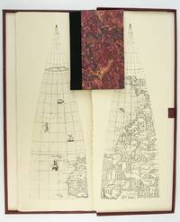
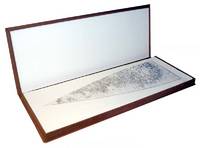
1987ST20505-11Madison Wisconsin: The Juniper Press 1987. No. 116 OF 150 COPIES. 632 x 250 mm. 25 x 9 3/4". 2p.l. 19 1 pp. <br/> Black quarter buckram over maroon marbled paper boards spine lettered in gilt. In a custom maroon buckram clamshell box. WITH 24 FACSIMILE GLOBE GORES. Signed by Woodward on the limitation page. Just a hint of use to the box booklet corners just a touch rubbed otherwise as new.<br/> <br/> This sizable attractive publication reproduces one of the largest complete sets of 16th century globe gores. Dating from around 1574 the original gores which when assembled would make a globe measuring just under 70 centimeters in diameter have been attributed to brothers Livio and Giulio Sanuto Venetian cartographers and engravers. Little is known about the gores' origin; the accompanying essay suggests they may have never made it to the final stages of publication and production possibly stopped by an outbreak of plague. This facsimile was created from the only extant set in the collection of Arthur Holzheimer 1932-2025 and was produced by his research foundation along with the Newberry Library. The gores are accompanied by a booklet by noted cartography scholar David Woodward 1942-2004 which provides background and the evidence supporting the attribution of the gores to the Sanuto brothers. The Juniper Press unknown
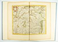
1985ST20505-12Fullerton California: Stone & Lorson 1985. ONE OF 89 COPIES in quarter vellum of a total edition of 115. 490 x 325 mm. 19 1/4 x 13". viii 23 1 pp. 1 leaf. <br/> Publisher's quarter vellum over gray paper boards covers with device in gilt smooth spine lettered in gilt. In just slightly chafed black buckram slipcase. WITH A MAP FROM THE ORIGINAL 1619 ATLAS bound in with period hand coloring. Map 293 "Tarvisina Marchia Et Tirolis Comitatus". De Hamel & Silver "Disbound and Dispersed" 186. One corner a bit bumped otherwise the main volume flawless; the map edges a bit browned and just slightly frayed a few light spots but still excellent with good color and strong general appeal.<br/> <br/> This attractive oversized production includes an original map of an important region of northeastern Italy taken from the 1619 edition of the Mercator-Hondius atlas. A pioneer in commercial cartography and a founder of the Netherlandish school of cartography and geography Mercator 1512-94 produced maps used around the world that were informed by his brilliant "Mercator Projection" which allowed the round Earth to be accurately depicted on a flat map. Near the end of his life he began work on an ambitious cosmography that would contain an account of the creation of the world a description of the universe descriptions of the countries and oceans of the world genealogies and political histories of the several countries and a chronology of the cosmos. Only the account of creation the chronology and maps of the known regions of the world came to fruition. Mercator having died before the work came to press it was completed by his heirs and published in 1595 with 107 maps. Leading Amsterdam map publisher Jodocus Hondius 1563-1612 acquired the plates in 1604 and issued the first Mercator-Hondius "Atlas" in 1606 with 37 maps he had engraved added to the original 107. Teacher and Hondius' brother-in-law Pieter van den Berg wrote the introduction and the descriptive text that appears on the versos of the maps. A 1611 edition increased the number of maps to 150 and another six were added in 1619. The hand-colored map included in our copy depicts the South Tyrol and Veneto regions including Lake Garda Verona Padua and Venice. It is accompanied with an essay by Norman J. W. Thrower 1919-2020 UCLA geography professor and cartographer describing the historical background of the atlas. Joel Silver in "Disbound and Dispersed" tells us that "the physical production of this leaf book is superb from the design by Vance Gerry to the presswork of Patrick Reagh.". Stone & Lorson unknown
19871201030076Madison Wisc. : Juniper Press 1987. Hardcover. Like New. Signed. Maroon cloth portfolio clamshell case that contains 24 facsimiles sheets 24" x 9" unbound. Case is in near fine condition with very minor scuffing. Facsimiles in fine condition. Also includes descriptive booklet Cloth 8vo hardcover with marbled boards. Cover and binding are in fine condition text has clear/unmarked pages. Booklet is signed by David Woodward on its limitation leaf. - Published in a limited edition of 150 copies no. 64.This is an oversized or heavy book that requires additional postage for international delivery outside of Canada and the US. <br><br> Madison [Wisc.] : Juniper Press hardcover
1839Map908London: John Betts 1839. 1st Edition . No Binding. Fine. Folio. Lithographic double page folding map with original outline colour and wash with an inset of Jamacia to the left of California the atlas 'THE LONDON SERIES OF MODERN MAPS' of c1839. Attractive decorative floral border with Texas still an independant state. A fine copy of a scarce map from John Betts Modern Altas of c1839. Nice original colour unfaded and a near mint copy of the map. PLEASE EMAIL FOR PHOTOS.14x16 inches 34x41cms. <br/> <br/> John Betts unknown
30730aafA Paris, chez L.B. Nolin (1657-1708), s.d., (entre 1701-1750), 45x57 cm, Carte gravée sur cuivre, cantons coloriés, pays voisinants partiellement coloriés, cartouche de titre en haut a droite, explications en bas a gauche, eschelle en ba a droite. / Kupferdruck, Erläuterungen unten links, Titelkartusche oben rechts, Masstab 6 Legende unten rechts. Koloriert.