Bartholomew CartographyBiblio.com

5 843 résultats
1997Q-0679777121Random House Reference 1997-01-28. Hardcover. New. In shrink wrap. Looks like an interesting title! Random House Reference hardcover
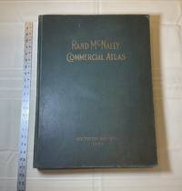
1929028276Chicago: Rand McNally & Company 1929. Good condition. Tears and creases to the title page. Vertical and corner creases up to page 6. SEE PHOTOS. Includes double page full color maps and other maps printed in yellow red and black. SEE PHOTOS. The double page maps open to an impressive 27.75" across. Contents: Part I: The World pp.4 - 23; Part II: The United States pp. 24 - 481; Part III: Foreign Countries pp. 482 - 537; Supplementary Maps: Canada Mexico China and Japan Polar Regions pp. 538 - 550. Bound in the original gilt-stamped green cloth. Oversize Hardcover. 15.50" wide by 20.75" tall by 2.25" thick at the spine. This massive extremely heavy book will require SUBSTANTIAL extra postage at our cost based on your locatuion. Sixtieth Edition 60th edition. Oversize Hardcover. Good condition. Illus. by NOT a library discard. 550 pages. Great Packaging Fast Shipping. Rand McNally & Company Hardcover
1892016610Chicago and New York: Rand McNally & Company 1892. Very Good condition but for short tears at 3 or 4 of the map folds which have been neatly reinforced with archival tape on the blank side. SEE PHOTOS. A very attractive well preserved copy. 60 pages of text including brief information on 78 railroads a detailed 39-page index and ads for Rand McNally publications. Attached at the rear is a full color map that unfolds to 13'' wide by 21" tall. Bound in the publisher's tan-color stiff printed wraps. Cover title: Rand McNally & Co's Indexed County and Township Pocket Map and Shippers' Guide of New Jersey Showing in Detail the Entire Railroad System The Express Company Doing Business over Each Road and Accurately Locating All Cities Towns Post Offices Railroad Stations Villages Counties Islands Lakes Rivers etc Locating the Nearest Mailing Point of All Local Places; Designating Telegraph Stations Population is Given According to the Latest Official Census" i.e. 1890. 1st ed No additional printings listed. Stiff card covers. Very Good condition. 60 pages a full color fold-out map. Rand McNally & Company Paperback
1929013898New York Chicago San Francisco: Rand McNally & Company 1929. 1929 edition No date on title page; 1929 on copyright page; no other printings listed. Very Good condition. 11.25" wide by 14.25" tall. Inner hinges are perfectly sound. Pages are clean and unmarked. Illustrated green endpapers feature scenes labeled Occident/Orient. First blank page has one vertical crease. Contains more than 125 pages of full-color maps. This 1929 edition is apparently quite scarce. Bound in the original dark green cloth lettered in gold on the front cover. Keywords: Atlases Map Reference Geography Maps. 1st ed No additional printings listed. Oversize Hardcover heavy. Very Good condition/No jacket probably as issued. 279pp. Rand McNally & Company Hardcover
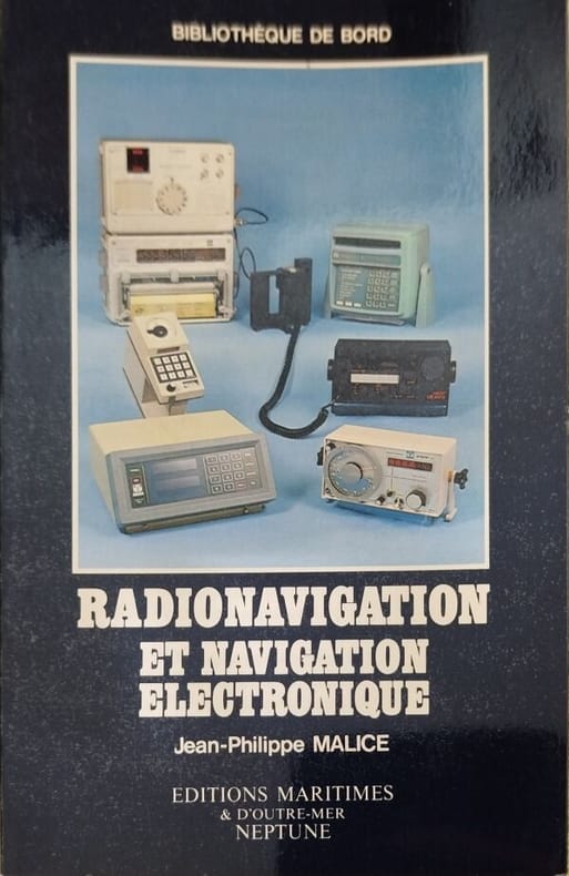
19819121Editions Maritimes & d'Outre-Mer Neptune 1981 191 pages in8. 1981. broché. 191 pages.
196961 grande carte en couleurs de 40 sections entoilées de 143 x 143 cm. Léger état d'usage sinon très bon état d'occasion.
Incisione all'acquaforte con dim. L. 59,5 x 53 cm. (impronta del rame L. 57,8 x 50 cm.). In basso a sinistra, entro cartiglio, titolo: Raconisium. Ser.mi Emanuelis Philiberti a Sabaudia Cariniani Principis Oppidum... e legenda dei luoghi con 14 rimandi numerati; in basso a destra la numerazione della tavola: LIV... - Condizioni generali buone malgrado qualche piccolo alone. Tavola LIV appartenente all'Edizione del 1725 del THEATRUM SABAUDIAE (Theatrum Statuum Regiae Celsitudinis Sabaudiae Ducis Pedemontii Principis Cypri Regis).
IN 16°, pp.VIII + 372, RILEG.IN MEZZA TELA RECENTE, CON TASSELLO IN PELLE E TITOLO IN ORO. MANTENUTA LA COPERTINA ORIGINALE. OPERA INTERESSANTE DELLA DIREZIONE CENTRALE DEGLI AFFARI COLONIALI SULLA CARTOGRAFIA AFRICANA.<BR>OTTIMA CONSERVAZIONE.
Foglio di cm. 60x56,8. fiumi in azzurro, rilievi ocra. Indica: strade rotabili, a fondo naturale, carovaniere, mulattiere, sentieri, passaghgi difficili, linea telegrafica telefonica, località con acque perenni abbondanti, , non abbondanti, non perenni, abitato, rovine, tombe, cimiteri, Chese, Conventi, campi di fortuna per aerei, fortini, località adatte ad accampamento, acacie, euforbie, palme, bambù, sicomori.
(Codice OS/0104) In 8° (25,5 cm) VIII-427 pp. Avec 132 figures et une planche rempliée. Broché, très bon état. ~~~ SPEDIZIONE IN ITALIA SEMPRE TRACCIATA
8°, pp. 47, brossura editoriale illustrata, titolo al piatto, disegni di Mino Maccari a piena pagina, alcune tabelle, esemplare molto buono. Ex libris privato applicato al contropiatto
8°, pp. 109, alcuni disegni nel testo. Brossura editoriale illustrata con mancanza, titolo al piatto e dorso. Giro umoristico di Lecco in 13 rioni e diverse puntate sul centro, con stampe originali dell'epoca su disegno dell'architetto Ugo Sacchi. Presentazione di A. Pedrone. Buono
Proveniente da : "Atlas novus sive tabulae geographicae totius orbis faciem, partes, imperia, regna et provincias exhibentes, exactissima cura juxta recentissimas observation. aeri incisae et venum expositae a Matthaeo Seutter chalcogr". Prima edizione.
Folding coloured map on cloth measuring 24.0 x 35.0 ins (approx. 61 x 89 cms) folding in 16 panels to 12.5 x 5.0 ins (approx. 32.0 x 13 cms); printed card covers, a very good, bright, clean copy. With small institutional stamp on front cover and inner wrapper [only]. The cover is Ellis Martin's 'Medallion Royal Arms' with blue border and location map, in long format. The generic form of this design became the first standard post-war OS cover. The survey is based on the full revision of 1920 with later corrections. Browne, 96.2.a.
Folding coloured map on cloth measuring 24.0 x 35.0 ins (approx. 61 x 89 cms) folding in 16 panels to 12.5 x 5.0 ins (approx. 32.0 x 13 cms); printed card covers, a very good, bright, clean copy. With small institutional stamp on front cover and inner wrapper [only]. The cover is Ellis Martin's 'Medallion Royal Arms' with blue border and location map, in long format. The generic form of this design became the first standard post-war OS cover. The survey is based on the full revision of 1923 with later corrections. Browne, 96.2.a.
Folding coloured map on paper measuring 24.0 x 35.0 ins (approx. 61 x 89 cms) folding in 16 panels to 12.5 x 5.0 ins (approx. 32.0 x 13 cms); printed card covers, a very good, bright, clean copy. With small institutional stamp on front cover and inner wrapper [only]. The cover is Ellis Martin's 'Medallion Royal Arms' with blue border and location map, in long format. The generic form of this design became the first standard post-war OS cover. The survey is based on the full revision of 1921 with later corrections. Browne, 96.2.a.
Amsterdam, 1630 circa. Dal “Theatrum Orbis Terrarum”, incisione in rame, colore d'epoca, cm 42 x 52,3 (alla lastra) più margini, testo francese al verso. Stemmi laterali. Diffusi aloni ai margini, difetti e fioriture agli angoli superiori.
Firenze, 1998, 8vo stralcio con copertina posticcia muta, pp. 687/692 con 2 carte a colori. - !! ATTENZIONE !!: Con il termine estratto (o stralcio) intendiamo riferirci ad un fascicolo contenente un articolo, completo in se, sia che esso sia stato stampato a parte utilizzando la stessa composizione sia che provenga direttamente da una rivista. Le pagine sono indicate come "da/a", ad esempio: 229/231 significa che il testo è composto da tre pagine. Quando la rivista di provenienza non viene indicata é perché ci è sconosciuta. - !! ATTENTION !!: : NOT A BOOK : “extract” or “excerpt” means simply a few pages, original nonetheless, printed in a magazine. Pages are indicated as in "from” “to", for example: 229/231 means the text comprises three pages (229, 230 and 231). If the magazine that contained the pages is not mentioned, it is because it is unknown to us.
Cartellina editoriale contente la carta conservata in ottimo stato.
<br/> TITOLO: Périodicité des grands déluges résultant du mouvement graduel de la ligne des apsides de la Terre. Théorie prouvée par les faits géologiques. Deuxième Ed. revue, augmentée et enrichie de deux cartes.: L'Europer antédiluvienne et la rupture de l'Isthme du Pas de Calais.<br/> AUTORE: Le Hon,H. (le capitaine).<br/> EDITORE: Dunod, Lacroix Van Meene et Cie Ed.<br/> DATA ED.: 1861,<br/> C
<br/> TITOLO: Périgord. Noir, Blanc, Vert, Pourpre... et les autres. <br/> AUTORE: Daney,Charles.<br/> CURATORE: Photographies Régine Rosenthal. Testo in francese.<br/> EDITORE: La Renaissance du Livre<br/> DATA ED.: 2002,<br/> EAN: 9782804606855
Francia, 1732 - 1746 circa. Tratta dal “Recueil de plusieurs plans des ports et rades et de quelques cartes particulières de la Mer Mediterranee" par Jacques Ayrouard pilote Real avec privilege du Roy. Incisione in rame all'acquaforte, b/n, cm 30,5 x 46 circa (alla lastra) più margini. Disegnata dal Ayrouard e incisa dal Corne, alcuni piani di Punti, Capi, Porti e Fanali del Mediterraneo tra cui quelli di San Remo, Oneglia, Albenga, Noli, Savona, Genova, Sestri Levante e Cinque Terre; si segnalano scandagli, pericoli per la navigazione e ancoraggi che si trovano lungo la costa. Poco si sa su Jacques Ayrouard, il quale pubblicò solo questo libro sui porti del Mediterraneo. Era un navigatore per la Marina Reale francese e dedicò il suo lavoro a Jean Federico Phélypeaux Comte de Maurepas, che fu Ministro della Marina per Luigi XV. Leggerissimo sfondo di inchiostratura, un leggero aloncino in prossimità dell'angolo in basso a sinistra, ottimo stato di conservazione.
IN 8, pp.40 + VII CARTE + v.r.f.t. CON LE SEZIONI DEL QUADRO D'UNIONE DEI FOGLI DELLA CARTA DEL REGNO D'ITALIA ( OMESSA LA VI SEZIONE ) + c.2 CON LE AGGIUNTE E VARIANTI AL TESTO DEL CATALOGO GENERALE DELLE PUBBLICAZIONI, EDIZ. GENNAIO 1939 V- XVII.<BR>SITUAZIONE AL 1°GENNAIO 1941 - XIX. COPERTINA EDITORIALE ILLUSTRATA A COLORI CON TITOLO. OTTIMA CONSERVAZIONE. ID 4302
IN 4°, pp.41+1 c.SCIOLTA CON LE AVVERTENZE. NUMEROSE FIGURE INTERCALATE NEL TESTO e f.t. in b/n/col. COPERTINA EDITORIALE ILLUSTRATA CON STEMMI E LA VEDUTA<BR>PANORAMICA DI FIRENZE. CON TITOLO. INTERESSANTE CATALOGO DELL'I.G.M. DI CARTE,STAMPE E LIBRI,CON APPROVAZIONE DEL MINISTERO DELLA GUERRA.<BR>OTTIMA CONSERVAZIONE. ID 458