2 675 résultats
190261457San Francisco CA: The History Publishing Co. 1902. Thick folio. 11 x 13.5 in. 545 3 31 1 xiii 1 pp. Extra-illustrated title text illustrations plates rubricated initials photogravure plates preserving tissue guards rubricated initials and more throughout. Full calf on beveled boards cover decoration & ornament embossed in blind on front cover gilt lettering stamped on front cover & spine gilt inner dentelles a.e.g. expertly rebacked w/ original spine laid-back down minor repairs to corners endpapers renewed ink markings & annotations on a few pages still a VG- tight and sound copy of this very heavy tome. First edition of this lavish production detailing the founding and growth of Freemasonry Lodges in the Oregon Washington Idaho & Montana Territories and later States including specific biographical details of key personnel. The weighty work opens with a narrative of the origins of Freemasonry the Scottish Rites and the Knights Templar as well as the rise and progress of the Mystic Shrine and Eastern Star. In 1846 7 Freemasons organized and petitioned the nearest lodge in Missouri for a charter granted for the Multnomah Lodge No. 84 in the same year. The first Masonic lodge in Washington was located in Olympia in 1853 while still part of the Oregon Territory. The History Publishing Co., hardcover
4013Los Angeles California:: The Company Copyright 1912 by D. W. Pontius. Corrected to November . Single sheet printed on one side only 19 23 7/8 inches folded to 9 6 1/8 inches OCLC shows two holdings at the Family Library in Utah. There are a small number of holdings for each of the updated maps. [Los Angeles, California:: The Company], Copyright 1912 by D. W. Pontius. Corrected to November, ,. unknown
186854075New York: John W. Amerman Publishers No. 47 Cedar St. 1868. 8vo. 17 3 pp. Very light salmon-coloured printed softcovers slight shelfwear NF copy. First edition of this informative work providing a concise history of the United States legal claims to the Oregon Territory detailing the efforts of missionaries such as Whitman and Perkins the fur growth of the fur trade the Whitman massacre by the Cayuse as well as extolling the tremendous economic potential of the West Coast. He makes specific mention of the newly constructed Transcontinental Railroad and the tremendous advantages this provided in transporting the mineral timber and agricultural production East. He also notes the purchase of Alaska the tremendous fisheries and the potential sources of wealth. Not in Smith Graff or Wickersham. John W. Amerman, Publishers, No. 47 Cedar St., paperback
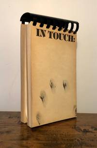
197610647Portland OR: Portland Center for the Visual Arts 1976. First Edition. Comb-bound. Near Fine. Seminal collection of 54 works by Northwest artists individually printed on thick cardstock 4.5" x 7 1/18" each printed rectos only. One page introduction by the Director of the exhibition Mary L. Beebe and a 15 page essay by Lippard titled "The Rites of a Passage" both printed on same thick cardstock. Laid in is a 8.5" x 14" description of works by Dennis Evans aka "Ubu Waugh" titled "Waughs Laws." Leaf edges a tad age-toned former owner name on inside front cover that of Cathy Hillenbrand art collector and publisher of the Real Comet Press; in sum a well preserved copy. Lippard's essay is a longer version of an article that appeared in a 1976 issue of Art in America. Many of the artists were associated with Seattle's and/or gallery sic; some of the Seattle artists include Gaylen Hansen Judy Lerner Brice Dennis Evans/Ubu Waugh Kim Hoffman Carolyn Law Michael McCafferty Barbara Horosko-Manderbach Richard Yoder Sherry Markovitz et al. A handsome catalog. Portland Center for the Visual Arts unknown
189253290Portland OR: Lewis & Dryden Printing Co. Oct. 1st 1892. Oblong folio. 200 pp. Colour chromolithograph frnts. of the Oregonian building 100s of photos 1 large double-page panorama of Portland OR maps illusts. Original embossed burgundy calf lettered & illustration in gilt on front cover by Meston-Dygert Book Manufacturing Co. expertly rebacked ffep. renewed still a VG copy with very bright gilt image on front cover. First edition of this scarce souvenir album intended to promote the history and economic strength of the Pacific Northwest and to extoll the virtues of Portland. The editors have includes 100s of photos and information about Portland buildings persons of interest sporting areas mountain climbing on Mt. Hood natural landmarks logging orchard farming shipping lines on the Columbia and Willamette industries and more. Of interest are the extensive sections on Washington state cities industries and more. There is also a small section on Idaho including Boise. Lewis & Dryden Printing Co., unknown
19701294Stoughton Massachusetts: Western Hemisphere Inc. MCMLXX 1970. - 1970. Limited Edition. Hardcover Half Leather. Fine Condition/Fine. Western Hemisphere Inc. MCMLXX 1970. - Stoughton Massachusetts 1970. Limited Edition. Fine Condition/Fine. Fine Bindings Signed by persons connected with book. Fine Condition in a Fine slipcase. Frontispiece illustrations 2 maps - one folding map at rear index. This is Number 21 of a Special Edition Limited to 100 copies & signed by the editor. - Designed by Lawton Kennedy. Size: Large Quarto 9 x 11-1/2. 389 pages. Item Type: Fine Bindings . Quantity Available: 1. Category: History; Western Americana::General; California; United States; 19th century; Americana; Natural History & Resources. Signed by persons connected with book. Library of Congress No: 7187921. Pictures of this item not already displayed here available upon request. Inventory No: 001294. Western Hemisphere, Inc., MCMLXX, (1970). - hardcover
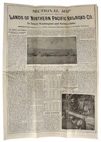
189546744St. Paul MN: s.i. 1895. Very Good. St. Paul MN: s.i. 1895. Land map folded into a bi-fold informational pamphlet 90x95 cm; 23x11 cm; 9 unpaginated panels. All panels generally toned and creased as expected with minor rubbing to extremities and one closed tear to top edge of map along middle fold. Overall a Very Good or better example. <br /> <br /> An information-packed pamphlet for farming colonists looking for "healthful and pleasant living" in the Pacific Northwest; folds out to a map of the region and available land advertised at $3 to $10 an acre which could be bought from the Northern Pacific Railroad Company. Rail tickets could be purchased following the "Yellowstone Park and Dining Car Route" which also offered "Free Colonist Sleeping Cars" and 150 pounds of baggage carried for free on each full fare. s.i. unknown
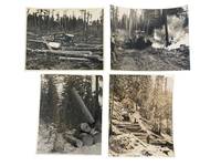
1920233311920. Logging Pacific Northwest logging industry photo archive documenting systems of timber extraction in Oregon Washington and Northern California during the early twentieth century illustrating how camps moved logs through cutover ground snowbound slopes skid roads and mechanized loading sites. The prints show the sequence of logging work: clearing hauling lifting sorting and burning slash as part of industrial forest production across the western lumber belt.<br /> <br /> Photo archive of 4 large silver gelatin photographs each approximately 8 x 9.5 inches Northern California Oregon and Washington circa 1920s-1940s. One photograph shows a jammer raising a massive log while a worker stands in the foreground with peavey in hand and freshly cut rounds stacked beside the machine; the verso reads "Jammer bringing in W.P. log / Park River Lbr. Co." Another records winter logging on a steep snow-covered hillside where a horse team and two workers move timber down a built log road; the verso notes "I-20 / winter logging at camp 23 PFI / 1019-CL." A third shows a bulldozer amid a broad cutover tract strewn with felled trunks and stumps emphasizing road building and ground clearing after cutting. The fourth captures active burning in the forest with smoke rising around a dozer and a handwritten verso caption reading "Burning out skid road with dozer." Captions include "PHOTO FROM / WESTERN PINE ASSOCIATION / Yeon Building Portland 4 Oregon / PLEASE RETURN" stamps a Rognon Studio Westwood California stamp and a Haas Brown Seattle studio mark preserving the circulation history of the prints within western forestry and commercial photography networks.<br /> <br /> These photographs come from the period when Pacific Northwest logging shifted across overlapping systems of machinery camp roads and organized slash disposal concrete evidence of how western timber companies converted forest land into transportable lumber under changing technological conditions. Creasing to corners and minor loss at corner margin on one image. Overall clear and sharp very good condition. The photographs preserve the working sequence of regional resource extraction and the transformation of forest landscapes in the Pacific Northwest. unknown
4014San Francisco:: The Company. 4to brown pebbled cloth black leather spine and tips; company’s name on front cover in gilt as well as “Earl V. Burkeâ€. Six-month run of an in-house organ of a company that provided large advertising cards used in electric street cars on the West Coast. It was published every Saturday and did not have a set number of pages per issue. Paging is erratic and at a certain point there are two numbering systems: one typed at the head of the page at one point dropping some 20 pages and the other rubberstamp numbering at the point of error to the end.The masthead to each issue has the following text: “The coaster is issued every Saturday for the exchange of ideas and news between our offices. It must not be circulated outside of our Organization. Contributions desired for publication should each San Francisco Office not later than Thursday of each week. If you benefit by reading the articles of others in the coaster you should reciprocate by letting us have some of your own ideas.The text is a mixture of social news: happenings in the various branches; retirements; encouraging rhetoric and express business instructions on the placement of cards some are returned to the client after the agree and instructions for ordering supplies.The first issue of this volume contains two pages outlining the United States eminence in many fields. With only 6% of the world’s population and 7% of the land the United States produced in 1920: 25% of the agricultural supplies; 40%of the mineral products; 34% of the manufactured goods.Earl Vincent Burke 1885–1963 was a graduate of UC Berkeley and is listed in the 1930 census as “Business Manager Advertisingâ€. He was a member of the Book Club of California; John Henry Nash printed an invitation for Burke’s lecture at the San Francisco Public Library on Master Printers. By the 1949 census he and his wife both listed themselves as “Free Lance Writersâ€. San Francisco:: [The Company],. hardcover
56-0322San Francisco Calif.: Southern Pacific Company 1949. Map. Blueline print 20" x 50" with red pencil indicating interchange points. From San Bruno to Fort Mason and Yerba Buena Island to Colma. Includes Index to Industries with approx. 700 listings locations indicated on map by both number and grid indices. Scale 1" = 1600'. San Francisco, Calif.: Southern Pacific Company, 1949. unknown
58-0509San Francisco Calif.: Southern Pacific Company 1948 rev. 1960. Blueline print 34 inches x 67 inches. From Port of Sacramento at Lake Washington to Watt Avenue Sutterville Road to Arcade Boulevard. Includes station points Mikon Washington Elvas Brighton Ramona Perkins Swanston Haggin Ben Ali. Includes Index of Industries with approx 500 industries listed. Scale 1 inch = 1000 feet. San Francisco, Calif.: Southern Pacific Company, 1948, rev. 1960. unknown
56-0328San Francisco Calif.: Southern Pacific Company 1950. Map. Blueline print 42" x 73". From French Camp to Calaveras River and San Joaquin River to US 99/Manteca Road. Includes Index to Industries wiith approx 250 listings. Scale 1" = 800'. with insert showing Rough and Ready Island scale 1" = 2000'. San Francisco, Calif.: Southern Pacific Company, 1950. unknown
58-0510San Francisco Calif.: Southern Pacific Company 1948 rev. 1960 switching zones and limits approved 1962. Blueline print 34 inches x 67 inches. Colored pencil indicates switching zones and limits. From Port of Sacramento at Lake Washington to Watt Avenue Sutterville Road to Arcade Boulevard. Includes station points Mikon Washington Elvas Brighton Ramona Perkins Swanston Haggin Ben Ali. Includes Index of Industries with approx 500 industries listed. Scale 1 inch = 1000 feet. San Francisco, Calif.: Southern Pacific Company, 1948, rev. 1960, switching zones and limits approved 1962. unknown
56-0243Denver Colo.: The Weiland Engineering Co. 1930. Insets and notes 1937 1940. Map. Blueprint 41.5" x 51". Some tape on face some tearing no missing material. Map of Nogales within city limits. With additional engineering and survey notes and official approval notation by mayor and city hall. Zones labelled. Scale 1" = 200'. Denver, Colo.: The Weiland Engineering Co., 1930. Insets and notes, 1937, 1940. unknown
58-0511San Francisco Calif.: Southern Pacific Company 1950. Blueline print 34 inches x 67 inches. From Sacramento City Park beyond Marconi Avenue and Auburn Boulevard along railroad tracks. With Rancho Del Paso station points Swanston Haggin Benali. Includes Schedule of Property listing 18 transfers 1865-1950. Scale 1 inch = 400 feet. San Francisco, Calif.: Southern Pacific Company, 1950 unknown
56-0375Los Angeles Calif.: Southern Pacific Company 1942 revised 1962. Map. Blueline print. 24 x 91 inches. Light scuffmarks. Along San Fernando Road from Kellogg Avenue to Goodwin Avenue. Includes Los Angeles Channel Ralph's Grocery Co Cinch Products Stires Drill California Zonolight Co. With Schedule of Property listing approx 15 transfers 1925-1942. Scale: 1 inch = 100 feet. Los Angeles, Calif.: Southern Pacific Company, 1942, revised 1962. unknown
56-0469Stockton Calif.: Southern Pacific Company 1928 rev. 1941. Blueline print 24 inches x 13 feet. Three maps joined securely. From 3400' west of First Street Los Banos to 3000' east of Abatto along railroad tracks. With 6" tear no missing material. Details of all industries along railroad tracks. Including Los Banos Lumber & Supply Co Standard Oil Co Central California Creameries. Scale 1" = 100'. Stockton, Calif.: Southern Pacific Company, 1928, rev. 1941. unknown
58-0496San Francisco Calif.: Southern Pacific Company 1918 rev. 1945. Blueline print 24 inches x 47 inches. From Aqua station beyond South San Francisco to 3rd & Townsend Station Visitacion to Daly City. Includes track plans for South San Francisco Visitacion San Francisco Cemetaries. Scale not indicated. San Francisco, Calif.: Southern Pacific Company, 1918, rev. 1945. unknown
42679Printed by: Detroit Rotary Gravure Co Nd. 1940. Artist Unknown printed size: 68.5x 55cm 25.5"x 21.5" Original B/W gravure photograph usual toning but a good clear image some slight chipping on the bottom margin not affecting the image without glass matt is present but is acidic and should be replace the mahogany stained oak frame has Canadian Pacific in block letters on the bottom of the frame. Printed by: Detroit Rotary Gravure Co, Nd. [1940?] unknown
2004x-0415280567Curzon Pr 2004. Hardcover. New. 1st edition. 288 pages. 9.25x6.25x1.00 inches. Curzon Pr hardcover
1999x-041517886XRoutledge 1999. Hardcover. New. 1st edition. 255 pages. 8.50x5.50x1.00 inches. Routledge hardcover
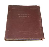
19434384Southwest Pacific: Directorate of Intelligence 1943. Quarto red cloth binder viii approximately 167 pp. odd pagination illustrated with tables and diagrams and a map. Binder cloth worn preliminary leaf shows signs of insect bites on bottom and top left corner otherwise a good copy. Pilot instruction manual belonging to a man named G. Erickson matricule: 413558. 3 additions were made to this manual on February 26th 1945 March 5th 1945 and April 1st 1945 respectively.</p> <p>This manual is divided into seven parts: handling of information enemy aircraft own aircraft shipping interrogation and reporting general and references. Directorate of Intelligence unknown
1953ZB573181Noumea: South Pacific Commission 1953-1959. volumes 3 through 9 an uninterrupted run of complete volumes pam bound original paper wrappers preserved illustrated ex library overall very good. - If you are reading this this item is actually physically in our stock and ready for shipment once ordered. We are not bookjackers. Buyer is responsible for any additional duties taxes or fees required by recipient's country. Photos available upon request. Noumea: South Pacific Commission unknown
56-0366Portland Ore.: Commission of Public Docks 1935. Map. Blackline print 23" x 49" with multicolor shading indicating switching zones. From meeting of Williamette and Colombia to eastern city boundary Linnton District to Vancouver Washington. With index to Port facilities approx 70 listings of docks grain elevators shipping industries and misc. industries using Harbor frontage. Scale approx 1" = 1700'. Portland, Ore.: Commission of Public Docks, 1935. unknown
56-0365Portland Ore.: Commission of Public Docks 1924. Map. Blueline print 23" x 49" with multicolor shading indicating switching zones. From meeting of Williamette and Colombia to eastern city boundary Linnton District to Vancouver Washington. With index to Port facilities approx 75 listings of docks shipping industries and misc. industries using Harbor frontage. Scale approx 1" = 1700'. Portland, Ore.: Commission of Public Docks, 1924. unknown