The Grand Trunk Pacific Railway CompanyBiblio.com
6 262 résultats
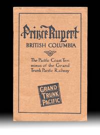
19114499Montreal QC: The Grand Trunk Pacific Railway Company 1911. Paperback. Fine. With "Fourth Edition April 1911" printed at foot of the "Announcements" page giving a good indication of the amount interest that the new terminal town and surrounding areas were generating at the time. Includes two fold-out maps one tipped in at title page and the other a real lithographic beauty and excellent promotional map is in color and tipped in at the rear with an additional two insert maps in it's corners. Both maps are in very fine condition. Brown printed wraps 8vo size 9.25 inches tall pp. 24 illustrated w. B&W photo reproductions showing the current stage of development of the town harbor and their surrounds with some images dated "September 1910" table of summit elevations and rwy grades on verso of terminal leaf. Volume w. a touch of rust to staples one leaf w. two light creases and a 1/4 inch closed tear at fore-edge else clean and unmarked throughout. The large color map at rear 33.5 x 26 inches wide is titled "Map Of The Grand Trunk Pacific Railway In British Columbia Showing Terminus At Prince Rupert" plate mark "4824" at lower left and has a copyright date of 1907 by Poole Bros. An additional date of "4-10-'11" is printed at the lower edge matching the pub. date of "Fourth Edition April 1911" printed on the "Announcements" page. These matching dates would have confirmed for potential investors and settlers that the map and pamphlet had the most up to date information available at the time. The two insert maps are "Map Of Price Rupert And Vicinity" and "Latitude Map". The frontis map 9x17 inches wide is titled "General Plan for the Development of Prince Rupert B.C. and was executed by Brett & Hall Landscape Architects Boston who used "City Beautiful" principles with success in Smithers and Fort Prince George as well. Evidently most of the Prince Rupert today is based upon this Brett & Hall plan. OCLC finds no copies of this 1911 edition of this GTPR pamphlet. Rumsey's copy of the large color map lacking the pamphlet and the frontis map is dated "3-28-'10 The Grand Trunk Pacific Railway Company paperback
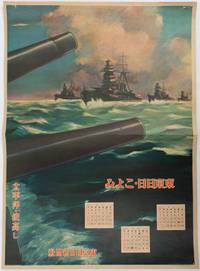
1619176888東京. Tokyo.: 東京日日新聞社. Tōkyō Nichinichi Shinbunsha. Showa 16 1941. Colour poster from a 1941 calendar. 53.5 x 38.5cm small holes at corners central horizontal fold. Some light even browning but overall a striking WWII image from a Japanese calendar. This colour illustrated calendar shows the months of March April and May 1941. The illustration features four Japanese war ships at sea with two naval guns in the foreground. The calendar is titled "Rough Sea on the Pacific Ocean". The implication being military threats are coming from across the Pacific. . 東京日日新聞社. [Tōkyō Nichinichi Shinbunsha]. unknown
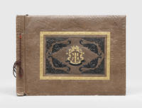
1940182459Manila: 1940s. A graphic album showing fighting in the Philippines the Marshall Islands Papua New Guinea Guam the Solomon Islands and Palau. The compiler chose to include violent images displaying the brutality of the campaign. The album opens with portrait shots of individual Marines or groups along with photographs of American encampments and ships. The scenes then turn more distressing with images of dead locals including children lying on the beach or next to tanks. The photographs were taken across the Pacific theatre: one shows an American soldier holding a flame-thrower on Kwajalein Atoll another shows a beach landing at Luzon and a third shows a Marine posing next to a sign in Bougainville. Most were taken in the final years of the conflict including at Guadalcanal and Peleliu. There are also shots of the end of the war one showing a Japanese soldier surrendering with a white flag and another showing Japanese prisoners of war in a camp in Guam. The final photograph is the most famous "Raising the Flag on Iwo Jima" showing six Marines raising the US flag on Mount Suribachi during the Battle of Iwo Jima. This photograph won the 1945 Pulitzer Prize for Photography. The majority of the photographs are commercial with a few opening portrait shots of the unidentified compiler. Oblong folio 286 x 390 mm. With 55 gelatin silver photographs one lacking approximately 90 x 130 mm landscape or portrait corner-mounted with tape recto and verso on 7 leaves remainder blank. With 2 additional gelatin silver photographs loosely inserted. Contemporary brown sheep commercial album tied through punched holes with brown cord front board stamped with central armourial panel in blind gilt and black. Boards chipped at extremities especially front board bottom left corner rear board rubbed leaves nicked at fore edge photographs moderately toned and creased some slightly torn and abraded: a good example. hardcover
Decorativa carta geografica pubblicata in The Illustrated Atlas, And Modern History Of The World Geographical, Political, Commercial & Statistical… edito da John Tallis. Le mappe del The Illustrated Atlas non solo fornivano conoscenze geografiche aggiornate, ma utilizzavano anche viste a vignetta all'interno del disegno per mostrare i popoli nativi e le loro occupazioni, le città e i punti di interesse. Le mappe si rifanno alla tradizione cartografica dei cartografi olandesi del XVII secolo, con bordi decorativi finemente incisi. Le tavole sono state disegnate e incise da John Rapkin con vedute realizzate da una serie di artisti di spicco. Le mappe furono pubblicate in volume completo dal 1851 fino al 1865 circa. Alcune delle mappe furono pubblicate anche in altri libri di storia pubblicati da Tallis, tra cui quello sulle British Colonies e, senza le vignette, in dizionari geografici ed enciclopedie fino al 1880 circa. John Tallis (1817-1876) era un editore di mappe britannico. Nato nelle Midlands, Tallis arrivò a Londra negli anni '40 del XIX secolo. Tallis iniziò la sua carriera londinese con una serie di notevoli vedute stradali di Londra. Iniziò una collaborazione con un certo Frederick Tallis, forse suo fratello, ma la loro collaborazione terminò nel 1849. In occasione della Grande Esposizione del 1851, Tallis pubblicò il The Illustrated Atlas. Le mappe furono successivamente ristampate dalla London Printing & Publishing Company, che lasciò intatta l'imprint di Tallis, assicurandogli così una fama duratura. Incisione su acciaio, coloritura dei confini all'acquarello, in ottime condizioni. Islands outlined with gold and surrounded by illustrations of Auckland, Mount Egmont, a New Zealander, and the port of Wellington. Border in a New Zealand motif. Decorative map taken from The Illustrated Atlas, And Modern History Of The World Geographical, Political, Commercial & Statistical by John Tallis The maps from The Illustrated Atlas were first published in serial form to a target audience that led insular lives due to the expense and hardship of travel. All that changed as the progress of the nineteenth century brought swift and dramatic changes in public awareness of far away places. Tallis' maps no doubt played an important role in this dramatic awakening. These maps not only provided up-to-date geographical knowledge, but also used vignette views within the map's design to show the native people and their occupations, cities and points of interest. The maps hark back to a cartographic tradition from the Dutch mapmakers of the seventeenth century with finely engraved decorative borders. The maps were drawn and engraved by John Rapkin with views drawn and engraved by a number of prominent artists. The maps were issued as a complete volume from 1851 until about 1865. Some of the maps were also published in other history books published by Tallis including British Colonies and, without the vignettes, in geographical dictionaries and encyclopedias until about 1880. John Tallis (1817-1876) was a British map publisher. Born in the Midlands, Tallis came to London in the 1840s. Tallis began his London career with a series of remarkable London street views. He began a partnership with a Frederick Tallis, possibly his brother, but their collaboration ended in 1849. For the Great Exhibition of 1851, Tallis published the Illustrated World Atlas, one of the last series of decorative world maps ever produced. The maps were later reissued by the London Printing & Publishing Company, who left the Tallis imprint intact, thus ensuring his enduring fame. In 1858, he began publication of the popular Illustrated News of the World and National Portrait Gallery of Eminent Personages, selling it in 1861 (it ceased publication in 1863). Engraving, hand-coloured outlines, in very good condition.
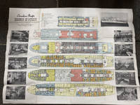
194849014Montreal Canada & Liverpool UK: Canadian Pacific n.d. ca 1948. ca 1948. First edition. Double Atlas Folio. 30 3/4" x 41" folded to 5 1/4" x 10 1/4." Illustrated on recto and verso with 6 large color deck plans delineating decks amenities cabins for first class and tourist class passengers together with black and white photo illustrations. Scarce deck plan for the Empress of Canada SS Duchess of Richmond and the Empress of France SS Duchess of Richmond after the two 20400 tons ocean liners had been refitted following World War II. Initially launched as the "Mini-Empresses" but also referred to as the "Drunken Duchesses" as they tended to roll in heavy seas. They were designed to allow travelers to sail further up the St. Lawrence River to Montreal as well as to those wishing to travel into the Great Lakes. The ships were fitted with enough capacity to hold 400 first class passengers and 300 tourist class passengers. The ships entered service from Liverpool to Montreal in July 1947 and September 1948 respectively. Sadly the Empress of Canada caught fire in 1953 and after re-floating was scrapped in Italy the following year. The Empress of France was refitted in 1958/1959 and continued to sail until retired in 1960. Some age toning slight closed tear at one fore-edge and with creasing at folds. Very good. Canadian Pacific, n.d. [ca 1948]. unknown
18851099Chicago: Geo. F. Cram 1885. Good plus. Large folding pamphlet approximately 20 x 41.5 inches. A few small chips and short closed tears at edges; several short separations and very minor losses along folds. Contemporary agent's ink stamp on cover panel. Tape repair across portion of horizontal fold; one panel with patches of light staining. A scarce colorful promotional for the Rock Island Route as well as its national and international connections with a fascinating stamp of an Australian sales agent. One side of the sheet prints an extensive promotional text and timetables for the various routes and services of the Chicago Rock Island & Pacific Railway. The main side of the sheet prints a map of the United States with state borders shaded in four colors highlighting the principal routes of the Rock Island from Chicago to Minnesota Iowa and Kansas and its connections to points on both the East and West Coasts. An inset map at lower right promotes the Rock Island as part of a transcontinental route between the United Kingdom Ireland and Australia. Most interestingly this copy is stamped on the cover panel with the information of a George. H. Hibbard "Australian Passenger Agent America's Cons'd Trans-continental Railways 6 Bridge Street Sydney N.S.W." Hibbard was evidently the agent in charge of distributing information about the trans-America route in Sydney one of its end points.<br /> <br /> Several issues of this map were published during the 1880s all scarce. We locate copies of the present 1885 issue at Stanford SMU and the Library of Congress. Geo. F. Cram unknown
18571004304to 11 ½ x8 ¾ original law calf morocco illustrated 4 134 85102 114 2 iv 64 pp. Some scuffing and wear to covers slight gouge to front joint chipping to edges. Two plates detached one with a chipped corner. Overall very good. Organized by the War department under the direction of Jefferson Davis who was Secretary of War at that time a collection of volumes was produced in the quest for the best route for a railroad to the West. Jefferson Davis wrote part of the introduction to this series and outlines the goals of the project. This report is on routes explored in Northern California and Oregon. Specifically the expedition was to look for a railroad route crossing the Sierra Nevada near the source of the Carson River and to see if it was feasible to connect the Sacramento valley with the Oregon Territory. Most of the color plates in this volume are located in the first three parts of the publication which is focused on topography geology and botanical subjects. This volume includes 23 color lithographs of scenery and botanical subjects 2 hand colored plates of birds and 24 steel engraved plates. Wagner-Camp 264a. Beverly Tucker, unknown
18561006214to leather spine and tips with marbled boards 36 Illustrations include 21 tinted/color lithographs one folding diagram two folding maps and a couple of black and white plates 36 14 136 127 175 pp. Binding with some wear at the spine and extremities hinges cracked some pages are a bit loose plates all present but probably not bound in correct order folding maps have a few tears some staining to front endpapers but not into the balance of the text plates and text show some aging foxing and browning but most plates resonably are clean. One of the great sources of information on the west the Pacific Railroad Reports also contains some great illustrations. This installment Vol. III is no exception. Included are some interesting and colorful pictures of the Mojave Indians and their territory. This report contains intelligence on an expedition near the 35th parallel which took the southern route due west to the Pacific Ocean from Fort Smith Kansas that was conducted by Lieutenant A.W. Whipple and assisted by Lieutenant J.C. Ives. Ives would make his own mark on western expansion a few years later in his travels on the Colorado River. The substantial amount of information on various Indain tribes makes this installment an important one. Since many of these volumes are broken for the plates they are getting somewhat scarce. Beverly Tucker, hardcover
17512342048Venezia: Presso Francesco Pitteri Con Licenza de' Superiori e Privilegio 1751. Revised Edition. Hard Cover. Very Good/No Jacket. Revised edition. Rebound with new endpapers. Minor ink notes on flyleaves modern owner bookplate on front endpaper of each volume. 1751 Hard Cover. 12 310; 406 pp. 12mo. Cloth spines gilt titles paper over boards. Italian text. An 18th century guide to Venice by Pietro Antonio Pacifico with engraved illustrations including several fold-outs. Presso Francesco Pitteri, Con Licenza de' Superiori, e Privilegio hardcover
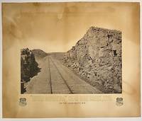
187510295Boston: Heliotype Printing 1875. Heliotype 38 cm x 48 cm on cream colored stock 55 cm x 66 cm with printed title and credit. Overall age toning. Heliotype promoting the Union Pacific line with a view of the tracks crossing Sherman Hill and the Continental Divide outside of the now ghost town of Sherman Wyoming. Sherman Hill is one of the landmarks on the transcontinental railroad and the highest point on the original U.P. line with a summit topping of 8247 feet above sea level. Sherman Hill is one of the easiest crossings of the Rockies and today it is one of the busiest lines. We are unable to locate another example of this poster. Rare. Heliotype Printing unknown
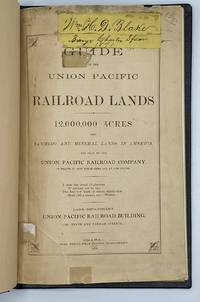
18709707Omaha: Omaha Herald Steam Printing Establishment 1870. First Edition. 44pp. Octavo 23 cm Black buckram with the title gilt stamped on the front board. Original printed salmon wrappers bound in. New endsheets and pastedowns. Manuscript label to head of original cover with paper of a similar color attached to the head of the verso. Small lib. ink stamp with accompanying 'Discard' stamp to title page. Complete with all three maps including the fold-out map 'Map of the Union Pacific Railroad Line in Nebraska' 19.5 cm x 56 cm / 7.5" x 22".<br /> <br /> Land promotional work from the Union Pacific encouraging the settlement of three million acres of U.P. lands that divides the available lands into three groups: agricultural lands the first 350 miles west of the Missouri River grazing lands from the forks of the Platte through the Laramie Plains in Wyoming and mineral lands between the Black Hills and the Wasatch Mountains. <br /> <br /> "No section of the United States furnishes facilities for grazing and stock raising superior to Nebraska and the lands on the line of the Union Pacific Railroad. The rich bottom lands of the valleys of the Platte Elkhorn Loup Fork Papillion Maple Shell Logan and Pebble Creeks Wood River Wahoo and Big Blue are included within these limits and present extensive tracts of the finest meadow land in America." Eberstadt 115: 856 later edition. Graff 4238 later edition. Herd 2351 later edition. Uncommon. Omaha Herald Steam Printing Establishment unknown
0006888San Francisco: The Bancroft Company 1893. First edition. Very Good. 12mo 64 pages 3/4 morocco scuffed marbled boards original pink wrappers bound in. Ex libris Cyrus H. McCormick son of the inventor; he was Chairman of International Harvester Corp. Scarce WorldCat cites only 9 copies. <br/><br/>Bennett was the Editor of "Bennett's Own" a weekly Hawaiian newspaper. He also authored the HONOLULU DIRECTORY and SKETCHES OF HAWAIIAN HISTORY. Forbes 4409 . The Bancroft Company hardcover
18851099Chicago: Geo. F. Cram 1885. Good plus. Large folding pamphlet approximately 20 x 41.5 inches. A few small chips and short closed tears at edges; several short separations and very minor losses along folds. Contemporary agent's ink stamp on cover panel. Tape repair across portion of horizontal fold; one panel with patches of light staining. A scarce colorful promotional for the Rock Island Route as well as its national and international connections with a fascinating stamp of an Australian sales agent. One side of the sheet prints an extensive promotional text and timetables for the various routes and services of the Chicago Rock Island & Pacific Railway. The main side of the sheet prints a map of the United States with state borders shaded in four colors highlighting the principal routes of the Rock Island from Chicago to Minnesota Iowa and Kansas and its connections to points on both the East and West Coasts. An inset map at lower right promotes the Rock Island as part of a transcontinental route between the United Kingdom Ireland and Australia. Most interestingly this copy is stamped on the cover panel with the information of a George. H. Hibbard "Australian Passenger Agent America's Cons'd Trans-continental Railways 6 Bridge Street Sydney N.S.W." Hibbard was evidently the agent in charge of distributing information about the trans-America route in Sydney one of its end points. Several issues of this map were published during the 1880s all scarce. We locate copies of the present 1885 issue at Stanford SMU and the Library of Congress. Geo. F. Cram unknown books
1850DEMO015143ILille France: L. Lefort 1850. Stated Second edition. Hardcover. Very Good. steel-engraved frontispiece. 8vo 258 pages 20th century half sprinkled calf marbled boards original wrappers bound in place. <br/><br/>Needs to be read with de Smet's LETTERS AND SKETCHES . AMONG THE INDIAN TRIBES OF THE ROCKY MOUNTAINS 1843 which contains several letters not included in this French text; but this French text "contains material not found in the English - Wagner-Camp-Becker 113a:5." Howes M288; Graff 3831; Monaghan 1332. Binding by "Reliure Francais". Issued in the Bibliotheque Historique et Morale this is actually the Third French Edition. Steel-engraved frontispiece. L. Lefort hardcover
1950WRCAM43346N.p. 1950. 12 1/2 x 50 inches. Torn into two pieces measuring 35 and 15 inches in length. Folded. Else very good. Long decorated strip of tapa a cloth made from tree bark by native people in the islands of the Pacific Ocean. Though previously used as cloth for clothing by native peoples today tapa is worn primarily on ceremonial occasions and is prized as artwork in the Western world. This is a handsome example of tapa cloth which fascinated Captain Cook and other explorers of the South Pacific. hardcover books
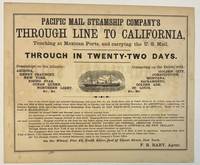
186740392New York 1867. Oblong broadsheet 9-1/2" x 11-1/2." Attractively printed within a ruled border with several type styles and sizes and engraved vignette of a steamship. The number '110' printed in lower margin beneath the border. Signed in type at the end "F. R. Baby Agent." Advertisement on verso for "Simons Brothers & Co. Manufacturers of the Metropolitan Shirt. . . Boston." Light foxing Very Good.<br /> <br /> "One of the above large and splendid Steamships will leave Pier No. 42 North River foot of Canal street at 12 o'clock noon on the 1st 11th and 21st of every month. . . for APSINWALL connecting via Panama Railway with one of the Company's Steamships from Panama for SAN FRANCISCO touching at ACAPULCO. Those of the 1st touch at MANZANILLO.<br /> "Families in Second Cabin and Steerage taken at reduced passage rates.<br /> "An allowance of one-quarter on through rates to clergymen and their families and school-teachers going to practice their vocations."<br /> According to Wikipedia "The Pacific Mail Steamship Company was founded April 18 1848 as a joint stock company under the laws of the State of New York by a group of New York City merchants. Incorporators included William H. Aspinwall Edwin Bartlett American consul at Lima Peru and also involved with the Panama Railroad Company Henry Chauncey Mr. Alsop G.G. Howland and S.S. Howland. The Pacific Mail Steamship Company was established to carry US mail on the Pacific leg of a transcontinental route via Panama."<br /> OCLC does not record this as of August 2024 nor does AAS; but the Huntington owns a copy "Date is determined by the vessels listed in the print". unknown
18561004314to original cloth rebacked with original spine strip laid on new endpapers. Illustrated with 20 of 21 color lithographs several steel engraved charts and shell engravings and three color lithographed folding maps. Table of contents list 20 color plates but some copies seem to have twenty-one. Two of the folding maps/charts have been placed in a rear endpaper pocket; one has a neat repair. A little rubbing to cloth and some minor darkening within. Could be missing one plate. Overall very good and nicely restored. One of the great sources of information on the west the Pacific Railroad Reports also contains some great illustrations. This installment Vol. III is no exception. Included are some interesting and colorful pictures of the Mojave Indians and their territory. This report contains intelligence on an expedition near the 35th parallel which took the southern route due west to the Pacific Ocean from Fort Smith Kansas that was conducted by Lieutenant A.W. Whipple and assisted by Lieutenant J.C. Ives. Ives would make his own mark on western expansion a few years later in his travels on the Colorado River. Wagner-Camp 263 Beverly Tucker hardcover
18571004304to 11 ½ x8 ¾ original law calf morocco illustrated 4 134 85102 114 2 iv 64 pp. Some scuffing and wear to covers slight gouge to front joint chipping to edges. Two plates detached one with a chipped corner. Overall very good. Organized by the War department under the direction of Jefferson Davis who was Secretary of War at that time a collection of volumes was produced in the quest for the best route for a railroad to the West. Jefferson Davis wrote part of the introduction to this series and outlines the goals of the project. This report is on routes explored in Northern California and Oregon. Specifically the expedition was to look for a railroad route crossing the Sierra Nevada near the source of the Carson River and to see if it was feasible to connect the Sacramento valley with the Oregon Territory. Most of the color plates in this volume are located in the first three parts of the publication which is focused on topography geology and botanical subjects. This volume includes 23 color lithographs of scenery and botanical subjects 2 hand colored plates of birds and 24 steel engraved plates. Wagner-Camp 264a. Beverly Tucker, unknown books
18561004314to original cloth rebacked with original spine strip laid on new endpapers. Illustrated with 20 of 21 color lithographs several steel engraved charts and shell engravings and three color lithographed folding maps. Table of contents list 20 color plates but some copies seem to have twenty-one. Two of the folding maps/charts have been placed in a rear endpaper pocket; one has a neat repair. A little rubbing to cloth and some minor darkening within. Could be missing one plate. Overall very good and nicely restored. One of the great sources of information on the west the Pacific Railroad Reports also contains some great illustrations. This installment Vol. III is no exception. Included are some interesting and colorful pictures of the Mojave Indians and their territory. This report contains intelligence on an expedition near the 35th parallel which took the southern route due west to the Pacific Ocean from Fort Smith Kansas that was conducted by Lieutenant A.W. Whipple and assisted by Lieutenant J.C. Ives. Ives would make his own mark on western expansion a few years later in his travels on the Colorado River. Wagner-Camp 263 Beverly Tucker hardcover books
18561006214to leather spine and tips with marbled boards 36 Illustrations include 21 tinted/color lithographs one folding diagram two folding maps and a couple of black and white plates 36 14 136 127 175 pp. Binding with some wear at the spine and extremities hinges cracked some pages are a bit loose plates all present but probably not bound in correct order folding maps have a few tears some staining to front endpapers but not into the balance of the text plates and text show some aging foxing and browning but most plates resonably are clean. One of the great sources of information on the west the Pacific Railroad Reports also contains some great illustrations. This installment Vol. III is no exception. Included are some interesting and colorful pictures of the Mojave Indians and their territory. This report contains intelligence on an expedition near the 35th parallel which took the southern route due west to the Pacific Ocean from Fort Smith Kansas that was conducted by Lieutenant A.W. Whipple and assisted by Lieutenant J.C. Ives. Ives would make his own mark on western expansion a few years later in his travels on the Colorado River. The substantial amount of information on various Indain tribes makes this installment an important one. Since many of these volumes are broken for the plates they are getting somewhat scarce. Beverly Tucker, hardcover books
17512198752Presso Francesco Pitteri Con Licenza de' Superiori e Privilegio 1751. Revised Edition. Hard Cover. Very Good/No Jacket. Revised edition. Rebound with new endpapers. Minor ink notes on flyleaves modern owner bookplate on front endpaper of each volume. 1751 Hard Cover. 12 310; 406 pp. 12mo. Cloth spines gilt titles paper over boards. Italian text. An 18th century guide to Venice by Pietro Antonio Pacifico with engraved illustrations including several fold-outs. Presso Francesco Pitteri, Con Licenza de' Superiori, e Privilegio hardcover books
56-0290San Francisco Calif.: Southern Pacific Company 1920 revised 1937. Map. Blueline print 24" x 54". From Cypress Ave to Phelan Ave. Only streets indicated west of Meridian Road approx. 50 industries indicated directly on map. Scale 1" = 500'. San Francisco, Calif.: Southern Pacific Company, 1920, revised 1937. unknown
56-0289San Francisco Calif.: Southern Pacific Company 1920 revised 1926. Map. Blueline print 24" x 54" with mauve red and green highlighting. From Cypress Ave to Phelan Ave. Only streets indicated west of Meridian Road approx. 40 industries indicated in downtown and West San Jose. Scale 1" = 500'. San Francisco, Calif.: Southern Pacific Company, 1920, revised 1926. unknown
56-0226San Francisco Calif.: Southern Pacific Company 1947 revised 1949. Map. Blueline print on vellum. 35 x 78 inches. With multicolor lines indicating switching zones. Map from San Francisco Bay to San Leandro and North Berkeley to Alameda and Oakland Airport. Index of Industries with approximately 600 entries. Scale: 1 inch = 1000 feet. San Francisco, Calif.: Southern Pacific Company, 1947, revised 1949. hardcover
56-0367Portland Ore.: Southern Pacific Company 1923 rev. 1949. Map. Blueline print 39" x 96". Along Williamette River extending approx 1 mile each direction from banks from Clackamas County border to east end of Southern Pacific railroad yard. With Index to Industries sorted by location and owner approx 650 listings indexed by number to map. Scale 1" = 400'. Portland, Ore.: Southern Pacific Company, 1923, rev. 1949. unknown