[Lunar Cartography] NASABiblio.com
5 783 résultats
19693792<p>A very uncommon map of the Sea of Tranquility area that would be the site of the first moon landing in 1969. According to a description of a related larger-scale map in a 2020 Bonham's auction "NASA mission planners created this internal Manned Spacecraft Center chart a few months before the flight in 1969."</p><p>The map encompasses the area from 14 degrees South to 14 degrees North Latitude and from 0 degrees to 42 degrees East Longitude. The coordinates of the Eagle's landing site were 0.675 degrees Latitude North and 23.47 degrees Longitude East – very near the center of the mapped area.</p><p>The map is numbered "MSC – 6238 – 69" in the lower right margin. As it was meant for internal use only the map appears to be significantly less common than the LAC Lunar Chart series and the USGS geologic chart series. We were unable to locate an online reference to the map on the Lunar and Planetary Institute website.</p><p><strong>Condition: </strong>Rolled never folded. Some crinkling in the lower margin. Tear at extreme lower right corner with map number has been closed with archival tape on the reverse. Good.</p><p>ICN 7706.1.</p> NASA Manned Spacecraft Center
1927159761Potsdam, 1927. 4°. 72 S. OBr. Umschl.l eicht gebräunt. Teils leicht stockfl. (Veröffentl. d. Königl. Preus. Geodät. Instit. N.F. 98)
1974621972Hannover, Schroedel, 1974. 3 Bl., 258 S. (Veröff. d. Akad. f. Raumforsch. u. Landesplanung 72).
1930159763Potsdam, 1930. 4°. 104 S. OBr. Umschl. leicht gebräunt. Tit. leicht fleckig. Tekt. a. Umschl. u. Tit. (Veröffentlichung d. Königl. Preuszischen Geodätischen Institutes. N.F. 105)
1919159745Berlin, 1919. 4°. 39 S. OBr. Umschl. lose u. braunrandig. BIndg. gelöst. (Veröffentlichung d. Königl. Preuszischen Geodätischen Institutes. N.F. 78)
1973162380München, 1973. 4°. 68 S. OBr. Klammern angerostet. Umschl. m. St. sowie Sign. (BAW. Veröff. d. Dt. Geodät. Komm. C 186).
193560001New York: John Day Reynal & Hitchcock 1935. 4to. xiv 351 1 pp. With 56 maps most full-page numerous text illustrations. Blue publisher’s cloth silver lettering front cover & spine minor shelfwear light rubbing at head & foot of spine corners w/ d.j. striking Art Deco cover art of ships voyaging minor creasing edgewear couple closed tears on back cover wear to corners still NF/VG- copy inscribed by author on half-title. First edition inscribed of this unashamedly Eurocentric voyages and exploration history detailing “all the great adventurers by land and sea from Hannu 2750 B.C. to Piccard 1935.†The specially prepared maps specifically show the ground and oceans covered by each explorer with the contemporary “Known World†starkly defined. The maps and histories sequentially “unroll†from the very small area around the Mediterranean to the World. Outhwaite 1892-1979 was an anthropologist who worked on American race relations at the Laura Spelman Rockefeller Memorial from 1923-1028 worked for the Rockefeller Foundation through the 1930’s and organized “Outhwaite Exhibits†for museums World’s Fairs and window displays. He also was an adventurer who sailed 14000 miles on the Atlantic Ocean from 1929-1930 onboard the yacht “Kinkajou†visiting Mt. Pelee Martinique. John Day, Reynal & Hitchcock, hardcover
1928187313Berlin, 1928. M. einigen Tab. 55 S. OBr. Umschl. kaum angestaubt. (Mitteil. d. Reichsamts für Landesaufnahme So.-H. 5).
Firenze, Istituto Geografico Militare, 1924-1936, fasc. 140 complessivi (9 annate complete + altri 32), raccolti in voll. 24, copp. fittizie (ma conservate le br. edit. dei fasc.), pp. 571, da 617 a 947 - 1064 - 1072 - 1407 - da 617 a 1321 - 729, da 765 a 888, da 995 a 1067 - 1347 - 742 - da 507 a 978 - 1089 - 1106 - 960. Numerose ill. in b.n. e cartine. Ampia bibliografia (incluse le riviste) e notiziario. Alcune adesioni. Contributi di: R. Almagià, R. Biasutti, C. Basevi, C. Casamorata, A. Loperfido, G. Pullè G. Abetti, E. Masini, G. Boffito, L. Arditi, A. Neppi Modona, L. Giannitrapani, L. Cipriani, ecc. Interessante rivista che tratta di geografia, esplorazioni, etnologia, cartografia, topografia, geologia, astronomia, ecc; numerosi articoli monografici su Oriente (Giappone, Manciuria, Cina, India), America Latina (Brasile, Perù, Bolivia, Cile, Argentina, ecc.), U.R.S.S. e sulle colonie italiane (Libia, Eritrea, Somalia); resoconti di Convegni e congressi: I Convegno Naz. Etrusco a Firenze (1926), II/III Assemblea dell'Unione Astronomica Internaz. (1925, 1928), Congresso Internaz. di Geografia a Cambrige (1928), XIX Riunione della Società Italiana per il progresso delle Scienze (1930), Congresso di studi coloniali di Firenze (1931), ecc.
1805Map935Paternoster Row London: Longman Hurst Rees & Orme 1805. 1st Edition 1st Printing. No Binding. Fine. Original early 19th century map MAP OF THE EASTERN COAST AND LANDS OF THE UNITED STATES BY AARON ARROWSMITH. A FINE CLEAN AND DARK IMPRESSION. Original folding plate covering North Florida to Lower Canada Watermarked heavy paper 1804. A scarce example and in fine un-coloured original condition.41x27cms. Double-page. <br/> <br/> Longman, Hurst, Rees & Orme unknown
1997017766Mansfield Centre Connecticut: Martino Fine Books 1997. Brand New in perfect condition. 2 vols in 1. STILL SEALED in the publisher's clear plastic SHRINKWRAP. NO rubbing. NO fading. Bright clean square and tight. Sharp corners. NO owner's name or bookplate. NOT a remainder. Fresh and crisp -- obviously never read. n. d. but 1997. HARDCOVER reprint limited to 150 copies of the 1950 and 1953 Library of Congress originals. 2 volumes bound as 1 with a total of 767 pages. Because this edition is bound in sturdy cloth it is much better suited to heavy use than the paper bindings of the original editions. A welcome reprint of an important and scarce reference. Described here are 6696 atlases. Entries are first arranged geographically and by subject national; state; and within the various states by county/parish city and region; special subject atlases include agriculture aviation canals climate coal geology history languages railroads etc. Then the atlases are re-listed by author/publisher in the index. A typical entry includes the atlas title; cartographer; publisher; city and date of first publication; dimensions in centimeters; number of pages plates and maps; the number that are colored etc. Occasional notes on contents. In the second part copies of the atlases held by some 180 libraries are located. Hodgkiss/Tatham KEYGUIDE TO INFORMATION SOURCES IN CARTOGRAPHY: "An indispensable reference for students of American history or of the development of American cartography." Bound in the original gilt-stamped blue cloth. Besterman 6267. Sheehy CL288. KEYGUIDE 94. 1997 reprint of 1950/53 originals. Hardcover. New/in publisher's shrinkwrap. 2 vols in 1: viii445pp. xiii301pp. 767 total. Great Packaging Fast Shipping. Martino Fine Books Hardcover
(Codice OS/0023) In 8° (24 cm) 362-6-22 pp. Textes en français, anglais, italien. Broché, dos réfait (toile), taches au plat, intérieur en très bon état. ~~~ SPEDIZIONE IN ITALIA SEMPRE TRACCIATA
Firenze, 1955, 8vo stralcio con copertina posticcia muta, pp. 137/141. - !! ATTENZIONE !!: Con il termine estratto (o stralcio) intendiamo riferirci ad un fascicolo contenente un articolo, completo in se, sia che esso sia stato stampato a parte utilizzando la stessa composizione sia che provenga direttamente da una rivista. Le pagine sono indicate come "da/a", ad esempio: 229/231 significa che il testo è composto da tre pagine. Quando la rivista di provenienza non viene indicata é perché ci è sconosciuta. - !! ATTENTION !!: : NOT A BOOK : “extract” or “excerpt” means simply a few pages, original nonetheless, printed in a magazine. Pages are indicated as in "from” “to", for example: 229/231 means the text comprises three pages (229, 230 and 231). If the magazine that contained the pages is not mentioned, it is because it is unknown to us.
Dalla “Carta Amministrativa del Regno d’Italia co' suoi stabilimenti politici, militari, civili e religiosi e con una parte degli stati limitrofi. Costrutta nel Deposito della Guerra per ordine del Ministro della Guerra e Marina nell'anno MDCCCXI, aggiunta e corretta nell'anno 1813”, edita a Milano nel 1813 (una grande carta composta da più fogli quadrettati e applicati su tela d'epoca, ciascuno di cm 54 x 67 circa per un perimetro totale di cm 1400 x 1100 circa), bella carta relativa alla costa più settentrionale del Mare Adriatico, con segnalati il Golfo del Quarnaro, il Vallone di Cherso, l'Isola di Veglia, tutte le isole Quarnerine e il Canale della Montagna o Morlacca e il Cnale di Pago; a est l'Istria, la Dalmazia, la Morlacca e la Croazia. La carta è composta da un foglio, numerato come foglio XV sulla parte incisa, e con il numero 15 al retro della tela. Benedetto e Gaudenzio Bordiga furono incisori e cartografi, originari della Valsesia e attivi a Milano nella prima metà del XIX secolo, un periodo caratterizzato da alterne vicende storico politiche, in cui realizzarono un discreto corpus incisorio. L'opera più importante cui contribuirono fu la “Carte générale du Théâtre de la Guerre en Italie”, una grande carta commissionata, nel 1797 dallo Stato Maggiore dell'Armata Francese di Napoleone, al capo battaglione Bacler d'Albe, capo del Gabinetto Cartografico Francese: la carta, celebrativa della prima campagna d'Italia, fu in gran parte realizzata a partire da carte preesistenti, fu realizzata in cinquantaquattro fogli sotto la direzione di Giacomo Pinchetti e fu appunto incisa dai fratelli Benedetto (1800 - 1834) e Gaudenzio Bordiga. Gaudenzio Bordiga (Camasco, Varallo, 10 febbraio 1773 – Milano, 18 gennaio 1837), seguì a Varallo studi letterari e di disegno. Stabilitosi a Milano con il fratello Benedetto, fu capo incisore dell'Istituto Geografico Militare e mantenne tale carica anche dopo l'occupazione austriaca. Senza la collaborazione del fratello Benedetto, Gaudenzio disegnò, e a volte incise, varie carte geografiche militari (“Carta delle stazioni militari in Italia”, 1804; “Carta militare del Regno d'Etruria e del principato di Lucca”, 1806) e scrisse opere di erudizione storico – artistica (“Notizie intorno alle opere di Gaudenzio Ferrari, pittore e plasticatore”, Milano, G. Pirotta, 1821; “Storia e guida del Sacro Monte di Varallo“, Varallo, 1830). Molto buono lo stato di conservazione.
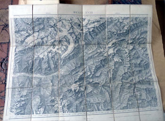
Une carte de la région des Grisons en Suisse de 62x75 cm. Entièrement et soigneusement entoilée et repliée en accordéon. Parfait état. Voir la photo.
185413817sans lieu Lanée successeur de Loguet 1854 1 Une carte de la région des Grisons en Suisse de 62x75 cm.
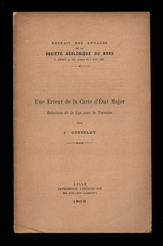
1905VBA-223Extrait des Annales de la Société Géologique du Nord. Lille, Imprimerie Liégeois-Six, 1905. Livret 22 x 14 cm. 7 pages. 1 planche hors-texte. Poids 20 grammes.
18828Flammarion, 2007. Fort volume broché de 575 pages, 16 pages d'illustration hors texte et foliotage. Très agréable exemplaire.
27.5x21.5 cm. 33 + 38 pages. Cover corners slightly worn. Spine edges slightly worn. Inner cover and pages slightly yellowing. Else in good condition.
IN ENGLISH AND HEBREW. 27.5x22cm. 38+33 pages. Softcover. In good condition.
21.5x27.5 cm. 33+38 pages. Softcover. Pages slightly age stained. Else in good condition.
Roma, Società Geografica Italiana, 1910, 8vo stralcio con copertina posticcia muta, pp. 269/279 con una tavola fotoincisa. - !! ATTENZIONE !!: Con il termine estratto (o stralcio) intendiamo riferirci ad un fascicolo contenente un articolo, completo in se, sia che esso sia stato stampato a parte utilizzando la stessa composizione sia che provenga direttamente da una rivista. Le pagine sono indicate come "da/a", ad esempio: 229/231 significa che il testo è composto da tre pagine. Quando la rivista di provenienza non viene indicata é perché ci è sconosciuta. - !! ATTENTION !!: : NOT A BOOK : “extract” or “excerpt” means simply a few pages, original nonetheless, printed in a magazine. Pages are indicated as in "from” “to", for example: 229/231 means the text comprises three pages (229, 230 and 231). If the magazine that contained the pages is not mentioned, it is because it is unknown to us.
<br/> STATO: NUOVO.<br/> TITOLO: Una terra oltre le stelle. Il planisfero di Martin Waldseemuller. 1507. <br/> AUTORE: Camerota,Filippo.<br/> EDITORE: Giunti<br/> DATA ED.: 2023,<br/> COLLANA: Coll.Orientamenti.<br/> EAN: 9788809967410
Il nome “America” compare per la prima volta su una mappa in un planisfero tedesco del 1507. Il suo autore era il cartografo Martin Waldseemüller e il suo titolo rimandava a una “Cosmografia universale secondo la tradizione di Tolomeo e le navigazioni di Amerigo Vespucci e altri”. A questa carta è dedicato il primo volume di una serie – “Orientamenti”, concepita in collaborazione con il Museo Gali <br/> STATO: NUOVO.<br/> TITOLO: Una terra oltre le stelle. Il planisfero di Martin Walseemuller. 1507. <br/> AUTORE: Camerota,Filippo.<br/> EDITORE: Giunti<br/> DATA ED.: 2023,<br/> COLLANA: Istituto e Museo della Scienza Galileo . Orientamenti.<br/>