5 783 résultats
Un magnifico esemplare del primo stato di quattro, avanti l'indirizzo del Camocio, con pieni margini, condizioni perfette. Molto rara.In basso al centro, in un cartiglio sormontato dallo stemma imperiale, si legge: TOCQUAY, over DOGGEY, fortezza inespugabile ne Confini d’ Ongheria, & Transilvania, Circha 30, leghe dilà da Buda, fra doi fiumi presa da Massimiliano Imp. L’anno 1565. per Lazaro fanswendi, suo Capitano & General nella detta jmpresa fatta sop’il giaccio con 33. Pecci d’Artiglierie, metterà basso li rampari & in due assalti presa & guadagnata nel termine de 4 giorni, trovorno nella detta fortezza denari & munitio[ni ] da guerra. Domenico Zenoi f.Orientazione con l’est in alto (ORIENS). Sulla tavola sono presenti alcune iscrizioni che identificano i diversi schieramenti e descrivono la battaglia. Acquaforte e bulino, dimensioni mm 405x290.Pianta prospettica che mostra la fortezza di Tokay, durante la conquista imperiale del 1565. L’occupazione di Tokaj è stato il primo evento a essere raffigurato in un largo numero di incisioni pubblicate a Vienna, Parigi e Venezia, subito dopo il suo accadimento. Tra queste incisioni, l’opera di Zenoi è di particolare interesse perché rappresenta la prima veduta di una fortezza ungherese incisa su rame.Nel 1565 l’imperatore Massimiliano, approfittando del fatto che i Turchi erano occupati nel Mediterraneo, s’impadronì sia di Tokaj che Szerencs, appartenenti alla Transilvania del principe Giovanni Sigismondo Zápolya, stato vassallo dei Turchi, creato dal sultano Solimano il Magnifico intorno al 1550. Il successo dell’operazione fu agevolato da Lazarus Freiherr von Schwendi, uno dei migliori comandanti e strateghi militari del tempo, che fu impegnato nelle guerre ungheresi dal 1565 al 1568. La riconquista di Tokaj, comequella di Szatmár, era di particolare importanza, poiché dal 1560 in avanti, l’Alta Ungheria ebbe due funzioni: serviva da bastione difensivo non solo contro gli Ottomani ma anche contro lo stato vassallo dei Turchi, ovvero il Principato di Transilvania. La fortificazione di Tokaj, su base pentagonale bastionata agli angoli, era stata progettata da Francesco da Pozzo nel 1556. Attraverso la cooperazione tra il Consiglio di Guerra di Corte e i possidenti ungheresi, entro il sesto decennio del XVI secolo fu istituito un nuovo sistema di difesa dei confini in Ungheria e in Croazia. Elemento portante del sistema era la linea di fortezze di frontiera che si estendeva dal mar Adriatico fino alla Transilvania, realizzata individuando una serie di zone di difesa che, anche per caratteristiche del territorio, oltre che per affinità etniche e politiche, potessero formare una rete difensiva omogenea. I vecchi castelli furono rinforzati con moderne fortezze progettate perlopiù da architetti militari italiani. Questa catena di 100-120 fortezze, di diverse dimensioni, fu divisa in sei Generalati di confine (Grenzgeneralat). Ciascun generalato si trovava sotto il comando di un capitano generale di frontiera: il generalato di Croazia e Adriatico; Slavonia e dei Vendi; di Canisia, il confine di Györ che proteggeva direttamente Vienna; il confine delle città minerarie, e infine quello dell’Alta Ungheria. Oltre ai sei confini, un ruolo di grande importanza spettava alla fortezza di Komáron.BibliografiaBifolco-Ronca, Cartografia e Topografia Italiana del XVI secolo, Catalogo ragionato delle opera a stampa (2018), tav. 552 I/IV; Destombes (1970): n. 174; De Vries (1981): n. 30; Hatfield House (1992): n. 93; Meurer (2002): n. 179; Ruge (1904-16): IV, n. 87.84; Tavernari (2014): n. 109; Szalai (2001): p. 131, tav. 220, nn. 1565/1a-c; Szalai-Matković (2012), p. 4; Szalai-Szantai (2006): n. 1565/1 a-c, tav. 211; Tooley (1939): n. 550. TOCQUAY, over DOGGEY, fortezza inespugabile ne Confini d’ Ongheria, & Transilvania, Circha 30, leghe dila da Buda, fra doi fiumi presa da Massimiliano Imp. L’anno 1565. per Lazaro fanswendi, suo Capitano & General nella detta jmpresa fatta sop’il giaccio con 33. Pecci d’Artiglierie, mettera basso li rampari & in due assalti presa & guadagnata nel termine de 4 giorni, trovorno nella detta fortezza denari & munitio[ni ] da guerra. Domenico Zenoi f. FIRST STATE OF FOUR, before the Camocio’s address.Etching and engraving, a fine impression, printed on contemporary laid paper, with margins, very good condition. Very rare.Perspective map showing the fortress of Tokay, during the imperial conquest of 1565. The occupation of Tokaj was the firstevent to be depicted in a large number of engravings published in Vienna, Paris and Venice, immediately after its occurrence. Between these etchings, the work of Zenoi is of particular interest because it represents the first view of a Hungarian fortress engraved on copper. In 1565 Emperor Maximilian, taking advantage of the fact that the Turks were occupied in the Mediterranean, took possession of both Tokajthat Szerencs, belonging to the Transylvania of Prince John Sigismund Zápolya, vassal state of the Turks, created by the sultanSuleiman the Magnificent around 1550. The success of the operation was facilitated by Lazarus Freiherr von Schwendi, one of the bestcommanders and military strategists of the time, who were engaged in the Hungarian wars from 1565 to 1568. The reconquest of Tokaj, asthat of Szatmár, was of particular importance, since from 1560 onwards, Upper Hungary had two functions: it served as a bastion defensive not only against the Ottomans but also against the vassal state of the Turks, or the Principality of Transylvania. The fortificationof Tokaj, on a pentagonal base bastioned at the corners, was designed by Francesco da Pozzo in 1556. Through cooperation between the Court War Council and the Hungarian landowners, a new system was established within the sixth decade of the sixteenth century defense of borders in Hungary and Croatia. Carrier of the system was the line of frontier fortresses that extended from the sea Adriatic up to Transylvania, created by identifying a series of defense zones which, also due to the characteristics of the territory, as well as for ethnic and political affinities, they could form a homogeneous defensive network. The old castles were reinforced with modern fortresses designed mostly by Italian military architects. This chain of 100-120 fortresses, of different sizes, was divided into six Generalates of border (Grenzgeneralat). Each generalate was under the command of a general border captain: the generalate of Croatia and the Adriatic; Slavonia and the Sell; of Canisia, the Györ border that directly protected Vienna; the border of the mining towns, finally that of Upper Hungary. Beyond the six borders, a role of great importance lay with the fortress of Komáron.BibliografiaBifolco-Ronca, Cartografia e Topografia Italiana del XVI secolo, Catalogo ragionato delle opera a stampa (2018), tav. 552 I/IV; Destombes (1970): n. 174; De Vries (1981): n. 30; Hatfield House (1992): n. 93; Meurer (2002): n. 179; Ruge (1904-16): IV, n. 87.84; Tavernari (2014): n. 109; Szalai (2001): p. 131, tav. 220, nn. 1565/1a-c; Szalai-Matković (2012), p. 4; Szalai-Szantai (2006): n. 1565/1 a-c, tav. 211; Tooley (1939): n. 550. Bifolco-Ronca, Cartografia e Topografia Italiana del XVI secolo, Catalogo ragionato delle opera a stampa (2018), tav. 552 I/IV
190570137- Carte 40 x 50 cm, pliée en 2.
12455DBo.J. [2 Warenabbildungen] Abraham Ortelius, geboren 1527 in Antwerpen, gestorben 1598 ebenda. Flämischer Geograph und Kartograf.
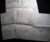
196526508Southold Long Island N.Y.: No Publisher Noted 1965. Three folded sectional maps of the Town of Southold Long Island NY. Approx. 14 1/2" x 18" size; printed black on cream paper stock. Section I depicting western portion Laurel Mattituck Cutchogue Nassau Point Robin's Island; Section II Peconic Southold village Bay View Hashamomack Greenport; Section III East Marion Oysterponds - Orient & a Fisher's Island map inset. Each map with its own numbered key-list of locations and short historical notes on them. Some edge tips-wear and soiling little spotting; old fold lines; in good condition. First Edition. Not Bound. Good. No Publisher Noted paperback books
In alto al centro, con caratteri grandi, si legge: THIONVILLE. In basso a sinistra, in un cartiglio di forma rettangolare: Vera Thiomvillae effigies sum, reddita docti Artificis manibus, quam modo Galli tenes, Dum tamen expugnor, cecidit fortissimus ille Stroza Italum Petrus gloria summa ducum. Anno domini. M.D.LVIII Die 22 Iunij. Sulla destra del cartiglio troviamo la firma: Nicolaus Beatrizet Lotaringus incidit: et formis. Orientazione nei quattro lati al centro con il nome dei punti cardinali: SEPTENTRIO, MERIDIES, ORIENS, OCCIDENS, il nord è in alto. Sono invertiti l’est e l’ovest. Pianta prospettica che raffigura la città durante la conquista del duca di Guisa. Possiamo dedurre dalla firma in lastra Nicolaus Beatrizet Lotaringus incidit: et formis, che venga incisa e pubblicata dall’artista lorenese. L’opera sembra essere il prototipo delle stampe dedicate all’avvenimento. L’assedio di Thionville si svolse dal 17 aprile al 23 giugno 1558. Si concluse con la vittoria dell’esercito francese comandato da Francesco di Guisa sull’esercito spagnolo. Il 17 aprile, le prime truppe del signore di Vieilleville arrivano sotto le mura di Thionville per prevenire l’arrivo delle razioni. Il 28 maggio arrivarono anche le truppe del duca di Guisa e Pietro Strozzi, nominato Maresciallo di Francia. Gli spagnoli tentarono di salvare le loro truppe intrappolate a Thionville, ma dopo due fallimenti, abbandonarono il presidio stesso. Il 21 giugno - come riportato nel cartiglio - il maresciallo Strozzi morì in seguito ad una ferita. Il 23 giugno, le truppe francesi presero possesso della città, ma il duca si oppone allo smantellamento delle fortificazioni. La città divenne francese, ma era completamente vuota perché a nessun residente fu permesso di rimanere. L’occupazione di Thionville dei francesi fu breve. Il 2 aprile 1559, Enrico II firma il trattato di Cateau-Cambrésis: Spagna e Francia si restituivano le conquiste fatte l’una a danno dell’altra negli ultimi otto anni, ma la Francia mantenne però Metz, Toul e Verdun. La prima tiratura è quella più diffusa nelle raccolte cinquecentesche. Attraverso un percorso che non siamo riusciti a ricostruire - come analoghe opere del Beatrizet, infatti, l’opera non è elencata nel catalogo Lafreri - la lastra fu acquistata da Giovanni Orlandi che ne realizzò una ristampa (1602) e quindi ceduta al fiammingo van Schoel (1614) autore dell’ultima edizione nota. Bulino, impresso su carta vergata coeva, con margini, in eccellente stato di conservazione. Esemplare del secondo stato di quattro, con l’indirizzo di Giovanni Orlandi e la data 1602. Bibliografia Bifolco-Ronca, Cartografia e topografia italiana del XVI secolo, pp. 1082-1083, tav. 446, II/IV; Destombes (1970): H.I. n. 12; Ganado (1994): p. 211, n. 26; Adhémar (1938): p. 94; Arrigoni-Bertarelli (1932): n. 24; Bartsch (1813): vol. XV, p. 271, n. 106 (TIB 29, p. 374); Bianchi (2003): n. 121; Robert-Dumesnil (1865) vol. IX, p. 178, n. 113. Top center, in large letters, reads: THIONVILLE. In the lower left corner, in a cartouche of rectangular shape: Vera Thiomvillae effigies sum, reddita docti Artificis manibus, quam modo Galli tenes, Dum tamen expugnor, cecidit fortissimus ille Stroza Italum Petrus gloria summa ducum. Anno domini. M.D.LVIII Die 22 Iunij. On the right of the cartouche we find the signature: Nicolaus Beatrizet Lotaringus incidit: et formis. Orientation in the four sides in the center with the name of the cardinal points: SEPTENTRIO, MERIDIES, ORIENS, OCCIDENS, the north is at the top. East and west are reversed. Perspective plan that represents the city during the conquest of the Duke of Guise. We can deduct from the signature on the plate Nicolaus Beatrizet Lotaringus incidit: et formis, which is engraved and published by the artist Lorraine. The work seems to be the prototype of the prints dedicated to the event. The siege of Thionville took place from April 17 to June 23, 1558. It ended with the victory of the French army commanded by Francis of Guise over the Spanish army. On April 17, the first troops of the Lord of Vieilleville arrived under the walls of Thionville to prevent the arrival of rations. On May 28, the troops of the Duke of Guise and Pietro Strozzi, appointed Marshal of France, also arrived. The Spanish tried to save their troops trapped in Thionville, but after two failures, they abandoned the garrison itself. On June 21 - as reported in the cartouche - Marshal Strozzi died following a wound. The 23 June, French troops took possession of the city, but the duke opposed to the dismantling of the fortifications. The city became French, but it was completely empty because no residents were allowed to stay. The occupation of Thionville by the French was brief. On April 2, 1559, Henry II signed the Treaty of Cateau-Cambrésis: Spain and France returned to each other the conquests made to the detriment of the other in the last eight years, but France kept Metz, Toul and Verdun. The first issue is the most common in sixteenth-century collections. Through a path that we have not been able to reconstruct - as similar works of Beatrizet, in fact, the work is not listed in the catalog Lafreri - the plate was purchased by Giovanni Orlandi who made a reprint (1602) and then sold to the Flemish Hendrick van Schoel (1614) author of the last known edition. Engraving, impressed on contemporary laid paper, with margins, in excellent condition. Exemple of the second state of four, with the address of Giovanni Orlandi and the date 1602. Literature Bifolco-Ronca, Cartografia e topografia italiana del XVI secolo, pp. 1082-1083, tav. 446, II/IV; Destombes (1970): H.I. n. 12; Ganado (1994): p. 211, n. 26; Adhémar (1938): p. 94; Arrigoni-Bertarelli (1932): n. 24; Bartsch (1813): vol. XV, p. 271, n. 106 (TIB 29, p. 374); Bianchi (2003): n. 121; Robert-Dumesnil (1865) vol. IX, p. 178, n. 113.
1916159741Potsdam, 1916. 4°. 51 S. OBr. Umschl. angeschmutzt u. leicht eingerissen. (Veröffentl. d. Königl. Preusz. Geodät. Inst. N.F. 66)
Ril. in tela con sovr., cm 45x31, pp 92, molte carte in b/n..Parte anastatica in lingua latina. Volume con leggeri segni del tempo alla sovracop.
69194Antwerp, Standaard Uitgeverij, 1570/1970 Lederen band, editie van 175, dit is nummer 117. 41 x 28.5 cm. *in mooie staat.
1964P266Amsterdam: Meridian Publishing Company 1964. facimile reprint . Hardback. Fine/V G Chipped. small folio. 192pp including 19 double page maps in black and white and an introduction by R.A. Skelton. A facsimile edition of the first atlas entirely devoted separately to the Americas. Originally published in 1597. A series of atlases in Facsimile. First series volume V. Original d.j. now proected by a clear mylar wrapper <br/> <br/> Meridian Publishing Company hardcover
2 vols. in-4,leg.t.t.edit.,titoli dorati,custodia,pp.207,197,36+77 figg. n.t. e 82+158 tavv. n.t. Allo stato di nuovo.
con numerose ill. a col. ed in b/n nel testo. Brossura originale illustrata. Catalogo della mostra tenutasi a Gorizia, Museo Provinciale di Storia ed Arte, Borgo Castello, dal 23 giugno al 9 ottobre 1989. Esemplare più che buono.
In-4 (cm. 29.40), brossura illustrata, pp. 314, (4), con illustrazioni in bianco e nero e a colori nel testo. Catalogo della Mostra: Gorizia, Borgo Castello, Museo Provinciale di Storia ed Arte, 23 Giugno - 9 Ottobre 1989. In ottimo stato (nice copy).
1967364Amsterdams Historisch Museum 22 x 22 Amsterdam 1967 This catalogue was compiled for the exhibition at the occasion of the international Conference on Cartography in Amsterdam, april 1967. It is a descriptive catalogue of cartographical material published in Amsterdam during the seventeenth century. Jaquette éditeur à rabats, 96 p., suivies de 24 illustrations N. & B. hors-texte, introduction en anglais et en hollandais. Couverture très légèrement salie, bon intérieur. Exemplaire en bon état.(C9) Livre
1967364Amsterdams Historisch Museum 22 x 22 Amsterdam 1967 This catalogue was compiled for the exhibition at the occasion of the international Conference on Cartography in Amsterdam, april 1967. It is a descriptive catalogue of cartographical material published in Amsterdam during the seventeenth century. Jaquette éditeur à rabats, 96 p., suivies de 24 illustrations N. & B. hors-texte, introduction en anglais et en hollandais. Couverture très légèrement salie, bon intérieur. Exemplaire en bon état.(C9) Livre
1974134426Edinburgh, Bartholomew & Son, 1974. 2°. M. 112 farb. Ktn. 50 S. Text. OKldr. M. Rsign. St. a. Tit.
195282192Minneapolis:: Printed for the Author by the Voyageur Press 1952. First edition; one of Sixty Copies Printed. Two looseleaf albums . Generally fine. 8vo. A comprehensive album for collecting postage stamps featuring maps from around the world with spaces to affix specimens and information about each stamp. In this example there are approximately 150 affixed stamps and 133 blank spaces for stamps. Printed for the Author by the Voyageur Press, unknown
1842Map 806Edinburgh: A&C Black 1842. No Binding. Fine/uncoloured. World map with Australia at the middle 140 degrees. Beautiful steel engraving from Encyclopaedia Britanica Seventh edition dated 1842. Plate CCLXIII. Fine example with no wear. Australia is named 'Australia and New Holland'. 410x260mm. Relief is shown by hachures. Engraved by S. Hall Bury Strt. Bloomsbury. Published by A. & C. Black. Engd. by G. Aikman Edinr. <br/> <br/> A&C Black unknown
1807Map942Paternoster Row London: Longman Hurst Rees & Orme 1807. 1st Edition 1st Printing. No Binding. Fine. Original early 19th century MAP OF THE WORLD On MERCATORS PROJECTION BY AARON ARROWSMITH. A FINE CLEAN AND DARK IMPRESSION. Original folding plate covering THE WHOLE WORLD printed on heavy paper dated 1807. A scarce example and in fine un-coloured original condition. 41x27cms. Double-page folding map.Engraved by Lodge.A LOVELY COPY <br/> <br/> Longman, Hurst, Rees & Orme unknown
1885MH045London: Blackie & Son 1885. 1st Edition . Hardcover. Fine. small 4to. Volume One only of two. cxiv 468pp. Original half calf with raised bands and dec. compartments. Green morocco label with titles in gilt. Original pub. half calf binding bound by Blackie of an interesting and well illustrated view of the world in the late Victorian period. 9 maps 16 plates <br/> <br/> Blackie & Son hardcover
1842Map 805Edinburgh: A&C Black 1842. No Binding. Fine/uncoloured. Folding plate of the two hemispheres. Beautiful steel engraving from Encyclopaedia Britanica Seventh edition dated 1842. Plate CCLXII. Fine example with no wear. Couple of small fox marks. Engraved by S. Hall Bury Str. Bloomsbury. Australia is named 'Australia and New Holland'. 400x280mm. <br/> <br/> A&C Black unknown
1806Map943Paternoster Row London: Longman Hurst Rees & Orme 1806. 1st Edition 1st Printing. No Binding. Fine. Original early 19th century MAP OF THE WORLD On MERCATORS PROJECTION BY AARON ARROWSMITH. A FINE CLEAN AND DARK IMPRESSION. Original folding plate covering THE WORLD printed on heavy paper dated 1807. A scarce example and in fine un-coloured original condition. 41x27cms. Double-page folding map.A NICE COPY <br/> <br/> Longman, Hurst, Rees & Orme unknown
illustrazioni in bianco e nero
1959031767New York: Frederick A. Praeger 1959. Two volumes complete with original slipcase published in 1959 at $47.50. Both volumes are first printings of the first edition with "First published. in 1959" so stated on the copyright pages and no indication of any other printings. Volume I: 1689-1900 Volume II: 1900-1953." Both books are in Fine condition and appear seldom if ever read. They are square and tight with sharp corners. NO owner's name or bookplate. NOT a library discard. NO dust jackets as issued. The original slipcase is in only Good condition entirely intact with minor soil and several edge cracks that have been securely and neatly glue reinforced. PHOTOS UPON REQUEST. With an introductory letter by Dwight D. Eisenhower. Pages are crisp clean and unmarked. There are approximately 600 total pages nearly half consisting of mostly full page maps printed in multiple colors. The maps cover the battles of American Colonial wars Revolutionary war War of 1812 Mexican war American civil war Spanish American war WW1 WW2 and Korean war. The two volumes are uniformly bound in the original gilt-stamped black cloth with oatmeal cloth spines with gilt-stamping over black spine panels. Oversize Oblong Hardcover. Altogether the measurements are 14.5" wide by 11" tall by 3" thick This large very heavy set will require SUBSTANTIAL extra postage for International shipments but only the standard one book charge for priority or media mail. We ship 2 volumes for cost of 1 via priority or media mail. First printings of the first edition. Oversize Hardcover. Fine condition/Good original slipcase. Illus. by NOT a library discard. 2 vols: irregular pagination but about 600 pages. Great Packaging Fast Shipping. Frederick A. Praeger Hardcover
(Codice BB/0761) Due volumi in 4º (28 cm) 348+372 pp. Catalogo d'asta, 562 splendidi pezzi descritti e illustrati con molte foto a colori. Prezzi di stima in sterline ed euro. Rilegati in tela rossa editoriale e titolo oro. Freschissimi. ~~~ SPEDIZIONE IN ITALIA SEMPRE TRACCIATA
2 Vols., 4to, 347;368pp., numerous plates and illustrations throughout (many coloured), orig. decorated cloth. "The collection of printed atlases and associated books assembled by the late Lord Wardington. is, in my view, the finest collection in private hands. In Sotheby's two-part sale over 650 individual items have been catalogued spanning the years from 1472 to the late twentieth century. There are some interesting incunabula containing maps, an example of the first atlas to be printed - the 1477 Bologna atlas by Claudius Ptolemaeus - with some maps as proof sheets, and a further two dozen Ptolemaic atlases up to the early eighteenth century. There follows a very wide range of atlases - Dutch, French, German, English, and others, including a strong array of holdings from the twentieth century; indeed with fresh acquisitions up to a year or so ago. It is unlikely that an offering such as this to the open market will be repeated!"?Introduction.