5 783 résultats
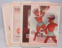
1940250450no city Spain: Wassermann 1940. Nineteen quarto leaves of alkaline paperstock each folded vertically in half to make nineteen separate advertising brochures of 8.5x5.5 inches all four faces of each brochure printed in colors with a come-on cover; pages within pp.2 & 3 print a detailed doublespread color map back cover mostly text with spot-color touches. Partial set 19 of an original total of 42. Each map features a different region or province in Spain including the Islands and North Africa while exterior covers boast a different medicine medications for the blood or bone for young and old: Take Aspasmol a sedative for spaamodic attacks &c &c. Please note that nos.13 and 37 use the same cover image but deal different meds and differing parts of Spain. All in nice condition clean and sound. Wassermann unknown books
1913GITc940Marseille Imprimerie Provençale 1913. In-8 broché 262pp 1 feuillet de table. Orné de 10 croquis dont 8 à pleine page et 1 hors texte, 1 fac simile de document, 4 cartes dépliantes hors texte dont 1 grande. Dos scotché, petite tache grasse ancienne (scotch)en tête du 1er plat de couverture, intérieur frais et complet.
1929GITc941Marseille Imprimerie Provençale 1929. In-8 broché 214pp 1 feuillet de table. orné de 2 croquis hors texte et 4 cartes dépliantes. Coupure sans manque sur 1 carte avec trace grasse ancienne (scotch), intérieur frais et complet.
115471Athens, Soc. for Hell. Cartography, 1989.
1891A91337Bruxelles, Société royale belge de géographie 1891 pp.179 à 372 + 1 tableau dépliant et 4 grandes cartes dépliantes & 8pp.de compte rendu des actes de la société, 23cm., br.orig. (dos restauré, qqs. taches), non coupé, bon état, [contient principalement: HENNEQUIN E.: Etude historique sur l'exécution de la carte de Ferraris et l'évolution de la cartographie depuis la publication de la carte de Flandre par Mercator 1540 jusque dans ces derniers temps (pp.177-296), DE BUSSCHERE L.: L'unification des heures, situation actuelle (pp.297-354)], A91337
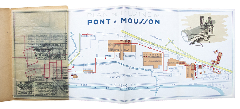
27063Plan des unités de production de l'usine de Pont à Mousson dépliant (465 x 180 mm) en couleurs (échelle 1/5000e) sur l'ensemble du site, accompagné d'un calque d'architecte détaillant en transparence les machines, installations et équipements pour chaque bâtiment. Ensemble relié sous couverture illustrée. Pont à Mousson, sans date (vers 1930).
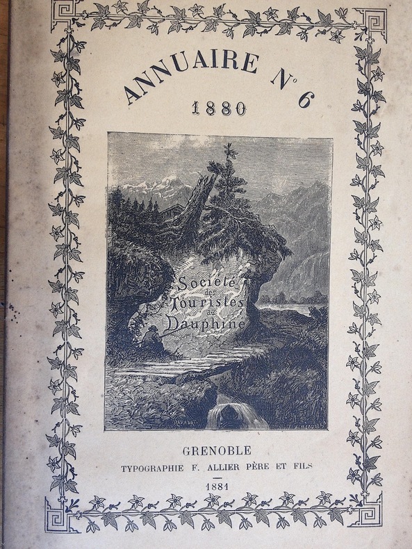
188123921881 1881 Edité à Grenoble chez Allier. 1881. Un volume in 8. broché; non coupé. 216 pages. Une très belle carte hors texte en couleurs plusieurs fois repliée, représentant la carte historique des Vallées Vaudoises par A. de Rochas d'Aiglun. éditée par le Spectateur Militaire. intérieur très frais. dos bruni comme souvent.
1904213882Gotha, Perthes, 1904. 4°. XXVIII, 376 S. Ohne Umschl. M. Kleberest v. ehemaliger Bind. Schnitt u. letzte S. etwas stockfl. St. a. Tit. (Petermanns geogr. Mitteil. Erg.-H. 148).
In alto a sinistra, in una targa dai bordi ornati, è impresso il titolo: SITO PARTICOLARE DIL CONTADO DI SEBENICO. Parte di DALMATIA IN SEBENICO MDLXX. In basso a sinistra, appena leggibile. Troviamo l’imprint editoriale: Ad sign: Colunt .V. Carta priva di scala grafica, orientazione e graduazione ai margini. Acquaforte e bulino, dimensioni mm 290x430. Esemplare di primo stato con l’imprint Ad sign: Colunt .V. chiaramente visibile e non abraso. Di tale tiratura si conosce il solo esemplare dell’atlante descritto da Meurer (cfr. The Strabo Illustratus Atlas, 2002, nn. 73-74) ora alla Bayerische Staatsbibliothek. “Carta anonima della regione di Sebenico e della Dalmazia centrale, che Meurer attribuisce al sebenicense Martino Rota, forse basandosi su quanto affermato in precedenza da Roberto Almagià: “sebbene negli esemplari da me visti non porti la firma del Rota, risale pur certamente a lui”. Dissociandoci da Meurer, per ragioni stilistiche assegniamo l’opera alla mano dell’incisore Natale Bonifacio, anch’egli originario della città dalmata. La carta ricorda infatti, in maniera molto evidente, altri prodotti cartografici del Bonifacio, in particolare, la tipologia del cartiglio. La peculiarità della carta è l’indirizzo in basso a sinistra Ad sign: Colunt. identificativo della tipografia di Paolo Forlani, che in questo caso potrebbe aver partecipato all’opera in qualità di editore. Il luogo di stampa indicato nel cartiglio – in Sebenico MDLXX – ci induce a credere che il Bonifacio abbia preparato la lastra nella sua città natale, o quantomeno vi avesse l’intenzione di stamparla. Sebbene non si possa escludere che esistano tirature della carta stampate a Sebenico, probabile che Bonifacio, rinunciando al suo progetto, si sia affidato poi a Forlani per la stampa. Secondo Meurer, l’opera ha una sua prova di stampa, priva dell’indirizzo del Forlani; tuttavia, sembra evidente che si tratti, in realtà, di una prova successiva, con l’indirizzo abraso e le cui tracce sono ancora visibili nella stampa” (cfr. S. Bifolco, F. Ronca, Cartografia e topografia italiana del XVI secolo, 2018: Tav. 641). Magnifica prova, impressa su carta vergata coeva con filigrana “scudo con scala e stella a sei punte” (Woodward nn. 244-250), con margini, in eccellente stato di conservazione. Foglio di estrema rarità, conosciuto in un solo esemplare di questa tiratura e in soli 9 esemplari istituzionali per la prova del secondo stato, con l’indirizzo abraso o parzialmente abraso: Chicago, Newberry Library; Milano, Raccolta Bertarelli; Modena, Biblioteca Estense; Monaco di Baviera, Bayerische Staatsbibliothek; Parigi, Bibliothèque Nationale; Roma, Alessandrina; Salisburgo, Universitätsbibliothek; Torino, Archivio di Stato; Venezia, Museo Correr (fonte, Cartografia e topografia italiana del XVI secolo, p. 1392). Natale Bonifacio (1538 – 1592) nacque a Sebenico, all’epoca del dominio della Repubblica di Venezia, da nobile famiglia. Poco si conosce dei primi anni della sua vita, ma intorno al 1570 lavorò a Venezia e a questo periodo appartengono numerose carte, datate tra il 1568 e il 1570, in seguito inserite nel Civitatum aliquot insignorum et locorum magis monitorum exacta delineation cum additione aliquot Insularum principalium edito da Ferrando Bertelli nel 1568, e da Donato Bertelli nel 1574. Dal 1575 fu a Roma, dove è autore di numerose incisioni. Tra queste citiamo il Cristo Benedicente, noto in tre stati (Lafreri, Duchetti e Orlandi); il Toro Farnese, dedicato ad Alessandro Farnese e edito dal Duchetti e inserito nello Speculum Romanae Magnificentiae. Le opere da lui incise recano spesso solo la sigla N.B.f(ecit); in altre, come la carta della Calabria di Prospero Parisio (1589), si firma invece Natalis Bonifacius Sabenice incidebat Romae. Paolo Forlani (attivo a Venezia tra il 1560 e il 1574), nasce a Verona, probabilmente nella terza decade del XVI secolo. Già da giovane mos... In the upper left, in a plate with ornate borders, is engraved the title: SITO PARTICOLARE DIL CONTADO DI SEBENICO. Part of DALMATIA IN SEBENICO MDLXX. In the lower left corner, barely legible. We find the editorial imprint: Ad sign: Colunt .V. Map without graphic scale, orientation and graduation in the margins. Etching and engraving, dimensions 290x430 mm. First state, with the imprint Ad sign: Colunt .V. clearly visible and not abraded. Of this first state, only one example is known from the atlas described by Meurer (see The Strabo Illustratus Atlas, 2002, nos. 73-74) now in the Bayerische Staatsbibliothek. An anonymous map of the region of Sibenik and central Dalmatia, which Meurer attributes to Martino Rota from Sibenik, perhaps based on what Roberto Almagià had previously stated: "although in the specimens I have seen it does not bear Rota's signature, it certainly belongs to him". Disassociating ourselves from Meurer, for stylistic reasons we assign the work to the hand of engraver Natale Bonifacio, who was also a native of the Dalmatian city. The map is in fact very reminiscent of other cartographic products of Bonifacio, in particular the type of cartouche. The peculiarity of this work is the address at lower left Ad sign: Colunt. identifying the printing house of Paolo Forlani, who in this case may have participated in the work as publisher. The place of printing indicated in the cartouche - in Sebenico MDLXX - leads us to believe that Bonifacio prepared the plate in his native city, or at least had the intention of printing it there. Although we cannot exclude that there is an early issue printed in Sibenik; it is probable that Bonifacio, having given up his project, then entrusted Forlani with the printing. According to Meurer, the work has its own proof, lacking Forlani's address; however, it seems clear that it is, in fact, a later proof, with the address abraded and whose traces are still visible in the print (cf. S. Bifolco, F. Ronca, Cartografia e topografia italiana del XVI secolo, 2018: Tav. 641). Magnificent proof, printed on contemporary laid paper with watermark "shield with ladder and six-pointed star" (Woodward nn. 244-250), with margins, in excellent state of preservation. Work of extreme rarity, known in only one copy of this first issue and in only 9 institutional copies for the second state (with the address abraded or partially abraded): Chicago, Newberry Library; Milan, Bertarelli; Modena, Biblioteca Estense; Munich, Bayerische Staatsbibliothek; Paris, Bibliothèque Nationale; Rome, Alessandrina; Salzburg, Universitätsbibliothek; Turin, Archivio di Stato; Venice, Museo Correr (source, Cartografia e topografia italiana del XVI secolo, p. 1392). Natale Bonifacio (1538 - 1592) was born in Sibenik, at the time of the dominion of the Republic of Venice, to a noble family. Little is known of the early years of his life, but around 1570 he worked in Venice and to this period belong numerous maps, dated between 1568 and 1570, later included in the Civitatum aliquot insignorum et locorum magis monitorum exacta delineation cum additione aliquot Insularum principalium edited by Ferrando Bertelli in 1568, and by Donato Bertelli in 1574. From 1575 he was in Rome, where he is the author of numerous engravings. Among these we mention the Cristo Benedicente, known in three states (Lafreri, Duchetti and Orlandi); the Toro Farnese, dedicated to Alessandro Farnese and published by Duchetti and inserted in the Speculum Romanae Magnificentiae. The works engraved by him often bear only the initials N.B.f(ecit); in others, such as the map of Calabria by Prospero Parisio (1589), he signed Natalis Bonifacius Sabenice incidebat Romae. Paolo Forlani (active in Venice between 1560 and 1574), was born in Verona, probably in the third decade of the sixteenth century. Already as a young man he showed his predisposition for drawing and artistic subjects, so he left Verona to move to Venice, where he l...
Vicenza, Paroni G.Tramontini,1846.In 8°pp.58n.+ 1 Carta di Roma più volte ripiegata, mm.(800X1200).+Una veduta alla fine a piena pagina. Copertina muta.(Frontespizio impolverato).
<br/> STATO: NUOVO.<br/> TITOLO: Siti e paesaggi. <br/> AUTORE: Ghio,Francesco.<br/> CURATORE: Prefaz.di Francesco Cellini.<br/> EDITORE: Alinea Editrice<br/> DATA ED.: 1999,<br/> EAN: 9788881253470
Carta geografica della provincia di Siracusa ed al retro gli itinerari dell'area (preistorico, greco, romano, bizantino, normanno-svevo, spagnolo, liberty, naturalistico, costiero, antropologico, gastronomico) (3b).
In 8? (cm ), senza rilegatura, pagg.1 litografia di cm 15x14,5 ca. (cm 27,2x18,8 ca. compresi i margini bianchi), scala 1:500,qualche leggerissima fioritura, ottimo es.
1988207928Instituto Nacional de Estadistica Geografia e Informatica, Mexico 1988. 69 pp. and 11 folded coloured maps (of 13, Carta topografica and Carta de fenomenos climatologicos are missing), Fol. (ca. 40 x 28 cm / maps ca. ca. 70 x 70 cm),
1987207929Instituto Nacional de Estadistica Geografia e Informatica, Mexico 1987. 56 pp. and 12 folded coloured maps (of 13, Carta de fenomenos climatologicos is missing), Fol. (ca. 40 x 28 cm / maps ca. ca. 70 x 70 cm),
1986207930Instituto Nacional de Estadistica Geografia e Informatica, Mexico 1986. 143 pp. and 13 folded coloured maps (complete), Fol. (ca. 40 x 28 cm / maps ca. ca. 70 x 70 cm),
1986207931Instituto Nacional de Estadistica Geografia e Informatica, Mexico 1986. 116 pp. and 14 folded coloured maps (complete), Fol. (ca. 40 x 28 cm / maps ca. ca. 70 x 70 cm),
(Codice OS/0256) In 4º (315x210 mm) 176 pp. Ex libris. In fine la tavola "Itinerario della strada Caserta P.te di Annibale". Buona rilegatura in similpelle blu, titolo al dorso. Buono stato. ~~~ SPEDIZIONE IN ITALIA SEMPRE TRACCIATA
(Codice MT/1989) In 4º (315x210 mm) 259 pp. Varie figure. Intercalati vari fogli di appunti manoscritti rilegati tra le pagine. Alcuni antichi restauri marginali. Ex libris. Buona rilegatura in similpelle blu, titolo al dorso. Non inclusi i 38 schizzi allegati a parte. ~~~ SPEDIZIONE IN ITALIA SEMPRE TRACCIATA
(Codice MT/1415) In 4º oblungo (28x28,5 cm). Atlante di 49 tavole, grandi e ripiegate. Srampa litografica. Brossura originale, minimi strappetti riparati al dorso. Ottimo stato. ~~~ SPEDIZIONE IN ITALIA SEMPRE TRACCIATA
(Codice MT/2170) In 4º (30,5x21,5 cm), 112, 128, 214+13 pp. Corso completo. Legatura originale, dorsi in tela, firma sulle copertine. Vari segni e note di studio a penna. Non incluso l'atlante di tavole. Ottimo stato. ~~~ SPEDIZIONE IN ITALIA SEMPRE TRACCIATA
37861Bucarest I. V. Socecù 1903 in 12 (18x11,5) 1 volume reliure pleine percaline marron ornée de l'éditeur, plat supérieur titré, 164 pages [1], avec des illustrations et 3 cartes dépliantes en couleurs. Très bel exemplaire ( Photographies sur demande / We can send pictures of this book on simple request )
Paperback, 184 p., 60 b/w ill. + 24 colour ill., 23 x 28 mm. ISBN 9782503517049. Durant l'annee 2004, de multiples manifestations culturelles se deroulent en Belgique pour celebrer la presidence neerlandaise de l'Union europeenne. La Bibliotheque royale de Belgique s'y associe en organisant une exposition consacree a Simon Stevin, qui incarnait deja l'idee europeenne : ne a Bruges en 1548, il emigra aux Pays-Bas pour y poursuivre sa carriere scientifique et pour assurer a ses idees la plus large diffusion possible. En l'absence de toute justification formelle de sa part, plusieurs hypotheses tentent d'expliquer ce depart -emigration forcee ou exil volontaire?- sans etre en mesure d'apporter une quelconque reponse qui puisse emporter la conviction. Aux Pays-Bas, Simon Stevin acquit la protection, la confiance et meme l'amitie du Prince Maurice de Nassau. Simon Stevin fut un theoricien, de tres haut niveau comme en temoignent notamment ses ecrits mathematiques, linguistiques ou cosmographiques. En outre, il fut un praticien hors pair dont les realisations dans des domaines aussi divers que l'hydraulique, la mecanique, la physique et l'art des fortifications prouvent le genie. Comme bien d'autres hommes de science de la Renaissance et des debuts de l'epoque moderne, Simon Stevin consacra beaucoup de son temps et de son energie a realiser des experiences scientifiques : il mettait en ?uvre la methode inductive dont il elargissait constamment le champ d'application. Cette nouvelle approche methodologique donna naissance a une science nouvelle. Languages : French
41487Turnhout, Brepols, 2004 Paperback, 184 p., 60 b/w ill. + 24 colour ill., 23 x 28 mm. ISBN 9782503517049.
Da Atlas Major, Amsterdam, 1660 circa. Incisione in rame, confini in colore d’epoca, cm 41 x 50 (alla lastra). Buon esemplare a pieni margini.